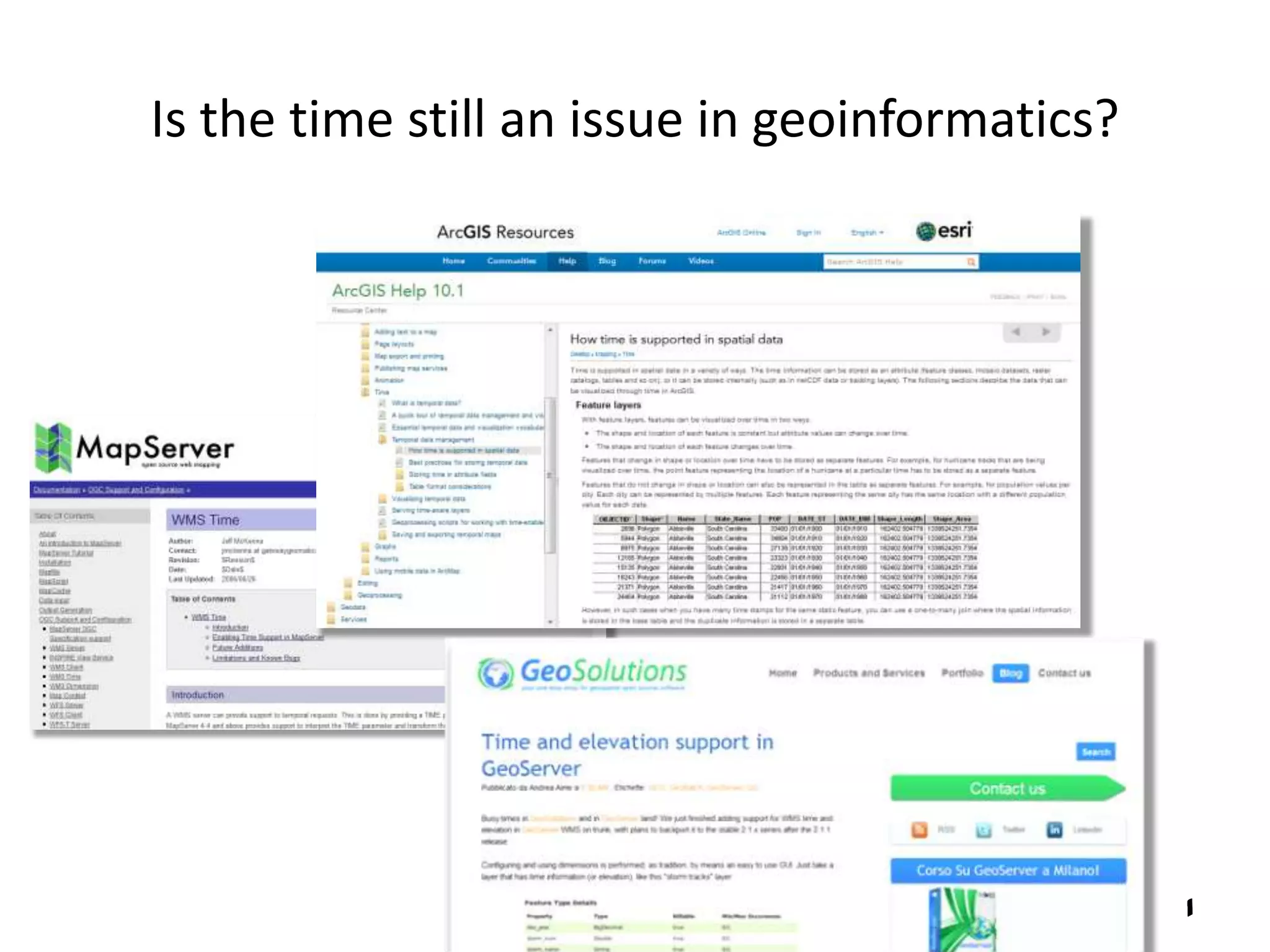
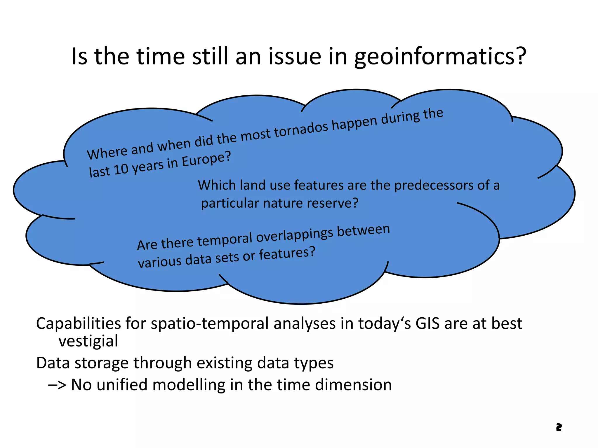
Providing methods for
                              Peter Broßeit
the capture and analysis of
dynamic phenomena through
a PostgreSQL extension
Is the time still an issue in geoinformatics?


                                                1
Is the time still an issue in geoinformatics?


                      Which land use features are the predecessors of a
                      particular nature reserve?


Capabilities for spatio-temporal analyses in today‘s GIS are at best
  vestigial
Data storage through existing data types
 –> No unified modelling in the time dimension

                                                                          2
Concept
• Modelling the valid time dimension with
  one user defined data type
• Instants, periods of time and temporal complexes
• Based on ISO19108


                       Actual Purpose:
  Unified modelling -> homogeneous queries
  Explicit modelling of periods of time and temporal
  complexes

                                                       3
Temporal Schema - ISO19108

   Schema to describe the temporal characteristics
             of geographic information

   Feature attributes, feature operations & feature
                       associations


• Temporal objects
• Various reference systems
• Combination with features

                                                      4
The Temporal Objects

                 TM_Primitive


                       ISO19108


                                  5
The Temporal Objects

                              TM_Primitive


                                    ISO19108

MultiPrimitive


                                               6
The Temporal Objects
TemporalPosition
                                     ISO19108


                                                7
The Temporal Objects
TemporalPosition
                                     ISO19108


                                                8
The Temporal Objects
TemporalPosition
                                        ISO19108


             Only one internal system


                                                   9
Textual Representation

• Necessary for the information exchange
  -> The user’s view on the database level
• Some terms are set by the Temporal Schema (ISO19108)

The concerning standardisation does not go far enough
-> Requires arbitrary specifications
-> Only restrictedly suitable for a general
information exchange                           ?
Actually needed: WKT for time

                                                         10
Operations

Basic functions
  Operating only in the time dimension
  e.g. Simple queries, Boolean operations, ISO19108-Functions


Spatio-temporal analysis
  Integrated processing in the spatial and temporal dimension
  e.g. ISO19108-Feature Successions


                                                                11
Relative Position


                    12
ISO19108 – Feature Successions

     Feature Substitution
     Feature Division
     Feature Fusion


May be derived trough a combined use of
 temporal and spatial operations

                                          13
Implementation with PostgreSQL

Why PostgreSQL?

                                    User defined base type in PostgreSQL

Standard compliance and far-reaching possibilities in configuration
Spatial functionality provided by PostGIS -> OGC compliant

Current capabilities:
       The six object types
       Exemplary the three types of reference frame
       Various basic functions
       Examples for spatio-temporal analysis

                                                                           14
What are the predecessor and successor
             associations between several countries?


Shapefile: W EIDEMANN, N. B.; DOREEN, K.; GLEDITSCH, K. S. (2010): The Geography of the International
System: The CShapes Dataset, http://nils.weidmann.ws/projects/cshapes/shapefile (2013-03-07).

                                                                                                        15
For each time step: In which state did the most
                  tornados take place?


Shapefile: NATIONALATLAS.GOV (2011): nationalatlas.gov – Map Layers, http://nationalatlas.gov/maplayers.html (2013-03-07).


                                                                                                                       16
Perspective
Purpose: From the proof-of-concept to the first release

•   Extend the range of functions
•   Decent documentation
•   Extensive testing
•   Validation of the concept

Particular:
Managing the various reference frames
Syntax for the information exchange
User defined reference frames


                                        Documentation with Doxygen
                                                                     17
Peter Broßeit
Peter.Brosseit@mailbox.tu-dresden.de


          Masters programme ‚Geoinformation Technologies‘


                                                            18

Providing methods for the capture and analysis of dynamic phenomena through a PostgreSQL extension

  • 1.
    Providing methods for Peter Broßeit the capture and analysis of dynamic phenomena through a PostgreSQL extension
  • 2.
    Is the timestill an issue in geoinformatics? 1
  • 3.
    Is the timestill an issue in geoinformatics? Which land use features are the predecessors of a particular nature reserve? Capabilities for spatio-temporal analyses in today‘s GIS are at best vestigial Data storage through existing data types –> No unified modelling in the time dimension 2
  • 4.
    Concept • Modelling thevalid time dimension with one user defined data type • Instants, periods of time and temporal complexes • Based on ISO19108 Actual Purpose: Unified modelling -> homogeneous queries Explicit modelling of periods of time and temporal complexes 3
  • 5.
    Temporal Schema -ISO19108 Schema to describe the temporal characteristics of geographic information Feature attributes, feature operations & feature associations • Temporal objects • Various reference systems • Combination with features 4
  • 6.
    The Temporal Objects TM_Primitive ISO19108 5
  • 7.
    The Temporal Objects TM_Primitive ISO19108 MultiPrimitive 6
  • 8.
  • 9.
  • 10.
    The Temporal Objects TemporalPosition ISO19108 Only one internal system 9
  • 11.
    Textual Representation • Necessaryfor the information exchange -> The user’s view on the database level • Some terms are set by the Temporal Schema (ISO19108) The concerning standardisation does not go far enough -> Requires arbitrary specifications -> Only restrictedly suitable for a general information exchange ? Actually needed: WKT for time 10
  • 12.
    Operations Basic functions Operating only in the time dimension e.g. Simple queries, Boolean operations, ISO19108-Functions Spatio-temporal analysis Integrated processing in the spatial and temporal dimension e.g. ISO19108-Feature Successions 11
  • 13.
  • 14.
    ISO19108 – FeatureSuccessions Feature Substitution Feature Division Feature Fusion May be derived trough a combined use of temporal and spatial operations 13
  • 15.
    Implementation with PostgreSQL WhyPostgreSQL? User defined base type in PostgreSQL Standard compliance and far-reaching possibilities in configuration Spatial functionality provided by PostGIS -> OGC compliant Current capabilities: The six object types Exemplary the three types of reference frame Various basic functions Examples for spatio-temporal analysis 14
  • 16.
    What are thepredecessor and successor associations between several countries? Shapefile: W EIDEMANN, N. B.; DOREEN, K.; GLEDITSCH, K. S. (2010): The Geography of the International System: The CShapes Dataset, http://nils.weidmann.ws/projects/cshapes/shapefile (2013-03-07). 15
  • 17.
    For each timestep: In which state did the most tornados take place? Shapefile: NATIONALATLAS.GOV (2011): nationalatlas.gov – Map Layers, http://nationalatlas.gov/maplayers.html (2013-03-07). 16
  • 18.
    Perspective Purpose: From theproof-of-concept to the first release • Extend the range of functions • Decent documentation • Extensive testing • Validation of the concept Particular: Managing the various reference frames Syntax for the information exchange User defined reference frames Documentation with Doxygen 17
  • 19.
    Peter Broßeit Peter.Brosseit@mailbox.tu-dresden.de Masters programme ‚Geoinformation Technologies‘ 18