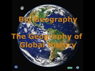
SlideShare a Scribd company logo
Big Geography The Geography of  Global History
We need a mental picture of the whole world, not just certain parts of it. This is “big geography.”
U S A. South America Africa
Hi. I’m Mundo. Did you know that how we “see” the world depends on how we project the world?
The Earth is a sphere. Therefore, it cannot be projected on a flat map without distortion. The question is,  which kind  of distortion?
Three World Map Projections Mercator, Peters, and Robinson
On a Mercator projection, invented by Gerardus Mercator in  1569, any straight line is a line of constant compass bearing.  This enables a navigator to plot a straight-line course.
Despite the values of the Mercator Projection, it distorts the size and shape of land areas. Fact: South America is  8 times as large as  Greenland. Fact: Africa is 14 times  as large as Greenland. The Peters Projection is an “ equal area” map. It  represents areas accurately, but it seriously distorts shapes. Compare the size of Europe to Africa on the two maps. Compare the size of the former USSR to China on the two maps.
Human beings inhabit  the biosphere. ,[object Object],[object Object],[object Object],[object Object]
The lithosphere is in constant, though slow motion. The surface of the earth and the location of its land  masses have therefore  had a continuously  changing history.
The scene of history is continuously moving land masses. Notice in the left column the names of distinct land  masses that no longer exist. The red dot represents the location of the Grand Canyon .    Pangaea Laurasia Gondwanaland India South  America 550 Million Years Ago 220 Million Years Ago 190 Million Years Ago 130 Million Years Ago 65 Million Years Ago Today
The largest context of human history is the entire planet.
70.9 % of the surface of the earth is water.  Human beings, however, are a land-dwelling species.  We call the biggest land areas continents.
How many continents  are there? Nine?  One? Seven?  Five? Four?
The conventional map of seven continents But what IS a continent?
Conventional definition of a continent A large mass of land surrounded, or nearly surrounded, by water.  If that is the conventional definition, why are  Europe and Asia separate continents?
Since the nineteenth century, most scholars have accepted the Ural Mountains as part of the dividing Line between “Europe” and “Asia” as continents. The Urals as a border between continents? They are not that impressive.
Ural Mts. Another part of the dividing line: Bosporus and Dardanelles (Straits) EUROPE  ASIA
Bosporus Istanbul Dardanelles
What significance have the Bosporus and Dardanelles had as a line dividing peoples from one another in history? Almost none!
The Ottoman Turkish Empire about 1550. Its territory cut straight across the Bosporus and Dardanelles.
Here’s a highway bridge across the Bosporus.  Today, you can drive from “Asia” to “Europe” in a few minutes.
So, why is Europe a continent? European scholars of the nineteenth century decided that it should be one. One of the benefits of having power in the world is that you get to name things!
[object Object],[object Object]
Asia + Europe = Eurasia E  U  R  A  S  I  A
But is Africa separated from Eurasia by a wide ocean? No!  Why not think of Eurasia and Africa together as a single “supercontinent?” Let’s call it “Afroeurasia.”
Africa + Asia + Europe = Afroeurasia A F R O E U R A S I A
Think of Afroeurasia as having some  seas “inside” it. Black Sea Caspian Sea Mediterranean Sea  Persian Gulf Red Sea You figure out which is which?
One of the big geographical features of Afroeurasia is the Great Arid Zone. This is the belt of arid or semi-arid land that extends nearly across Afroeurasia. Great Arid Zone
Scenes in the Great Arid Zone of Afroeurasia Extreme dryness  Ahaggar Mts., Sahara Desert Semi-aridity Grassy steppes of Mongolia
Historically, peoples who herd animals as a way of life have inhabited many parts of the Great Arid Zone. These herders are pastoral nomads, that is, they move with their herds or flocks from pasture to pasture. Herders in Mongolia
A major theme in world history has been the dynamic relations between pastoral  nomadic peoples of the Great Arid Zone… … and peoples who  have been farmers  or city-dwellers.
Nomadic peoples of the Great Arid Zone both traded and clashed with farming and city-dwelling peoples who lived adjacent to the Great Arid Zone.  One of the greatest clashes was the attacks of Mongol nomads on cities of Eurasia in the 13th century.
2 3 4 5 6 8 9 10 11 The Eleven Seas of Afroeurasia They made it easier for people to communicate by water across Afroeurasia. 7 1 Name these seas!
Before modern times, merchants relayed goods from one link in the “chain of seas” to another. That is, a single merchant did not make the trip from one end of the chain to the other, though it was theoretically possible.
Another feature of big geography is the earth’s great mountain chains Mountains have been barriers to human communication.  But passes across them have also served as  “ valves” of communication.
The major winds and currents of the oceans Until the coming of steamships in the 19th century, sailors had to know winds and currents to have confidence that they could sail from one  place to another in an approximate amount of time. These winds  and currents follow large global patterns. It was a matter of  discovering what those patterns were. summer winter Indian Ocean  Monsoon Winds
The wind cycle in the North Atlantic helped Christopher Columbus sail both ways  across the ocean. WIND WIND
So, how many continents? ,[object Object],[object Object],[object Object],[object Object],[object Object],[object Object],[object Object],[object Object],[object Object],But is it possible to think of North and South America as ONE continent?
Are the Americas one continent or two? Try to think of  the Gulf of  Mexico and  the  Caribbean Sea as bodies of water  “ inside” the Americas . Gulf of  Mexico Caribbean  Sea
Columbia Mississippi Amazon Congo Niger Danube Nile Tigris-Euphrates Indus Ganges Mekong Yangze Yellow (Huang) Darling-Murray Finally, let’s not forget great rivers. They have served as channels of communication between seas and deep interior lands.

More Related Content

What's hot

CONTINENTAL DRIFT THEORY EVIDENCES ppt
CONTINENTAL DRIFT THEORY EVIDENCES pptCONTINENTAL DRIFT THEORY EVIDENCES ppt
CONTINENTAL DRIFT THEORY EVIDENCES ppt
DARYL (MONKAYO NHS)
 
Continental drift
Continental driftContinental drift
Continental driftJenny Dixon
 
Drifted supercontinent!
Drifted supercontinent!Drifted supercontinent!
Drifted supercontinent!
Blessie Bustamante
 
Continental drift theory discuss
Continental drift theory discussContinental drift theory discuss
Continental drift theory discuss
Makati Science High School
 
Continental Drift Theory by Rajkumar
Continental Drift Theory by RajkumarContinental Drift Theory by Rajkumar
Continental Drift Theory by Rajkumar
Raj Kumar
 
Mystery
Mystery Mystery
Mystery
Rama Devi
 
Continental Drift
Continental DriftContinental Drift
Continental Driftally3569
 
Mars
MarsMars
Mysteries of the world
Mysteries of the worldMysteries of the world
Mysteries of the world
SimranGuwalani
 
The pangaea theory
The pangaea theoryThe pangaea theory
The pangaea theory
Ms Wilson
 
Apresentação Dr. Majid Labbaf Khaneiki - ICQHS
Apresentação Dr. Majid Labbaf Khaneiki - ICQHSApresentação Dr. Majid Labbaf Khaneiki - ICQHS
Apresentação Dr. Majid Labbaf Khaneiki - ICQHS
Luís Inverno
 
Unit 1. 2. 2 continental drift
Unit 1. 2. 2 continental driftUnit 1. 2. 2 continental drift
Unit 1. 2. 2 continental drift
Jed Encepto
 
10 mysterious places in the world
10 mysterious places in the world10 mysterious places in the world
10 mysterious places in the world
dipali mishra
 
CONTINENTAL DRIFT THEORY PPT
CONTINENTAL DRIFT THEORY PPT CONTINENTAL DRIFT THEORY PPT
CONTINENTAL DRIFT THEORY PPT
Ram Shankar
 
The lost city of atlantis
The lost city of atlantisThe lost city of atlantis
The lost city of atlantisDipanker Singh
 
The lost city of atlantis. .. . .!
The lost city of atlantis. .. . .!The lost city of atlantis. .. . .!
The lost city of atlantis. .. . .!
Kevin Jimmy
 
History & Culture of Astronomy April 10, 2009 acloutier copyright
History  & Culture of Astronomy  April 10, 2009 acloutier copyrightHistory  & Culture of Astronomy  April 10, 2009 acloutier copyright
History & Culture of Astronomy April 10, 2009 acloutier copyright
Annie C. Cloutier
 

What's hot (20)

CONTINENTAL DRIFT THEORY EVIDENCES ppt
CONTINENTAL DRIFT THEORY EVIDENCES pptCONTINENTAL DRIFT THEORY EVIDENCES ppt
CONTINENTAL DRIFT THEORY EVIDENCES ppt
 
Prolegomena To The Great Asian War
Prolegomena To The Great Asian WarProlegomena To The Great Asian War
Prolegomena To The Great Asian War
 
Untitled document
Untitled documentUntitled document
Untitled document
 
Continental drift
Continental driftContinental drift
Continental drift
 
Drifted supercontinent!
Drifted supercontinent!Drifted supercontinent!
Drifted supercontinent!
 
Continental drift theory discuss
Continental drift theory discussContinental drift theory discuss
Continental drift theory discuss
 
Continental Drift Theory by Rajkumar
Continental Drift Theory by RajkumarContinental Drift Theory by Rajkumar
Continental Drift Theory by Rajkumar
 
Mystery
Mystery Mystery
Mystery
 
Continental Drift
Continental DriftContinental Drift
Continental Drift
 
Mars
MarsMars
Mars
 
Mysteries of the world
Mysteries of the worldMysteries of the world
Mysteries of the world
 
Research no
Research noResearch no
Research no
 
The pangaea theory
The pangaea theoryThe pangaea theory
The pangaea theory
 
Apresentação Dr. Majid Labbaf Khaneiki - ICQHS
Apresentação Dr. Majid Labbaf Khaneiki - ICQHSApresentação Dr. Majid Labbaf Khaneiki - ICQHS
Apresentação Dr. Majid Labbaf Khaneiki - ICQHS
 
Unit 1. 2. 2 continental drift
Unit 1. 2. 2 continental driftUnit 1. 2. 2 continental drift
Unit 1. 2. 2 continental drift
 
10 mysterious places in the world
10 mysterious places in the world10 mysterious places in the world
10 mysterious places in the world
 
CONTINENTAL DRIFT THEORY PPT
CONTINENTAL DRIFT THEORY PPT CONTINENTAL DRIFT THEORY PPT
CONTINENTAL DRIFT THEORY PPT
 
The lost city of atlantis
The lost city of atlantisThe lost city of atlantis
The lost city of atlantis
 
The lost city of atlantis. .. . .!
The lost city of atlantis. .. . .!The lost city of atlantis. .. . .!
The lost city of atlantis. .. . .!
 
History & Culture of Astronomy April 10, 2009 acloutier copyright
History  & Culture of Astronomy  April 10, 2009 acloutier copyrightHistory  & Culture of Astronomy  April 10, 2009 acloutier copyright
History & Culture of Astronomy April 10, 2009 acloutier copyright
 

Similar to Big geography

Theme 1 science history & trade powerpoint
Theme 1 science history & trade powerpointTheme 1 science history & trade powerpoint
Theme 1 science history & trade powerpointgnsmann
 
Theme 1 science history & trade powerpoint
Theme 1 science history & trade powerpointTheme 1 science history & trade powerpoint
Theme 1 science history & trade powerpointgnsmann
 
Theme 1 science history & trade powerpoint
Theme 1 science history & trade powerpointTheme 1 science history & trade powerpoint
Theme 1 science history & trade powerpointgnsmann
 
Theme 1 science history & trade powerpoint
Theme 1 science history & trade powerpointTheme 1 science history & trade powerpoint
Theme 1 science history & trade powerpointgnsmann
 
Theme 1 science history & trade powerpoint
Theme 1 science history & trade powerpointTheme 1 science history & trade powerpoint
Theme 1 science history & trade powerpointgnsmann
 
Project Infinity Research Report_052310
Project Infinity Research Report_052310Project Infinity Research Report_052310
Project Infinity Research Report_052310Garrick Sturgill
 
The Atlantic Ocean
The  Atlantic  OceanThe  Atlantic  Ocean
The Atlantic Ocean
Prof. A.Balasubramanian
 
continental-drifting.pptx
continental-drifting.pptxcontinental-drifting.pptx
continental-drifting.pptx
AhmedMushtaq15
 
Ocean 1
Ocean 1Ocean 1
The Pacific Ocean
The Pacific OceanThe Pacific Ocean
The Pacific Ocean
Prof. A.Balasubramanian
 
Unit 8: The Four World Zones
Unit 8: The Four World ZonesUnit 8: The Four World Zones
Unit 8: The Four World Zones
Big History Project
 
nla.news-article49022347.3 (1).pdf
nla.news-article49022347.3 (1).pdfnla.news-article49022347.3 (1).pdf
nla.news-article49022347.3 (1).pdf
BraydenStoch2
 
Pounce Round1 "Travel & Tourism Quiz"
Pounce Round1 "Travel & Tourism Quiz"Pounce Round1 "Travel & Tourism Quiz"
Pounce Round1 "Travel & Tourism Quiz"Pratyush Mahapatra
 
LAndforms
LAndformsLAndforms
LAndforms
aliciadiez
 
187The World of Inner Africa Geography, Race, and Langua
187The World of Inner Africa Geography, Race, and Langua187The World of Inner Africa Geography, Race, and Langua
187The World of Inner Africa Geography, Race, and Langua
AnastaciaShadelb
 
Atlas Of Ancient Oceans And Continents Plate Tectonics During The Last 1.5 B...
Atlas Of Ancient Oceans And Continents  Plate Tectonics During The Last 1.5 B...Atlas Of Ancient Oceans And Continents  Plate Tectonics During The Last 1.5 B...
Atlas Of Ancient Oceans And Continents Plate Tectonics During The Last 1.5 B...
Sabrina Baloi
 
Topography of ocean floors
Topography of ocean floorsTopography of ocean floors
Topography of ocean floors
Prof. A.Balasubramanian
 
22 Mar 1952 - Origin Of The Continents_ Did They Float Away_.pdf
22 Mar 1952 - Origin Of The Continents_ Did They Float Away_.pdf22 Mar 1952 - Origin Of The Continents_ Did They Float Away_.pdf
22 Mar 1952 - Origin Of The Continents_ Did They Float Away_.pdf
BraydenStoch2
 
2019 tg lithosphere1 earth
2019 tg lithosphere1 earth2019 tg lithosphere1 earth
2019 tg lithosphere1 earth
Juan Antonio García González
 
South America
South AmericaSouth America
South America
CyanideBlue
 

Similar to Big geography (20)

Theme 1 science history & trade powerpoint
Theme 1 science history & trade powerpointTheme 1 science history & trade powerpoint
Theme 1 science history & trade powerpoint
 
Theme 1 science history & trade powerpoint
Theme 1 science history & trade powerpointTheme 1 science history & trade powerpoint
Theme 1 science history & trade powerpoint
 
Theme 1 science history & trade powerpoint
Theme 1 science history & trade powerpointTheme 1 science history & trade powerpoint
Theme 1 science history & trade powerpoint
 
Theme 1 science history & trade powerpoint
Theme 1 science history & trade powerpointTheme 1 science history & trade powerpoint
Theme 1 science history & trade powerpoint
 
Theme 1 science history & trade powerpoint
Theme 1 science history & trade powerpointTheme 1 science history & trade powerpoint
Theme 1 science history & trade powerpoint
 
Project Infinity Research Report_052310
Project Infinity Research Report_052310Project Infinity Research Report_052310
Project Infinity Research Report_052310
 
The Atlantic Ocean
The  Atlantic  OceanThe  Atlantic  Ocean
The Atlantic Ocean
 
continental-drifting.pptx
continental-drifting.pptxcontinental-drifting.pptx
continental-drifting.pptx
 
Ocean 1
Ocean 1Ocean 1
Ocean 1
 
The Pacific Ocean
The Pacific OceanThe Pacific Ocean
The Pacific Ocean
 
Unit 8: The Four World Zones
Unit 8: The Four World ZonesUnit 8: The Four World Zones
Unit 8: The Four World Zones
 
nla.news-article49022347.3 (1).pdf
nla.news-article49022347.3 (1).pdfnla.news-article49022347.3 (1).pdf
nla.news-article49022347.3 (1).pdf
 
Pounce Round1 "Travel & Tourism Quiz"
Pounce Round1 "Travel & Tourism Quiz"Pounce Round1 "Travel & Tourism Quiz"
Pounce Round1 "Travel & Tourism Quiz"
 
LAndforms
LAndformsLAndforms
LAndforms
 
187The World of Inner Africa Geography, Race, and Langua
187The World of Inner Africa Geography, Race, and Langua187The World of Inner Africa Geography, Race, and Langua
187The World of Inner Africa Geography, Race, and Langua
 
Atlas Of Ancient Oceans And Continents Plate Tectonics During The Last 1.5 B...
Atlas Of Ancient Oceans And Continents  Plate Tectonics During The Last 1.5 B...Atlas Of Ancient Oceans And Continents  Plate Tectonics During The Last 1.5 B...
Atlas Of Ancient Oceans And Continents Plate Tectonics During The Last 1.5 B...
 
Topography of ocean floors
Topography of ocean floorsTopography of ocean floors
Topography of ocean floors
 
22 Mar 1952 - Origin Of The Continents_ Did They Float Away_.pdf
22 Mar 1952 - Origin Of The Continents_ Did They Float Away_.pdf22 Mar 1952 - Origin Of The Continents_ Did They Float Away_.pdf
22 Mar 1952 - Origin Of The Continents_ Did They Float Away_.pdf
 
2019 tg lithosphere1 earth
2019 tg lithosphere1 earth2019 tg lithosphere1 earth
2019 tg lithosphere1 earth
 
South America
South AmericaSouth America
South America
 

Recently uploaded

Multithreading_in_C++ - std::thread, race condition
Multithreading_in_C++ - std::thread, race conditionMultithreading_in_C++ - std::thread, race condition
Multithreading_in_C++ - std::thread, race condition
Mohammed Sikander
 
Synthetic Fiber Construction in lab .pptx
Synthetic Fiber Construction in lab .pptxSynthetic Fiber Construction in lab .pptx
Synthetic Fiber Construction in lab .pptx
Pavel ( NSTU)
 
Digital Tools and AI for Teaching Learning and Research
Digital Tools and AI for Teaching Learning and ResearchDigital Tools and AI for Teaching Learning and Research
Digital Tools and AI for Teaching Learning and Research
Vikramjit Singh
 
A Survey of Techniques for Maximizing LLM Performance.pptx
A Survey of Techniques for Maximizing LLM Performance.pptxA Survey of Techniques for Maximizing LLM Performance.pptx
A Survey of Techniques for Maximizing LLM Performance.pptx
thanhdowork
 
Welcome to TechSoup New Member Orientation and Q&A (May 2024).pdf
Welcome to TechSoup   New Member Orientation and Q&A (May 2024).pdfWelcome to TechSoup   New Member Orientation and Q&A (May 2024).pdf
Welcome to TechSoup New Member Orientation and Q&A (May 2024).pdf
TechSoup
 
Lapbook sobre os Regimes Totalitários.pdf
Lapbook sobre os Regimes Totalitários.pdfLapbook sobre os Regimes Totalitários.pdf
Lapbook sobre os Regimes Totalitários.pdf
Jean Carlos Nunes Paixão
 
Introduction to AI for Nonprofits with Tapp Network
Introduction to AI for Nonprofits with Tapp NetworkIntroduction to AI for Nonprofits with Tapp Network
Introduction to AI for Nonprofits with Tapp Network
TechSoup
 
TESDA TM1 REVIEWER FOR NATIONAL ASSESSMENT WRITTEN AND ORAL QUESTIONS WITH A...
TESDA TM1 REVIEWER  FOR NATIONAL ASSESSMENT WRITTEN AND ORAL QUESTIONS WITH A...TESDA TM1 REVIEWER  FOR NATIONAL ASSESSMENT WRITTEN AND ORAL QUESTIONS WITH A...
TESDA TM1 REVIEWER FOR NATIONAL ASSESSMENT WRITTEN AND ORAL QUESTIONS WITH A...
EugeneSaldivar
 
Biological Screening of Herbal Drugs in detailed.
Biological Screening of Herbal Drugs in detailed.Biological Screening of Herbal Drugs in detailed.
Biological Screening of Herbal Drugs in detailed.
Ashokrao Mane college of Pharmacy Peth-Vadgaon
 
Overview on Edible Vaccine: Pros & Cons with Mechanism
Overview on Edible Vaccine: Pros & Cons with MechanismOverview on Edible Vaccine: Pros & Cons with Mechanism
Overview on Edible Vaccine: Pros & Cons with Mechanism
DeeptiGupta154
 
Acetabularia Information For Class 9 .docx
Acetabularia Information For Class 9  .docxAcetabularia Information For Class 9  .docx
Acetabularia Information For Class 9 .docx
vaibhavrinwa19
 
Francesca Gottschalk - How can education support child empowerment.pptx
Francesca Gottschalk - How can education support child empowerment.pptxFrancesca Gottschalk - How can education support child empowerment.pptx
Francesca Gottschalk - How can education support child empowerment.pptx
EduSkills OECD
 
Marketing internship report file for MBA
Marketing internship report file for MBAMarketing internship report file for MBA
Marketing internship report file for MBA
gb193092
 
CACJapan - GROUP Presentation 1- Wk 4.pdf
CACJapan - GROUP Presentation 1- Wk 4.pdfCACJapan - GROUP Presentation 1- Wk 4.pdf
CACJapan - GROUP Presentation 1- Wk 4.pdf
camakaiclarkmusic
 
Azure Interview Questions and Answers PDF By ScholarHat
Azure Interview Questions and Answers PDF By ScholarHatAzure Interview Questions and Answers PDF By ScholarHat
Azure Interview Questions and Answers PDF By ScholarHat
Scholarhat
 
The Accursed House by Émile Gaboriau.pptx
The Accursed House by Émile Gaboriau.pptxThe Accursed House by Émile Gaboriau.pptx
The Accursed House by Émile Gaboriau.pptx
DhatriParmar
 
A Strategic Approach: GenAI in Education
A Strategic Approach: GenAI in EducationA Strategic Approach: GenAI in Education
A Strategic Approach: GenAI in Education
Peter Windle
 
Language Across the Curriculm LAC B.Ed.
Language Across the  Curriculm LAC B.Ed.Language Across the  Curriculm LAC B.Ed.
Language Across the Curriculm LAC B.Ed.
Atul Kumar Singh
 
Unit 2- Research Aptitude (UGC NET Paper I).pdf
Unit 2- Research Aptitude (UGC NET Paper I).pdfUnit 2- Research Aptitude (UGC NET Paper I).pdf
Unit 2- Research Aptitude (UGC NET Paper I).pdf
Thiyagu K
 
BÀI TẬP BỔ TRỢ TIẾNG ANH GLOBAL SUCCESS LỚP 3 - CẢ NĂM (CÓ FILE NGHE VÀ ĐÁP Á...
BÀI TẬP BỔ TRỢ TIẾNG ANH GLOBAL SUCCESS LỚP 3 - CẢ NĂM (CÓ FILE NGHE VÀ ĐÁP Á...BÀI TẬP BỔ TRỢ TIẾNG ANH GLOBAL SUCCESS LỚP 3 - CẢ NĂM (CÓ FILE NGHE VÀ ĐÁP Á...
BÀI TẬP BỔ TRỢ TIẾNG ANH GLOBAL SUCCESS LỚP 3 - CẢ NĂM (CÓ FILE NGHE VÀ ĐÁP Á...
Nguyen Thanh Tu Collection
 

Recently uploaded (20)

Multithreading_in_C++ - std::thread, race condition
Multithreading_in_C++ - std::thread, race conditionMultithreading_in_C++ - std::thread, race condition
Multithreading_in_C++ - std::thread, race condition
 
Synthetic Fiber Construction in lab .pptx
Synthetic Fiber Construction in lab .pptxSynthetic Fiber Construction in lab .pptx
Synthetic Fiber Construction in lab .pptx
 
Digital Tools and AI for Teaching Learning and Research
Digital Tools and AI for Teaching Learning and ResearchDigital Tools and AI for Teaching Learning and Research
Digital Tools and AI for Teaching Learning and Research
 
A Survey of Techniques for Maximizing LLM Performance.pptx
A Survey of Techniques for Maximizing LLM Performance.pptxA Survey of Techniques for Maximizing LLM Performance.pptx
A Survey of Techniques for Maximizing LLM Performance.pptx
 
Welcome to TechSoup New Member Orientation and Q&A (May 2024).pdf
Welcome to TechSoup   New Member Orientation and Q&A (May 2024).pdfWelcome to TechSoup   New Member Orientation and Q&A (May 2024).pdf
Welcome to TechSoup New Member Orientation and Q&A (May 2024).pdf
 
Lapbook sobre os Regimes Totalitários.pdf
Lapbook sobre os Regimes Totalitários.pdfLapbook sobre os Regimes Totalitários.pdf
Lapbook sobre os Regimes Totalitários.pdf
 
Introduction to AI for Nonprofits with Tapp Network
Introduction to AI for Nonprofits with Tapp NetworkIntroduction to AI for Nonprofits with Tapp Network
Introduction to AI for Nonprofits with Tapp Network
 
TESDA TM1 REVIEWER FOR NATIONAL ASSESSMENT WRITTEN AND ORAL QUESTIONS WITH A...
TESDA TM1 REVIEWER  FOR NATIONAL ASSESSMENT WRITTEN AND ORAL QUESTIONS WITH A...TESDA TM1 REVIEWER  FOR NATIONAL ASSESSMENT WRITTEN AND ORAL QUESTIONS WITH A...
TESDA TM1 REVIEWER FOR NATIONAL ASSESSMENT WRITTEN AND ORAL QUESTIONS WITH A...
 
Biological Screening of Herbal Drugs in detailed.
Biological Screening of Herbal Drugs in detailed.Biological Screening of Herbal Drugs in detailed.
Biological Screening of Herbal Drugs in detailed.
 
Overview on Edible Vaccine: Pros & Cons with Mechanism
Overview on Edible Vaccine: Pros & Cons with MechanismOverview on Edible Vaccine: Pros & Cons with Mechanism
Overview on Edible Vaccine: Pros & Cons with Mechanism
 
Acetabularia Information For Class 9 .docx
Acetabularia Information For Class 9  .docxAcetabularia Information For Class 9  .docx
Acetabularia Information For Class 9 .docx
 
Francesca Gottschalk - How can education support child empowerment.pptx
Francesca Gottschalk - How can education support child empowerment.pptxFrancesca Gottschalk - How can education support child empowerment.pptx
Francesca Gottschalk - How can education support child empowerment.pptx
 
Marketing internship report file for MBA
Marketing internship report file for MBAMarketing internship report file for MBA
Marketing internship report file for MBA
 
CACJapan - GROUP Presentation 1- Wk 4.pdf
CACJapan - GROUP Presentation 1- Wk 4.pdfCACJapan - GROUP Presentation 1- Wk 4.pdf
CACJapan - GROUP Presentation 1- Wk 4.pdf
 
Azure Interview Questions and Answers PDF By ScholarHat
Azure Interview Questions and Answers PDF By ScholarHatAzure Interview Questions and Answers PDF By ScholarHat
Azure Interview Questions and Answers PDF By ScholarHat
 
The Accursed House by Émile Gaboriau.pptx
The Accursed House by Émile Gaboriau.pptxThe Accursed House by Émile Gaboriau.pptx
The Accursed House by Émile Gaboriau.pptx
 
A Strategic Approach: GenAI in Education
A Strategic Approach: GenAI in EducationA Strategic Approach: GenAI in Education
A Strategic Approach: GenAI in Education
 
Language Across the Curriculm LAC B.Ed.
Language Across the  Curriculm LAC B.Ed.Language Across the  Curriculm LAC B.Ed.
Language Across the Curriculm LAC B.Ed.
 
Unit 2- Research Aptitude (UGC NET Paper I).pdf
Unit 2- Research Aptitude (UGC NET Paper I).pdfUnit 2- Research Aptitude (UGC NET Paper I).pdf
Unit 2- Research Aptitude (UGC NET Paper I).pdf
 
BÀI TẬP BỔ TRỢ TIẾNG ANH GLOBAL SUCCESS LỚP 3 - CẢ NĂM (CÓ FILE NGHE VÀ ĐÁP Á...
BÀI TẬP BỔ TRỢ TIẾNG ANH GLOBAL SUCCESS LỚP 3 - CẢ NĂM (CÓ FILE NGHE VÀ ĐÁP Á...BÀI TẬP BỔ TRỢ TIẾNG ANH GLOBAL SUCCESS LỚP 3 - CẢ NĂM (CÓ FILE NGHE VÀ ĐÁP Á...
BÀI TẬP BỔ TRỢ TIẾNG ANH GLOBAL SUCCESS LỚP 3 - CẢ NĂM (CÓ FILE NGHE VÀ ĐÁP Á...
 

Big geography

  • 1. Big Geography The Geography of Global History
  • 2. We need a mental picture of the whole world, not just certain parts of it. This is “big geography.”
  • 3. U S A. South America Africa
  • 4. Hi. I’m Mundo. Did you know that how we “see” the world depends on how we project the world?
  • 5. The Earth is a sphere. Therefore, it cannot be projected on a flat map without distortion. The question is, which kind of distortion?
  • 6. Three World Map Projections Mercator, Peters, and Robinson
  • 7. On a Mercator projection, invented by Gerardus Mercator in 1569, any straight line is a line of constant compass bearing. This enables a navigator to plot a straight-line course.
  • 8. Despite the values of the Mercator Projection, it distorts the size and shape of land areas. Fact: South America is 8 times as large as Greenland. Fact: Africa is 14 times as large as Greenland. The Peters Projection is an “ equal area” map. It represents areas accurately, but it seriously distorts shapes. Compare the size of Europe to Africa on the two maps. Compare the size of the former USSR to China on the two maps.
  • 9.
  • 10. The lithosphere is in constant, though slow motion. The surface of the earth and the location of its land masses have therefore had a continuously changing history.
  • 11. The scene of history is continuously moving land masses. Notice in the left column the names of distinct land masses that no longer exist. The red dot represents the location of the Grand Canyon .  Pangaea Laurasia Gondwanaland India South America 550 Million Years Ago 220 Million Years Ago 190 Million Years Ago 130 Million Years Ago 65 Million Years Ago Today
  • 12. The largest context of human history is the entire planet.
  • 13. 70.9 % of the surface of the earth is water. Human beings, however, are a land-dwelling species. We call the biggest land areas continents.
  • 14. How many continents are there? Nine? One? Seven? Five? Four?
  • 15. The conventional map of seven continents But what IS a continent?
  • 16. Conventional definition of a continent A large mass of land surrounded, or nearly surrounded, by water. If that is the conventional definition, why are Europe and Asia separate continents?
  • 17. Since the nineteenth century, most scholars have accepted the Ural Mountains as part of the dividing Line between “Europe” and “Asia” as continents. The Urals as a border between continents? They are not that impressive.
  • 18. Ural Mts. Another part of the dividing line: Bosporus and Dardanelles (Straits) EUROPE ASIA
  • 20. What significance have the Bosporus and Dardanelles had as a line dividing peoples from one another in history? Almost none!
  • 21. The Ottoman Turkish Empire about 1550. Its territory cut straight across the Bosporus and Dardanelles.
  • 22. Here’s a highway bridge across the Bosporus. Today, you can drive from “Asia” to “Europe” in a few minutes.
  • 23. So, why is Europe a continent? European scholars of the nineteenth century decided that it should be one. One of the benefits of having power in the world is that you get to name things!
  • 24.
  • 25. Asia + Europe = Eurasia E U R A S I A
  • 26. But is Africa separated from Eurasia by a wide ocean? No! Why not think of Eurasia and Africa together as a single “supercontinent?” Let’s call it “Afroeurasia.”
  • 27. Africa + Asia + Europe = Afroeurasia A F R O E U R A S I A
  • 28. Think of Afroeurasia as having some seas “inside” it. Black Sea Caspian Sea Mediterranean Sea Persian Gulf Red Sea You figure out which is which?
  • 29. One of the big geographical features of Afroeurasia is the Great Arid Zone. This is the belt of arid or semi-arid land that extends nearly across Afroeurasia. Great Arid Zone
  • 30. Scenes in the Great Arid Zone of Afroeurasia Extreme dryness Ahaggar Mts., Sahara Desert Semi-aridity Grassy steppes of Mongolia
  • 31. Historically, peoples who herd animals as a way of life have inhabited many parts of the Great Arid Zone. These herders are pastoral nomads, that is, they move with their herds or flocks from pasture to pasture. Herders in Mongolia
  • 32. A major theme in world history has been the dynamic relations between pastoral nomadic peoples of the Great Arid Zone… … and peoples who have been farmers or city-dwellers.
  • 33. Nomadic peoples of the Great Arid Zone both traded and clashed with farming and city-dwelling peoples who lived adjacent to the Great Arid Zone. One of the greatest clashes was the attacks of Mongol nomads on cities of Eurasia in the 13th century.
  • 34. 2 3 4 5 6 8 9 10 11 The Eleven Seas of Afroeurasia They made it easier for people to communicate by water across Afroeurasia. 7 1 Name these seas!
  • 35. Before modern times, merchants relayed goods from one link in the “chain of seas” to another. That is, a single merchant did not make the trip from one end of the chain to the other, though it was theoretically possible.
  • 36. Another feature of big geography is the earth’s great mountain chains Mountains have been barriers to human communication. But passes across them have also served as “ valves” of communication.
  • 37. The major winds and currents of the oceans Until the coming of steamships in the 19th century, sailors had to know winds and currents to have confidence that they could sail from one place to another in an approximate amount of time. These winds and currents follow large global patterns. It was a matter of discovering what those patterns were. summer winter Indian Ocean Monsoon Winds
  • 38. The wind cycle in the North Atlantic helped Christopher Columbus sail both ways across the ocean. WIND WIND
  • 39.
  • 40. Are the Americas one continent or two? Try to think of the Gulf of Mexico and the Caribbean Sea as bodies of water “ inside” the Americas . Gulf of Mexico Caribbean Sea
  • 41. Columbia Mississippi Amazon Congo Niger Danube Nile Tigris-Euphrates Indus Ganges Mekong Yangze Yellow (Huang) Darling-Murray Finally, let’s not forget great rivers. They have served as channels of communication between seas and deep interior lands.

Editor's Notes

  1. NASA Big Blue Marble Images http://rsd.gsfc.nasa.gov/rsd/bluemarble/index.html
  2. Cartoon source unknown. If you know the source, please share with Director, World History for Us All, http://worldhistoryforusall.sdsu.edu.
  3. http://bestanimations.com/Earth&Space/Earth/Earth6.html
  4. Copyright © 1999 Peter H. Dana, Department of Geography, University of Texas at Austin, 1995. The Geographer's Craft Project, Department of Geography, The University of Colorado. Http://www.colorado.edu/geography/gcraft/notes/mapproj/mapproj_f.html .
  5. Any straight line on a Mercator-projection map is a line of constant true bearing that enables a navigator to plot a straight-line course.
  6. Land area of Alaska: 615, 230 sq. miles. Land area of Texas: 267, 277 sq. miles. Texas is 43% of the size of Alaska.
  7. Source: Grand Canyon Explorer www.kaibab.org Copyright Bob Ribokas
  8. http://members.eb.com/world/continents-world.html Encyclopedia Britannica on-line
  9. http://members.eb.com/world/continents-world.html Encyclopedia Britannica on-line
  10. Left: www.peakware.com/encyclopedia/peaks/photo Right: Encarta Encyclopedia
  11. http://members.eb.com/world/continents-world.html Encyclopedia Britannica on-line
  12. Photo by R. Dunn
  13. http://members.eb.com/world/continents-world.html Encyclopedia Britannica on-line
  14. http://members.eb.com/world/continents-world.html Encyclopedia Britannica on-line
  15. http://members.eb.com/world/continents-world.html Encyclopedia Britannica on-line
  16. ttp://images.google.com/imgres?imgurl=http://green.nationalgeographic.com/staticfiles/NGS/Shared/StaticFiles/Environment/Images/Habitat/Desert/map-world-desert-580.jpg&imgrefurl=http://green.nationalgeographic.com/environment/habitats/desert-map.html&h=347&w=580&sz=41&hl=en&start=2&um=1&tbnid=2gS32Ce0oSTqTM:&tbnh=80&tbnw=134&prev=/images%3Fq%3Dworld%2Bdeserts%26svnum%3D10%26um%3D1%26hl%3Den%26client%3Dsafari%26rls%3Den-us%26sa%3DX
  17. Horses on Steppe Virtual Mongolia http://www.kiku.com/electric_samurai/virtual_mongol/index.html World Deserts http://www.nps.gov/moja/mojadewd.htm
  18. http://members.eb.com/world/continents-world.html Encyclopedia Britannica on-line
  19. The New Encyclopaedia Britannica , 15th Ed., 1988, v. 25, p. 139.
  20. The New Encyclopaedia Britannica , 15th Ed., 1988, v. 25, p. 139.
  21. The New Encyclopaedia Britannica , 15th Ed., 1988, v. 25, p. 139.