Download as PDF, PPTX

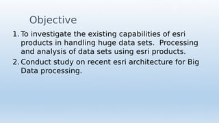
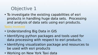

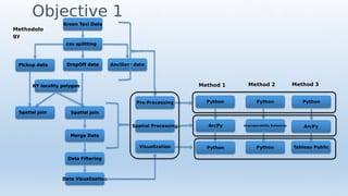
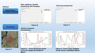
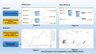
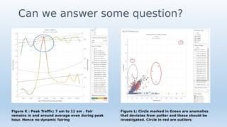
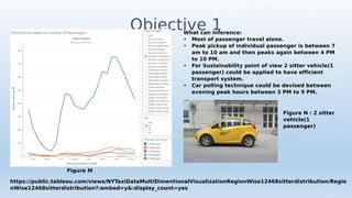
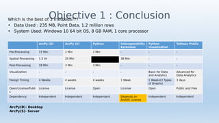
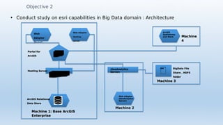


This document discusses investigating the capabilities of ESRI products for handling large datasets and big data. The objectives are to study ESRI's existing abilities to process and analyze large data sets, and to examine ESRI's architecture for big data processing. The author works with New York taxi trip data, comparing different processing and visualization methods in Python, ArcPy, and Tableau Public. These include spatial joining, data filtering, and creating visualizations to analyze patterns and outliers. The conclusion evaluates the best method based on processing time, dependencies, and license restrictions. Objective 2 briefly outlines ESRI's machine-based architecture for hosting big data solutions.


![제 23회 보아즈(BOAZ) 빅데이터 컨퍼런스 - [MBOAX] : ABSA를 활용한 소비자 반응 분석 기반 운영 효율화 대시보드 설계](https://cdn.slidesharecdn.com/ss_thumbnails/3-1boaz23rdconferencemboax-260203102709-9d519923-thumbnail.jpg?width=640&height=640&fit=bounds)


