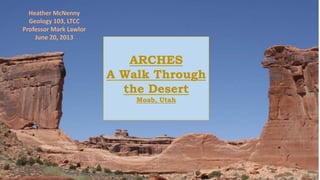
1. ARCHES
A Walk Through
the Desert
Moab, Utah
Heather McNenny
Geology 103, LTCC
Professor Mark Lawlor
June 20, 2013
2. CONTENT
• LOCATION, GEOGRAPHY, AND
MAP
• BACKGROUND of INFO
• GEOLOGICAL HISTORY
• COLORADO RIVER
• FLORA
• FAUNA
• BIOLOGICAL SOIL CRUST
• ROCK SAMPLES
• REFERENCES
4. Background of Info
Most of the information
gathered was during a trip I
took this June. The
information came from
Arches National Park and
Park Rangers. Any other
sources used will be listed in
the references page.
All of the photos were taken
on this trip, unless otherwise
stated.
5. Geological
History
• 300 MA, a sea flowed into the region and eventually
evaporated, leaving behind an evaporate bed of salt. This
salt bed is what lays underneath this area, causing the
arches, monoliths and spires.
• Desert conditions during the Early Jurassic brought thick
deposits of Navajo Sandstone ,followed by deposits of
Entrada Sandstone placed by streams and wind.
• Due to the weight of the sandstone cover, the salt bed
underneath liquefied, thrusting rock up creating salt domes.
• Faulting occurred between the salt domes causing the
imposing "Moab Fault."
• Erosion further created the landscape of the arches, leaving
the Navajo and Entrada Sandstone cover.
• Water forming to ice in cracks of the sandstone has caused
further erosion from the expansion and contraction of the
water. Wind helped to clear out debris, and cause further
erosion. The layers of fins in the rock strong enough to
overcome the erosion are what provide the arches today.
6. The Colorado
River
Cutting through the desert is the
Colorado River.
• The Colorado was formed as a result of the
Laramide orogeny that pushed up the Rocky
Mountains.
• This orogeny caused a stream running
westward, draining the water left behind from
the inland ocean of the Cretaceous period.
• The Colorado is responsible for cutting dramatic
geologic areas such as the Grand Canyon, and
the Colorado Plateau.
• Volcanic basalt flows dammed the Colorado
River into the Grand Canyon 1.8-10,000 years
ago, backing the river up 500 miles, all of the
way to Moab. As the dams eroded, it caused
major flooding, and waters up to 700ft barreling
through the Grand Canyon area.
7. FLORA
Pinyon Pine- Known for
producing pine nuts. From
the Pinus species, with two
major sub species: Pinus
Edulis and Pinus
Monophylla. Located all
over this area. The root
system is very strong, and
can break rock in search for
nutrients. Conifers such as
the Pinyon Pine evolved
from gymnosperms of the
Devonian Period of the
Paleozoic Era, reaching
their peak diversity in the
Mesozoic Era.
Prickly Pear Cactus- Known
as an edible cactus for both
humans and animals.
Found all over this area.
Common in arid conditions
in the Western
Hemisphere. Due to the
cooling in the Cenozoic
era, it created arid
conditions. This led to the
evolution of xerophytes. A
particular xerophyte which
was a jungle thorn bush is
the relative of all cacti.
8. FAUNA
Long Nosed Leopard
Lizzard-"Gambelia
Wisleizenii" Included in
genus "Crotaphytus"-
Found crossing my feet.
Common in Colorado
Plateau Deserts. Ancestry
prevalent in the Pilocene-
and early Pleistoscene.
Mule Deer-"Sensu Stricto"-
Evolved from Black Tail
Deer. Originally dating back
to the late Neogene with
the introduction of hooved
mammals.
Found grazing near Pinyon
Trees. They are known to
feed on conifers and other
desert plants such as sage
and other shrubs.
9. BIOLOGICAL
SOIL CRUST
Critical part of desert
ecosystems that
encourages life diversity
and nutrient cycling.
The crust is formed by
cyanobacteria, fungi,
lichens, and other
bacterias, holding together
the crust. This protects it
from erosion. The bacteria
adds nutrients to the soil
supporting vascular plant
life.
10. ROCK
SAMPLES
Quartzite-
A metamorphic rock
originating from quartz
sandstone. Due to tectonic
forces, pressure and
heat metamorphose quartz
sandstone into quartzite.
When it cools, the quartz
crystalizes, and fuses the
other materials
together. This rock is hard,
and has an outer layer of
quartz sandstone.
Quartz Sandstone-
A sedimentary rock
containing 95% quartz.
Formed by cementation of
sand grains. It generally
contains calcium
carbonate, silica, or iron
oxides. Its hardness is
determined by it's
cementing material.
11. REFERNCES
MAPS- mapofutah.net. Web. June 20,2013.
National Parks Service, Arches National Park. Web. June 20, 2013.
Evolution and Phylogeny of Cacti. Dalhousie Collection of Cacti and Other Succulents. Web.
June 20, 2013.
Gambelia Wislizenii. The IUCN Red List for Threatened Species. February, 2012. Web. June 20, 2013.
Rolf O. Peterson. Deer of the World: Their Evolution, Behavior, and Ecology. The Journal of Wildlife
Management, Vol. 64, No. 2, 606-607. Apr., 2000. Web. June 20, 2013.