Shellfish Management Plan Meeting Updates
•
1 like•879 views

Shellfish Management Plan Meeting Updates presented at April 14th, 2014 Rhode Island Shellfish Management Plan Stakeholder meeting
Report
Share
Report
Share
Download to read offline

Recommended
Zahl des Tages; 39,1 Milliarden Euro Umsatz im deutschen eCommerce
Zahl des Tages: 39,1 Milliarden Euro Umsatz im deutschen Online-Handel für 2013
Curcumin job file
This script runs a Gaussian 09 quantum chemistry calculation using 2 CPUs on a single compute node. It sets up the environment, runs the calculation using the methane2.input file, and cleans up scratch files when finished. The calculation is small and only uses one fourth of the node's resources.
Lab 10 nmr n1_2011
1. The document describes using Gaussian 03 on a Linux cluster to calculate the energies, NMR chemical shifts, and natural charges of several carbocation structures. Students will model one assigned carbocation and its neutral hydrocarbon in different geometries.
2. Calculations will be performed using Titan to optimize geometries at the AM1 level, then Gaussian 03 for further optimization and calculation of NMR shielding values and natural charges.
3. Instructions are provided for setting up accounts, transferring files to the cluster, running Gaussian 03 calculations, and extracting results from output files.
Trendradar: Der DIY Google Cardboard Controller
Virtual Reality-Papier Controller zum Selbstausrucken für $2 von Google Play. Kompatibel nur mir der VR App Arcade Shooter Poppist.
Asian Carp Invasion
The document discusses the invasion of Asian carp into the Great Lakes. Asian carp were introduced to the US in the 1970s but escaped into rivers due to flooding. They have since proliferated and migrated north, threatening the $7 billion Great Lake fisheries. Efforts to stop the carp include electric barriers on the Chicago Canal and plans for physical barriers or hydrologic separation. Removal efforts focus on netting and killing carp in key areas.
September SMP Update--Summer Progress
Azure Cygler, Extensions Specialist at URI Coastal Resources Center and Rhode Island Sea Grant, provides an update on the Shellfish Management Plan's progress through the summer.
2015 International Spatial Planning Symposium: Sharing Practical Solutions
The document summarizes findings from a review of marine spatial plans around the world. It finds that most plans are implemented at smaller spatial scales than entire ecosystems. It also finds that few institutional changes are made to governing bodies to implement coastal and marine spatial planning, relying instead on existing agencies. Additionally, it notes that while formal decision support tools are used, informal expert judgment also plays a role. The main messages are that there is no single approach for marine spatial planning and that the value is in the planning process of engaging stakeholders as much as the final plan.
Regional Planning
Five regional planning bodies have been established across the United States to coordinate ocean planning: the Northeast, Mid-Atlantic, Pacific Islands, Caribbean, and West Coast. The Northeast and Mid-Atlantic regions have established charters and are drafting regional marine plans to be completed in 2016. The Pacific Islands has a charter and is beginning to draft a plan, while the Caribbean is still finalizing its charter and the West Coast is working on one.
Ocean Planning's Impact
This document assessed the impact of past ocean management plans in several countries and U.S. states. It found that the plans supported $4.1 billion in ocean economies by siting wind farms and retaining existing industries. The plans also generated hundreds of millions of dollars annually in economic gains for new industries like wind power and retained billions within existing industries like fishing and tourism. While fishermen lost some access, they were compensated. The plans encouraged collaboration among stakeholders and expanded environmental protections over 50% of the planned areas while managing industrial growth. Future research on newer plans is needed to fully understand the long-term economic, environmental and social impacts of comprehensive ocean management.
Block Island Wind Farm
The Block Island Wind Farm project will consist of 5 turbines generating 30 MW of energy, enough for 17,000 homes. Construction is underway and commercial operations are scheduled for 2016. The project has completed permitting, engineering, and financing. It will create over 300 construction jobs and establish a new cable to the mainland, positioning the US for national leadership in offshore wind.
STORMTOOLS for Beginners
This document provides a tutorial for using STORMTOOLS, a web-based mapping tool for understanding coastal flood risk in Rhode Island. It outlines how to access and use the various features and layers in STORMTOOLS to determine flood depths and impacts under different hurricane and sea level rise scenarios. Key features include zooming and panning the map, adjusting layer transparency, toggling layers on and off, and clicking on locations to view flood depths and identify emergency services. The tutorial is created by a team from the University of Rhode Island and the Rhode Island Coastal Resources Management Council.
Beach samp stakeholder_tools_071415
Shoreline Change Special Area Management Plan (Beach SAMP) Stakeholder Meeting. Held on July 14, 2015. The purpose of the meeting was to review progress to date on development of tools, and discuss the next phase of the Beach SAMP porject.
Legal and Policy Strategies for SLAMM in Rhode Island
This document discusses potential legal and policy strategies for addressing sea level rise and marsh migration in Rhode Island. It examines transferred development rights and rolling easements as adaptive tools, noting that the strategies were researched by Sea Grant Law Fellows to help inform the SLAMM and Beach SAMP teams. The Beach SAMP process will further explore using these strategies as well as property rights and liability issues related to climate change impacts.
Coastal Wetland Adaptation Strategies
This document summarizes coastal wetland adaptation strategies presented at two municipal workshops in October 2014. The strategies included upland actions like facilitating marsh migration and removing barriers, as well as in-marsh actions like drainage improvements, elevation enhancement, and erosion control. Specific project examples were provided from locations around Rhode Island where marsh migration was being facilitated or impeded, and adaptation techniques like creek excavation and land protection were undertaken. Partnerships between municipalities, land trusts, and state agencies were noted as important for implementing projects costing $5,000 to $15,000 each to adapt coastal marshes to sea level rise.
Coastal Weland Management and Adaptation Straegies
Methods, Partnerships and Resources
SLAMM Municipal Workshop
October 26 & 28, 2014
Caitlin Chaffee
Wenley Ferguson
Sea Level Rise & the Conservation of Wetlands: Issues and Opportunities for C...
1) The document discusses how municipalities in Rhode Island can incorporate projections of sea level rise and coastal flooding from the SLAMM (Sea Level Affecting Marshes Model) into their local comprehensive plans and policies.
2) It provides examples of how North Kingstown used SLAMM maps and data to update hazard mitigation and adaptation strategies in their comprehensive plan.
3) The document outlines challenges municipalities may face in planning for sea level rise and adapting infrastructure, and compares approaches some other states have taken through regulations and designated planning areas.
Local Case Studies
This document summarizes several local case studies on coastal communities in Rhode Island that are vulnerable to sea level rise. It describes modeling of 1 foot, 3 foot, and 5 foot sea level rise scenarios for the communities of Jamestown, Barrington/Warren, and Charlestown. For each community, the document identifies current land uses and infrastructure that are at risk of flooding and inundation. It also provides potential issues and opportunities to address the impacts of sea level rise through actions such as elevating roads, relocating facilities, protecting undeveloped lands, and coordinating land management between stakeholders.
Sea Level Affecting Marshes Model (SLAMM)
The Sea Level Affecting Marshes Model (SLAMM) simulates wetland conversions during sea level rise. It has been applied and improved since 1985 and used worldwide. The document describes how SLAMM models elevation, vegetation zones, accretion rates, and other parameters to project wetland impacts from sea level rise under various scenarios. It also notes limitations such as uncertainty in sea level projections and complexity of ground conditions and coastal dynamics.
Sea Levels Affecting Marshes Model Using SLAMM to Conserve Rhode Island’s Coa...
This document summarizes information presented at a workshop on using the Sea Level Affecting Marshes Model (SLAMM) to project impacts of sea level rise on coastal wetlands in Rhode Island. Key points include:
- Tidal marshes provide important ecosystem services like habitat, water filtration, and flood protection. Rhode Island has lost over 50% of its historic salt marshes.
- Sea levels are rising faster in Rhode Island due to climate change, increasing the risk of wetland loss and property damage from flooding. The SLAMM model projects significant wetland loss under scenarios of 1, 3, and 5 feet of sea level rise.
- The SLAMM projections will help identify vulnerable wetlands and
RI Shoreline Change Special Area Management Plan
This document discusses planning for sea level rise in Rhode Island. It provides past, present and projected future rates of sea level rise. It identifies potential impacts of sea level rise such as erosion, overwash, wetland loss, and infrastructure failure. Maps show examples of projected inundation in Newport Harbor from 5 feet of sea level rise. The document outlines studies and data being collected on erosion rates, sediment transport, inundation mapping, and economic impacts. It discusses developing policy recommendations, education materials, and adaptation guidelines for municipalities. Products under development include updated erosion maps, economic analyses, and identification of at-risk infrastructure. The goal is to provide cities and towns with tools and lessons from other areas to help plan for and
STORMTOOLS* -Simplified Flood Inundation Maps for RI with Sea Level Rise (SLR)
Malcolm L. Spaulding1
Chris Damon2
1Professor Emeritus, Ocean Engineering
2Environmental Data Center
University of RI
December 9, 2014
*http://www.beachsamp.org/research/stormtools/
Narragansett, RI
IBHS FORTIFIED Building Programs
Key Tools for Businesses
Overview of tools and resources that can help businesses address priority resilience issues. Fortified Commercial ™ – Chuck Miccolis, Insurance Institute for Business and Home Safety
Lessons from Sandy and Green Infrastructure Strategies
Hoboken, New Jersey—Lessons from Sandy and Green Infrastructure Strategy. How to prepare for the next storm and be creative with flood control. Presented by Stephen Marks, City of Hoboken
Economic Justification for Action Now in Rhode Island
Economic Justification for Action Now in Rhode Island. What is the evidence that acting now saves money by James Neumann, Industrial Economics.
Green Infrastructure
Key Tools for Businesses: An overview of tools and resources that can help businesses address priority resilience issues. Resilience Green Infrastructure presented by James Houle, Stormwater Center, University of New Hampshire.
Gulf of Mexico Alliance Resilient Marina Checklist
Key Tools for Businesses: An overview of tools and resources that can help businesses address priority resilience issues. Resilience Checklist presented by Lauren Land, Louisiana Sea Grant College Program
PCOS corelations and management through Ayurveda.
This presentation includes basic of PCOS their pathology and treatment and also Ayurveda correlation of PCOS and Ayurvedic line of treatment mentioned in classics.
ISO/IEC 27001, ISO/IEC 42001, and GDPR: Best Practices for Implementation and...
Denis is a dynamic and results-driven Chief Information Officer (CIO) with a distinguished career spanning information systems analysis and technical project management. With a proven track record of spearheading the design and delivery of cutting-edge Information Management solutions, he has consistently elevated business operations, streamlined reporting functions, and maximized process efficiency.
Certified as an ISO/IEC 27001: Information Security Management Systems (ISMS) Lead Implementer, Data Protection Officer, and Cyber Risks Analyst, Denis brings a heightened focus on data security, privacy, and cyber resilience to every endeavor.
His expertise extends across a diverse spectrum of reporting, database, and web development applications, underpinned by an exceptional grasp of data storage and virtualization technologies. His proficiency in application testing, database administration, and data cleansing ensures seamless execution of complex projects.
What sets Denis apart is his comprehensive understanding of Business and Systems Analysis technologies, honed through involvement in all phases of the Software Development Lifecycle (SDLC). From meticulous requirements gathering to precise analysis, innovative design, rigorous development, thorough testing, and successful implementation, he has consistently delivered exceptional results.
Throughout his career, he has taken on multifaceted roles, from leading technical project management teams to owning solutions that drive operational excellence. His conscientious and proactive approach is unwavering, whether he is working independently or collaboratively within a team. His ability to connect with colleagues on a personal level underscores his commitment to fostering a harmonious and productive workplace environment.
Date: May 29, 2024
Tags: Information Security, ISO/IEC 27001, ISO/IEC 42001, Artificial Intelligence, GDPR
-------------------------------------------------------------------------------
Find out more about ISO training and certification services
Training: ISO/IEC 27001 Information Security Management System - EN | PECB
ISO/IEC 42001 Artificial Intelligence Management System - EN | PECB
General Data Protection Regulation (GDPR) - Training Courses - EN | PECB
Webinars: https://pecb.com/webinars
Article: https://pecb.com/article
-------------------------------------------------------------------------------
For more information about PECB:
Website: https://pecb.com/
LinkedIn: https://www.linkedin.com/company/pecb/
Facebook: https://www.facebook.com/PECBInternational/
Slideshare: http://www.slideshare.net/PECBCERTIFICATION
More Related Content
More from riseagrant
2015 International Spatial Planning Symposium: Sharing Practical Solutions
The document summarizes findings from a review of marine spatial plans around the world. It finds that most plans are implemented at smaller spatial scales than entire ecosystems. It also finds that few institutional changes are made to governing bodies to implement coastal and marine spatial planning, relying instead on existing agencies. Additionally, it notes that while formal decision support tools are used, informal expert judgment also plays a role. The main messages are that there is no single approach for marine spatial planning and that the value is in the planning process of engaging stakeholders as much as the final plan.
Regional Planning
Five regional planning bodies have been established across the United States to coordinate ocean planning: the Northeast, Mid-Atlantic, Pacific Islands, Caribbean, and West Coast. The Northeast and Mid-Atlantic regions have established charters and are drafting regional marine plans to be completed in 2016. The Pacific Islands has a charter and is beginning to draft a plan, while the Caribbean is still finalizing its charter and the West Coast is working on one.
Ocean Planning's Impact
This document assessed the impact of past ocean management plans in several countries and U.S. states. It found that the plans supported $4.1 billion in ocean economies by siting wind farms and retaining existing industries. The plans also generated hundreds of millions of dollars annually in economic gains for new industries like wind power and retained billions within existing industries like fishing and tourism. While fishermen lost some access, they were compensated. The plans encouraged collaboration among stakeholders and expanded environmental protections over 50% of the planned areas while managing industrial growth. Future research on newer plans is needed to fully understand the long-term economic, environmental and social impacts of comprehensive ocean management.
Block Island Wind Farm
The Block Island Wind Farm project will consist of 5 turbines generating 30 MW of energy, enough for 17,000 homes. Construction is underway and commercial operations are scheduled for 2016. The project has completed permitting, engineering, and financing. It will create over 300 construction jobs and establish a new cable to the mainland, positioning the US for national leadership in offshore wind.
STORMTOOLS for Beginners
This document provides a tutorial for using STORMTOOLS, a web-based mapping tool for understanding coastal flood risk in Rhode Island. It outlines how to access and use the various features and layers in STORMTOOLS to determine flood depths and impacts under different hurricane and sea level rise scenarios. Key features include zooming and panning the map, adjusting layer transparency, toggling layers on and off, and clicking on locations to view flood depths and identify emergency services. The tutorial is created by a team from the University of Rhode Island and the Rhode Island Coastal Resources Management Council.
Beach samp stakeholder_tools_071415
Shoreline Change Special Area Management Plan (Beach SAMP) Stakeholder Meeting. Held on July 14, 2015. The purpose of the meeting was to review progress to date on development of tools, and discuss the next phase of the Beach SAMP porject.
Legal and Policy Strategies for SLAMM in Rhode Island
This document discusses potential legal and policy strategies for addressing sea level rise and marsh migration in Rhode Island. It examines transferred development rights and rolling easements as adaptive tools, noting that the strategies were researched by Sea Grant Law Fellows to help inform the SLAMM and Beach SAMP teams. The Beach SAMP process will further explore using these strategies as well as property rights and liability issues related to climate change impacts.
Coastal Wetland Adaptation Strategies
This document summarizes coastal wetland adaptation strategies presented at two municipal workshops in October 2014. The strategies included upland actions like facilitating marsh migration and removing barriers, as well as in-marsh actions like drainage improvements, elevation enhancement, and erosion control. Specific project examples were provided from locations around Rhode Island where marsh migration was being facilitated or impeded, and adaptation techniques like creek excavation and land protection were undertaken. Partnerships between municipalities, land trusts, and state agencies were noted as important for implementing projects costing $5,000 to $15,000 each to adapt coastal marshes to sea level rise.
Coastal Weland Management and Adaptation Straegies
Methods, Partnerships and Resources
SLAMM Municipal Workshop
October 26 & 28, 2014
Caitlin Chaffee
Wenley Ferguson
Sea Level Rise & the Conservation of Wetlands: Issues and Opportunities for C...
1) The document discusses how municipalities in Rhode Island can incorporate projections of sea level rise and coastal flooding from the SLAMM (Sea Level Affecting Marshes Model) into their local comprehensive plans and policies.
2) It provides examples of how North Kingstown used SLAMM maps and data to update hazard mitigation and adaptation strategies in their comprehensive plan.
3) The document outlines challenges municipalities may face in planning for sea level rise and adapting infrastructure, and compares approaches some other states have taken through regulations and designated planning areas.
Local Case Studies
This document summarizes several local case studies on coastal communities in Rhode Island that are vulnerable to sea level rise. It describes modeling of 1 foot, 3 foot, and 5 foot sea level rise scenarios for the communities of Jamestown, Barrington/Warren, and Charlestown. For each community, the document identifies current land uses and infrastructure that are at risk of flooding and inundation. It also provides potential issues and opportunities to address the impacts of sea level rise through actions such as elevating roads, relocating facilities, protecting undeveloped lands, and coordinating land management between stakeholders.
Sea Level Affecting Marshes Model (SLAMM)
The Sea Level Affecting Marshes Model (SLAMM) simulates wetland conversions during sea level rise. It has been applied and improved since 1985 and used worldwide. The document describes how SLAMM models elevation, vegetation zones, accretion rates, and other parameters to project wetland impacts from sea level rise under various scenarios. It also notes limitations such as uncertainty in sea level projections and complexity of ground conditions and coastal dynamics.
Sea Levels Affecting Marshes Model Using SLAMM to Conserve Rhode Island’s Coa...
This document summarizes information presented at a workshop on using the Sea Level Affecting Marshes Model (SLAMM) to project impacts of sea level rise on coastal wetlands in Rhode Island. Key points include:
- Tidal marshes provide important ecosystem services like habitat, water filtration, and flood protection. Rhode Island has lost over 50% of its historic salt marshes.
- Sea levels are rising faster in Rhode Island due to climate change, increasing the risk of wetland loss and property damage from flooding. The SLAMM model projects significant wetland loss under scenarios of 1, 3, and 5 feet of sea level rise.
- The SLAMM projections will help identify vulnerable wetlands and
RI Shoreline Change Special Area Management Plan
This document discusses planning for sea level rise in Rhode Island. It provides past, present and projected future rates of sea level rise. It identifies potential impacts of sea level rise such as erosion, overwash, wetland loss, and infrastructure failure. Maps show examples of projected inundation in Newport Harbor from 5 feet of sea level rise. The document outlines studies and data being collected on erosion rates, sediment transport, inundation mapping, and economic impacts. It discusses developing policy recommendations, education materials, and adaptation guidelines for municipalities. Products under development include updated erosion maps, economic analyses, and identification of at-risk infrastructure. The goal is to provide cities and towns with tools and lessons from other areas to help plan for and
STORMTOOLS* -Simplified Flood Inundation Maps for RI with Sea Level Rise (SLR)
Malcolm L. Spaulding1
Chris Damon2
1Professor Emeritus, Ocean Engineering
2Environmental Data Center
University of RI
December 9, 2014
*http://www.beachsamp.org/research/stormtools/
Narragansett, RI
IBHS FORTIFIED Building Programs
Key Tools for Businesses
Overview of tools and resources that can help businesses address priority resilience issues. Fortified Commercial ™ – Chuck Miccolis, Insurance Institute for Business and Home Safety
Lessons from Sandy and Green Infrastructure Strategies
Hoboken, New Jersey—Lessons from Sandy and Green Infrastructure Strategy. How to prepare for the next storm and be creative with flood control. Presented by Stephen Marks, City of Hoboken
Economic Justification for Action Now in Rhode Island
Economic Justification for Action Now in Rhode Island. What is the evidence that acting now saves money by James Neumann, Industrial Economics.
Green Infrastructure
Key Tools for Businesses: An overview of tools and resources that can help businesses address priority resilience issues. Resilience Green Infrastructure presented by James Houle, Stormwater Center, University of New Hampshire.
Gulf of Mexico Alliance Resilient Marina Checklist
Key Tools for Businesses: An overview of tools and resources that can help businesses address priority resilience issues. Resilience Checklist presented by Lauren Land, Louisiana Sea Grant College Program
More from riseagrant (20)
2015 International Spatial Planning Symposium: Sharing Practical Solutions
2015 International Spatial Planning Symposium: Sharing Practical Solutions
Legal and Policy Strategies for SLAMM in Rhode Island
Legal and Policy Strategies for SLAMM in Rhode Island
Coastal Weland Management and Adaptation Straegies
Coastal Weland Management and Adaptation Straegies
Sea Level Rise & the Conservation of Wetlands: Issues and Opportunities for C...
Sea Level Rise & the Conservation of Wetlands: Issues and Opportunities for C...
Sea Levels Affecting Marshes Model Using SLAMM to Conserve Rhode Island’s Coa...
Sea Levels Affecting Marshes Model Using SLAMM to Conserve Rhode Island’s Coa...
STORMTOOLS* -Simplified Flood Inundation Maps for RI with Sea Level Rise (SLR)
STORMTOOLS* -Simplified Flood Inundation Maps for RI with Sea Level Rise (SLR)
Lessons from Sandy and Green Infrastructure Strategies
Lessons from Sandy and Green Infrastructure Strategies
Economic Justification for Action Now in Rhode Island
Economic Justification for Action Now in Rhode Island
Gulf of Mexico Alliance Resilient Marina Checklist
Gulf of Mexico Alliance Resilient Marina Checklist
Recently uploaded
PCOS corelations and management through Ayurveda.
This presentation includes basic of PCOS their pathology and treatment and also Ayurveda correlation of PCOS and Ayurvedic line of treatment mentioned in classics.
ISO/IEC 27001, ISO/IEC 42001, and GDPR: Best Practices for Implementation and...
Denis is a dynamic and results-driven Chief Information Officer (CIO) with a distinguished career spanning information systems analysis and technical project management. With a proven track record of spearheading the design and delivery of cutting-edge Information Management solutions, he has consistently elevated business operations, streamlined reporting functions, and maximized process efficiency.
Certified as an ISO/IEC 27001: Information Security Management Systems (ISMS) Lead Implementer, Data Protection Officer, and Cyber Risks Analyst, Denis brings a heightened focus on data security, privacy, and cyber resilience to every endeavor.
His expertise extends across a diverse spectrum of reporting, database, and web development applications, underpinned by an exceptional grasp of data storage and virtualization technologies. His proficiency in application testing, database administration, and data cleansing ensures seamless execution of complex projects.
What sets Denis apart is his comprehensive understanding of Business and Systems Analysis technologies, honed through involvement in all phases of the Software Development Lifecycle (SDLC). From meticulous requirements gathering to precise analysis, innovative design, rigorous development, thorough testing, and successful implementation, he has consistently delivered exceptional results.
Throughout his career, he has taken on multifaceted roles, from leading technical project management teams to owning solutions that drive operational excellence. His conscientious and proactive approach is unwavering, whether he is working independently or collaboratively within a team. His ability to connect with colleagues on a personal level underscores his commitment to fostering a harmonious and productive workplace environment.
Date: May 29, 2024
Tags: Information Security, ISO/IEC 27001, ISO/IEC 42001, Artificial Intelligence, GDPR
-------------------------------------------------------------------------------
Find out more about ISO training and certification services
Training: ISO/IEC 27001 Information Security Management System - EN | PECB
ISO/IEC 42001 Artificial Intelligence Management System - EN | PECB
General Data Protection Regulation (GDPR) - Training Courses - EN | PECB
Webinars: https://pecb.com/webinars
Article: https://pecb.com/article
-------------------------------------------------------------------------------
For more information about PECB:
Website: https://pecb.com/
LinkedIn: https://www.linkedin.com/company/pecb/
Facebook: https://www.facebook.com/PECBInternational/
Slideshare: http://www.slideshare.net/PECBCERTIFICATION
Chapter 4 - Islamic Financial Institutions in Malaysia.pptx
Chapter 4 - Islamic Financial Institutions in Malaysia.pptxMohd Adib Abd Muin, Senior Lecturer at Universiti Utara Malaysia
This slide is special for master students (MIBS & MIFB) in UUM. Also useful for readers who are interested in the topic of contemporary Islamic banking.
How to Make a Field Mandatory in Odoo 17
In Odoo, making a field required can be done through both Python code and XML views. When you set the required attribute to True in Python code, it makes the field required across all views where it's used. Conversely, when you set the required attribute in XML views, it makes the field required only in the context of that particular view.
LAND USE LAND COVER AND NDVI OF MIRZAPUR DISTRICT, UP
This Dissertation explores the particular circumstances of Mirzapur, a region located in the
core of India. Mirzapur, with its varied terrains and abundant biodiversity, offers an optimal
environment for investigating the changes in vegetation cover dynamics. Our study utilizes
advanced technologies such as GIS (Geographic Information Systems) and Remote sensing to
analyze the transformations that have taken place over the course of a decade.
The complex relationship between human activities and the environment has been the focus
of extensive research and worry. As the global community grapples with swift urbanization,
population expansion, and economic progress, the effects on natural ecosystems are becoming
more evident. A crucial element of this impact is the alteration of vegetation cover, which plays a
significant role in maintaining the ecological equilibrium of our planet.Land serves as the foundation for all human activities and provides the necessary materials for
these activities. As the most crucial natural resource, its utilization by humans results in different
'Land uses,' which are determined by both human activities and the physical characteristics of the
land.
The utilization of land is impacted by human needs and environmental factors. In countries
like India, rapid population growth and the emphasis on extensive resource exploitation can lead
to significant land degradation, adversely affecting the region's land cover.
Therefore, human intervention has significantly influenced land use patterns over many
centuries, evolving its structure over time and space. In the present era, these changes have
accelerated due to factors such as agriculture and urbanization. Information regarding land use and
cover is essential for various planning and management tasks related to the Earth's surface,
providing crucial environmental data for scientific, resource management, policy purposes, and
diverse human activities.
Accurate understanding of land use and cover is imperative for the development planning
of any area. Consequently, a wide range of professionals, including earth system scientists, land
and water managers, and urban planners, are interested in obtaining data on land use and cover
changes, conversion trends, and other related patterns. The spatial dimensions of land use and
cover support policymakers and scientists in making well-informed decisions, as alterations in
these patterns indicate shifts in economic and social conditions. Monitoring such changes with the
help of Advanced technologies like Remote Sensing and Geographic Information Systems is
crucial for coordinated efforts across different administrative levels. Advanced technologies like
Remote Sensing and Geographic Information Systems
9
Changes in vegetation cover refer to variations in the distribution, composition, and overall
structure of plant communities across different temporal and spatial scales. These changes can
occur natural.
RHEOLOGY Physical pharmaceutics-II notes for B.pharm 4th sem students
Physical pharmaceutics notes for B.pharm students
Reimagining Your Library Space: How to Increase the Vibes in Your Library No ...
Librarians are leading the way in creating future-ready citizens – now we need to update our spaces to match. In this session, attendees will get inspiration for transforming their library spaces. You’ll learn how to survey students and patrons, create a focus group, and use design thinking to brainstorm ideas for your space. We’ll discuss budget friendly ways to change your space as well as how to find funding. No matter where you’re at, you’ll find ideas for reimagining your space in this session.
Wound healing PPT
This document provides an overview of wound healing, its functions, stages, mechanisms, factors affecting it, and complications.
A wound is a break in the integrity of the skin or tissues, which may be associated with disruption of the structure and function.
Healing is the body’s response to injury in an attempt to restore normal structure and functions.
Healing can occur in two ways: Regeneration and Repair
There are 4 phases of wound healing: hemostasis, inflammation, proliferation, and remodeling. This document also describes the mechanism of wound healing. Factors that affect healing include infection, uncontrolled diabetes, poor nutrition, age, anemia, the presence of foreign bodies, etc.
Complications of wound healing like infection, hyperpigmentation of scar, contractures, and keloid formation.
Walmart Business+ and Spark Good for Nonprofits.pdf
"Learn about all the ways Walmart supports nonprofit organizations.
You will hear from Liz Willett, the Head of Nonprofits, and hear about what Walmart is doing to help nonprofits, including Walmart Business and Spark Good. Walmart Business+ is a new offer for nonprofits that offers discounts and also streamlines nonprofits order and expense tracking, saving time and money.
The webinar may also give some examples on how nonprofits can best leverage Walmart Business+.
The event will cover the following::
Walmart Business + (https://business.walmart.com/plus) is a new shopping experience for nonprofits, schools, and local business customers that connects an exclusive online shopping experience to stores. Benefits include free delivery and shipping, a 'Spend Analytics” feature, special discounts, deals and tax-exempt shopping.
Special TechSoup offer for a free 180 days membership, and up to $150 in discounts on eligible orders.
Spark Good (walmart.com/sparkgood) is a charitable platform that enables nonprofits to receive donations directly from customers and associates.
Answers about how you can do more with Walmart!"
Pengantar Penggunaan Flutter - Dart programming language1.pptx
Pengantar Penggunaan Flutter - Dart programming language1.pptx
How to Fix the Import Error in the Odoo 17
An import error occurs when a program fails to import a module or library, disrupting its execution. In languages like Python, this issue arises when the specified module cannot be found or accessed, hindering the program's functionality. Resolving import errors is crucial for maintaining smooth software operation and uninterrupted development processes.
clinical examination of hip joint (1).pdf
described clinical examination all orthopeadic conditions .
The Diamonds of 2023-2024 in the IGRA collection
A review of the growth of the Israel Genealogy Research Association Database Collection for the last 12 months. Our collection is now passed the 3 million mark and still growing. See which archives have contributed the most. See the different types of records we have, and which years have had records added. You can also see what we have for the future.
Recently uploaded (20)
ISO/IEC 27001, ISO/IEC 42001, and GDPR: Best Practices for Implementation and...
ISO/IEC 27001, ISO/IEC 42001, and GDPR: Best Practices for Implementation and...
Chapter 4 - Islamic Financial Institutions in Malaysia.pptx
Chapter 4 - Islamic Financial Institutions in Malaysia.pptx
LAND USE LAND COVER AND NDVI OF MIRZAPUR DISTRICT, UP
LAND USE LAND COVER AND NDVI OF MIRZAPUR DISTRICT, UP
Liberal Approach to the Study of Indian Politics.pdf
Liberal Approach to the Study of Indian Politics.pdf
RHEOLOGY Physical pharmaceutics-II notes for B.pharm 4th sem students
RHEOLOGY Physical pharmaceutics-II notes for B.pharm 4th sem students
Film vocab for eal 3 students: Australia the movie
Film vocab for eal 3 students: Australia the movie
Reimagining Your Library Space: How to Increase the Vibes in Your Library No ...
Reimagining Your Library Space: How to Increase the Vibes in Your Library No ...
Walmart Business+ and Spark Good for Nonprofits.pdf
Walmart Business+ and Spark Good for Nonprofits.pdf
Pengantar Penggunaan Flutter - Dart programming language1.pptx
Pengantar Penggunaan Flutter - Dart programming language1.pptx
Shellfish Management Plan Meeting Updates
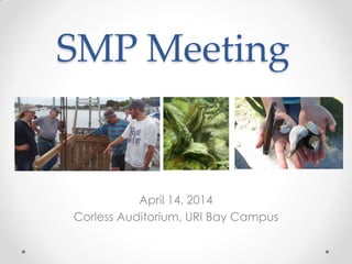
- 1. SMP Meeting April 14, 2014 Corless Auditorium, URI Bay Campus
- 2. Plan for the Evening… • Quick SMP updates • “Feature Presentation”, followed by Q/A • Three short presentations from Sea Grant-Funded researchers, followed by Q/A
- 3. Sea Grant-funded research presentations… Scott Rutherford, et al. “Quahog Larval Dispersion and Settlement in Narragansett Bay” Tom Angell, Kathy Castro, Katie Eagan “Developing Information and Local Capacity to Manage the R.I. Whelk Fishery.” Roxanna Smolowitz “Could Disease in Blue Mussels Affect Commercial Culture in the Northeast Region?”
- 4. SMP Updates… • Chapter 1 ready • www.rismp.org/ The Plan • Next Chapters for review o Ch.8, Ch.3 (May) o Ch.5 (June) o Ch.2 (July) • Comment period through August
- 5. SMP Updates… • Marketing progress, Hope & Main • State Vibrio Plan (for oysters) • Plan to assess and maintain signage • East Bay Upweller - In progress • Upcoming events & seminars • Please take a survey!
- 6. Our “Feature Presentation”… “Where the Wild Quahogs Are: Looking at Quahog Larval Supply and Distribution in the Upper Narragansett Bay” Dale Leavitt (RWU), David Ullman (GSO), Chris Kincaid (GSO), Dennis Erkan (DEM), Mike McGiveney (RISA), Scott Rutherford (RWU), Mark Gibson (DEM), Jeff Mercer (DEM), and Tim Scott (RWU)