Expanding frontiers of collaboration: EUscreenXLMariana Salgado
This is a presentation we have done (Mariana Salgado
Inga Vizgirdiene) in Tallinn, Estonia on the 28.10.2015. We describe the reasons for archives to participate in this kind of projects and the process of designing tools for portals such EUscreenXL. The conference was BAAC (Baltic Audiovisual Archive Council).
Sound Connections pilot @ Europeana Creative Culture Jam 2015, VIennaLizzy Komen
Lizzy Komen from the Netherlands Institute for Sound and Vision presented the "Sound Connections" social networks pilot. The pilot allows communities to explore and enrich sound collections from several cultural institutions through a social networking platform. Partners in the pilot include the British Library, Historypin, Ontotext, and the Netherlands Institute for Sound and Vision. The pilot connects thousands of audio tracks from each institution. Users can tag and comment on sounds, and cultural institutions receive notifications about user contributions. Historypin has extended the platform by allowing other institutions to host collections and by increasing scale through projects on the First World War Centenary Hub.
Geoscience Data Transfers Standards: EarthResourceML and GeoSciML, tools to d...Minerals4EU
Jouni Vuollo (GTK) presented EarthResourceML and GeoSciML, tools to deliver mineral resources data in EU and globally, at the first international conference on Minerals in Circular Economy, Finland, 26-27 November 2014. Conference website: www.mince.fi
Minerals4EU - European Intelligence Network on the Supply of Raw MaterialsMinerals4EU
The Minerals4EU Project is designed to meet the recommendations of the Raw Materials Initiative and will develop an EU Mineral intelligence network structure delivering a web portal, a European Minerals Yearbook and foresight studies. This presentation gives an overview of the Project. More information about the Project is available at www.minerals4eu.eu
This document outlines the vision and goals of E-RIHS, a proposed European Research Infrastructure for Heritage Science. E-RIHS aims to be a flagship infrastructure that provides access to analytical instruments, scientific archives, and mobile laboratories for advanced study and preservation of cultural heritage objects and collections. It identifies key priorities such as developing interdisciplinary collaborations, connecting knowledge through data sharing, and ensuring excellence, ethics, quality, and community engagement in heritage science research. The infrastructure is intended to foster new discoveries, methods, and generations of scientists working at the intersection of heritage and science.
Minerals4EU - Delivering the European Minerals YearbookMinerals4EU
The European Minerals Yearbook was presented in a Stakeholder Workshop in Brussels 3 December 2014 by the Work Package 4 Team, lead by the British Geological Survey (BGS). More information about the Minerals4EU Project is available at www.minerals4eu.eu
The Register of Antarctic Marine Species (RAMS) has three main objectives:
1) Provide taxonomic data to various Antarctic biodiversity information systems.
2) Establish a benchmark of current taxonomic knowledge of Southern Ocean biodiversity.
3) Serve as an authoritative reference for Antarctic marine species classification.
The document describes a dataset of sea stars (Antarctic starfish) collected during the ANDEEP3 expedition in 2005. The expedition focused on deep-sea stations in the Powell Basin and Weddell Sea of Antarctica. Sea stars were collected using trawling methods at depths ranging from 1,047 to 4,931 meters. The dataset includes information on the starfish specimens collected, such as location and depth of collection. A data paper describing the dataset was published in the peer-reviewed open-access journal ZooKeys to make the dataset available and provide scholarly credit to the data publishers.
The document describes plans to build an online, collaborative field guide for Antarctic wildlife. It will allow users to browse entries on different taxa, build custom field guides, and download printable versions. Several organizations will collaborate and contribute content. The field guide will have a backoffice for editing and a frontoffice for public use. It will integrate with existing databases and image sources. The goal is to provide comprehensive information on Antarctic species to help with identification in the field.
The document discusses biodiversity data from Antarctica and efforts to make it freely accessible online. It describes several initiatives including SCAR-MarBIN, ANTABIF, and GBIF that host Antarctic biodiversity data and enable users to access over 1 million records. Examples of applications for the data are also provided, such as modeling species distributions, examining responses to climate change, and designing targeted scientific expeditions. Challenges in fully realizing the potential of the data are also discussed.
Presentation given at the Standing Groups meeting at the SCAR Open Science Conference. This presentation focuses on a facet of the ANTABIF architecture, the GBIF Integrated Publishing Toolkit
This presentation was given as a keynote during the CAML session at the SCAR open science conference in Buenos Aires, August 2010. Its an introduction to Polar data sharing, focusing on SCAR's Marine Biodiversity Information Network (www.scarmarbin.be) and the new Antarctic Biodiversity Information Facility (www.biodiversity.aq). Both these projects aim at offering free and open access to raw scientific data pertaining to Antarctic biodiversity.
OSGi Users' Forum UK - Meeting 23rd June 2011mfrancis
This document summarizes the agenda and notes from an OSGi Users' Forum meeting held in London on June 23, 2011. The meeting included welcome remarks, announcements about upcoming OSGi events, and a panel discussion on OSGi development tooling featuring representatives from BndTools, Equinox, Pax, and other OSGi tools. The agenda items were: welcome and announcements, the tooling panel discussion, and closing remarks before attendees went to a local pub for drinks.
This document discusses OpenStreetMap (OSM) and its role in responding to the 2011 Tohoku earthquake and tsunami in Japan. It notes that OSM is a free editable map of the world created via wiki-style collaboration. After the disaster, OSM provided up-to-date maps of the affected areas incorporating satellite imagery and GPS data collected by volunteers. OSM has since become a key open source mapping platform for disaster response.
International Biodiversity Projects and Natural History Museums: Current stat...Klaus Riede
International Biodiversity Projects and Natural History Museums: Current state and perspectives
Presentation Nov 2009 Brussels, premises of Leibniz Gemeinschaft.
Though somewhat outdated, most of the issues and projects are still valid
EBI's role in barcoding includes broader dissemination of barcoding data as part of INSDC, developing data structures and standards, providing submission services, and hosting repositories of reference datasets and tools for data access. EBI is working to develop specific data structures for specimens, cultures, and biomaterials under INSDC and a data standard for barcoding. It provides interactive and programmatic retrieval and aims to further roles in locus discovery, sequencing processing, and integration with collections and taxonomic databases.
SCAR-MarBIN and ANTABIF are open access biodiversity data portals for Antarctic species. They provide taxonomic and geospatial data for over 50 million records through their websites and web services. The portals aim to build an open ecosystem for sharing Antarctic biodiversity data through standardization and community involvement. Upcoming products will include georeferenced genetic data and interactive atlases.
The document discusses opening up and sharing bibliographic data. It covers the history and development of the world wide web, semantic web, and open data movement. The presentation argues that libraries and cultural heritage institutions should make their bibliographic metadata openly available under open licenses in order to share information and resources with other institutions, users, and the world.
Biodiversity Information Networks: Dataflows for interdisciplinary sciencesGBIF_NPT
Danis and Parsons, presentation given at the World Conference on Marine Biodiversity, Aberdeen, September 2011.
ANSTRACT: In this paper, we present SCAR’s Marine Biodiversity Information Network (SCAR-MarBIN, www.scarmarbin.be), introduce the new Antarctic Biodiversity Information Facility (ANTABIF, www.biodiversity.aq) and argue that it has become vital and practicable to support an international mechanism for the exchange of scientific data. This approach allows to integrate large data volumes, and helps modern biologists to face a “data deluge” using new techniques and technologies currently developed in the field of biodiversity informatics. Biodiversity is an example of data-intensive science, and certainly requires an interdisciplinary, scalable approach to address complex systemic problems such as environmental change and its impact on marine ecosystems. This paper discusses the experience of data scientists seeking to collect, curate, and provide data during the timeframe of the International Polar Year. The data content of the SCAR-MarBIN and ANTABIF holdings has been explored, and recent published analyses are used to illustrate concrete examples. We find that while technology is a critical factor to address this dimension, the greater challenges are more socio-cultural than technical. We describe a vision of discoverable, open, linked, useful, and safe data and suggest the need for a rapid socio-technical evolution in the overall science data ecosystem.
Biodiversity Information Networks: dataflows for interdisciplinary scienceBruno Danis
In this paper, we present SCAR’s Marine Biodiversity Information Network (SCAR-MarBIN, www.scarmarbin.be), introduce the new Antarctic Biodiversity Information Facility (ANTABIF, HYPERLINK "http://www.biodiversity.aq" www.biodiversity.aq) and argue that it has become vital and practicable to support an international mechanism for the exchange of scientific data. This approach allows to integrate large data volumes, and helps modern biologists to face a “data deluge” using new techniques and technologies currently developed in the field of biodiversity informatics. Biodiversity is an example of data-intensive science, and certainly requires an interdisciplinary, scalable approach to address complex systemic problems such as environmental change and its impact on marine ecosystems. This paper discusses the experience of data scientists seeking to collect, curate, and provide data during the timeframe of the International Polar Year. The data content of the SCAR-MarBIN and ANTABIF holdings has been explored, and recent published analyses are used to illustrate concrete examples. We find that while technology is a critical factor to address this dimension, the greater challenges are more socio-cultural than technical. We describe a vision of discoverable, open, linked, useful, and safe data and suggest the need for a rapid socio-technical evolution in the overall science data ecosystem.
This document provides an overview and objectives of an ANTABIF training session. The training will familiarize participants with ANTABIF's architecture, functionalities, tools and standards. It will include hands-on exercises with dummy and real data. The objectives are to learn about ANTABIF, see demonstrations of its features, and collect feedback on its usefulness. The agenda includes technical overviews, standards, publishing tools, and hands-on sessions.
The document discusses ontology repositories and the OntoPortal technology, describing several ontology repositories including AgroPortal, EcoPortal, and others that use OntoPortal, and highlighting how OntoPortal enables collaboration and sharing of semantic artifacts across domains through its open source repository platform. It also provides an overview of ontology repositories in general and examples of ontologies hosted in AgroPortal.
The document discusses SCAR-MarBIN and ANTABIF, which provide free and open access to Antarctic biodiversity data. Their goals are to exchange scientific data and results from Antarctica freely to promote international cooperation and adaptive conservation/management. They have developed web portals and databases containing over 850,000 visitors and 35 million data records downloaded. Their philosophy is to build an open electronic ecosystem offering access to taxonomic and geospatial biodiversity data using open source solutions.
ACEF: Australian Coastal Ecosystems FacilityTERN Australia
The presentation provides an overview of services offered by ACEF. The presentation was part of the Workshop on Approaches to Terrestrial Ecosystem Data Management : from collection to synthesis and beyond which was held on 9th of March 2016 in University of Queensland.
BioVeL (Biodiversity Virtual e-Laboratory) is an e-laboratory that supports research on biodiversity using large amounts of data from cross-disciplinary sources.
Digital library initiatives in Turkey: A brief overviewYasar Tonta
Paper presented at 2009 ASIS&T Annual Meeting Thriving on Diversity - Information Opportunities in a Pluralistic World, November 6-11, 2009, Vancouver, British Columbia, Canada.
The document outlines the life cycle of linked geospatial data, including modeling geospatial domains and ontologies, generating RDF data from heterogeneous sources, publishing the data online according to linked data principles, and developing applications to unlock the value of the published geospatial data. It provides examples of tools used for each stage, such as geometry2rdf for generating RDF, Virtuoso for publishing, and map4rdf for a map-based visualization application.
This document summarizes the work of the Marine Biology Lab at the Université Libre de Bruxelles led by Bruno Danis. It describes the lab's research focusing on various topics related to marine biology in Antarctica such as symbiosis, eco-physiology, biogeography, and biodiversity informatics. It lists the biological models, approaches, and objectives for each research topic. It also provides information on the lab's partners, funding, timelines, and publications. The lab operates the biodiversity.aq ecosystem which includes tools and databases for taxonomy, occurrences, an atlas, field guides, and microbial data.
VERSO: Ecosystem Responses in the Southern OceanBruno Danis
General presentation of the BELSPO funded vERSO (Ecosystem Resoponses to Changes in the Southern Ocean) project. More information on www.versoproject.be
A new atlas, providing the most thorough audit of marine life in the Southern Ocean, is published this week by the Scientific Committee on Antarctic Research (SCAR). Leading marine biologists and oceanographers from all over the world spent the last four years compiling everything they know about ocean species from microbes to whales. It’s the first time that such an effort has been undertaken since 1969 when the American Society of Geography published its Antarctic Map Folio Series.
In an unprecedented international collaboration 147 scientists from 91 institutions across 22 countries (Australia, Belgium, Brazil, Canada, Chile, Denmark, France, Germany, Ireland, Italy, Japan, the Netherlands, New Zealand, Norway, Poland, Portugal, Russia, South Africa, Spain, Switzerland, the UK and the USA) combined their expertise and knowledge to produce the new Biogeographic Atlas of the Southern Ocean. More than 9000 species are recorded, ranging from microbes to whales. Hundreds of thousands of records show the extent of scientific knowledge on the distribution of life in the Southern Ocean. In 66 chapters, the scientists examine the evolution, physical environment, genetics and possible impact of climate change on marine organisms in the region.
Chief editor, Claude De Broyer, of the Royal Belgian Institute of Natural Sciences, said: “This is the first time that all the records of the unique Antarctic marine biodiversity, from the very beginnings of Antarctic exploration in the days of Captain Cook, have been compiled, analysed and mapped by the scientific community. It has resulted in a comprehensive atlas and an accessible database of useful information on the conservation of Antarctic marine life.”
Register of Antarctic Marine Species - AquaRESBruno Danis
RAMS (the Register of Antarctic Marine Species) is a free and open access database that contains taxonomic and biogeographic data for over 18,000 accepted Antarctic marine species. It is a community-driven project with a board of 60 editors. RAMS is part of the larger WoRMS (World Register of Marine Species) database. It serves as a taxonomic backbone for many Antarctic biodiversity projects and is aimed at supporting science, conservation, and management efforts. RAMS data is accessible on the biodiversity.aq website.
Presentation given at the Microbial Antarctic Resource System (mARS), during the SCAR Open Science Conference 2012, in Portland. Presented by Alison Murray and Bruno Danis.
This document provides information about a meeting to design an integrated information system called MARS (Microbial Antarctic Resource System) for microbial biodiversity data from Antarctica. The goals are to capture stakeholder needs, scope the project, identify requirements, examine challenges of unifying different data types, and provide recommendations. Participants will discuss priorities and needs, examine sample data, and have hands-on activities over multiple days to iteratively design MARS.
An overview of Antarctic biodiversity networksBruno Danis
The document summarizes Bruno Danis' presentation on Antarctic Biodiversity Networks at the GBIF Science Symposium 2011. Some key points:
- Antarctic Treaty of 1959 inspired sharing of scientific data from Antarctica freely.
- SCAR-MarBIN and ANTABIF facilitate open access to Antarctic biodiversity data through various tools and portals.
- Achievements include the Reference Antarctic Marine Species database, over 1 million georeferenced records published through GBIF and OBIS, and community projects like the Antarctic Field Guides and Biogeography Atlas of the Southern Ocean.
- Future challenges include continued technological improvements and promoting a culture of open data sharing in the Antarctic community.
The document discusses two biodiversity information networks - SCAR-MarBIN and ANTABIF - that provide free and open access to Antarctic biodiversity data. They follow a general philosophy of building an electronic ecosystem that exposes biodiversity data and metadata in multiple contexts through community collaboration and standardization. The networks have developed web portals, taxonomic and geospatial databases, field guides, and tools that follow open standards to facilitate data sharing and discovery. Projects aim to georeference genetic data and develop a Southern Ocean biogeography atlas.
Antarctic ozone evolution since 1898 and the International Polar yearsBruno Danis
This document summarizes the evolution of Antarctic ozone observations since the first International Polar Year in 1898. It notes that the first scientific expedition to Antarctica was in 1898-1899 by a Belgian-led international team. Early observations from this period showed conditions like polar stratospheric clouds that are now known to contribute to ozone depletion. Systematic ozone monitoring began in the 1930s and Belgian scientists participated in subsequent International Polar Years, installing ozone monitoring stations in Antarctica and Africa. The first detection of the ozone hole occurred in the early 1980s by Japanese and British scientists, though it may have been discovered earlier if an International Polar Year had been organized in 1983 when conditions were suitable.
This document provides information about SCAR-MarBIN and ANTABIF, which are web platforms that provide open access to marine biodiversity data. SCAR-MarBIN was funded by various organizations and aims to build a network of biodiversity data, adopt standards, and make data accessible to science, conservation and management. It contains over 1 million records from 138 datasets covering over 5,200 taxa. ANTABIF is being developed to create a new portal for Antarctic biodiversity data. Both aim to ensure the long-term continuation of sharing biodiversity data networks.
Main news related to the CCS TSI 2023 (2023/1695)Jakub Marek
An English 🇬🇧 translation of a presentation to the speech I gave about the main changes brought by CCS TSI 2023 at the biggest Czech conference on Communications and signalling systems on Railways, which was held in Clarion Hotel Olomouc from 7th to 9th November 2023 (konferenceszt.cz). Attended by around 500 participants and 200 on-line followers.
The original Czech 🇨🇿 version of the presentation can be found here: https://www.slideshare.net/slideshow/hlavni-novinky-souvisejici-s-ccs-tsi-2023-2023-1695/269688092 .
The videorecording (in Czech) from the presentation is available here: https://youtu.be/WzjJWm4IyPk?si=SImb06tuXGb30BEH .
Introduction of Cybersecurity with OSS at Code Europe 2024Hiroshi SHIBATA
I develop the Ruby programming language, RubyGems, and Bundler, which are package managers for Ruby. Today, I will introduce how to enhance the security of your application using open-source software (OSS) examples from Ruby and RubyGems.
The first topic is CVE (Common Vulnerabilities and Exposures). I have published CVEs many times. But what exactly is a CVE? I'll provide a basic understanding of CVEs and explain how to detect and handle vulnerabilities in OSS.
Next, let's discuss package managers. Package managers play a critical role in the OSS ecosystem. I'll explain how to manage library dependencies in your application.
I'll share insights into how the Ruby and RubyGems core team works to keep our ecosystem safe. By the end of this talk, you'll have a better understanding of how to safeguard your code.
leewayhertz.com-AI in predictive maintenance Use cases technologies benefits ...alexjohnson7307
Predictive maintenance is a proactive approach that anticipates equipment failures before they happen. At the forefront of this innovative strategy is Artificial Intelligence (AI), which brings unprecedented precision and efficiency. AI in predictive maintenance is transforming industries by reducing downtime, minimizing costs, and enhancing productivity.
FREE A4 Cyber Security Awareness Posters-Social Engineering part 3Data Hops
Free A4 downloadable and printable Cyber Security, Social Engineering Safety and security Training Posters . Promote security awareness in the home or workplace. Lock them Out From training providers datahops.com
Monitoring and Managing Anomaly Detection on OpenShift.pdfTosin Akinosho
Monitoring and Managing Anomaly Detection on OpenShift
Overview
Dive into the world of anomaly detection on edge devices with our comprehensive hands-on tutorial. This SlideShare presentation will guide you through the entire process, from data collection and model training to edge deployment and real-time monitoring. Perfect for those looking to implement robust anomaly detection systems on resource-constrained IoT/edge devices.
Key Topics Covered
1. Introduction to Anomaly Detection
- Understand the fundamentals of anomaly detection and its importance in identifying unusual behavior or failures in systems.
2. Understanding Edge (IoT)
- Learn about edge computing and IoT, and how they enable real-time data processing and decision-making at the source.
3. What is ArgoCD?
- Discover ArgoCD, a declarative, GitOps continuous delivery tool for Kubernetes, and its role in deploying applications on edge devices.
4. Deployment Using ArgoCD for Edge Devices
- Step-by-step guide on deploying anomaly detection models on edge devices using ArgoCD.
5. Introduction to Apache Kafka and S3
- Explore Apache Kafka for real-time data streaming and Amazon S3 for scalable storage solutions.
6. Viewing Kafka Messages in the Data Lake
- Learn how to view and analyze Kafka messages stored in a data lake for better insights.
7. What is Prometheus?
- Get to know Prometheus, an open-source monitoring and alerting toolkit, and its application in monitoring edge devices.
8. Monitoring Application Metrics with Prometheus
- Detailed instructions on setting up Prometheus to monitor the performance and health of your anomaly detection system.
9. What is Camel K?
- Introduction to Camel K, a lightweight integration framework built on Apache Camel, designed for Kubernetes.
10. Configuring Camel K Integrations for Data Pipelines
- Learn how to configure Camel K for seamless data pipeline integrations in your anomaly detection workflow.
11. What is a Jupyter Notebook?
- Overview of Jupyter Notebooks, an open-source web application for creating and sharing documents with live code, equations, visualizations, and narrative text.
12. Jupyter Notebooks with Code Examples
- Hands-on examples and code snippets in Jupyter Notebooks to help you implement and test anomaly detection models.
This presentation provides valuable insights into effective cost-saving techniques on AWS. Learn how to optimize your AWS resources by rightsizing, increasing elasticity, picking the right storage class, and choosing the best pricing model. Additionally, discover essential governance mechanisms to ensure continuous cost efficiency. Whether you are new to AWS or an experienced user, this presentation provides clear and practical tips to help you reduce your cloud costs and get the most out of your budget.
Digital Banking in the Cloud: How Citizens Bank Unlocked Their MainframePrecisely
Inconsistent user experience and siloed data, high costs, and changing customer expectations – Citizens Bank was experiencing these challenges while it was attempting to deliver a superior digital banking experience for its clients. Its core banking applications run on the mainframe and Citizens was using legacy utilities to get the critical mainframe data to feed customer-facing channels, like call centers, web, and mobile. Ultimately, this led to higher operating costs (MIPS), delayed response times, and longer time to market.
Ever-changing customer expectations demand more modern digital experiences, and the bank needed to find a solution that could provide real-time data to its customer channels with low latency and operating costs. Join this session to learn how Citizens is leveraging Precisely to replicate mainframe data to its customer channels and deliver on their “modern digital bank” experiences.
Skybuffer SAM4U tool for SAP license adoptionTatiana Kojar
Manage and optimize your license adoption and consumption with SAM4U, an SAP free customer software asset management tool.
SAM4U, an SAP complimentary software asset management tool for customers, delivers a detailed and well-structured overview of license inventory and usage with a user-friendly interface. We offer a hosted, cost-effective, and performance-optimized SAM4U setup in the Skybuffer Cloud environment. You retain ownership of the system and data, while we manage the ABAP 7.58 infrastructure, ensuring fixed Total Cost of Ownership (TCO) and exceptional services through the SAP Fiori interface.
Generating privacy-protected synthetic data using Secludy and MilvusZilliz
During this demo, the founders of Secludy will demonstrate how their system utilizes Milvus to store and manipulate embeddings for generating privacy-protected synthetic data. Their approach not only maintains the confidentiality of the original data but also enhances the utility and scalability of LLMs under privacy constraints. Attendees, including machine learning engineers, data scientists, and data managers, will witness first-hand how Secludy's integration with Milvus empowers organizations to harness the power of LLMs securely and efficiently.
Trusted Execution Environment for Decentralized Process MiningLucaBarbaro3
Presentation of the paper "Trusted Execution Environment for Decentralized Process Mining" given during the CAiSE 2024 Conference in Cyprus on June 7, 2024.
How to Interpret Trends in the Kalyan Rajdhani Mix Chart.pdfChart Kalyan
A Mix Chart displays historical data of numbers in a graphical or tabular form. The Kalyan Rajdhani Mix Chart specifically shows the results of a sequence of numbers over different periods.
Ivanti’s Patch Tuesday breakdown goes beyond patching your applications and brings you the intelligence and guidance needed to prioritize where to focus your attention first. Catch early analysis on our Ivanti blog, then join industry expert Chris Goettl for the Patch Tuesday Webinar Event. There we’ll do a deep dive into each of the bulletins and give guidance on the risks associated with the newly-identified vulnerabilities.
Fueling AI with Great Data with Airbyte WebinarZilliz
This talk will focus on how to collect data from a variety of sources, leveraging this data for RAG and other GenAI use cases, and finally charting your course to productionalization.
Building Production Ready Search Pipelines with Spark and MilvusZilliz
Spark is the widely used ETL tool for processing, indexing and ingesting data to serving stack for search. Milvus is the production-ready open-source vector database. In this talk we will show how to use Spark to process unstructured data to extract vector representations, and push the vectors to Milvus vector database for search serving.
Building Production Ready Search Pipelines with Spark and Milvus
Antabif general
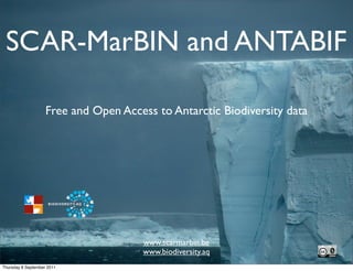
1. SCAR-MarBIN and ANTABIF
Free and Open Access to Antarctic Biodiversity data
www.scarmarbin.be
www.biodiversity.aq
Thursday 8 September 2011
2. Antarctic Treaty
(our inspiration)
« In order to promote international cooperation in
scientific investigation in Antarctica, as provided for in
Article III (1c) of the Treaty, the Contracting Parties agree
that, to the greatest extent feasible and practicable: […]
Scientific observations and results from Antarctica shall be
exchanged and made freely available. »
Thursday 8 September 2011
3. “Exchanging” biodiversity
data
• science-based, adaptative conservation and
management
• testing fundamental theories
• consolidation of the community
• establish a benchmark for undisputed evidence of
change/shifts
Thursday 8 September 2011
5. SCAR-MarBIN & ANTABIF
• www.scarmarbin.be: marine biodiversity information
network
• www.biodiversity.aq: biodiversity information facility
• Main funding: Belgian science Policy office (BELSPO)
• International Polar Year (IPY) 2007/08
• Census of Antarctic Marine Life (CAML)
• Ocean Biogeographic Information System (OBIS)
• Global Biodiversity Information Facility (GBIF)
Thursday 8 September 2011
6. General philosophy
• Build an electronic ecosystem
• Offer free and open access to data and technology
• Expose all the (biodiversity) data and metadata, in
multiple contexts
• Remain community-driven, and collaborative
• Adopt strong standardization
• Work for science, conservation, management
Thursday 8 September 2011
8. [results]: webportal (s)
taxonomy, biogeography
vizualisation
open access
900,188 visitors
8,011,935 hits
>50,000,000 dld records
ANTABIF coming up
Thursday 8 September 2011
9. [results]: taxonomic data
• The first RAMS
all taxa
• Board of 60+ editors
all species • Feeds WoRMS, CoL and EoL
valid species
• 17,098 taxa (RAMS)
• Building a dynamic RAS
• 24,248 taxa (RAS)
0 3.750 7.500 11.250 15.000
Thursday 8 September 2011
10. [results]: geospatial data
1,288,441 records
198 datasets
119 geodatasets
5,235 taxa
Feeds OBIS, GBIF
Downloadable
WebGIS
Webservices
Thursday 8 September 2011
12. Antarctic Field Guides
afg.biodiversity.aq
afg.scarmarbin.be
• Community platform to build customized field
guides
• Identification aid
• Best available pictures
• Descriptions
• Dynamically built from various sources
Thursday 8 September 2011
19. Products... coming up
Georeferenced genetic data: CAML barcoding
Polar Macroscope working group: BiPolar analyses
Princess Elisabeth Station Data Management
Microbes...
Biogeography Atlas: interactive Atlas
Thursday 8 September 2011