Download to read offline


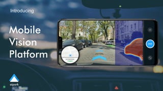
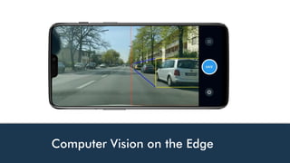


Aipark provides live parking maps aimed at developers, addressing the challenge of finding parking that often adds significant time and traffic in urban areas. The platform utilizes data from over 14 million vehicles and various sources, allowing users to locate parking 2.5 times faster. Aipark's services integrate AI and computer vision, focusing on enhancing mobility and efficiency in cities.


![SPZ marketing brochure[1]](https://cdn.slidesharecdn.com/ss_thumbnails/6b2d2974-2512-42e6-98c7-ea7ee42d9fc4-161017014017-thumbnail.jpg?width=640&height=640&fit=bounds)