Agi 09 Soapbox Slides 1 Spatial
•Download as PPT, PDF•
1 like•483 views

The document discusses the importance of using consistent language and terminology when communicating about geospatial data and spatial data infrastructures (SDIs). It notes there are many acronyms, terms, and concepts used differently depending on context. To effectively integrate and ensure quality of increasing volumes of geospatial data, it is important to define concepts and their relationships through shared vocabularies and ontologies. Formalizing semantics and rules helps provide a common understanding and ensures consistent use of terminology, which is important for tasks like data transformation and validation.

Recommended
Recommended
More Related Content
Similar to Agi 09 Soapbox Slides 1 Spatial
Similar to Agi 09 Soapbox Slides 1 Spatial (20)
More from Steven Ramage
More from Steven Ramage (20)
Agi 09 Soapbox Slides 1 Spatial
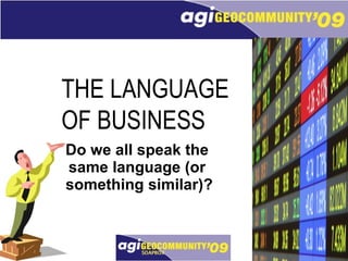
- 1. Do we all speak the same language (or something similar)? THE LANGUAGE OF BUSINESS
- 16. unlocking data, empowering business
Editor's Notes
- Mine damer og herrer er der noen kann verstoje meg vis eg snakker pa norsk? I was just asking, in Norwegian if anyone could understand me to highlight the point of this short soapbox session. Often we think we are speaking the same language, but are we? I think I could have also called this presentation – interoperability and standards or context and consensus.
- This image highlights that even if we do speak the same language, what we say is open to interpretation. The first chap on the phone in the top left hand corner starts the image flow by saying he has a stock that could really excel, i.e. do well. By the time it reaches the tenth chap he is screaming sell. Then below there is one fellow who has had enough and says, goodbye, i.e. cheerio. Another round of exchanges and the penultimate guy is screaming BUY!
- In the previous example it became fairly obvious that the consequences of misinterpreting what is being said, can potentially be disastrous, especially if you are the one investing your hard-earned cash! So I’m getting on my soapbox to try and get people to think a bit more about what and how they communicate, especially when it comes to geospatial data software and services.
- This point may be irreverent, after all what does it really matter if you say location or geospatial? Actually it is very important to a large number of marketing people and industry executives. I sit on several communications teams for industry organisations including a pan-European project and these terms are quite often interchanged, but the meaning or interpretation is not always the same!
- So how do we fare as an industry? I have worked in shipping, oil & gas offshore services and electronics distribution and I think there are as many TLAs or Three Letter Acronyms in the geospatial sector as there are in those industries combined. Does this matter?
- Earlier today there was the SDI – Spatial Data Infrastructure stream that was sponsored by 1Spatial. Commentators across the industry have been saying for years that we need to open up the geospatial sector. Is this a moot point with what Oracle has done with the spatial data type in a relational database or with the public accessing Google Earth? Either way using industry terms require context so they can be understood.
- So what does context mean in geospatial terms? Notably in the standards world there is a great deal of activity around common understanding and interpreting information in a consistent and machine readable way. More recently there have been advances in areas, such as OWL – web ontology language to formally model such concepts and SWRL – semantic web rules language extending constraint definition within OWL. This should allow machines to reason over the relationships between the modelled objects.
- So what about some real world examples where this may impact us in our day-to-day jobs? If you are working in a pan-European or international environment you will almost certainly come across different descriptions of the same thing. If you take a road for example then it has different connotations and business meaning depending whatever your end purpose is for building applications or using geospatial data. And this is also about context.
- So let’s assume we have determined the context, what is then the intended meaning? How do you ensure that customers and suppliers are talking the same language or how do you even ensure that your own colleagues internally are speaking about the same thing? There is quite often a systems engineering chasm that opens when a customer provides a data specification requirement to a salesperson or consultant and then that specification being delivered first time, on time and according to the requirements!
- This is where rules can help. If there are rules pertaining to the semantics or meaning of the data then these rules can control and measure quality. Within a given (and understood) context then potentially everyone can access the same view or data specification based on rules. Anyone with a browser and suitable access and security privileges can see what exists in the rules and share it across the enterprise using a rules repository. The rules need to be flexible, portable and ideally with a natural language English text available for non-technical staff. This is what 1Spatial has invested several million£ pounds in over the last few years.
- If any of you attended the SDI Stream this afternoon you would have heard 1Spatial’s CEO, Mike Sanderson talking about the need for data consistency to achieve the UK Location Information Infrastructure. The basic premise is that if certain aspects of data quality, such as logical consistency, topological integrity and semantic interoperability are left to individual data providers with no independent checking mechanism or data validation then there will be inconsistent data being collected as part of the UK Location Programme. A proposed approach is to use a series of common, agreed and understood rules to ensure there is some data validation across the geospatial data supply chain. INSPIRE data specifications provide some examples that will help bring this home.
- As part of the INSPIRE Annex I data specifications testing 1Spatial, as the UK technology provider in ESDIN, worked on several themes in several countries. For example, transportation networks in Belgium and Sweden. We also worked on cadastral parcels in a few countries and in the UK we worked with the Environment Agency of England & Wales to test the Detailed River Network data transforming the standard data unchanged to meet INSPIRE specifications for the hydrography theme. As you can see because we used a rules-based approach we were able to identify values in the INSPIRE specs that are not necessarily represented as the same values in the base data created and managed by the EA.
- Being able to understand the context of the INSPIRE data specifications and knowing the meaning of the EA data (based on rules) meant that the schema transformation was carried out successfully. A bonus of this approach is that you can also do data validation and conformance checking since you are using rules that represent the data specifications. The results can then be fed back into a data improvement workflow.
- With constantly increasing volume and complexity of data (made accessible through SDIs, etc.) it is essential that this is done based on the same business language within a specific information context. This enforces the need for data reliability both from a quality and availability or accessibility point of view. 1Spatial systems are designed to cope these challenges and are able to integrate, transform and quality control such volumes of information through a scalable architecture.
- We understand the industry well and speak your language. Our solutions can help you trust your data in a cost-effective manner to fulfil and support your role as part of the geospatial data supply chain, unlocking your data and empowering your business.