Academia session: Fabio Fussi, University of Milano-Bicocca, 16th January UN Water Zaragoza Conference 2015
•Download as PPTX, PDF•
1 like•657 views
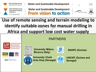
This document summarizes a research project using remote sensing and terrain modeling to identify suitable zones for manual drilling in Senegal and Guinea. The research is a collaboration between University Milano Bicocca, University Cheik Anta Diop, SNAPE, and UNICEF. The objective is to integrate hydrogeological data with remote sensing data to characterize shallow aquifers and identify zones suitable for manual drilling. The study areas are in Senegal's Louga-Kebemer region and Guinea's Kankan and Faranah regions. Expected outputs include validated methods to infer shallow hydrogeology and suitability for manual drilling from indirect data, as well as maps of suitable zones. Key factors for success
Report
Share
Report
Share

Recommended
NASA DEVELOP Waste Tire Pile Maps from Space
This document summarizes a project that used satellite imagery and image analysis techniques to locate illegal waste tire piles in California. Students developed a methodology called TIRe (Tire Identification from Reflectance) to analyze Landsat satellite images and identify tire piles. The project tested the TIRe model on four study sites across two climate regions, locating all known tire piles as well as two previously unknown piles. While some false positives occurred, the technology could reduce inspection time and provide accurate maps to support environmental management. The project was completed on schedule and within budget.
Aerospace and remote sensing
Remote sensing provides information about objects on Earth through reflected or emitted radiation captured from a distance. In India, remote sensing is used extensively for agriculture and resource management. The document outlines the various applications of remote sensing in agriculture, including crop production forecasting, crop damage assessment, soil mapping, and drought monitoring. It also describes India's remote sensing program developed by ISRO to design, build, and launch satellites, and the various centers established for remote sensing education and applications.
Use of remote sensing for land cover monitoring servir science applications
This document discusses land cover mapping using remote sensing. It provides background on land cover mapping and monitoring in the Himalayan region, where deforestation and forest degradation have been issues. Remote sensing using satellite imagery and tools like GIS allows accurate land cover mapping over large areas. The document discusses different remote sensing platforms and sensors, as well as image classification techniques including unsupervised, supervised and object-based classification. It provides examples of software used for object-based image analysis, and outlines the steps involved in land cover mapping projects using remote sensing.
Role of geo-informatics in land use/land cover
Geo-informatics, which consists of remote sensing and GIS, plays an important role in land use/land cover studies. Remote sensing provides synoptic and multi-temporal data on land use/cover patterns that can be analyzed using GIS. Together, remote sensing and GIS allow researchers to study land use/cover changes over time in a cost effective and accurate manner. Geo-informatics has been widely used for land use/cover mapping and monitoring due to its time-saving capabilities and ability to store, analyze, and display land use/cover data to support planning, management, and utilization of land resources.
Remote Sensing and GIS in Land Use / Land Cover Mapping
This document discusses using remote sensing and GIS for land use/land cover mapping. It describes analyzing agricultural versus urban land to ensure development doesn't degrade farmland. Land cover refers to ground surface characteristics like vegetation or bare soil, while land use refers to how land is used, such as agriculture or recreation. The document outlines classification systems and criteria for remote sensing-based land use/land cover mapping. It also discusses digital classification techniques, global and national land use datasets, and applications of remote sensing for natural resource management and change detection analysis.
Wetland mapping
This document discusses using remote sensing to map wetlands. It begins by defining wetlands and their functions like flood control and wildlife habitat. It then explains that remote sensing uses sensors on aircraft or satellites to observe the Earth's surface without direct contact. Satellites like Landsat have been used since the 1970s to map wetlands by analyzing bands that distinguish land from water. The study area for the document is located in western Karnataka, India. Landsat TM and IRS P6 Liss III images from 1990 to 2009 were analyzed using ERDAS and ArcGIS software to delineate wetlands over time and detect land use/land cover changes. The results found decreases in forest area and water bodies from 1998 to 2008-2009
Change detection analysis in land use / land cover of Pune city using remotel...
Lecture delivered in the National Conference entitled “Monitoring Degraded Lands” jointly organized by Agasti Arts, Commerce and Dadasaheb Rupwate Science
College, Akole and Maharashtra Bhugolshastra Parishad Pune to be held on 4 to 6 February 2014.
Land use land cover mapping for smart village using gis
This document summarizes a presentation on land use and land cover mapping for a smart village in India using GIS. The objectives were to understand GIS and remote sensing technologies and their applications in precision agriculture. The presenter described collecting satellite imagery, classifying land use types, and mapping them for the village of Kundewadi to identify agriculture, settlements, vegetation, water bodies and other land types. Pie charts showed the results, which found people primarily used the land for agriculture and suggested ways to improve wastewater, groundwater, solid waste management and increase agriculture land and trees.
Land Use and Land Cover change monitoring of Surajpur Wetland, Uttar Pradesh:...
Abstract:
Wetlands are extremely important areas throughout the world for wildlife protection, recreation, sediment control and flood prevention. Wetlands are important bird’s habitats and birds use them for feeding, roosting, nesting and rearing their young. In Surajpur Wetland are mainly used for agriculture, fisheries, reclamation for harboring and irrigation purposes. In this paper an attempt is made to study the changes in land use and land cover in Surajpur wetland area over 11 years’ period (2003-2014). LULC is an important component in understanding the interactions of the human activities with the environment and thus it is necessary to be able to simulate changes. The land cover mapping of study area was attempted using remotely sensed images of Landsat and Google Earth imagery. The study area was classified into five categories on the basis of field study, geographical conditions, and remote sensing data. LULC changes have been detected by image processing method in EDRAS imagine 2014 and ArcGIS 10.3. The eleven years’ time period of 2003-2014 shows the major type of land use change. Vegetation area that occupied about around 60 per cent of the Surajpur wetland area in 2003 has decreased to 34.25 percent in 2014. Wetland is increased 8.17 percent and Urban area, Fallow land and Water body also have experienced change. Finally, through the work it is recommended that the wetlands need detail mapping through the use of advance remote sensing techniques like microwave and LIDAR for restoration and management of wetland.
Keywords: LULC, ArcGIS, Surajpur, ERDAS, Remote Sensing
Change detection process and techniques
This summarizes a document about change detection techniques in remote sensing for analyzing land use and land cover changes. Remote sensing using aerial photographs and satellite imagery allows efficient monitoring of land cover changes compared to traditional field surveys. Change detection involves identifying transformations of land cover types over time and space using multi-temporal remote sensing data. Common techniques include comparing imagery from Landsat, QuickBird and other satellite sensors to detect changes in agriculture, deforestation, urban growth and other human and natural impacts on the earth's surface.
Land Use/Land Cover Mapping Of Allahabad City by Using Remote Sensing & GIS
The present study was carried out to produce and evaluate the land use/land cover maps by on
screen visual interpretation. The studies of land cover of Allahabad city (study area) consist of 87517.47 ha
out of which 5500.35 ha is build up land (Urban / Rural) Area. In this respect, the Build up land (Urban /
Rural) area scorers 6.28% of the total area. It has also been found that about 17155.001ha (19.60 %) of
area is covered by current fallow land. The double/triple crop land of 30178.44ha (34.84%). The area
covered by gullied / ravines is 1539.20 ha (1.75 %) and that of the kharif crop land is 2828.00 ha (3.23 %).
The area covered by other wasteland is 2551.05ha (2.91%). Table 4.1 shows the area distribution of the
various land use and land cover of Allahabad city.
GIS and Remote Sensing
This document summarizes a report on using GIS and remote sensing for natural resource mapping and management. It was prepared by Kamal Abdurahman for his supervisor at Koya University. The report describes using satellite imagery to map geology, vegetation, soils, and land use/land cover in a region of the Middle East. Imagery was analyzed using GIS software to extract spatial information on natural resources for sustainable management and decision making. Field verification involved collecting GPS points to validate mapped resources. Final maps of the study area's geology, soils, vegetation and land use were produced at a scale of 1:25,000.
Remote Sensing and GIS Techniques
Remote sensing and GIS techniques allow large-scale analysis of changes in land use and monitoring of soil characteristics. Conventional soil sampling cannot provide the temporal and spatial data needed. Remote sensing provides continuous monitoring of soil moisture, roughness, texture, and temperature. GIS integrates spatial data and allows analysis of complex spatial problems in agriculture, including soil mapping and assessing land for suitable crop planting. The combined use of remote sensing and GIS allows management of problematic soils like salinity, erosion, and assessing drought and flood risks.
Application of GIS and Remote Sensing in the analysis of Landuse/Landcover ch...
This document summarizes a study that analyzed land use and land cover changes on Jharkhali Island in the Sundarbans region of West Bengal, India between 1990 and 2010 using remote sensing and GIS techniques. The objectives were to classify land cover, determine changes in vegetation cover, and evaluate the socioeconomic implications. Supervised classification and change detection methods revealed accretion of new land, a shift to more anthropogenic land uses, and ongoing pressure on the local ecology from population growth. Similar changes were found to be occurring elsewhere in the Sundarbans region.
Remote sensing presentation
This document provides an overview of a seminar on remote sensing, GIS and their application for soil fertility mapping. It introduces remote sensing concepts like passive and active sensing, platforms like aircraft and satellites, and multispectral sensors. It discusses how GIS organizes geographic data and examples of data sources. The document presents a case study that mapped soil properties in Mathura District, India using remote sensing and GIS techniques. It describes the digitizing process in ArcGIS and studies on mapping clay minerals and soil contamination with spectroscopy. The document concludes that remote sensing and GIS can efficiently map large areas to aid in crop selection and productivity.
Soil Infrared Spectroscopy - Applications in Africa International Workshop, K...
http://www.fao.org/globalsoilpartnership
This presentation was made during the International Workshop "Soil Spectroscopy: the present and future of Soil Monitoring" that took place at FAO HQ Rome, Italy from 4-6 December 2013. This presentation was made by Keith D Shepherd, and it has the objective to present Soil Infrared Spectroscopy Applications in Africa.
©FAO: http://www.fao.org
Soil spectroscopy in the africa soil information service: Getting the best ou...
Soil spectroscopy in the africa soil information service: Getting the best ou...Land Health Decisions (SD4) ICRAF
1. Soil spectroscopy is being used in the Africa Soil Information Service (AfSIS) to monitor soils across Africa and identify soil properties and issues.
2. Infrared spectroscopy allows identification of mineral composition, organic matter, and other properties in soils to help with agricultural and environmental management.
3. AfSIS has established a network of soil spectral labs across Africa and provides online tools and services to analyze soil spectra and properties.UAV Mangroves Rev 0 colour
This study investigated the use of aerial photographs collected from an unmanned aerial vehicle (UAV) to map and monitor mangrove communities in Port Hedland, Western Australia at a high spatial resolution. The UAV collected imagery of mangrove sites with a pixel size of 2cm, allowing classification of mangroves down to the individual plant level. Analysis of the imagery found that the two dominant mangrove species, Avicennia marina and Rhizophora stylosa, made up 88% of the living canopy cover across the two study sites. The high resolution imagery from the UAV provides an effective method for detailed and frequent monitoring of mangrove community composition and health.
Land cover and Land Use
The document provides an overview of land use and land cover (LULC) analysis using remote sensing and GIS techniques. It discusses key terminologies like land cover and land use. LULC studies are important for planning, management and monitoring programs. The methodology involves data collection, preprocessing like geometric and radiometric corrections, image classification using supervised or unsupervised methods to produce LULC maps. A case study on LULC change detection in Sikkim Himalaya, India from 1988-2017 is presented which found increases in dense forest and agriculture land areas over the study period. RS and GIS techniques are concluded to be very useful for LULC monitoring and assessment.
Application of Remote Sensing Techniques for Change Detection in Land Use/ La...
IOSR Journal of Applied Geology and Geophysics (IOSR-JAGG) is a double blind peer reviewed International Journal that provides rapid publication (within a month) of articles in all areas of Applied Geology and Geophysics. The journal welcomes publications of high quality papers on theoretical developments and practical applications in Applied Geology and Geophysics. Original research papers, state-of-the-art reviews, and high quality technical notes are invited for publications.
Landuse landcover mapping
Land cover refers to the feature present and land use refers to the human activity associated with a plot of land
Remote sensing and it's applications
Remote sensing uses electromagnetic radiation to obtain information about objects without direct contact. It has many applications in civil engineering including regional planning, terrain mapping, water resources engineering, transportation analysis, and landslide studies. Remote sensing data is collected spatially and converted to geospatial data through GIS systems. This data provides valuable terrain, geological, and land use information useful for site investigations, infrastructure planning and development, monitoring of dams, reservoirs, and flooding, mineral exploration, urban development, and construction of protective structures.
Image classification and land cover mapping
The document introduces land cover mapping techniques using satellite images, noting that land cover represents physical materials on Earth's surface and can be mapped through analysis of remotely sensed imagery or field surveys, with accurate land cover information supporting applications like planning, disaster management, and policy development.
Waste management using gis and remote sensing
Remote sensing and GIS techniques can help address many challenges in municipal solid waste management. The document discusses how these techniques provide important data for tasks like locating waste bins and tracking waste collection trucks. Case studies from around the world demonstrate that remote sensing and GIS have been used to develop optimal waste collection routes, select appropriate sites for landfills and waste treatment plants, and evaluate land usage and environmental impacts. When integrated with other data sources, these techniques can improve waste management decision making and make systems more efficient.
GIS and Remote Sensing in Diagnosis and Management of Problem Soil with audio...
GIS and Remote Sensing in Diagnosis and Management of Problem Soil for agriculture, soil science, agronomy, forestry, land management and planning with audio by Dr. Kamini Roy
Ijees38 59
This document discusses a study that used GIS and remote sensing technologies to identify suitable landfill sites in Addis Ababa, Ethiopia. Multiple criteria were considered, including geology, groundwater levels, proximity to infrastructure, slope, and land use/land cover. Data layers for each criterion were generated and reclassified. Analytical hierarchy process was used to assign weights to each criterion and class. The weighted criteria were combined in GIS to produce a landfill suitability map. Based on the analysis, 40.5 km2 was found highly suitable, 68.7 km2 moderately suitable, and 417.8 km2 unsuitable for landfill development. Twelve candidate sites in highly suitable areas were further evaluated based on size and
IMPACT OF COAL MINING ON LAND USE/LAND COVER USING REMOTE SENSING AND GIS TEC...
The document discusses two case studies that analyze the impact of coal mining on land use and land cover over time using remote sensing and GIS techniques. Both studies find that coal mining activities have significantly degraded forests and agricultural lands through the creation of mining pits and dumping of overburden materials. The first case study examines changes between 1993 and 2010 around Singrauli, India, finding increases in mining and settlements and decreases in forests and water bodies. The second assesses changes from 1992 to 2009 in South Karanpura, India, documenting total forest destruction near some mines. Both studies demonstrate the ability of remote sensing and GIS to accurately measure and monitor land use/cover changes over periods of mining.
PERI-URBAN LAND USE CHANGE IN LAGOS THE MEGA-CITY SEMINAR 2
This document provides background information on a research study investigating peri-urban land use changes in the Lagos megacity between 1976 and 2013. It discusses the global trends of urbanization and issues related to megacity growth such as environmental degradation. The study aims to assess land use changes using remote sensing and GIS, investigate the determinants of change, and evaluate land management policies. The conceptual framework is based on the DPSIR model. A hybrid research design incorporating spatial analysis and field surveys will be used to collect primary and secondary data on the physical, social and policy dimensions of peri-urban land use change in Lagos.
Two global transboundary water conventions: a catalyst for cooperation on sha...
Two global conventions, the UN Watercourses Convention and UNECE Water Convention, provide frameworks for transboundary water cooperation. While they have similarities in substantive norms like equitable utilization and no-harm, they also complement each other. The UNECE Convention has more detailed provisions and an implementation framework, while the UN Watercourses Convention has a broader scope. Together they provide stronger guidance and reinforce each other's principles. The conventions support cooperation through capacity building, data sharing, joint projects and raising awareness of international water law.
M commerce summit2012
The document summarizes key points from a Zappos Mobile mcommerce Summit presentation. It discusses Zappos' founding in 1999 and acquisition by Amazon in 2009. It then focuses on Zappos' mobile team which has been working on mobile strategies for the last 6 months, including push notifications, badges, frequent releases and optimizing the checkout process for mobile. It concludes by providing contact information for the presenter.
More Related Content
What's hot
Land Use and Land Cover change monitoring of Surajpur Wetland, Uttar Pradesh:...
Abstract:
Wetlands are extremely important areas throughout the world for wildlife protection, recreation, sediment control and flood prevention. Wetlands are important bird’s habitats and birds use them for feeding, roosting, nesting and rearing their young. In Surajpur Wetland are mainly used for agriculture, fisheries, reclamation for harboring and irrigation purposes. In this paper an attempt is made to study the changes in land use and land cover in Surajpur wetland area over 11 years’ period (2003-2014). LULC is an important component in understanding the interactions of the human activities with the environment and thus it is necessary to be able to simulate changes. The land cover mapping of study area was attempted using remotely sensed images of Landsat and Google Earth imagery. The study area was classified into five categories on the basis of field study, geographical conditions, and remote sensing data. LULC changes have been detected by image processing method in EDRAS imagine 2014 and ArcGIS 10.3. The eleven years’ time period of 2003-2014 shows the major type of land use change. Vegetation area that occupied about around 60 per cent of the Surajpur wetland area in 2003 has decreased to 34.25 percent in 2014. Wetland is increased 8.17 percent and Urban area, Fallow land and Water body also have experienced change. Finally, through the work it is recommended that the wetlands need detail mapping through the use of advance remote sensing techniques like microwave and LIDAR for restoration and management of wetland.
Keywords: LULC, ArcGIS, Surajpur, ERDAS, Remote Sensing
Change detection process and techniques
This summarizes a document about change detection techniques in remote sensing for analyzing land use and land cover changes. Remote sensing using aerial photographs and satellite imagery allows efficient monitoring of land cover changes compared to traditional field surveys. Change detection involves identifying transformations of land cover types over time and space using multi-temporal remote sensing data. Common techniques include comparing imagery from Landsat, QuickBird and other satellite sensors to detect changes in agriculture, deforestation, urban growth and other human and natural impacts on the earth's surface.
Land Use/Land Cover Mapping Of Allahabad City by Using Remote Sensing & GIS
The present study was carried out to produce and evaluate the land use/land cover maps by on
screen visual interpretation. The studies of land cover of Allahabad city (study area) consist of 87517.47 ha
out of which 5500.35 ha is build up land (Urban / Rural) Area. In this respect, the Build up land (Urban /
Rural) area scorers 6.28% of the total area. It has also been found that about 17155.001ha (19.60 %) of
area is covered by current fallow land. The double/triple crop land of 30178.44ha (34.84%). The area
covered by gullied / ravines is 1539.20 ha (1.75 %) and that of the kharif crop land is 2828.00 ha (3.23 %).
The area covered by other wasteland is 2551.05ha (2.91%). Table 4.1 shows the area distribution of the
various land use and land cover of Allahabad city.
GIS and Remote Sensing
This document summarizes a report on using GIS and remote sensing for natural resource mapping and management. It was prepared by Kamal Abdurahman for his supervisor at Koya University. The report describes using satellite imagery to map geology, vegetation, soils, and land use/land cover in a region of the Middle East. Imagery was analyzed using GIS software to extract spatial information on natural resources for sustainable management and decision making. Field verification involved collecting GPS points to validate mapped resources. Final maps of the study area's geology, soils, vegetation and land use were produced at a scale of 1:25,000.
Remote Sensing and GIS Techniques
Remote sensing and GIS techniques allow large-scale analysis of changes in land use and monitoring of soil characteristics. Conventional soil sampling cannot provide the temporal and spatial data needed. Remote sensing provides continuous monitoring of soil moisture, roughness, texture, and temperature. GIS integrates spatial data and allows analysis of complex spatial problems in agriculture, including soil mapping and assessing land for suitable crop planting. The combined use of remote sensing and GIS allows management of problematic soils like salinity, erosion, and assessing drought and flood risks.
Application of GIS and Remote Sensing in the analysis of Landuse/Landcover ch...
This document summarizes a study that analyzed land use and land cover changes on Jharkhali Island in the Sundarbans region of West Bengal, India between 1990 and 2010 using remote sensing and GIS techniques. The objectives were to classify land cover, determine changes in vegetation cover, and evaluate the socioeconomic implications. Supervised classification and change detection methods revealed accretion of new land, a shift to more anthropogenic land uses, and ongoing pressure on the local ecology from population growth. Similar changes were found to be occurring elsewhere in the Sundarbans region.
Remote sensing presentation
This document provides an overview of a seminar on remote sensing, GIS and their application for soil fertility mapping. It introduces remote sensing concepts like passive and active sensing, platforms like aircraft and satellites, and multispectral sensors. It discusses how GIS organizes geographic data and examples of data sources. The document presents a case study that mapped soil properties in Mathura District, India using remote sensing and GIS techniques. It describes the digitizing process in ArcGIS and studies on mapping clay minerals and soil contamination with spectroscopy. The document concludes that remote sensing and GIS can efficiently map large areas to aid in crop selection and productivity.
Soil Infrared Spectroscopy - Applications in Africa International Workshop, K...
http://www.fao.org/globalsoilpartnership
This presentation was made during the International Workshop "Soil Spectroscopy: the present and future of Soil Monitoring" that took place at FAO HQ Rome, Italy from 4-6 December 2013. This presentation was made by Keith D Shepherd, and it has the objective to present Soil Infrared Spectroscopy Applications in Africa.
©FAO: http://www.fao.org
Soil spectroscopy in the africa soil information service: Getting the best ou...
Soil spectroscopy in the africa soil information service: Getting the best ou...Land Health Decisions (SD4) ICRAF
1. Soil spectroscopy is being used in the Africa Soil Information Service (AfSIS) to monitor soils across Africa and identify soil properties and issues.
2. Infrared spectroscopy allows identification of mineral composition, organic matter, and other properties in soils to help with agricultural and environmental management.
3. AfSIS has established a network of soil spectral labs across Africa and provides online tools and services to analyze soil spectra and properties.UAV Mangroves Rev 0 colour
This study investigated the use of aerial photographs collected from an unmanned aerial vehicle (UAV) to map and monitor mangrove communities in Port Hedland, Western Australia at a high spatial resolution. The UAV collected imagery of mangrove sites with a pixel size of 2cm, allowing classification of mangroves down to the individual plant level. Analysis of the imagery found that the two dominant mangrove species, Avicennia marina and Rhizophora stylosa, made up 88% of the living canopy cover across the two study sites. The high resolution imagery from the UAV provides an effective method for detailed and frequent monitoring of mangrove community composition and health.
Land cover and Land Use
The document provides an overview of land use and land cover (LULC) analysis using remote sensing and GIS techniques. It discusses key terminologies like land cover and land use. LULC studies are important for planning, management and monitoring programs. The methodology involves data collection, preprocessing like geometric and radiometric corrections, image classification using supervised or unsupervised methods to produce LULC maps. A case study on LULC change detection in Sikkim Himalaya, India from 1988-2017 is presented which found increases in dense forest and agriculture land areas over the study period. RS and GIS techniques are concluded to be very useful for LULC monitoring and assessment.
Application of Remote Sensing Techniques for Change Detection in Land Use/ La...
IOSR Journal of Applied Geology and Geophysics (IOSR-JAGG) is a double blind peer reviewed International Journal that provides rapid publication (within a month) of articles in all areas of Applied Geology and Geophysics. The journal welcomes publications of high quality papers on theoretical developments and practical applications in Applied Geology and Geophysics. Original research papers, state-of-the-art reviews, and high quality technical notes are invited for publications.
Landuse landcover mapping
Land cover refers to the feature present and land use refers to the human activity associated with a plot of land
Remote sensing and it's applications
Remote sensing uses electromagnetic radiation to obtain information about objects without direct contact. It has many applications in civil engineering including regional planning, terrain mapping, water resources engineering, transportation analysis, and landslide studies. Remote sensing data is collected spatially and converted to geospatial data through GIS systems. This data provides valuable terrain, geological, and land use information useful for site investigations, infrastructure planning and development, monitoring of dams, reservoirs, and flooding, mineral exploration, urban development, and construction of protective structures.
Image classification and land cover mapping
The document introduces land cover mapping techniques using satellite images, noting that land cover represents physical materials on Earth's surface and can be mapped through analysis of remotely sensed imagery or field surveys, with accurate land cover information supporting applications like planning, disaster management, and policy development.
Waste management using gis and remote sensing
Remote sensing and GIS techniques can help address many challenges in municipal solid waste management. The document discusses how these techniques provide important data for tasks like locating waste bins and tracking waste collection trucks. Case studies from around the world demonstrate that remote sensing and GIS have been used to develop optimal waste collection routes, select appropriate sites for landfills and waste treatment plants, and evaluate land usage and environmental impacts. When integrated with other data sources, these techniques can improve waste management decision making and make systems more efficient.
GIS and Remote Sensing in Diagnosis and Management of Problem Soil with audio...
GIS and Remote Sensing in Diagnosis and Management of Problem Soil for agriculture, soil science, agronomy, forestry, land management and planning with audio by Dr. Kamini Roy
Ijees38 59
This document discusses a study that used GIS and remote sensing technologies to identify suitable landfill sites in Addis Ababa, Ethiopia. Multiple criteria were considered, including geology, groundwater levels, proximity to infrastructure, slope, and land use/land cover. Data layers for each criterion were generated and reclassified. Analytical hierarchy process was used to assign weights to each criterion and class. The weighted criteria were combined in GIS to produce a landfill suitability map. Based on the analysis, 40.5 km2 was found highly suitable, 68.7 km2 moderately suitable, and 417.8 km2 unsuitable for landfill development. Twelve candidate sites in highly suitable areas were further evaluated based on size and
IMPACT OF COAL MINING ON LAND USE/LAND COVER USING REMOTE SENSING AND GIS TEC...
The document discusses two case studies that analyze the impact of coal mining on land use and land cover over time using remote sensing and GIS techniques. Both studies find that coal mining activities have significantly degraded forests and agricultural lands through the creation of mining pits and dumping of overburden materials. The first case study examines changes between 1993 and 2010 around Singrauli, India, finding increases in mining and settlements and decreases in forests and water bodies. The second assesses changes from 1992 to 2009 in South Karanpura, India, documenting total forest destruction near some mines. Both studies demonstrate the ability of remote sensing and GIS to accurately measure and monitor land use/cover changes over periods of mining.
PERI-URBAN LAND USE CHANGE IN LAGOS THE MEGA-CITY SEMINAR 2
This document provides background information on a research study investigating peri-urban land use changes in the Lagos megacity between 1976 and 2013. It discusses the global trends of urbanization and issues related to megacity growth such as environmental degradation. The study aims to assess land use changes using remote sensing and GIS, investigate the determinants of change, and evaluate land management policies. The conceptual framework is based on the DPSIR model. A hybrid research design incorporating spatial analysis and field surveys will be used to collect primary and secondary data on the physical, social and policy dimensions of peri-urban land use change in Lagos.
What's hot (20)
Land Use and Land Cover change monitoring of Surajpur Wetland, Uttar Pradesh:...
Land Use and Land Cover change monitoring of Surajpur Wetland, Uttar Pradesh:...
Land Use/Land Cover Mapping Of Allahabad City by Using Remote Sensing & GIS
Land Use/Land Cover Mapping Of Allahabad City by Using Remote Sensing & GIS
Application of GIS and Remote Sensing in the analysis of Landuse/Landcover ch...
Application of GIS and Remote Sensing in the analysis of Landuse/Landcover ch...
Soil Infrared Spectroscopy - Applications in Africa International Workshop, K...
Soil Infrared Spectroscopy - Applications in Africa International Workshop, K...
Soil spectroscopy in the africa soil information service: Getting the best ou...
Soil spectroscopy in the africa soil information service: Getting the best ou...
Application of Remote Sensing Techniques for Change Detection in Land Use/ La...
Application of Remote Sensing Techniques for Change Detection in Land Use/ La...
GIS and Remote Sensing in Diagnosis and Management of Problem Soil with audio...
GIS and Remote Sensing in Diagnosis and Management of Problem Soil with audio...
IMPACT OF COAL MINING ON LAND USE/LAND COVER USING REMOTE SENSING AND GIS TEC...
IMPACT OF COAL MINING ON LAND USE/LAND COVER USING REMOTE SENSING AND GIS TEC...
PERI-URBAN LAND USE CHANGE IN LAGOS THE MEGA-CITY SEMINAR 2
PERI-URBAN LAND USE CHANGE IN LAGOS THE MEGA-CITY SEMINAR 2
Viewers also liked
Two global transboundary water conventions: a catalyst for cooperation on sha...
Two global conventions, the UN Watercourses Convention and UNECE Water Convention, provide frameworks for transboundary water cooperation. While they have similarities in substantive norms like equitable utilization and no-harm, they also complement each other. The UNECE Convention has more detailed provisions and an implementation framework, while the UN Watercourses Convention has a broader scope. Together they provide stronger guidance and reinforce each other's principles. The conventions support cooperation through capacity building, data sharing, joint projects and raising awareness of international water law.
M commerce summit2012
The document summarizes key points from a Zappos Mobile mcommerce Summit presentation. It discusses Zappos' founding in 1999 and acquisition by Amazon in 2009. It then focuses on Zappos' mobile team which has been working on mobile strategies for the last 6 months, including push notifications, badges, frequent releases and optimizing the checkout process for mobile. It concludes by providing contact information for the presenter.
Academia session: John Chilton, International Association of Hydrogeologists,...
The UPGRo Programme provides funding for research partnerships between academic researchers and field practitioners focused on groundwater and international development. It requires multi-disciplinary approaches and knowledge dissemination. The featured project examines the 20-40% failure rate of rural handpumps in developing countries within 2 years, representing a $1.2 billion cumulative cost. The project analyzes failed pumps, boreholes and water quality across sites to identify symptoms, causal factors and underlying conditions contributing to supply failures. Common issues found include low water pH and quality from galvanized iron materials, inappropriate borehole designs, and lack of community maintenance capacity. Deeper underlying root causes include entrenched practices in implementing agencies, lack of technical capacity and understanding of local ground
Abengoa-FB Side Event – Collado, Abengoa, 14th January, 2015 UN Water Confere...
This document discusses water sustainability challenges including increasing water demand driven by population growth, uneven distribution, climate change, and rapidly growing cities. This is exacerbating water scarcity issues. Climate change is negatively impacting freshwater resources through changes in precipitation patterns, snow/ice melting, and soil moisture. Many water withdrawals are unsustainable, exceeding replenishment rates. Water quality is threatened by pesticides/fertilizers, emerging contaminants, and industrial/agricultural effluents. The water-energy nexus also poses challenges since many industries require large amounts of water which is difficult to treat. Solutions proposed include improving efficiency, integrated energy-water planning, reducing dependency, and Abengoa's technologies around desal
Presentation Jack Moss, Financing instruments Wrap up, 17th January UN Water ...
This document discusses financing sustainable water services. Some key points made include:
- Water services require funding to be sustainable, but "free water" is an illusion and does not generate enough revenue.
- The costs of not having adequate water services are very high for both the public and businesses.
- Water pricing needs to cover real costs to avoid a vicious cycle of low funding, degraded infrastructure, and poor service quality.
- While some innovative financing instruments exist, projects need sound business models where revenues cover total expenditures.
- Water pricing is political and policymakers need to understand that tariffs and taxes must fund real costs, not just short-term interests.
- Most people are willing to pay for reliable water
BeWater
- Making society an active participant in
water adaptation to globa...
The document discusses the BeWater project which aims to make society an active participant in water adaptation to global change. It will study four river basins in the Mediterranean to understand river basin dynamics and how they can be extrapolated to other areas. The project will take a collaborative approach involving public, private, and civil society through dialogue, awareness, and empowerment. It will also examine the links between society and territory as well as science and society relationships. The goals are to address governance challenges around climate and policy, face the water-energy-food security nexus, and review policies across multiple sectors to identify complementarities and conflicts for adaptation and participation opportunities.
Academia session: Dabo Guan, University of East Anglia, 16th January UN Water...
This document discusses flood footprint analysis, which aims to quantify the total economic impacts of flooding, including direct damages and indirect impacts on wider economic systems. It proposes using input-output analysis to model interdependencies between sectors and estimate indirect effects. The framework is demonstrated through applications analyzing the 2007 floods in Sheffield and 2009 floods across Central Europe. Flood footprint results are presented as total economic losses compared to regional GDP. The analysis also examines imbalances in production and recovery patterns over time.
Presentation1 osmosis and diffusion
The cell membrane is composed of phospholipids, cholesterol, and proteins. It ranges from 7.5-10 nm thick and is only visible under an electron microscope. The cell membrane has several functions including being selectively permeable, acting as a physical barrier, allowing communication between cells, and establishing connections between cells. Transport across the cell membrane can occur through passive transport mechanisms like simple diffusion, facilitated diffusion, and osmosis. Active transport requires energy and moves molecules against their concentration gradient using carrier proteins like sodium-potassium pumps and proton pumps. Vesicular transport uses endocytosis and exocytosis to move larger molecules and vesicles across the membrane.
IRIS Service Director Masterclass
In these Masterclass slides, dedicated to IRIS Service Director customers, we take a detailed look at three areas, designed to save you time and money every day:
- Crystal Director module - used to automate email, document and report production.
- Scheduler integration with Outlook calendars.
- Web module for sub-contractors and for customers.
Academia session: Sarantuyaa Zandaryaa ,UNESCO, 16th January UN Water Zaragoz...
The document discusses a convener by UNESCO on academia sessions. It notes that science and capacity building are key to sustainable development and reducing inequalities. The role of academia is crucial in implementing water-related SDGs through advancing research, developing solutions, and disseminating knowledge. Successful achievement of SDGs on water requires defining goals based on evidence, supporting implementation, and developing monitoring mechanisms. The document outlines expectations and objectives of academia sessions, including engaging scientific communities, discussing challenges and tools to implement targets, and exchanging views. Specific sessions are proposed on water quality risk assessment frameworks, integrated risk governance and monitoring, water resources management tools, and tools for WASH implementation with an equity lens.
UNECE Session: Luis Simas, ERSAR, 15th January UN Water Zaragoza Conference 2015
Luís Simas,ERSAR -Portuguese Water and Waste Services Regulation Authority, Portugal
Special Regional Session: Implementing the water related SDGs in the UNECE region
Media: Meenakshi Shedde, Mumbai, India, 16th January UN Water Zaragoza Confer...
In the Kutch district of India, which receives very little rainfall, women traditionally had to walk long distances to collect drinking water for their families. This changed when an NGO worked with local women to organize water committees and train them. Led by a tribal grandmother, the women studied local geology and revived traditional water sources, enabling their village to become self-reliant for water rather than relying on government supplies. Their success inspired other villages, with women in some places building wells themselves. It helped bridge social divisions and allowed conservative Muslim women to take on new public roles managing water resources.
Walking home
The document calculates the number of steps it would take to walk 2.3 miles from school to home. It provides the conversion rates for miles to feet and the average step length in feet. Using these conversions and the distance of 2.3 miles, it determines it would take approximately 154,135 steps to walk from school to home.
Academia: Richard Lawford, Morgan State University, 16th January UN Water Zar...
Earth observations can help monitor progress on the UN's Sustainable Development Goals (SDGs) related to water. Satellite imagery and other earth observation data can be used to monitor indicators for SDG targets like water quality, water use efficiency, integrated water resource management, and natural water capital. However, establishing an earth observation-based monitoring system faces challenges like ensuring continuity of data collection, validating indicators in different climates, building national capabilities, and overcoming reluctance to adopt more open approaches. Overall, earth observations have potential to cost-effectively monitor expanded water indicators if integrated into SDG planning and prototyped through further research.
Presentation Beom-Sik Yoo, WWF7 secretariat, 17th January UN Water Zaragoza C...
The 7th World Water Forum will be held from April 12-17, 2015 in Daegu and Gyeongju, Republic of Korea. The Forum is expected to draw approximately 35,000 participants from the global water community. The key objective of the 7th Forum is "IMPLEMENTATION" - focusing on processes and mechanisms to implement solutions to global water issues across four areas: water security, water for development and prosperity, water for sustainability, and constructing feasible implementation mechanisms. The Forum will identify challenges, champions, and commitments to drive implementation efforts forward.
Academia session: Ricard Gine, UPC, 16th January UN Water Zaragoza Conference...
This case study developed an improved framework for local water, sanitation, and hygiene (WASH) planning in Kenya. It involved collecting updated WASH-specific data at the local level and analyzing it to create planning indices and rankings to prioritize locations lacking coverage. The framework identified the neediest areas and determined appropriate actions. It aimed to support evidence-based planning and equitable targeting of resources. The case study demonstrated how academia can contribute updated data and decision-making tools to improve local WASH planning and coordination of initiatives. Continued use of the framework requires engagement of local authorities and updating data over time.
MLK Tribute
Bowling Green State University is holding its 9th annual Martin Luther King Jr. Day of Service where over 1,000 students, faculty, and staff will volunteer at nearly 50 community sites. This year's projects include working at the Toledo Zoo, painting at community organizations, and building picnic tables. The university is also participating in the new MLK Jr. Season of Service Consortium which is coordinating various events and activities throughout Northwest Ohio to honor MLK from January 9th to 22nd. Volunteers will do projects from 10am to 3:30pm and then attend a closing ceremony.
The death of Jennifer Nichols' father at age 10 set her on a path to help children through her work with Upward
Viewers also liked (20)
Two global transboundary water conventions: a catalyst for cooperation on sha...
Two global transboundary water conventions: a catalyst for cooperation on sha...
Academia session: John Chilton, International Association of Hydrogeologists,...
Academia session: John Chilton, International Association of Hydrogeologists,...
Abengoa-FB Side Event – Collado, Abengoa, 14th January, 2015 UN Water Confere...
Abengoa-FB Side Event – Collado, Abengoa, 14th January, 2015 UN Water Confere...
Presentation Jack Moss, Financing instruments Wrap up, 17th January UN Water ...
Presentation Jack Moss, Financing instruments Wrap up, 17th January UN Water ...
BeWater
- Making society an active participant in
water adaptation to globa...
BeWater
- Making society an active participant in
water adaptation to globa...
Academia session: Dabo Guan, University of East Anglia, 16th January UN Water...
Academia session: Dabo Guan, University of East Anglia, 16th January UN Water...
Academia session: Sarantuyaa Zandaryaa ,UNESCO, 16th January UN Water Zaragoz...
Academia session: Sarantuyaa Zandaryaa ,UNESCO, 16th January UN Water Zaragoz...
UNECE Session: Luis Simas, ERSAR, 15th January UN Water Zaragoza Conference 2015
UNECE Session: Luis Simas, ERSAR, 15th January UN Water Zaragoza Conference 2015
Media: Meenakshi Shedde, Mumbai, India, 16th January UN Water Zaragoza Confer...
Media: Meenakshi Shedde, Mumbai, India, 16th January UN Water Zaragoza Confer...
Academia: Richard Lawford, Morgan State University, 16th January UN Water Zar...
Academia: Richard Lawford, Morgan State University, 16th January UN Water Zar...
Presentation Beom-Sik Yoo, WWF7 secretariat, 17th January UN Water Zaragoza C...
Presentation Beom-Sik Yoo, WWF7 secretariat, 17th January UN Water Zaragoza C...
Academia session: Ricard Gine, UPC, 16th January UN Water Zaragoza Conference...
Academia session: Ricard Gine, UPC, 16th January UN Water Zaragoza Conference...
Similar to Academia session: Fabio Fussi, University of Milano-Bicocca, 16th January UN Water Zaragoza Conference 2015
Soluzioni space-based per la sostenibilità
This document summarizes Maria Antonia Brovelli's presentation on using earth observation for sustainability. It discusses several projects using Copernicus data and geospatial analysis to monitor land, water, air and the water-energy nexus. These include monitoring land cover change, deforestation, landslides, lake water quality, air pollution and suitable areas for renewable energy. The presentation also discusses capacity building initiatives for universities, secondary schools and Africa on using earth observation techniques.
Academia session: Mohamed Ahmed, UNGSC, 16th January UN Water Zaragoza Confer...
This document summarizes a UN conference presentation on using groundwater exploration to support UN field operations in Mali. It describes how satellite imagery and geospatial technologies were used to identify potential drilling locations. Field studies including georesistivity testing were conducted to image subsurface structures. Multiple boreholes were successfully drilled across different regions, with over a 90% success rate compared to typical rates of 20-30%. The project demonstrated the utility of modern techniques for groundwater management and increased the demand for these services to support other UN agencies.
Shaban a-wrm and-governance_in_lebanon_cnrs
The document discusses the role of the National Council for Scientific Research (CNRS) in water resource management and governance in Lebanon. It outlines CNRS's use of remote sensing, GIS, and field data to monitor water resources and climate trends. CNRS has conducted many projects on topics like groundwater assessment, snow cover dynamics, and river discharge. CNRS collaborates with various government agencies, NGOs, universities, and international organizations on projects and policy. Its research provides essential data and analysis to inform Lebanon's water policies, strategies, and governance.
Identification Of Ground Water Potential Zones In Tamil Nadu By Remote Sensin...
A case study was conducted to find out the groundwater potential zones in Salem, Erode and Namakkal districts, Tamil Nadu, India with an aerial extent of 360.60 km2. The thematic maps such as geology, geomorphology, soil hydrological group, land use / land cover and drainage map were prepared for the study area. The Digital Elevation Model (DEM) has been generated from the 10 m interval contour lines (which is derived from SOI, Toposheet 1:25000 scale) and obtained the slope (%) of the study area. The groundwater potential zones were obtained by overlaying all the thematic maps in terms of weighted overlay methods using the spatial analysis tool in Arc GIS 9.3. During weighted overlay analysis, the ranking has been given for each individual parameter of each thematic map and weights were assigned according to the influence such as soil −25%, geomorphology − 25%, land use/land cover −25%, slope − 15%, lineament − 5% and drainage / streams − 5% and find out the potential zones in terms of good, moderate and poor zones with the area of 49.70 km2, 261.61 km2 and 46.04 km2 respectively. The potential zone wise study area was overlaid with village boundary map and the village wise groundwater potential zones with three categories such as good, moderate and poor zones were obtained. This GIS based output result was validated by conducting field survey by randomly selecting wells in different villages using GPS instruments. The coordinates of each well location were obtained by GPS and plotted in the GIS platform and it was clearly shown that the well coordinates were exactly seated with the classified zones.
4.4. mproware andrea de angelis - a glance on improware innovative means t...
The IMPROWARE project aims to promote sustainable water management in Egypt and Tunisia through aquifer recharge and wastewater reuse pilots. Funded for 30 months with a €3.6 million budget, it involves upgrading wastewater treatment plants in Nobariya, Egypt and Korba, Tunisia, as well as public outreach activities. Through modeling, surveys, and stakeholder engagement, the project compares aquifer recharge methods and their impacts on water resources, while building technical and policy capacities in the region.
K0372057065
1) The study analyzed sewer chokes in Nairobi's Western region using GIS to better understand spatial patterns. Field surveys identified major choke causes as rags, grit, and roots.
2) Hotspot analysis revealed choke hotspots in areas like Kawangware and Kangemi with high frequencies surrounded by other high frequency areas. Coldspots included Loresho and Spring Valley with low frequencies surrounded by other low areas.
3) Factors influencing chokes like population density, poverty, households, vandalism, and water supply availability correlated positively with choke occurrences. Geographic weighted regression spatially showed where each factor was a strong or weak predictor of chokes.
An integrative information aqueduct to close the gaps between global satellit...
This document describes the iAqueduct project which aims to close gaps between global satellite observation of the water cycle and local sustainable water resource management. It involves 6 work packages: 1) downscaling global water cycle products to field scale; 2) retrieving soil properties; 3) developing scaling functions between soil moisture and evapotranspiration; 4) developing a generic iAqueduct toolbox; 5) demonstrating benefits of closing water cycle gaps; and 6) disseminating knowledge and tools for water management. The project will integrate various data sources, models, and methods to provide high-resolution water cycle information for improving hydrological modeling and water resource management.
From Digital Earth to the Internet of Places for Management of Risks and Emer...
From Digital Earth to the Internet of Places for Management of Risks and Emer...Maria Antonia Brovelli
The document discusses the transition from Digital Earth to the Internet of Places and how geospatial data and technologies can be used for risk and emergency management. It provides examples of participatory mapping projects conducted by the GEO Laboratory, including reporting potholes, architectural barriers, and cultural points of interest. The laboratory is developing open source platforms like PoliCrowd to enable collaborative geospatial data collection and visualization.Low resource deep learning to detect waste intensity in the river flow
This document summarizes a study that used the YOLO v3 deep learning algorithm to detect waste in river flows and calculate waste intensity. Researchers collected 340 images of waste in rivers to use as a training dataset for a YOLO v3 model. The model was tested on videos of river flows and achieved 98.74% confidence in detecting waste objects. The resulting application can detect a variety of waste sizes, from small food wrappers to large objects, and count the number of waste items intersecting a drawn reference line in each video frame. This waste detection and counting system aims to help monitor waste in rivers and predict when river cleaning is needed.
Using Satellite Imagery To Better Plan, Monitor and Measure Interventions
An information brief by the UN Innovation Network (UNIN) which provides an introduction to satellite imagery and highlights how different UN Agencies are already using satellite imagery in their work, incl. monitoring water quality, creating population maps, mapping schools, and monitoring asset and engineering projects.
Application of Remote Sensing & GIS Techniques in Watershed Management
Topic - Application of Remote Sensing
& GIS Techniques in Watershed Management
From Global satellite water cycle products to field scale satellite water states
The document proposes downscaling global satellite soil moisture and evapotranspiration products to field scale using various methods. It involves (1) downscaling satellite data using in-situ observations, Sentinel data, and UAS data, (2) deriving root zone soil moisture from surface measurements using models, and (3) characterizing spatial distribution of soil moisture and evapotranspiration at multiple sites. Current progress includes field data collection, UAS surveys, and generating 1km soil moisture data using random forest regression.
Ar24289294
This study uses image processing and remote sensing to detect land use changes in Palladam Taluk, Tamil Nadu, India between 1972 and 2011. Landsat imagery from 2011 was classified using supervised classification in SAGA GIS and topographic maps from 1972 were digitized in QGIS. The classified 2011 image and digitized 1972 maps were analyzed in QGIS to estimate land use areas and detect changes. Results found settlements increased 260% from 14.36km2 to 37.35km2 between 1972 and 2011 due to urban expansion and population growth. Water bodies increased 17% likely due to new quarry pools. Minimal changes were detected for transportation networks.
presentation_OCRE_Demontis_Lisbona_2002_12_07.pdf
The document describes the NuraghEO project which uses aerial and satellite data to study Sardinian Nuragic archaeological sites. The project aims to develop a methodology using remote sensing to identify areas of interest for excavation and monitor sites for subsidence or other changes. Researchers are analyzing interferometric radar data to detect ground motions and optical data to map vegetation and temperature anomalies that could indicate buried structures. The Planetek Rheticus Platform is providing multi-temporal aerial and satellite imagery which is analyzed using algorithms to identify areas needing further study and monitoring to help archaeological research.
Nile-Goblet software: Mapping rainwater management strategies made easy for s...
Poster prepared by Catherine Pfeifer, An Notenbaert and Carlos Quiros for the ILRI@40 Workshop, Addis Ababa, 7 November 2014.
Most of the agriculture in the Ethiopian part of the Nile Basin depends is rain-fed. Its low productivity can be explained to a large extend by the lack of appropriate rainwater management.
Promoting rainwater management practices in Ethiopia is not new, however they have been promoted :
regardless of the bio-physical and socio-economic context without considering local expertise without accounting for synergies between rainwater management practices at landscape scale
Identification of Groundwater Potential Survey Using QGIS of DBATU campus, Ma...
This document summarizes a study that used GIS tools to identify potential groundwater zones on the campus of Dr. Babasaheb Ambedkar Technological University in Maharashtra, India. The researchers created various thematic maps of the study area using data on geomorphology, land use/land cover, drainage density, slope, and vectors. Electrical resistivity tests were conducted at three points on campus to determine subsurface rock and water conditions. Point 1 found water-bearing weathered rock from 1-23 meters. Point 2 found water-bearing weathered and fractured rock from 4-26 meters. Point 3 detected only hard, impermeable rock with no water. The study aims to identify suitable locations for future construction
Extraction of Water-body Area from High-resolution Landsat Imagery
Extraction of water bodies from satellite imagery has been broadly explored in the current decade. So many techniques were involved in detecting of the surface water bodies from satellite data. To detect and extracting of surface water body changes in Nagarjuna Sagar Reservoir, Andhra Pradesh from the period 1989 to 2017, were calculated using Landsat-5 TM, and Landsat-8 OLI data. Unsupervised classification and spectral water indexing methods, including the Normalized Difference Vegetation Index (NDVI), Normalized Difference Moisture Index (NDMI), Normalized Difference Water Index (NDWI), and Modified Normalized Difference Water Index (MNDWI), were used to detect and extraction of the surface water body from satellite data. Instead of all index methods, the MNDWI was performed better results. The Reservoir water area was extracted using spectral water indexing methods (NDVI, NDWI, MNDWI, and NDMI) in 1989, 1997, 2007, and 2017. The shoreline shrunk in the twenty-eight-year duration of images. The Reservoir Nagarjuna Sagar lost nearly around one-fourth of its surface water area compared to 1989. However, the Reservoir has a critical position in recent years due to changes in surface water and getting higher mud and sand. Maximum water surface area of the Reservoir will lose if such decreasing tendency follows continuously.
HIC_2014
This document describes a prototype architecture for a citizen science application focused on water management. The architecture allows users to collect field data on water-related phenomena using mobile devices, access and share data online, and view data through web interfaces. It was developed by the Geomatics Laboratory at Politecnico di Milano and the Po River Basin Authority to engage the public in reporting issues in the Po River basin and increase water monitoring. The prototype utilizes free and open source software and collects data through a mobile app, then stores, publishes, and visualizes the data on a web map for users to view and interact with. Future work will expand public involvement in testing the app and improve the web interface.
Aquifer Mapping, Moni-ppt.pptx
This document summarizes a student project on aquifer mapping, monitoring, and analysis in southern Chikkaballapura, India. The objectives were to develop a mobile app to collect borewell data, generate maps of aquifer zones and groundwater depth, and suggest rainwater harvesting methods. The methodology involved data collection using the app, GIS analysis including depth contours and Thiessen polygons, and subsurface mapping. The conclusions were that mapping and monitoring are important but difficult in rural areas, and subsurface mapping can identify aquifers while exhausted borewells pose dangers if uncased.
Similar to Academia session: Fabio Fussi, University of Milano-Bicocca, 16th January UN Water Zaragoza Conference 2015 (20)
Academia session: Mohamed Ahmed, UNGSC, 16th January UN Water Zaragoza Confer...
Academia session: Mohamed Ahmed, UNGSC, 16th January UN Water Zaragoza Confer...
Identification Of Ground Water Potential Zones In Tamil Nadu By Remote Sensin...
Identification Of Ground Water Potential Zones In Tamil Nadu By Remote Sensin...
PHD third Semester Presentation-Jan2021-V.Shiva Chandra.pptx
PHD third Semester Presentation-Jan2021-V.Shiva Chandra.pptx
4.4. mproware andrea de angelis - a glance on improware innovative means t...
4.4. mproware andrea de angelis - a glance on improware innovative means t...
An integrative information aqueduct to close the gaps between global satellit...
An integrative information aqueduct to close the gaps between global satellit...
From Digital Earth to the Internet of Places for Management of Risks and Emer...
From Digital Earth to the Internet of Places for Management of Risks and Emer...
Low resource deep learning to detect waste intensity in the river flow
Low resource deep learning to detect waste intensity in the river flow
Using Satellite Imagery To Better Plan, Monitor and Measure Interventions
Using Satellite Imagery To Better Plan, Monitor and Measure Interventions
Application of Remote Sensing & GIS Techniques in Watershed Management
Application of Remote Sensing & GIS Techniques in Watershed Management
From Global satellite water cycle products to field scale satellite water states
From Global satellite water cycle products to field scale satellite water states
Nile-Goblet software: Mapping rainwater management strategies made easy for s...
Nile-Goblet software: Mapping rainwater management strategies made easy for s...
Identification of Groundwater Potential Survey Using QGIS of DBATU campus, Ma...
Identification of Groundwater Potential Survey Using QGIS of DBATU campus, Ma...
Extraction of Water-body Area from High-resolution Landsat Imagery
Extraction of Water-body Area from High-resolution Landsat Imagery
More from water-decade
Side event huma Right Water:Maria del Mar Rivero, ONGAWA, 14th January UN Wat...
El documento discute el derecho humano al agua y al saneamiento desde la perspectiva de la sociedad civil. Presenta las cinco dimensiones del derecho humano al agua y al saneamiento: disponibilidad, calidad, accesibilidad, asequibilidad y aceptabilidad. También destaca la importancia de la no discriminación, la responsabilización, la información y la participación. Usa a Nicaragua como ejemplo, donde una coalición de organizaciones monitorea y evalúa el acceso al agua más allá de los resultados reportados oficialmente, y da cuenta de una re
Side event huma Right Water:Silvia Emanuelli, HIC-AL, 14th January UN Water C...
Este documento resume un caso de litigio en Morelos, México sobre el derecho humano al agua y saneamiento. 100 familias que viven en la colonia Tres de Mayo no tenían acceso a agua potable ni saneamiento. Se presentaron 4 amparos individuales alegando violaciones a estos derechos. En 2012 se logró una sentencia favorable, pero la autoridad solo proporcionó agua 4 horas por semana, violando estándares internacionales. El caso llegó a la Suprema Corte, la cual estableció contenidos más precisos para estos derechos. Aunque
Side event huma Right Water:Santiago Milans del Bosch, 14th January UN Water ...
Este documento resume un discurso sobre la exigibilidad del derecho humano al agua y al saneamiento en el contexto de un caso judicial en España. El discurso discute (1) la normativa aplicable al derecho humano al agua, (2) un caso específico sobre la adjudicación de un contrato de suministro de agua, y (3) las sentencias del Tribunal Supremo relacionadas con este caso que enfatizan la necesidad de balancear la seguridad jurídica y los intereses generales con la protección del derecho humano al agua.
Side event huma Right Water:Liber Martin, CONICET, 14th January UN Water Conf...
La presentación resume el caso de la cuenca Matanza-Riachuelo en Argentina y la sentencia "Mendoza" de 2008 relacionada con este caso. Introduce el contexto del reconocimiento del derecho humano al agua en Argentina y describe (1) la demanda original sobre contaminación ambiental en la cuenca, (2) la creación de la Autoridad de la Cuenca Matanza Riachuelo en 2006, y (3) cómo la sentencia "Mendoza" estableció un enfoque de derechos humanos y responsabilidades para limpiar y recomponer la
Side event huma Right Water:Leo Heller, Special raporteur UN, 14th January UN...
This document discusses human rights related to water and sanitation. It begins by noting that while the MDG target for water was met in 2012, 800 million people still lack access to clean drinking water. Sanitation targets were far off track, with billions of people lacking access. It then outlines the legal basis for establishing water and sanitation as human rights. Key aspects of a human rights-based approach are equality, non-discrimination, participation, and accountability. The document explores what constitutes the human rights to water and sanitation, and discusses barriers to accessing justice for rights violations. Effective access to justice requires that mechanisms for addressing complaints are impartial, expeditious and provide meaningful remedies.
Side event huma Right Water:Carlos Pablo Alcaine, Medicusmundi, 14th January ...
El documento describe el caso legal de indígenas y campesinos ecuatorianos contra la compañía petrolera Chevron-Texaco por daños ambientales causados por la extracción de petróleo en la Amazonía entre 1964 y 1992. La compañía derramó grandes cantidades de petróleo y vertió desechos tóxicos en el medio ambiente, lo que provocó un aumento de la incidencia de cáncer y abortos espontáneos en la población local. Aunque Chevron fue condenada a pagar una indemnización multimillon
Side event huma Right Water:Cristina Monge, ECODES, 14th January UN Water Con...
The document outlines the origin, mission, operations, and activities of an organization called the Water Alliance Bureau. Formed in 2006 by South American and Spanish actors focused on water resources, the Bureau aims to improve water and sanitation services in Central America. It operates in Latin America and Spain, focusing on human rights, governance, and sustainable technologies related to water and resource management. The Bureau coordinates projects, training, and publications to build capacity through technical cooperation between partners.
Side event huma Right Water:Blanca Bengoechea, UPComillas, 14th January UN Wa...
Este documento describe un estudio realizado en El Gallinero, un asentamiento informal en Madrid, sobre el acceso al agua y el saneamiento de los residentes. El estudio incluyó entrevistas y grupos de discusión con niños para comprender sus percepciones. Los niños reportaron que debían ducharse con una jarra de agua calentada sobre un barreño y defecar fuera y escondidos, en lugar de tener acceso a baños. El estudio también analizó la normativa sobre los derechos humanos y los planes de las instituciones públicas y privadas para
Governments: Faraj El-Awar,UN Habitat, WCCE, 16th January UN Water Zaragoza C...
The document discusses challenges and tools for realizing human rights to water and sanitation. It outlines implementation challenges including inadequate financing, outdated infrastructure, weak governance and limited capacity. It then presents five case studies showing how tools like mapping access, workshops to improve sanitation, cost-benefit analyses, empowering women in management, and creating independent regulatory bodies have helped address these challenges and advance rights in locations like Nairobi, Kuala Lumpur, Nigeria and Portugal. The key lessons are that economic evidence, advocacy, capacity building and political will for independent regulation can help creation and replication of successful tools.
Governments: Htun Lwin Oo, Myanmar Water Resources Ministry, WCCE, 16th Janua...
The document discusses water resources and sustainable development in Myanmar. It provides background on Myanmar's geography, climate, population, and water resources potential. It then summarizes the formation of Myanmar's National Water Resources Committee to coordinate water management. The committee works to build capacity through education and pilot projects. Challenges include limited data sharing, budget constraints, and capacity issues. Moving forward, priorities include enacting water laws, building young professionals' capacity, and strengthening international cooperation to support integrated water resources management.
Civil Society: Shauna Curry, 16th January UN Water Zaragoza Conference 2015
The document summarizes a panel discussion on civil society and the human right to safe drinking water and sanitation. It introduces the panel members and their areas of focus. It then presents a case study from the Tegemeo Women's Group in Tanzania, which built water and sanitation infrastructure in their village over many years, facing challenges along the way. Their success was due to community participation, international cooperation, sustainability plans, and women's empowerment. The discussion addressed what is needed for communities to realize their right to water, including sufficient financing, appropriate technologies, capacity development, and local governance.
Civil Society: Khin Ni Ni Thein, ARBRO, 16th January UN Water Zaragoza Confer...
This document summarizes a presentation given in Zaragoza, Spain on water management challenges and solutions in Myanmar. It discusses Myanmar's participation in developing post-2015 Sustainable Development Goals, the country's water scarcity issues, and the role of the National Water Resources Committee and civil society organizations in implementing integrated water resources management. Some key points include: (1) Myanmar faces water scarcity issues due to variations in rainfall and loss of forest cover; (2) the NWRC was created to ensure water, food, and energy security through effective management; (3) NGOs like ARBRO and WRTC work with the NWRC and communities to develop policy and governance solutions aimed at improving allocation and
Academia session: Colin Green, Middlesex University, 16th January UN Water Za...
The document discusses sustainable development and water management. It addresses several key points:
1) Water management is fundamentally about coping with variability and sharing a limited resource. It involves balancing allocation and provision while dealing with economic and technological challenges.
2) Pushing technological frontiers through better tools, techniques, knowledge transfer, and adoption of efficient technologies can help close demand-supply gaps and improve water management.
3) A variety of approaches are needed to change behaviors and policies to work towards sustainable development goals in water management. Economic instruments require careful consideration.
Academia session: Joan Rose, Michigan State University , 16th January UN Wate...
This document discusses using risk assessment as a tool to improve water quality and the role of higher education institutions. It provides an overview of a conference on this topic, including discussion questions on various issues like how water quality is impacting health globally, how to integrate science and policy in risk analysis frameworks, and the future of water education curricula. The document also discusses challenges like population growth pressures on water resources and fecal contamination of water supplies. It advocates using risk assessment and other tools within a multi-disciplinary approach to address these challenges and protect water quality and public health.
Academia session: Sharon Velasquez, UpGro, 16th January UN Water Zaragoza Con...
This document describes a research project developing a biosensor to detect anthropogenic pollution in river water and groundwater in Tanzania. The biosensor uses microbial fuel cells (MFCs) and has shown correlations between chemical oxygen demand (COD) levels and the current density response of the biosensor. The researchers are now looking to deploy the biosensor for field testing and collect data on water quality in areas with poor sanitation systems. They seek collaborators to help with deployment and feedback from water experts on the technology and data use. The overall goal is to facilitate affordable, long-term water quality monitoring.
Academia session WASH OP: Ricard Gine, UPC, 16th January UN Water Zaragoza Co...
This document discusses academia's contribution to implementing the UN Sustainable Development Goals related to water, sanitation, and hygiene (WASH). It outlines the key issues to be addressed, including hygiene, inequalities, service levels, sustainability, and areas beyond households. The main sections discuss financing, research, capacity development, technology, sustainability, institutional frameworks, and monitoring/evaluation. Case studies from locations like Uganda, Dar es Salaam, Mali, and Kenya illustrate how academia can help address challenges through appropriate technologies, knowledge transfer, and tools to support local decision-making.
Side Event WFN_Giuseppe Frapporti, Environment Agency, 14th January, UN Water...
The document summarizes a water footprint assessment conducted by the Environment Agency for the Hertfordshire North London area. The assessment examined water usage over the area's 3,500 square kilometers and population of over 6 million. It analyzed sources of water including chalk aquifers, chalk rivers, and public water supply. The assessment also looked at water usage and potential impacts in dry versus wet years. It outlined the four phases of a water footprint assessment including accounting, sustainability assessment, response formulation, and goal setting. The goal is to understand water scarcity and pollution issues and recommend improvements to water management.
Side Event WFN_Michael Spencer, AWS, 14th January, UN Water Conference Zarago...
The document discusses water stewardship and the Alliance for Water Stewardship (AWS). It defines water stewardship as the use of water that is socially equitable, environmentally sustainable and economically beneficial. The AWS works with businesses and other organizations to adopt a catchment-based approach to water management through a voluntary standard. The standard is a six step process that businesses can follow to understand their water use impacts and risks and engage local stakeholders to develop management plans tailored to the specific catchment context. The document provides several case studies of businesses in different industries that have benefited from the AWS approach.
Side Event IMDEA_Joan Sanz, Veolia, 14th January, UN Water Conference Zaragoz...
El documento describe la reutilización directa de aguas residuales tratadas en Windhoek, Namibia. En 1968, Windhoek construyó la primera planta para regenerar aguas residuales y producir agua potable, siendo pionera en este campo. Actualmente, el 26% del agua potable de Windhoek proviene de una planta de regeneración que trata las aguas residuales mediante procesos de depuración, naturalización y recarga de acuíferos. El éxito de este sistema se debe a la necesidad de agua en la región,
Side Event Global Water Solidarity_Julio Martínez, Zaragoza City Council, 14t...
El documento describe los esfuerzos del Ayuntamiento de Zaragoza para mejorar el acceso al agua en países en desarrollo a través de su programa de cooperación al desarrollo desde 1992. Se ha enfocado cada vez más en proyectos relacionados con el agua desde 2005, implementando sistemas de suministro como pozos mejorados y cisternas, así como sistemas de saneamiento como letrinas y depuración. Los proyectos también se enfocan en participación comunitaria, apropiación local y fortalecimiento institucional a largo plazo.
More from water-decade (20)
Side event huma Right Water:Maria del Mar Rivero, ONGAWA, 14th January UN Wat...
Side event huma Right Water:Maria del Mar Rivero, ONGAWA, 14th January UN Wat...
Side event huma Right Water:Silvia Emanuelli, HIC-AL, 14th January UN Water C...
Side event huma Right Water:Silvia Emanuelli, HIC-AL, 14th January UN Water C...
Side event huma Right Water:Santiago Milans del Bosch, 14th January UN Water ...
Side event huma Right Water:Santiago Milans del Bosch, 14th January UN Water ...
Side event huma Right Water:Liber Martin, CONICET, 14th January UN Water Conf...
Side event huma Right Water:Liber Martin, CONICET, 14th January UN Water Conf...
Side event huma Right Water:Leo Heller, Special raporteur UN, 14th January UN...
Side event huma Right Water:Leo Heller, Special raporteur UN, 14th January UN...
Side event huma Right Water:Carlos Pablo Alcaine, Medicusmundi, 14th January ...
Side event huma Right Water:Carlos Pablo Alcaine, Medicusmundi, 14th January ...
Side event huma Right Water:Cristina Monge, ECODES, 14th January UN Water Con...
Side event huma Right Water:Cristina Monge, ECODES, 14th January UN Water Con...
Side event huma Right Water:Blanca Bengoechea, UPComillas, 14th January UN Wa...
Side event huma Right Water:Blanca Bengoechea, UPComillas, 14th January UN Wa...
Governments: Faraj El-Awar,UN Habitat, WCCE, 16th January UN Water Zaragoza C...
Governments: Faraj El-Awar,UN Habitat, WCCE, 16th January UN Water Zaragoza C...
Governments: Htun Lwin Oo, Myanmar Water Resources Ministry, WCCE, 16th Janua...
Governments: Htun Lwin Oo, Myanmar Water Resources Ministry, WCCE, 16th Janua...
Civil Society: Shauna Curry, 16th January UN Water Zaragoza Conference 2015
Civil Society: Shauna Curry, 16th January UN Water Zaragoza Conference 2015
Civil Society: Khin Ni Ni Thein, ARBRO, 16th January UN Water Zaragoza Confer...
Civil Society: Khin Ni Ni Thein, ARBRO, 16th January UN Water Zaragoza Confer...
Academia session: Colin Green, Middlesex University, 16th January UN Water Za...
Academia session: Colin Green, Middlesex University, 16th January UN Water Za...
Academia session: Joan Rose, Michigan State University , 16th January UN Wate...
Academia session: Joan Rose, Michigan State University , 16th January UN Wate...
Academia session: Sharon Velasquez, UpGro, 16th January UN Water Zaragoza Con...
Academia session: Sharon Velasquez, UpGro, 16th January UN Water Zaragoza Con...
Academia session WASH OP: Ricard Gine, UPC, 16th January UN Water Zaragoza Co...
Academia session WASH OP: Ricard Gine, UPC, 16th January UN Water Zaragoza Co...
Side Event WFN_Giuseppe Frapporti, Environment Agency, 14th January, UN Water...
Side Event WFN_Giuseppe Frapporti, Environment Agency, 14th January, UN Water...
Side Event WFN_Michael Spencer, AWS, 14th January, UN Water Conference Zarago...
Side Event WFN_Michael Spencer, AWS, 14th January, UN Water Conference Zarago...
Side Event IMDEA_Joan Sanz, Veolia, 14th January, UN Water Conference Zaragoz...
Side Event IMDEA_Joan Sanz, Veolia, 14th January, UN Water Conference Zaragoz...
Side Event Global Water Solidarity_Julio Martínez, Zaragoza City Council, 14t...
Side Event Global Water Solidarity_Julio Martínez, Zaragoza City Council, 14t...
Academia session: Fabio Fussi, University of Milano-Bicocca, 16th January UN Water Zaragoza Conference 2015
- 1. University Milano Bicocca (Italy) University Cheik Anta Diop (Senegal) SNAPE (Guinea) UNICEF (Guinea and Senegal) PARTNERS Use of remote sensing and terrain modeling to identify suitable zones for manual drilling in Africa and support low cost water supply
- 2. MANUAL DRILLING techniques of drilling boreholes for groundwater exploitation using human or animal power (not mechanized equipment). These techniques are well known in countries with large alluvial deposits (India, Nepal, Bangladesh, etc) High quality hand drilled wells can provide sustainable and clean water supply
- 3. Advantages of manual drilling Cheaper than mechanized boreholes Easy to implement with locally made equipment “manual work intensive” and not “capital intensive” ; source of income for local groups Limitations of manual drilling Manual drilling is feasible only under hydrogeological suitable conditions Soft unconsolidated shallow geological layers Water level not too deep Good hydraulic conductivity of shallow porous aquifers IT IS IMPORTANT TO IDENTIFY THOSE ZONES WHERE HYDROGEOLOGICAL CONDITIONS ARE SUITABLE FOR MANUAL DRILLING. MAPS OF SUITABLE ZONES HAVE BEEN COMPLETED IN 15 COUNTRIES SINCE 2008
- 4. OBJECTIVE OF THE RESEARCH Integration of direct hydrogeological information from existing database with indirect parameters from Remote Sensing and terrain modeling to characterize shallow aquifers and identify suitable zones for manual drilling DURATION November 2013 – April 2015 STUDY AREA REGION OF LOUGA – KEBEMER (NORTH WEST SENEGAL REGION OF KANKAN AND FARANAH (EAST GUINEA)
- 5. ACTIVITY ACADEMIA NATIONAL INSTITUTIONS INTERNATIONAL ORGANISATIONS SCIENTIFIC RESEARCH AND CAPACITY BUILDING -UNIVERSITY MILANO BICOCCA (IT) -UNIVERSITY CHEIK ANTA DIOP (SEN) -University of Thies (SEN) DISSEMINATION As above -UNICEF INTEGRATION RESEARCH INTO NATIONAL STRATEGY FOR WATER SUPPLY -SNAPE (Guinea) - DGPRE (Sen) COORDINATION WITH MANUAL DRILLING PROGRAM -UNIVERSITY MILANO BICOCCA (IT) -SNAPE (Guinea) - UNICEF - Practica FUNDING NERC (UK) - scientific research UNICEF (with external donors) for manual drilling in Guinea Role of partners and external stakeholders
- 6. Geo-Environmental indicators (Geology, Soil, Morphometry, Vegetation dynamics, Soil moisture, Thermal Inertia) Thematic maps, Remote Sensing (optical, radar), Digital terrain model (Geo)Statistical model Borehole logs interpretation, pump test, geophysics Map of suitable zones for manual drilling Hydrogeological features at observation points Scientific approach
- 7. Source of data NATIONAL DATABASE OF WATER POINT Free satellite images (MODIS) THEMATIC MAPS Radar images (obtained from European Space Agency free of cost) THE RESEARCH IS BASED ON AVAILABLE AND FREE OF COST DATA AND WITH LIMITED COST FOR FIELD DATA COLLECTION. THIS FACILITATE THE EXTENSION OF THIS METHOD TO OTHER REGIONS,
- 8. Estimating feasibility and potential for manual drilling at borehole positions VEGETATION DYNAMICS - DRY SEASON MEAN NDVI LOUGA 0.1 0.25 Extraction of environmental parameters from remote sensing Preliminary results achieved
- 9. Expected final outputs - Definition and validation of structured method to infer shallow hydrogeology and suitability for manual drilling from indirect data - Generation of maps of suitability for manual drilling in 2 study area FACTORS OF SUCCESS -Collaboration between partners -Coordination between scientific research, training of drilling teams, implementation of hand drilled wells in target zones, advocacy - Deep Involvement by national institution (SNAPE) -Active role of UNICEF in support and fund raising Factor of success
- 10. Thanks very much for the attention