SlideShare a Scribd company logo
1 of 4
Download to read offline
ISSN (e): 2250 – 3005 || Vol, 04 || Issue, 12 || December – 2014 ||
International Journal of Computational Engineering Research (IJCER)
www.ijceronline.com Open Access Journal Page 1
The Aerial Wetted Path of Geostationary Transmission
Luis G. Hidalgo1
, Jesús A. Hidalgo2
and Antonio Vidal3
1
Universidad Central de Venezuela, Caracas, Venezuela.
2
Universidad Simón Bolívar, Baruta, Sartenejas, Estado Miranda,
3
Universidad Simón Bolívar, Baruta, Sartenejas, Estado Miranda,
1. Introduction
The information transmitted from geostationary satellites toward receptors located at the Earth’s
surface must to cross the lower part of the atmosphere named troposphere in which the phenomenon of
attenuation of the electromagnetic energy of the waves used for transmission occurs. The rain produces strong
attenuation through a descending slopped distance across water droplets named here effective wetted path (D,
km) with its vertical component supposed proportional to the rainfall intensity R (mm/h). Formulas give R from
the unitary attenuation γ (dBz//km). Even though those receptors are not designed as rain gauges, the signal
strength (S, %), most of the time included as a menu option in the commands of equipment, may be used to
calculate decibels (dBz) but D remains unknown. Figure 1 shows the antenna of a receptor of direct TV
transmission broadcasted by the G-3C satellite in a moment during a rainy event; the signal strength S was
attenuated by rain from 98% to 80%. The objective here is then the estimation of D as a function of S to late
calculate R. The R value may be considered important in times of abundant or scarce rain for human use of fresh
water, thus any new issue on this matter would be reported. Receptors of direct TV transmission are considered
here but other options may be useful. Myriad of users of direct TV and other satellite applications with receptors
providing signal strength may apply the issue reported here to estimate both paths and rain rates but doing
verifications and adjusts by new coordinates and new dish sizes.
Figure 1. Image of a parabolic antenna of Direct TV receptor (TC121) during a rainy event.
Abstract:
The aerial effective wetted path of geostationary satellite transmission focused to the Earth´s surface
was both defined taking into account the warm sector of rainy cloud and estimated as a function of
signal strength. A standard path of 4.88 km was obtained for Caracas with a 60 cm dish parabolic
receptor pointing with a 55° elevation angle to an associated direct TV satellite in Ku band. Such
function helps to estimate rainfall intensity with ±3 mm/h bulk error for stormy weather. Myriad of
users of direct TV and other satellite applications with theirs receptors providing signal strength may
apply the present issue to estimate paths and rain rates but doing verifications and adjusts by new
coordinates and new dish sizes.
Keywords: Wetted, path, satellite, rainfall, geostationary, signal, strength
Article Title
www.ijceronline.com Open Access Journal Page 2
2. Specific rainfall attenuation theory
A geostationary satellite transmits radio waves to the Earth’s surface that can be captured by special
device named receiver which has parabolic antenna composed by dish and horn at the front of the dish. The
radio waves, most of the time in the microwave band, are composed by a combination of carried, subcarrier and
encoded data rename popularly the signal. The transmission must to cross the troposphere where a phenomenon
named attenuation occurs. This phenomenon consists in the energy withdrawal of the carrier due to permanent
and temporary factors. The permanent or basic attenuation is caused by fixed factors as the Fresnel divergence
and energy abortion by CO2 and O2. Energy withdrawal named rain fade caused by energy absorption and
dispersion by temporary rainfall droplets is here the subject matter of study. Droplets reflect radio waves energy
but water molecules absorb it. The relative signal strength S is measured respect to a standard from 0% to 100%
by a meter included in the receptor. In the perfect receptor S=0% for strong rain fade with no detected signal but
S=100% for no rainfall. The radio waves must to cross the troposphere in which the attenuation can be
maximized by strong rains; the total length across rain showers in the clouds and below the clouds is the
effective wetted path D (km). Designed for Caracas, Figure 2 helps to understand the wetted path dimension of
the direct TV transmissions (Satellite G-3C) across a 12000 m high troposphere during heavy rainy episodes.
The descending inclined wetted path runs D0=4883 m from the 0°C ice level to TC121 crossing the
condensation level at 500 m above TC121. The horizontal projection of this path reaches 2801 m. TC121 is
located at altitude 877 m but 33 m above the soil. Data for that figure were obtained from [1]. In the present case
S was measured with the TC121 receptor referred in Figure 1. The real D can be different to D0 (km).
Figure 2. Standard scheme of transmission crossing a large rain stage cumulus over TC121.
The D valued will be actualized as follows. During no rains S=Smax but during rains S is less than
Smax and the attenuation is:
Article Title
www.ijceronline.com Open Access Journal Page 3
γ = [-log(S/Smax)]/D (1)
Where γ is the bulk unitary attenuation in dBz/km, S is the signal strength measured with the meter in
the receiver at a moment with rainfall and Smax is local S measured without rainfall; both for a specific satellite
transponder. A transponder is a satellite device used to focus radio waves to areas of the Earth’s surface. Most
references present a standard formula for rain attenuation like this:
γ = aRb
(2)
Where γ is the bulk unitary attenuation in dBz/km of horizontal radio wave at a specific moment
crossing a falling down vertical shower of rainfall R (mm/h); constants a and b are parameters depending of the
radio wave frequency. The International Telecommunication Union (ITU) presents mean values a=0.0242 and
b=1.1879 for 12 GHz [2]. D=0 for R=0. To actualize D for each moment was used c value between 0 and 1 with
the following linear interpolation:
D = c(1-S/Smax)·D0 (3)
3. Rain gauging experiments
During the years 2008 to 2012 were collected observational data of 7 storms that permitted to obtain
pairs of true rainfall intensity R* and S. In an electronic sheet was programmed the calculation of R from S
assuming c values until the mean error of R* minus R reaches zero with a specific standard deviation. The
c=1.84 gave the zero error with standard deviation ±2.9 mm/h. In those experiments was used transponder 13
with Smax=98. Table 1 shows results summary. The attenuation Beer´s law may be used also for calculations
but this was not intended here.
Table 1. Estimation errors in rain gauging experiments.
Day Begin End R (mm/h) R* (mm/h) Error (mm/h)
10Aug2009 16:00 17:00 14.7 17.0 -2.3
15Nov2009 13:00 14:00 13.4 13.0 0.4
30Jul2009 19:13 19:31 20.6 15.0 5.6
04Oct2009 16:58 18:45 15.9 15.1 0.8
23Oct2008 16:58 18:34 12.7 16.3 -3.5
04May2011 13:46 13:53 13.4 13.7 -0.3
12Jun2012 15:28 15:28 17.5 18.0 -0.5
2.9
4. Effective or bulk wetted path
The maximum occasional value of the inclined wetted path corresponding to heavy cumulonimbus
(Cb) rains reached temporary 1.84 times the standard value of 4.88 km or near 9 km assuring the presence of
water droplets above the 0°C ice level inside Cb. Observations during jet flying in the area permitted detect the
joint occurrence of ice crystal and droplets above the 0°C ice level touching the windows of the jets occasional.
More information of this fact is not available due to notable gap of cloud physic studies in the area. The top of
this kind of Cb clouds reaches height of 12 km near the tropopause.
5. Final verification
In 16 August 2014 for the 150 minutes from 16:35 to 19:05 local time were collected 157 values of S
which were transformed in 157 values of R using the above formulation with c=1.84 to obtain a bulk intensity
value of 19 mm/h against a measured value of 18 mm/h. Figure 3 shows detail of D variation during this
complex rainy event. Out-of-signal time was 12 minutes. The error +1 mm/h is inside the above mentioned bulk
of ±3 mm/h, thus it may be considered acceptable. With this verification the present stage of research touches
final but further research should be expected to minimize errors.
Article Title
www.ijceronline.com Open Access Journal Page 4
Figure 3. Histogram of wetted path during stormy episode of 16 August 2014.
6. Conclusions
It has been possible to estimate the wetted path of satellite transmission and the rainfall intensity from
the signal strength measured with a low cost direct TV receptor during stormy weather episodes. An error of
nearly ±3 mm/h was obtained. The change of receptor to a dish of 120 cm instead the 60 cm used actually is
recommendable to minimize error. Occasional out-of-signal events of heavy rainfall constitute the main
restriction of the present development. As satellite geostationary transmission runs downward over an inclined
path and the above mentioned rain attenuation formula was designed for horizontal path, more specific research
on this subject must be undertaken to minimize errors doubtless.
7. Acknowledgments
We owe thanks to both the Telecommunication Technicians Ramon Arturo Hernandez who teaches us
rain fade calculations and the Electronic Engineer Diego Stanfield who advices us on the possibility of watching
the signal strength using menu options in most satellite receptors as that of direct TV.
References
[1] L.G. Hidalgo and J. A. Hidalgo. Cálculo de la intensidad de lluvia por satélite. ISBN 9789801252429. 2011.
[2] ITU. Specific attenuation model for rain for use in prediction models. ITU-R P-838-P. 2005
Figure and table captions should be 10-point boldface Helvetica (or a similar sans-serif font). Callouts should
be 9-point non-boldface Helvetica. Initially capitalize only the first word of each figure caption and table title.
Figures and tables must be numbered separately. For example: “Figure 1. Database contexts” , “Table 1. Input
data”. Figure captions are to be centered below the figures. Table titles are to be centered above the tables.

More Related Content

What's hot

150860106006 54 55_62
150860106006 54 55_62150860106006 54 55_62
150860106006 54 55_62Riya2001998
 
Class lecture on Hydrology by Rabindra Ranjan saha Lecture 10
Class lecture on Hydrology by Rabindra Ranjan saha Lecture 10Class lecture on Hydrology by Rabindra Ranjan saha Lecture 10
Class lecture on Hydrology by Rabindra Ranjan saha Lecture 10World University of Bangladesh
 
L8 unit hydrograph
L8 unit hydrographL8 unit hydrograph
L8 unit hydrographMEHEDIMASUM2
 
Hydrology ( computation of average rainfall )
Hydrology ( computation of average rainfall )Hydrology ( computation of average rainfall )
Hydrology ( computation of average rainfall )Latif Hyder Wadho
 
TU1.T10.4.ppt
TU1.T10.4.pptTU1.T10.4.ppt
TU1.T10.4.pptgrssieee
 
Workshop on Storm Water Modeling Approaches
Workshop on Storm Water Modeling ApproachesWorkshop on Storm Water Modeling Approaches
Workshop on Storm Water Modeling ApproachesM. Damon Weiss
 
S curve hydrograph
S curve hydrographS curve hydrograph
S curve hydrographSatish Taji
 
Class lectures on Hydrology by Rabindra Ranjan Saha Lecture 12
Class lectures on Hydrology by Rabindra Ranjan Saha Lecture 12Class lectures on Hydrology by Rabindra Ranjan Saha Lecture 12
Class lectures on Hydrology by Rabindra Ranjan Saha Lecture 12World University of Bangladesh
 
Water Resources Engineering - Question Bank (Subjective)
Water Resources Engineering - Question Bank (Subjective)Water Resources Engineering - Question Bank (Subjective)
Water Resources Engineering - Question Bank (Subjective)Malla Reddy University
 
igarss11stiles_ver3.pptx
igarss11stiles_ver3.pptxigarss11stiles_ver3.pptx
igarss11stiles_ver3.pptxgrssieee
 
Class lectures on Hydrology by Rabindra Ranjan Saha Lecture 11
Class lectures on Hydrology by Rabindra Ranjan Saha Lecture 11Class lectures on Hydrology by Rabindra Ranjan Saha Lecture 11
Class lectures on Hydrology by Rabindra Ranjan Saha Lecture 11World University of Bangladesh
 
Synthetic unit hydrograph
Synthetic unit hydrographSynthetic unit hydrograph
Synthetic unit hydrographuzma shaikh
 

What's hot (19)

July 30-130-Ken Kagy2
July 30-130-Ken Kagy2July 30-130-Ken Kagy2
July 30-130-Ken Kagy2
 
150860106006 54 55_62
150860106006 54 55_62150860106006 54 55_62
150860106006 54 55_62
 
Class lecture on Hydrology by Rabindra Ranjan saha Lecture 10
Class lecture on Hydrology by Rabindra Ranjan saha Lecture 10Class lecture on Hydrology by Rabindra Ranjan saha Lecture 10
Class lecture on Hydrology by Rabindra Ranjan saha Lecture 10
 
Updating the curve number method for rainfall runoff estimation
Updating the curve number method for rainfall runoff estimationUpdating the curve number method for rainfall runoff estimation
Updating the curve number method for rainfall runoff estimation
 
Rainfall-Runoff Modelling
Rainfall-Runoff ModellingRainfall-Runoff Modelling
Rainfall-Runoff Modelling
 
L8 unit hydrograph
L8 unit hydrographL8 unit hydrograph
L8 unit hydrograph
 
Hydrology ( computation of average rainfall )
Hydrology ( computation of average rainfall )Hydrology ( computation of average rainfall )
Hydrology ( computation of average rainfall )
 
Precepitation
PrecepitationPrecepitation
Precepitation
 
Urban areas
Urban areasUrban areas
Urban areas
 
TU1.T10.4.ppt
TU1.T10.4.pptTU1.T10.4.ppt
TU1.T10.4.ppt
 
Workshop on Storm Water Modeling Approaches
Workshop on Storm Water Modeling ApproachesWorkshop on Storm Water Modeling Approaches
Workshop on Storm Water Modeling Approaches
 
S curve hydrograph
S curve hydrographS curve hydrograph
S curve hydrograph
 
Unit hydrograph
Unit hydrographUnit hydrograph
Unit hydrograph
 
Class lectures on Hydrology by Rabindra Ranjan Saha Lecture 12
Class lectures on Hydrology by Rabindra Ranjan Saha Lecture 12Class lectures on Hydrology by Rabindra Ranjan Saha Lecture 12
Class lectures on Hydrology by Rabindra Ranjan Saha Lecture 12
 
Water Resources Engineering - Question Bank (Subjective)
Water Resources Engineering - Question Bank (Subjective)Water Resources Engineering - Question Bank (Subjective)
Water Resources Engineering - Question Bank (Subjective)
 
igarss11stiles_ver3.pptx
igarss11stiles_ver3.pptxigarss11stiles_ver3.pptx
igarss11stiles_ver3.pptx
 
Class lectures on Hydrology by Rabindra Ranjan Saha Lecture 11
Class lectures on Hydrology by Rabindra Ranjan Saha Lecture 11Class lectures on Hydrology by Rabindra Ranjan Saha Lecture 11
Class lectures on Hydrology by Rabindra Ranjan Saha Lecture 11
 
4-1 foret
4-1 foret4-1 foret
4-1 foret
 
Synthetic unit hydrograph
Synthetic unit hydrographSynthetic unit hydrograph
Synthetic unit hydrograph
 

Similar to The Aerial Wetted Path of Geostationary Transmission

Estimation of Water Vapour Attenuation And Rain Attenuation
Estimation of Water Vapour Attenuation And Rain AttenuationEstimation of Water Vapour Attenuation And Rain Attenuation
Estimation of Water Vapour Attenuation And Rain AttenuationIJERA Editor
 
A high performance model for rainfall effect on radio signals
A high performance model for rainfall effect on radio signalsA high performance model for rainfall effect on radio signals
A high performance model for rainfall effect on radio signalsAlexander Decker
 
Estimation of Rain Attenuation based on ITU-R Model in Guntur (A.P), India
Estimation of Rain Attenuation based on ITU-R Model in Guntur (A.P), IndiaEstimation of Rain Attenuation based on ITU-R Model in Guntur (A.P), India
Estimation of Rain Attenuation based on ITU-R Model in Guntur (A.P), IndiaIDES Editor
 
Satellite Communication.ppt
Satellite Communication.pptSatellite Communication.ppt
Satellite Communication.pptDeepaksenthil4
 
Satellite communication 3
Satellite communication   3Satellite communication   3
Satellite communication 3sardarwaleed3
 
Rain attenuation statistics for mobile satellite communications estimated fro...
Rain attenuation statistics for mobile satellite communications estimated fro...Rain attenuation statistics for mobile satellite communications estimated fro...
Rain attenuation statistics for mobile satellite communications estimated fro...TELKOMNIKA JOURNAL
 
Tropospheric Scintillation with Rain Attenuation of Ku Band at Tropical Region
Tropospheric Scintillation with Rain Attenuation of Ku Band at Tropical RegionTropospheric Scintillation with Rain Attenuation of Ku Band at Tropical Region
Tropospheric Scintillation with Rain Attenuation of Ku Band at Tropical RegionTELKOMNIKA JOURNAL
 
A methodology for precise estimation of rain attenuation on terrestrial milli...
A methodology for precise estimation of rain attenuation on terrestrial milli...A methodology for precise estimation of rain attenuation on terrestrial milli...
A methodology for precise estimation of rain attenuation on terrestrial milli...TELKOMNIKA JOURNAL
 
presentation_meissner.pptx
presentation_meissner.pptxpresentation_meissner.pptx
presentation_meissner.pptxgrssieee
 
IUKWC Workshop Nov16: Developing Hydro-climatic Services for Water Security –...
IUKWC Workshop Nov16: Developing Hydro-climatic Services for Water Security –...IUKWC Workshop Nov16: Developing Hydro-climatic Services for Water Security –...
IUKWC Workshop Nov16: Developing Hydro-climatic Services for Water Security –...India UK Water Centre (IUKWC)
 
Comparison_of_rain_attenuation_models_of_satellite.pdf
Comparison_of_rain_attenuation_models_of_satellite.pdfComparison_of_rain_attenuation_models_of_satellite.pdf
Comparison_of_rain_attenuation_models_of_satellite.pdfDeepakSinghNagarkoti
 
Narayan Shrestha [ACCURACY OF X-BAND LOCAL AREA WEATHER RADAR (LAWR) OF LEUVE...
Narayan Shrestha [ACCURACY OF X-BAND LOCAL AREA WEATHER RADAR (LAWR) OF LEUVE...Narayan Shrestha [ACCURACY OF X-BAND LOCAL AREA WEATHER RADAR (LAWR) OF LEUVE...
Narayan Shrestha [ACCURACY OF X-BAND LOCAL AREA WEATHER RADAR (LAWR) OF LEUVE...Narayan Shrestha
 
Using Sentinel-1 with InSAR Land Subsidence Presentor Minh
Using Sentinel-1 with InSAR Land Subsidence Presentor MinhUsing Sentinel-1 with InSAR Land Subsidence Presentor Minh
Using Sentinel-1 with InSAR Land Subsidence Presentor Minhnguyenminhnm
 
Investigation of time diversity gain for earth to satellite link using rain r...
Investigation of time diversity gain for earth to satellite link using rain r...Investigation of time diversity gain for earth to satellite link using rain r...
Investigation of time diversity gain for earth to satellite link using rain r...journalBEEI
 
Weibull Distribution Based Channel Prototype For Decrease of Rain Attenuation...
Weibull Distribution Based Channel Prototype For Decrease of Rain Attenuation...Weibull Distribution Based Channel Prototype For Decrease of Rain Attenuation...
Weibull Distribution Based Channel Prototype For Decrease of Rain Attenuation...IJTET Journal
 
Systematic Variation of Rain Rate and Radar Reflectivity Relations for Micro ...
Systematic Variation of Rain Rate and Radar Reflectivity Relations for Micro ...Systematic Variation of Rain Rate and Radar Reflectivity Relations for Micro ...
Systematic Variation of Rain Rate and Radar Reflectivity Relations for Micro ...iosrjce
 

Similar to The Aerial Wetted Path of Geostationary Transmission (20)

Estimation of Water Vapour Attenuation And Rain Attenuation
Estimation of Water Vapour Attenuation And Rain AttenuationEstimation of Water Vapour Attenuation And Rain Attenuation
Estimation of Water Vapour Attenuation And Rain Attenuation
 
A high performance model for rainfall effect on radio signals
A high performance model for rainfall effect on radio signalsA high performance model for rainfall effect on radio signals
A high performance model for rainfall effect on radio signals
 
Estimation of Rain Attenuation based on ITU-R Model in Guntur (A.P), India
Estimation of Rain Attenuation based on ITU-R Model in Guntur (A.P), IndiaEstimation of Rain Attenuation based on ITU-R Model in Guntur (A.P), India
Estimation of Rain Attenuation based on ITU-R Model in Guntur (A.P), India
 
D133439
D133439D133439
D133439
 
Satellite Communication.ppt
Satellite Communication.pptSatellite Communication.ppt
Satellite Communication.ppt
 
Satellite communication 3
Satellite communication   3Satellite communication   3
Satellite communication 3
 
Rain attenuation statistics for mobile satellite communications estimated fro...
Rain attenuation statistics for mobile satellite communications estimated fro...Rain attenuation statistics for mobile satellite communications estimated fro...
Rain attenuation statistics for mobile satellite communications estimated fro...
 
Tropospheric Scintillation with Rain Attenuation of Ku Band at Tropical Region
Tropospheric Scintillation with Rain Attenuation of Ku Band at Tropical RegionTropospheric Scintillation with Rain Attenuation of Ku Band at Tropical Region
Tropospheric Scintillation with Rain Attenuation of Ku Band at Tropical Region
 
RatingFromSpace_A3
RatingFromSpace_A3RatingFromSpace_A3
RatingFromSpace_A3
 
A methodology for precise estimation of rain attenuation on terrestrial milli...
A methodology for precise estimation of rain attenuation on terrestrial milli...A methodology for precise estimation of rain attenuation on terrestrial milli...
A methodology for precise estimation of rain attenuation on terrestrial milli...
 
MEA
MEAMEA
MEA
 
presentation_meissner.pptx
presentation_meissner.pptxpresentation_meissner.pptx
presentation_meissner.pptx
 
IUKWC Workshop Nov16: Developing Hydro-climatic Services for Water Security –...
IUKWC Workshop Nov16: Developing Hydro-climatic Services for Water Security –...IUKWC Workshop Nov16: Developing Hydro-climatic Services for Water Security –...
IUKWC Workshop Nov16: Developing Hydro-climatic Services for Water Security –...
 
Comparison_of_rain_attenuation_models_of_satellite.pdf
Comparison_of_rain_attenuation_models_of_satellite.pdfComparison_of_rain_attenuation_models_of_satellite.pdf
Comparison_of_rain_attenuation_models_of_satellite.pdf
 
Narayan Shrestha [ACCURACY OF X-BAND LOCAL AREA WEATHER RADAR (LAWR) OF LEUVE...
Narayan Shrestha [ACCURACY OF X-BAND LOCAL AREA WEATHER RADAR (LAWR) OF LEUVE...Narayan Shrestha [ACCURACY OF X-BAND LOCAL AREA WEATHER RADAR (LAWR) OF LEUVE...
Narayan Shrestha [ACCURACY OF X-BAND LOCAL AREA WEATHER RADAR (LAWR) OF LEUVE...
 
Using Sentinel-1 with InSAR Land Subsidence Presentor Minh
Using Sentinel-1 with InSAR Land Subsidence Presentor MinhUsing Sentinel-1 with InSAR Land Subsidence Presentor Minh
Using Sentinel-1 with InSAR Land Subsidence Presentor Minh
 
#5
#5#5
#5
 
Investigation of time diversity gain for earth to satellite link using rain r...
Investigation of time diversity gain for earth to satellite link using rain r...Investigation of time diversity gain for earth to satellite link using rain r...
Investigation of time diversity gain for earth to satellite link using rain r...
 
Weibull Distribution Based Channel Prototype For Decrease of Rain Attenuation...
Weibull Distribution Based Channel Prototype For Decrease of Rain Attenuation...Weibull Distribution Based Channel Prototype For Decrease of Rain Attenuation...
Weibull Distribution Based Channel Prototype For Decrease of Rain Attenuation...
 
Systematic Variation of Rain Rate and Radar Reflectivity Relations for Micro ...
Systematic Variation of Rain Rate and Radar Reflectivity Relations for Micro ...Systematic Variation of Rain Rate and Radar Reflectivity Relations for Micro ...
Systematic Variation of Rain Rate and Radar Reflectivity Relations for Micro ...
 

Recently uploaded

WordPress Websites for Engineers: Elevate Your Brand
WordPress Websites for Engineers: Elevate Your BrandWordPress Websites for Engineers: Elevate Your Brand
WordPress Websites for Engineers: Elevate Your Brandgvaughan
 
Science&tech:THE INFORMATION AGE STS.pdf
Science&tech:THE INFORMATION AGE STS.pdfScience&tech:THE INFORMATION AGE STS.pdf
Science&tech:THE INFORMATION AGE STS.pdfjimielynbastida
 
Beyond Boundaries: Leveraging No-Code Solutions for Industry Innovation
Beyond Boundaries: Leveraging No-Code Solutions for Industry InnovationBeyond Boundaries: Leveraging No-Code Solutions for Industry Innovation
Beyond Boundaries: Leveraging No-Code Solutions for Industry InnovationSafe Software
 
"ML in Production",Oleksandr Bagan
"ML in Production",Oleksandr Bagan"ML in Production",Oleksandr Bagan
"ML in Production",Oleksandr BaganFwdays
 
Unblocking The Main Thread Solving ANRs and Frozen Frames
Unblocking The Main Thread Solving ANRs and Frozen FramesUnblocking The Main Thread Solving ANRs and Frozen Frames
Unblocking The Main Thread Solving ANRs and Frozen FramesSinan KOZAK
 
Advanced Test Driven-Development @ php[tek] 2024
Advanced Test Driven-Development @ php[tek] 2024Advanced Test Driven-Development @ php[tek] 2024
Advanced Test Driven-Development @ php[tek] 2024Scott Keck-Warren
 
Scanning the Internet for External Cloud Exposures via SSL Certs
Scanning the Internet for External Cloud Exposures via SSL CertsScanning the Internet for External Cloud Exposures via SSL Certs
Scanning the Internet for External Cloud Exposures via SSL CertsRizwan Syed
 
"Federated learning: out of reach no matter how close",Oleksandr Lapshyn
"Federated learning: out of reach no matter how close",Oleksandr Lapshyn"Federated learning: out of reach no matter how close",Oleksandr Lapshyn
"Federated learning: out of reach no matter how close",Oleksandr LapshynFwdays
 
AI as an Interface for Commercial Buildings
AI as an Interface for Commercial BuildingsAI as an Interface for Commercial Buildings
AI as an Interface for Commercial BuildingsMemoori
 
Unraveling Multimodality with Large Language Models.pdf
Unraveling Multimodality with Large Language Models.pdfUnraveling Multimodality with Large Language Models.pdf
Unraveling Multimodality with Large Language Models.pdfAlex Barbosa Coqueiro
 
Are Multi-Cloud and Serverless Good or Bad?
Are Multi-Cloud and Serverless Good or Bad?Are Multi-Cloud and Serverless Good or Bad?
Are Multi-Cloud and Serverless Good or Bad?Mattias Andersson
 
Kotlin Multiplatform & Compose Multiplatform - Starter kit for pragmatics
Kotlin Multiplatform & Compose Multiplatform - Starter kit for pragmaticsKotlin Multiplatform & Compose Multiplatform - Starter kit for pragmatics
Kotlin Multiplatform & Compose Multiplatform - Starter kit for pragmaticscarlostorres15106
 
Pigging Solutions in Pet Food Manufacturing
Pigging Solutions in Pet Food ManufacturingPigging Solutions in Pet Food Manufacturing
Pigging Solutions in Pet Food ManufacturingPigging Solutions
 
CloudStudio User manual (basic edition):
CloudStudio User manual (basic edition):CloudStudio User manual (basic edition):
CloudStudio User manual (basic edition):comworks
 
My Hashitalk Indonesia April 2024 Presentation
My Hashitalk Indonesia April 2024 PresentationMy Hashitalk Indonesia April 2024 Presentation
My Hashitalk Indonesia April 2024 PresentationRidwan Fadjar
 
Tech-Forward - Achieving Business Readiness For Copilot in Microsoft 365
Tech-Forward - Achieving Business Readiness For Copilot in Microsoft 365Tech-Forward - Achieving Business Readiness For Copilot in Microsoft 365
Tech-Forward - Achieving Business Readiness For Copilot in Microsoft 3652toLead Limited
 
Connect Wave/ connectwave Pitch Deck Presentation
Connect Wave/ connectwave Pitch Deck PresentationConnect Wave/ connectwave Pitch Deck Presentation
Connect Wave/ connectwave Pitch Deck PresentationSlibray Presentation
 
Gen AI in Business - Global Trends Report 2024.pdf
Gen AI in Business - Global Trends Report 2024.pdfGen AI in Business - Global Trends Report 2024.pdf
Gen AI in Business - Global Trends Report 2024.pdfAddepto
 

Recently uploaded (20)

WordPress Websites for Engineers: Elevate Your Brand
WordPress Websites for Engineers: Elevate Your BrandWordPress Websites for Engineers: Elevate Your Brand
WordPress Websites for Engineers: Elevate Your Brand
 
Science&tech:THE INFORMATION AGE STS.pdf
Science&tech:THE INFORMATION AGE STS.pdfScience&tech:THE INFORMATION AGE STS.pdf
Science&tech:THE INFORMATION AGE STS.pdf
 
Beyond Boundaries: Leveraging No-Code Solutions for Industry Innovation
Beyond Boundaries: Leveraging No-Code Solutions for Industry InnovationBeyond Boundaries: Leveraging No-Code Solutions for Industry Innovation
Beyond Boundaries: Leveraging No-Code Solutions for Industry Innovation
 
"ML in Production",Oleksandr Bagan
"ML in Production",Oleksandr Bagan"ML in Production",Oleksandr Bagan
"ML in Production",Oleksandr Bagan
 
Unblocking The Main Thread Solving ANRs and Frozen Frames
Unblocking The Main Thread Solving ANRs and Frozen FramesUnblocking The Main Thread Solving ANRs and Frozen Frames
Unblocking The Main Thread Solving ANRs and Frozen Frames
 
DMCC Future of Trade Web3 - Special Edition
DMCC Future of Trade Web3 - Special EditionDMCC Future of Trade Web3 - Special Edition
DMCC Future of Trade Web3 - Special Edition
 
Advanced Test Driven-Development @ php[tek] 2024
Advanced Test Driven-Development @ php[tek] 2024Advanced Test Driven-Development @ php[tek] 2024
Advanced Test Driven-Development @ php[tek] 2024
 
Scanning the Internet for External Cloud Exposures via SSL Certs
Scanning the Internet for External Cloud Exposures via SSL CertsScanning the Internet for External Cloud Exposures via SSL Certs
Scanning the Internet for External Cloud Exposures via SSL Certs
 
"Federated learning: out of reach no matter how close",Oleksandr Lapshyn
"Federated learning: out of reach no matter how close",Oleksandr Lapshyn"Federated learning: out of reach no matter how close",Oleksandr Lapshyn
"Federated learning: out of reach no matter how close",Oleksandr Lapshyn
 
AI as an Interface for Commercial Buildings
AI as an Interface for Commercial BuildingsAI as an Interface for Commercial Buildings
AI as an Interface for Commercial Buildings
 
Unraveling Multimodality with Large Language Models.pdf
Unraveling Multimodality with Large Language Models.pdfUnraveling Multimodality with Large Language Models.pdf
Unraveling Multimodality with Large Language Models.pdf
 
Are Multi-Cloud and Serverless Good or Bad?
Are Multi-Cloud and Serverless Good or Bad?Are Multi-Cloud and Serverless Good or Bad?
Are Multi-Cloud and Serverless Good or Bad?
 
Kotlin Multiplatform & Compose Multiplatform - Starter kit for pragmatics
Kotlin Multiplatform & Compose Multiplatform - Starter kit for pragmaticsKotlin Multiplatform & Compose Multiplatform - Starter kit for pragmatics
Kotlin Multiplatform & Compose Multiplatform - Starter kit for pragmatics
 
Pigging Solutions in Pet Food Manufacturing
Pigging Solutions in Pet Food ManufacturingPigging Solutions in Pet Food Manufacturing
Pigging Solutions in Pet Food Manufacturing
 
CloudStudio User manual (basic edition):
CloudStudio User manual (basic edition):CloudStudio User manual (basic edition):
CloudStudio User manual (basic edition):
 
My Hashitalk Indonesia April 2024 Presentation
My Hashitalk Indonesia April 2024 PresentationMy Hashitalk Indonesia April 2024 Presentation
My Hashitalk Indonesia April 2024 Presentation
 
Tech-Forward - Achieving Business Readiness For Copilot in Microsoft 365
Tech-Forward - Achieving Business Readiness For Copilot in Microsoft 365Tech-Forward - Achieving Business Readiness For Copilot in Microsoft 365
Tech-Forward - Achieving Business Readiness For Copilot in Microsoft 365
 
Connect Wave/ connectwave Pitch Deck Presentation
Connect Wave/ connectwave Pitch Deck PresentationConnect Wave/ connectwave Pitch Deck Presentation
Connect Wave/ connectwave Pitch Deck Presentation
 
E-Vehicle_Hacking_by_Parul Sharma_null_owasp.pptx
E-Vehicle_Hacking_by_Parul Sharma_null_owasp.pptxE-Vehicle_Hacking_by_Parul Sharma_null_owasp.pptx
E-Vehicle_Hacking_by_Parul Sharma_null_owasp.pptx
 
Gen AI in Business - Global Trends Report 2024.pdf
Gen AI in Business - Global Trends Report 2024.pdfGen AI in Business - Global Trends Report 2024.pdf
Gen AI in Business - Global Trends Report 2024.pdf
 

The Aerial Wetted Path of Geostationary Transmission

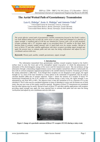
  • 1. ISSN (e): 2250 – 3005 || Vol, 04 || Issue, 12 || December – 2014 || International Journal of Computational Engineering Research (IJCER) www.ijceronline.com Open Access Journal Page 1 The Aerial Wetted Path of Geostationary Transmission Luis G. Hidalgo1 , Jesús A. Hidalgo2 and Antonio Vidal3 1 Universidad Central de Venezuela, Caracas, Venezuela. 2 Universidad Simón Bolívar, Baruta, Sartenejas, Estado Miranda, 3 Universidad Simón Bolívar, Baruta, Sartenejas, Estado Miranda, 1. Introduction The information transmitted from geostationary satellites toward receptors located at the Earth’s surface must to cross the lower part of the atmosphere named troposphere in which the phenomenon of attenuation of the electromagnetic energy of the waves used for transmission occurs. The rain produces strong attenuation through a descending slopped distance across water droplets named here effective wetted path (D, km) with its vertical component supposed proportional to the rainfall intensity R (mm/h). Formulas give R from the unitary attenuation γ (dBz//km). Even though those receptors are not designed as rain gauges, the signal strength (S, %), most of the time included as a menu option in the commands of equipment, may be used to calculate decibels (dBz) but D remains unknown. Figure 1 shows the antenna of a receptor of direct TV transmission broadcasted by the G-3C satellite in a moment during a rainy event; the signal strength S was attenuated by rain from 98% to 80%. The objective here is then the estimation of D as a function of S to late calculate R. The R value may be considered important in times of abundant or scarce rain for human use of fresh water, thus any new issue on this matter would be reported. Receptors of direct TV transmission are considered here but other options may be useful. Myriad of users of direct TV and other satellite applications with receptors providing signal strength may apply the issue reported here to estimate both paths and rain rates but doing verifications and adjusts by new coordinates and new dish sizes. Figure 1. Image of a parabolic antenna of Direct TV receptor (TC121) during a rainy event. Abstract: The aerial effective wetted path of geostationary satellite transmission focused to the Earth´s surface was both defined taking into account the warm sector of rainy cloud and estimated as a function of signal strength. A standard path of 4.88 km was obtained for Caracas with a 60 cm dish parabolic receptor pointing with a 55° elevation angle to an associated direct TV satellite in Ku band. Such function helps to estimate rainfall intensity with ±3 mm/h bulk error for stormy weather. Myriad of users of direct TV and other satellite applications with theirs receptors providing signal strength may apply the present issue to estimate paths and rain rates but doing verifications and adjusts by new coordinates and new dish sizes. Keywords: Wetted, path, satellite, rainfall, geostationary, signal, strength
  • 2. Article Title www.ijceronline.com Open Access Journal Page 2 2. Specific rainfall attenuation theory A geostationary satellite transmits radio waves to the Earth’s surface that can be captured by special device named receiver which has parabolic antenna composed by dish and horn at the front of the dish. The radio waves, most of the time in the microwave band, are composed by a combination of carried, subcarrier and encoded data rename popularly the signal. The transmission must to cross the troposphere where a phenomenon named attenuation occurs. This phenomenon consists in the energy withdrawal of the carrier due to permanent and temporary factors. The permanent or basic attenuation is caused by fixed factors as the Fresnel divergence and energy abortion by CO2 and O2. Energy withdrawal named rain fade caused by energy absorption and dispersion by temporary rainfall droplets is here the subject matter of study. Droplets reflect radio waves energy but water molecules absorb it. The relative signal strength S is measured respect to a standard from 0% to 100% by a meter included in the receptor. In the perfect receptor S=0% for strong rain fade with no detected signal but S=100% for no rainfall. The radio waves must to cross the troposphere in which the attenuation can be maximized by strong rains; the total length across rain showers in the clouds and below the clouds is the effective wetted path D (km). Designed for Caracas, Figure 2 helps to understand the wetted path dimension of the direct TV transmissions (Satellite G-3C) across a 12000 m high troposphere during heavy rainy episodes. The descending inclined wetted path runs D0=4883 m from the 0°C ice level to TC121 crossing the condensation level at 500 m above TC121. The horizontal projection of this path reaches 2801 m. TC121 is located at altitude 877 m but 33 m above the soil. Data for that figure were obtained from [1]. In the present case S was measured with the TC121 receptor referred in Figure 1. The real D can be different to D0 (km). Figure 2. Standard scheme of transmission crossing a large rain stage cumulus over TC121. The D valued will be actualized as follows. During no rains S=Smax but during rains S is less than Smax and the attenuation is:
  • 3. Article Title www.ijceronline.com Open Access Journal Page 3 γ = [-log(S/Smax)]/D (1) Where γ is the bulk unitary attenuation in dBz/km, S is the signal strength measured with the meter in the receiver at a moment with rainfall and Smax is local S measured without rainfall; both for a specific satellite transponder. A transponder is a satellite device used to focus radio waves to areas of the Earth’s surface. Most references present a standard formula for rain attenuation like this: γ = aRb (2) Where γ is the bulk unitary attenuation in dBz/km of horizontal radio wave at a specific moment crossing a falling down vertical shower of rainfall R (mm/h); constants a and b are parameters depending of the radio wave frequency. The International Telecommunication Union (ITU) presents mean values a=0.0242 and b=1.1879 for 12 GHz [2]. D=0 for R=0. To actualize D for each moment was used c value between 0 and 1 with the following linear interpolation: D = c(1-S/Smax)·D0 (3) 3. Rain gauging experiments During the years 2008 to 2012 were collected observational data of 7 storms that permitted to obtain pairs of true rainfall intensity R* and S. In an electronic sheet was programmed the calculation of R from S assuming c values until the mean error of R* minus R reaches zero with a specific standard deviation. The c=1.84 gave the zero error with standard deviation ±2.9 mm/h. In those experiments was used transponder 13 with Smax=98. Table 1 shows results summary. The attenuation Beer´s law may be used also for calculations but this was not intended here. Table 1. Estimation errors in rain gauging experiments. Day Begin End R (mm/h) R* (mm/h) Error (mm/h) 10Aug2009 16:00 17:00 14.7 17.0 -2.3 15Nov2009 13:00 14:00 13.4 13.0 0.4 30Jul2009 19:13 19:31 20.6 15.0 5.6 04Oct2009 16:58 18:45 15.9 15.1 0.8 23Oct2008 16:58 18:34 12.7 16.3 -3.5 04May2011 13:46 13:53 13.4 13.7 -0.3 12Jun2012 15:28 15:28 17.5 18.0 -0.5 2.9 4. Effective or bulk wetted path The maximum occasional value of the inclined wetted path corresponding to heavy cumulonimbus (Cb) rains reached temporary 1.84 times the standard value of 4.88 km or near 9 km assuring the presence of water droplets above the 0°C ice level inside Cb. Observations during jet flying in the area permitted detect the joint occurrence of ice crystal and droplets above the 0°C ice level touching the windows of the jets occasional. More information of this fact is not available due to notable gap of cloud physic studies in the area. The top of this kind of Cb clouds reaches height of 12 km near the tropopause. 5. Final verification In 16 August 2014 for the 150 minutes from 16:35 to 19:05 local time were collected 157 values of S which were transformed in 157 values of R using the above formulation with c=1.84 to obtain a bulk intensity value of 19 mm/h against a measured value of 18 mm/h. Figure 3 shows detail of D variation during this complex rainy event. Out-of-signal time was 12 minutes. The error +1 mm/h is inside the above mentioned bulk of ±3 mm/h, thus it may be considered acceptable. With this verification the present stage of research touches final but further research should be expected to minimize errors.
  • 4. Article Title www.ijceronline.com Open Access Journal Page 4 Figure 3. Histogram of wetted path during stormy episode of 16 August 2014. 6. Conclusions It has been possible to estimate the wetted path of satellite transmission and the rainfall intensity from the signal strength measured with a low cost direct TV receptor during stormy weather episodes. An error of nearly ±3 mm/h was obtained. The change of receptor to a dish of 120 cm instead the 60 cm used actually is recommendable to minimize error. Occasional out-of-signal events of heavy rainfall constitute the main restriction of the present development. As satellite geostationary transmission runs downward over an inclined path and the above mentioned rain attenuation formula was designed for horizontal path, more specific research on this subject must be undertaken to minimize errors doubtless. 7. Acknowledgments We owe thanks to both the Telecommunication Technicians Ramon Arturo Hernandez who teaches us rain fade calculations and the Electronic Engineer Diego Stanfield who advices us on the possibility of watching the signal strength using menu options in most satellite receptors as that of direct TV. References [1] L.G. Hidalgo and J. A. Hidalgo. Cálculo de la intensidad de lluvia por satélite. ISBN 9789801252429. 2011. [2] ITU. Specific attenuation model for rain for use in prediction models. ITU-R P-838-P. 2005 Figure and table captions should be 10-point boldface Helvetica (or a similar sans-serif font). Callouts should be 9-point non-boldface Helvetica. Initially capitalize only the first word of each figure caption and table title. Figures and tables must be numbered separately. For example: “Figure 1. Database contexts” , “Table 1. Input data”. Figure captions are to be centered below the figures. Table titles are to be centered above the tables.