Download as PDF, PPTX


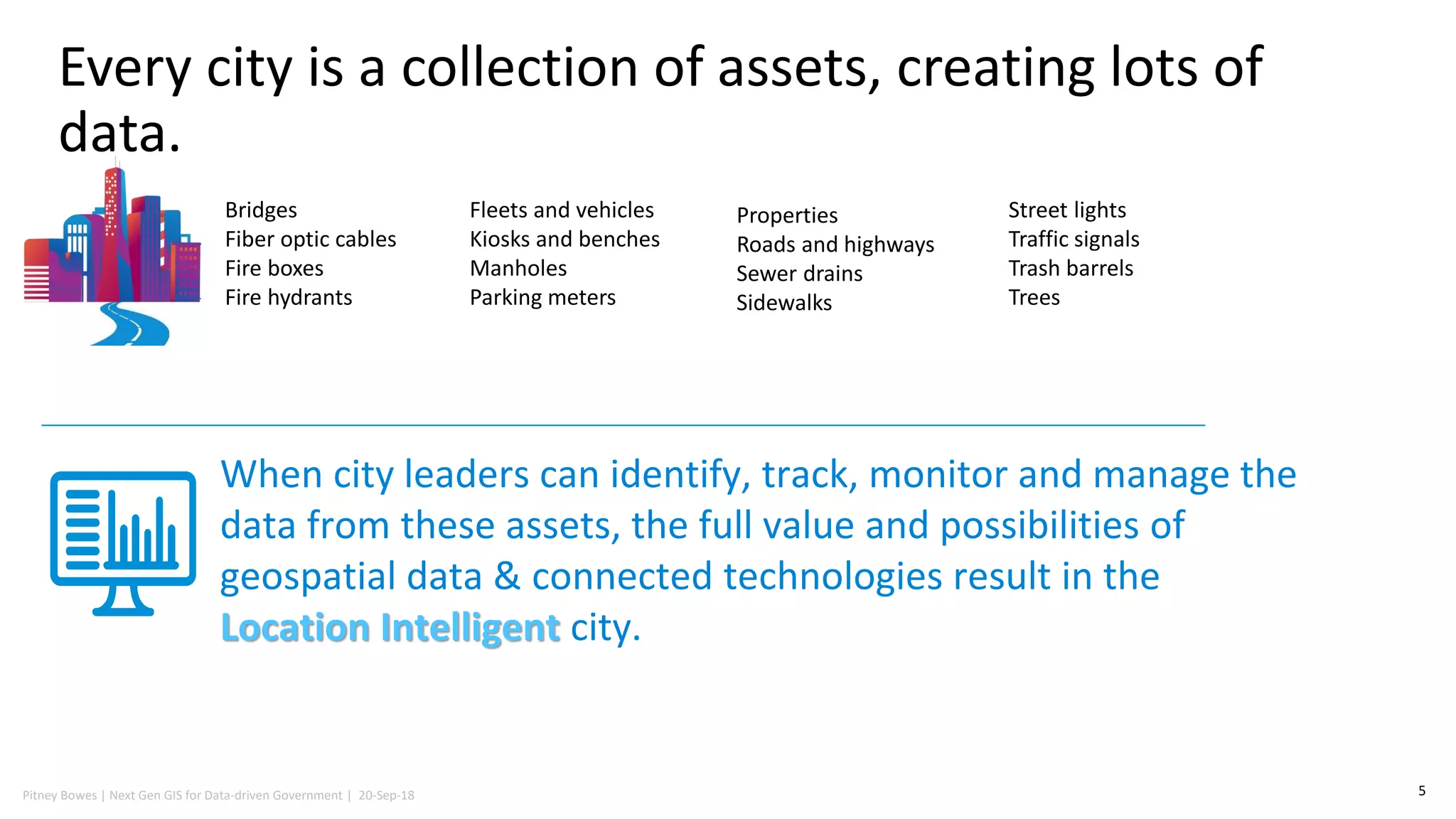
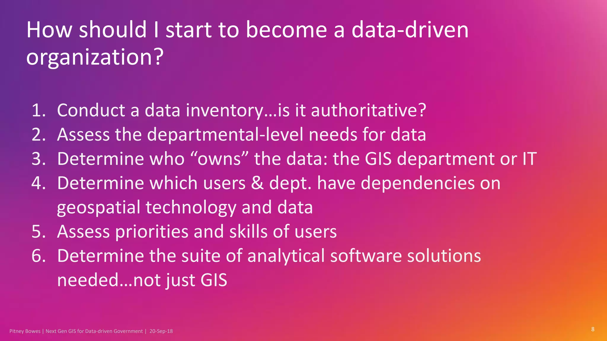

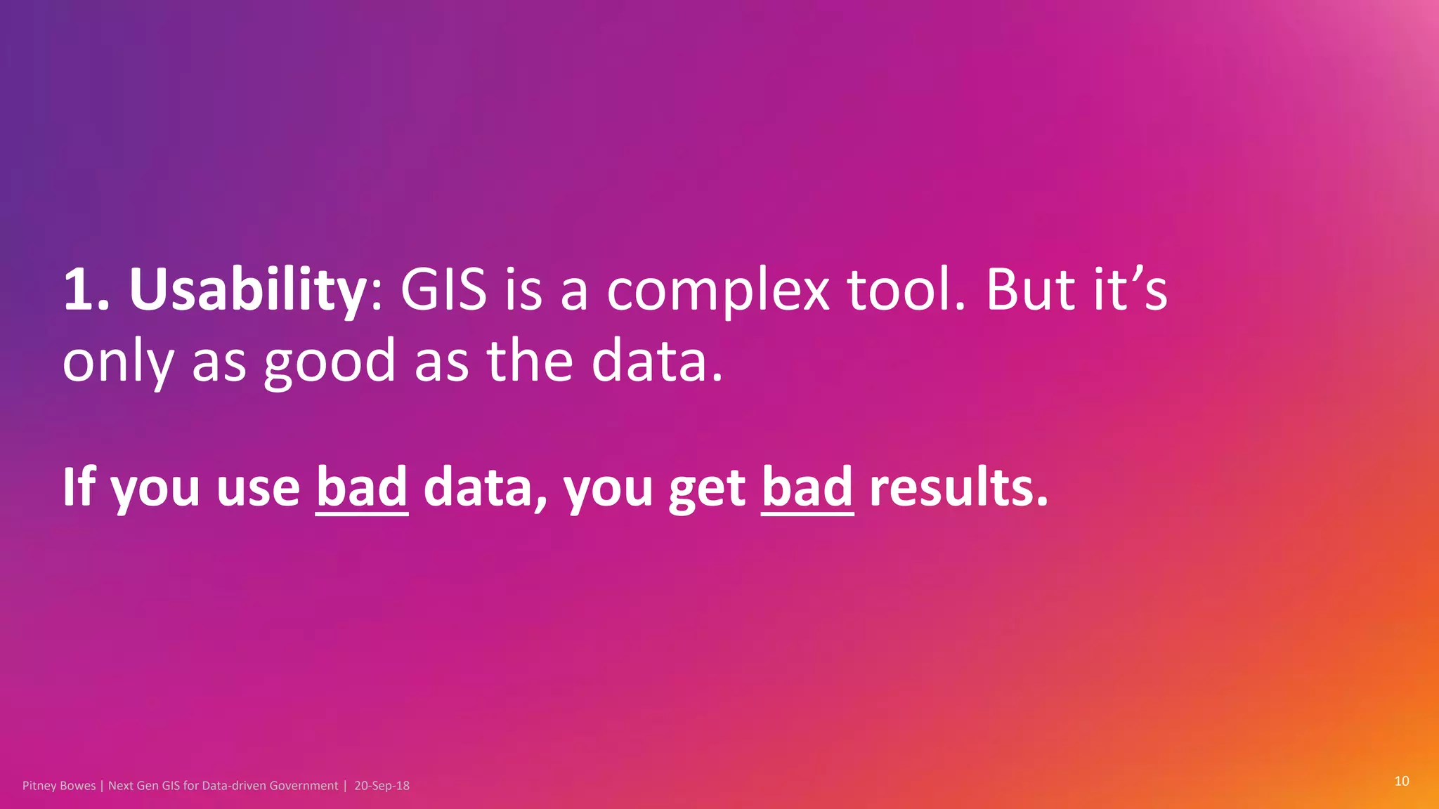
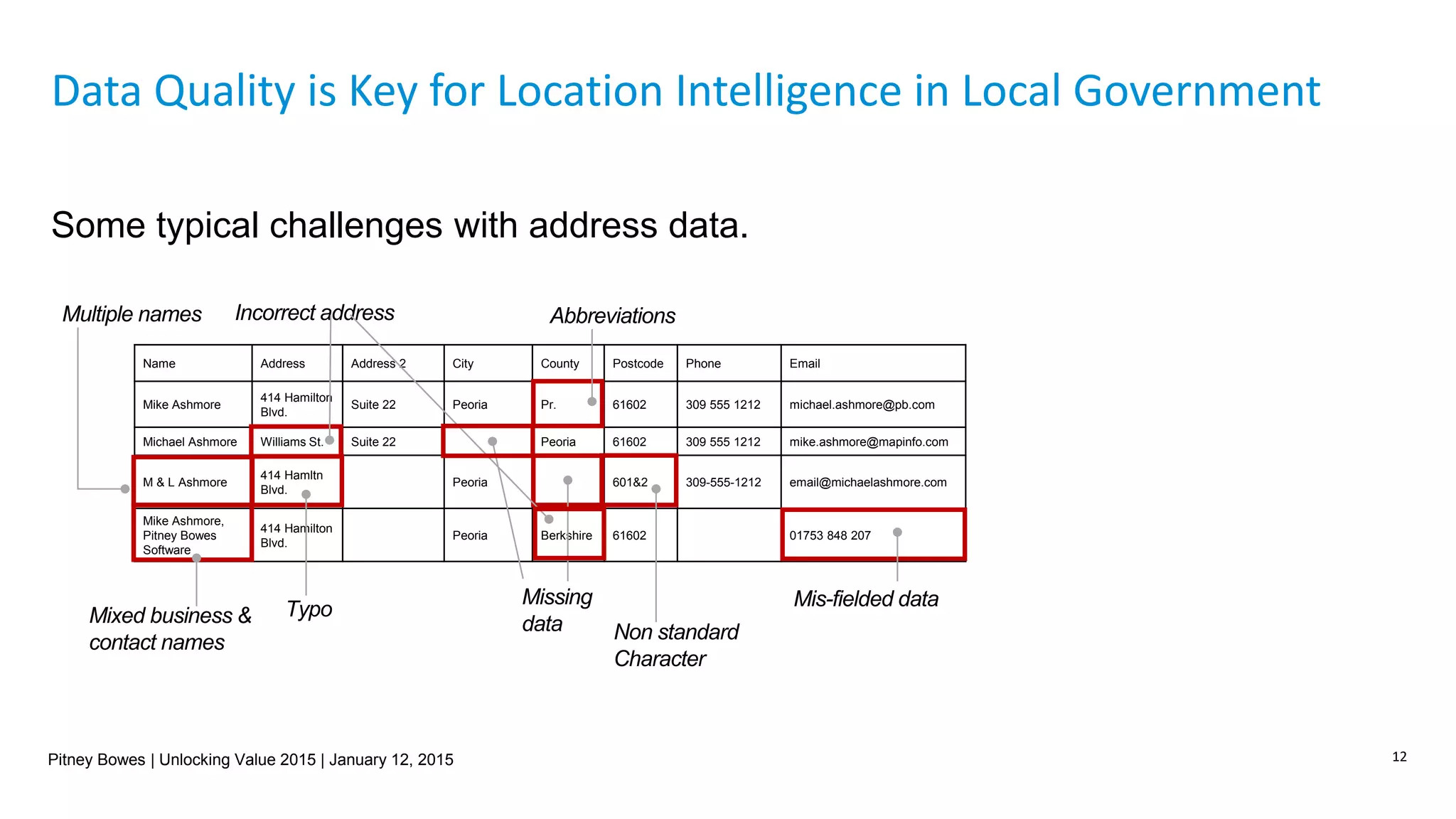

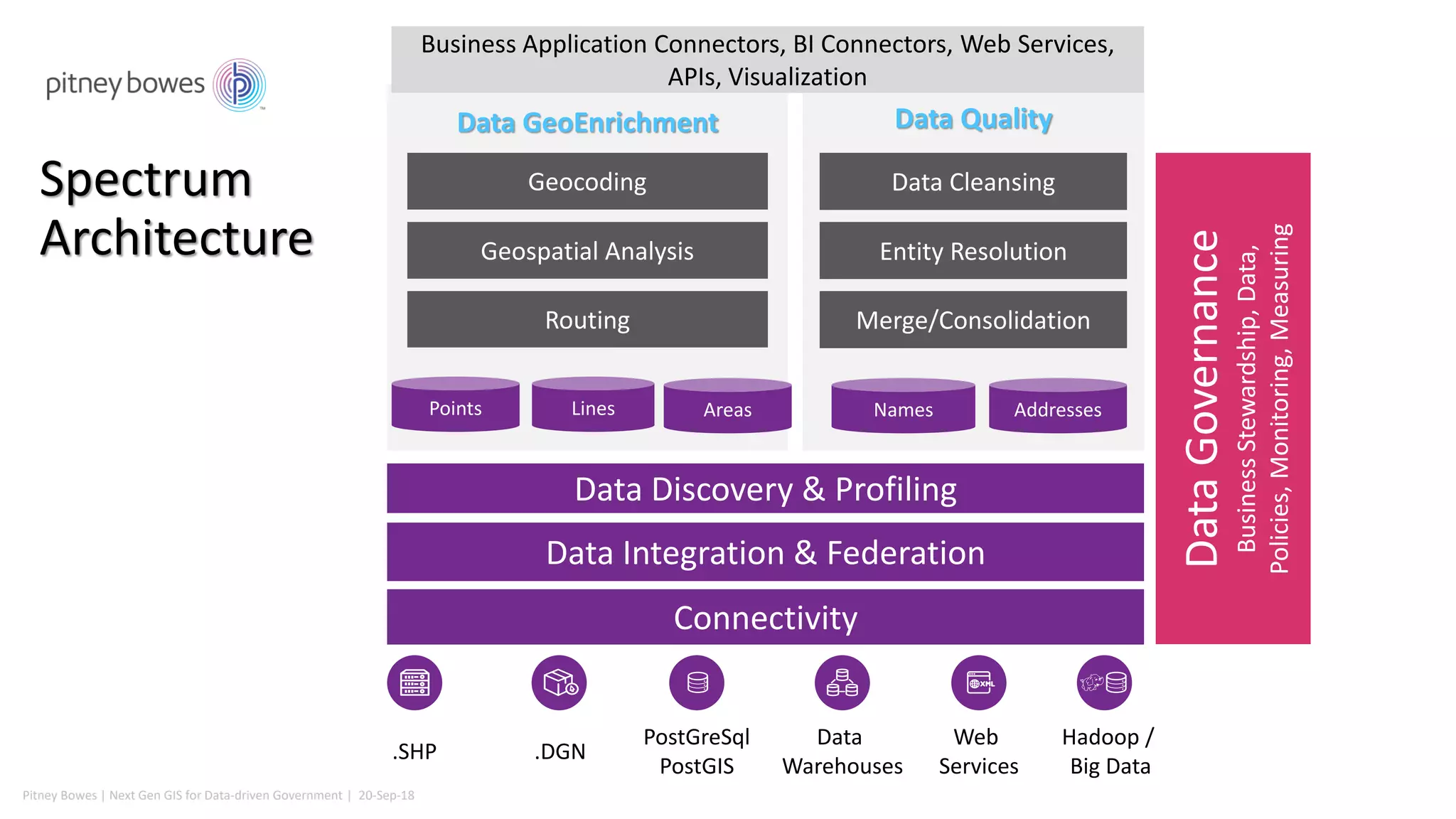
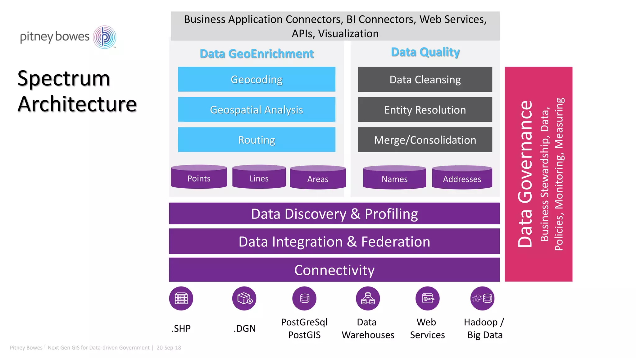
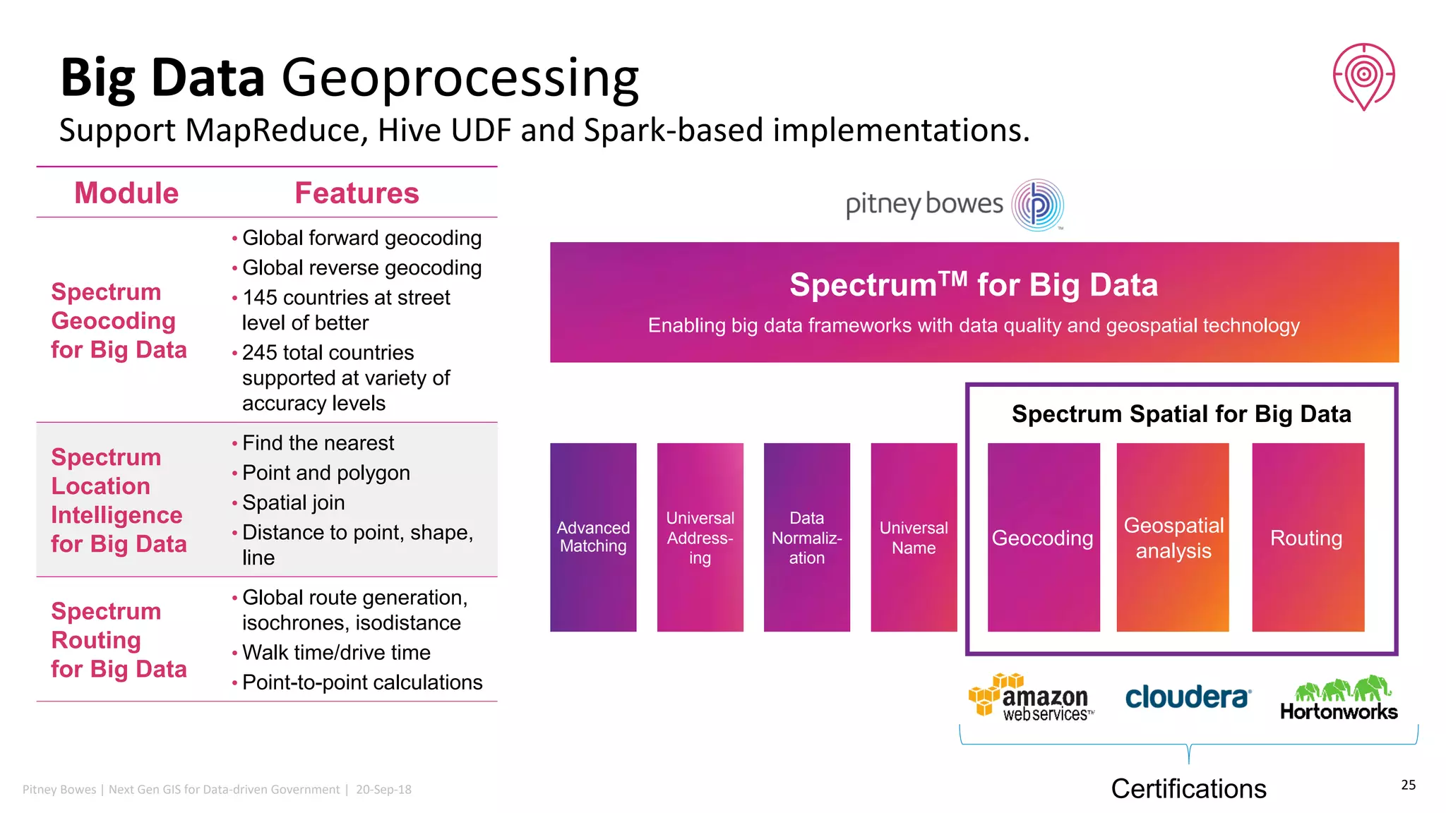


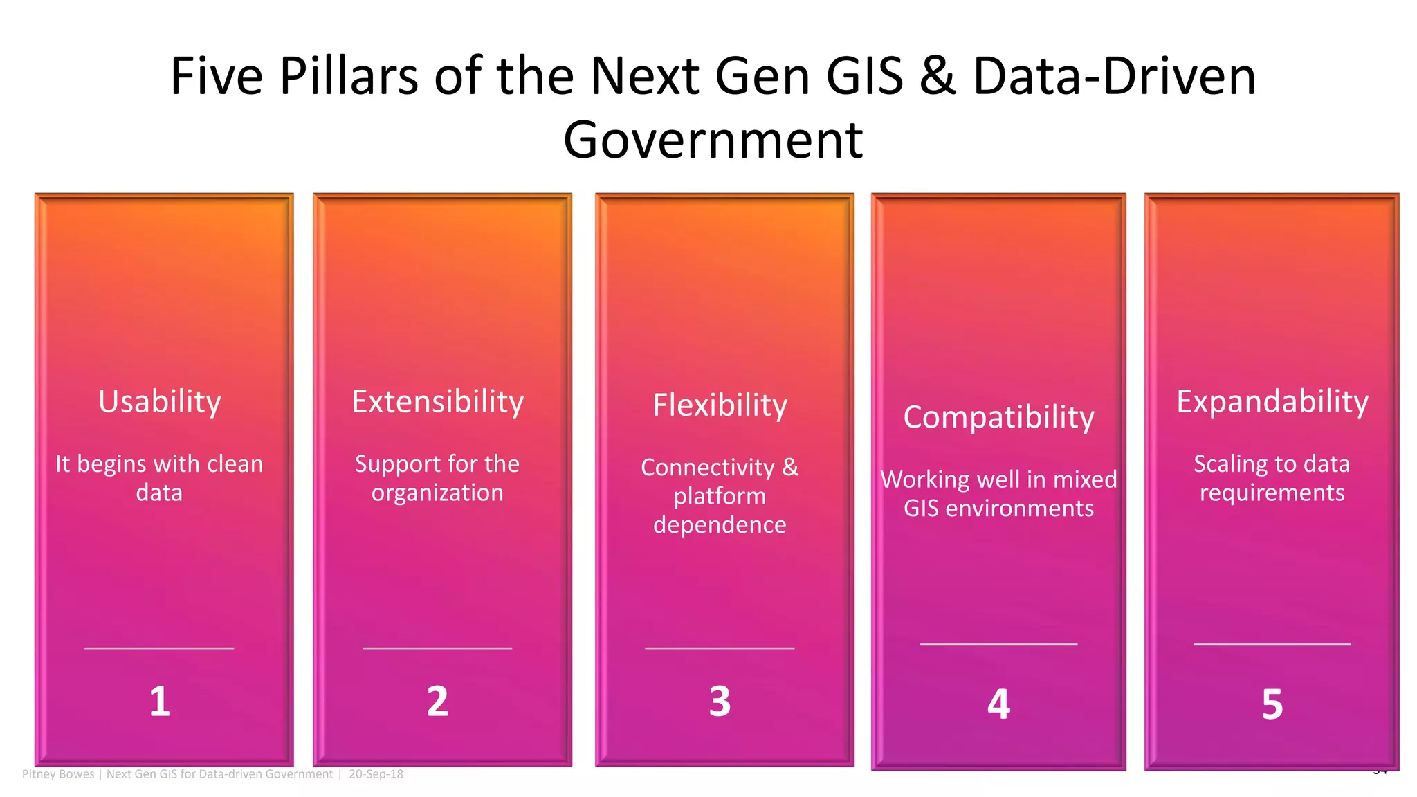


The document discusses the necessity for government agencies to become location intelligent by leveraging geospatial data to manage city assets effectively. It outlines the challenges and solutions associated with becoming a data-driven organization, highlighting the importance of data quality, integration, and user accessibility. Additionally, it identifies five key pillars for next-generation GIS and data-driven governance, emphasizing extensibility, flexibility, compatibility, and usability.


![Coded Agents – with UiPath SDK + LangGraph [Virtual Hands-on Workshop]](https://cdn.slidesharecdn.com/ss_thumbnails/codedagentsdeck-251215155422-5497c599-thumbnail.jpg?width=640&height=640&fit=bounds)


