The report provides a good assessment of debris flow hazards but more detailed site-specific analysis is needed. Emergency countermeasures after the 2010 slopes failures may have been inadequate without considering groundwater issues. To identify responsibilities, more information is needed on the air force base's drainage system design and construction activities. The ecological reservoir likely reduced disaster impacts by storing sediments, but a debris flow simulation could provide more insights. Regular inspections and mitigation may be needed to address future landslide and debris flow risks. Evidence suggests tunnel blasting had little effect on triggering the 2011 slope failures.
Sensor web enablement for debris flow monitoring system in taiwanCybera Inc.
Presentation by Yao-Min (Frank) Fang during the Sensor Web System and Visualization paper session of the Sensor Web Enablement workshop (held during the 2011 Cybera Summit).
Rainfall Intensity Duration Frequency Graph ear Reture Period torm Du.pdffashioncollection2
Rainfall Intensity Duration Frequency Graph ear Reture Period torm Duration (minutes 3. The
Village of Aurora was never flooded before the Year 2016. Ever since a new development in the
neighboring city, the area started to experience the flood in 2017. An investigation was launched
and found that the new development was the cause of the flood for the downstream area
including the Aurora Village. What measures can be applied to mitigate the flood for the
downstream area?
Solution
The major development project which causes the flooding of the down stream areas are dams,
dams have both advantages and disadvantages in their own way, compared to the disadvantages
the advantages are more when compared in the long run, one of the major problem is flooding of
villages in the down stream areas and a lot of ecosystem is submerged while construction of the
dam, the following measures can be taken to prevent the flooding of areas in the down stream:
1. Design the dam in such a way that there would be minimum impact on the environment and
the population living nearby
2. If the soil is not fertile, then stabilize the soil if not done the erosion takes place
3. Remeandering of rivers is to be done so that they are in their natural course itself
4. Provide more reservouir for storing of water
5. Provide an alarming system for reducing of impact on the surrounding population
6. Provide sufficient number of crest gates to control the flow in case of floods
7. Construct the buildings above the ground level in flood prone areas, so that the houses will not
be damaged
The above measures would be sufficient enough to diminish the effect of flood in a given area..
#36068 Topic SCI 207 Our Dependence upon the EnvironmentNumber.docxAASTHA76
#36068 Topic: SCI 207 Our Dependence upon the Environment
Number of Pages: 1 (Double Spaced)
Number of sources: 2
Writing Style: APA
Type of document: Essay
Academic Level:Undergraduate
Category: Environmental Issues
Language Style: English (U.S.)
Order Instructions: ATTACHED
Week 3 - Assignment 1
Ground and Surface Water Interactions Laboratory
[WLO: 2] [CLOs: 1, 3, 4, 5]
This lab enables you to design models of different scenarios that affect the earth’s surface water and groundwater.
The Process:
Take the required photos and complete all parts of the assignment (calculations, data tables, etc.). On the “Lab Worksheet,” answer all of the questions in the “Lab Questions” section. Finally, transfer all of your answers and visual elements from the “Lab Worksheet” into the “Lab Report.” You will submit both the “Lab Report” and the “Lab Worksheet” to Waypoint.
The Assignment:
Making sure to complete all of the following items before submission:
Before you begin this assignment, read the Groundwater and Surface Water Interactions Investigation ManualPreview the document and review The Scientific Method (Links to an external site.)Links to an external site.presentation video.
Follow the instructions in the manual to complete Activities 1, 2, and 3 using materials in your kit, augmented by additional materials that you will supply. Photograph each activity following these instructions:
When taking lab photos, you need to include in each image a strip of paper with your name and the date clearly written on it.
Complete all parts of the Week 3 Lab WorksheetPreview the document and answer all of the questions in the “Lab Questions” section.
Transfer your responses to the lab questions and data tables and your photos from the “Lab Worksheet” into the “Lab Report” by downloading the Lab Report TemplatePreview the document.
Submit your completed “Lab Report” and your “Lab Worksheet” through Waypoint.
Groundwater and Surface
Water Interactions
Investigation
Manual
ENVIRONMENTAL SCIENCE
Made ADA compliant by
NetCentric Technologies using
the CommonLook® software
Key
Personal protective
equipment
(PPE)
goggles gloves apron
follow
link to
video
photograph
results and
submit
stopwatch
required
warning corrosion flammable toxic environment health hazard
GROUNDWATER AND SURFACE WATER INTERACTIONS
Overview
Clean drinking water is vital for all human life. In this lab, students
will learn how freshwater sources interact through the natural
processes of the hydrosphere (all the water on the planet)
and what happens to drinking water supplies when our planet
becomes altered by human activities. Students will design models
of different scenarios that affect the earth’s surface water and
groundwater. The models will demonstrate overconsumption and
dro
Background
The hydrosphere encompasses all the water
on the planet. It includes freshwater and
saltwater; liquid, solid, and vapor; and water
.
36002 Topic SCI 207 Our Dependence upon the EnvironmentNumber.docxrhetttrevannion
36002 Topic: SCI 207 Our Dependence upon the Environment
Number of Pages: 2 (Double Spaced)
Number of sources: 3
Writing Style: APA
Type of document: Essay
Academic Level:Undergraduate
Category: Environmental Issues
Language Style: English (U.S.)
Order Instructions: Attached
Week 1 - Assignment 1
Stream Morphology Laboratory
[WLO: 1] [CLOs: 1, 3, 5]
This lab enables you to construct a physical scale model of a stream system to help you understand how streams and rivers shape the landscape, and how human actions can affect river ecosystems. This lab is done with materials that you will need to supply; the list of items you will need to obtain is in the Stream Morphology Investigation ManualPreview the document.
The Process:
Take the required photos and complete all parts of the assignment (calculations, data tables, etc.). On the “Lab Worksheet,” answer all of the questions in the “Lab Questions” section. Finally, transfer all of your answers and visual elements from the “Lab Worksheet” into the “Lab Report.” You will submit both the “Lab Report” and the “Lab Worksheet” to Waypoint.
The Assignment:
Make sure to complete all of the following items before submission:
Before you begin the assignment, read the Stream Morphology Investigation ManualPreview the document and review The Scientific Method presentation video.
Complete Activity 1 and Activity 2 using the materials that you supply. Photograph each activity following these instructions:
When taking lab photos, you need to include in each image a strip of paper with your name and the date clearly written on it.
Complete all parts of the Week 1 Lab WorksheetPreview the document and answer all of the questions in the “Lab Questions” section.
Transfer your responses to the lab questions and the data tables and your photos from the “Lab Worksheet” into the Lab Report TemplatePreview the document.
Submit your completed “Lab Report” and “Lab Worksheet” through Waypoint.
ENVIRONMENTAL SCIENCE
Stream Morphology
Investigation Manual
STREAM MORPHOLOGY
Table of Contents
2 Overview 2 Outcomes
2 Time Requirements
3 Background
9 Materials
10 Safety
10 Preparation 10 Activity 1
12 Activity 2
13 Submission
13 Disposal and Cleanup
14 Lab Worksheet
18 Lab Questions
Overview
Students will construct a physical scale model of a stream system to help understand how streams and rivers shape the solid earth (i.e., the landscape). Students will perform several experiments
to determine streamflow properties under different conditions. They will apply the scientific method, testing their own scenarios regarding human impacts on river systems.
Outcomes
• Design a stream table model to analyze the different characteristics of streamflow.
• Explain the effects of watersheds on the surrounding environment in terms of the biology, water quality, and economic importance of streams.
• Identify different stream features based on their geological formation due to erosion an.
A contribution to the analysis of urban erosion (Democratic Republic of Congo) ExternalEvents
Mr A. Emery Murhula, Cabinet d’expertise environnemental et social (CEE), Democratic Republic of the Congo. Global Symposium on Soil Erosion (GSER19), 15 - 17 May 2019 at FAO HQ.
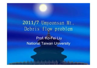
1. 2011/7 Umyeonsan Mt.
Debris flow problem
Prof. Ko-Fei Liu
National Taiwan University
2. The Interim Report
1. Is a very good report regarding potential
hazard and related assessment. Or the
best I have ever seen.
2. But discussion on individual site can not
only rely on statistic data analysis which is
correct to use for a larger number of sites.
3. Regarding the issues that needs resolved,
this report is not prepared for it.
4. Dispute resolving equals lawsuit and needs
evidence or some kind of proof of the crime.
3. Adequacy of recovery works done for the
slopes failed in 2010
1. Not considering ground water issue, and not
enough protection for rain fall, it is indeed mot
adequacy. I do agree with the report.
2. But a more detailed description for 2010
emergency countermeasure design is necessary.
So that there is enough evidence to identify the
responsibility of design or construction.
4. Effect of landslide and drained
water from Air Force base
Water seeps in
Soil
Military base wall
Concrete and without drainage system
6. To identify the responsibility of air force base,
we need information on
1. Drainage system design on 2011/7
2. If there is still construction work which
requires vibration or penatration
3. The new drainage system which put water
in downstream channel is a lot safer and a
huge improvement.
7.
8. How much rainfall? The probability of occurrence is too high alone boundary
9. Water level high, Top soil depth is thin
So land slides and debris flow should start
from mid stream
10. Ecological reservoir
To identify the role of ecological reservoir, it is essential
to know what is flow out of the ecological reservoir.
1. If only mud flow flows out of the reservoir, then the
reservoir has succeeded in storing all the sediments
and therefore reduced the disaster. There is no
description of the situation right after the disaster. Is it
a lot of debris hit and deposited in the downstream, or
just mud flow came down and flood most of the people.
This has to be ensured through photos or interviews
with local people.
19. 1. If it was debris flow came out of the damaged
spillway, then a simulation of debris flows is
necessary. Since the main stream from spillway to
500m upstream, it is very flat with less than 10
degree, so if debris flow came as one single large
wave, this reservoir should play a role of reducing
the disaster. However, if debris flows came as
many small waves, this reservoir may have
collected all the sediment and created a huge
debris flow and make more damage to
downstream.
2. A careful numerical simulation can solve this
question
20. Further improvement
There will be debris flow and landslides
in the future in this watershed.
A regular inspection plan and
mitigation might be needed
21. Blast from tunnels
1. Logically, places near the blast should be influenced more
severely. So if blast indeed has its effect on soil and bedrocks,
then the portion just above the tunnel can be a best proof.
Since there is no evidence of landslides or debris just above the
tunnel or in the surrounding area, this is a proof that blasts had
little or no effect of initiation of land slides or debris flows
2. Does the blasts weaken the soil and bedrocks such that debris
flow came from upstream? There is no trace of erosion near the
blast.
3. Soil actual can absorb energy from blasts, so there should be
no effect from the blasts for 2011/7 debris flow.
4. Will there be any long term effect if bedrocks are cracked,
remains to be seen