SlideShare a Scribd company logo
1 of 38
Download to read offline
Private Land Conservation Opportunities in Alberta’s Bow Valley


    Technical Report #9           By: Karsten Heuer and Tracy Lee
    July 2010
Yellowstone to Yukon Conservation Initiative
Technical Report #9
July 2010


Private Land Conservation Opportunities in Alberta’s Bow Valley


Authors:
Karsten Heuer, M. Sc. Ecology
Tracy Lee, M. Sc., Miistakis Institute for the Rockies


1240 Railway Avenue, Unit 200
Canmore, Alberta T1W 1P4


Cover photograph by Jay Honeyman


(Printed on recycled materials)


PRIVATE LAND CONSERVATION OPPORTUNITIES IN ALBERTA’S BOW VALLEY
FOR MORE INFORMATION CONTACT:
Yellowstone to Yukon Conservation Initiative
1240 Railway Avenue, Unit 200
Canmore, Alberta T1W 1P4 Canada
Telephone: (403) 609-2666
Fax: (403) 609-2667
Available for download from http://www.y2y.net (follow the links to “Library” and “Reports)


SUGGESTED CITATION:
Heuer, Karsten and Tracy Lee. 2010. Private Land Conservation Opportunities in Alberta’s
Bow Valley. Yellowstone to Yukon Conservation Initiative, Canmore, Alberta, Technical
Report #9, July 2010.


COPYRIGHT:
The contents of this paper are solely the property of the Yellowstone to Yukon Conservation
Initiative and Bow Valley Land Conservancy, and cannot be reproduced without permission
from both parties.


DISCLAIMER:
This document is disseminated under the sponsorship of the Yellowstone to Yukon Conservation
Initiative in the interest of information exchange. Yellowstone to Yukon Conservation Initiative
assumes no responsibility for its contents or use thereof.


The contents of this report reflect the views of the authors, who are responsible for the facts and
accuracy of the data presented herein. The contents do not necessarily reflect the official policies of
Yellowstone to Yukon Conservation Initiative.


PRIVATE LAND CONSERVATION OPPORTUNITIES IN ALBERTA’S BOW VALLEY                                         i
Acknowledgement
This analysis was possible due to the generous sharing of wildlife data and land ownership information by
the Province of Alberta, the Town of Canmore, and the Municipality of Bighorn. We would also like to thank
representatives from the Town of Canmore, the MD of Bighorn, the Parks and Protected Areas Division of the
Alberta Government, Canmore’s Biosphere Institute, the Yellowstone to Yukon Conservation Initiative, the Bow
Valley Naturalists, Heather MacFadyen of BowCORD, Lafarge, Baymag, biologists Anne Forshner and Jesse
Whittington, and local naturalist Bob Smith for comments on our approach. Finally, thanks to the following
organizations for funding this project: the Bow Valley Land Conservancy, the Alberta Real Estate Foundation, and
the Nature Conservancy of Canada (Alberta Region).


PRIVATE LAND CONSERVATION OPPORTUNITIES IN ALBERTA’S BOW VALLEY                                                    ii
Table of Contents
Introduction.....................................................................................................................................................................1

Background.....................................................................................................................................................................2

Goals................................................................................................................................................................................3

Study Area.......................................................................................................................................................................3

Methods and Results.......................................................................................................................................................4

Conclusion and Recommendations...............................................................................................................................29

References.....................................................................................................................................................................30

Appendix A...................................................................................................................................................................31


PRIVATE LAND CONSERVATION OPPORTUNITIES IN ALBERTA’S BOW VALLEY                                                                                                                    iii
Figures
Figure 1: Conservation priorities for the Bow Natural Area..........................................................................................2

Figure 2. Study Area.......................................................................................................................................................5

Figure 3. Existing wildlife corridors and habitat patches...............................................................................................6

Figure 4. Five study subunits: Canmore West; Canmore; Canmore East; Exshaw; and Bow Valley Park....................7

Figure 5. GPS points collected from 3 radio-collared grizzly bears between 1988-2004..............................................8

Figure 6. GPS points collected from 5 radio-collared cougars between 2000-2003......................................................9

Figure 7. Snow tracking sequences for cougar, lynx, wolf and bobcat 1999-2009......................................................10

Figure 8. Existing and new wildlife corridors and habitat partches for Canmore East and Exshaw subunits.............13

Figure 9. Streams, rivers, lakes and moist and wet areas in the Bow Valley study area..............................................15

Figure 10. Riparian/wetland layer.................................................................................................................................16

Figure 11. Area of conservation interest.......................................................................................................................17

Figure 12. Conservation targets in the Bow Valley.......................................................................................................19

Figure 13. Priority lands for conservation in the Bow Valley........................................................................................20

Figure 14. Priority lands for conservation in the Bow Valley with connectivity and riparian/wetland overlay...........21


Tables
Table 1: Percent fit of wildlife data into BCEAG wildlife corridors and habitat patches.............................................11

Table 2: Percent fit of wildlife data into existing and new BCEAG corridors and habitat patches for Canmore East
and Exshaw subunits.....................................................................................................................................................12

Table 3: Percentage fit of wildlife data into BCEAG corridor and habitat patch alignments versus new ones for entire
study area......................................................................................................................................................................14

Table 4: Private Land Conservation Targets and Priorities for the Bow Valley............................................................22


PRIVATE LAND CONSERVATION OPPORTUNITIES IN ALBERTA’S BOW VALLEY                                                                                                                iv
Introduction

Alberta’s upper Bow River valley is a critical           The saving grace for this troubled valley is that much
component of a much larger network of core wildlife      of it is protected. To the west of Canmore lies Banff
reserves and corridors spanning the eastern slopes       National Park and to the east, west and south lie
and main ranges of the Canadian Rocky Mountains.         portions of the Nordic Centre, Bow Valley, and Spray
These, in turn, form a significant anchor of the          Valley Provincial Parks. But the effectiveness of
Yellowstone to Yukon (Y2Y) region. The Bow Valley        these protected areas is undermined by the inability
is a rare east-west trending valley in a landscape       of wild animals to move through an increasingly
dominated by north-south ridgelines that provides        complex system of squeeze points on the unprotected
high-quality, low-elevation wildlife habitat and         private and provincial lands between them. Some
winter range in a region where over half of the          of these unprotected lands are so developed that
land base is comprised of rock and ice. It is both a     they are beyond restoration; however, others hold
thoroughfare and a home for an extensive array of        incredible conservation opportunities. The purpose
mammals, including grizzly bears, lynx, cougars,         of this project is to identify and prioritize private
wolves, elk, bighorn sheep, bobcats and wolverines,      land conservation opportunities so that tools such as
as well as a variety of birds, amphibians and aquatic    easements, covenants, land swaps, and acquisitions
species.                                                 can be strategically pursued by land trusts and
                                                         private land conservancies where landowners may be
For many of these animals, however, the region is        amenable.
also among the most developed places in their North
American range. The Town of Canmore (which has
more than doubled in population in the last ten years
to 17,000 residents); the hamlets of Deadman’s Flats,
Lac Des Arcs, Exshaw and Harvie Heights; an active
rock mining industry; the Trans-Canada Highway;
the Canadian Pacific Railway; and a myriad of
recreational trails and facilities used by hundreds
of thousands of tourists, Bow Valley residents,
and enthusiasts from the nearby city of Calgary
(population 1 million); all combine to create a maze
of obstructions and squeeze points in a landscape
that is already topographically complex. Indeed, all
the recent wildlife research in the study area shows
a landscape so constricted by natural and man-made
barriers that, in many cases, once-viable movement
routes for bears, wolves and other animals have been
severely constricted or cut off (e.g., Whittington and
Forshner, 2009; Gibeau et al., 2002; Percy, 2003;
Paquet, 1996).


PRIVATE LAND CONSERVATION OPPORTUNITIES IN ALBERTA’S BOW VALLEY                                               1
Background

The conservation of key parcels of private land            priorities and actions for the entire Bow Natural
in the Bow Valley is of interest to a number of            Region (NCC, 2009). However, the scale of this
organizations, including the Bow Valley Land               plan, which covers an area that extends east to
Conservancy (BVLC), the Nature Conservancy of              Calgary and as far south as Longview (Figure 1),
Canada (NCC), the Alberta Conservation Association         is so large that specific parcels of land are difficult
(ACA), the Yellowstone to Yukon Conservation               to identify and target for conservation. This report
Initiative, the Town of Canmore, and the Alberta           supplements the NCC’s previous work with greater
Government. What has been lacking so far, however,         detail for the upper Bow Valley and, in doing so,
is an approach that identifies and prioritizes private      furthers two of the NCC’s goals, which are to 1)
parcels of land based on their biological and              support the conservation of grizzly bears along the
conservation values.                                       eastern slopes portion of the Bow Natural Area; and
                                                           2) enhance the ecological integrity and conservation
The NCC took steps towards addressing this need            values of federally and provincially protected
in 2009 when it completed its Bow Natural Area             areas within Kananaskis Country and the mountain
Conservation Plan, which sets conservation targets,        national parks (NCC, 2009).


      Figure 1: Conservation Priorities for the Bow Natural Area (as determined by the Nature Conservancy
      of Canada, 2009).


PRIVATE LAND CONSERVATION OPPORTUNITIES IN ALBERTA’S BOW VALLEY                                                    2
Goals                                                    Study Area

The goals of this project are to:                        The study area, located around the Town of
                                                         Canmore and the Hamlet of Exshaw, is bounded by
1.   Identify private lands in the Bow Valley that are   Banff National Park to the west, the Stoney Indian
     important for large carnivore connectivity and      Reserve to the east, the Don Getty and Bow Valley
     wetland/riparian conservation.                      Wildland Provincial Parks to the north, and Bow
                                                         Valley Wildland Provincial Parks and Spray Valley
2.   Strengthen this analysis through a workshop         Provincial Park to the south (Figure 2). Because the
     to gather feedback from local biologists, land      focus of this project was on the valley-bottom lands
     managers and politicians.                           where human development and wildlife compete
                                                         for limited, low-angle terrain, all lands higher than
3.   Rank and prioritize lands using a matrix that       1840 metres above sea level (5000’) and steeper than
     lists the strengths/advantages versus weaknesses/   300 were excluded from the analysis (see BCEAG,
     disadvantages of each identified parcel.             1999; and Whittington and Forshner, 2009 for slope
                                                         justification).


PRIVATE LAND CONSERVATION OPPORTUNITIES IN ALBERTA’S BOW VALLEY                                               3
Methods and Results

Lands of conservation interest were identified by
building two layers of biological information and
overlaying them with land ownership. The two layers
of biological information were:

1.   Connectivity (which captures the movement
     and habitat needs of the vast majority of
     large mammals and, by virtue of the umbrella
     approach, most smaller species as well); and


2.   Riparian/wetland habitats (which captures
     the needs of more specialized species, including
     amphibians, nesting waterfowl and fish).


Connectivity

Our starting model was the existing map of wildlife
corridors and habitat patches developed by the Bow
Corridor Ecosystem Advisory Group (BCEAG) in
1999 (Figure 3). We then asked the question: how
well does this model capture actual wildlife use and
movement? In search of the answer, we divided the
study area into five subunits (Figure 4) and overlaid
three sets of wildlife data: 1369 GPS locations from
three radio-collared grizzly bears (Figure 5); 3306
GPS locations from five radio-collared cougars
(Figure 6); and 1081 kilometres of snow tracking
sequences of cougar, wolf, lynx and bobcat collected
over the past 10 years (Figure 7).


PRIVATE LAND CONSERVATION OPPORTUNITIES IN ALBERTA’S BOW VALLEY   4
PRIVATE LAND CONSERVATION OPPORTUNITIES IN ALBERTA’S BOW VALLEY   5
PRIVATE LAND CONSERVATION OPPORTUNITIES IN ALBERTA’S BOW VALLEY   6
PRIVATE LAND CONSERVATION OPPORTUNITIES IN ALBERTA’S BOW VALLEY   7
PRIVATE LAND CONSERVATION OPPORTUNITIES IN ALBERTA’S BOW VALLEY   8
PRIVATE LAND CONSERVATION OPPORTUNITIES IN ALBERTA’S BOW VALLEY   9
PRIVATE LAND CONSERVATION OPPORTUNITIES IN ALBERTA’S BOW VALLEY   10
Although substantial in volume, the above data has                  occurred in the Canmore East and Exshaw study units.
limitations: it wasn’t collected equally or randomly                These poor fits can be attributed to the following four
across the landscape (e.g. backtracking effort was                  factors:
greater on south-facing slopes above the Town of                    •    The absence of designated corridors and habitat
Canmore in the Canmore West and Canmore subunits                         patches on the north side of the Bow Valley east
(Figure 7)). This lack of randomness and uniformity                      of Canmore (lower slopes of Grotto, Exshaw and
introduced statistical challenges that led us to adopt                   Loder mountains) where cougar GPS locations
a very straightforward assessment of the data: for                       (Figure 6) and cougar, wolf, lynx and bobcat
each study unit we simply calculated the percentage                      backtracking sessions (Figure 7) occur in high
of wildlife data that fell within the current BCEAG                      densities.
corridor and habitat patch alignments (Table1). This
approach worked well for our mandate, which was                     •    Inadequate wildlife corridor alignment on the
to identify conservation opportunities on private                        private lands below Wind Ridge Mountain (i.e.,
lands in the Bow Valley, given that wildlife are                         the “corridor disconnect” on Three Sisters lands
already displaced and stressed by existing levels of                     east of Stewart Creek) where high amounts of
development (see Whittington and Forshner, 2009;                         wildlife activity exist (Figures 5, 6 and 7).*
Gibeau et al., 2002; Herrero, 2005; and Weaver et al.,              •    The absence of corridors on the north side of
1996), that current designated corridors and habitat                     the Bow Valley below Mount MacGillivray and
patches are suboptimal (see BCEAG ,1999 for ideal                        around Lac des Arcs, where known cougar, wolf
dimensions), and that opportunities to conserve                          and lynx movements exist (Figures 6 and 7).
biologically important private lands should be seized.
                                                                    •    The absence of a designated corridor in the
                                                                         Exshaw Creek Valley, which is used by bears to
We considered values less than 75% (shaded yellow
                                                                         link low elevation and high elevation habitats
in Table 1) to be of concern, of which the majority
                                                                         (Figure 5).

 Table 1: Percent fit of wildlife data into BCEAG wildlife corridors and habitat patches.
  Species        Data Type       Canmore        Canmore         Canmore        Exshaw         Bow Valley      All Study
                                 West                           East                          Park            Units

                                                                                                              Combined

  Grizzly        GPS             96%            80%             50%            23%            100%            63%
                 (points)        (N=128)        (N=437)         (N=739)        (N=44)         (N=21)          (N=1369)
  Cougar         GPS             100%           89%             71%            47%            100%            72%
                 (points)        (N=323)        (N=94)          (N=2585)       (N=279)        (N=25)          (N=3306)
  Cougar         Backtrack       80%            72%             72%            46%            97%             76%
                 (km)            (N=110)        (N=106)         (N=215)        (N=38)         (N=4)           (N=473)
  Wolf           Backtrack       98%            81%             62%            55%            97%             79%
                 (km)            (N=158)        (N=76)          (N=217)        (N=10)         (n=31)          (N=493)
  Lynx           Backtrack       100%           100%            70%            50%            No data         71%
                 (km)            (N=5)          (N=6)           (N=49)         (N=12)                         (N=71)
  Bobcat         Backtrack       No data        No data         100%           44%            No data         56%
                 (km)            No data        No data         (N=2)          (N=8)                          (N=44)

*Lands immediately west of the Stewart Creek cross-valley corridor have been developed since all but the cougar GPS data were
 collected; hence the overlap of grizzly GPS points and wolf backtracking data on an urban subdivision visible on the air photo.

PRIVATE LAND CONSERVATION OPPORTUNITIES IN ALBERTA’S BOW VALLEY                                                               11
In the hopes of building a better connectivity layer
we addressed these shortfalls by adding 5 corridors,
extending or widening 3 corridors, and adding
three small habitat patches to the existing BCEAG
corridor and habitat patch alignments for these two
subunits (Figure 8). We then re-ran our analysis to
see if these additions better accommodated the data
(Table 2). Note that, because of the biological value
and political sensitivity of undeveloped private lands
east of Stewart Creek (currently part of the Three
Sisters lands in receivership), we further subdivided
our analysis of the Canmore East subunit into two
scenarios: one with a wildlife corridor alignment
as proposed by Alberta Sustainable Resource
Development (ASRD) in 2002 (Three Sisters
Mountain Village, 2003, Appendix 1), and one which
designates the entire area east of Stewart Creek and
south of the Trans Canada Highway as a habitat patch
(Figure 8).


   Table 2: Percent fit of wildlife data into existing (Figure 3) and new (Figure 8) BCEAG corridors and
   habitat patches for Canmore East and Exshaw subunits.
                                                    Canmore East
                                                                                          Exshaw
                                        Existing               New
    Species         Data Type                         w/ ASRD     w/ Stewart
                                                     Stewart Ck. Ck. Habitat      Existing         New
                                                      Corridor      Patch

    Grizzly         GPS                   50%             55%            75%        23%            93%

                    GPS                   71%             78%            82%        47%            90%
    Cougar
                    Backtrack             72%             80%            88%        46%            88%

    Wolf            Backtrack             62%             65%            77%        55%            94%

    Lynx            Backtrack             70%             75%            91%        50%            93%

    Bobcat          Backtrack            100%            100%            100%       44%            67%
   * Yellow shading denotes category of concern due to poor fit (<75%).


PRIVATE LAND CONSERVATION OPPORTUNITIES IN ALBERTA’S BOW VALLEY                                           12
PRIVATE LAND CONSERVATION OPPORTUNITIES IN ALBERTA’S BOW VALLEY   13
We were encouraged by the improvement in the above
numbers and, as a final check, ran the analysis for
the entire study area (Table 3). Based on the results,
we adopted all corridor and habitat patch alignments
depicted in Figure 8 as our Connectivity Layer.

              Table 3: Percentage fit of wildlife data into existing BCEAG corridor and habitat
              patch alignments (Figure 3) versus new ones (Figure 8) for entire study area.
              Species       Data Type                 All Subunits Combined
                                                      Existing BCEAG           NewΩ

              Grizzly       GPS (points)                  63% (N=1369)                   85%

                            GPS (points)                  72% (N=3306)                   79%
              Cougar
                            Backtrack (km)                 76% (N=473)                   87%

              Wolf          Backtrack (km)                 79% (N=493)                   86%

              Lynx          Backtrack (km)                 71% (N=71)                    93%

              eBobcat       Backtrack (km)                 56% (N=44)                    75%
             Ω
               Includes habitat patch east of Stewart Creek instead of 2008 ASRD corridor alignment.
             * Yellow shading denotes category of concern due to poor fit (<75%).


Riparian/Wetland Habitats                                        Land Ownership

Once the Connectivity Layer was completed we                     Land ownership information was obtained from
turned our attention to riparian and wetland habitats            the Town of Canmore, the Municipal District of
in the hopes of capturing overlooked habitats for                Bighorn, AltaLIS and Alberta Parks and Protected
more specialized species (e.g., waterfowl, amphibians            Areas. Although our focus was on privately deeded
and fish). To do this we mapped streams, rivers and               lands, we included provincial, leased, and municipal-
lakes across the study area as well as wet and moist             owned lands as part of our analysis in the hopes of
areas (Alberta Vegetation Index: hydric, hygric and              encouraging and facilitating a coordinated approach to
subhydric categories) (Figure 9). We then applied                conservation in the valley.
buffers of 100m to all lakes and wetlands and 60m
to all streams and rivers (Lee and Smyth, 2003;
ASRD, 2008; Jon Jorgensen pers. comm.) and, after
overlaying available amphibian locations (Alberta
Parks and Protected Areas) and getting near-perfect
overlap, adopted this buffered area as our Riparian/
Wetland Layer (Figure 10).

Lands of Conservation Interest

The two biological layers (Connectivity and Riparian/
Wetland) were then combined to create our area of
conservation interest (Figure 11).


PRIVATE LAND CONSERVATION OPPORTUNITIES IN ALBERTA’S BOW VALLEY                                                      14
PRIVATE LAND CONSERVATION OPPORTUNITIES IN ALBERTA’S BOW VALLEY   15
PRIVATE LAND CONSERVATION OPPORTUNITIES IN ALBERTA’S BOW VALLEY   16
PRIVATE LAND CONSERVATION OPPORTUNITIES IN ALBERTA’S BOW VALLEY   17
Conservation Targets                                      Prioritizing Conservation Targets

We then overlaid Lands of Conservation Interest           Part of the peer review process was to prioritize
(Figure 11) with land ownership to create a map           conservation targets. This was done by drawing on the
of conservation targets for the valley (Figure 12).       collective knowledge and wisdom gathered during the
These targets denote the legal boundaries of every        workshop to assess each parcel of land based on the
parcel of land where the biological and ownership         following attributes:
layers intersected. In most cases the area of actual
                                                          •   Conservation Value – e.g., winter range for
conservation interest is considerably smaller (i.e., an
                                                              ungulates, presence of rare plants, squeeze point
entire section of land appears as a conservation target
                                                              in critical corridor, etc.
even if only a corner of it overlaps with a corridor,
habitat patch or buffered riparian or wetland area        •   Conservation Urgency – e.g., whether or not
– e.g., compare Figures 13 and 14).                           the parcel is physically developable, current
                                                              municipal zoning (if applicable), etc.
The map of Conservation Targets (Figure 12) and
how it was derived was then subjected to peer review      •   Integrity and Management of Adjacent Lands
during an all-day workshop of local biologists, land          – e.g., whether the parcel is part of a designated
managers, land conservancies, and conservationists            corridor or not, whether it abuts a habitat patch or
held in late March, 2010. Invitees who were                   protected area, etc.
unable to attend were consulted in the weeks that
                                                          •   Recreation Value – e.g., presence of trails, access
followed. Altogether over 25 people were consulted,
                                                              to other recreation areas, etc.
including representatives from Alberta Parks and
Protected Areas, the Town of Canmore, the MD of           •   Receptiveness of Owner – e.g., whether or not
Bighorn, Lafarge Canada, Baymag, Yellowstone                  the owner is known to be open to conservation
to Yukon Conservation Initiative, the Bow Valley              tools (e.g., land swaps, development credits
Naturalists, the Bow Valley Land Conservancy,                 and trades, easements, tax credits, ecogifts,
the Bow Committee on Responsible Development                  etc.) being applied to his or her lands. This was
(BowCORD) and independent biologists. Errors in               informally assessed, and is a matter for discussion
land ownership were identified and corrected during            with individual owners. Neither the identity or
this process, critical winter range for Bighorn sheep         attitudes of owners of particular pieces of private
was incorporated into the new habitat patches, existing       land are disclosed in this report.
and pending conservation easements were identified,
and a local expert on rare plants was consulted. Figure   Discussion points were organized into a priority
12 incorporates all of this input.                        matrix (Table 4) and cross-referenced to final maps
                                                          of priority lands for conservation in the Bow Valley
                                                          (Figures 13 and 14).


PRIVATE LAND CONSERVATION OPPORTUNITIES IN ALBERTA’S BOW VALLEY                                                   18
PRIVATE LAND CONSERVATION OPPORTUNITIES IN ALBERTA’S BOW VALLEY   19
PRIVATE LAND CONSERVATION OPPORTUNITIES IN ALBERTA’S BOW VALLEY   20
PRIVATE LAND CONSERVATION OPPORTUNITIES IN ALBERTA’S BOW VALLEY   21
Table 4: Private Land Conservation Targets and Priorities for the Bow Valley
Map        Parcel            Size Conservation         Conservation         Integrity &    Recreation Value Possible Tools       Overall Priority
Code       Description       acres Value               Urgency              Management of                   (only if owner is
                                                                            Adjacent Lands                  willing)
A          Old Ranger        4.4   Medium –Good        Low – Currently      Very High          Low - very small Acquisition or   Medium
           Station                 cougar and          zoned Wildland       – Surrounded on parcel.             Easement
                                   ungulate habitat    Conservation         three sides by
                                   on three sides.     District by TOC.     BVWPP, 4th side is
                                   Concern about                            highway frontage.
                                   spill-over effect
                                   from human
                                   use in adjacent
                                   high density
                                   development.
B          Silvertip Golf    120   High – Lower        High – Zoned         High               Medium – green   Easement         High
           Course                  portion part        Direct Control by    – Conservation     space and golf
                                   of secondary        TOC. Possibility     easements in place course.
                                   (ungulate) wildlife of urban             on 2 adjoining
                                   corridor; upper     development if       properties for
                                   portion part of     golf course proves   secondary
                                   primary wildlife unprofitable. TOC        corridor; BVWPP
                                   corridor. Impacted has very little       captures rest of
                                   by adjacent golf control.                upper corridor.
                                   course.
C          Silvertip Gully   17    Very High – Part Low – Zoned          Very High         High – green       Easement           Very High
                                   of designated       Direct Control by – conservation    space with
                                   secondary           TOC but deemed easements in place walking trails
                                   (ungulate) wildlife undevelopable due on 2 adjoining
                                   corridor.           to slope.         properties for
                                                                         secondary
                                                                         corridor.
D          Larch Island      14    High – Part of      Low – Zoned       Very High – All Very high            Acquisition        High
                                   Georgetown          Wildland          other islands in  – Existing walking
                                   Regional Habitat Conservation by Bow River              and interpretive
                                   Patch; closed       TOC.              protected as part trails used
                                   annually by                           of CNCPP.         extensively by
                                   wildlife officers                                        local residents.
                                   due to bears; good
                                   fall, winter and
                                   spring range for
                                   elk.


PRIVATE LAND CONSERVATION OPPORTUNITIES IN ALBERTA’S BOW VALLEY                                                                                     22
Map      Parcel           Size Conservation           Conservation         Integrity &    Recreation Value Possible Tools      Overall Priority
Code     Description      acres Value                 Urgency              Management of                   (only if owner is
                                                                           Adjacent Lands                  willing)
E        Policeman’s      20.4   High – Part of the High                   Medium              Very High – used Acquisition    High
         Creek A                 South Canmore – Zoned Wildland            – Surrounded on 2 by local residents
                                 Habitat Patch      Conservation by        sides by provincial for walking.
                                 – important winter TOC.                   unprotected lands
                                 range and calving                         (zoned Wildland
                                 habitat for local                         by TOC); to
                                 herd of elk.                              the north by
                                                                           condominiums, to
                                                                           the east by small
                                                                           parcel (F) that is
                                                                           a candidate for an
                                                                           easement.
F        Policeman’s      2.15   High – Part of the Low                    Medium              Low – a few        Easement     Medium
         Creek B                 South Canmore – Zoned Wildland            – Surrounded on 2 unofficial trails.
                                 Habitat Patch      Conservation by        sides by provincial Land on other side
                                 – important winter TOC.                   unprotected lands of creek is owner-
                                 range and calving                         (zoned Wildland occupied.
                                 habitat for local                         by TOC); to the
                                 herd of elk.                              west by 20-acre
                                                                           parcel (E).

G        Athletes Village 18.3   High – Located       Medium               Very High         Medium              Easement      Medium
                                 adjacent to          – Currently zoned    – wedged between – trailhead for
                                 wildlife corridor    Direct Control by    wildlife corridor Grassi Lakes trail.
                                 and very near to     TOC.                 (which is within
                                 Rundle Forebay                            CNCPP) and
                                 wildlife crossing                         Grassi Lakes
                                 structure.                                Habitat Patch.
H        Right-of-way      18    High – part of       Low – Currently      Very High         High – walking     Easement       Medium
         on either side of       wildlife corridor    zoned Wildland       – surrounded by   trails.
         canal                   between CNCPP        Conservation         lands currently
                                 and Grassi Lakes     by TOC. Gated        zoned Wildland
                                 Habitat Patch;       access roads for     Conservation by
                                 flanks Rundle         canal and pipeline   TOC.
                                 Forebay wildlife     maintenance;
                                 crossing structure   no development
                                 on both sides.       intent.


PRIVATE LAND CONSERVATION OPPORTUNITIES IN ALBERTA’S BOW VALLEY                                                                                   23
Map      Parcel          Size Conservation            Conservation         Integrity &    Recreation Value Possible Tools          Overall Priority
Code     Description     acres Value                  Urgency              Management of                   (only if owner is
                                                                           Adjacent Lands                  willing)
I        Dog Pond        92.5   Very High             High – Currently     Very High            Very High – used Acquisition or    Very High
                                – Part of Grassi      zoned Wildland       – BVWPP to the       extensively by   Easement
                                Lakes Habitat         Conservation by      south and lands      walkers and
                                Patch; used by        TOC.                 zoned Wildand        bikers.
                                amphibians,                                Conservation to
                                grizzly bears and                          the east and west.
                                everything in
                                between.
J        Quarry Lake     237    Very High             Low – Currently      Very High            Very High – used Easement          Low
                                - Part of Grassi      zoned Natural        – BVWPP to the       extensively by
                                Lakes Habitat         Parkland by          south and lands      walkers, bikers
                                Patch; used by        TOC, mandate of      zoned Wildand        and swimmers.
                                amphibians,           RMHF (which is       Conservation to
                                grizzly bears and     50% controlled       the east and west.
                                everything in         by TOC) is for
                                between.              recreation and
                                                      open natural
                                                      space.
K        West end Peaks 4.5     Very High             Medium               High – BVWPP Low – very small Acquisition               High
         of Grassi              – located at pinch-   – Currently zoned    and primary        parcel – vacant lot.
                                point at west end     Urban Reserve by     corridor to the
                                of Three Sisters      TOC; however,        south, Grassi
                                primary wildlife      legal agreement      Lakes Habitat
                                corridor.             says maximum         Patch to the west,
                                                      number of            high density urban
                                                      developable units    development to
                                                      in Peaks of Grassi   north and east.
                                                      already achieved.
L        Three Sisters   296    High – Important      Low – Currently Very High –               Medium – bisected Acquisition or   Medium
         Creek                  movement              zoned Wildland surrounded on all          by hike/bike trail Easement
                                corridor between      Conservation by sides by BVWPP.           leading into upper
                                low and high          TOC. Due to lack                          Three Sisters
                                elevation habitats    of access and                             Creek.
                                for a number of       cost of servicing,
                                species; within       unlikely to be
                                riparian buffer.      developed.


PRIVATE LAND CONSERVATION OPPORTUNITIES IN ALBERTA’S BOW VALLEY                                                                                       24
Map      Parcel            Size Conservation          Conservation       Integrity &    Recreation Value Possible Tools            Overall Priority
Code     Description       acres Value                Urgency            Management of                   (only if owner is
                                                                         Adjacent Lands                  willing)
M        Upper Stewart     78    High – Important     Low – Currently Very High –            Medium – bisected Acquisition or      Medium
         Creek                   movement             zoned Wildland surrounded on all       by hike/bike trail Easement
                                 corridor between     Conservation by sides by BVWPP.        leading into upper
                                 low and high         TOC and, due to                        Stewart Creek.
                                 elevation habitats   lack of access and
                                 for a number of      cost of servicing,
                                 species; within      unlikely to be
                                 riparian buffer.     developed.

N        East of Stewart   860   Very High – Last     Very High            High – flanked     Medium               Acquisition,     Very High
         Creek                   sizeable swath       – Currently in       by BVWPP to       – numerous hike/     land swap with
                                 of low-elevation     receivership.        the south, and    bike trails bisect   provincial
                                 habitat remaining    Possibilities for established          the land along the   government,
                                 in the valley;       partial acquisition corridor network   main valley and      or transfer of
                                 used extensively     but market value to the east and       accessing Stewart    development
                                 by all ungulates     contingent on        west.             and Three Sisters    credits
                                 and carnivores;      longstanding issue                     Creeks.
                                 critically           of wildlife corridor
                                 positioned at        alignments being
                                 mouth of Wind        resolved.
                                 Valley; includes
                                 wetland habitat
                                 occupied by
                                 amphibians.

O        Wind Valley A     20    Very High – Part Moderate               Medium – flanked Low – currently          Easement         High
                                 of corridor at    – access problems     by unprotected      no trails in the
                                 mouth of the Wind through existing      crown lands         area.
                                 Valley.           quarry. Currently     destined for
                                                   zoned Wildland        park status one
                                                   Conservation.         side, otherwise
                                                                         contingent on
                                                                         what happens with
                                                                         adjacent Taylor (P)
                                                                         and Three Sisters
                                                                         (N) lands.


PRIVATE LAND CONSERVATION OPPORTUNITIES IN ALBERTA’S BOW VALLEY                                                                                       25
Map      Parcel          Size Conservation          Conservation         Integrity &    Recreation Value Possible Tools            Overall Priority
Code     Description     acres Value                Urgency              Management of                   (only if owner is
                                                                         Adjacent Lands                  willing)

P        Wind Valley B   63.4   High – part        Unknown               Medium – flanked High – includes Easement or               Medium
                                of corridor at     – Active Rundle       by unprotected     trail to Spray Falls. development
                                mouth of Wind      rock quarry           Crown lands                              credit trade
                                Valley, good       (Thunderstone)        destined for Park
                                riparian habitat   with new rock         status on two
                                and rare old-      cutting facility      sides. Other sides
                                growth Douglas recently installed        contingent on
                                Fir trees. Parcel in Exshaw. Intent      future of Three
                                compromised by to further develop        Sisters (N) and
                                active Rundle rock unknown.              Lambert (O) lands.
                                quarry.
Q        Bighorn         6.8    Very High          Low                   Medium – rock      Low – no trails in Easement            Medium
         Meadows B              – critical winter                        quarries currently the area.
                                range for bighorn                        exist to either
                                sheep and deer,                          side with no
                                very good cougar                         overall plan to
                                habitat; functions                       maintain wildlife
                                as corridor for                          movement.
                                other species                            Neighbour to the
                                travelling around                        west has ACA
                                Gap Lake.                                conservation
                                                                         easement in place.
R        Gap Lake        17      Very High          High – owner         Medium             Medium – no trails Acquisition or      High
                                – critical winter   has agreement        – BVWPP to         on property.       Easement
                                range for bighorn   for access with      south, existing
                                sheep and deer,     Alberta Ministry     conservation
                                very good cougar    of Transportation.   easement to north;
                                habitat.                                 compromised
                                                                         by 1A Highway,
                                                                         CPR and nearby
                                                                         quarries.
S        Exshaw West     87.5   Very High – high Low – southern          Low – Abuts          High – well used Easement on         Medium
                                quality cougar and half (below           community of         area on periphery northern half of
                                sheep habitat and powerline)             Exshaw and rock      of Exshaw for     property
                                critical corridor in included in MDP     quarry on two        hiking and dog
                                very constricted as residential          sides; unprotected   walking.
                                part of Bow Valley lots for future       Crown land to
                                (Exshaw and Lac expansion of             north and east.
                                Des Arcs).           Exshaw; northern
                                                     half currently
                                                     undevelopable
                                                     due to slope and
                                                     access.

PRIVATE LAND CONSERVATION OPPORTUNITIES IN ALBERTA’S BOW VALLEY                                                                                       26
Map      Parcel         Size Conservation         Conservation          Integrity &    Recreation Value Possible Tools            Overall Priority
Code     Description    acres Value               Urgency               Management of                   (only if owner is
                                                                        Adjacent Lands                  willing)

T        Exshaw East    49    Very High – high Low – southern           Low – Abuts          High – well used Easement on         Medium
                              quality cougar and half (below            community of         area on periphery northern half of
                              sheep habitat and powerline)              Exshaw and rock      of Exshaw for     property
                              critical corridor in included in MDP      quarry on two        hiking and dog
                              very constricted as residential lots      sides; unprotected   walking.
                              part of Bow Valley for future Exshaw      Crown land to
                              (Exshaw and Lac expansion;                north and east.
                              Des Arcs).           northern half
                                                   undevelopable
                                                   due to slope and
                                                   access.

U        Graymont Plant 100   High – area used    Low – currently       Medium               Low – no trails    Easement with     Low
                              by bobcats and      occupied by           – Southern           on property; quite option for
                              lynx; landscape     Graymont plant.       edge abuts onto      a bit of dust and acquisition
                              connection at       Company not           BVWPP.               noise.
                              mouth of Jura       interested in
                              Creek; wetlands     having neighbours
                              and pond.           due to dust/noise
                                                  conflicts.

V        Graymont Lands 363   High – large        Low – no active       Medium               Medium – used by Easement with       Low
                              area used by        mining and none       - Northern edge      rock climbers to option for
                              bobcats, lynx,      planned for near      abuts BVWPP,         access Kid Goat acquisition
                              cougar, sheep and   future. Graymont      western edge         and other cliffs in
                              elk; movement       un- interested in     abuts rock mining    the area.
                              route to and        development due       leases, eastern
                              from Yamnuska       to poss dust/ noise   edge by active
                              Regional Habitat    complaints.           landfill.
                              Patch.
W        Landfill        80    Low (currently      Low – expected High – BVWPP Medium – popular Easement                           Low
                              a landfill) but      lifespan of landfill and Yamnuska        area for hiking
                              potential to        ~30 years.          natural area        and accessing rock
                              be high once                            surround parcel on climbs.
                              reclamation                             two sides, parcel V
                              complete.                               on west side.


PRIVATE LAND CONSERVATION OPPORTUNITIES IN ALBERTA’S BOW VALLEY                                                                                      27
Map        Parcel            Size Conservation            Conservation       Integrity &        Recreation Value Possible Tools        Overall Priority
Code       Description       acres Value                  Urgency            Management of                        (only if owner is
                                                                             Adjacent Lands                       willing)
X          Rafter Six Guest 21      Very High –           High - History     Very High          Very High         Easement             High
           Ranch                    premium montane       of development     – surrounded       – popular with
                                    habitat away from     proposals.         by Bow Valley      hikers, bikers,
                                    highways and          Concern with       Provincial Park on river runners and
                                    railway on banks      spread of guests   three sides.       horse riders.
                                    of Kananaskis         into surrounding
                                    River.                habitat.
Y*         Seebee West           103Very High – high      High – Land        Medium              Medium – area     Easement or         Medium
                                    concentrations        unneeded for       – bordered on       well-used by      acquisition
                                    of rare plants,       operation of power three sides by      fishermen and
                                    especially orchids    plants.            low-density         the occasional
                                    and good cliff                           development         naturalist.
                                    nesting habitat for                      of Stoney First
                                    raptors and other                        Nation Reserve.
                                    birds.
Z*         Seebee East           770Very High - high      Very High - ASP Medium                 Low – access      Easement            Medium
                                    concentrations        approved for         – bordered on     restricted to
                                    of rare plants        5,000-person town three sides by       members of
                                    (orchids) and cliff   to be built on site. low-density       Stoney Nakoda
                                    nesting habitat                            development       First Nation.
                                    for raptors..                              of Stoney First
                                    Huge impacts of                            Nation Reserve.
                                    proposed 5,000-
                                    person town
                                    on surrounding
                                    landscape (e.g.,
                                    Yamnuska
                                    Regional Habitat
                                    Patch, Bow Valley
                                    Provincial Park).

BVWPP = Bow Valley Wildland Provincial Park
CNCC = Canmore Nordic Centre Provincial Park
TOC = Town of Canmore
BVPP = Bow Valley Provincial Park
MDP = Municipal Development Plan
ASP = Area Structure Plan
* Parcels Y and Z fall outside (just east) of the study area but were identified by a sufficient number of people during the consultative phase of this project to
warrant inclusion.

PRIVATE LAND CONSERVATION OPPORTUNITIES IN ALBERTA’S BOW VALLEY                                                                                                    28
Conclusion and Recommendations

This study was undertaken at the request of the
Yellowstone to Yukon Conservation Initiative with
funding from the Bow Valley Land Conservancy to
identify conservation target priorities in Alberta’s
Bow Valley between Banff National Park and
the Stoney Nakoda Indian Reserve. Using the
methodology described above, we identified 26
parcels, encompassing some 3,400 acres, which
require conservation management if this portion of
the Bow Valley is to continue to support regional
wildlife populations and to serve as a corridor linking
protected habitats in Kananaskis Country with those in
Banff National Park. Ten of the identified parcels rank
as high or very high in conservation priority. These
parcels constitute an urgent agenda for private land
conservation in the Bow Valley. We recommend that
the Yellowstone to Yukon Conservation Initiative and
the private land conservancies with which it works
develop a strategy and seek the resources to secure
them.


PRIVATE LAND CONSERVATION OPPORTUNITIES IN ALBERTA’S BOW VALLEY   29
References

Alberta Sustainable Resource Development, Public Lands and Forests Division Forest Management Branch, 2008.
Alberta Timber Harvest Planning and Operating Ground Rules Framework for Renewal. 100p.

BCEAG (Bow Corridor Ecosystem Advisory Group). 1999. Wildlife Corridor and Habitat Patch Guidelines for the
Bow Valley. Municipal District of Bighorn, Town of Canmore, Banff National Park, Government of Alberta. 27 pp.

Gibeau, M. L., A. P. Clevenger, S. Herrero, and J. Wierzchowski. 2002. Grizzly bear response to human
development and activities in the Bow River Watershed, Alberta, Canada. Biological Conservation. 103:227-236.

Herrero S, ed. 2005. Biology, demography, ecology and management of grizzly bears in and around Banff National
Park and Kananaskis Country. ESGBP Final Report, University of Calgary, Alberta. 248pp.

Lee, P., and Smyth, C. 2003. Riparian forest management: paradigms for ecological management and practices
in Alberta. Report produced by the Alberta Research Council (Vegreville, Alberta) and the Alberta Conservation
Association (Edmonton, Alberta) for the Northern Watershed Project Stakeholder Committee. Northern Watershed
Project Final Report No. 1, 117pp.

Nature Conservancy of Canada, 2009. Bow Natural Area Conservation Plan. 98p.

Paquet, P. C. 1993. Summary reference document: ecological studies of recolonizing wolves in the central Canadian
Rocky Mountains. Final report. Parks Canada, Banff National Park.

Percy, M. 2003. Temporal and spatial activity patterns of large carnivores in the Bow Valley of Banff National Park.
M.Sc. thesis. University of Alberta. Edmonton, Alberta.

Three Sisters Mountain Village. 2003. Wildlife Corridor Brief – Overview of Wildlife Corridors on the Three Sisters
Property.

Weaver, J. L., P. C. Paquet, and L. F. Ruggiero. 1996. Resilience and Conservation of Large Carnivores in the Rocky
Mountains. Conservation Biology 10:964-976.

Whittington, J and A. Forshner. 2009. An analysis of wildlife snow tracking, winter transect, and highway underpass
data in the Eastern Bow Valley.


PRIVATE LAND CONSERVATION OPPORTUNITIES IN ALBERTA’S BOW VALLEY                                                    30
Appendix A

Yellowstone to Yukon Conservation
Initiative

The Yellowstone to Yukon Conservation Initiative
                                                                                     NUNAVUT
(Y2Y) is a Transboundary effort to maintain and
restore the unique natural heritage of the mountain               Yellowstone to Yukon Region

landscape extending from the southern extent of
the Greater Yellowstone Ecosystem to the Arctic
Circle in the Yukon. Based out of its headquarters
in Canmore, Alberta, with an office in Bozeman,
Montana, and staff in Banff, Alberta, and Armstrong,
British Columbia, Y2Y promotes collaborative efforts
to maintain viable and interconnected populations
of native carnivores, fish and birds throughout the
region. Hundreds of organizations representing over
a million citizens have endorsed the Y2Y vision. Y2Y
envisions a day when residents, visitors, communities,
land use managers and aboriginal groups throughout
the region understand and appreciate their location
within the world’s last, fully functioning mountain
ecosystem and undertake or support actions that foster
its conservation.


To learn more about the Yellowstone to Yukon
Conservation Initiative, please visit www.y2y.net.


PRIVATE LAND CONSERVATION OPPORTUNITIES IN ALBERTA’S BOW VALLEY                                31

More Related Content

Similar to Private Land Conservation Opportunities in Alberta's Bow Valley

SCOTLAND HEIGHTS PRELIMINARY FOREST CONSERVATION REPORT
SCOTLAND HEIGHTS PRELIMINARY FOREST CONSERVATION REPORTSCOTLAND HEIGHTS PRELIMINARY FOREST CONSERVATION REPORT
SCOTLAND HEIGHTS PRELIMINARY FOREST CONSERVATION REPORTWilliam Swanson
 
USGS: The Principal Rare Earth Elements Deposits of the United States
USGS: The Principal Rare Earth Elements Deposits of the United StatesUSGS: The Principal Rare Earth Elements Deposits of the United States
USGS: The Principal Rare Earth Elements Deposits of the United StatesRare Earths / Rare Metals
 
Designing a Geo-Ecology and Education nature trail by Florian Hopp (North Ame...
Designing a Geo-Ecology and Education nature trail by Florian Hopp (North Ame...Designing a Geo-Ecology and Education nature trail by Florian Hopp (North Ame...
Designing a Geo-Ecology and Education nature trail by Florian Hopp (North Ame...Quarry Life Award by HeidelbergCement
 
CLN 1.0 Progress Report_print
CLN 1.0 Progress Report_printCLN 1.0 Progress Report_print
CLN 1.0 Progress Report_printCrystal Simons
 
Natural Resources Inventory
Natural Resources InventoryNatural Resources Inventory
Natural Resources InventoryTas Vámos
 
Wildlife and Habitat Conservation Framework
Wildlife and Habitat Conservation FrameworkWildlife and Habitat Conservation Framework
Wildlife and Habitat Conservation FrameworkCasey Eganey
 
Arkansas Naturally
Arkansas NaturallyArkansas Naturally
Arkansas Naturallyannypm
 
Research report recreational trail development impact on wildlife
Research report recreational trail development impact on wildlifeResearch report recreational trail development impact on wildlife
Research report recreational trail development impact on wildlifeCharles Bayless
 
Fils 16
Fils 16Fils 16
Fils 16teman
 
Decorah Envirothon - Groundwater in the paleozoic plateau
Decorah Envirothon - Groundwater in the paleozoic plateauDecorah Envirothon - Groundwater in the paleozoic plateau
Decorah Envirothon - Groundwater in the paleozoic plateauJohn Kraus
 
Geography Pdf Print
Geography Pdf PrintGeography Pdf Print
Geography Pdf Printashd_122
 

Similar to Private Land Conservation Opportunities in Alberta's Bow Valley (20)

SCOTLAND HEIGHTS PRELIMINARY FOREST CONSERVATION REPORT
SCOTLAND HEIGHTS PRELIMINARY FOREST CONSERVATION REPORTSCOTLAND HEIGHTS PRELIMINARY FOREST CONSERVATION REPORT
SCOTLAND HEIGHTS PRELIMINARY FOREST CONSERVATION REPORT
 
DPH HMP 4-18-05
DPH HMP 4-18-05DPH HMP 4-18-05
DPH HMP 4-18-05
 
USGS: The Principal Rare Earth Elements Deposits of the United States
USGS: The Principal Rare Earth Elements Deposits of the United StatesUSGS: The Principal Rare Earth Elements Deposits of the United States
USGS: The Principal Rare Earth Elements Deposits of the United States
 
Designing a Geo-Ecology and Education nature trail by Florian Hopp (North Ame...
Designing a Geo-Ecology and Education nature trail by Florian Hopp (North Ame...Designing a Geo-Ecology and Education nature trail by Florian Hopp (North Ame...
Designing a Geo-Ecology and Education nature trail by Florian Hopp (North Ame...
 
CLN 1.0 Progress Report_print
CLN 1.0 Progress Report_printCLN 1.0 Progress Report_print
CLN 1.0 Progress Report_print
 
Natural Resources Inventory
Natural Resources InventoryNatural Resources Inventory
Natural Resources Inventory
 
Wildlife and Habitat Conservation Framework
Wildlife and Habitat Conservation FrameworkWildlife and Habitat Conservation Framework
Wildlife and Habitat Conservation Framework
 
DERMA Management
DERMA ManagementDERMA Management
DERMA Management
 
Arkansas Naturally
Arkansas NaturallyArkansas Naturally
Arkansas Naturally
 
Research report recreational trail development impact on wildlife
Research report recreational trail development impact on wildlifeResearch report recreational trail development impact on wildlife
Research report recreational trail development impact on wildlife
 
Fils 16
Fils 16Fils 16
Fils 16
 
Wind Energy in the Appalachians
Wind Energy in the AppalachiansWind Energy in the Appalachians
Wind Energy in the Appalachians
 
Decorah Envirothon - Groundwater in the paleozoic plateau
Decorah Envirothon - Groundwater in the paleozoic plateauDecorah Envirothon - Groundwater in the paleozoic plateau
Decorah Envirothon - Groundwater in the paleozoic plateau
 
National Park
National ParkNational Park
National Park
 
Picture Canyon
Picture CanyonPicture Canyon
Picture Canyon
 
The New Forest Frontier 2004
The New Forest Frontier 2004The New Forest Frontier 2004
The New Forest Frontier 2004
 
VP Poster
VP PosterVP Poster
VP Poster
 
Geography Pdf Print
Geography Pdf PrintGeography Pdf Print
Geography Pdf Print
 
NE Sandhills
NE SandhillsNE Sandhills
NE Sandhills
 
Little Mountain Ranch
Little Mountain RanchLittle Mountain Ranch
Little Mountain Ranch
 

More from Alberta Real Estate Foundation

Legal defense costs 2009 18 foothills land trust $24,420 2 of 5
Legal defense costs 2009 18 foothills land trust $24,420 2 of 5Legal defense costs 2009 18 foothills land trust $24,420 2 of 5
Legal defense costs 2009 18 foothills land trust $24,420 2 of 5Alberta Real Estate Foundation
 
Conservation easement 2009 18 foothills land trust $24,420 3 of 5
Conservation easement 2009 18 foothills land trust $24,420 3 of 5Conservation easement 2009 18 foothills land trust $24,420 3 of 5
Conservation easement 2009 18 foothills land trust $24,420 3 of 5Alberta Real Estate Foundation
 
Policies and procedures 2009 18 foothills land trust $24,420 1 of 5
Policies and procedures 2009 18 foothills land trust $24,420 1 of 5Policies and procedures 2009 18 foothills land trust $24,420 1 of 5
Policies and procedures 2009 18 foothills land trust $24,420 1 of 5Alberta Real Estate Foundation
 
Alberta land trust 2009 03 4 of 6-best stewardship practises
Alberta land trust 2009 03 4 of 6-best stewardship practisesAlberta land trust 2009 03 4 of 6-best stewardship practises
Alberta land trust 2009 03 4 of 6-best stewardship practisesAlberta Real Estate Foundation
 
Alberta land trust 2009 03 3 of 6-dedicated stewardship funding
Alberta land trust 2009 03 3 of 6-dedicated stewardship fundingAlberta land trust 2009 03 3 of 6-dedicated stewardship funding
Alberta land trust 2009 03 3 of 6-dedicated stewardship fundingAlberta Real Estate Foundation
 
Alberta land trust 2009 03 1 of 6-baseline documentation
Alberta land trust 2009 03 1 of 6-baseline documentationAlberta land trust 2009 03 1 of 6-baseline documentation
Alberta land trust 2009 03 1 of 6-baseline documentationAlberta Real Estate Foundation
 
Alberta land trust 2009 03 5 of 6-beneficial management practices
Alberta land trust 2009 03 5 of 6-beneficial management practicesAlberta land trust 2009 03 5 of 6-beneficial management practices
Alberta land trust 2009 03 5 of 6-beneficial management practicesAlberta Real Estate Foundation
 
Alberta land trust 2009 03 2 of 6-stewardship monitoring training
Alberta land trust 2009 03 2 of 6-stewardship monitoring trainingAlberta land trust 2009 03 2 of 6-stewardship monitoring training
Alberta land trust 2009 03 2 of 6-stewardship monitoring trainingAlberta Real Estate Foundation
 
Re-imagining our Neighbourhoods - Thought Leaders Report
Re-imagining our Neighbourhoods - Thought Leaders ReportRe-imagining our Neighbourhoods - Thought Leaders Report
Re-imagining our Neighbourhoods - Thought Leaders ReportAlberta Real Estate Foundation
 
Cows and fish 2009 29 communicating ecological worth $50,000
Cows and fish 2009 29 communicating ecological worth $50,000Cows and fish 2009 29 communicating ecological worth $50,000
Cows and fish 2009 29 communicating ecological worth $50,000Alberta Real Estate Foundation
 

More from Alberta Real Estate Foundation (19)

Legal defense costs 2009 18 foothills land trust $24,420 2 of 5
Legal defense costs 2009 18 foothills land trust $24,420 2 of 5Legal defense costs 2009 18 foothills land trust $24,420 2 of 5
Legal defense costs 2009 18 foothills land trust $24,420 2 of 5
 
Conservation easement 2009 18 foothills land trust $24,420 3 of 5
Conservation easement 2009 18 foothills land trust $24,420 3 of 5Conservation easement 2009 18 foothills land trust $24,420 3 of 5
Conservation easement 2009 18 foothills land trust $24,420 3 of 5
 
Policies and procedures 2009 18 foothills land trust $24,420 1 of 5
Policies and procedures 2009 18 foothills land trust $24,420 1 of 5Policies and procedures 2009 18 foothills land trust $24,420 1 of 5
Policies and procedures 2009 18 foothills land trust $24,420 1 of 5
 
Baseline template 2009 18 foothills land trust 4 of 5
Baseline template 2009 18 foothills land trust 4 of 5Baseline template 2009 18 foothills land trust 4 of 5
Baseline template 2009 18 foothills land trust 4 of 5
 
Alberta land trust 2009 03 4 of 6-best stewardship practises
Alberta land trust 2009 03 4 of 6-best stewardship practisesAlberta land trust 2009 03 4 of 6-best stewardship practises
Alberta land trust 2009 03 4 of 6-best stewardship practises
 
Alberta land trust 2009 03 3 of 6-dedicated stewardship funding
Alberta land trust 2009 03 3 of 6-dedicated stewardship fundingAlberta land trust 2009 03 3 of 6-dedicated stewardship funding
Alberta land trust 2009 03 3 of 6-dedicated stewardship funding
 
Alberta land trust 2009 03 1 of 6-baseline documentation
Alberta land trust 2009 03 1 of 6-baseline documentationAlberta land trust 2009 03 1 of 6-baseline documentation
Alberta land trust 2009 03 1 of 6-baseline documentation
 
Alberta land trust 2009 03 5 of 6-beneficial management practices
Alberta land trust 2009 03 5 of 6-beneficial management practicesAlberta land trust 2009 03 5 of 6-beneficial management practices
Alberta land trust 2009 03 5 of 6-beneficial management practices
 
Alberta land trust 2009 03 2 of 6-stewardship monitoring training
Alberta land trust 2009 03 2 of 6-stewardship monitoring trainingAlberta land trust 2009 03 2 of 6-stewardship monitoring training
Alberta land trust 2009 03 2 of 6-stewardship monitoring training
 
Re-Imagining our Neighbourhoods Slides
Re-Imagining our Neighbourhoods SlidesRe-Imagining our Neighbourhoods Slides
Re-Imagining our Neighbourhoods Slides
 
Re-imagining our Neighbourhoods - Thought Leaders Report
Re-imagining our Neighbourhoods - Thought Leaders ReportRe-imagining our Neighbourhoods - Thought Leaders Report
Re-imagining our Neighbourhoods - Thought Leaders Report
 
Sustainability at Home: A toolkit for Albertans
Sustainability at Home: A toolkit for AlbertansSustainability at Home: A toolkit for Albertans
Sustainability at Home: A toolkit for Albertans
 
Carsharing in Greater Forest Lawn
Carsharing in Greater Forest LawnCarsharing in Greater Forest Lawn
Carsharing in Greater Forest Lawn
 
Cows and fish 2009 29 communicating ecological worth $50,000
Cows and fish 2009 29 communicating ecological worth $50,000Cows and fish 2009 29 communicating ecological worth $50,000
Cows and fish 2009 29 communicating ecological worth $50,000
 
Baseline documentation foothills land trust 5 of 5
Baseline documentation foothills land trust 5 of 5Baseline documentation foothills land trust 5 of 5
Baseline documentation foothills land trust 5 of 5
 
6 of 6 fund development
6 of 6 fund development 6 of 6 fund development
6 of 6 fund development
 
Sustainable Action Canmore
Sustainable Action CanmoreSustainable Action Canmore
Sustainable Action Canmore
 
Greening Roofs in Edmonton
Greening Roofs in EdmontonGreening Roofs in Edmonton
Greening Roofs in Edmonton
 
Green Calgary Your New Home
Green Calgary Your New HomeGreen Calgary Your New Home
Green Calgary Your New Home
 

Recently uploaded

Transcript: #StandardsGoals for 2024: What’s new for BISAC - Tech Forum 2024
Transcript: #StandardsGoals for 2024: What’s new for BISAC - Tech Forum 2024Transcript: #StandardsGoals for 2024: What’s new for BISAC - Tech Forum 2024
Transcript: #StandardsGoals for 2024: What’s new for BISAC - Tech Forum 2024BookNet Canada
 
New from BookNet Canada for 2024: BNC BiblioShare - Tech Forum 2024
New from BookNet Canada for 2024: BNC BiblioShare - Tech Forum 2024New from BookNet Canada for 2024: BNC BiblioShare - Tech Forum 2024
New from BookNet Canada for 2024: BNC BiblioShare - Tech Forum 2024BookNet Canada
 
SIEMENS: RAPUNZEL – A Tale About Knowledge Graph
SIEMENS: RAPUNZEL – A Tale About Knowledge GraphSIEMENS: RAPUNZEL – A Tale About Knowledge Graph
SIEMENS: RAPUNZEL – A Tale About Knowledge GraphNeo4j
 
Swan(sea) Song – personal research during my six years at Swansea ... and bey...
Swan(sea) Song – personal research during my six years at Swansea ... and bey...Swan(sea) Song – personal research during my six years at Swansea ... and bey...
Swan(sea) Song – personal research during my six years at Swansea ... and bey...Alan Dix
 
Advanced Test Driven-Development @ php[tek] 2024
Advanced Test Driven-Development @ php[tek] 2024Advanced Test Driven-Development @ php[tek] 2024
Advanced Test Driven-Development @ php[tek] 2024Scott Keck-Warren
 
Designing IA for AI - Information Architecture Conference 2024
Designing IA for AI - Information Architecture Conference 2024Designing IA for AI - Information Architecture Conference 2024
Designing IA for AI - Information Architecture Conference 2024Enterprise Knowledge
 
Unlocking the Potential of the Cloud for IBM Power Systems
Unlocking the Potential of the Cloud for IBM Power SystemsUnlocking the Potential of the Cloud for IBM Power Systems
Unlocking the Potential of the Cloud for IBM Power SystemsPrecisely
 
Enhancing Worker Digital Experience: A Hands-on Workshop for Partners
Enhancing Worker Digital Experience: A Hands-on Workshop for PartnersEnhancing Worker Digital Experience: A Hands-on Workshop for Partners
Enhancing Worker Digital Experience: A Hands-on Workshop for PartnersThousandEyes
 
Streamlining Python Development: A Guide to a Modern Project Setup
Streamlining Python Development: A Guide to a Modern Project SetupStreamlining Python Development: A Guide to a Modern Project Setup
Streamlining Python Development: A Guide to a Modern Project SetupFlorian Wilhelm
 
Human Factors of XR: Using Human Factors to Design XR Systems
Human Factors of XR: Using Human Factors to Design XR SystemsHuman Factors of XR: Using Human Factors to Design XR Systems
Human Factors of XR: Using Human Factors to Design XR SystemsMark Billinghurst
 
Pigging Solutions in Pet Food Manufacturing
Pigging Solutions in Pet Food ManufacturingPigging Solutions in Pet Food Manufacturing
Pigging Solutions in Pet Food ManufacturingPigging Solutions
 
Bluetooth Controlled Car with Arduino.pdf
Bluetooth Controlled Car with Arduino.pdfBluetooth Controlled Car with Arduino.pdf
Bluetooth Controlled Car with Arduino.pdfngoud9212
 
Scanning the Internet for External Cloud Exposures via SSL Certs
Scanning the Internet for External Cloud Exposures via SSL CertsScanning the Internet for External Cloud Exposures via SSL Certs
Scanning the Internet for External Cloud Exposures via SSL CertsRizwan Syed
 
#StandardsGoals for 2024: What’s new for BISAC - Tech Forum 2024
#StandardsGoals for 2024: What’s new for BISAC - Tech Forum 2024#StandardsGoals for 2024: What’s new for BISAC - Tech Forum 2024
#StandardsGoals for 2024: What’s new for BISAC - Tech Forum 2024BookNet Canada
 
Are Multi-Cloud and Serverless Good or Bad?
Are Multi-Cloud and Serverless Good or Bad?Are Multi-Cloud and Serverless Good or Bad?
Are Multi-Cloud and Serverless Good or Bad?Mattias Andersson
 
Artificial intelligence in the post-deep learning era
Artificial intelligence in the post-deep learning eraArtificial intelligence in the post-deep learning era
Artificial intelligence in the post-deep learning eraDeakin University
 
Unleash Your Potential - Namagunga Girls Coding Club
Unleash Your Potential - Namagunga Girls Coding ClubUnleash Your Potential - Namagunga Girls Coding Club
Unleash Your Potential - Namagunga Girls Coding ClubKalema Edgar
 

Recently uploaded (20)

Transcript: #StandardsGoals for 2024: What’s new for BISAC - Tech Forum 2024
Transcript: #StandardsGoals for 2024: What’s new for BISAC - Tech Forum 2024Transcript: #StandardsGoals for 2024: What’s new for BISAC - Tech Forum 2024
Transcript: #StandardsGoals for 2024: What’s new for BISAC - Tech Forum 2024
 
New from BookNet Canada for 2024: BNC BiblioShare - Tech Forum 2024
New from BookNet Canada for 2024: BNC BiblioShare - Tech Forum 2024New from BookNet Canada for 2024: BNC BiblioShare - Tech Forum 2024
New from BookNet Canada for 2024: BNC BiblioShare - Tech Forum 2024
 
SIEMENS: RAPUNZEL – A Tale About Knowledge Graph
SIEMENS: RAPUNZEL – A Tale About Knowledge GraphSIEMENS: RAPUNZEL – A Tale About Knowledge Graph
SIEMENS: RAPUNZEL – A Tale About Knowledge Graph
 
Swan(sea) Song – personal research during my six years at Swansea ... and bey...
Swan(sea) Song – personal research during my six years at Swansea ... and bey...Swan(sea) Song – personal research during my six years at Swansea ... and bey...
Swan(sea) Song – personal research during my six years at Swansea ... and bey...
 
Hot Sexy call girls in Panjabi Bagh 🔝 9953056974 🔝 Delhi escort Service
Hot Sexy call girls in Panjabi Bagh 🔝 9953056974 🔝 Delhi escort ServiceHot Sexy call girls in Panjabi Bagh 🔝 9953056974 🔝 Delhi escort Service
Hot Sexy call girls in Panjabi Bagh 🔝 9953056974 🔝 Delhi escort Service
 
Advanced Test Driven-Development @ php[tek] 2024
Advanced Test Driven-Development @ php[tek] 2024Advanced Test Driven-Development @ php[tek] 2024
Advanced Test Driven-Development @ php[tek] 2024
 
Designing IA for AI - Information Architecture Conference 2024
Designing IA for AI - Information Architecture Conference 2024Designing IA for AI - Information Architecture Conference 2024
Designing IA for AI - Information Architecture Conference 2024
 
Unlocking the Potential of the Cloud for IBM Power Systems
Unlocking the Potential of the Cloud for IBM Power SystemsUnlocking the Potential of the Cloud for IBM Power Systems
Unlocking the Potential of the Cloud for IBM Power Systems
 
Enhancing Worker Digital Experience: A Hands-on Workshop for Partners
Enhancing Worker Digital Experience: A Hands-on Workshop for PartnersEnhancing Worker Digital Experience: A Hands-on Workshop for Partners
Enhancing Worker Digital Experience: A Hands-on Workshop for Partners
 
The transition to renewables in India.pdf
The transition to renewables in India.pdfThe transition to renewables in India.pdf
The transition to renewables in India.pdf
 
Streamlining Python Development: A Guide to a Modern Project Setup
Streamlining Python Development: A Guide to a Modern Project SetupStreamlining Python Development: A Guide to a Modern Project Setup
Streamlining Python Development: A Guide to a Modern Project Setup
 
Human Factors of XR: Using Human Factors to Design XR Systems
Human Factors of XR: Using Human Factors to Design XR SystemsHuman Factors of XR: Using Human Factors to Design XR Systems
Human Factors of XR: Using Human Factors to Design XR Systems
 
Pigging Solutions in Pet Food Manufacturing
Pigging Solutions in Pet Food ManufacturingPigging Solutions in Pet Food Manufacturing
Pigging Solutions in Pet Food Manufacturing
 
Bluetooth Controlled Car with Arduino.pdf
Bluetooth Controlled Car with Arduino.pdfBluetooth Controlled Car with Arduino.pdf
Bluetooth Controlled Car with Arduino.pdf
 
Scanning the Internet for External Cloud Exposures via SSL Certs
Scanning the Internet for External Cloud Exposures via SSL CertsScanning the Internet for External Cloud Exposures via SSL Certs
Scanning the Internet for External Cloud Exposures via SSL Certs
 
#StandardsGoals for 2024: What’s new for BISAC - Tech Forum 2024
#StandardsGoals for 2024: What’s new for BISAC - Tech Forum 2024#StandardsGoals for 2024: What’s new for BISAC - Tech Forum 2024
#StandardsGoals for 2024: What’s new for BISAC - Tech Forum 2024
 
Are Multi-Cloud and Serverless Good or Bad?
Are Multi-Cloud and Serverless Good or Bad?Are Multi-Cloud and Serverless Good or Bad?
Are Multi-Cloud and Serverless Good or Bad?
 
Artificial intelligence in the post-deep learning era
Artificial intelligence in the post-deep learning eraArtificial intelligence in the post-deep learning era
Artificial intelligence in the post-deep learning era
 
Unleash Your Potential - Namagunga Girls Coding Club
Unleash Your Potential - Namagunga Girls Coding ClubUnleash Your Potential - Namagunga Girls Coding Club
Unleash Your Potential - Namagunga Girls Coding Club
 
E-Vehicle_Hacking_by_Parul Sharma_null_owasp.pptx
E-Vehicle_Hacking_by_Parul Sharma_null_owasp.pptxE-Vehicle_Hacking_by_Parul Sharma_null_owasp.pptx
E-Vehicle_Hacking_by_Parul Sharma_null_owasp.pptx
 

Private Land Conservation Opportunities in Alberta's Bow Valley

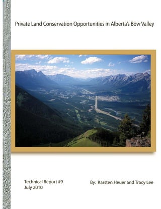
  • 1. Private Land Conservation Opportunities in Alberta’s Bow Valley Technical Report #9 By: Karsten Heuer and Tracy Lee July 2010
  • 2.
  • 3. Yellowstone to Yukon Conservation Initiative Technical Report #9 July 2010 Private Land Conservation Opportunities in Alberta’s Bow Valley Authors: Karsten Heuer, M. Sc. Ecology Tracy Lee, M. Sc., Miistakis Institute for the Rockies 1240 Railway Avenue, Unit 200 Canmore, Alberta T1W 1P4 Cover photograph by Jay Honeyman (Printed on recycled materials) PRIVATE LAND CONSERVATION OPPORTUNITIES IN ALBERTA’S BOW VALLEY
  • 4. FOR MORE INFORMATION CONTACT: Yellowstone to Yukon Conservation Initiative 1240 Railway Avenue, Unit 200 Canmore, Alberta T1W 1P4 Canada Telephone: (403) 609-2666 Fax: (403) 609-2667 Available for download from http://www.y2y.net (follow the links to “Library” and “Reports) SUGGESTED CITATION: Heuer, Karsten and Tracy Lee. 2010. Private Land Conservation Opportunities in Alberta’s Bow Valley. Yellowstone to Yukon Conservation Initiative, Canmore, Alberta, Technical Report #9, July 2010. COPYRIGHT: The contents of this paper are solely the property of the Yellowstone to Yukon Conservation Initiative and Bow Valley Land Conservancy, and cannot be reproduced without permission from both parties. DISCLAIMER: This document is disseminated under the sponsorship of the Yellowstone to Yukon Conservation Initiative in the interest of information exchange. Yellowstone to Yukon Conservation Initiative assumes no responsibility for its contents or use thereof. The contents of this report reflect the views of the authors, who are responsible for the facts and accuracy of the data presented herein. The contents do not necessarily reflect the official policies of Yellowstone to Yukon Conservation Initiative. PRIVATE LAND CONSERVATION OPPORTUNITIES IN ALBERTA’S BOW VALLEY i
  • 5. Acknowledgement This analysis was possible due to the generous sharing of wildlife data and land ownership information by the Province of Alberta, the Town of Canmore, and the Municipality of Bighorn. We would also like to thank representatives from the Town of Canmore, the MD of Bighorn, the Parks and Protected Areas Division of the Alberta Government, Canmore’s Biosphere Institute, the Yellowstone to Yukon Conservation Initiative, the Bow Valley Naturalists, Heather MacFadyen of BowCORD, Lafarge, Baymag, biologists Anne Forshner and Jesse Whittington, and local naturalist Bob Smith for comments on our approach. Finally, thanks to the following organizations for funding this project: the Bow Valley Land Conservancy, the Alberta Real Estate Foundation, and the Nature Conservancy of Canada (Alberta Region). PRIVATE LAND CONSERVATION OPPORTUNITIES IN ALBERTA’S BOW VALLEY ii
  • 6. Table of Contents Introduction.....................................................................................................................................................................1 Background.....................................................................................................................................................................2 Goals................................................................................................................................................................................3 Study Area.......................................................................................................................................................................3 Methods and Results.......................................................................................................................................................4 Conclusion and Recommendations...............................................................................................................................29 References.....................................................................................................................................................................30 Appendix A...................................................................................................................................................................31 PRIVATE LAND CONSERVATION OPPORTUNITIES IN ALBERTA’S BOW VALLEY iii
  • 7. Figures Figure 1: Conservation priorities for the Bow Natural Area..........................................................................................2 Figure 2. Study Area.......................................................................................................................................................5 Figure 3. Existing wildlife corridors and habitat patches...............................................................................................6 Figure 4. Five study subunits: Canmore West; Canmore; Canmore East; Exshaw; and Bow Valley Park....................7 Figure 5. GPS points collected from 3 radio-collared grizzly bears between 1988-2004..............................................8 Figure 6. GPS points collected from 5 radio-collared cougars between 2000-2003......................................................9 Figure 7. Snow tracking sequences for cougar, lynx, wolf and bobcat 1999-2009......................................................10 Figure 8. Existing and new wildlife corridors and habitat partches for Canmore East and Exshaw subunits.............13 Figure 9. Streams, rivers, lakes and moist and wet areas in the Bow Valley study area..............................................15 Figure 10. Riparian/wetland layer.................................................................................................................................16 Figure 11. Area of conservation interest.......................................................................................................................17 Figure 12. Conservation targets in the Bow Valley.......................................................................................................19 Figure 13. Priority lands for conservation in the Bow Valley........................................................................................20 Figure 14. Priority lands for conservation in the Bow Valley with connectivity and riparian/wetland overlay...........21 Tables Table 1: Percent fit of wildlife data into BCEAG wildlife corridors and habitat patches.............................................11 Table 2: Percent fit of wildlife data into existing and new BCEAG corridors and habitat patches for Canmore East and Exshaw subunits.....................................................................................................................................................12 Table 3: Percentage fit of wildlife data into BCEAG corridor and habitat patch alignments versus new ones for entire study area......................................................................................................................................................................14 Table 4: Private Land Conservation Targets and Priorities for the Bow Valley............................................................22 PRIVATE LAND CONSERVATION OPPORTUNITIES IN ALBERTA’S BOW VALLEY iv
  • 8. Introduction Alberta’s upper Bow River valley is a critical The saving grace for this troubled valley is that much component of a much larger network of core wildlife of it is protected. To the west of Canmore lies Banff reserves and corridors spanning the eastern slopes National Park and to the east, west and south lie and main ranges of the Canadian Rocky Mountains. portions of the Nordic Centre, Bow Valley, and Spray These, in turn, form a significant anchor of the Valley Provincial Parks. But the effectiveness of Yellowstone to Yukon (Y2Y) region. The Bow Valley these protected areas is undermined by the inability is a rare east-west trending valley in a landscape of wild animals to move through an increasingly dominated by north-south ridgelines that provides complex system of squeeze points on the unprotected high-quality, low-elevation wildlife habitat and private and provincial lands between them. Some winter range in a region where over half of the of these unprotected lands are so developed that land base is comprised of rock and ice. It is both a they are beyond restoration; however, others hold thoroughfare and a home for an extensive array of incredible conservation opportunities. The purpose mammals, including grizzly bears, lynx, cougars, of this project is to identify and prioritize private wolves, elk, bighorn sheep, bobcats and wolverines, land conservation opportunities so that tools such as as well as a variety of birds, amphibians and aquatic easements, covenants, land swaps, and acquisitions species. can be strategically pursued by land trusts and private land conservancies where landowners may be For many of these animals, however, the region is amenable. also among the most developed places in their North American range. The Town of Canmore (which has more than doubled in population in the last ten years to 17,000 residents); the hamlets of Deadman’s Flats, Lac Des Arcs, Exshaw and Harvie Heights; an active rock mining industry; the Trans-Canada Highway; the Canadian Pacific Railway; and a myriad of recreational trails and facilities used by hundreds of thousands of tourists, Bow Valley residents, and enthusiasts from the nearby city of Calgary (population 1 million); all combine to create a maze of obstructions and squeeze points in a landscape that is already topographically complex. Indeed, all the recent wildlife research in the study area shows a landscape so constricted by natural and man-made barriers that, in many cases, once-viable movement routes for bears, wolves and other animals have been severely constricted or cut off (e.g., Whittington and Forshner, 2009; Gibeau et al., 2002; Percy, 2003; Paquet, 1996). PRIVATE LAND CONSERVATION OPPORTUNITIES IN ALBERTA’S BOW VALLEY 1
  • 9. Background The conservation of key parcels of private land priorities and actions for the entire Bow Natural in the Bow Valley is of interest to a number of Region (NCC, 2009). However, the scale of this organizations, including the Bow Valley Land plan, which covers an area that extends east to Conservancy (BVLC), the Nature Conservancy of Calgary and as far south as Longview (Figure 1), Canada (NCC), the Alberta Conservation Association is so large that specific parcels of land are difficult (ACA), the Yellowstone to Yukon Conservation to identify and target for conservation. This report Initiative, the Town of Canmore, and the Alberta supplements the NCC’s previous work with greater Government. What has been lacking so far, however, detail for the upper Bow Valley and, in doing so, is an approach that identifies and prioritizes private furthers two of the NCC’s goals, which are to 1) parcels of land based on their biological and support the conservation of grizzly bears along the conservation values. eastern slopes portion of the Bow Natural Area; and 2) enhance the ecological integrity and conservation The NCC took steps towards addressing this need values of federally and provincially protected in 2009 when it completed its Bow Natural Area areas within Kananaskis Country and the mountain Conservation Plan, which sets conservation targets, national parks (NCC, 2009). Figure 1: Conservation Priorities for the Bow Natural Area (as determined by the Nature Conservancy of Canada, 2009). PRIVATE LAND CONSERVATION OPPORTUNITIES IN ALBERTA’S BOW VALLEY 2
  • 10. Goals Study Area The goals of this project are to: The study area, located around the Town of Canmore and the Hamlet of Exshaw, is bounded by 1. Identify private lands in the Bow Valley that are Banff National Park to the west, the Stoney Indian important for large carnivore connectivity and Reserve to the east, the Don Getty and Bow Valley wetland/riparian conservation. Wildland Provincial Parks to the north, and Bow Valley Wildland Provincial Parks and Spray Valley 2. Strengthen this analysis through a workshop Provincial Park to the south (Figure 2). Because the to gather feedback from local biologists, land focus of this project was on the valley-bottom lands managers and politicians. where human development and wildlife compete for limited, low-angle terrain, all lands higher than 3. Rank and prioritize lands using a matrix that 1840 metres above sea level (5000’) and steeper than lists the strengths/advantages versus weaknesses/ 300 were excluded from the analysis (see BCEAG, disadvantages of each identified parcel. 1999; and Whittington and Forshner, 2009 for slope justification). PRIVATE LAND CONSERVATION OPPORTUNITIES IN ALBERTA’S BOW VALLEY 3
  • 11. Methods and Results Lands of conservation interest were identified by building two layers of biological information and overlaying them with land ownership. The two layers of biological information were: 1. Connectivity (which captures the movement and habitat needs of the vast majority of large mammals and, by virtue of the umbrella approach, most smaller species as well); and 2. Riparian/wetland habitats (which captures the needs of more specialized species, including amphibians, nesting waterfowl and fish). Connectivity Our starting model was the existing map of wildlife corridors and habitat patches developed by the Bow Corridor Ecosystem Advisory Group (BCEAG) in 1999 (Figure 3). We then asked the question: how well does this model capture actual wildlife use and movement? In search of the answer, we divided the study area into five subunits (Figure 4) and overlaid three sets of wildlife data: 1369 GPS locations from three radio-collared grizzly bears (Figure 5); 3306 GPS locations from five radio-collared cougars (Figure 6); and 1081 kilometres of snow tracking sequences of cougar, wolf, lynx and bobcat collected over the past 10 years (Figure 7). PRIVATE LAND CONSERVATION OPPORTUNITIES IN ALBERTA’S BOW VALLEY 4
  • 12. PRIVATE LAND CONSERVATION OPPORTUNITIES IN ALBERTA’S BOW VALLEY 5
  • 13. PRIVATE LAND CONSERVATION OPPORTUNITIES IN ALBERTA’S BOW VALLEY 6
  • 14. PRIVATE LAND CONSERVATION OPPORTUNITIES IN ALBERTA’S BOW VALLEY 7
  • 15. PRIVATE LAND CONSERVATION OPPORTUNITIES IN ALBERTA’S BOW VALLEY 8
  • 16. PRIVATE LAND CONSERVATION OPPORTUNITIES IN ALBERTA’S BOW VALLEY 9
  • 17. PRIVATE LAND CONSERVATION OPPORTUNITIES IN ALBERTA’S BOW VALLEY 10
  • 18. Although substantial in volume, the above data has occurred in the Canmore East and Exshaw study units. limitations: it wasn’t collected equally or randomly These poor fits can be attributed to the following four across the landscape (e.g. backtracking effort was factors: greater on south-facing slopes above the Town of • The absence of designated corridors and habitat Canmore in the Canmore West and Canmore subunits patches on the north side of the Bow Valley east (Figure 7)). This lack of randomness and uniformity of Canmore (lower slopes of Grotto, Exshaw and introduced statistical challenges that led us to adopt Loder mountains) where cougar GPS locations a very straightforward assessment of the data: for (Figure 6) and cougar, wolf, lynx and bobcat each study unit we simply calculated the percentage backtracking sessions (Figure 7) occur in high of wildlife data that fell within the current BCEAG densities. corridor and habitat patch alignments (Table1). This approach worked well for our mandate, which was • Inadequate wildlife corridor alignment on the to identify conservation opportunities on private private lands below Wind Ridge Mountain (i.e., lands in the Bow Valley, given that wildlife are the “corridor disconnect” on Three Sisters lands already displaced and stressed by existing levels of east of Stewart Creek) where high amounts of development (see Whittington and Forshner, 2009; wildlife activity exist (Figures 5, 6 and 7).* Gibeau et al., 2002; Herrero, 2005; and Weaver et al., • The absence of corridors on the north side of 1996), that current designated corridors and habitat the Bow Valley below Mount MacGillivray and patches are suboptimal (see BCEAG ,1999 for ideal around Lac des Arcs, where known cougar, wolf dimensions), and that opportunities to conserve and lynx movements exist (Figures 6 and 7). biologically important private lands should be seized. • The absence of a designated corridor in the Exshaw Creek Valley, which is used by bears to We considered values less than 75% (shaded yellow link low elevation and high elevation habitats in Table 1) to be of concern, of which the majority (Figure 5). Table 1: Percent fit of wildlife data into BCEAG wildlife corridors and habitat patches. Species Data Type Canmore Canmore Canmore Exshaw Bow Valley All Study West East Park Units Combined Grizzly GPS 96% 80% 50% 23% 100% 63% (points) (N=128) (N=437) (N=739) (N=44) (N=21) (N=1369) Cougar GPS 100% 89% 71% 47% 100% 72% (points) (N=323) (N=94) (N=2585) (N=279) (N=25) (N=3306) Cougar Backtrack 80% 72% 72% 46% 97% 76% (km) (N=110) (N=106) (N=215) (N=38) (N=4) (N=473) Wolf Backtrack 98% 81% 62% 55% 97% 79% (km) (N=158) (N=76) (N=217) (N=10) (n=31) (N=493) Lynx Backtrack 100% 100% 70% 50% No data 71% (km) (N=5) (N=6) (N=49) (N=12) (N=71) Bobcat Backtrack No data No data 100% 44% No data 56% (km) No data No data (N=2) (N=8) (N=44) *Lands immediately west of the Stewart Creek cross-valley corridor have been developed since all but the cougar GPS data were collected; hence the overlap of grizzly GPS points and wolf backtracking data on an urban subdivision visible on the air photo. PRIVATE LAND CONSERVATION OPPORTUNITIES IN ALBERTA’S BOW VALLEY 11
  • 19. In the hopes of building a better connectivity layer we addressed these shortfalls by adding 5 corridors, extending or widening 3 corridors, and adding three small habitat patches to the existing BCEAG corridor and habitat patch alignments for these two subunits (Figure 8). We then re-ran our analysis to see if these additions better accommodated the data (Table 2). Note that, because of the biological value and political sensitivity of undeveloped private lands east of Stewart Creek (currently part of the Three Sisters lands in receivership), we further subdivided our analysis of the Canmore East subunit into two scenarios: one with a wildlife corridor alignment as proposed by Alberta Sustainable Resource Development (ASRD) in 2002 (Three Sisters Mountain Village, 2003, Appendix 1), and one which designates the entire area east of Stewart Creek and south of the Trans Canada Highway as a habitat patch (Figure 8). Table 2: Percent fit of wildlife data into existing (Figure 3) and new (Figure 8) BCEAG corridors and habitat patches for Canmore East and Exshaw subunits. Canmore East Exshaw Existing New Species Data Type w/ ASRD w/ Stewart Stewart Ck. Ck. Habitat Existing New Corridor Patch Grizzly GPS 50% 55% 75% 23% 93% GPS 71% 78% 82% 47% 90% Cougar Backtrack 72% 80% 88% 46% 88% Wolf Backtrack 62% 65% 77% 55% 94% Lynx Backtrack 70% 75% 91% 50% 93% Bobcat Backtrack 100% 100% 100% 44% 67% * Yellow shading denotes category of concern due to poor fit (<75%). PRIVATE LAND CONSERVATION OPPORTUNITIES IN ALBERTA’S BOW VALLEY 12
  • 20. PRIVATE LAND CONSERVATION OPPORTUNITIES IN ALBERTA’S BOW VALLEY 13
  • 21. We were encouraged by the improvement in the above numbers and, as a final check, ran the analysis for the entire study area (Table 3). Based on the results, we adopted all corridor and habitat patch alignments depicted in Figure 8 as our Connectivity Layer. Table 3: Percentage fit of wildlife data into existing BCEAG corridor and habitat patch alignments (Figure 3) versus new ones (Figure 8) for entire study area. Species Data Type All Subunits Combined Existing BCEAG NewΩ Grizzly GPS (points) 63% (N=1369) 85% GPS (points) 72% (N=3306) 79% Cougar Backtrack (km) 76% (N=473) 87% Wolf Backtrack (km) 79% (N=493) 86% Lynx Backtrack (km) 71% (N=71) 93% eBobcat Backtrack (km) 56% (N=44) 75% Ω Includes habitat patch east of Stewart Creek instead of 2008 ASRD corridor alignment. * Yellow shading denotes category of concern due to poor fit (<75%). Riparian/Wetland Habitats Land Ownership Once the Connectivity Layer was completed we Land ownership information was obtained from turned our attention to riparian and wetland habitats the Town of Canmore, the Municipal District of in the hopes of capturing overlooked habitats for Bighorn, AltaLIS and Alberta Parks and Protected more specialized species (e.g., waterfowl, amphibians Areas. Although our focus was on privately deeded and fish). To do this we mapped streams, rivers and lands, we included provincial, leased, and municipal- lakes across the study area as well as wet and moist owned lands as part of our analysis in the hopes of areas (Alberta Vegetation Index: hydric, hygric and encouraging and facilitating a coordinated approach to subhydric categories) (Figure 9). We then applied conservation in the valley. buffers of 100m to all lakes and wetlands and 60m to all streams and rivers (Lee and Smyth, 2003; ASRD, 2008; Jon Jorgensen pers. comm.) and, after overlaying available amphibian locations (Alberta Parks and Protected Areas) and getting near-perfect overlap, adopted this buffered area as our Riparian/ Wetland Layer (Figure 10). Lands of Conservation Interest The two biological layers (Connectivity and Riparian/ Wetland) were then combined to create our area of conservation interest (Figure 11). PRIVATE LAND CONSERVATION OPPORTUNITIES IN ALBERTA’S BOW VALLEY 14
  • 22. PRIVATE LAND CONSERVATION OPPORTUNITIES IN ALBERTA’S BOW VALLEY 15
  • 23. PRIVATE LAND CONSERVATION OPPORTUNITIES IN ALBERTA’S BOW VALLEY 16
  • 24. PRIVATE LAND CONSERVATION OPPORTUNITIES IN ALBERTA’S BOW VALLEY 17
  • 25. Conservation Targets Prioritizing Conservation Targets We then overlaid Lands of Conservation Interest Part of the peer review process was to prioritize (Figure 11) with land ownership to create a map conservation targets. This was done by drawing on the of conservation targets for the valley (Figure 12). collective knowledge and wisdom gathered during the These targets denote the legal boundaries of every workshop to assess each parcel of land based on the parcel of land where the biological and ownership following attributes: layers intersected. In most cases the area of actual • Conservation Value – e.g., winter range for conservation interest is considerably smaller (i.e., an ungulates, presence of rare plants, squeeze point entire section of land appears as a conservation target in critical corridor, etc. even if only a corner of it overlaps with a corridor, habitat patch or buffered riparian or wetland area • Conservation Urgency – e.g., whether or not – e.g., compare Figures 13 and 14). the parcel is physically developable, current municipal zoning (if applicable), etc. The map of Conservation Targets (Figure 12) and how it was derived was then subjected to peer review • Integrity and Management of Adjacent Lands during an all-day workshop of local biologists, land – e.g., whether the parcel is part of a designated managers, land conservancies, and conservationists corridor or not, whether it abuts a habitat patch or held in late March, 2010. Invitees who were protected area, etc. unable to attend were consulted in the weeks that • Recreation Value – e.g., presence of trails, access followed. Altogether over 25 people were consulted, to other recreation areas, etc. including representatives from Alberta Parks and Protected Areas, the Town of Canmore, the MD of • Receptiveness of Owner – e.g., whether or not Bighorn, Lafarge Canada, Baymag, Yellowstone the owner is known to be open to conservation to Yukon Conservation Initiative, the Bow Valley tools (e.g., land swaps, development credits Naturalists, the Bow Valley Land Conservancy, and trades, easements, tax credits, ecogifts, the Bow Committee on Responsible Development etc.) being applied to his or her lands. This was (BowCORD) and independent biologists. Errors in informally assessed, and is a matter for discussion land ownership were identified and corrected during with individual owners. Neither the identity or this process, critical winter range for Bighorn sheep attitudes of owners of particular pieces of private was incorporated into the new habitat patches, existing land are disclosed in this report. and pending conservation easements were identified, and a local expert on rare plants was consulted. Figure Discussion points were organized into a priority 12 incorporates all of this input. matrix (Table 4) and cross-referenced to final maps of priority lands for conservation in the Bow Valley (Figures 13 and 14). PRIVATE LAND CONSERVATION OPPORTUNITIES IN ALBERTA’S BOW VALLEY 18
  • 26. PRIVATE LAND CONSERVATION OPPORTUNITIES IN ALBERTA’S BOW VALLEY 19
  • 27. PRIVATE LAND CONSERVATION OPPORTUNITIES IN ALBERTA’S BOW VALLEY 20
  • 28. PRIVATE LAND CONSERVATION OPPORTUNITIES IN ALBERTA’S BOW VALLEY 21
  • 29. Table 4: Private Land Conservation Targets and Priorities for the Bow Valley Map Parcel Size Conservation Conservation Integrity & Recreation Value Possible Tools Overall Priority Code Description acres Value Urgency Management of (only if owner is Adjacent Lands willing) A Old Ranger 4.4 Medium –Good Low – Currently Very High Low - very small Acquisition or Medium Station cougar and zoned Wildland – Surrounded on parcel. Easement ungulate habitat Conservation three sides by on three sides. District by TOC. BVWPP, 4th side is Concern about highway frontage. spill-over effect from human use in adjacent high density development. B Silvertip Golf 120 High – Lower High – Zoned High Medium – green Easement High Course portion part Direct Control by – Conservation space and golf of secondary TOC. Possibility easements in place course. (ungulate) wildlife of urban on 2 adjoining corridor; upper development if properties for portion part of golf course proves secondary primary wildlife unprofitable. TOC corridor; BVWPP corridor. Impacted has very little captures rest of by adjacent golf control. upper corridor. course. C Silvertip Gully 17 Very High – Part Low – Zoned Very High High – green Easement Very High of designated Direct Control by – conservation space with secondary TOC but deemed easements in place walking trails (ungulate) wildlife undevelopable due on 2 adjoining corridor. to slope. properties for secondary corridor. D Larch Island 14 High – Part of Low – Zoned Very High – All Very high Acquisition High Georgetown Wildland other islands in – Existing walking Regional Habitat Conservation by Bow River and interpretive Patch; closed TOC. protected as part trails used annually by of CNCPP. extensively by wildlife officers local residents. due to bears; good fall, winter and spring range for elk. PRIVATE LAND CONSERVATION OPPORTUNITIES IN ALBERTA’S BOW VALLEY 22
  • 30. Map Parcel Size Conservation Conservation Integrity & Recreation Value Possible Tools Overall Priority Code Description acres Value Urgency Management of (only if owner is Adjacent Lands willing) E Policeman’s 20.4 High – Part of the High Medium Very High – used Acquisition High Creek A South Canmore – Zoned Wildland – Surrounded on 2 by local residents Habitat Patch Conservation by sides by provincial for walking. – important winter TOC. unprotected lands range and calving (zoned Wildland habitat for local by TOC); to herd of elk. the north by condominiums, to the east by small parcel (F) that is a candidate for an easement. F Policeman’s 2.15 High – Part of the Low Medium Low – a few Easement Medium Creek B South Canmore – Zoned Wildland – Surrounded on 2 unofficial trails. Habitat Patch Conservation by sides by provincial Land on other side – important winter TOC. unprotected lands of creek is owner- range and calving (zoned Wildland occupied. habitat for local by TOC); to the herd of elk. west by 20-acre parcel (E). G Athletes Village 18.3 High – Located Medium Very High Medium Easement Medium adjacent to – Currently zoned – wedged between – trailhead for wildlife corridor Direct Control by wildlife corridor Grassi Lakes trail. and very near to TOC. (which is within Rundle Forebay CNCPP) and wildlife crossing Grassi Lakes structure. Habitat Patch. H Right-of-way 18 High – part of Low – Currently Very High High – walking Easement Medium on either side of wildlife corridor zoned Wildland – surrounded by trails. canal between CNCPP Conservation lands currently and Grassi Lakes by TOC. Gated zoned Wildland Habitat Patch; access roads for Conservation by flanks Rundle canal and pipeline TOC. Forebay wildlife maintenance; crossing structure no development on both sides. intent. PRIVATE LAND CONSERVATION OPPORTUNITIES IN ALBERTA’S BOW VALLEY 23
  • 31. Map Parcel Size Conservation Conservation Integrity & Recreation Value Possible Tools Overall Priority Code Description acres Value Urgency Management of (only if owner is Adjacent Lands willing) I Dog Pond 92.5 Very High High – Currently Very High Very High – used Acquisition or Very High – Part of Grassi zoned Wildland – BVWPP to the extensively by Easement Lakes Habitat Conservation by south and lands walkers and Patch; used by TOC. zoned Wildand bikers. amphibians, Conservation to grizzly bears and the east and west. everything in between. J Quarry Lake 237 Very High Low – Currently Very High Very High – used Easement Low - Part of Grassi zoned Natural – BVWPP to the extensively by Lakes Habitat Parkland by south and lands walkers, bikers Patch; used by TOC, mandate of zoned Wildand and swimmers. amphibians, RMHF (which is Conservation to grizzly bears and 50% controlled the east and west. everything in by TOC) is for between. recreation and open natural space. K West end Peaks 4.5 Very High Medium High – BVWPP Low – very small Acquisition High of Grassi – located at pinch- – Currently zoned and primary parcel – vacant lot. point at west end Urban Reserve by corridor to the of Three Sisters TOC; however, south, Grassi primary wildlife legal agreement Lakes Habitat corridor. says maximum Patch to the west, number of high density urban developable units development to in Peaks of Grassi north and east. already achieved. L Three Sisters 296 High – Important Low – Currently Very High – Medium – bisected Acquisition or Medium Creek movement zoned Wildland surrounded on all by hike/bike trail Easement corridor between Conservation by sides by BVWPP. leading into upper low and high TOC. Due to lack Three Sisters elevation habitats of access and Creek. for a number of cost of servicing, species; within unlikely to be riparian buffer. developed. PRIVATE LAND CONSERVATION OPPORTUNITIES IN ALBERTA’S BOW VALLEY 24
  • 32. Map Parcel Size Conservation Conservation Integrity & Recreation Value Possible Tools Overall Priority Code Description acres Value Urgency Management of (only if owner is Adjacent Lands willing) M Upper Stewart 78 High – Important Low – Currently Very High – Medium – bisected Acquisition or Medium Creek movement zoned Wildland surrounded on all by hike/bike trail Easement corridor between Conservation by sides by BVWPP. leading into upper low and high TOC and, due to Stewart Creek. elevation habitats lack of access and for a number of cost of servicing, species; within unlikely to be riparian buffer. developed. N East of Stewart 860 Very High – Last Very High High – flanked Medium Acquisition, Very High Creek sizeable swath – Currently in by BVWPP to – numerous hike/ land swap with of low-elevation receivership. the south, and bike trails bisect provincial habitat remaining Possibilities for established the land along the government, in the valley; partial acquisition corridor network main valley and or transfer of used extensively but market value to the east and accessing Stewart development by all ungulates contingent on west. and Three Sisters credits and carnivores; longstanding issue Creeks. critically of wildlife corridor positioned at alignments being mouth of Wind resolved. Valley; includes wetland habitat occupied by amphibians. O Wind Valley A 20 Very High – Part Moderate Medium – flanked Low – currently Easement High of corridor at – access problems by unprotected no trails in the mouth of the Wind through existing crown lands area. Valley. quarry. Currently destined for zoned Wildland park status one Conservation. side, otherwise contingent on what happens with adjacent Taylor (P) and Three Sisters (N) lands. PRIVATE LAND CONSERVATION OPPORTUNITIES IN ALBERTA’S BOW VALLEY 25
  • 33. Map Parcel Size Conservation Conservation Integrity & Recreation Value Possible Tools Overall Priority Code Description acres Value Urgency Management of (only if owner is Adjacent Lands willing) P Wind Valley B 63.4 High – part Unknown Medium – flanked High – includes Easement or Medium of corridor at – Active Rundle by unprotected trail to Spray Falls. development mouth of Wind rock quarry Crown lands credit trade Valley, good (Thunderstone) destined for Park riparian habitat with new rock status on two and rare old- cutting facility sides. Other sides growth Douglas recently installed contingent on Fir trees. Parcel in Exshaw. Intent future of Three compromised by to further develop Sisters (N) and active Rundle rock unknown. Lambert (O) lands. quarry. Q Bighorn 6.8 Very High Low Medium – rock Low – no trails in Easement Medium Meadows B – critical winter quarries currently the area. range for bighorn exist to either sheep and deer, side with no very good cougar overall plan to habitat; functions maintain wildlife as corridor for movement. other species Neighbour to the travelling around west has ACA Gap Lake. conservation easement in place. R Gap Lake 17 Very High High – owner Medium Medium – no trails Acquisition or High – critical winter has agreement – BVWPP to on property. Easement range for bighorn for access with south, existing sheep and deer, Alberta Ministry conservation very good cougar of Transportation. easement to north; habitat. compromised by 1A Highway, CPR and nearby quarries. S Exshaw West 87.5 Very High – high Low – southern Low – Abuts High – well used Easement on Medium quality cougar and half (below community of area on periphery northern half of sheep habitat and powerline) Exshaw and rock of Exshaw for property critical corridor in included in MDP quarry on two hiking and dog very constricted as residential sides; unprotected walking. part of Bow Valley lots for future Crown land to (Exshaw and Lac expansion of north and east. Des Arcs). Exshaw; northern half currently undevelopable due to slope and access. PRIVATE LAND CONSERVATION OPPORTUNITIES IN ALBERTA’S BOW VALLEY 26
  • 34. Map Parcel Size Conservation Conservation Integrity & Recreation Value Possible Tools Overall Priority Code Description acres Value Urgency Management of (only if owner is Adjacent Lands willing) T Exshaw East 49 Very High – high Low – southern Low – Abuts High – well used Easement on Medium quality cougar and half (below community of area on periphery northern half of sheep habitat and powerline) Exshaw and rock of Exshaw for property critical corridor in included in MDP quarry on two hiking and dog very constricted as residential lots sides; unprotected walking. part of Bow Valley for future Exshaw Crown land to (Exshaw and Lac expansion; north and east. Des Arcs). northern half undevelopable due to slope and access. U Graymont Plant 100 High – area used Low – currently Medium Low – no trails Easement with Low by bobcats and occupied by – Southern on property; quite option for lynx; landscape Graymont plant. edge abuts onto a bit of dust and acquisition connection at Company not BVWPP. noise. mouth of Jura interested in Creek; wetlands having neighbours and pond. due to dust/noise conflicts. V Graymont Lands 363 High – large Low – no active Medium Medium – used by Easement with Low area used by mining and none - Northern edge rock climbers to option for bobcats, lynx, planned for near abuts BVWPP, access Kid Goat acquisition cougar, sheep and future. Graymont western edge and other cliffs in elk; movement un- interested in abuts rock mining the area. route to and development due leases, eastern from Yamnuska to poss dust/ noise edge by active Regional Habitat complaints. landfill. Patch. W Landfill 80 Low (currently Low – expected High – BVWPP Medium – popular Easement Low a landfill) but lifespan of landfill and Yamnuska area for hiking potential to ~30 years. natural area and accessing rock be high once surround parcel on climbs. reclamation two sides, parcel V complete. on west side. PRIVATE LAND CONSERVATION OPPORTUNITIES IN ALBERTA’S BOW VALLEY 27
  • 35. Map Parcel Size Conservation Conservation Integrity & Recreation Value Possible Tools Overall Priority Code Description acres Value Urgency Management of (only if owner is Adjacent Lands willing) X Rafter Six Guest 21 Very High – High - History Very High Very High Easement High Ranch premium montane of development – surrounded – popular with habitat away from proposals. by Bow Valley hikers, bikers, highways and Concern with Provincial Park on river runners and railway on banks spread of guests three sides. horse riders. of Kananaskis into surrounding River. habitat. Y* Seebee West 103Very High – high High – Land Medium Medium – area Easement or Medium concentrations unneeded for – bordered on well-used by acquisition of rare plants, operation of power three sides by fishermen and especially orchids plants. low-density the occasional and good cliff development naturalist. nesting habitat for of Stoney First raptors and other Nation Reserve. birds. Z* Seebee East 770Very High - high Very High - ASP Medium Low – access Easement Medium concentrations approved for – bordered on restricted to of rare plants 5,000-person town three sides by members of (orchids) and cliff to be built on site. low-density Stoney Nakoda nesting habitat development First Nation. for raptors.. of Stoney First Huge impacts of Nation Reserve. proposed 5,000- person town on surrounding landscape (e.g., Yamnuska Regional Habitat Patch, Bow Valley Provincial Park). BVWPP = Bow Valley Wildland Provincial Park CNCC = Canmore Nordic Centre Provincial Park TOC = Town of Canmore BVPP = Bow Valley Provincial Park MDP = Municipal Development Plan ASP = Area Structure Plan * Parcels Y and Z fall outside (just east) of the study area but were identified by a sufficient number of people during the consultative phase of this project to warrant inclusion. PRIVATE LAND CONSERVATION OPPORTUNITIES IN ALBERTA’S BOW VALLEY 28
  • 36. Conclusion and Recommendations This study was undertaken at the request of the Yellowstone to Yukon Conservation Initiative with funding from the Bow Valley Land Conservancy to identify conservation target priorities in Alberta’s Bow Valley between Banff National Park and the Stoney Nakoda Indian Reserve. Using the methodology described above, we identified 26 parcels, encompassing some 3,400 acres, which require conservation management if this portion of the Bow Valley is to continue to support regional wildlife populations and to serve as a corridor linking protected habitats in Kananaskis Country with those in Banff National Park. Ten of the identified parcels rank as high or very high in conservation priority. These parcels constitute an urgent agenda for private land conservation in the Bow Valley. We recommend that the Yellowstone to Yukon Conservation Initiative and the private land conservancies with which it works develop a strategy and seek the resources to secure them. PRIVATE LAND CONSERVATION OPPORTUNITIES IN ALBERTA’S BOW VALLEY 29
  • 37. References Alberta Sustainable Resource Development, Public Lands and Forests Division Forest Management Branch, 2008. Alberta Timber Harvest Planning and Operating Ground Rules Framework for Renewal. 100p. BCEAG (Bow Corridor Ecosystem Advisory Group). 1999. Wildlife Corridor and Habitat Patch Guidelines for the Bow Valley. Municipal District of Bighorn, Town of Canmore, Banff National Park, Government of Alberta. 27 pp. Gibeau, M. L., A. P. Clevenger, S. Herrero, and J. Wierzchowski. 2002. Grizzly bear response to human development and activities in the Bow River Watershed, Alberta, Canada. Biological Conservation. 103:227-236. Herrero S, ed. 2005. Biology, demography, ecology and management of grizzly bears in and around Banff National Park and Kananaskis Country. ESGBP Final Report, University of Calgary, Alberta. 248pp. Lee, P., and Smyth, C. 2003. Riparian forest management: paradigms for ecological management and practices in Alberta. Report produced by the Alberta Research Council (Vegreville, Alberta) and the Alberta Conservation Association (Edmonton, Alberta) for the Northern Watershed Project Stakeholder Committee. Northern Watershed Project Final Report No. 1, 117pp. Nature Conservancy of Canada, 2009. Bow Natural Area Conservation Plan. 98p. Paquet, P. C. 1993. Summary reference document: ecological studies of recolonizing wolves in the central Canadian Rocky Mountains. Final report. Parks Canada, Banff National Park. Percy, M. 2003. Temporal and spatial activity patterns of large carnivores in the Bow Valley of Banff National Park. M.Sc. thesis. University of Alberta. Edmonton, Alberta. Three Sisters Mountain Village. 2003. Wildlife Corridor Brief – Overview of Wildlife Corridors on the Three Sisters Property. Weaver, J. L., P. C. Paquet, and L. F. Ruggiero. 1996. Resilience and Conservation of Large Carnivores in the Rocky Mountains. Conservation Biology 10:964-976. Whittington, J and A. Forshner. 2009. An analysis of wildlife snow tracking, winter transect, and highway underpass data in the Eastern Bow Valley. PRIVATE LAND CONSERVATION OPPORTUNITIES IN ALBERTA’S BOW VALLEY 30
  • 38. Appendix A Yellowstone to Yukon Conservation Initiative The Yellowstone to Yukon Conservation Initiative NUNAVUT (Y2Y) is a Transboundary effort to maintain and restore the unique natural heritage of the mountain Yellowstone to Yukon Region landscape extending from the southern extent of the Greater Yellowstone Ecosystem to the Arctic Circle in the Yukon. Based out of its headquarters in Canmore, Alberta, with an office in Bozeman, Montana, and staff in Banff, Alberta, and Armstrong, British Columbia, Y2Y promotes collaborative efforts to maintain viable and interconnected populations of native carnivores, fish and birds throughout the region. Hundreds of organizations representing over a million citizens have endorsed the Y2Y vision. Y2Y envisions a day when residents, visitors, communities, land use managers and aboriginal groups throughout the region understand and appreciate their location within the world’s last, fully functioning mountain ecosystem and undertake or support actions that foster its conservation. To learn more about the Yellowstone to Yukon Conservation Initiative, please visit www.y2y.net. PRIVATE LAND CONSERVATION OPPORTUNITIES IN ALBERTA’S BOW VALLEY 31