
Recommended
More Related Content
Viewers also liked
Viewers also liked (17)
Similar to Decorah Envirothon - Groundwater in the paleozoic plateau
Similar to Decorah Envirothon - Groundwater in the paleozoic plateau (20)
More from John Kraus
More from John Kraus (15)
Recently uploaded
Recently uploaded (20)
Decorah Envirothon - Groundwater in the paleozoic plateau
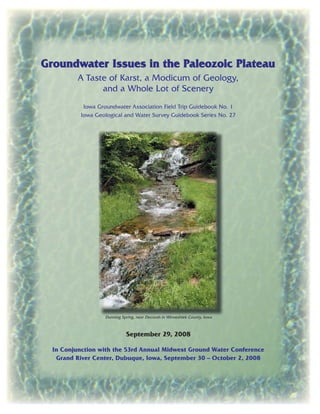
- 1. Groundwater Issues in the Paleozoic PlateauGroundwater Issues in the Paleozoic Plateau A Taste of Karst, a Modicum of Geology, and a Whole Lot of Scenery Iowa Groundwater Association Field Trip Guidebook No. 1 Iowa Geological and Water Survey Guidebook Series No. 27 Dunning Spring, near Decorah in Winneshiek County, Iowa September 29, 2008 In Conjunction with the 53rd Annual Midwest Ground Water Conference Grand River Center, Dubuque, Iowa, September 30 – October 2, 2008
- 3. Groundwater Issues in the Paleozoic Plateau A Taste of Karst, a Modicum of Geology, and a Whole Lot of Scenery Iowa Groundwater Association Field Trip Guidebook No. 1 Iowa Geological and Water Survey Guidebook Series No. 27 In Conjunction with the 53rd Annual Midwest Ground Water Conference Grand River Center, Dubuque, Iowa, September 30 – October 2, 2008 With contributions by Iowa Department of Natural Resources Richard Leopold, Director September 2008 M.K. Anderson Iowa DNR-Water Supply Engineering Bruce Blair Iowa DNR-Forestry Michael Bounk Iowa DNR-Geological and Water Survey Lora Friest Northeast Iowa Resource Conservation and Development James Hedges Luther College John Hogeman Winneshiek County Landfill Operator Claire Hruby Iowa DNR-Geographic Information Systems Bill Kalishek Iowa DNR-Fisheries George E. Knudson Luther College Bob Libra Iowa DNR-Geological and Water Survey Huaibao Liu Iowa DNR-Geological and Water Survey Robert McKay Iowa DNR-Geological and Water Survey Jeff Myrom Iowa DNR-Solid Waste Eric O’Brien Iowa DNR-Geological and Water Survey Karen Osterkamp Iowa DNR-Fisheries Jean C. Prior Iowa DNR-Geological and Water Survey James Ranum Natural Resources Conservation Service Robert Rowden Iowa DNR-Geological and Water Survey Joe Sanfilippo Iowa DNR-Manchester Field Office Gary Siegwarth Iowa DNR-Fisheries Mary Skopec Iowa DNR-Geological and Water Survey Stephanie Surine Iowa DNR-Geological and Water Survey Paul VanDorpe Iowa DNR-Geological and Water Survey
- 4. CONTENTS INTRODUCTION . . . . . . . . . . . . . . . . . . . . 1 The Karst Landscape of Northeast Iowa . . . . . . . . . . . . . . 1 References . . . . . . . . . . . . . . . . . . . . 1 PALEOZOIC PLATEAU . . . . . . . . . . . . . . . . . . 2 What is the Paleozoic Plateau? . . . . . . . . . . . . . . . . 2 Bedrock Geology of Northeast Iowa. . . . . . . . . . . . . . . 2 Cambrian . . . . . . . . . . . . . . . . . . . . 3 Ordovician . . . . . . . . . . . . . . . . . . . . 5 Siluiran . . . . . . . . . . . . . . . . . . . . 7 Devonian . . . . . . . . . . . . . . . . . . . . 7 References . . . . . . . . . . . . . . . . . . . . 7 Quaternary History of the Paleozoic Plateau. . . . . . . . . . . . . 8 Introduction . . . . . . . . . . . . . . . . . . . 8 Paleozoic Plateau Landform Region . . . . . . . . . . . . . . 8 Early Studies of Northeastern Iowa – the “Driftless Area” . . . . . . . . 9 Quaternary Materials in the Paleozoic Plateau . . . . . . . . . . . 9 References . . . . . . . . . . . . . . . . . . . . 11 Karst and Cave Formation and Development on the Paleozoic Plateau . . . . . . 12 Mechanical Karst Formation and Development in Iowa . . . . . . . . . 13 Distribution of Karst in Northeast Iowa . . . . . . . . . . . . . 14 References . . . . . . . . . . . . . . . . . . . . 15 LIVING WITH KARST . . . . . . . . . . . . . . . . . . . 16 Sources of Bacteria in Karst. . . . . . . . . . . . . . . . . 16 Tourism and Agriculture . . . . . . . . . . . . . . . . . . 16 Trout Fishing . . . . . . . . . . . . . . . . . . . . 16 Landfills – Solid Waste in Karst . . . . . . . . . . . . . . . . 17 Wastewater and Water Quality . . . . . . . . . . . . . . . . 19 Animal Feeding Operations in Karst . . . . . . . . . . . . . . 19 Forestry Planting – Alternative Land Use . . . . . . . . . . . . . 20 Pasture-based Dairies – Alternative Land Use . . . . . . . . . . . . 20 GROUNDWATER RESOURCES . . . . . . . . . . . . . . . . 20 An Overview of Water Use Permitting in Iowa . . . . . . . . . . . . 20 Authority/Mission . . . . . . . . . . . . . . . . . . 21 Usual Procedures . . . . . . . . . . . . . . . . . . 21
- 5. FIELD TRIP STOPS . . . . . . . . . . . . . . . . . . . 23 STOP 1. . . . . . . . . . . . . . . . . . . . . . . 25 Guttenberg scenic overlooks . . . . . . . . . . . . . . . . 25 South overlook . . . . . . . . . . . . . . . . . . . 25 North overlook . . . . . . . . . . . . . . . . . . . 25 Sinkhole Development . . . . . . . . . . . . . . . . . 25 STOP 2. . . . . . . . . . . . . . . . . . . . . . . 29 Allamakee County Park near Rossville . . . . . . . . . . . . . . 29 Glenwood Cave . . . . . . . . . . . . . . . . . . 29 References . . . . . . . . . . . . . . . . . . . . 30 STOP 3. . . . . . . . . . . . . . . . . . . . . . . 31 Skyline Quarry – The View from Inside an Aquifer . . . . . . . . . . . 31 Decorah Ice Cave . . . . . . . . . . . . . . . . . . . 32 STOP 4. LUNCH . . . . . . . . . . . . . . . . . . . . 33 Dunning Spring Park – The Bottom of an Aquifer . . . . . . . . . . . 33 Losing Streams . . . . . . . . . . . . . . . . . . . 33 STOP 5. . . . . . . . . . . . . . . . . . . . . . . 35 Roberts Creek Sinkhole . . . . . . . . . . . . . . . . . 35 Results from the Big Spring Basin Water Quality Monitoring and Demonstration Projects . . . . . . . . . . . . . . . . . 36 STOP 6. . . . . . . . . . . . . . . . . . . . . . . 39 Chicken Ridge . . . . . . . . . . . . . . . . . . . . 39 Drinking Water . . . . . . . . . . . . . . . . . . 39 MAP OF FIELD TRIP STOPS . . . . . . . . . . . . . inside back cover
- 6. Figure 1. Generalized stratigraphic succession for northeast Iowa and the field trip area (from Hallberg et al., 1983).
- 7. 1 INTRODUCTION The Karst Landscape of Northeast Iowa Bob Libra Iowa Department of Natural Resources, Iowa Geological and Water Survey A variety of geologic factors have produced the karst, shallow rock, high relief landscape of northeast Iowa. First, Paleozoic age carbonate (limestone and dolomite) rocks form the up- permost bedrock over much of the area. These carbonate strata are broken into various sized “blocks” by vertical fractures and roughly hori- zontal bedding planes. As groundwater circulates through these cracks, it slowly dissolves the rock away, creating wide fractures, pipes, voids, and caves. Second, erosion has removed much of the glacial deposits that once covered the landscape, leaving the carbonate rocks near the surface, typically within 25 feet and often within 10 feet. When rock that contains voids and openings is combined with a thin cover of soil, the soil may collapse into the rock openings producing sink- holes. Finally, the proximity of this area to the deeply cut Mississippi River Valley has resulted in steep, deep stream valleys. These solutionally modified karst-carbonate rocks are excellent aquifers. They are capable of transmitting large quantities of groundwater at quite fast rates. However, the presence of sink- holes allows surface runoff and any associated contamination to directly enter these rock strata. When sinkholes or enlarged fractures occur in stream valleys and other drainage ways, entire streams may disappear into the rock. These streams are called “losing streams.” In addition, “between the sinkholes,” the thin soil cover pro- vides much less filtration of percolating water than occurs elsewhere in the state. These factors make the aquifers, and water wells tapping them, very vulnerable to contamination and allow any contaminants that reach the aquifer to spread long distances very quickly – especially by groundwater standards. Water – and any contaminants – enter karst- carbonate aquifers via sinkholes, losing streams, and by infiltration through the shallow soils in flat upland areas. The water travels through cracks and voids to the water table, below which all voids are water-filled. The groundwater then travels “down-flow” through the broken rocks to springs and seeps along the deeply cut stream valleys. These springs and seeps supply much of the stream flow in shallow rock areas. The carbonate aquifers are underlain by less trans- missive rocks, called confining beds, which act as the “bottom seal” of the aquifer. Springs and seeps are most prominent where the contact be- tween the aquifer and the underlying confining bed is exposed in valleys. Figure 1 is a generalized stratigraphic col- umn for northeast Iowa, showing the sequence of rocks that underlie the area. The unit called the Galena Limestone is the most karst-affected unit. In particular, most of the sinkholes and large springs in this area are formed in this unit. The unit called the Prairie du Chien Dolomite is another carbonate unit that exhibits voids and dissolved fractures, but few sinkholes. We will be referring to the rock column and geologic map throughout the trip to keep ourselves geo- graphically and geologically located. References Hallberg, G.R., Hoyer, B.E., Bettis, E.A., III, and Libra, R.D., 1983, Hydrogeology, water quality, and land management in the Big Spring Basin, Clayton County, Iowa: Iowa Geological Survey, Open-File Report 83-3, 191 p.
- 8. 2 PALEOZOIC PLATEAU What is the Paleozoic Plateau? Jean C. Prior (retired) Iowa Department of Natural Resources Iowa Geological and Water Survey Iowa has seven major landform regions, and Paleozoic Plateau is the name given to the dis- tinctive, high-relief terrain in the northeastern part of the state (Figure 2). This field trip tra- verses through parts of Allamakee, Winneshiek, and Clayton counties and examines the unique topography, geology, and hydrology that set this region apart from the rest of Iowa. Watch for rugged terrain, steep escarpments, abundant rock outcrops, deep narrow valleys, springs, seeps, fast-flowing streams, and abundant wood- lands as well as broad sweeping views across uniformly rolling summits. These unexpectedly scenic landscapes were dubbed “the Switzerland of Iowa” by Samuel Calvin, one of Iowa’s best known 19th century geologists. The key to this dramatic difference in the Iowa landscape is the dominance of shallow sedimentary bedrock at or near the land sur- face. Whereas glacial deposits of various kinds dominate other regions of the state, they are nearly absent here and more durable limestones and dolomites (carbonate rocks), sandstone, and shale units control the topography. These sedimentary strata, collectively referred to as Paleozoic in age, include fossiliferous rocks of Cambrian, Ordovician, Silurian, and Devonian age (Figure 3). Their layered sequences vary in resistance to erosion and, as a consequence, dis- tinct geologic formations can be traced for miles across the landscape, mirroring the underlying bedrock units. Distinctive plateau surfaces are developed across the Hopkinton, Galena, and Prairie du Chien dolomites in particular. These carbonate units are marked along their edges by bold bluffs and escarpments, which produce an angular, stepped skyline all the way from the prominent (often wooded) bluff line along the Silurian Escarpment at the western border of the region eastward to the dramatic drop into the entrenched valley of the Mississippi River along the eastern margin of the region. When observing limestone and dolomite outcrops, notice the prominent vertical fractures and crevices as well as the numerous horizontal bedding planes, recesses, and overhangs. These intersecting pathways, occurring at nearly right angles, are the primary avenues for infiltrating groundwater. The lime-rich strata are slowly sol- uble in the percolating waters. Through geologic time, this process has given rise to karst fea- tures such as sinkholes, “disappearing streams,” caves, and springs as well as an explanation for the many sharply angled stream courses. These carbonate rocks also contain valuable ground- water resources for wells throughout the region. Thus, the karst topography characteristic of this region, with its inseparable surface water and groundwater interactions, results in a high vul- nerability of this area to groundwater contamina- tion problems. Understanding the geologic and hydrologic systems at work across and beneath the Paleo- zoic Plateau region is important to meeting the challenges of landuse, water quality, water sup- ply, recreation, and conservation issues in this part of Iowa. Bedrock Geology of Northeast Iowa Robert M. McKay Iowa Department of Natural Resources Iowa Geological and Water Survey The bedrock formations of northeast Iowa are concealed, to varying degrees, by a cover of Quaternary deposits, but the majority of the area traversed by this field trip is within the por- tion of the state referred to by Prior (1991) as the “Paleozoic Plateau.” This landform region is characterized by a thin mantle of Quaternary materials overlying early Paleozoic bedrock. Much of this area has traditionally been included within the so-called “Driftless Area,” and al- though glacial deposits are largely absent across this area, the region is not truly “driftless,” as scattered erosional outliers of glacial till are not-
- 9. 3 ed in more than a few places. All major streams within this area are incised into bedrock, and the bulk of the Quaternary deposits that conceal bedrock are upland loess deposits, valley wall colluvial deposits of mixed loess and bedrock, and alluvial sediments. Figure 4 is an extract of the Bedrock Geol- ogy of Northeast Iowa map (Witzke, et al., 1998; Witzke, 1998) for the area of the field trip. It shows the major bedrock units, the field trip route, and significant towns along the route. Figure 1 illustrates the generalized stratigraphic sequence within all of northeast Iowa. Paleozoic strata across this region are deposits primarily of shallow marine origin that accumulated on slowly subsiding cratonic basins and shelves and along the margins of gentle positive arches. De- pocenters and facies belts shifted through time in response to distant tectonic activity at continen- tal margins and craton lithospheric adjustments from older Precambrian structures and basins (Bunker et al., 1985; Bunker et al., 1988; Witzke and Bunker, 1996). All Paleozoic strata of the region appear to be flat lying, but actually have a regional dip to the southwest that varies between 20 to 40 feet per mile. Along some local struc- tures, strata attain slightly higher dips. Cambrian Cambrian strata are the oldest exposed rocks within the region, but these rocks will not be seen because they lie to the northeast of the trip route or are buried under thick alluvial depos- its of the modern Mississippi River. The most notable of these units is the Jordan Sandstone, a friable, quartzose sandstone of sheet-like distribution approximately 100 feet thick. The Jordan forms the lower part of Cambrian-Or- dovician aquifer system across eastern Iowa Figure 2. Landform regions of Iowa.
- 10. 4 0 0.01 0.02 0.6 1.3 1.7 2.5 5 13 65 74 83 91 95 102 142 160 206 251 299 306 312 318 327 340 350 359 359 374 385 391 397 416 423 428 443 455 461 472 488 501 542 900 1050 1100 1280 1640 1760 2100 2500 KEY sandstone, sand siltstone, silt shale, mudstone limestone dolomite diamicton (glacial till) igneous- metamorphic gypsum, anhydrite coal chert oolite Holocene units (DeForest Fm.) Dows Peoria alluvium Glasford Loveland Wolf Creek & Alburnett fms. (“A & B” tills), unnamed alluv. unnamed “C-tills” & unnamed alluv. Unnamed (“salt & pepper”) Manson Impact Niobrara Fm. Fort Benton Group Dakota Fm. Fort Dodge Fm. 75 Wabaunsee Group Shawnee Group Douglas & Lansing groups Kansas City Group Bronson Group Marmaton Group Cherokee Group Caseyville Fm. Pella Fm. “St. Louis” Fm. Warsaw - Keokuk fms. Gilmore City Fm. Burling- ton Fm. Maynes Creek Fm. “North Hill Gp.” “Maple Mill” (Grassy Creek - Saverton) Lime Creek Fm. Cedar Valley Group Wapsipinicon Group Gower Fm. Scotch Grove Fm. Hopkinton Fm. Blanding - Mosalem fms. Maquoketa Fm. Galena Group Platteville Fm. St. Peter - Glenwood fms. Prairie du Chien Group Jordan Sandstone St. Lawrence Fm. Lone Rock Fm. Wonewoc Fm. Eau Claire Fm. Mt. Simon Sandstone unnamed Keweenawan Supergroup mafic intrusives granites, rhyolites, metamorphics Sioux Quartzite granites, gneisses, metavolcanics gneisses, mafics, iron formation System Rocks Rock-unit names Maximum thickness (ft) QUATERNARY Holo- cene TERTIARY L-M L-M PliocenePleistocene CRETACEOUS LowerUpper JUR- ASSIC TRI- ASSIC PERM- IAN PENNSYLVANIANMISSISSIPPIAN LowerLower LLowerLower MiddleMiddle MiddleMid. UpperUpper UpperUUpperUpper DEVONIANSILURIANORDOVICIANCAMBRIANPRECAMBRIAN PROTEROZOICARCHEAN not present in Iowa Iowa Department of Natural Resources Geological Survey 109 Trowbridge Hall Iowa City, Iowa 52242-1319 100 100 60/200 100 80 95 400 200 50 265 500 320 220 200 140 120 200 750 85 75 160 200 140 160 150 120 300 300 400 180 150 300 160 160 350 290 80 450 650 130 240 180 150 250 1400 800 25,000 40,000 500 10,000 (million years before present) Age System RocksRock-unit names Maximum thickness (ft) g g g g volcanics “red clastics” 2910 glauconite breccia Printed on recycled paper (million years before present) Age 1800 1480 www.igsb.uiowa.edu Figure 3. Stratigraphic column of Iowa.
- 11. 5 and surrounding states. Many communities and commercial entities draw their primary source of water from “Jordan” wells. Ordovician The Ordovician Prairie du Chien Group, above the Jordan, comprises the middle unit of the Cambrian-Ordovician aquifer. The Oneota Formation, the lower subdivision of the Prairie du Chien Group, is a dense to vuggy, cherty do- lomite that averages 200 feet thick. It consists of numerous stacked cycles of shallow subtidal to peritidal carbonate rock. Some zones within the Oneota exhibit enhanced porosity of meter-scale vugs and pores which almost certainly contrib- ute to water availability in many wells. Locally, the formation hosts small occurrences of Upper Mississippi Valley type lead mineralization. The Skakopee Formation, averaging 100 feet thick, is the upper division of the Prairie du Chien Group and lies disconformably on the Oneota. Its basal member, the quartzose New Richmond or Root Valley Sandstone, grades upward into the shallow-water carbonates of the Willow River Member which contains distinctive beds of oolites and stromatilites. The trip will pass a roadcut of large, meter-scale stromatolites, along Allamakee County Road X26 after crossing the Yellow River before Stop 2. The uppermost unit of the Cambrian-Ordovi- cian aquifer is the well-known St. Peter Sand- stone, a friable, high-purity, fine- to medium- grained quartz sandstone that averages 50 feet in thickness. The St. Peter rests unconformably on older Ordovician and Cambrian strata across the upper Midwest and locally thick sequences of St. Peter, exceeding 250 feet in thickness, DubuqueDe la wa reBuc ha na n Fa ye tte Cla yton Alla m a ke eWinne shie k Decorah Dubuque Guttenberg Garnavillo Elkader Postville DEVONIAN SILURIAN Dc Dw Ss Sls Ops Cw Cjl Ogp Om Shb ORDOVICIAN CAMBRIAN Cedar Valley Group Wapsipinicon Group Scotch Grove Fm. Hopkinton and Blanding Fms. Silurian Limestone facies Maquoketa Fm. Wonewoc and Eau Claire Fms. Galena Group and Platteville Fm. Prairie du Chien Group and St. Peter Sandstone Jordan, St. Lawrence, and Lone Rock Fms. M ISSISS PIPI R I V E R Field Trip Route Figure 4. Bedrock geology of northeast Iowa with field trip route and selected towns (adapted from Witzke et al., 1998).
- 12. 6 fill paleovalleys on this erosion surface. Com- munity and commercial wells typically case-off the unit to prevent production of fine sand, how- ever, many domestic wells in the region utilize the St. Peter as their primary aquifer. Although the trip will not stop at any St. Peter outcrop, the formation is visible in the valley wall of the Mississippi on the northwest side of Guttenberg, and again south of the crossing of the Yellow River along X26, and finally along Winneshiek County Road A52 east of Decorah. The St. Peter is currently mined along the Mississippi River at Clayton, Clayton County and shipped to the southern U.S. for use as a propping agent sand in the oilfields when hydraulic fractures need to be propped open. The Glenwood Formation overlies the St. Peter everywhere and is an unusually thin, but highly distinctive green to gray, variably phos- phatic and sandy, shale unit. It averages 4 to 8 feet thick and forms the lowermost division of an informal confining unit comprised of the Glenwood and the overlying Platteville and Dec- orah formations. In wet times small water seeps often form at the top of Glenwood outcrops. The Platteville Formation, a dense, fossiliferous dolomite and limestone formation, occurs above the Glenwood. It averages 30 to 50 feet in thick- ness, being thinner to the north, and is widely quarried for road stone. The overlying Decorah Formation forms the upper and most effective division of this aquitard. The Decorah is included as the lowest statigraphic division of the Galena Group but is not considered part of the Galena aquifer. It is a sparsely to highly fossiliferous unit that averages 40 feet thick. It is shale-dominant to the north at Decorah, its type area, where it is known as the Decorah Shale but is limestone-dominant to the south near Guttenberg. The Decorah Shale aquitard is a major barrier to groundwater flow from the overlying Galena Group carbonates. Throughout the region, major groundwater springs issue from the base of the overlying Ga- lena Group carbonates due to the presence of the Decorah Shale. The trip will not stop to see the Decorah Shale, but it can be viewed at a quarry in Decorah along the south side of State High- way 9 as the trip leaves Decorah. The Galena Group is a resistant carbonate interval that is well displayed in the Ordovician outcrop of northeast Iowa. It forms prominent vertical outcrops along stream courses and stands well in roadcuts such as that at Stop 1. The bulk of the Galena Group is comprised in ascending order of three formations: the Dun- leith, the Wise Lake, and the Dubuque. The Dunleith averages 135 feet thick, the Wise Lake 65 feet, and the Dubuque 35 feet, for a combined aquifer thickness of 235 feet that is remark- ably consistent across the area. In the Dubuque area these formations are composed primarily of dolomite, but north of Dubuque County the sequence becomes dominated by limestone, and this is the area of karst that the Galena Group is so well known for. In general the Dunleith is variably cherty and chert is one characteristic that is used to divide the Dunleith from the over- lying Wise Lake; the Dunleith is also fossilifer- ous and contains numerous thin shaly horizons. The Wise Lake is mostly chert-free, and often appears thick-bedded in exposures, a charac- teristic derived from the extensive bioturbated fabric that typifies the formation. The Dubuque is fossiliferous limestone with notable crinoid skeletal debris. It typically appears as thin to me- dium beds separated by thin beds of gray shale. All the units are jointed or fractured and karst- solutional features or activity is visible at nearly any exposure or quarry. Major joints have been widened by solutional activity and secondary carbonate deposits of flowstone are often com- monly observed (Hallberg et al., 1983). The land surface above the Galena typically displays sink- hole topography to varying degrees, and some areas, such as near Stop 2 in southern Allamakee County, can be characterized as sinkhole plains. Stops 2, 3, 4, and 5 will all focus on the Galena Group aquifer and its karst characteristics. The Maquoketa Formation overlies the Ga- lena Group. It is an Upper Ordovician aquitard characterized by shale and carbonate strata that exhibits considerable north-to-south facies varia- tions within the outcrop belt of northeast Iowa
- 13. 7 (Witzke et al., 1998). In Dubuque County, the Maquoketa is dominated by green-gray shale with subordinate interbeds of dolomite. The low- er interval in this area includes a basal phospho- rite and brown organic shale facies, locally with phosphatic dolomites. Significant sub-Silurian erosional relief on the Maquoketa shales is seen in this area. Northward in the outcrop belt the formation incorporates progressively more car- bonate facies, where the Maquoketa can be read- ily subdivided into four constituent members, ascending: 1) Elgin (limestone/dolomite, vari- ably cherty, shale interbeds, basal phosphorite); 2) Clermont (shale and argillaceous limestone/ dolomite); 3) Fort Atkinson (fossiliferous lime- stone); and 4) Brainard (green-gray shale, dolo- mite interbeds in upper part). The alternation of resistant carbonates and easily eroded shale seen in the vertical progression of members produces a distinctive landscape within the Maquoketa exposure belt. The Maquoketa is capped by Si- lurian strata over much of eastern Iowa, but the Maquoketa is beveled northward in Winneshiek County beneath the Devonian (Witzke et al., 1998). Although a significant part of the trip will travel over the Maquoketa Formation there are few exposures. The Maquoketa and its shale- dominated nature forms an effective aquitard above the Galena Group and below the overly- ing Silurian and Devonian carbonates. Silurian Silurian strata along the field trip route are restricted to that of the Tete des Morts, Bland- ing, and Hopkinton formations. The Blanding Formation is a distinctive very cherty dolomite interval above the Tete des Morts dolomite. The Hopkinton Formation, the thickest Silurian formation in the trip area, is widely exposed in eastern Iowa, and everywhere is known to overlie the Blanding. The Hopkinton consists of variably fossiliferous dolomite of differing tex- tures and is variably cherty. The aggregate thick- ness of these units is approximately 125 feet along the trip route. They comprise the bedrock that forms the prominent physiographic feature termed the “Niagaran” or Silurian Escarpment in eastern Iowa, and the trip will inspect the Bland- ing Formation at Stop 6 along the feather edge of the escarpment at “Chicken Ridge.” Silurian dolomite strata of the escarpment host numer- ous sinkholes and related mechanical/solutional karst, and some groundwater springs do issue from Silurian strata along the foot of the escarp- ment. Devonian Devonian strata of the Wapsipinicon and Ce- dar Valley groups cap the bedrock sequence in the western counties of the field trip region. The Wapsipinicon Group, averaging 75 feet thick, lies unconformably above Silurian and Ordovi- cian strata and rests as low as the middle por- tion of the Maquoketa Formation in Winneshiek County. It is comprised of a basal Spillville Formation composed of thick bedded dolomite and limestone, and an upper division, the Pini- con Ridge Formation, composed of laminated to brecciated limestone and shaly dolomite. The younger Cedar Valley Group attains thickness in excess of 100 feet and is dominated by lami- nated to fossiliferous, variably cherty limestone and dolomite. References Bunker, B.J., Ludvigson, G.A., and Witzke, B.J., 1985, The Plum River Fault Zone and the struc- tural and stratigraphic framework of eastern Iowa: Iowa Geological Survey, Technical Information Series, no. 13, 126 p. Bunker, B.J., Witzke, B.J., Watney, W.L., Ludvigson, G.A.,1988, Phanerozoic history of the central midcontinent, United States: in The Geology of North America, Sedimentary Cover – North American Craton: U.S., Geological Society of America, v. D2, p. 243-260. Hallberg, G.R., Hoyer, B.E., Bettis, E.A., III, and Libra, R.D., 1983, Hydrogeology, water quality, and land management in the Big Spring Basin, Clayton County, Iowa: Iowa Geological Survey, Open-File Report 83-3, 191 p.
- 14. 8 Prior, J.C., 1991, Landforms of Iowa: University of Iowa Press, Iowa City, 154 p. Witzke, B.J., and Bunker, B.J., 1996, Relative sea- level changes during Middle Ordovician through Mississippian deposition in the Iowa area, North American Craton, in Witzke, B.J., Ludvigson, G.A., and Day, J., eds., Paleozoic Sequence Stra- tigraphy: Views from the North American Craton: Geological Society of America, Special Paper 306, p. 307-330. Witzke, B.J., Ludvigson, G.A., McKay, R. M., An- derson, R. R., Bunker, B. J., Giglierano, J. D., Pope, J. P., Goettemoeller, A. E., and Slaughter, M. K., 1998, Bedrock geology of northeast Iowa, Digital geologic map of Iowa, Phase 2: Northeast Iowa scale 1:250,000; contract completion report to U.S. Geological Survey for Assistance Award No. 1434-HQ-97-AG-01719, August 1998. Witzke, B.J., 1998, Bedrock Geologic Map of North- east Iowa – text discussion: online at http://www. igsb.uiowa.edu/gsbpubs/pdf/OFM-1998-7_txt. pdf. Quaternary History of the Paleozoic Plateau Stephanie Surine Iowa Department of Natural Resources Iowa Geological and Water Survey Introduction On this Iowa Groundwater Association spon- sored field trip, participants will travel to the most unique landform region of Iowa. The field trip area is almost entirely within the Paleozoic Plateau and includes stops in Winneshiek, Alla- makee, and Clayton counties. Steep-sided cliffs, bluffs, deeply entrenched stream valleys, and karst features are characteristic of this markedly different physiographic region of northeast Iowa. In contrast to other parts of the state, where gla- cial cover dominates, the surficial character of this area is bedrock controlled. The Paleozoic Plateau is bordered by the Iowan Surface which comprises the western portion of Winneshiek County and the southernmost edge of Clayton County. Paleozoic Plateau Landform Region The Paleozoic Plateau region is characterized by an abundance of bedrock exposures, deep and narrow valleys, and limited glacial deposits. The steep slopes, bluffs, abundant rock outcrops, waterfalls, rapids, sinkholes, springs, and en- trenched stream valleys form a unique physio- graphic setting. These characteristics combine to form an area of many diverse microclimates that support varied flora and fauna communities not represented elsewhere in the state. The boundar- ies of this landform region are defined along the southern and western margins with the change from a rugged, dissected, rock-controlled land- scape to that of the gently rolling, lower relief landscapes of the Iowan Surface to the west and the Southern Iowa Drift Plain to the south. The Quaternary deposits of the Paleozoic Plateau are characterized by loess covered patches of iso- lated glacial till and alluvial materials. The characteristic features of the Paleozoic Plateau are representative of deep dissection by streams through gently inclined Paleozoic rock units with varying resistance to erosion. These rocks range in age from 350 to 600 million years old and include formations from the Devonian, Silurian, Ordovician, and Cambrian. The rocks dip gently to the southwest, exposing progres- sively older Paleozoic rock units in the north- east corner of the state. The more resistant rock types (sandstones and carbonates) form cliffs and escarpments high on the landscape whereas the more easily weatherable shales have gentler slopes. This differential weathering creates a landscape reflecting the local bedrock. Topog- raphy is also controlled by extensive karst de- velopment in this area forming caves, sinkholes, springs, and subsurface caverns. The Mississippi River also influenced landscape development, and its tributary valleys contain well preserved terraces, older floodplain deposit remnants, and entrenched and hanging meanders. All of these features indicate the complexity of the alluvial history and river development associated with glacial melting and drainage diversions.
- 15. 9 Early Studies of Northeastern Iowa – the “Driftless Area” The landscape region of northeast Iowa was originally termed the “Driftless Area” due to the scarcity of glacial deposits and the belief that this area had never been glaciated. Later stud- ies indicated this was not the case, and it was termed the Paleozoic Plateau (Prior, 1976). The first geological investigations of northeast Iowa were completed during the 1840s under the di- rection of David Dale Owen (in Calvin, 1894). In 1862, Whitney was the first to document a Driftless Area in Iowa, Wisconsin, Minnesota, and Illinois and produced a map depicting this region. Chamberlain (1883) and Chamberlain and Salisbury (1886) later used Whitney’s des- ignation in their mapping of the Driftless Area boundary in Iowa and noted a “pebbly border of earlier drift” in all except a few townships. Although the researchers recognized this drift as foreign material, they did not believe these ma- terials had been deposited directly by the ice and thought they were possibly ice-rafted debris or the result of floodwaters. Numerous studies and maps were published for this region by the Iowa Geological Survey from 1892 through the early 1900s. McGee (1891) and Calvin (1894, 1906) recognized up- land glacial materials and granite boulders, but did not consider them to be “proper” drift. Other studies described glacial outwash materials and boulders of non-native origin, but they were not determined to be directly deposited by glaciers. Due to the lack of glacially deposited materials, the high relief, and the extensive bedrock expo- sures, all these investigations led to the conclu- sion that the northeastern region of Iowa had not been glaciated. While working on a Master’s thesis, A. J. Williams documented 80 patches of glacial drift in what had previously been called the Drift- less Area. Due to the upland position of the drift and the differences between these materials and the Kansan drift to the west, he believed these deposits were Nebraskan in age. Prior to the completion of his Ph.D. in 1923 (Williams, 1923), a field conference was held, and at its completion researchers generally agreed that the drift east of the Kansan border was in fact deposited by a glacier and that the Kansan oc- curs both in the valleys and on the uplands. Kay and Apfel (1928) later published Williams’ map showing the locations of upland drift in north- eastern Iowa. From then on the area was mapped as Nebraskan and no truly driftless area was rec- ognized in Iowa. In 1966, Trowbridge published a summary of previous works and included additional data from his studies of the region. In all, Trowbridge documented more than 100 occurrences of gla- cial drift and determined that these materials are till and not outwash. Trowbridge’s research further supported the idea that areas in northeast Iowa previously considered “driftless” by re- searchers had been glaciated. The term Driftless Area came into being and was commonly used as a term to describe the region of high relief, heavily dissected, bed- rock-controlled landscape of northeastern Iowa. However, the original area designated as the Driftless Area was much smaller than the region of rugged topography and associated flora and fauna commonly referred to by natural scien- tists. Therefore, it was incorporated into a much larger area than initially defined and termed the Paleozoic Plateau. Within this larger area, many remnants of glacial drift are identified, making the terminology “Driftless Area” incorrect. The term Paleozoic Plateau is a better description for this physiographic region and incorporates the much larger topographically and ecologically similar area referred to by natural scientists and biologists. Quaternary Materials in the Paleozoic Plateau The Paleozoic Plateau region was glaci- ated multiple times during the Pre-Illinoian between 2.2 million and 500,000 years ago. Based on work by Hallberg (1980a), it has been determined that two Pre-Illinoian till units are present, the Wolf Creek and the Alburnett for- mations. The younger Wolf Creek Formation
- 16. 10 cannot be directly dated in northeast Iowa, but based on other studies it is younger than 600 ka, and it is estimated to be about 500 ka indicating the last time glacial ice advanced into this area (Hallberg and Boellstorff, 1978; Lineback, 1979; Hallberg, 1980b). Stream erosion and hillslope development since the last glaciation has re- sulted in the removal of most of the glacial ma- terials, except those high on the divides, and has produced the dissected landscape we see today (Hallberg et al., 1984). More recent studies and drilling associated with mapping projects in the Upper Iowa River Watershed indicate that although glacial till is rarely recognized in outcrop, it is commonly found in drill core at upland locations. Review of existing drilling records shows the same pat- tern of till distribution. Most exposures at lower elevations and slopes near valleys are comprised of loess derived colluvium over bedrock. It is believed that a period of mass erosion oc- curred that removed till from slopes and left till on the uplands. Early researchers didn’t have the benefit of drilling records and were limited to outcrops leading to the idea of a “Driftless Area.” Glacial till thins toward the Mississippi River and is very limited in extent in Allamakee County. The majority of Winneshiek County has till in upland positions and increases in distribu- tion to the west. The western third of the county is in the Iowan Surface landform region with loamy reworked glacial till at the surface and a thin mantle of eolian silt (loess) and sand. Upland surfaces are mantled with 3 to 6 me- ters of Wisconsin age Peoria Formation loess which has been radiocarbon dated at 25.3 ± 0.65 ka (Hallberg et al., 1978). The end of loess deposition in Iowa is considered to be about 14 ka (Ruhe, 1969) and these materials often ob- scure the glacial deposits. On the primary stream divides, 4 to 6 meters of loess overlies well- drained paleosols developed on Pre-Illinoian tills. The paleosols are generally 1 to 2 meters thick, but locally may be up to 2 to 5 meters thick. These thicknesses and other features are typical of Late-Sangamon paleosols. Yarmouth- Sangamon paleosols are only locally preserved on the divides. The Late-Sangamon paleosol may extend to the Paleozoic bedrock surface (Hallberg et al., 1984). Although many early studies suggested that the landform features of the Paleozoic Plateau are very old, more recent research indicates that the modern drainage system and dissected land- scape of this region occurred during the Pleis- tocene. The oldest valley remnants are buried by Pre-Illinoian tills and may be middle to early Pleistocene in age, although the time of incision is not well constrained. Evidence is derived from studies of the upland stratigraphy and erosion, karst systems, fluvial and terrace deposits of the stream valleys, and the dating of speleothems. Knox and Attig (1988) studied the Bridge- port terrace in the lower Wisconsin River valley, Wisconsin. Paleomagnetic dating of the Bridge- port terrace sediments indicate that they are older than 730 ka. The valley would have had to already be entrenched by this time, indicating a minimum age for these deposits. Therefore, they believe that the Mississippi River between northeast Iowa and southwestern Wisconsin was deeply entrenched by Pre-Illinoian time. Research summarized in Hallberg and others (1984) suggests that the Mississippi River and its tributaries are of middle Pleistocene age (500 ka). The major drainage lines were established by Late Sangamon time, however major stream incision probably began prior to the Illinoian (300 ka). The Upper Mississippi River valley likely originated as an ice-marginal stream dur- ing a Pre-Illinoian ice advance. The relationship between karst deposits and Pre-Illinoian tills can also yield information regarding the landscape evolution of the Paleo- zoic Plateau area. Karst ages have been deter- mined by radiometrically dating speleothems. Fifty speleothems in Minnesota and Iowa have been dated (Lively, 1983). A few dates range from 250 ka to greater than 350 ka, but the ma- jority of the dates fall into three general group- ings: 163-100 ka, 60-35 ka, and from 15 ka to present. Speleothem growth is episodic and partially controlled by climate, and dates provide minimum ages on major valley downcutting,
- 17. 11 which lowered the piezometric surface and al- lowed speleothem growth in vadose caves. During the past 25 ka in the upper Missis- sippi River valley, there have been four major episodes of alluvial activity (Knox, 1996). The period between 25 ka and 14 ka was character- ized by large quantities of bedload sediment being transported by a braided stream system. This aggradation has been related to outburst floods from glacial lakes and normal meltwater discharge from the Wisconsin glacier. An island braided channel system developed between 14 ka and 9 ka as large discharges from outlet failures of proglacial lakes and sustained low sediment flows caused major downcutting. Mod- ern Holocene climate and vegetation systems developed from 9 ka to approximately 150 to 200 years before present. The upper Mississippi River returned to aggradation as Late Wisconsin age sediment in tributaries remobilized. Domi- nant processes during this period involved minor downcutting, channel migration, and the develop- ment of fluvial fans and deltas at the junction of tributaries. The fourth episode encompasses the time since European settlement when agricultural land use, channelization, and dam building have greatly impacted the upper Mississippi River. References Calvin, S., 1894. Geology of Allamakee County. Iowa Geological Survey Annual Report, v. 4, p. 35-120. Calvin, S., 1906. Geology of Winneshiek County. Iowa Geological Survey Annual Report, v. 16, p. 37-146. Chamberlain, T.C., 1883. General geology of Wis- consin. Wisconsin Geological Survey, geology of Wisconsin, survey of 1873-1879, v. 1, p. 3-300. Chamberlain, T.C. and Salisbury, R.D., 1886. Pre- liminary paper of the driftless area of the upper Mississippi valley. U.S. Geological Survey, 6th Annual Report, p. 199-322. Hallberg, G.R., 1980a. Pleistocene stratigraphy in east-central Iowa. Iowa Geological Survey Tech- nical Information Series 10, 168p. Hallberg, G.R., 1980b. Status of Pre-Wisconsin Pleis- tocene stratigraphy in Iowa. Geological Society of America- Abstracts with Programs, v. 12, no. 5, p. 228. Hallberg, G.R., and Boellstorff, J.D., 1978. Strati- graphic “confusion” in the region of the type ar- eas of Kansan and Nebraskan deposits. Geologi- cal Society of America- Abstracts with Programs, v. 10, no. 6, p.255. Hallberg, G.R., Fenton, T.E., Miller, G.A., and Lute- neger, A.J., 1978. The Iowan erosion surface: an old story, an important lesson, and some new wrinkles, in Anderson, R.R. (ed.), 42nd Annual Tri-State Geological Field Conference, Geology of East-Central Iowa, p. 2-1 to 2-94. Hallberg, G.R., Bettis, E.A., III, and Prior, J.C., 1984. Geologic overview of the Paleozoic Plateau re- gion of northeastern Iowa. Iowa Academy of Sci- ence Proceedings, v. 91 (1), p. 3-11. Kay, G.F. and Apfel, E.T., 1928. Pre-Illinoian Pleisto- cene geology of Iowa. Iowa Geological Survey, v. 34, p. 1-304. Knox, J.C. and Attig, J.W., 1988. Geology of the Pre- Illinoian sediment in the Bridgeport terrace, lower Wisconsin River valley, Wisconsin. Journal of Geology, v. 96, p. 505-513. Knox, J.C., 1996. Late Quaternary Upper Mississippi River alluvial episodes and their significance to the Lower Mississippi River system. Engineering Geology, v. 45, p. 263-285. Lineback, J.A., 1979. The status of the Illinoian gla- cial stage. Midwest Friends of the Pleistocene 26th Field Conference, Illinois State Geological Survey Guidebook 13, p. 69-78. Lively, R.S., 1983. A U-Series speleothem growth record form southeastern Minnesota. Geological Society of America Abstracts with Programs, v. 15, no. 4, p. 263. McGee, W.J., 1891. The Pleistocene history of north- eastern Iowa. U.S. Geological Survey, 11th An- nual Report, p. 189-577. Prior, J.C., 1976. A regional guide to Iowa landforms, Iowa Geological Survey Education Series 3, 16p. Ruhe, R.V., 1969. Quaternary Landscapes in Iowa, Iowa State University Press, Ames, 255p. Trowbridge, A.C., 1966. Glacial drift in the “Driftless Area” of northeast Iowa. Iowa Geological Survey Report of Investigations 2, 28 p.
- 18. 12 Whitney, J.D., 1862. Report on the Upper Mississippi lead region, physiogeography and surface geol- ogy. Geology of Wisconsin, v. 1, p. 93-139. Williams, A.J., 1923. The physiographic history of the “Driftless Area” of Iowa. State University of Iowa Library, Unpublished Ph.D. Dissertation, Iowa City. Karst and Cave Formation and Development on the Paleozoic Plateau Michael Bounk Iowa Department of Natural Resources Iowa Geological and Water Survey In most carbonate rocks, there is relatively little intergranular porosity compared to sand- stones. For this reason, most water movement through carbonates is along vertical fractures, or joints, and horizontal bedding planes. As water moves through these openings, it dissolves some of the confining rock, thus enlarging the open- ings and allowing greater flow. This diverts flow from smaller adjacent openings and concentrates flow in the larger conduits causing them to in- crease in diameter. The overall direction of groundwater flow in carbonate rocks is down-head in response to hydrostatic pressure, as it is in a more hydrologi- cally, more isotropic rock such as sandstone. In carbonates however, flow is concentrated along fractures and bedding planes, zones of high hy- draulic conductivity or water movement. Thus, solutional conduit and cavern development in Iowa occurs along those fracture trends which best facilitate down-head movement (Bounk 1983a, 1983b) The presently active and easily discernible karst landforms were not the first to develop in what is now the Paleozoic Plateau. Prior to the Pleistocene, other episodes of karstification oc- curred in carbonate rocks in this area. Most of this older karst was destroyed by erosion prior to and during the advance of Pleistocene glaciers into this area. The present northeast Iowa karst system began to develop after retreat of Pre-Il- linoian glaciers from the area approximately 500,000 years ago (Hallberg, 1980). At that time, glacial deposits covered much of the land- scape, and relief was subtle compared to that in the area today. Groundwater levels would have been fairly high and water flow was down head along horizontal bedding planes and vertical fractures. As time progressed, groundwater dis- solved portions of the rock along these zones of high hydraulic conductivity and elliptical-shaped conduits began to develop. These first conduits developed while completely water filled under phreatic conditions. Sometime before 30,000 years ago, entrenchment of the Mississippi River and its major tributary valleys lowered the level of groundwater far below the land surface of upland areas. As the level of the groundwater dropped, conduits closer to the land surface became partly air-filled and cavern formation continued under vadose conditions. Under these conditions, water in a conduit is analogous to a surface stream and it dissolves and mechanically erodes the floor of the conduit, forming a can- yon-like vadose trench below the elliptical phre- atic tube. Many spectacular cave formations, such as stalactites and stalagmites, form under vadose conditions as dripstone and flowstone ac- cumulate because of the high carbonate content of the water. Where a vertical conduit enlarged near the surface and the mantle of glacial or al- luvial deposits collapsed, sinkholes developed. Occasionally, a surface drainageway was inter- cepted by a large sinkhole and a blind valley developed. When valleys intercepted conduits at the groundwater level, springs formed. As vadose processes operated in the aerated zone, conduit enlargement continued in the phreatic zone. These processes continue to operate today, increasing the secondary porosity of the carbon- ate rocks and allowing for faster groundwater flow through these aquifers. Water in a sinking stream or entering a sinkhole also carries sediment into the conduit system. As conduits are abandoned, they may become partly or entirely filled with sediment. Many of these plugged passages, remnants of earlier cavern systems, are known from explored sections of northeast Iowa caves. In addition, large blocks occasionally fall from the roof and
- 19. 13 Cold Water Cave, in northeastern Iowa, is shown in both photos. This cave contains spectacular speleothems, including stalactites, stalagmites, bacon rind (shown in photo below), soda straws, and flowstone. sides of caverns forming “breakdown.” Some passages become blocked with breakdown and are abandoned. In some instances breakdown, plus the downcutting of a surface stream into a cavern, will result in destruction of the cavern and formation of a steep-sided valley at the sur- face. Indicators of former cave systems which have since been destroyed include: 1) large blocks of breakdown on the valley floor; 2) natu- ral bridges formed from small, uncollapsed sec- tions of the original cavern; and 3) tufa, which is deposited at or near springs, and is highly porous due to the presence of plant material (generally moss) incorporated at the time of deposit. Mechanical Karst Formation and Development in Iowa Another type of karst, mechanical karst, de- velops in massive carbonate units which overlie
- 20. 14 shale. In this instance, the carbonate/shale con- tact is lubricated by groundwater, and blocks of the overlying carbonates slide downslope on the overlying shale. Often the base of the mov- ing rock rotates outward, forming a roofed cave. Slumping of overlying unconsolidated material results in the development of sinkholes which form in parallel alignment to the nearby bluf- fline. This type of sinkhole usually occurs within a few hundred feet of the bluffline (Hansel, 1976). Distribution of Karst in Northeast Iowa Karst development includes several types of landforms which result from solution and me- chanical movement of the carbonate rocks and from collapse of overlying, unconsolidated de- posits into solutional and mechanically induced openings. These landforms are not uniformly distributed across northeast Iowa. Instead, they are concentrated where lithologic, hydrologic, and geomorphic conditions have promoted their development and preservation. Figure 5 shows the general distribution of karst features in northeastern Iowa. Two major areas of concentration are readily apparent: the outcrop area of the Ordovician-age Galena Group, and a zone extending roughly northwest to southeast along the leading edge of Silurian- age strata in northern Dubuque, southwestern Clayton, and northeastern Fayette counties. Solutional karst dominates the Galena out- crop area. Sinkholes are abundant in portions of this area, with more then 1,800 recorded in a single township (Ludlow) in southwestern Al- lamakee County (Hallberg and Hoyer, 1982). Sinkholes in northeast Iowa range from about two meters in diameter and one-half meter deep to large depressions one hundred meters in di- ameter and in excess of ten meters deep. Blind valleys are also common in this area where high sinkhole concentrations are found. Several caves are known in the Galena outcrop area. These range from a minimum of a few meters to a maximum known length of over 28 kilometers. Generally, the larger caves contain streams and are said to be hydrologically active. The streams in these caves emerge at the surface as springs. Springs issuing from the Galena vary in average discharge from less than three liters a minute to over 75,000 liters a minute, although the ma- jority occur at the low end of the spectrum. A single spring can also show wide fluctuations in discharge throughout the year. An estimated 100-fold increase in flow can occur following a heavy rain or spring snowmelt. Occasional examples of mechanical karst also are found in the Galena outcrop area. These usually are restricted to escarpments along major valleys draining the area. Some of these mechan- ical karst features are shaped so as to trap cold winter air and hold it far into the warmer spring and summer months. Water descending into these areas during the spring freezes and forms ice, from which the term, “ice cave” is derived. Prior to widespread use of refrigeration, several ice caves, such as Decorah Ice Cave, were used by local inhabitants for cold storage. Karst along the Silurian Escarpment is domi- nantly mechanical in origin (Hansel, 1976). Here, Silurian strata are underlain by the Ordo- vician-age Maquoketa Shale. Water percolating through the Silurian carbonates is perched at the contact with the underlying shale. This lubricat- ing action coupled with high relief along the escarpment induces downslope movement of the Silurian rocks and development of mechanical karst. Some solutional karst is also developed in this area, but the known caves and other solution features are smaller than those formed in the Ga- lena outcrop area.
- 21. 15 References Bounk, M. J., 1983a. Some factors influencing phre- atic cave development in the Silurian strata of Iowa. Proc. Iowa Acad. Sci. 90:19-25. Bounk, M. J., 1983b. Karstification of the Silurian Escarpment in Fayette County, Northeastern Iowa. Geological Society of Iowa Guidebook 40, 26 p. Bounk, M. J., and Bettis, E.A., 1984. Karst Devel- opment in Northeastern Iowa, Iowa. Proc. Iowa Acad. Sci. 91:12-15. Hallberg, G. R., 1980. Pleistocene stratigraphy in east-central Iowa. Iowa Geological Survey Tech- nical Information Series No. 10, 168 p. Hallberg, G. R., and Hoyer, B. E., 1982. Sinkholes, hydrogeology, and groundwater quality in north- east Iowa. Contract report, Iowa Geological Sur- vey, Iowa City, 120 p. Hansel, A. K., 1976. Mechanically induced karst development along the Silurian Escarpment in northeastern Iowa. Unpublished M.S. thesis, Uni- versity of Northern Iowa, Cedar Falls. Figure 5. Areas in Iowa with varying levels of karst development and potential. ClaytonFayette Dubuque
- 22. 16 LIVING WITH KARST Sources of Bacteria in Karst Eric O’Brien Iowa Department of Natural Resources Iowa Geological and Water Survey and Mary Skopec Iowa Department of Natural Resources Iowa Geological and Water Survey The Upper Iowa River and its watershed are valuable natural and economic resources located in extreme northeast Iowa and southeast Min- nesota. The Upper Iowa River watershed is a 1,005-square-mile watershed recognized by the U.S. Environmental Protection Agency and the State of Iowa as a priority watershed for water quality protection. This river system is heavily utilized for swimming, tubing, and canoeing. The river has a variety of water quality issues. Some reaches of the river were placed on Iowa’s Impaired Waters List in 2004. Concentrations of the indicator bacteria E. coli exceeded state stan- dards for body contact in recreational waters. Efforts to lower bacteria levels need information on the source(s) of the bacteria. In the Upper Iowa Watershed, this involves knowing where the water sources are. The presence of sinkholes and losing streams, which may contribute bac- teria-laden runoff to the complex groundwater system, complicates the question of where the bacterial sources are located. Further, in all our watersheds, there are questions as to the biologi- cal sources of bacteria. Are they from human waste, livestock manure, or wildlife? Tourism and Agriculture Lora Friest Northeast Iowa Resource Conservation and Development (RC&D) Northeast Iowa communities balance the economics of agriculture and tourism every day. On one side of the scale is a strong agricultural community with a rich heritage that includes hundreds of small livestock and dairy producers managing hay and pasture on steep, highly erod- ible slopes. On the other side of the scale is a burgeoning recreation and tourism industry that capitalizes on the beautiful and unique features found in the rolling hills of northeast Iowa and the coldwater fisheries and streams that flow through them. The marriage of these two indus- tries creates a balanced, diverse economy, but it also creates an environment for conflict when one industry tries to dominate the resources or when shifts in one industry negatively impact the other. Trout Fishing Bill Kalishek, Fisheries Iowa Department of Natural Resources and Karen Osterkamp, Fisheries Iowa Department of Natural Resources Trout fishing is a major economic force in northeast Iowa. It is estimated that angler expen- ditures for all Iowa coldwater trout fisheries total $13.9 million per year. The American Sportfish- ing Association’s report “Sportfishing in Ameri- ca” indicated the retail sales related to all fishing in Iowa was $356 million and total economic output from these sales was $728 million. All of Iowa’s 105 trout streams are located in 10 counties in the northeastern part of the state. Trout have a water temperature require- ment that restricts their distribution in Iowa. In general, trout cannot survive in water greater than 75 degrees. Most Iowa waters will reach maximum summer water temperature of greater than 80 degrees. The only waters that stay cold enough during the summer to support trout are the spring-fed streams that drain from the karst topography of northeast Iowa. A coldwater trout stream is a very complex natural system. The quality of the stream is af- fected by the underground aquifer that forms the spring flow, the surface watershed that drains into the stream, the land use immediately along the stream, and the physical characteristics in the
- 23. 17 stream itself. High-quality trout streams result from successful partnerships between private landowners and conservation agencies in the management of these natural resources. During rainfall events, sinkhole-driven water source can be contaminated by heavy silt loads and high concentrations of nitrogen gas. These runoff events cause severe fish mortality and health problems, and fish production and effi- ciency are greatly impacted. Problems with fish health are still directly related to runoff events and necessitate costly treatments to minimize disease outbreaks. It is apparent that additional improvements in the watershed will have a posi- tive impact on fish health. Landfills – Solid Waste in Karst Jeff Myrom, Solid Waste Iowa Department of Natural Resources and John Hogeman Winneshiek County Landfill Operator and Joe Sanfilippo Manchester Field Office Iowa Department of Natural Resources and Bob Libra Iowa Department of Natural Resources Iowa Geological and Water Survey and Bill Kalishek, Fisheries Iowa Department of Natural Resources The Iowa Department of Natural Resources regulates landfills through the solid waste pro- gram. Landfills are tracked from the initial site Livestock is one of the many potential sources of E. coli bacteria in Iowa streams.
- 24. 18 selection through approval of the engineer’s site plans, construction of base works, day-to-day operations, final closure, and the 30-year post- closure monitoring and maintenance. The DNR’s Solid Waste Section gives initial site approval, approves plans, and monitors re- ports that the landfill operators and responsible officials are required to submit. The reports include water monitoring, gas monitoring, and engineer inspections. The DNR’s Field Office located in Manches- ter inspects the site on a periodic basis for com- pliance with the solid waste regulations and to offer operator assistance. The Field Office also maintains a working relationship with the land- fill personnel so they are aware that assistance from the DNR is available. The Field Office also works closely with the Solid Waste Section to insure that any concerns noted in any of the re- ports are properly addressed. Although not a stop on this trip, the Win- neshiek County landfill lies within a few miles of some of the most karst-affected areas in the state. How can a landfill be in such a setting? Relatively subtle changes in the underlying geol- ogy occur in the landfill area. Here, more slowly permeable shale and shaley carbonate rocks of the Maquoketa Formation overlie the Galena Limestone. The Maquoketa rocks are less prone to fracturing and karst formation, although the lowermost part of the formation does exhibit some sinkholes. Also, there is a somewhat great- er thickness of glacial deposits. Taken together, these deposits provide suitable materials for the landfill cells. The Winneshiek County Sanitary Landfill is a regional landfill serving the counties of Win- neshiek, Howard, and Clayton, the municipality of Postville, and Fillmore County in Minnesota. The population served by the Winneshiek Coun- ty Sanitary Landfill is approximately 63,000. It is estimated that the remaining life of this landfill is 11 years (2019). When the landfill is closed the Winneshiek County Area Solid Waste Agency is required to monitor and maintain the site for the following 30 years. The items that will be monitored include methane gas produc- tion, settlement, groundwater, storm water run- off, leachate, fencing, vegetation, building main- tenance, and erosion. Closure and post-closure costs at this site are included in the tipping fee that the current landfill customers are paying. Groundwater monitoring is required at all Municipal Solid Waste Landfills. Monitoring wells are placed and designed based on the “hydrogeologic investigation” that was done for each landfill. A range of parameters are measured depending upon well position and site history. In 2004, a review of annual moni- toring reports from landfills was conducted by the DNR-Solid Waste and Geological Survey staff. At that time, there were 14 monitoring wells in use at the Winneshiek landfill. Wells monitor both the “top of the water table” within the unconsolidated deposits, and groundwater from the underlying bedrock. Two locations on Trout River are also monitored, as the stream passes close to the landfill and loses water into the Galena Limestone downstream to the north. While some monitoring wells have detected indications of landfill leachate in the shallow geologic materials, concentrations have not been significantly above background, and no upward trends were visually identified in the monitoring data. The review included a recommendation for better monitoring of the deeper zones, given the relatively vulnerable nature of the underlying aquifers. Stream sampling has shown minor con- tamination in Trout River. The landfill operates a leachate control/recirculation system which is likely helping to limit leachate movement. Trout River is a small coldwater stream that originates 2 miles south of the Winneshiek County landfill. As the stream flows north to- ward its confluence with the Upper Iowa River, it is adjacent to the east edge of the landfill site. Downstream of the landfill Trout River is a losing stream and goes completely dry in one segment during most summers. This stream has been stocked with four-inch fingerling brook trout yearly since 2000. Brook trout are the trout that are native to Iowa and the trout species that
- 25. 19 is the most intolerant of warm water tempera- tures and pollution. These trout have survived and flourished in the section of Trout River on the landfill property. Recent fishery surveys have shown good numbers of brook trout present with fish up to 14 inches in length. In the case of the Winneshiek County Landfill, a managed brook trout stream and a landfill are compatible uses for the same piece of property. Wastewater and Water Quality Joe Sanfilippo Manchester Field Office Iowa Department of Natural Resources Iowa has a little over 1,500 facilities covered under individual “National Pollutant Discharge Elimination System” (NPDES) permits. Of those, about 800 are municipal facilities, 365 are industrial facilities, 280 are semi-public fa- cilities (such as mobile home parks), and there are about 80 other miscellaneous facilities with permits (water treatment plants, land application facilities, and industrial stormwater). In addition, there are three stormwater general permits that cover a total of more than 6,000 active sites, and one general permit for over 400 rock and sand- and-gravel mining operations. The Department of Natural Resources regulates wastewater facilities through the Na- tional Pollution Discharge Elimination System (NPDES) permitting and inspection process. Plans for wastewater plants, beginning with site location separation distances, were submit- ted to the department and separation distances were verified in the field. The final plans were reviewed and approved by DNR engineers prior to construction. Plants will be monitored by the owners, who will operate the plant and submit periodic reports to the department. The plant will also be monitored by the DNR’s Field Office in Manchester which will conduct periodic inspec- tions of the plant, monitor the receiving streams, and respond to concerns from the public. Animal Feeding Operations in Karst Claire Hruby Geographic Information Systems Iowa Department of Natural Resources Within the outcrop belt of the Galena Lime- stone, the Allamakee County Soil Survey shows more than 1,000 sinkholes in one 36-square-mile township, or about one mapped sinkhole every 20 acres. The sinkholes here aren’t all mapped; in places the soil survey stopped trying to map individual sinkholes and created a soil mapping unit that is described as containing “sinkholes too numerous to map.” Senate File 2293 banned confinement struc- tures within 1,000 feet of “known” sinkholes. Much of the soil mapping was carried out 20 or more years ago. DNR’s Geological and Water Survey, the Northeast Iowa RC&D, and other partners are mapping sinkholes in the area to improve and update our knowledge of their loca- tions and characteristics. In Ludlow Township, Allamakee County, and adjacent areas, over 75% of the land is within 1,000 feet of known sinkholes. Sinkholes are present within 200 feet of certain farm’s animal feeding operation (AFO) structures. The Prairie du Chien dolomite forms an im- portant statewide aquifer. Wells as far southwest as the Des Moines area are drilled into the Prai- rie du Chien and the underlying Jordan Sand- stone, where these rocks lie more than 1,500 feet below the surface. The Prairie du Chien typically exhibits solutionally enlarged openings, but rarely sinkholes. The number of Prairie du Chien sinkholes mapped by the county soil survey are miniscule compared to those mapped on the Ga- lena Limestone. However, subsurface voids do occur in the Prairie du Chien, even though there are no sinkholes to help indicate their presence. Unanticipated voids found to be present affect manure operators in this area.
- 26. 20 Forestry Planting – Alternative Land Use Bruce Blair, Forestry Iowa Department of Natural Resources The wood products industry in northeast Iowa is booming. The region’s climate and great soils combine to produce some of the highest quality fine hardwoods in the world. Buyers travel from all over to northeast Iowa because we are viewed as growing some of the best qual- ity black walnut anywhere. In a recent timber harvest in Delaware County, a 2.5 acre stand of red oak, white oak, and black walnut sold for $29,200. The 140-year-old trees were quite large, but were otherwise of typical quality for the area. The stand went virtually unmanaged from the time squirrels planted the seeds. The stand averaged $83.43 of net return per acre per year with very small input costs including no property taxes. The water quality benefits from timber pro- duction are obvious when compared with row crop production. Storm runoff is minimal with most of the rain being intercepted by the forest canopy and absorbed in the soil. Pollution from pesticides and nutrients is a tiny fraction of that from row crop production. Woodlands also pro- vide clean air, wildlife habitat, carbon storage, and recreation. Timber production in northeast Iowa is a terrific conservation alternative. Policy makers and natural resource agencies should promote timber production on our most highly erodible farm ground. Pasture-based Dairies – Alternative Land Use James Ranum Natural Resources Conservation Service A pasture-based dairy will have around one acre of intensively managed pasture per cow. They may have another half-acre of hay where they take one or two cuttings, then graze. They may purchase their stored feed, creating a mar- ket for other producers. These well managed pastures will be a dense sward which practically eliminates soil erosion and greatly reduces sur- face runoff. On a 10% slope, a 3-inch rain in 90 minutes will only have 10% runoff vs. 50% to 60% for cropland or overgrazed pastures. The reduced runoff decreases the chance of nutri- ents and pesticides reaching sinkholes. Another water quality advantage is the reduced amount of fertilizers and pesticides applied to the land. A 100-cow dairy would have 100 acres of pas- ture receiving 0 to 100 lbs/acre of nitrogen and minimal phosphorus compared to row crop that would be heavily fertilized. Pesticides are only spot applied as needed, as opposed to broadcast applications for cropland. Another advantage can be the reduced amount of manure storage needed. Seasonal systems can have the cows on pasture from seven to twelve months spreading their own manure. Cropland can be converted to long-term pasture for less than $100 per acre making this system the most cost effective meth- od of erosion control. The local community receives considerable economic benefits from dairies, and new opera- tions should be a priority. Grass-based systems are a viable entry avenue for beginning farmers. Two hundred acres could support a 100-cow dairy. Low costs and labor efficiency are the keys to success. An efficient milking parlor is es- sential and should be considered as a cost share- able practice in the same manner as a manure storage structure. GROUNDWATER RESOURCES An Overview of Water Use Permitting in Iowa M. K. Anderson Water Supply Engineering Section Iowa Department of Natural Resources In order to obtain and use groundwater in Iowa, state law requires a water allocation permit. This is required by municipalities, in- dustries, agricultural and golf course irrigators, farms, agribusinesses, and any other user of over 25,000 gallons of water per day. These permits are required under Iowa laws that originated during the droughts of the 1950s. The stated
- 27. 21 purpose of the law is to “...assure that the water resources of the state be put to beneficial use to the fullest extent possible, that the waste or un- reasonable use, or unreasonable methods of use of water be prevented, and that the conservation and protection of water resources be required with the view to their reasonable and beneficial use of the people.” The law requires permitting the use of all wa- ter in quantities over 25,000 gallons per day. It applies to the use of water from streams and res- ervoirs, gravel pits, quarries, and other sources. The injection of water into the ground, for dis- posal of water used in heat pumps, or for other purposes, is also regulated, but in practice, this is done by EPA. The term of these permits is 10 years; in some circumstances, they are issued for a shorter period. Authority/Mission The authority for regulating water allocation arises from the mission the State has to protect public health and welfare. The use of water by one person can affect other nearby water users and the general public. Iowa’s water allocation program attempts to sort through various com- peting uses, by doing the following: 1. An administrative procedure to resolve water use conflicts. 2. A permitting program to ensure consistency in decisions on the use of water. 3. Provisions for public involvement in issuing water allocation permits and in general estab- lishing water-use policies. All waters, surface and groundwater, are “public waters and public wealth” of Iowa citi- zens. Iowa statute provides an allocation system based on the concept of “beneficial use.” The key points are: 1. Water resources are to be put to beneficial use to the fullest extent of which they’re capable. 2. Waste, unreasonable use, and unreasonable methods of water use are prevented. 3. Water conservation is expected. 4. Established average minimum instream flows are protected. Usual Procedures Application for a water use permit is made on a 6-page form supplied by the Iowa DNR, last updated in 2005 and available on our web-site. The completed forms must be accompanied by a $25 fee and a map showing the location of the proposed well must be returned to the DNR. The location of the land upon which the water is to be used must also be shown on the map. The ap- plicant should include a description of the exact manner in which they intend to use the water for which a permit is requested. When DNR receives an application, it is initially screened to determine whether there is sufficient information provided to process the application. In the case of groundwater, the Iowa Administrative Code requires that available hydrogeological information be reviewed to de- termine what, if any, further information the ap- plicant must provide. The IAC specifically states that additional information, over and above that requested by the application form, may be re- quired. The application is not complete without this additional information; the applicant must supply it in order to obtain the water-use permit. If DNR is unable to identify the aquifer from which withdrawals are proposed, the applicant is required to assist in determining this. They’re further required to provide information that will assist DNR to predict the effects of the with- drawals upon the aquifer and upon neighboring water supplies. DNR may require a survey of surrounding wells (usually within 1-2 mile radi- us), to determine the probability of serious well interference problems. Water-quality data, if available, though not specifically mentioned in the rules, is helpful in determining the aquifer that is being tapped. It should be supplied by the applicant if it is avail- able and may be requested by DNR. In practice, DNR relies heavily on the expertise of the Iowa
- 28. 22 Geological and Water Survey (IGWS) in Iowa City to evaluate data in ambiguous cases. Test drilling may be required, and if done, the well logs must be submitted to IGWS in Iowa City. Yield tests may be needed, and even controlled aquifer tests using the formal Theis method are on occasion necessary. These are done under the supervision of a registered well driller or a licensed professional engineer. DNR may require monitoring well installation for the aquifer test. For wells in a karst-type hydrogeologic set- ting, special procedures are suggested. Where possible, the Department will ask the applicant to conduct some form of hydrogeologic map- ping. Hydrogeologic mapping has a high degree of accuracy and produces an easily defensible wellhead protection area. This method maps physical flow boundaries using a combination of geologic, geomorphic, and geophysical methods. To determine the appropriate flow boundaries, studies of the aquifer are undertaken to iden- tify varying rock characteristics, the extent and thickness of unconfined aquifers, groundwater drainage divides, and groundwater and surface water basin delineation. This method can be used to delineate well- head protection aquifers whose flow boundaries are close to the surface, such as glacial and al- luvial aquifers and those aquifers exhibiting dif- ferent physical properties in different directions, such as fractured bedrock and karst. This delin- eation technique requires technical expertise in the geological sciences. Hydrogeologic mapping may prove expensive if sufficient hydrogeologic data does not exist and field investigations are necessary. New karst wells will, however, re- quire hydrogeologic mapping with associated field verification before a final permit is issued. After all the necessary supporting informa- tion is received, a summary report of the appli- cation is written containing recommendations to award or deny the permit. It describes the hydro- geologic context of the proposed withdrawal, the anticipated effects of the proposed withdrawals of groundwater, and indicates whether verified well interference has been found. The reasons for the inclusion of non-standard permit condi- tions are indicated in the summary report. Upon completion of the summary report, DNR publishes a notice of its intent to award a permit. The Iowa Administrative Code allows 20 days for the public to request a copy of the sum- mary report and to submit comments. The com- ment period may be extended for cause. At the end of the notice period, DNR consid- ers all comments and if necessary revises the summary report. The initial decision is then issued, as either a Water Use Permit or a disap- proval of the application. Complete disapprovals are very rare. In many cases, though, special conditions are included in the permit. In oth- ers, the rates of withdrawal, and the total annual amount of withdrawals, may be reduced from the rates and amounts requested to facilitate wise and beneficial use of the water resource. Copies of the initial decision are mailed to the applicant, all who provided comments, and any others who request a copy. Community water tower in Colesburg, Iowa.
- 29. 23 FIELD TRIP STOPS (See inside back cover for map of Field Trip Stops.)
- 30. 24
- 31. 25 STOP 1. Guttenberg scenic overlooks There are two Mississippi River scenic over- looks at Guttenberg: south and north. The south overlook, while stratigraphically important, will be bypassed on this trip because the focus of this trip is karst-related issues. Besides which, we’re on a tight schedule! South overlook from Delgado, David J., ed., Ordovician Galena Group of the Upper Mississippi Valley – Deposi- tion, Diagenesis, and Paleoecology, Guidebook for the 13th Annual Field Conference September 30 – October 2, 1983, Great Lakes Section Soci- ety of Economic Paleontologists and Mineralo- gists, Stop 3, p. R16 – R27. “This magnificent road cut, constructed in 1975, is the most nearly complete exposure of the Galena Group. Parts of the Decorah and Dubuque formations, and the entire Dunleith and Wise Lake formations are exposed without break, with road level access to the Dunleith and lower Wise Lake. Upper Wise Lake and Dubuque strata must be reached with ladders but can be examined by intrepid sedimentologists with sufficient motivation. This cut illustrates most of the characteristics and sedimentological problems associated with the Galena Group.” North overlook Paul VanDorpe Iowa Department of Natural Resources Iowa Geological and Water Survey While enjoying the colorful view of islands, sloughs, and Mississippi River vehicular traf- fic, keep in mind that you’re looking at the top of about 350 feet of alluvium. That amount of down-cutting, below the river level you see be- fore you, is approximately the same as the dis- tance from the river level to where we’re stand- ing, perhaps a bit more. That’s a lot of missing rock! Accompanying down-cutting are changes in base level, which, of course, affected solu- tional karst and cave development across the Pa- leozoic Plateau. So enjoy the view of the mighty “Ole Man River,” ‘cause he’s had a profound influence on what you’re going to see today. Additional information about this area: Sinkhole Development Bob Libra Iowa Department of Natural Resources Iowa Geological and Water Survey Percolating soil water is typically acidic and therefore can dissolve carbonate rocks such as limestone. When near surface fractures and cracks are dissolved into larger voids, the overlying glacial soils may no longer have the strength to bridge the void and will slowly begin to slump downward. The process of dissolving out voids takes thousands to tens of thousands of years. The failure of surface soils over the void is a much shorter process. It can occur over months to years, or it can occur instantaneously. Figure 1-1 is a schematic depiction of sinkhole Scenic overlook of the Mississippi River at Guttenberg.
- 32. 26 formation. Saturated glacial soils will collapse into voids more readily than dry soils. They can flow and ooze into relatively small openings. For this reason, seepage from earthen structures such as lagoons and farm ponds may accelerate col- lapse, as the seepage keeps the underlying soils permanently saturated. This was the unfortunate case of the Garnavillo sewage lagoon in Clayton County in the early 1980s. The Garnavillo lagoon system was built as a passive three-cell system, a design easy for the small community to maintain and operate. The lagoon cell shown in Figure 1-2 was built into a hillside, with the floor of the lagoon cut to within 5 feet of the Galena Limestone. As the lagoon system was approaching completion, stormwater was directed into this cell to test the seal of the liner, filling the cell to roughly a 1-2 foot depth. This occurred on a Friday afternoon. By Monday morning, a sinkhole had formed and the lagoon was dry (Figures 1-2 and 1-3). Over the coming months, a line of small depressions formed in the cell. Ultimately, this cell and a second were abandoned. The third cell, which overlies a thicker cover of glacial materials, was converted to an aerated system. This was a less simple design than the city had planned on, but it was a retrofit that would work. In the more typical setting in the countryside, when a sinkhole forms, it becomes the new low spot on the ground. Runoff will flow downhill into the sinkhole, and typically cause headward erosion and the establishment of a drainage way leading to the sink. Eventually the sinkhole may form its own watershed. Other sinkholes form in streams beds and are referred to more commonly as stream sinks or just as a losing stream point. These sinkholes come with their own watershed. Since sinkholes take surface drainage, they receive inputs of sediment as well. Often, they will become “plugged” with sediment, and have no obvious opening. However, since they will continue to receive drainage, they will often plug and unplug repeatedly. This can happen on time- scales of months, years, or decades. Sinkholes have been known to “form” and expose decades- old farm equipment that was dumped in a former sinkhole, at that location, in the past. Along with sediment, sinkholes may receive runoff containing relatively high levels of herbi- cides, phosphorus, bacteria, ammonia nitrogen, and organic matter. This water is delivered into Figure 1-1. Diagram showing steps in sinkhole formation.
- 33. 27 the groundwater system with little or no filtra- tion and may travel quickly through the frac- tured and karsted rocks. The water may impact wells or recharge the coldwater streams found in the valleys below. As suggested above, sinkholes are far too convenient locations for waste disposal. Trash, old equipment, white goods, cars, and pesticide Figure 1-2. City of Garnavillo lagoon after sinkhole failure. Figure 1-3. Close-up of sinkhole at City of Garnavillo lagoon. cans have been disposed of in sinkholes in the past. While this practice is no longer as common as it used to be, some dumping still occurs. The Groundwater Protection Act of 1987 provided funds for a number of sinkhole cleanups. As you can imagine, removing large quantities of trash and old equipment, mixed with sediment and rock, is not an easy or inexpensive task.
- 34. 28
- 35. 29 STOP 2. Allamakee County Park near Rossville The Rossville County Park is located on the drainage divide between the Yellow River to the south and Paint Creek to the north. State High- way 76 follows the divide southeast to the Mis- sissippi River, a distance of roughly 10 miles. The valleys of Paint Creek and the Yellow River are cut through the Galena Limestone and into the St. Peter Sandstone and older rocks. But on the divide, Galena Limestone is present much of the way to the Mississippi River, and sinkholes are very common in the Rossville area (see Fig- ure 2-1). We will view and enter a prominent sinkhole in the wooded part of the park, and see several depressions in the ground where sink- holes appear to be forming…or re-forming. Field trip refreshments sponsored by HOWARD R. GREEN COMPANY Thank You. Additional information about this area: Glenwood Cave Michael Bounk Iowa Department of Natural Resources Iowa Geological and Water Survey Glenwood Cave is developed near the base of the Dunleith Fm. of Ordovician age. The entrance at the end of the box canyon is a wet weather overflow. Figure 2-2 is an incomplete map of Glenwood Cave (Iowa Grotto, 1992) overlain on the USGS 7.5’ quadrangle. During dry weather, this entrance leads downward about 10’ to water level. This wet passage can be followed for about 1,600 feet to a “T” intersection with a stream that flows from left to right. This stream sumps (goes completely under water) about 30 ft. to the right of the “T.” It is believed to resurge at a spring located in the valley to the north of here, on the west side of the north-south road. To the left of the “T,” the Figure 2-1. Color infrared photo of the Ross- ville area showing sinkholes (yellow circles). STOP 2
- 36. 30 passage continues for about 1,100 ft. to where the stream comes out of an un-enterable slot. A short distance before this, there is a flowstone climb up to an upper level. Total passage length for this cave is estimated to be about 1 mile. At one time the passage at the end of which the entrance is located extended at least to the end of the box canyon. It has since retreated due to headward collapse of the canyon. The collapsed rock prevents the stream from flowing out here except during higher water levels. WARNING: This entrance and several hun- dred feet of passage can be sumped for months at a time; therefore, it should only be entered, beyond the beginning of the water, during dry conditions, when rain is not expected, and in the company of experienced wetsuit cavers. A full wetsuit is required. This cave was shown as a commercial cave during the summers from 1931-1935. The tour was by boat and cost 25 cents a person. The boats which held a guide and two passengers were poled by the guide. Illumination was by flashlight (Hedges, 1974). Glenwood Spring and Cave is an easily ac- cessible example of the several known stream caves which can or could be entered through their springs. Other springs, in the Galena Group, which are known or believed to be fed by solutional caves, include Dunning Spring in Decorah, and Big Spring near Elkader. These and other springs and related solutional conduits are important components in the hydrology of the Galena Group in its outcrop area in northeast Iowa. Understanding the factors controlling the development of this karst is important in protect- ing this source of water from contamination by both point source and nonpoint sources of pollu- tion. This karst is also important as the site of deposition of speleothems. The oxygen isotope and carbon 14 analyses of sufficient stalagmites can provide us with a chronology of the mean annual temperature, of the area where the cave is located, through time. References Hedges, 1974, Intercom, vol. 10, issue 1, National Speleological Society Convention Guidebook, p. 117. Iowa Grotto, 1992, Iowa Cave Map Book, vol. 1, p. 142. Figure 2-2. Mapped extent (in red) of Glenwood Cave.
- 37. 31 STOP 3. Skyline Quarry – The View from Inside an Aquifer Bob Libra and Robert M. McKay Iowa Department of Natural Resources Iowa Geological and Water Survey STOP! If you are not wearing a hard hat, you must remain on the bus. Skyline Quarry is owned and operated by Bruening Rock Products, Inc. of Decorah. The quarry floor is about 102 feet above the top of the underlying Decorah Shale; about 70 feet of Galena limestone is mined here. The quarry sec- tion is essentially in the middle of the 235-foot thick limestone portion of the Galena Group. The lower 35 feet of the section is within the upper part of the Dunleith Formation. It is composed of dense limestone with mudstone to packstone depositional textures and contains numerous chert nodule horizons. Distinctive multimillimeter-thick, dark-colored surfaces, referred to as hardgrounds or corrosion surfaces, are common. These are features formed on the seafloor during times of sediment starvation and possible water chemistry change. The overlying Wise Lake Formation comprises the upper half of the quarry section. It contains minor chert in the lower few feet but is mostly chert-free, tends to be thicker bedded, and has a well developed bioturbated depositional fabric. The upper 10 feet of Wise Lake is considered suitable for con- crete aggregate. As you enter the quarry, you are in essence “stepping into” the Galena aquifer. Visible in the quarry walls are nearly vertical fractures and nearly horizontal bedding planes that have been solutionally enlarged to varying degrees (Figure 3-1). These are the pathways that groundwater flows through. The rock “matrix” itself has little permeability and transmits little groundwater. As the groundwater is forced to flow through only a small percentage of the rock, it moves relatively fast. Where large, open, cavernous conduits are present, dye traces have shown flow rates rang- ing from miles per hour following rainstorms to thousands of feet per day during dry periods. The larger voids act as drains for the aquifer, and groundwater within smaller openings and frac- tures follows the path of least resistance, moving towards the larger voids. Geologists spend much time explaining that groundwater isn’t contained in underground rivers. However, in karst aqui- fers the underground river analogy isn’t that far off; major conduits are like the main stem of a river, and the smaller voids and fractures are like a three-dimensional web of tributaries. This is in contrast to sand, gravel, and sandstone aquifers, where groundwater movement is more uniform throughout the aquifer and much slower as it works its way between the individual sand and gravel particles. At the top of the quarry walls, only a thin cover of unconsolidated soils is present. Beneath this thin soil mantle, fractures widen (Figure 3-2). This is the result of void formation near the top of the bedrock, a common occurrence in karst that marks the first steps towards sinkhole formation. A larger sinkhole is also exposed in cross-section by the quarry walls (Figure 3-3). The combination of a thin soil cover that of- fers limited filtration and protection from any contamination in downward-percolating soil water, sinkholes which capture surface runoff and direct it into the aquifer, and essentially no removal of contaminants from the fast moving groundwater in the fractures results in common water-quality problems in the Galena aquifer. As this aquifer supplies much of the “baseflow” for area streams, any contamination is delivered to the streams as well. Long-term groundwater monitoring has been conducted at Big Spring, which drains a 100-square-mile area underlain by the Galena Limestone in Clayton County. On average over 15,000 gallons per minute of groundwater dis- charges from Big Spring to the Turkey River. For comparison, this is a little over one-half of the average amount of water produced by the Des Moines Water Works. Land use in Big Spring’s “groundwater-shed” is essentially all agricultural. Typically, 45-50% of the land is
- 38. 32 in corn production and 35-40% is used to raise alfalfa. Small dairy and hog operations are com- mon. Concentrations of nitrate-N at Big Spring commonly are near the 10 mg/L U.S. EPA drink- ing water standard. Low levels of atrazine (0.1 to 1.0 ug/L) are typically present, along with 200 to 300 ug/L of phosphorus. Fecal bacteria levels are commonly in the hundreds to thousands of colonies/100 ml. Concentrations of phosphorus, bacteria, and herbicides are generally 1-2 orders of magnitude greater following major rainfall events. These data point out the vulnerability to contamination of this productive karst aquifer. Additional information about this area: Decorah Ice Cave George E. Knudson and James Hedges Luther College, Decorah, Iowa The Ice Cave at Decorah, Iowa, is the larg- est known glacière in North America east of the Black Hills and the subject of much international speculation. A satisfactory theory for ice forma- tion in late spring is that cold air circulates freely through the cave in winter, cooling the rocks to below freezing. Warmed air ascends through fis- sures in the roof. Thick layers of ice occur after a thaw of the bluff surface above. Since the mouth of the cave is higher than the ice chamber, cold air is trapped in the interior in the summer al- lowing ice to persist until August or September. Figure 3-1. Skyline Quarry. Note vertical and horizontal fractures. Figure 3-2. Skyline Quarry. Note widening of vertical fracture below soil horizon. Figure 3-3. Skyline Quarry. Note sinkhole in cross section.
- 39. 33 STOP 4. LUNCH Dunning Spring Park – The Bottom of an Aquifer Dunning Spring issues from near the base of the Galena aquifer. The much less permeable Decorah Shale - the confining bed “floor” for the aquifer - is near the land surface, forcing the water to discharge from the wall of the Upper Iowa River Valley. The result is the picturesque falls. The groundwater issuing from the spring is flowing through an open, cavernous conduit, formed by the solutional enlargement of frac- tures. Solutionally modified fractures and cracks are the most common characteristic of karst. The water from this (and most larger springs in the area) maintains a fairly constant temperature of about 45 degrees F most of the year. Exceptions occur after snowmelt or heavy rains when colder or warmer water rapidly enters the aquifer via sinkholes and losing streams. About 50 feet be- low our feet is the contact between the Decorah confining bed and the underlying St. Peter Sand- stone. Additional information about the area between Stops 4 and 5: Losing Streams Bob Libra Iowa Department of Natural Resources Iowa Geological and Water Survey Losing streams are defined by Iowa Code: “Losing streams” means streams which lose 30 percent or more of their flow during the seven-day, ten-year low stream flow periods to cracks and crevices of rock formations, sand and gravel deposits, or sinkholes in the streambed. An additional part of the Code addresses losing streams this way: The Escherichia coli (E. coli) content of wa- ter which enters a sinkhole or losing stream segment, regardless of the water body’s designated use, shall not exceed a Geomet- ric Mean value of 126 organisms/100 ml or a sample maximum value of 235 organ- isms/100 ml. No new wastewater discharges will be allowed on watercourses which di- rectly or indirectly enter sinkholes or losing stream segments. Iowa streams, whether losing or not, com- monly exceed these bacteria levels. At pres- ent, new discharges to losing streams are not allowed, regardless of the level of treatment. Streams that lose water to fractured rocks and sinkholes are typically considered greater envi- ronmental and public health threats than those that lose water to sand and gravel aquifers, in Dunning Spring near Decorah in Winneshiek County, Iowa.
- 40. 34 that the lost surface drainage moves much faster and farther in fractured rock, and can appear in hard-to-predict places. The fractured rock situa- tions also offers little or no filtration of contami- nants. Losing streams are not uncommon in north- east Iowa and other parts of the state that are underlain by shallow permeable bedrock. Some streams lose water into their underlying sand and gravel deposits, even when no shallow rock or karst is involved. Losing streams are complex to characterize, as the losing aspect may vary sea- sonally, and the locations where water goes into the ground often changes through the year with flow conditions. Efforts to map losing stream reaches, sinkholes, and springs are underway in northeast Iowa, including detailed geologic map- ping to further our ability to predict where such features are most likely to occur. The Yellow River in this area provides a larger example of a losing stream. The Yellow River heads on the slowly permeable Maquoketa Formation, and as its valley cuts into the karstic Galena Limestone, the river loses water into the rock. In the drier parts of most years, the Yel- low River has no flow as it crosses the Galena Limestone, although it is fed by an 80-square- mile watershed. Further downstream, the valley cuts into the Decorah Shale “floor” below the Galena. Where this occurs, numerous springs discharge groundwater into the Yellow River, and its flow from that point on downstream is typically perennial. Hecker Creek is a tributary of the Yellow River. The creek heads near Postville and joins the Yellow about 3 miles north. The uppermost part of the watershed is underlain by bedrock of the relatively slowly permeable Maquoketa Formation, and a relatively thick cover of glacial deposits. As the stream flows north, its valley cuts into the underlying karstic Galena Lime- stone. Where the stream runs over the fractured Galena bedrock, it “loses water” into the rock. During relatively dry conditions, the entire flow disappears into the rock. Postville straddles the drainage divide be- tween the Yellow and Turkey rivers. Postville is underlain by 40 to 100 feet of unconsolidated glacial materials which rest on the Maquoketa Formation. The karst-forming Galena Limestone is nowhere to be seen, and in fact lies about 200 feet deep. Between Postville and the Yellow River, Hecker Creek cuts downward towards the upward-sloping Galena Limestone. Where the two meet, the creek begins to lose water.
- 41. 35 STOP 5. Roberts Creek Sinkhole Gary Siegwarth, Fisheries Bureau Iowa Department of Natural Resources The Roberts Creek sinkhole, located 2 miles west of Farmersburg, can be a highly visible example of a losing stream. During low flows, the direct opening allows the entire stream- flow to cascade and disappear into the opening (Figure 5-1). For several consecutive years this sink caused nearly four miles of Roberts Creek to go completely dry. During higher flows, the sink becomes submerged and is barely visible. The original 1856 land survey map for Clay- ton County documents Roberts Creek ending abruptly and labeled as “Sink” in Section 15 on the accompanying map (Figure 5-2). More re- cent maps showed Roberts Creek connected to Poney Creek with no mention of the losing por- tion. The current sinkhole opening is located in Section 14, several miles downstream from the originally documented opening. In 2005, a dye-trace was conducted that con- firmed the direct connection of Roberts Creek to Big Spring. The sinkhole is 5.8 straight line miles (“as the crow flies”) from Big Spring and it took nearly 3 days for the dye to be detected at the spring during low flows. However, flow bypass manipulations that temporarily diverted flows around the opening during this same low- flow period were detected in flow changes at the spring within several hours. The Roberts Creek connection is also the suspected origin of numer- ous non-trout fish species that show up in race- ways at the trout hatchery. Roberts Creek is currently listed as an im- paired stream due to excessive nutrients that plague the stream. Due to the connection of this impaired stream to the Big Spring aquifer, there are water quality concerns at Big Spring because of the associated use of the spring for rearing trout. The direct connection of Roberts Creek is Figure 5-1. Roberts Creek sinkhole. Note the large visible sink- hole that is taking the entire flow of Roberts Creek.