Download to read offline

![Learner Guide
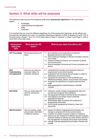
A. Question
Hydrology and fluvial geomorphology
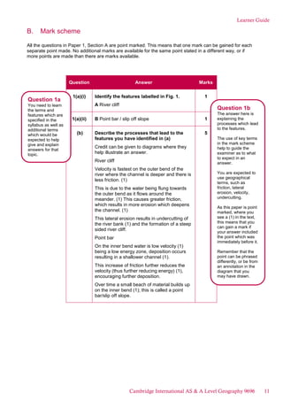
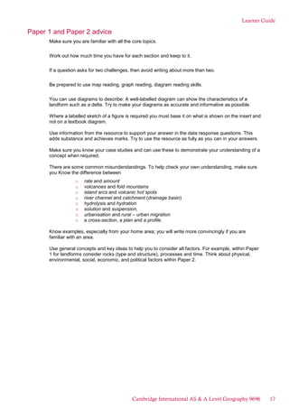
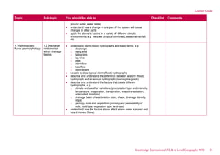
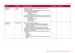
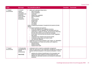
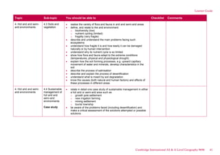
1 Fig. 1 shows features of a meander on the River Swale in North Yorkshire, UK.
(a) Identify the features labelled in Fig. 1.
(i) A
(ii) B [2]
(b) Describe the processes that lead to the features you have identified in (a). [5]
(c) Briefly explain how a floodplain is formed. [3]
Fig. 1
A meander on the River Swale in North Yorkshire, UK
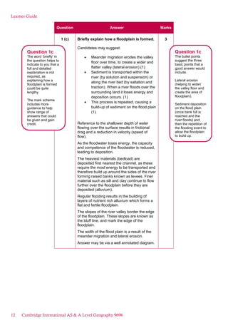
Identify The examiner will be expecting you to
give the name of feature A and B in Fig. 1.
Describe The examiner will be expecting you to
give the key characteristics of the processes that
lead to the formation of the features shown in
Fig. 1.
Explain The examiner will be expecting you to
set out the causes of the formation of a
floodplain.
10 Cambridge International AS & A Level Geography 9696](https://image.slidesharecdn.com/164742-learner-guide-for-cambridge-international-as-a-level-geography-9696-for-examination-from-2018-240116145239-62583e47/85/164742-learner-guide-for-cambridge-international-as-a-level-geography-9696-for-examination-from-2018-pdf-10-320.jpg)


The document provides guidance for students taking the Cambridge International AS & A Level Geography exam. It begins by outlining the syllabus content and what students need to know. It then describes how students will be assessed, including details on the different exam papers, questions types, and weighting of assessment objectives. An example question and response is provided to demonstrate how responses might be viewed. Key points made include identifying words in questions, understanding what is required, explaining marking schemes, highlighting strengths and weaknesses in sample responses, and describing how responses could be improved. Overall, the document aims to help students understand the exam structure and format, recognize what is expected in responses, and develop effective revision strategies.


