Download to read offline
![Journal of Advanced Computing and Communication Technologies (ISSN: 2347 - 2804)
Volume No.2 Issue No. 4, August 2014
(ETACICT-2014)
56
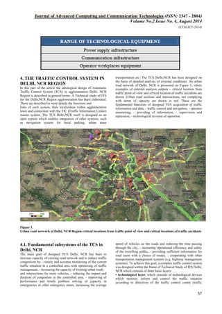
ITS
AGGLOMERATIONS
Implementation domain
Figure 1. Realization domains ofAutomatic TIS project
3. BASIC STEPS OF ITS
AGGLOMERATIONS MPLEMENTATION
– TECHNICAL STUDY
In ITS systems design the process shown on Figure 2 was
generally accepted in accordance with the technical regulation
TP 09/2008 [2], where the phased process of ITS systems
creation (a necessary design documentation process) is
described. These stages are closely related to each other and
result in an integrated implementation of transport systems that
are solving the transport service for a defined territory.
Technical Study Functional
Specification
Construction
Project
Continuous
realization project
realization project
Analysis of
conditions &
frame
determination of
technological
equipment scope
Detailed function
system design
Constructional
design of
individual objects
resulting from
functional
specification
Establishment of
applicant’s ability
to realize the
system
Detailed
specifications of
system, devices
and infrastructure
Figure 2. Phases of ITS implementation
For realization purposes of the TIS it is necessary in the first
phase of implementation domain of ITS agglomerations to
elaborate the Technical study (TS) for each town agglomeration,
i.e. A document which: - analyses the existing and expected
situation, - defines problems on the basis of this analysis, which
is necessary to be solved, - defines a framework for solution and
its technical characteristics, or different alternatives of solutions.
The aim of TS is an analysis of external conditions in particular
solving urban area of agglomeration (Table 1) and framework
for determination of the extent of technological equipment
(Table 2) in terms of the technical regulation TP 09/2008 [2]
The minimal range of external conditions analysis is as follows:
-
classification of individual road sections, - constructional
properties of roads, - identification of road sections in which
capacity is reduced (according to TP 10/2010) because of
objective or subjective reasons, - identification of critical
locations from traffic point of view, - identification of critical
locations from meteorological point of view, - determination of
sections from which traffic has to be instantly excluded in case
of need, - determination of network control need, -
constructional properties analysis of tunnels (for each tunnel
separately), - analysis of other important factors. The range of a
basic framework design infrastructure is as follows: - power
supply infrastructure, - communication infrastructure and -
operator workplaces equipment. In an analysis of external
conditions, the following primary inputs have been considered:
analysis of construction conditions and traffic volume of the
road network, capacity analysis of roads and intersections,
possibilities of diversion routes, as well as analysis of traffic
accidents, weather conditions and the existing state of
technology systems.
Table 1. The minimal range of external conditions analysis
Table 2. The range of a basic framework design infrastructure](https://image.slidesharecdn.com/141066391742615207-150126034758-conversion-gate01/85/Basic-Concept-of-the-Technical-Study-of-the-Automatic-Traffic-Congestion-Control-System-in-Delhi-NCR-Region-2-320.jpg)
![Journal of Advanced Computing and Communication Technologies (ISSN: 2347 - 2804)
Volume No.2 Issue No. 4, August 2014
(ETACICT-2014)
59
Monitoring camera system is created by Closed Circuit TV
(CCTV). CCTV is a system for monitoring traffic situation of
selected roads and intersections, for visually and
simultaneously checking it at traffic information centres when
incident or emergency happens, for helping road-users and for
performing a
road safety function. Considering this, CCTV is designed on 17
locations and there are rotary DOME cameras designed (Figure
10).
4.5. Variable Message Sign System – VMSS
Variable Message Sign System (VMSS) is a system to inform
road users about road and traffic states, car accidents, closed
roads or road construction information in real time. Variable
message signs are applied for reroute traffic flow to alternative
routes from overloaded roads, too. VMSS is designed for three
purposes in Delhi, NCR - to regulate traffic flow – reroute
traffic to alternative routes, - to control traffic flow and - to
inform road users. The informing drivers, the warning about
existing congestions and diverting traffic on alternative routes
is possible by change of certain symbols or messages on
VMSS.
There are VMSS (prismatic or LED) designed at 5 locations in
Delhi, NCR (Figure 10).
4.6. Data Communication Network – DCN
The created communication network infrastructure formed by
optical network (Figure 9) will serve for network transmission
of data between traffic (operator) centre and technological
devices (TD) combined into technological nodes [4, 5]. The
technological node is according to configuration able to support
several TDs like vehicle detector, variable traffic sign, traffic
controller, surveillance CCTV camera, etc.
Figure 9. Private backbone network (L1 type) TCS Delhi,
NCR
4.7. Traffic Control Centre – TCC
The Traffic Control Centre is a place concentrating the initial
care of traffic controlled area. It is intended for application
domains for traffic data processing, traffic control and
monitoring of the entire traffic control system. It operates all
technological devices and ensures archiving of all events by a
record system. In this location the momentary technical
conditions of all devices in traffic controlled area are monitored
and where necessary an intervention is decided. The central
control system inputs within its competitions actively into
traffic control in the controlled area in full-automatic mode.
The competent dispatching worker – operator can perform,
based on supporting systems results, an adequate intervention to
traffic control by either inputting the necessary data (for
example about a traffic accident) into the automatic control
system, or by a direct manual action. From practical perspective
within traffic control in a town a main function is examined –
optimisation of traffic flows in controlled area together with
control of critical or emergency states. For on-line control it is
necessary to ensure that the Traffic Control Centre in Delhi,
NCR has actual information not only from TCS subsystems
(LTCS, VDS, eventually CCTV), but also from the superior
Traffic Information Centre. Traffic data and information from
TCS subsystems will directly from the picture of traffic
situation in town or send information about critical or
emergency state (occurrence of congestions, traffic accident or
other emergency situation). The superior NTIC will provide to
TCS information primarily about traffic situation on main roads
entering town and also on the adjacent superior road network
(D1 highway and R4 motor way), on which the town
communication system is connected. This way the TCS Delhi,
NCR will be able to react on time on traffic problems on these
roads and optimize the traffic control in town with respect on
traffic situation or traffic problems outside town. It also holds in
the opposite case when based on traffic data from TCS Delhi,
NCR enables the superior TIS to effectively control and
regulate traffic on adjacent and superior road network outside
town with respect to current
traffic situation in town. Besides traffic control and regulation
itself it is necessary to ensure informing of drivers either from
position of TCS Delhi, NCR or TIS by the available ways
(VMSS, RDS-TMS, radio, cell-phone, and internet).
4.8. Localization of Technological Devices with in Delhi,
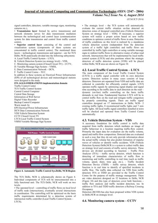
NCR Agglomeration
Based on TCS Delhi, NCR proposal on the controlled road
network of town Delhi, NCR it is possible to generate a final
location plan of designed technological devices (Figure 10).
This way deployed technological devices after completion by
another ITS devices (like meteorological-stations of RWIS
system, etc.) complexly cover the controlled area and
accomplish the goals summarized in the conclusion of this
paper.
5. CONCLUSIONS
The proposal of Automatic TCS Delhi, NCR significantly
contributes to reduction of congestions formation and high
traffic volumes on by overloaded urban roads within the Delhi,
NCR. At the same time it creates a background for a significant
operational effectiveness increase of authorities, organizations
and institutions in the area of administration and maintenance
of roads, their components and accessories, in the area of
economy of pavements and other property, in the area of traffic
supervision on roads. The real output of the Automatic TCS in
Delhi,NCR is implementation of procedures within the area of
traffic control and optimization and within the area of analytical
operation targeting towards permanent removal of traffic
problems which impair safety or traffic continuity within the
Delhi,NCR.](https://image.slidesharecdn.com/141066391742615207-150126034758-conversion-gate01/85/Basic-Concept-of-the-Technical-Study-of-the-Automatic-Traffic-Congestion-Control-System-in-Delhi-NCR-Region-5-320.jpg)
![Journal of Advanced Computing and Communication Technologies (ISSN: 2347 - 2804)
Volume No.2 Issue No. 4, August 2014
(ETACICT-2014)
60
Figure 10. The proposed deployment of technological devices in Delhi, NCR
6. REFERENCES
[1] W.Wen, “A dynamic and automatic traffic light control
expert system for solving the road congestion problem,”
Science direct: Expert system with applications, 34, pp.
2370-2381, 2008
[2] Yujie Dai, Jinzong Hu, Dongbin Zhao, Fenghua Zhu,
“Neural network based online traffic signal controller
design,” IEEE conference on Intelligent Transportation
System, pp. 1045-1050, 5-7 Oct. 2011
[3] Patel.M, Ranganathan.N, “IDUTC: an intelligent decision-
making system for urban traffic control applications,”
IEEE Transactions on Vehicular Technology, pp. 816-829,
May 2001.
[4] E. Fern´andez and R. Marti, “GRASP for seam drawing in
mosaicking of aerial photographic maps,” J. Heuristics,
vol. 5, pp. 181–197, 1999.
[5] M. Brown and D. G. Lowe, “Automatic panoramic image
stitching using invariant features,” Int’l J. Computer
Vision, vol. 74, no. 1, pp. 59–73, 2007.
[6] P. Mclauchlan and A. Jaenicke, “Image mosaicing using
sequential bundle adjustment,” Image and Vision
Computing, vol. 20, pp. 751–759, 2002.
[7] G. M. Cortelazzo and L. Lucchese, “A new method of
image mosaicking and its application to cultural heritage
representation,” Proc. Eurographics,vol. 88, no. 3, 1999.
[8] R. Szeliski, “Image alignment and stitching: A tutorial,” in
Handbook of Mathematical Models in Computer Vision,
Springer, pp. 273–292, 2005.
[9] Lisa Brown, “A survey of image registration techniques,"
ACM Computing Surveys, vol. 24, no. 4, pp. 326-376,
Dec. 1992.
[10] Jan Kybic, Philippe Th_evenaz, and Michael Unser,
“Multiresolution spline warping for EPI registration," in
Proceedings of SPIE, Denver, Colorado, July 1999, vol.
3813, pp. 571-579, SPIE.
[11] Ruzena Bajcsy and Stane Kova_ci_c, “Multiresolution
elastic matching," Computer Vision, Graphics, and Image
Processing, vol. 46, pp. 1-21, 1989.](https://image.slidesharecdn.com/141066391742615207-150126034758-conversion-gate01/85/Basic-Concept-of-the-Technical-Study-of-the-Automatic-Traffic-Congestion-Control-System-in-Delhi-NCR-Region-6-320.jpg)

This document summarizes a technical study analyzing an automatic traffic congestion control system for Delhi, NCR Region in India. The study analyzed the current state of intelligent transportation systems in the region and proposed a framework for an integrated urban traffic control system. The proposed system would consist of four main implementation domains: traffic information generation and acquisition, intelligent transportation systems for main roads, and intelligent transportation systems for urban agglomerations. For the urban areas, the study analyzed external traffic conditions and defined critical locations for 11 cities. It then proposed a traffic control system consisting of localized traffic control, vehicle detection, traffic monitoring cameras, and variable message signs to optimize traffic flow and reduce congestion across the region.