

Recommended
Recommended
More Related Content
What's hot
What's hot (20)
Similar to Surveying problem solving
Similar to Surveying problem solving (20)
Recently uploaded
Recently uploaded (20)
Surveying problem solving
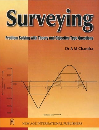
- 1. Dr AM Chandra 2000 2000 Distance (m) ..
- 2. Surveying
- 4. Surveying Dr AM Chandra Prof. of Civil Engineering Indian Institute ofiedmology Roorkee NEW AGE NEW AGE INTERNATIONAL(P) LIMITED, PUBLISHERS New Delhi' Bangalore ' Chennai ' Cochin' Guwahati ' Hyderabad Jalandhar· Kolkala· Lucknow· Mumbai' Ranchi Visit us at www.newagepublishers.com
- 5. Copyright © 2005, NewAge International (P) Ltd., Publishers Published by NewAge International (P) Ltd., Publishers All rights reserved. No part of this ebook may be reproduced in any form, by photostat, microfilm, xerography, or any other means, or incorporated into any information retrieval system, electronic or mechanical, without the written permission of the publisher. All inquiries should be emailed to rights@newagepublishers.com PUBLISHING FOR ONE WORLD NEWAGE INTERNATIONAL(P) LIMITED, PUBLISHERS 4835/24,Ansari Road, Daryaganj, New Delhi - 110002 Visitusatwww.newagepublishers.com ISBN (13) : 978-81-224-2532-1
- 8. 24-.)+- The book adopts a classical pedagogical approach by providing a vivid insight into the theory of surveying and its application through solving typical problems in the field of surveying. It aims at helping the students understand surveying more comprehensively through solving field related problems. Each chapter of the book commences with a summary of basic theory and a range of worked out examples making it very useful for all undergraduate and postgraduate courses in surveying. Alternative solutions to the problems wherever possible, have also been included for stimulating the budding minds. A number of objective type questions which are now a days commonly used in many competitive examinations, have been included on each topic to help the readers to get better score in such examinations. At the end, a number of selected unsolved problems have also been included to attain confidence on the subject by solving them. The book is also intended to help students preparing for AMIE, IS, and Diploma examinations. The practicing engineers and surveyors will also find the book very useful in their career while preparing designs and layouts of various application-oriented projects. Constructive suggestions towards the improvement of the book in the next edition are fervently solicited. The author expresses his gratitude to the Arba Minch University, Ethiopia, for providing him a conducive environment during his stay there from Sept. 2002 to June 2004, which made it possible for writing this book. The author also wishes to express his thanks to all his colleagues in India and abroad who helped him directly or indirectly, in writing this book. Roorkee —Dr A M Chandra LEE
- 10. CONTENTS 2=CAI 2HAB=?A (LEE) 1. ERRORS IN MEASUREMENTS AND THEIR PROPAGATION 1 1.1 Error Types 1 1.2 Probability Distribution 1 1.3 Most Probable Value 1 1.4 Standard Deviation 2 1.5 Variance 2 1.6 Standard Error of Mean 2 1.7 Most Probable Error 3 1.8 Confidence Limits 3 1.9 Weight 3 1.10 Precision and Accuracy 4 1.11 Propagation of Error 4 1.12 Normal Distribution 5 2. DISTANCE MEASUREMENT 20 2.1. Direct Method Using a Tape 20 2.2. Error in Pull Correction due to Error in Pull 23 2.3. Error in Sag Correction due to Error in Pull 23 2.4. Elongation of a Steel Tape when Used for Measurements in a Vertical Shaft 24 2.5. Tacheometric or Optical Method 26 2.6. Subtense Tacheometry 27 2.7. Effect of Staff Vertically 27 2.8. Effect of Error in Measurement of Horizontal Angle in Subtense Tacheometry 29 2.9. Electromagnetic Distance Measurement (EDM) 30 2.10. Accuracy in Vertical Angle Measurements 36 3. LEVELLING 59 3.1. Levelling 59 3.2. Level Surface 59 EN
- 11. 3.3. Datum 59 3.4. Level Line 59 3.5. Direct Differential or Spirit Levelling 60 3.6. Comparison of Methods and their Uses 63 3.7. Loop Closure and its Apportioning 64 3.8. Reciprocal Levelling 64 3.9. Trigonometric Levelling 65 3.10. Sensitivity of a Level Tube 67 3.11. Two-Peg Test 67 3.12. Eye and Object Correction 68 4. THEODOLITE AND TRAVERSE SURVEYING 89 4.1. The Theodolite 89 4.2 Errors due to Maladjustments of the Theodolite 90 4.3 Traverse 92 4.4 Coordinates 92 4.5 Bearing 93 4.6 Departure and Latitude 93 4.7 Easting and Northing 94 4.8 Balancing the Traverse 94 4.9 Omitted Observations 95 4.10 Centring Error of Theodolite 96 4.11 Compatibility of Linear and Angular Measurements 97 5. ADJUSTMENT OF SURVEY OBSERVATIONS 122 5.1. Adjustment of Observations 122 5.2. Method of Last Squares 122 5.3. Observation Equations and Condition Equations 122 5.4. Normal Equation 123 5.5. Least Squares Method of Correlates 124 5.6. Method of Differences 124 5.7. Method of Variation of Coordinates 124 5.8. General Method of Adjusting a Polygon with a Central Station 125 6. TRIANGULATION AND TRILATERATION 166 6.1. Triangulation Surveys 166 6.2. Strength of Figure 166 6.3. Distance of Visible Horizon 167 N
- 12. 6.4. Phase of a Signal 167 6.5. Satellite Station, Reduction to Centre, and Eccentricity of Signal 168 6.6. Location of Points by Intersection and Resection 170 6.7. Reduction of Slope Distance 173 6.8. Spherical Triangle 176 6.9. Effect of Earth’s Curvature 177 6.10. Convergence 178 7. CURVE RANGING 202 7.1. Curves 202 7.2. Circular Curves 202 7.3. Compound Curves 204 7.4. Reverse Curves 205 7.5. Transition Curves 207 7.6. Vertical Curves 208 8. AREAS AND VOLUMES 256 8.1. Areas and Volumes 256 8.2. Areas 256 8.3. Volumes 258 8.4. Heights of Points from a Digital Terrai Model 261 8.5. Mass-Haul Diagram 262 9. POINT LOCATION AND SETTING OUT 287 9.1. Setting Out 287 9.2. Point Location 287 9.3. Intersection and Resection 287 9.4. Transfer of Surface Alignment-Tunnelling 288 9.5. Setting out by Bearing and Distance 289 9.6. Monitoring Movements 289 9.7. Construction Lasers 289 9.8. Sight Rails for a Trench Sewer 289 9.9. Embankment Profile Boards 290 Selected Problems 310 Index 323 NE
- 14. ERRORS IN MEASUREMENTS AND THEIR PROPAGATION 1.1 ERROR TYPES Gross errors are, in fact, not errors at all, but results of mistakes that are due to the carelessness of the observer. The gross errors must be detected and eliminated from the survey measurements before such measurements can be used. Systematic errors follow some pattern and can be expressed by functional relationships based on some deterministic system. Like the gross errors, the systematic errors must also be removed from the measurements by applying necessary corrections. After all mistakes and systematic errors have been detected and removed from the measurements, there will still remain some errors in the measurements, called the random errors or accidental errors. The random errors are treated using probability models. Theory of errors deals only with such type of observational errors. 1.2 PROBABILITY DISTRIBUTION If a large number of masurements have been taken, the frequency distribution could be considered to be the probability distribution. The statistical analysis of survey observations has indicated that the survey measurements follow normal distribution or Gaussian distribution, being expressed by the equation, dxedy x 22 1 2/)( 2 1 σµ πσ −− = ...(1.1) where dy is the probability that the value will lie between the limits of x1 and (x1+dx), µ is the true mean of the population, and σ is the standard deviation. 1.3 MOST PROBABLE VALUE Different conditions under which the measurements are made, cause variations in measurments and, therefore, no measured quantity is completely detrminable. A fixed value of a quantity may be concieved as its true value. The difference between the measured quantity and its true value τ is known as error ε, i.e., τε −= x ...(1.2) Since the true value of a measured quantity cannot be determined, the exact value of ε can never be found out. However, if a best estimate xˆ which is known as the most probable value of τ, can be determined, xˆ can be used as a reference to express the variations in x. If we define υ as residual then 1
- 15. 2 SURVEYING xx −= ˆυ ...(1.3) The residuals express the variations or deviations in the measurements. 1.4 STANDARD DEVIATION Standard deviation also called the root-mean square (R.M.S.) error, is a measure of spread of a distribution and for the population, assuming the observations are of equal reliability it is expressed as −Σ ±= n x n 2 )(µ σ ...(1.4) However, µ cannot be determined from a sample of observations. Instead, the arithmetic mean x is accepted as the most probable value and the population standard deviation is estimated as σn x x n − = ± − − L NM O QP1 2 1 Σ ( ) ( ) ...(1.5) or − Σ ±= )1( 2 n υ ...(1.6) The standard deviation given by the above expression is also called the standard error. Henceforth in this book the symbol σ will mean 1−nσ . 1.5 VARIANCE Variance of a quantity is expressed as 1 2 − Σ = n V υ ...(1.7) or 2 1−= nσ or 2 σ= ...(1.8) and is also used as a measure of dispersion or spread of a distribution. 1.6 STANDARD ERROR OF MEAN The standard error of mean σm is given by − Σ ±= )1( 2 nn m υ σ ...(1.9) or = n σ ± ...(1.10)
- 16. ERRORS IN MEASUREMENTS AND THEIR PROPAGATION 3 and hence the precision of the mean is enhanced with respect to that of a single observation. There aren deviations (or residuals) from the mean of the sample and their sum will be zero. Thus, knowing (n – 1) deviations the surveyor could deduce the remaining deviation and it may be said that there are (n – 1) degrees of freedom. This number is used when estimating the population standard deviation. 1.7 MOST PROBABLE ERROR The most probable error is defined as the error for which there are equal chances of the true error being less and greater than probable error. In other words, the probability of the true error being less than the probable error is 50% and the probability of the true error being greater than the probable error is also 50%. The most probable error is given by − Σ ±= )1( 6745.0 2 n e υ ...(1.11) σ6745.0±= ...(1.12) 1.8 CONFIDENCE LIMITS After establishing the sample mean as estimate of the true value of the quantity, the range of values within which the true value should lie for a given probability is required. This range is called the confidence interval, its bounds called the confidence limits. Confidence limits can be established for that stated probability from the standard deviation for a set of observations. Statistical tables are available for this purpose. A figure of 95% frequently chosen implies that nineteen times out of twenty the true value will lie within the computed limits. The presence of a very large error in a set of normally distributed errors, suggests an occurance to the contrary and such an observation can be rejected if the residual error is larger than three times the standard deviation. 1.9 WEIGHT This quantity ω is known as weight of the measurement indicates the reliability of a quantity. It is inversely proportional to the variance ( 2 σ ) of the observation, and can be expressed as ω σ = k 2 where k is a constant of proportionality. If the weights and the standard errors for observations x1, x2, ,….., etc., are respectively 1ω , 2ω ,….., etc., and 1σ , 2σ ,….., etc., and uσ is the standard error for the observation having unit weight then we have 22 22 2 11 ...... uσσωσω === . ...(1.13) Hence ,2 1 2 1 σ σ ω u = ,2 2 2 2 σ σ ω u = etc.,
- 17. 4 SURVEYING and ,2 1 2 2 2 1 σ σ ω ω = etc. ...(1.14) The weights are applied to the individual measurements of unequal reliability to reduce them to one standard. The most probable value is then the weighted mean xm of the measurements. Thus ( ) ω ω Σ Σ = x xmˆ , ...(1.15) and standard error of the wieghted mean σ ω ω x m m x x n = ± − − L N MM O Q PP Σ Σ ( ) ( ) 2 1 m r ...(1.16) The standard deviation of an observation of unit weight is given by σ ω u mx x n = ± − − L N MM O Q PP Σ ( ) ( ) 2 1 m r ...(1.17) and the standard deviation of an observation of weight nω is given by σ ω ω w m n x x n = ± − − L N MM O Q PP Σ ( ) ( ) 2 1 m r ...(1.18) 1.10 PRECISION AND ACCURACY Precision is the degree of closeness or conformity of repeated measurements of the same quantity to each other whereas the accuracy is the degree of conformity of a measurement to its true value. 1.11 PROPAGATION OF ERROR The calculation of quantities such as areas, volumes, difference in height, horizontal distance, etc., using the measured quantities distances and angles, is done through mathematical relationships between the computed quantities and the measured quantities. Since the measured quantities have errors, it is inevitable that the quantities computed from them will not have errors. Evaluation of the errors in the computed quantities as the function of errors in the measurements, is called error propagation. Let y = f(x1, x2,......., xn) then the error in y is dy f x dx f x dx f x dx n n= + + + ∂ ∂ ∂ ∂ ∂ ∂1 1 2 2 ....... ...(1.19) and the standard deviation of y is 22 2 2 1 2 ........21 ∂ ∂ ++ ∂ ∂ + ∂ ∂ = nx n xxy x f x f x f σσσσ ...(1.20)
- 18. ERRORS IN MEASUREMENTS AND THEIR PROPAGATION 5 where ,, 21 dxdx ....., etc., are the errors in x1, x2,....., etc., and ,, 21 xx σσ ....., etc., are their standard deviations. In a similar way if nxxxy +++= .......21 then 2222 ........21 nxxxy σσσσ +++= , since 1x f ∂ ∂ , etc. = 1. ...(1.21) And if y = 1kx in which k is free of error σ σy xk= 1 since 1x f ∂ ∂ = k. In the above relationships it is assumed that x1, x2,......., xn are independent implying that the probability of any single observation having a certain value does not depend on the values of other observations. 1.12 NORMAL DISTRIBUTION The expression for the normal distribution is dy e dxx = − −1 2 1 2 22 σ π µ σ( ) / . ...(1.23) Taking σ µ x u − = , the expression becomes dy e duu = −1 2 2 2 π / . ...(1.24) Eq. (1.24) is the standardized form of the above expression, and Fig. 1.1 illustrates the relationship between dy/du and u is illustrated in Fig. 1.1. The curve is symmetrical and its total area is 1, the two parts about u = 0 having areas of 0.5. The shaded area has the value 1 2 21 2 π e duu u − −∞ + z / and it gives the probability of u being lying between – ∞ and + u1. The unshaded area gives the probability that u will be larger than + u1. Since the curve is symmetrical, the probability that u takes up a value outside the range + u1 to – u1 is given by the two areas indicated in Fig. 1.2.
- 19. 6 SURVEYING 0−1−2−3 +1 +2 +3 u u1 dxdy 0−1−2−3 +1 +2 +3 u dxdy Fig. 1.1 Fig. 1.2 The values of the ordinates of the standardized form of the expression for the normal distribution, and the corresponding definite integrals, have been determined for a wide range of u and are available in various publications. A part of such table is given in Table 1.5 and some typical values used in this example have been taken from this table. Example 1.1. The following are the observations made on the same angle: 47o 26′13″ 47o 26′18″ 47o 26′10″ 47o 26′15″ 47o 26′16″ 47o 26′12″ 47o 26′09″ 47o 26′15″ 47o 26′18″ 47o 26′14″ Determine (a) the most probable value of the angle, (b) the range, (c) the standard deviation, (d) the standard error of the mean, and (e) the 95% confidence limits. Solution: For convenience in calculation of the required quantities let us tabulate the data as in Table 1.1. The total number of observations n = 10. (a) Most probable value = x = 47°26′14″″″″″ (b) Range = 47°26′18″ – 47°26′09″ = 9″″″″″ (c) Standard deviation − Σ ±= )1( 2 n υ σ − ±= )110( 84 = ± 3.1″″″″″. dy dx dy dx
- 20. ERRORS IN MEASUREMENTS AND THEIR PROPAGATION 7 (d) Standard error of mean n m σ σ ±= 10 1.3 ±= = ± 1.0″″″″″. Table 1.1 Observed angles (x) υ=− )ˆ( xx 22 )ˆ( υ=− xx 47°26’13″ + 1 1 10″ + 4 16 16″ – 2 4 09″ + 5 25 18″ – 4 16 18″ – 4 16 15″ – 1 1 12″ + 2 4 15″ – 1 1 14″ 0 0 Σ = 140″ 0=Σ 84=Σ x x n = = ° ′ ′′ = ° ′ ′′ Σ 47 6 140 10 47 26 14 (e) 95% confidence limits The lower confidence limit n t x σ −= ˆ The upper confidence limit n t x σ += ˆ ...(1.22) where t is selected from statistical tables for a given value of n. For n = 10, t = 2.26 and so t n σ = = ′′ 2 26 3 1 10 2 2 . × . . . Hence the 95% confidence limits are 47°26′′′′′14″″″″″ ± 2.2″″″″″. It is a common practice in surveying to reject any observation that differs from the most probable value by more than three times the standard deviation. Example 1.2. The length of a base line was measured using two different EDM instruments A and B under identical conditions with the following results given in Table 1.2. Determine the
- 21. 8 SURVEYING relative precision of the two instruments and the most probable length of the base line. Table 1.2 A (m) B (m) 1001.678 1001.677 1001.670 1001.681 1001.667 1001.675 1001.682 1001.678 1001.674 1001.677 1001.679 1001.682 1001.679 1001.675 Solution: (i) The standard deviation of the masurements by A − ±= − Σ ±= )16( 164 )1( 2 n A υ σ = ± 5.73 mm. Table 1.3 A B Distance υ 2 υ Distance υ 2 υ (m) (mm) (mm2 ) (m) (mm) (mm2 ) 1001.678 – 3 9 1001.677 + 1 1 1001.670 + 5 25 1001.681 – 3 9 1001.667 + 8 64 1001.675 + 3 9 1001.682 – 7 49 1001.678 0 0 1001.674 + 1 1 1001.677 + 1 1 1001.679 – 4 16 1001.682 – 4 16 1001.679 – 1 1 1001.675 + 3 9 050.6001=Σ 164=Σ 424.8013=Σ 46=Σ 675.1001 6 050.6001 ˆ ==Ax m 678.1001 8 424.8013 ˆ ==Bx m The standard deviation of the measurements by B − ±= )18( 46 Bσ = ± 2.56 mm.
- 22. ERRORS IN MEASUREMENTS AND THEIR PROPAGATION 9 The standard error of the mean for A 34.2 6 73.5 ±=±=mAσ mm. (ii) The standard error of the mean for B 91.0 8 56.2 ±=±=mBσ mm. (iii) The relative precision of the two instruments A and B is calculated as follows: If the weights of the measurements 1001.675 m and 1001.678 m are Aω and Bω having the standard errors of means as ± 2.34 mm and ± 0.91 mm, repectively, then the ratio BA ωω is a measure of the relative precision of the two instruments. Thus 6.6 1 34.2 91.0 2 2 2 2 = == A B B A σ σ ω ω Therefore, 6.6 B A ω ω = . (iv) The most probable length of the line is the weighted mean of the two observed lengths. Now ω ω ω Σ Σ = )( x x BA BBAA LL ωω ωω + + = = + + ω ω ω ω B B B B 6 6 1001 675 1001 678 6 6 . × . × . . 6.61 678.10016.6675.1001 + ×+ = = 1001.6776 m. In accordance with the observations, ωxˆ could be written as 1001.678 m to the nearest millimetre. Example 1.3. An angle was measured with different weights as follows: Determine (a) the most probable value of the angle, (b) the standard deviation of an obsevation of unit weight, (c) the standard deviation of an observation of weight 3, and (d) the standard error of the weighted mean.
- 23. 10 SURVEYING Angle Weight (ω ) 86°47′25″ 1 86°47′28″ 3 86°47′22″ 1 86°47′26″ 2 86°47′23″ 4 86°47′30″ 1 86°47′28″ 3 86°47′26″ 3 Solution: Tabulating the data and the weighted results working from a datum of 86°47′, we get the values as given in Table 1.4. (a) The most probable value of the angle is the weighted mean =ωx Datum + ( ) ω ω Σ Σ x = ° ′ + = ° ′ ′′86 47 467 18 86 47 25 9. (b) Standard deviation of an observation of unit weight ( ) − Σ ±= )1( 2 n u ωυ σ ( )18 93 − ±= ±= 3.64″″″″″. Table 1.4 Observed x ω ω x υ 2 ωυ angle 86°47′25″ 25 1 25 + 1 1 86°47′28″ 28 3 84 – 2 12 86°47′22″ 22 1 22 + 4 16 86°47′26″ 26 2 52 0 0 86°47′23″ 23 4 92 + 3 36 86°47′30″ 30 1 30 – 4 16 86°47′28″ 28 3 84 – 2 12 86°47′26″ 26 3 78 0 0 208=Σ 18=Σ 467=Σ 93=Σ 26 8 208 ˆ ==x
- 24. ERRORS IN MEASUREMENTS AND THEIR PROPAGATION 11 (c) Standard deviation of an observation of weight 3 ( ) − Σ ±= )1( 2 nnω ωυ σϖ −× ±= )18(3 93 ±= 2.10″″″″″. Alternatively, 22 22 2 11 ...... uσσωσω === We have 33 =ω , therefore 3 64.3 3 64.3 3 22 2 ±= == ϖ ϖ σ σ σ u (d) Standard error of the weighted mean σ ωυ ω xm n = ± − L N MM O Q PP Σ Σ b g2 1( ) ×− ±= 18)18( 93 ±= 0.86″″″″″. Alternatively, 22 umm s σω = Since ωω Σ=m , we have ω σ Σ ±= u ms 18 64.3 ±= ±= 0.86″″″″″. Example 1.4. If the standard deviation uσ of a single measurement in Example 1.1 is ± 3, calculate (i) the magnitude of the deviation likely to occur once in every two measurements, ±= 2.10″″″″″.
- 25. 12 SURVEYING (ii) the probability that a single measurement may deviate from the true value by ± 6, and (iii) the probability that the mean of nine measurments may deviate from the true value by ± 1.5. Solution: If a deviation is to occur once in every two measurements a probability of 50% is implied. Thus in Fig. 1.2 the two shaded parts have areas of 0.25 each and the total shaded area is 0.5. Table 1.5 u dy/du −∞ + z u 0.0 0.3989 0.5000 0.6 0.3332 0.7257 0.7 0.3123 0.7580 1.5 0.1295 0.9332 2.0 0.0540 0.9772 Since −∞ + z u1 is the shaded area as shown in Fig. 1.2, a value of u is required such that 1 0 25 1 − = −∞ + z . , u i.e., = −∞ + z 0 75 1 . . u By inspection, we find in the Table 1.5 that the value 0.75 of the integral lies between the values 0.6 and 0.7 of u. The value of u is 0.6745 for = −∞ + z 0 75 1 . . u Now σ µ x u − = =0.6745 therefore, deviation (u – x) = 0.6745 σ = ± 0.6745 × 3 = ± 2.0. (b) For a deviation (u – x) of ± 6 for a single measure u x = − = = ′′ µ σ 6 3 2 0. . For u = + 2.0 from Table 1.5, we have = −∞ + z 0 9772 2 0 . . . Hence 1 1 0 9772 0 0228 2 0 − = − = −∞ + z . . . . For the deviation to lie at the limits of, or outside, the range + 6 to – 6, the probability is
- 26. ERRORS IN MEASUREMENTS AND THEIR PROPAGATION 13 = 2 × 0.0228 = 0.0456, or 4.6%. (c) The standard deviation of the mean of nine observations 9 0.3 == n m σ σ = ± 1.0. For a deviation of ±1.5 u x m = − = ′′µ σ 15 1 0. = 1.5. For u = + 1.5 from the Table 1.5, we get 1 1 0 9332 0 0668 15 − = − = −∞ + z . . . . Therefore the probability of assuming a deviation of ± 1.5 = 2 × 0.0668 = 0.1336, or 13.4%. Example 1.5. The coordinates with standard deviations of two stations A and B were determined as given below. Calculate the length and standard deviation of AB. Station Easting Northing A 456.961 m ± 20 mm 573.237 m ± 30 mm B 724.616 m ± 40 mm 702.443 m ± 50 mm The length of AB was independently measured as 297.426 m ± 70 mm and its separate determination by EDM is as 297.155 m ± 15 mm. Calculate the most probable length of the line and its standard deviation. Solution: If ∆E is the difference in the eastings of A and B and ∆N is the difference in the northings then the length of the line AB ( ) ( ) 22 22 22 206.129655.267 237.573443.702961.456616.724 += −+−= ∆+∆= NE = 297.209 m. From Eq. (1.21) the standard deviation σE and σN of ∆E and ∆N, respectively, are 222 222 NBNAN EBEAE σσσ σσσ += +=
- 27. 14 SURVEYING 20±=EAσ mm; 40±=EBσ mm; 30±=NAσ mm; 50±=NBσ mm. Therefore, 222 4020 +=Eσ , or 7.44±=Eσ mm 222 5030 +=Nσ , or 3.58±=Nσ mm Now from Eq. (1.20), the standard deviation of the computed length AB σ ∂ ∂ σ ∂ ∂ σAB E N L E L L 2 2 2 = F HG I KJ + F HG I KJ∆ ∆b g b g …(a) where 22 NEL ∆+∆= ...(b) Now by differentiating Eq. (b), we get ∂ ∂ L E E E N ∆ ∆ ∆ ∆ a f b g= + −1 2 2 2 2 1 2 × × / = + = = = ∆ ∆ ∆ ∆E E N E L2 2 267 655 297 209 0 901 . . . Similarly, ( ) 435.0 209.297 206.129 == ∆ = ∆∂ ∂ L N E L Hence from Eq. (a), we get ( ) ( )222 3.58435.07.44901.0 ×+×=ABσ = 2265.206 or ABσ = ± 47.6 mm. Now we have three values of the length AB and their standard deviations as given in Table 1.6. Table 1.6 Length (l) by σ ω = 1/σ2 (m) (mm) Tape 297.426 ± 70 1/4900 EDM 297.155 ± 15 1/225 Calculation 297.209 ± 47.6 1/2266 Since the weight of a measured quantity is inversely proportional to its variance, we can calculate the weights of the lengths obtained by different methods, and these have been given in Table 1.6.
- 28. ERRORS IN MEASUREMENTS AND THEIR PROPAGATION 15 The most probable length of AB is the weighted mean of the three values of AB. Thus 2266 1 225 1 4900 1 209.297 2266 1 155.297 225 1 426.297 4900 1 ++ ×+×+× =L = 297.171 m. The weight of L is 2266 1 225 1 4900 1 ++=Σω = 0.00509 Since ω 2 /1 σ= ω σ L L = 1 2 σ ω L L = = 1 1 0 00509. = ± 14.0 mm. The standard deviation of the length 297.171 m is ± 14.0 mm. Example 1.6. A base line AB was measured accurately using a subtense bar 1 m long. From a point C near the centre of the base, the lengths AC and CB were measured as 9.375 m and 9.493 m, respectively. If the standard error in the angular mesurement was ± 1″, determine the error in the length of the line. Solution: In Fig. 1.3, the subtense bar PQ is at C and the angles α and β were measured at A and B, respectively. It is given that PQ = b = 1 m AC = x1 = 9.375 m CB = x2 = 9.493 m For subtense bar measurements, we have 2 tan2 θ b x = …(a) where x = the computed distance, and θ = the angle subtended at the station by the subtense bar. When θ is small, Eq. (a) can be written as Fig. 1.3
- 29. 16 SURVEYING , θ b x = or x b =θ Therefore 2 θ θdb dx −= 2 −= x b db θ )( 2 radiansind b dx θ θ −= Writing ,,,, ασσσσ CBACAB and βσ as the respective standard errors, we have 000426.0 206265 1 1 375.9 22 1 ±=×=−= ασσ b x AC m 000437.0 206265 1 1 493.9 22 2 ±=×=−= βσσ b x CB m 222 CBACAB σσσ += 22 000437.0000426.0 +±=ABσ = ± 0.61 mm. The ratio of the standard error to the measured length (AB = 9.375 + 9.493 = 18.868 m) is given as = 868.18 00061.0 = 1 in 30931 Example 1.7. The sides of a rectangular tract were measured as 82.397 m and 66.132 m with a 30 m metallic tape too short by 25 mm. Calculate the error in the area of the tract. Solution: Let the two sides of the tract be x1 and x2 then the area y = x1.x2 ...(a) If the errors in x1 and x2 are dx1 and dx2, respectively, then the error in y 2 2 1 1 dx x y dx x y dy ∂ ∂ + ∂ ∂ = ...(b) Now from Eq. (a), we get 132.662 1 == ∂ ∂ x x y m 397.821 2 == ∂ ∂ x x y m. The values of 1dx and 2dx are computed as
- 30. ERRORS IN MEASUREMENTS AND THEIR PROPAGATION 17 069.0397.82 30 025.0 1 =×=dx m 055.0132.66 30 025.0 2 =×=dx m. Therefore from Eq. (b), we get 055.0397.82069.0132.66 ×+×=dy = 9.095 m2 . The percentage of error 100 132.66397.82 095.9 × × = = 0.17 %. Example 1.8. Two sides and the included angle of a triangle were measured as under: a = 757.64 ± 0.045 m b = 946.70 ± 0.055 m C = 54°18' ± 25 Compute the area of the triangle and its standard error. Solution: (a) Area of a triangle CabA sin 2 1 = ...(a) = ° ′ 1 2 757 64 946 70 54 18× . × . × sin = 291236.62 m2 . (b) Standard error in A 222 2 ∂ ∂ + ∂ ∂ + ∂ ∂ = cbaA c A b A a A σσσσ ...(b) Differentiating Eq. (a), we get ∂ ∂ A a b C= = ° ′ = 1 2 1 2 946 70 54 18 384 400sin × . × sin . ∂ ∂ A b b C= = ° ′ = 1 2 1 2 747 64 54 18 307 633sin × . × sin . ∂ ∂ A C ab C= − = − ° ′ = 1 2 1 2 946 70 757 64 54 18 209274 739cos × . × . × sin . Now from Eq. (b), we get ( ) ( ) 2 22 206265 25 739.209274055.0633.307045.0400.384 ×+×+×±=Aσ = ± 35.05 m2 .
- 31. 18 SURVEYING OBJECTIVE TYPE QUESTIONS 1. Accuracy is a term which indicates the degree of conformity of a measurement to its (a) most probable value. (b) mean value. (c) true value. (d) standard error. 2. Precision is a term which indicates the degree of conformity of (a) measured value to its true value. (b) measured value to its mean value. (c) measured value to its weighted mean value. (d) repeated measurements of the same quantity to each other. 3. Theory of probability is applied to (a) gross errors. (b) systematic errors. (c) random errors. (d) all the above. 4. Residual of a measured quantity is the (a) difference of the observed value from its most probable value. (b) value obtained by adding the most probable value to its true value. (c) remainder of the division of the true value by its most probable value. (d) product of the most probable value and the observed value. 5. If the standard deviation of a quantity is ± 1″, the maximum error would be (a) 2.39″. (b) 3.29″. (c) 2.93″. (d) 9.23″. 6. If the standard deviation of an observation is ± 10 m, the most probable error would be (a) 6.745 m. (b) 20 m. (c) 10 m. (d) 0.6745 m. 7. The systematic errors (a) are always positive. (b) are always negative. (c) may be positive or negative. (d) have same sign as the gross errors. 8. Variance of a quantity is an indicator of (a) precision. (b) accuracy. (c) randomness. (d) regular nature. 9. In the case of a function y = f(x1,x2), the error in y is computed as (a) 2 2 1 1 dx x f dx x f dy ∂ ∂ + ∂ ∂ = (b) 2 2 2 1 2 1 dx x f dx x f dy ∂ ∂ + ∂ ∂ =
- 32. ERRORS IN MEASUREMENTS AND THEIR PROPAGATION 19 (c) ( ) ( )2 2 2 2 1 1 dx x f dx x f dy ∂ ∂ + ∂ ∂ = (d) 2 2 2 2 1 1 ∂ ∂ + ∂ ∂ = dx x f dx x f dy 10. The adjusted value of an observed quantity may contain (a) small gross errors. (b) small systematic errors. (c) small random errors. (d) all the above. 11. One of the characteristics of random errors is that (a) small errors occur as frequently as the large errors. (b) plus errors occur more frequently than the negative errors. (c) small errors occur more frequently than the large errors. (d) large errors may occur more frequently. 12. If the standard error of each tape length used to measure a length is ± 0.01 m. the standard error in 4 tape lengths will be (a) 0.01 m. (b) 0.02 m. (c) 0.04 m. (d) 0.16 m. ANSWERS 1. (c) 2. (d) 3. (c) 4. (a) 5. (b) 6. (a) 7. (c) 8. (a) 9. (a) 10. (c) 11. (c) 12. (b).
- 33. 20 SURVEYING DISTANCE MEASUREMENT Three methods of distance measurement are briefly discussed in this chapter. They are Direct method using a tape or wire Tacheometric method or optical method EDM (Electromagnetic Distance Measuring equipment) method. 2.1 DIRECT METHOD USING A TAPE In this method, steel tapes or wires are used to measure distance very accurately. Nowadays, EDM is being used exclusively for accurate measurements but the steel tape still is of value for measuring limited lengths for setting out purposes. Tape measurements require certain corrections to be applied to the measured distance depending upon the conditions under which the measurements have been made. These corrections are discussed below. Correction for Absolute Length Due to manufacturing defects the absolute length of the tape may be different from its designated or nominal length. Also with use the tape may stretch causing change in the length and it is imperative that the tape is regularly checked under standard conditions to determine its absolute length. The correction for absolute length or standardization is given by L l c ac = ...(2.1) where c = the correction per tape length, l = the designated or nominal length of the tape, and L= the measured length of the line. If the absolute length is more than the nominal length the sign of the correction is positive and vice versa. Correction for Temperature If the tape is used at a field temperature different from the standardization temperature then the temperature correction to the measured length is ( )Ltmttc 0−=α ...(2.2) 20
- 34. DISTANCE MEASUREMENT 21 End support Intermediate support Catenary Sag Chord Length where α = the coefficient of thermal expansion of the tape material, tm = the mean field temperature, and t0 = the standardization temperature. The sign of the correction takes the sign of ( )0ttm − . Correction for Pull or Tension If the pull applied to the tape in the field is different from the standardization pull, the pull correction is to be applied to the measured length. This correction is ( ) L AE PP pc 0− = ...(2.3) where P = the pull applied during the measurement, 0P = the standardization pull, A = the area of cross-section of the tape, and E = the Young’s modulus for the tape material. The sign of the correction is same as that of ( )0PP − . Correction for Sag For very accurate measurements the tape can be allowed to hang in catenary between two supports (Fig. 2.1a). In the case of long tape, intermediate supports as shown in Fig. 2.1b, can be used to reduce the magnitude of correction. (a) (b) Fig. 2.1 The tape hanging between two supports, free of ground, sags under its own weight, with maximum dip occurring at the middle of the tape. This necessitates a correction for sag if the tape has been standardized on the flat, to reduce the curved length to the chord length. The correction for the sag is c W P Lg = F HG I KJ1 24 2 ...(2.4) where W = the weight of the tape per span length. Sag
- 35. 22 SURVEYING The sign of this correction is always negative. If both the ends of the tape are not at the same level, a further correction due to slope is required. It is given by ′ =c cg g cos α ...(2.5) where α = the angle of slope between the end supports. Correction for Slope If the length L is measured on the slope as shown in Fig. 2.2, it must be reduced to its horizontal equivalent L cos θ. The required slope correction is c Ls = −1 cos θb g (exact) ...(2.6) L h 2 2 = (approximate) …(2.7) where θ = the angle of the slope, and h = the difference in elevation of the ends of the tape. The sign of this correction is always negative. Correction for Alignment If the intermediate points are not in correct alignment with ends of the line, a correction for alignment given below, is applied to the measured length (Fig. 2.3). L d cm 2 2 = (approximate) …(2.8) where d = the distance by which the other end of the tape is out of alignment. The correction for alignment is always negative. Reduction to Mean Sea Level (M.S.L.) In the case of long lines in triangulation surveys the relationship between the length AB measured on the ground and the equivalent length A′B′ at mean sea level has to be considered (Fig. 2.4). Determination of the equivalent mean sea level length of the measured length is known as reduction to mean sea level. The reduced length at mean sea level is given by L R R H L′ = +( ) …(2.9) L cosθ hL θ Fig. 2.2 dL A B Fig. 2.3 A R L L′ M.S.L. A′ Fig. 2.4
- 36. DISTANCE MEASUREMENT 23 where R = the mean earth’s radius (6372 km), and H = the average elevation of the line. When H is considered small compared to R, the correction to L is given as c HL R approximatemsl = ( ) …(2.10) The sign of the correction is always negative. The various tape corrections discussed above, are summarized in Table 2.1. 2.2 ERROR IN PULL CORRECTION DUE TO ERROR IN PULL If the nominal applied pull is in error the required correction for pull will be in error. Let the error in the nominal applied pull P be ± Pδ then the actual pull correction = ( ) L AE PPP 0−± δ …(2.11) and nominal pull correction = ( ) L AE PP 0− …(2.12) Therefore error = actual pull correction – nominal pull correction = ( ) L AE PPP 0−± δ – ( ) L AE PP 0− = ± P AE L δ …(2.13) From Eq. (2.12), we have 0 correctionpullnominal PPAE L − = Therefore from Eq. (2.13), we get Error in pull correction = P PP δ 0 correctionpullnominal − ± …(2.14) From Eq. (2.14), we find that an increase in pull increases the pull correction. 2.3 ERROR IN SAG CORRECTION DUE TO ERROR IN PULL If the applied pull is in error the computed sag correction will be in error. Let the error in pull be ± δP then the actual sag correction L PP W 2 24 1 ± −= δ
- 37. 24 SURVEYING 22 1 24 1 − ± −= P P L P W δ and nominal sag correction L P W 2 24 1 −= Therefore error − ± −= − 11 24 1 22 P P L P W δ −= P P L P W δ 2 24 1 2 m neglecting the terms of higher power. = m nominal sag correction P Pδ2 ...(2.15) Eq. (2.15) shows that an increase in pull correction reduces the sag correction. 2.4 ELONGATION OF A STEEL TAPE WHEN USED FOR MEASUREMENTS IN A VERTICAL SHAFT Elongation in a steel tape takes place when transferring the level in a tunnel through a vertical shaft. This is required to establish a temporary bench mark so that the construction can be carried Table 2.1 Correction Sign Formula Absolute length (ca) ± L l c Temperature (ct) ± ( )Ltmt 0−α Pull (cp) ± ( ) L AE PP 0− Sag (cg) – L P W 2 24 1 Slope (cs) – ( )Lθcos1− (exact) Alignment (cm) – L h 2 2 (approximate) Mean sea level (cmsl ) − L d 2 2 (approximate) R HL (approximate)
- 38. DISTANCE MEASUREMENT 25 out to correct level as well as to correct line. Levels are carried down from a known datum, may be at the side of the excavated shaft at top, using a very long tape hanging vertically and free of restrictions to carry out operation in a single stage. In the case when a very long tape is not available, the operation is carried out by marking the separate tape lengths in descending order. The elongation in the length of the tape AC hanging vertically from a fixed point A due to its own weight as shown in Fig. 2.5, can be determined as below. Let s = the elongation of the tape, g = the acceleration due to gravity, x = the length of the suspended tape used for the measurement, (l – x) = the additional length of the tape not required in the measurements, A = the area of cross-section of the tape, E = the modulus of elasticity of the tape material, m = the mass of the tape per unit length, M = the attached mass, l = the total length of the tape, and P0 = the standard pull. The tension sustained by the vertical tape due to self-loading is maximum at A. The tension varies with y considered from free-end of the tape, i.e., it is maximum when y is maximum and, therefore, the elongations induced in the small element of length dy, are greater in magnitude in the upper regions of the tape than in the lower regions. Considering an element dy at y, loading on the element dy = mgy and extension over the length dy AE dy mgy= Therefore, extension over length AB, Ex ( )∫ − = l xl AE dy mgy ( ) constant 2 2 + = − l xl y AE mg We have Ex = 0 when y = 0, therefore the constant = 0. Thus ( )[ ]22 2 xll AE mg Ex −−= − = 2 2 xl AE mgx …(2.16) To ensure verticality of the tape and to minimize the oscillation, a mass M may be attached to the lower end A. It will have a uniform effect over the tape in the elongation of the tape. x l dy y (l−x) A B Support Fixed end of tape Measured length Free end of tape C Fig. 2.5
- 39. 26 SURVEYING Additional extension due to mass M over length x AE x Mg= If the standard pull is P0 , it should be allowed in the same way as the standard pull in the pull correction. Therefore elongation over length x becomes AE xP AE Mgxxl AE mgx Ex 0 2 2 −+ − = ( ) −+−= g P Mxl m AE gx 0 2 2 …(2.17) 2.5 TACHEOMETRIC OR OPTICAL METHOD In stadia tacheometry the line of sight of the tacheometer may be kept horizontal or inclined depending upon the field conditions. In the case of horizontal line of sight (Fig. 2.6), the horizontal distance between the instrument at A and the staff at B is D = ks + c ...(2.18) where k and c = the multiplying and additive constants of the tacheometer, and s = the staff intercept, = ST – SB , where ST and SB are the top hair and bottom hair readings, respectively. Generally, the value of k and c are kept equal to 100 and 0 (zero), respectively, for making the computations simpler. Thus D = 100 s ...(2.19) Datum D s hi hA hB SM A B Levelling staff Horizontal line of sight Tacheometer Fig. 2.6 The elevations of the points, in this case, are obtained by determining the height of instrument and taking the middle hair reading. Let hi = the height of the instrument axis above the ground at A, hA, hB = the elevations of A and B, and
- 40. DISTANCE MEASUREMENT 27 SM = the middle hair reading then the height of instrument is H.I. = hA + hi and hB = H.I. – SM = hA + hi – SM ...(2.20) In the case of inclined line of sight as shown in Fig. 2.7, the vertical angle α is measured, and the horizontal and vertical distances, D and V, respectively, are determined from the following expressions. α2 cosksD = ...(2.21) α2sin 2 1 ksV = ...(2.22) The elevation of B is computed as below. hB = hA + hi + V – SM ...(2.23) 2.6 SUBTENSE TACHEOMETRY In subtense tacheometry the distance is determined by measuring the horizontal angle subtended by the subtense bar targets (Fig. 2.8a) and for heighting, a vertical angle is also measured (Fig. 2.8b). Let b = the length of the subtense bar PQ, θ = the horizontal angle subtended by the subtense bar targets P and Q at the station A, and α = the vertical angle of R at O then 2 tan2 θ b D = ≈ θ b (when θ is small) …(2.24) αtanDV = …(2.25) and siAB hVhhh −++= …(2.26) where hs = the height of the subtense bar above the ground. When a vertical bar with two targets is used vertical angles are required to be measured and the method is termed as tangential system. 2.7 EFFECT OF STAFF VERTICALITY In Fig. 2.9, the staff is inclined through angle δ towards the instrument. The staff intercept for the inclined staff would be PQ rather than the desired value MN for the vertical staff. Datum s hi hA hB V A BHorizontal Inclined line of sight SMα Fig. 2.7
- 41. 28 SURVEYING Datum hi hA hB V A B Horizontal Inclined line of sight hS α b P Q R O Subtense bar (a) (b) Fig. 2.8 Draw two lines ab and cd perpendicular to the line of sight. Since ab and cd are very close to each other, it can be assumed that ab = cd. Moreover, ∠PBM = δ ∠MEa = α ∠PFc = α + δ From ∆MEa, we have αcosMEaE = or cdMNab == αcos …(2.27) From DPFc, we have cF PF= +cos α δb g or cd PQ= +cos α δb g …(2.28) Equating the values of cd from Eqs. (2.27) and (2.28), we get MN PQcos cosα α δ= +b g or MN PQ = +cos cos α δ α b g …(2.29) The Eq. (2.29) holds for the case when the staff is inclined away from the instrument for angle of elevation (α). In Fig. 2.10, the staff is inclined away from the instrument. In this case ∠PFc = α – δ Therefore, MN PQ = −cos cos α δ α b g …(2.30) Datum b/2
- 42. DISTANCE MEASUREMENT 29 Fig. 2.9 Fig. 2.10 The Eq. (2.30) holds for the case the staff is inclined towards the instrument for the angle of elevation (α). 2.8 EFFECT OF ERROR IN MEASUREMENT OF HORIZONTAL ANGLE IN SUBTENSE TACHEOMETRRY From Eq. (2.24), the horizontal distance RO (Fig. 2.8a) is 2 tan2 θ b D = = θ b (when θ is small) …(2.31) θ θ d b dD 2 −= Substituting the value of θ from Eq. (2.31), we get θd b D dD 2 −= …(2.32) The above expression gives the error in D for the given accuracy in θ. The negative sign shows that there is decrease in D for increase in θ. The relative accuracy or fractional error in linear measurements is given by the following expression. θd b D D dD −= …(2.33) 2.9 EFFECT OF SUBTENSE BAR NOT BEING NORMAL TO THE LINE JOINING THE INSTRUMENT AND THE SUBTENSE BAR Let the subtense bar A′B′ be out from being normal to the line OC by an angle δ as shown in Fig. 2.11, then OC′ = D′ = A′C′ cot 2 θ A′C′ = A′C cos δ
- 43. 30 SURVEYING ′ = ′D A C cos cotδ θ 2 = b 2 2 cos cotδ θ …(2.34) Therefore error in horizontal distance D = D – D′ 2 cotcos 22 cot 2 θ δ θ bb −= ( )δ θ cos1 2 cot 2 −= b …(2.35) 2.10 EELECTROMAGNETIC DISTANCE MEASUREMENT (EDM) The EDM equipments which are commonly used in land surveying are mainly electronic or microwave systems and electro-optical instruments. These operate on the principle that a transmitter at the master station sends modulated continuous carrier wave to a receiver at the remote station from which it is returned (Fig. 2.12). The instruments measure slope distance D between transmitter and receiver. It is done by modulating the continuous carrier wave at different frequencies and then measuring the phase difference at the master between the outgoing and incoming signals. This introduces an element of double distance is introduced. The expression for the distance D traversed by the wave is knD ++= λ π φ λ 2 2 …(2.36) where φ = the measured phase difference, λ = the modulated wavelength, n = the number of complete wavelength contained within the double distance (an unknown), and k = a constant. To evaluate n, different modulated frequencies are deployed and the phase difference of the various outgoing and measuring signals are compared. If c0 is the velocity of light in vacuum and f is the frequency, we have nf c0 =λ …(2.37) where n is the refractive index ratio of the medium through which the wave passes. Its value depends upon air temperature, atmospheric pressure, vapour pressure and relative humidity. The velocity of light c0 in vacuum is taken as 3 × 10⁸ m/s. Fig. 2.11 θ /2 θ A′ B′ O b/2 b/2 A B C C′ D D′ δ
- 44. DISTANCE MEASUREMENT 31 Fig. 2.12 The infrared based EDM equipments fall within the electro-optical group. Nowadays, most local survey and setting out for engineering works are being carried out using these EDM’s. The infrared EDM has a passive reflector, using a retrodioptive prism to reflect the transmitted infrared wave to the master. The distances of 1-3 km can be measured with an accuracy of ± 5 mm. Many of these instruments have microprocessors to produce horizontal distance, difference in elevation, etc. Over long ranges (up to 100 km with an accuracy of ± 50 mm) electronic or microwave instruments are generally used. The remote instrument needs an operator acting to the instructions from the master at the other end of the line. The signal is transmitted from the master station, received by the remote station and retransmitted to the master station. Measurement of Distance from Phase Difference The difference of the phase angle of the reflected signal and the phase angle of the transmitted signal is the phase difference. Thus, if φ1 and φ2 are the phase angles of the transmitted and reflected signals, respectively, then the phase angle difference is 12 φφφ −=∆ …(2.38) The phase difference is usually expressed as a fraction of the wavelength (λ). For example, ∆φ 0° 90° 180° 270° 360° Wavelength 0 λ/4 λ/2 3λ/4 λ Fig. 2.13 shows a line AB. The wave is transmitted from the master at A towards the reflector at B and is reflected back by the reflector and received back by the master at A. From A to B the wave completes 2 cycles and 1/4 cycles. Thus if at A phase angle is 0° and at B it is 90° then 4 90 λ φ ==∆ o and the distance between A and B is 4 2 λ λ +=D Again from B to A, the wave completes 2 cycles and 1/4 cycles. Thus if φ1 is 90° at B and φ2 is 180° at A, then 4 90 λ φ == o D and the distance between A and B is Transmitter Wave fronts λ/4 D λ λ Master station Remote station Receiver
- 45. 32 SURVEYING 4 2 λ λ +=D The phase difference between the wave at A when transmitted and when received back is 180°, i.e., λ/2 and the number of complete cycles is 4. Thus += += 2 4 2 1 2 42 λ λ λ λ D D …(2.39) The above expression in a general form can be written as ( )λλ ∆+= nD 2 1 where n = the number of complete cycles of the wave in traveling from A to B and back from B to A, and ∆l = the fraction of wavelength traveled by the wave from A to B and back from B to A. The value of ∆λ depends upon the phase difference of the wave transmitted and that received back at the master. It is measured as phase angle (φ) at A by an electrical phase detector built in the master unit at A. Obviously, λ φ λ ∆ =∆ o 360 where ∆φ = the phase difference = 12 φφ − In Eq. (3.39), n is an unknown and thus the value of D cannot be determined. In EDM instruments the frequency can be increased in multiples of 10 and the phase difference for each frequency is determined separately. The distance is calculated by evaluating the values of n solving the following simultaneous equations for each frequency. ( )111 2 1 λλ ∆+= nD …(2.40) ( )222 2 1 λλ ∆+= nD …(2.41) ( )333 2 1 λλ ∆+= nD …(2.42) For more accurate results, three or more frequencies are used and the resulting equations are solved. Let us take an example to explain the determination of n1, n2, n3, etc. To measure a distance three frequencies f1, f2, and f3 were used in the instrument and phase differences ∆λ1, ∆λ2, and ∆λ3 were measured. The f2 frequency is 1 10 9 f and the f3 frequency is 1 100 99 f . The wavelength of f1 is 10 m.
- 46. DISTANCE MEASUREMENT 33 We know that f 1 ∝λ therefore, 1 2 2 1 f f = λ λ 1 2 1 2 λλ f f = = f f 1 1 9 10 10× = = 100 9 11111. m. 2¼ cycle 1 cycle ¼ cycle 1 cycle 180°0° 180°φ ° = 360° 360°90°360° 180°360° Wave travelling from A to B A Master Wave travelling from B to A A Master B Reflector (Outward) (Inward) 4½ cycle 2¼ cycle Fig. 2.13 Similarly, λ3 1 1 99 100 10= f f × = 1000 99 = 10.101 m. Let the wavelength of the frequency (f1 – f2) be λ′ and that of (f1 – f3) be λ″, then ( ) 101010 10 1 1 11 21 11 ×=== − =′ λ λλ λ f f ff f = 100 m ( ) 10100100 100 1 1 11 31 11 ×=== − =′′ λ λλ λ f f ff f = 1000 m. Since one single wave of frequency (f1 – f2) has length of 100 m, λ1 being 10 m and λ2 being 11.111 m, the f1 frequency wave has complete 10 wavelengths and the f2 frequency wave has complete 9 wavelengths within a distance of 100 m. To any point within the 100 m length, or stage, the phase of the (f1 – f2) frequency wave is equal to the difference in the phases of the other two waves. For example, at the 50 m point the phase of f1 is (10/2) × 2π = 10π whilst that of f2 is (9/2) × 2π = 9π, giving a difference of
- 47. 34 SURVEYING 10π – 9π = π, which is the phase of the (f1 – f2) frequency. This relationship allows distance to be measured within 100 m. This statement applies as well when we consider a distance of 1000 m. Within distance of 500 m, the f1 wave has phase of (100/2) × 2π = 100π, the f3 wave has (99/2) × 2π = 99π, and the (f1 – f3) wave has phase of 100π – 99π = π. If in a similar manner further frequencies are applied, the measurement can be extended to a distance of 10,000 m, etc., without any ambiguity. The term fine frequency can be assigned to f1 which appear in all the frequency difference values, i.e. (f1 – f2) whilst the other frequencies needed to make up the stages, or measurements of distance 100 m, 1000 m, etc., are termed as coarse frequencies. The f1 phase difference measured at the master station covers the length for 0 m to 10 m. The electronics involved in modern EDM instruments automatically takes care of the whole procedure. On inspection of Fig. 2.14, it will be seen that two important facts arise: (a) When ∆λ1 ∆λ2, n1 = n2 + 1 (n1 = 7, n2 = 6) (b) When ∆λ1 ∆λ2, n1 = n2 (n1 = 5, n2 = 5) These facts are important when evaluating overall phase differences. Now from Eqs. (2.40) and (2.41), we get 111 λλ ∆+n = 222 λλ ∆+n 111 λλ ∆+n = ( ) 221 1 λλ ∆+−n ...(2.43) From Eq. (3.43) the value of n1 can be determined. Fig 2.14 Effect of Atmospheric Conditions All electromagnetic waves travel with the same velocity in a vacuum. The velocity of the waves is reduced when travelling through atmosphere due to retarding effect of atmosphere. Moreover, the velocity does not remain constant due to changes in the atmospheric conditions. The wavelength λ of a wave of frequency f has the following relationship with its velocity V. f V =λ EDM instruments use electromagnetic waves, any change in V will affect λ and thus the measurement of the distance is also affected because the distance is measured in terms of wavelengths. Refractive Index Ratio The changes in velocity are determined from the changes in the refractive index ratio (n). The refractive index ratio is the ratio of the velocity of electromagnetic waves in vacuum to that in 1 2 3 4 5 6 1 2 3 4 5 6 7 ∆λ′2 ∆λ2 ∆λ1∆λ′1 Master MasterReflector f1, λ1 f2, 9 10 λ1 (a) (b)
- 48. DISTANCE MEASUREMENT 35 atmosphere. Thus V c n 0 = or n c V 0 = The value of n is equal to or greater than unity. The value depends upon air temperature, atmospheric pressure and the vapour pressure. For the instruments using carrier waves of wavelength in or near visible range of electromagnetic spectrum, the value of n is given by ( ) ( ) −=− 760 273 11 0 p T nn …(2.44) = 760 273 0 p T NN …(2.45) where p = the atmospheric pressure in millimetre of mercury, T = the absolute temperature in degrees Kelvin (T = 273° + t°C), n0 = the refractive index ratio of air at 0°C and 760 mm of mercury, N = (n – 1) and, N0 = (n0 – 1). The value of n0 is given by ( ) 6 420 10 068.08864.4 604.2871 − × + +=− λλ n …(2.46) where λ is the wavelength of the carrier wave in µm. The instruments that use microwaves, the value of n for them is obtained from ( ) ( ) e TT ep T n ++−=×− 5748 1 26.8649.103 101 6 …(2.47) where e is the water vapour pressure in millimetre of mercury. Determination of Correct Distance If the distance D′ has not been measured under the standard conditions, it has to be corrected. The correct distance D is given by ′= n n DD s …(2.48)
- 49. 36 SURVEYING where ns = the standardizing refractive index, n = the refractive index at the time of measurement. The values of ns and n are obtained from Eq. (2.44) taking the appropriate values of p, T, n0, and e. Slope and Height Corrections The measured lengths using EDM instruments are generally slope lengths. The following corrections are applied to get their horizontal equivalent and then the equivalent mean sea level length. The correction for slope is given by Eqs. (2.6) and (2.7) and that for the mean sea level by Eq. (2.10). The sign of both the corrections is negative. Thus if the measured length is L′, the correct length is L L c c L L HL R g msl= ′ + + = ′ − − ′ − ′1 cos θb g L R H ′ −= θcos …(2.49) where θ = the slope angle of the line, H = the average elevation of the line, and R = the mean radius of the earth (≈ 6370 km). 2.11 ACCURACY IN VERTICAL ANGLE MEASUREMENTS The accuracy, with which a vertical angle must be measured in order to reduce a slope distance to the corresponding horizontal distance, can be determined. Accuracy in distances can be expressed as absolute or relative. If a distance of 10,000 m is measured with an accuracy of 1 m then the absolute accuracy with which the distance has been measured is 1 m. For this case, the relative accuracy is 1 m/10,000 m or 1/10,000 or 1:10,000. The relative accuracy is preferred as it does not involve the length of lines. Fig 2.15 In Fig 2.15, let the slope distance AB be S and the corresponding horizontal distance be D. If α is the slope angle, we can write D = S cos α …(2.50) Differentiating Eq. (2.50), we get dD = – S cos α dα …(2.51) α A D S B
- 50. DISTANCE MEASUREMENT 37 Dividing Eq. (2.51) by Eq. (2.50) and disregarding the negative sign, the relative accuracy is given as D dD = α αα cos sin S dS = αα dtan …(2.52) where dα is a the desired accuracy in measurement of the slope angle α for an accuracy of D dD in linear measurements. Example 2.1. A line AB between the stations A and B was measured as 348.28 using a 20 m tape, too short by 0.05 m. Determine the correct length of AB, the reduced horizontal length of AB if AB lay on a slope of 1 in 25, and the reading required to produce a horizontal distance of 22.86 m between two pegs, one being 0.56 m above the other. Solution: (a) Since the tape is too short by 0.05 m, actual length of AB will be less than the measured length. The correction required to the measured length is L l c ca = It is given that c = 0.05 m l = 20 m L = 348.28 m 28.348 20 05.0 ×=ac = 0.87 m The correct length of the line = 348.28 – 0.87 = 347.41 m (b) A slope of 1 in 25 implies that there is a rise of 1 m for every 25 m horizontal distance. If the angle of slope is α (Fig. 2.16) then tan α = 1 25 25 1 tan 1− =α = 2°17′26″ Thus the horizontal equivalent of the corrected slope length 347.41 m is D 25 m 1 mαA B Fig. 2.16
- 51. 38 SURVEYING D AB= = ° ′ ′′ cos . × cos ( ) α 347 41 2 17 26 = 347.13 m. Alternatively, for small angles, 25 1 =α radians = 13712 ′′′o , which gives the same value of D as above. From Fig. 2.17, we have 22 22 56.086.22 += += CBACAB = 22.87 m Therefore the reading required = 22.87 + 87.22 0.20 05.0 × = 22.93 m Example 2.2. A tape of standard length 20 m at 85°F was used to measure a base line. The measured distance was 882.50 m. The following being the slopes for the various segments of the line: Segment length (m) Slope 100 2°20′ 150 4°12′ 50 1°06′ 200 7°48′ 300 3°00′ 82.5 5°10′ Calculate the true length of the line if the mean temperature during measurement was 63°F and the coefficient of thermal expansion of the tape material is 6.5 × 10⁻⁶ per °F. Solution: Correction for temperature ( )Lttc mt 0−=α ( ) 50.8828563105.6 6 ×−××= − = – 0.126 m Correction for slope ( )[ ]Lcs αcos1−Σ= ( ) ( ) ( ) ( ) ( ) ( ) 5.82015cos1300003cos1200847cos1 50601cos1150214cos1100022cos1 ×′−+×′−+×′− +×′−+×′−+×′−= ooo ooo = –3.092 m 0.56 mA B C22.86 m Fig. 2.17
- 52. DISTANCE MEASUREMENT 39 Total correction = st cc + = –0.126 + (– 3.092) = – 3.218 m Correct length = 882.50 – 3.218 = 879.282 m Example 2.3. A base line was measured by tape suspended in catenary under a pull of 145 N, the mean temperature being 14°C. The lengths of various segments of the tape and the difference in level of the two ends of a segment are given in Table 2.2. Table 2.2 Bay/Span Length Difference in (m) level (m) 1 29.988 + 0.346 2 29.895 – 0.214 3 29.838 + 0.309 4 29.910 – 0.106 If the tape was standardized on the flat under a pull of 95 N at 18°C determine the correct length of the line. Take Cross-sectional area of the tape = 3.35 mm2 Mass of the tape = 0.025 kg/m Coefficient of linear expansion = 0.9 × 10⁻⁶ per °C Young’s modulus = 14.8 × 10⁴ MN/m2 Mean height of the line above M.S.L. = 51.76 m Radius of earth = 6370 km Solution: It is given that P0 = 95 N, P = 145 N t0 = 18°C, tm = 14°C A = 3.35 mm2 , =α 0.9 × 10⁻⁶ per °C w = mg = 0.025 × 9.81 kg/m E = 14.8 × 10⁴ MN/m2 = 6 64 10 10108.14 ×× N/mm2 = 14.8 × 10⁴ N/mm2 H = 51.76 m, R = 6370 km Total length of the tape L = 29.988 + 29.895 + 29.838 + 29.910 = 119.631 m Temperature correction ( )Lttc mt 0−= α = 0.9 × 10–6 × (14 – 18) × 119.631 = – 0.0004 m Pull correction ( )L AE PP cp 0− =
- 53. 40 SURVEYING = 4 108.1435.3 631.119)95145( ×× ×− = 0.0121 m Sag correction L P W cg 2 24 1 −= = + + + − 4 2 4 3 2 3 2 2 2 1 2 1 24 1 24 1 24 1 24 1 l P wl l P wl l P wl l P wl ( )3 4 3 3 3 2 3 12 2 24 llll P w +++−= ( ) ( )3333 2 2 910.29838.29895.29988.29 14524 81.9025.0 +++ × × −= = – 0.0128 m Slope correction L h cs 2 2 −= = +++× 910.29 106.0 838.29 309.0 895.29 214.0 988.29 346.0 2 1 2222 = – 0.0045 m M.S.L. correction cmsl = – R HL = – 10006370 631.11976.51 × × = – 0.0010 m Total correction = mslsgpt ccccc ++++ = – 0.0004 + 0.0121 – 0.0128 – 0.0045 – 0.0010 = – 0.0066 m Correct length = 119.631 – 0.0066 = 119.624 m Example 2.4. It is proposed to widen a highway by increasing the gradient of the side slope to 1 in 1.5. The difference in level between the bottom and top of the embankment at a critical section was measured as 15.0 m. The length of the embankment along the side slope was measured as 29.872 m using a steel tape under a pull of 151 N at a temperature of 27°C. Determine the additional road width which will be available with the new slope.
- 54. DISTANCE MEASUREMENT 41 The tape was standardized on the flat at 18°C under a pull of 47 N. The cross-sectional area of the tape is 6.5 mm2 , E = 20.8 × 10⁴ MN/m2 and α = 1.1 × 10⁻⁵ per °C. Solution: Temperature correction ( )Lttc mt 0−=α = 1.1 × 10–5 × (27 – 18) × 29.872 = 0.0030 m Pull correction ( )L AE PP cp 0− = = 6 6 4 10 10 108.205.6 872.29)47151( ××× ×− = 0.0023 m Total correction to the measured slope length L = 0.0030 + 0.0023 = 0.0053 m Correct slope length L′ = 29.872 + 0.0053 = 29.877 m. To determine the equivalent horizontal distance x (Fig. 2.18), the approximate formula L h 2 2 given by Eq. (2.7), should not be used. This will induce a very significant error on the steep slopes for small values of h. Instead directly the Pythagoras’s theorem should be used. 2222 15877.29 −=−′= hLx = 25.839 m The existing slope = = F H I K 15 29 877 1 29 877 15 . . 2 1 = or 1 in 2 (i.e., n = 2) Now the additional road width d is obtained as below. 839.255.115 1 5.1 15 −×= = + d xd = 3.34 m Example 2.5. A tape of 30 m length suspended in catenary measured the length of a base line. After applying all corrections the deduced length of the base line was 1462.36 m. Later on it was found that the actual pull applied was 155 N and not the 165 N as recorded in the field book. Correct the deduced length for the incorrect pull. d h = 15 m L′ B x 1 in 1.5 1 in n Proposed slope Existing slope Fig. 2.18
- 55. 42 SURVEYING The tape was standardized on the flat under a pull of 85 N having a mass of 0.024 kg/m and cross-sectional area of 4.12 mm2 . The Young’s modulus of the tape material is 152000 MN/ m2 and the acceleration due to gravity is 9.806 m/s2 . Solution: It is given that P0 = 85 N, P = 165 N, Pδ = 155 – 165 = – 10 N E = 6 6 10 10152000× N/mm2 = 152000 N/mm2 W = 0.024 × 9.806 × 30 = 7.060 kg per 30 m A = 4.12 mm2 g = 9.806 m/s2 Nominal pull correction = ( ) L AE PP 0− ( ) 15200012.4 3085165 × ×− = = 0.0038 m per 30 m Nominal sag correction L P W 2 24 1 −= 30 165 060.7 24 1 2 × ×−= = –0.0023 m per 30 m From Eq. (2.14), we have Error in pull correction = P PP δ 0 correctionpullnominal − 10 85165 0038.0 × − = = 0.0005 m per 30 m Since the sign of the correction is same as that of Pδ , the correction will be = –0.0005 m per 30 m 30 36.1462 0005.0 ×−= for the whole length = –0.0244 m
- 56. DISTANCE MEASUREMENT 43 From Eq. (2.15), we have Error in sag correction = nominal sag correction × P Pδ2 Since the sign of this correction is opposite of the sign of δP, the correction of pull error in sag ( ) 165 102 0023.0 × ×−+= per 30 m 30 36.1462 165 102 0023.0 × × ×−= for the whole length = –0.0136 m Thus the total sag correction was too small by 0.0136 m. The length of the line has, therefore, been overestimated because the pull correction (too large) would have been added to the measured length, since (P P0), whilst the sag correction (too small ) would have been subtracted. Therefore, overestimation = 0.0244 + 0.0136 = 0.0380 m The correct length of the line = 1462.36 – 0.0380 = 1462.322 m Example 2.6. The depth of a mine shaft was measured as 834.66 m using a 1000 m steel tape having a cross-section of 10 mm2 and a mass of 0.08 kg/m. Calculate the correct depth of the mine shaft if the tape was standardized at a tension of 182 N. The Young’s modulus of elasticity of the tape material is 21 × 104 N/mm2 and g = 9.806 m/s2 . Solution: The elongation in the tape hanging vertically is given by Eq. (2.17), is Ex ( ) −+−= g P Mxl m AE gx 0 2 2 It is given that P0 = 182 N, l = 1000 m, x = 834.66 m g = 9.806 m/s2 , E = 21 × 104 N/mm2 A = 10 mm2 , m = 0.08 kg/m, M = 0 Ex ( ) −+−× ×× × = 806.9 182 066.83410002 2 08.0 102110 66.834806.9 4 = 0.109 m Therefore the correct depth of the shaft = 834.66 + 0.109 = 834.77 m.
- 57. 44 SURVEYING Example 2.7. To determine the distance between two points A and B, a tacheometer was set up at P and the following observations were recorded. (a) Staff at A Staff readings = 2.225, 2.605, 2.985 Vertical angle = + 7°54′ (b) Staff at B Staff readings = 1.640, 1.920, 2.200 Vertical angle = – 1°46′ (c) Horizontal angle APB = + 68°32′30″ Elevation of A = 315.600 m k = 100 m c = 0.00 m Determine the distance AB and the elevation of B. Solution: The horizontal distance is given by D = ks cos2 α If the horizontal distances PA and PB are DA and DB, respectively, then ( ) ( ) 564.74457cos225.2985.2100 2 =′×−×= o AD m ( ) ( ) 947.55641cos640.1200.2100 2 =′×−×= o BD m Now in ∆ APB if ∠ APB is θ and the distance AB is D then D D D D DA B A B 2 2 2 2 2 2 74 564 55 947 2 74 564 55 947 68 32 30 5637 686 = + − = + − ° ′ ′′ = cos . . × . × . × cos . θ b g or D = 75.085 m (ii) The vertical distance V is given by α2sin 2 1 ksV = If the vertical distances for the points A and B are VA and VB, respectively, then ( ) 347.104572sin760.0100 2 1 =′××××= o AV m ( ) 726.16412sin560.0100 2 1 =′××××= o BV m The elevation of the line of sight for A is H.I. = Elevation of A + middle hair reading at A – VA = 315.600 + 2.605 – 10.347 = 307.858 m.
- 58. DISTANCE MEASUREMENT 45 The elevation of B is hB = H.I. – VB – middle hair reading at B = 307.858 – 1.726 – 1.920 = 304.212 m. Example 2.8. The following tacheometric observations were made on two points P and Q from station A. Table 2.3 Staff at Vertical angle Staff reading Upper Middle Lower P – 5°12′ 1.388 0.978 0.610 Q + 27°35′ 1.604 1.286 0.997 The height of the tacheometer at A above the ground was 1.55 m. Determine the elevations of P and Q if the elevation of A is 75.500 m. The stadia constant k and c are respectively 100 and 0.00 m. Assuming that the standard error in stadia reading is ± 1.6 mm and of vertical angle ± 1.5′, also calculate the standard errors of the horizontal distances and height differences. Solution: Since the vertical angles are given, the line of sights are inclined for both the points. From Eqs. (2.21) and (2.22), we have α2 cosksH = …(a) α2sin 2 1 ksV = …(b) The given data are ( ) 215,m778.0610.0388.1 11 ′==−= o αs ( ) 5327,m607.0997.0604.1 22 ′==−= o αs Therefore the distances ( ) 161.77215cos778.0100 2 =′××= o APH m ( ) 022.72152sin778.0100 2 1 =′××××= o APV m ( ) 686.475327cos607.0100 2 =′××= o AQH m ( ) 912.2453272sin607.0100 2 1 =′××××= o AQV m The height of the instrument H.I. = Elevation of A + instrument height = 75.500 + 1.55 = 77.050 m
- 59. 46 SURVEYING Elevation of P hP = H.I. – VAP – middle hair reading at P = 77.050 – 7.022 – 0.978 = 69.050 m Elevation Q HQ = H.I. + VAQ – middle hair reading at Q = 77.050 + 24.912 – 1.286 = 100.676 m. To find the standard errors of horizontal and vertical distances, the expressions (a) and (b) are differentiated with respect to staff intercept (s) and vertical angle (α), as the distances are influenced by these two quantities. It is assumed that the multiplying constant k is unchanged. α2 cosk s H = ∂ ∂ ααα α 2sinsincos2 ksks H −=−= ∂ ∂ α2sin 2 1 k s V = ∂ ∂ …(c) ∂ ∂α α α V ks ks= = 1 2 2 2 2(cos ) × cos …(d) Thus the standard error in horizontal distance 22 2 ∂ ∂ + ∂ ∂ = ασ α σσ H s H sH …(e) and the standard error in vertical distance 22 2 ∂ ∂ + ∂ ∂ = ασ α σσ V s V sV …(f) where σs and σα are the standard errors of stadia reading and vertical angle, respectively. In obtaining the staff intercept s at a station, two readings are involved and the standard error in one stadia reading is ± 1.6 mm, thus the standard error σs of s is calculated as σ σ σs s s 2 2 2 2 2 1 2 1 6 1 6 5 12= + = + =. . . mm2 The standard error σ1 of vertical angle measurement at a station is ± 1.5′, therefore ( ) ( )24 2 22 103633.4 18060 5.1 5.1 − ×= ×== π σα
- 60. DISTANCE MEASUREMENT 47 Now from Fig. 2.19, the difference in elevation between two points, say, A and P, is MiAP SVhhh −−+= or iMPA hSVhhh −+==− …(g) where SM = the middle hair reading, and hi = the height of the instrument above the ground. Assuming hi as constant, the value of h will be affected due to errors in V and SM. Thus the standard error of h is given by 22 2 ∂ ∂ + ∂ ∂ = MS M Vh S h V h σσσ …(h) From Eq. (g), we get 1= ∂ ∂ V h and 1= ∂ ∂ MS h From Eq. (f), we get 2 2 2 2 2 ασ α σσ ∂ ∂ + ∂ ∂ = V s V sV Substituting the value of s V ∂ ∂ and α∂ ∂V from Eq. (c) and (d), we get ( ) 222 2 2 2cos2sin 2 1 ασασασ ksk sV + = 56.26.1 22 ==MSσ mm2 Thus ( ) 2222 2 2 2cos2sin 2 1 MSsh ksk σσασασ α ++ = and from Eq. (e), we have ( ) ( ) 222222 2sincos ασασασ ksk sH += Between A and P ( ) ( )( ) ( ) 2 42222 103633.42152sin1000778.010012.5215cos100 − ××′××××+×′×= oo Hσ = 50399.9 mm2 Fig. 2.19 hA A P SM Datum hi hB V A
- 61. 48 SURVEYING σH = ± 224.5 mm = ± 0.22 σh 2 2 21 2 100 2 5 12 5 12 100 0 778 1000 2 5 12= ° F HG I KJ + + °′ ′ × × sin × × . . × × cos ×c h c he j × . × .4 3633 10 2 564 2− +c h = 1534.5 mm2 σh = ± 39.2 mm = ± 0.039 mm Between A and Q ( ) ( )( ) ( ) 2 42222 103633.453272sin1000607.010012.55327cos100 − ××′××××+×′×= oo Hσ = 32071.2 mm2 σH = ± 179.1 mm = ± 0.18 m σh 2 2 21 2 100 2 27 35 5 12 100 0 607 1000 2 27 35= ° ′ F HG I KJ + + ° ′× ×sin × × . . × × cos ×b g b gc h × . × .4 3633 10 2 564 2− +c h j = 8855.3 mm2 σh = ± 94.1 mm = ± 0.09 m. Example 2.9. The following tacheometric observations were made from station A to stations 1 and 2. Table 2.4 Instrument Staff at Zenith Staff reading at station angle Upper Middle Lower A 1 96° 55′ 1.388 0.899 0.409 2 122°18′ 1.665 1.350 1.032 Calculate the errors in horizontal and vertical distances if the staff was inclined by 1° to the vertical in the following cases: (a) Staff inclined towards the instrument for the line A–1. (b) Staff inclined away from the instrument for the line A–2. The height of the instrument above ground was 1.52 m. Take stadia constants as 100 and 0.0 m. Solution: Let us first calculate the vertical angles from the zenith angles and the staff intercepts. For the line A–1 α1 = 90° – 96°55′ = – 6°55′ s1 = 1.388 – 0.409 = 0.979 m
- 62. DISTANCE MEASUREMENT 49 For the line A–2 α2 = 90° – 122°18′′ = – 32°18′ s2 = 1.665 – 1.032 = 0.633 m For the line A–1 The apparent horizontal distance from Eq. (2.21) when the staff is truly vertical, is 48.96556cos979.0100cos 22 1 =′××==′ o αksD m The correct horizontal distance D when the staff is inclined, is obtained from Eq. (2.29) by replacing in the above expression s1 by s1 cos cos α δ α +b g. Thus D ks ks= + = +1 2 1 cos cos cos cos cos α δ α α α δ α b g b g = ° + ° °′ ′ 100 0 979 6 55 1 6 55× . × cos × cosc h = 96.26 m Therefore error = D′ – D = 96.48 – 96.26 = 0.22 m = 1 in 436 (approximately). The apparent vertical distance from Eq. (2.22) is ( ) ( ) 70.115562sin979.0100 2 1 2sin 2 1 1 =′××××==′ o αksV m The correct vertical distance is V ks= + = ° ′ + ° ° ′ ° ′ 1 2 2 1 2 100 0 979 6 55 1 2 6 55 6 55 1 cos cos sin × × . × cos × sin × cos α δ α α b g b g b g b g b g = 11.68 m Therefore, error = V′ – V = 11.70 – 11.68 = 0.02 m = 1 in 584 (approximately). For the line A–2 The apparent horizontal distance is ( ) 23.458132cos633.0100 2 =′××=′ o D m When the staff is inclined away from the instrument the correct horizontal distance from Eq. (2.30), is ( ) ( )8132cos18132cos633.0100 ′×−′××= ooo D = 45.72 m Therefore error = D′ – D = 45.23 – 45.72 = 0.49 m = 1 in 93 (approximately).
- 63. 50 SURVEYING The apparent vertical distance is ′ = ° ′ =V 1 2 100 0 633 2 32 18 28 59× × . × sin × .b g m The correct vertical distance is V = ° ′ − ° ° ′ ° ′ 1 2 100 0 633 32 18 1 2 32 18 32 18 × × . × cos × sin × cos b g b g b g = 28.90 m Therefore error = V′ – V = 28.59 – 28.90 = 0.31 m = 1 in 93 (approximately). Example 2.10. In Example 2.9, if the elevation of the point 1 is 115.673 m, determine the correct elevation of the point 2. The height of the instrument above ground is 1.52 m. Solution: Let h1, h2 = the elevations of the points 1 and 2, S1, S2 = the middle hair readings at the points 1 and 2, V1, V2 = the vertical distances for the points 1 and 2, and hi = the height of the instrument above ground. The height of the instrument above the mean sea level at A is H.I. = h1 + hi + S1 + V1 = 115.673 + 1.52 + 0.899 + 11.68 = 129.772 m The elevation of the point 2 is h2 = H.I. 22 SV +− = 129.772 – 28.90 – 1.350 = 99.522 m. Example 2.11. To measure a line AB, a theodolite was set up at A and a subtense bar of length 2 m was set up at B. The horizontal angle measured at A for the subtense bar targets was 4°02′26.4″. Determine the length of AB, the fractional error in the length AB if the horizontal angle was measured with an accuracy of ± 1.5″, and the error in AB if the subtense bar was out by 1° from being normal to AB. Solution: Horizontal distance in subtense tacheometry is given by AB b = 2 2 cot θ = ° ′ ′′F H I K 2 0 2 4 02 26 4 2 . × cot . = 28.348 m.
- 64. DISTANCE MEASUREMENT 51 The error in distance AB is 206265 5.1 2 348.28 2 2 ′′ ×−= −= θd b D dD = 0.003 m (neglecting the sign). The fractional error is = = dD D dD D 1 = 1 in 9449 The error in horizontal distance due to the bar not being normal to AB, is given by ∆D b = − = ° ′ ′′F HG I KJ − ° 2 2 1 2 2 4 02 26 4 2 1 1 cot ( cos ) × cot . × ( cos ) θ δ = 0.004 m. Example 2.12. A line AB was measured using EDM. The instrument was set up at P in line with AB on the side of A remote from B. The wavelength of frequency 1 (f1) is 10 m exactly. Frequency 2 (f2) is (9/10) f1 and that of frequency 3 (f3) is (99/100) f1. Calculate the accurate length of AB that is known to be less than 200 m, from the phase difference readings given in Table 2.5. Table 2.5 Line Phase difference (m) f1 f2 f3 PA 4.337 7.670 0.600 PB 7.386 1.830 9.911 Solution: In Sec. 2.11.1, we have found out that λ2 = 11.111 m λ3 = 10.101 m From Eq. (2.43) for the line PA, we have 222111 λλλλ ∆+=∆+ nn 670.7111.11337.410 21 +=+ nn Since 21 λλ ∆∆ 121 += nn
- 65. 52 SURVEYING or 112 −= nn Thus 670.7)1(111.11337.410 11 +−=+ nn or 71 =n This calculation has removed any ambiguity in the number of complete wavelengths of f1 frequency lying within the 0 to 100 m stage. Now considering f3 frequency which when related to f1 gives the 0 to 1000 m stage. Let 1n′ be the number of complete wavelengths of f1 and n3 be that of f3, then 600.0101.10337.410 31 +=+′ nn Since 21 λλ ∆∆ 31 nn =′ 600.0101.10337.410 11 +′=+′ nn or 371 =′n Thus there are 37 complete wavelengths of f1 within the distance of PA. Therefore from Eq. (2.40), we get 2PA = 37 × 10 + 4.337 = 374.337 m For the line PB, we have 830.1111.11386.710 21 +=+ nn Since 21 λλ ∆∆ 21 nn = or 51 =n Again 911.9101.10386.710 31 +=+′ nn Since 21 λλ ∆∆ 131 +=′ nn or 751 =′n Therefore, 2PB = 75 × 10 + 7.386 = 757.386 m Thus AB = 2 22 PAPB − 2 337.374386.757 − = = 191.525 m.
- 66. DISTANCE MEASUREMENT 53 Example 2.13. The following observations were made to measure the length of a base line AB using an EDM instrument. Measured distance = 1556.315 m Elevation of instrument at A = 188.28 m Elevation of reflector at B = 206.35 m Temperature = 24°C Pressure = 750 mm of mercury Calculate the correct length of AB and its reduced length at mean sea level. Take ns = 1.0002851, n0 = 296 × 10–6 and R = 6370 km. Solution: From Eq. (2.44), we have ( ) ( ) −=− 760 273 11 0 p T nn ( ) + ××=− − 760 750 24273 273 102961 6 n or n = 1.0002685 From Eq. (2.48), we have ′= n n DD s ×= 0002685.1 0002851.1 315.1556D = 1556.341 m From Eq. (2.49), the correct length of AB is = − F H I K ′cos θ H R L 9.54930 341.1556 28.18835.206 sin 1 ′′′= − = − o θ Therefore, ( ) ( ) 341.1556 100063702 35.20628.188 9.5493cos × ×× + −′′′= = 1556.188 m. Example 2.14. The slope distance between two stations A and B measured with EDM when corrected for meteorological conditions and instrument constants, is 113.893 m. The heights of the instrument and reflector are 1.740 m and 1.844 m, respectively, above the ground. To measure the
- 67. 54 SURVEYING vertical angle a theodolite was set up at A, 1.660 m above the ground and a target at B having height above the ground as 1.634 m. The measured angle above the horizontal was + 4°23′18″. Determine (a) The horizontal length of the line AB. (b) To what precision the slope angle be measured (c) if the relative precision of the reduced horizontal distance is to be 1/100000. (d) if the reduced horizontal distance is to have a standard error of ± 1.8 mm. Solution: If the heights of the instrument and the target are not same, a correction known as eye and object correction is required to be determined to get the correct vertical angle. In Fig. 2.20a, the observed vertical angle is α. If the correct vertical angle α′ and the correction to α is β then βαα +=′ While measuring the distance as shown Fig. 2.20b, the height of the EDM and the reflector should also be same and the inclination of the line of sight due to height difference between the EDM and the reflector, a correction of β is to be applied to the slope angle θ, to make the line of sight inclined at α + β to the horizontal. Fig. 2.20 From Fig. 2.19a, we have 893.113 026.0 893.113 634.1660.1 = − =β radians = 1.47520626 893.113 026.0 ′′=′′× From Fig. 2.19b, we have 893.113 104.0 893.113 740.1844.1 = − =γ radians 4.083520626 893.113 104.0 ′′′=′′×= (a) (b) Line
- 68. DISTANCE MEASUREMENT 55 The correct slope angle θ = α + β + γ = 4°23′18″ + 47.1″ + 3′08.4″ 5.13724 ′′′= o Therefore the horizontal distance L L= ′ = ° ′ ′′ cos . × cos . θ 113 893 4 27 13 5 = 113.549 m. We have L L= ′ cos θ dL L d= − ′ sin θ θ …(a) The negative sign in the above expression shows decrease in L with increase in dθ. Thus the relative accuracy dL L L L d= ′ ′ sin cos . θ θ θ = tanθ .dθ It is given that 100000 1 = L dL , therefore, θd×′′′= 5.13724tan 100000 1 o or dθ = 0.000128 radians = 0.000128 × 206265″ = 26″ It is given that dL = ± 1.5 mm, therefore, from Eq. (a), we get θd×′′′×= 5.13724sin893.1130015.0 o dθ = 0 .000169 radians = 0.000169 × 206265″ = ± 35″″″″″.
- 69. 56 SURVEYING OBJECTIVE TYPE QUESTIONS 1. A metallic tape is (a) a tape made of any metal. (b) another name of a steel tape. (c) another name of an invar tape. (d) is a tape of water proof fabric into which metal wires are woven. 2. Spring balance in linear measurements is used (a) to know the weight of the tape (b) to apply the desired pull. (c) to know the standard pull at the time of measurement. (d) none of the above. 3. Ranging in distance mesurements is (a) another name of taping. (b) a process of establishing intermediate points on a line. (c) putting the ranging rod on the hill top for reciprocal ranging. (d) a process of determining the intersectoion of two straight lines. 4. Reciprocal ranging is employed when (a) the two ends of a line are not intervisible. (b) one end of a line is inaccessible. (c) both the ends are inaccessible. (d) the ends of the line are not visible even from intermediate points. 5. The following expression gives the relative accuracy in linear measurements when the slope angle is α. (a) dD D d= tan . .2α α (b) dD D d= tan . .2 α α (c) dD D d= 2 tan . .α α (d) dD D d= tan . .α α 6. If the slope angle 64°08′07″ is measured to an accuracy of 10″ the expected relative accuracy in the linear measurements is (a) 1/10. (b) 1/100. (c) 1/1000. (d) 1/10000. 7. The temperature correction and pull correction (a) may have same sign. (b) always have same sign. (c) always have opposite signs. (d) always have positive sign. 8. The sag corrections on hills (a) is positive. (b) is negative. (c) may be either positive or negative. (d) is zero
- 70. DISTANCE MEASUREMENT 57 9. The correction for reduced length on the mean sea level is proportional to (a) H. (b) H2 . (c) 1/H. (d) 1/2H. where H is the mean elevetion of the line. 10. If the difference in the levels of the two ends of a 50 m long line is 1 m and its ends are out of alignment by 5 m then the corrections for slope (cs) and alignment (cm) are related to each other as (a) cs = 4cm. (b) cs = 0.4cm. (c) cs = 0.04cm. (d) cs = 0.004cm. 11. Stadia is a form of tacheometric mesurements that relies on (a) fixed intercept. (b) fixed angle intercept (c) varying angle intercept (d) none of the above. 12. The tacheometric method of surveying is generally preferred for (a) providing primary control. (b) large scale survey. (c) fixing points with highest precision. (d) difficult terrain. 13. If two points A and B 125 m apart, have difference in elevation of 0.5 m, the slope correction to the measured length is (a) + 0.001 m. (b) 0.001 m. (c) + 0.0125 m. (d) 0.001 m. 14. The branch of surveying in which an optical instrument is used too determine both horizontal and vertical positions, is known as (a) Tachemetry. (b) Tachometry. (c) Tacheometry. (d) Telemetry. 15. If the vertical angle from one station to another 100 m apart, is 60°, the staff intercept for a tacheometer with k = 100 and c = 0, would be (a) 1. (b) 4. (c) 5. (d) 0.1. 16. Electronic distance measurement instruments use (a) X-rays. (b) Sound waves. (c) Light waves. (d) Magnetic flux. 17. Modern EDM instruments work on the principle of measuring (a) the reflected energy generated by electromagnetic waves. (b) total time taken by electromagnetic wave in travelling the distance. (c) the change in frequency of the electromagnetic waves. (d) the phase difference between the transmitted and the reflected electromagnetic waves. 18. The range of infrared EDM instrument is generally limited to measuring the distances (a) 2 to 3 km. (b) 20 to 30 km. (c) 200 to 300 km. (d) more than 300 km.
- 71. 58 SURVEYING 19. Electromagnetic waves are unaffected by (a) air temperature. (b) atmospheric pressure. (c) vapour pressure. (d) wind speed. ANSWERS 1. (d) 2. (b) 3. (b) 4. (a) 5. (d) 6. (d) 7. (a) 8. (b) 9. (a) 10. (c) 11. (b) 12. (d) 13. (b) 14. (c) 15. (b) 16. (c) 17. (d) 18. (a) 19. (d).
- 72. LEVELLING 3.1 LEVELLING Levelling is an operation in surveying performed to determine the difference in levels of two points. By this operation the height of a point from a datum, known as elevation, is determined. 3.2 LEVEL SURFACE A level surface is the equipotential surface of the earth’s gravity field. It is a curved surface and every element of which is normal to the plumb line. 3.3 DATUM A datum is a reference surface of constant potential, called as a level surface of the earth’s gravity field, for measuring the elevations of the points. One of such surfaces is the mean sea level surface and is considered as a standard datum. Also an arbitrary surface may be adopted as a datum. 3.4 LEVEL LINE A line lying in a level surface is a level line. It is thus a curved line. Line of sight Horizontal line Staff held vertical Mean sea-level Fig. 3.1 A level in proper adjustment, and correctly set up, produces a horizontal line of sight which is at right angles to the direction of gravity and tangential to the level line at the instrument height. It follows a constant height above mean sea level and hence is a curved line, as shown in Fig. 3.1. Over short distances, such as those met in civil engineering works, the two lines can be taken to coincide. Over long distances a correction is required to reduce the staff readings given by the horizontal line of sight to the level line equivalent. Refraction of the line of sight is also to be taken into account. The corrections for the curvature of the level line Cc and refraction Cr are shown in 59 !
- 73. 60 SURVEYING Fig. 3.2. The combined correction is given by C d R cr = − 3 7 2 ...(3.1) where Ccr = the correction for the curvature and refraction, d = the distance of the staff from the point of tangency, and R = the mean earth’s radius. For the value of R = 6370 km and d in kilometre, the value of Ccr in metre is given as 2 067.0 dCcr −= ...(3.2) Fig. 3.2 3.5 DIRECT DIFFERENTIAL OR SPIRIT LEVELLING Differential levelling or spirit levelling is the most accurate simple direct method of determining the difference of level between two points using an instrument known as level with a levelling staff. A level establishes a horizontal line of sight and the difference in the level of the line of sight and the point over which the levelling staff is held, is measured through the levelling staff. Fig. 3.3 shows the principle of determining the difference in level ∆h between two points A and B, and thus the elevation of one of them can be determined if the elevation of the other one is known. SA and SB are the staff readings at A and B, respectively, and hA and hB are their respective elevations. Fig. 3.3 Level line Line of sight H orizontal line M ean sea-level C r C c C cr
- 74. LEVELLING 61 From the figure, we find that (i) if SB SA, the point B is higher than point A. (ii) if SB SA, the point B is lower than point A. (iii) to determine the difference of level, the elevation of ground point at which the level is set up, is not required. Booking and Reducing the Levels Before discussing the booking and methods of reducing levels, the following terms associated with differential levelling must be understood. Station: A station is the point where the levelling staff is held. (Points A, a, b, B, c, and C in Fig. 3.4). Height of instrument (H.I.) or height of collimation: For any set up of the level, the elevation of the line of sight is the height of instrument. (H.I. = hA + SA in Fig. 3.3). Back sight (B.S.): It is the first reading taken on the staff after setting up the level usually to determine the height of instrument. It is usually made to some form of a bench mark (B.M.) or to the points whose elevations have already been determined. When the instrument position has to be changed, the first sight taken in the next section is also a back sight. (Staff readings S1 and S5 in Fig. 3.4). Section-1 Section-2 B.M. C.P. 1 2 A B C a b B.S. F.S. F.S. c B.S. I.S.. I.S.S1 S2 S3 S4 S5 S6 S7 B.M. Staff position/Station Instrument position I.S Fig. 3.4 Fore sight (F.S.): It is the last reading from an instrument position on to a staff held at a point. It is thus the last reading taken within a section of levels before shifting the instrument to the next section, and also the last reading taken over the whole series of levels. (Staff readings S4 and S7 in Fig. 3.4). Change point (C.P.) or turning point: A change point or turning point is the point where both the fore sight and back sight are made on a staff held at that point. A change point is required before moving the level from one section to another section. By taking the fore sight the elevation of the change point is determined and by taking the back sight the height of instrument is determined. The change points relate the various sections by making fore sight and back sight at the same point. (Point B in Fig. 3.4). Intermediate sight (I.S.): The term ‘intermediate sight’ covers all sightings and consequent staff readings made between back sight and fore sight within each section. Thus, intermediate sight station is neither the change point nor the last point. (Points a, b, and c in Fig. 3.4). Balancing of sights: When the distances of the stations where back sight and fore sight are taken from the instrument station, are kept approximately equal, it is known as balancing of sights. Balancing of sights minimizes the effect of instrumental and other errors.
- 75. 62 SURVEYING Section-1Section-2 Reduced level (R.L.): Reduced level of a point is its height or depth above or below the assumed datum. It is the elevation of the point. Rise and fall: The difference of level between two consecutive points indicates a rise or a fall between the two points. In Fig. 3.3, if (SA – SB) is positive, it is a rise and if negative, it is a fall. Rise and fall are determined for the points lying within a section. Section: A section comprises of one back sight, one fore sight and all the intermediate sights taken from one instrument set up within that section. Thus the number of sections is equal to the number of set ups of the instrument. (From A to B for instrument position 1 is section-1 and from B to C for instrument position 2 is section-2 in Fig. 3.4). For booking and reducing the levels of points, there are two systems, namely the height of instrument or height of collimation method and rise and fall method. The columns for booking the readings in a level book are same for both the methods but for reducing the levels, the number of additional columns depends upon the method of reducing the levels. Note that except for the change point, each staff reading is written on a separate line so that each staff position has its unique reduced level. This remains true at the change point since the staff does not move and the back sight from a forward instrument station is taken at the same staff position where the fore sight has been taken from the backward instrument station. To explain the booking and reducing levels, the levelling operation from stations A to C shown in Fig. 3.4, has been presented in Tables 3.1 and 3.2 for both the methods. These tables may have additional columns for showing chainage, embankment, cutting, etc., if required. Table 3.1 Height of instrument method Station B.S. I.S. F.S. H.I. R.L. Remarks A S1 H.I.A = hA B.M. = ha hA +S1 a S2 ha = H.I.A – S2 b S3 hb = H.I.A – S3 B S5 S4 H.I.B = hB = H.I.A – S4 C.P. – hB + S5 c S6 hc = H.I.B – S6 C S7 HC = H.I.B – S7 Σ B.S. Σ F.S. Check: Σ B.S. – Σ F.S. = Last R.L. – First R.L. In reducing the levels for various points by the height of instrument method, the height of instrument (H.I.) for the each section highlighted by different shades, is determined by adding the elevation of the point to the back sight reading taken at that point. The H.I. remains unchanged for all the staff readings taken within that section and therefore, the levels of all the points lying in that section are reduced by subtracting the corresponding staff readings, i.e., I.S. or F.S., from the H.I. of that section. In the rise and fall method, the rises and the falls are found out for the points lying within each section. Adding or subtracting the rise or fall to or from the reduced level of the backward
- 76. LEVELLING 63 Section-1Section-2 station obtains the level for a forward station. In Table 3.2, r and f indicate the rise and the fall, respectively, assumed between the consecutive points. Table 3.2 Rise and fall method Station B.S. I.S. F.S. Rise Fall R.L. Remarks A S1 hA B.M. = ha a S2 r1 = ha = hA + r1 S1 – S2 b S3 f1 = S2 – S3 hb = ha – f1 B S5 S4 f2 = S3 – S4 hB = hb – f2 C.P. c S6 f3 = S5 – S6 hc = hB – f3 C S7 r2 = HC = hc + r2 S6 – S7 Σ B.S. Σ F.S. Σ Rise Σ Fall Check: Σ B.S. − Σ F.S. = Σ Rise − Σ Fall = Last R.L. − First R.L. The arithmetic involved in reduction of the levels is used as check on the computations. The following rules are used in the two methods of reduction of levels. (a) For the height of instrument method (i) Σ B.S. – Σ F.S. = Last R.L. – First R.L. (ii) Σ [H.I. × (No. of I.S.’s + 1)] – Σ I.S. – Σ F.S. = Σ R.L. – First R.L. (b) For the rise and fall method Σ B.S. – Σ F.S. = Σ Rise – Σ Fall = Last R.L. – First R.L. 3.6 COMPARISON OF METHODS AND THEIR USES Less arithmetic is involved in the reduction of levels with the height of instrument method than with the rise and fall method, in particular when large numbers of intermediate sights is involved. Moreover, the rise and fall method gives an arithmetic check on all the levels reduced, i.e., including the points where the intermediate sights have been taken, whereas in the height of instrument method, the check is on the levels reduced at the change points only. In the height of instrument method the check on all the sights is available only using the second formula that is not as simple as the first one. The height of instrument method involves less computation in reducing the levels when there are large numbers of intermediate sights and thus it is faster than the rise and fall method. The rise and fall method, therefore, should be employed only when a very few or no intermediate sights are taken in the whole levelling operation. In such case, frequent change of instrument position requires determination of the height of instrument for the each setting of the instrument and, therefore, computations involved in the height of instrument method may be more or less equal to that required in the rise and fall method. On the other hand, it has a disadvantage of not having check on the intermediate sights, if any, unless the second check is applied.
- 77. 64 SURVEYING 3.7 LOOP CLOSURE AND ITS APPORTIONING A loop closure or misclosure is the amount by which a level circuit fails to close. It is the difference of elevation of the measured or computed elevation and known or established elevation of the same point. Thus loop closure is given by e = computed value of R.L. – known value of R.L. If the length of the loop or circuit is L and the distance of a station to which the correction c is computed, is l, then L l ec −= ...(3.3) Alternatively, the correction is applied to the elevations of each change point and the closing point of known elevation. If there are n1 change points then the total number points at which the corrections are to be applied is n = n1 + 1 and the correction at each point is n e −= ...(3.4) The corrections at the intermediate points are taken as same as that for the change points to which they are related. Another approach could be to apply total of –e/2 correction equally to all the back sights and total of +e/2 correction equally to all the fore sights. Thus if there are nB back sights and nF fore sights then correction to each back sight = Bn e 2 − correction to each fore sight = Fn e 2 + ...(3.5) 3.8 RECIPROCAL LEVELLING Reciprocal levelling is employed to determine the correct difference of level between two points which are quite apart and where it is not possible to set up the instrument between the two points for balancing the sights. It eliminates the errors due to the curvature of the earth, atmospheric refraction and collimation. If the two points between which the difference of level is required to be determined are A and B then in reciprocal levelling, the first set of staff readings (a1 and b1) is taken by placing the staff on A and B, and instrument close to A. The second set of readings (a2 and b2) is taken again on A and B by placing the instrument close to B. The difference of level between A and B is given by ( ) ( ) 2 2211 baba h −+− =∆ ...(3.6)
- 78. LEVELLING 65 and the combined error is given by ( ) ( ) 2 2211 abab e −−− = ...(3.7) where e = el + ec – er ...(3.8) el = the collimation error assumed positive for the line of sight inclined upward, ec = the error due to the earth’s curvature, and er = the error due to the atmospheric refraction. We have ec – er = the combined curvature and refraction error = 0.067d2 . The collimation error is thus given by el = e – 0.067d2 in metre …(3.9) where d is the distance between A and B in kilometre. 3.9 TRIGONOMETRIC LEVELLING Trigonometric levelling involves measurement of vertical angle and either the horizontal or slope distance between the two points between which the difference of level is to be determined. Fig. 3.5 shows station A and station B whose height is to be established by reciprocal observations from A on to signal at B and from B on to signal at A. Vertical angles α (angle of elevation) and β (angle of depression), are measured at A and B, respectively. The refracted line of sight will be inclined to the direct line AB and therefore, the tangent to the refracted line of sight makes an angle υ with AB. The vertical angle α is measured with respect to this tangent and to the horizontal at A. Similarly, from B the angle of depression β is measured from the horizontal to the tangent to the line of sight. The point C lies on the arc through A, which is parallel to the mean sea level surface. d is the geodetic or spheroidal distance between A and B, and could be deduced from the geodetic coordinates of the two points. Angle BAC between AB and chord AC is related to angle θ between the two verticals at A and B which meet at the earth’s centre, since AC makes an angle of θ/2 with the horizontal at A. If the elevations of A and B are hA and hB, respectively, then the difference in elevation ∆h between A and B, is found out by solving the triangle ABC for BC. Thus in triangle ABC −+−+− −+ = υ θ α θ υ θ α 22 90180sin 2 sin oo ACBC = )cos( ) 2 sin( υθα υ θ α −+ −+ AC ...(3.10)