Introduction to geodynamics
•Download as PPTX, PDF•
2 likes•1,137 views

Geodynamics studies mantle convection and plate tectonics to understand phenomena like seafloor spreading and mountain building. It provides fundamentals for how the solid Earth works as a heat engine. Early theorists like Wegener and Du Toit proposed continental drift to explain geological similarities between continents. In the 1960s, seafloor mapping and studies of magnetic pole positions in rocks supported plate tectonics, where convection in the mantle drives the motion of rigid tectonic plates. This theory was accepted when it provided a unifying framework and mechanism to explain observations of geology and geophysics.

Recommended
Recommended
More Related Content
What's hot
What's hot (20)
Similar to Introduction to geodynamics
Similar to Introduction to geodynamics (20)
More from Prashant Katti
More from Prashant Katti (20)
Recently uploaded
Recently uploaded (20)
Introduction to geodynamics
- 1. 1
- 2. 2
- 3. 3
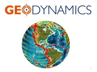
- 4. Introduction • Geodynamics is a subfield of geophysics dealing with dynamics of the Earth. • It applies physics, chemistry and mathematics to the understanding of how mantle convection leads to plate tectonics and geologic phenomena such as seafloor spreading, mountain building, volcanoes, earthquakes, faulting and so on. 4
- 5. What is Geodynamics ? The branch of geophysics concerned with measuring, modeling, and interpreting the configuration and motion of the crust, mantle, and core of the earth and other planets. 5
- 6. Geodynamics provides the fundamentals necessary for an understanding of the workings of the solid Earth. The Earth is a heat engine, with the source of the heat the decay of radioactive elements and the cooling of the Earth from its initial accretion. The work output includes earthquakes, volcanic eruptions, and mountain building. Geodynamics comprehensively explains these concepts in the context of the role of mantle convection and plate tectonics. Observations such as the Earth’s gravity field, surface heat flow, distribution of earthquakes, surface stresses and strains, and distribution of elements are discussed. 6
- 7. Since the l6th century, cartographers have noticed the jigsaw-puzzle fit of the continental edges. Since the 19th century, geologists have known that some fossil plants and animals are extraordinarily similar across the globe, and some sequences of rock formations in distant continents are also strikingly alike. 7
- 9. The similarity in shape between the west coast of Africa and the east coast of South America was noted as early as 1620 by Francis Bacon. This “fit” has led many authors to speculate on how these two continents might have been attached. A detailed exposition of the hypothesis of continental drift was put forward by Frank B. Taylor (1910). The hypothesis was further developed by Alfred Wegener beginning in 1912 and summarized in his book The Origin of Continents and Oceans (Wegener, 1946). 9
- 10. As a meteorologist, Wegener was particularly interested in the observation that glaciation had occurred in equatorial regions at the same time that tropical conditions prevailed at high latitudes. This observation in itself could be explained by polar wander, a shift of the rotational axis without other surface deformation. Wegener argued that for several hundred million years during the late Paleozoic and Mesozoic eras (200 million to 300 million years ago), the continents were united into a supercontinent that he labeled Pangea—all Earth. 10
- 11. Alfred Wegener (1880 – 1930) 11
- 12. He suggested that tidal forces or forces associated with the rotation of the Earth were responsible for the breakup of this continent and the subsequent continental drift. Further and more detailed qualitative arguments favoring continental drift were presented by Alexander du Toit, particularly in his book Our Wandering Continents (du Toit, 1937). Du Toit argued that instead of a single supercontinent, there had formerly been a northern continent, Laurasia, and a southern continent, Gondwanaland, separated by the Tethys Ocean. 12
- 13. 13
- 14. At the turn of the 20th century, Austrian geologist Eduard Suess proposed the theory of Gondwanaland to account for these similarities: that a giant supercontinent had once covered much or all of Earth's surface before breaking apart to form continents and ocean basins. 14
- 15. Eduard Suess (1831 –1914) 15
- 16. Continental drift was not accepted when first proposed, but in the 1960s it became a cornerstone of the new global theory of plate tectonics. The motion of land masses is now explained as a consequence of moving "plates"—large fragments of the earth's surface layer in which the continents are embedded. 16
- 17. BEFORE CONTINENTAL DRIFT: VERSIONS OF CONTRACTION THEORY One of the central scientific questions of 19th-century geology was the origin of mountains. How were they formed? What process squeezed and folded rocks like putty? What made the earth's surface move? Most theories invoked terrestrial contraction as a causal force. It was widely believed that Earth had formed as a hot, incandescent body, and had been steadily cooling since the beginning of geological time. Because most materials contract as they cool, it seemed logical to assume that Earth had been contracting as it cooled, too. As it did, its surface would have deformed, producing mountains. 17
- 18. Geologist James Dwight Dana (1813- 1895) had developed a different version of contraction theory. Dana suggested that the continents had formed early in earth history, when low-temperature minerals such as quartz and feldspar had solidified. Then the globe continued to cool and contract, until the high- temperature minerals such as olivine and pyroxene finally solidified: on the moon, to form the lunar craters; on Earth, to form the ocean basins. 18
- 19. James Dwight Dana (1813 – 1895) 19
- 20. In the early 20th century, contraction theory was challenged by three independent lines of evidence. The first came from field mapping. Nineteenth- century geologists had worked in great detail to determine the structure of mountain belts, particularly the Swiss Alps and the North American Appalachians. When they mapped the folded sequences of rocks in these regions, they found the folds to be so extensive that if one could unfold them the rock layers would extend for hundreds of miles. 20
- 21. The second line of evidence came from geodesy—the science of the shape (or figure) of the earth. While field geologists were unraveling the structure of the Alps and Appalachians, cartographers with the Great Trignometrical Survey of India were making geodetic measurements to produce accurate maps of British colonial holdings. In the early 1850s, Colonel (later Sir) George Everest, the surveyor-general of India, discovered a discrepancy in the measured distance between two stations, Kaliana and Kalianpur, 370 miles (600 kilometers) apart. When measured on the basis of surveyor's triangulations, the latitude difference was five seconds greater than when computed on the basis of astronomical observation. Everest thought the difference might be due to the gravitational attraction of the Himalayas on the surveyors' plumb bobs, and enlisted John Pratt (1809- 1871), a Cambridge-trained mathematician and the archdeacon of Calcutta, to examine the problem. 21
- 22. Pratt proposed that the observed effects could be explained if the surface topography of the mountains were somehow compensated by a deficit of mass beneath them— an idea that came to be known as isostasy, or "equal standing." 22
- 23. Third, and most fundamental, physicists discovered radiogenic heat, which contradicted the basic assumption of contraction theory that the earth was steadily cooling. With contraction no longer assumed, earth scientists were motivated to search for other driving forces of deformation. 23
- 24. In the United States, the question was addressed by Harvard geology professor Reginald A. Daly (1871- 1957), North America's strongest defender of continental drift. Daly argued that the key to tectonic problems was to be found in the earth's layered structure. 24
- 25. Reginald A. Daly (1871-1957) 25
- 26. • Advances in seismology suggested that the earth contained three major layers: crust, substrate (or mantle), and core 26
- 27. 27
- 28. During the 1950s extensive exploration of the seafloor led to an improved understanding of the worldwide range of mountains on the seafloor known as mid-ocean ridges. Harry Hess (1962) hypothesized that the seafloor was created at the axis of a ridge and moved away from the ridge to form an ocean in a process now referred to as seafloor spreading. This process explains the similarity in shape between continental margins. As a continent breaks apart, a new ocean ridge forms. The ocean floor created is formed symmetrically at this ocean ridge, creating a new ocean. This is how the Atlantic Ocean was formed; the mid-Atlantic ridge where the ocean formed now bisects the ocean. 28
- 29. Harry Hammond Hess (1906 - 1969) 29
- 30. It should be realized, however, that the concept of continental drift won general acceptance by Earth scientists only in the period between 1967 and 1970. Although convincing qualitative, primarily geological, arguments had been put forward to support continental drift, almost all Earth scientists and, in particular, almost all geophysicists had opposed the hypothesis. Their opposition was mainly based on arguments concerning the rigidity of the mantle and the lack of an adequate driving mechanism. 30
- 31. The propagation of seismic shear waves showed beyond any doubt that the mantle was a solid. An essential question was how horizontal displacements of thousands of kilometers could be accommodated by solid rock. The fluid like behavior of the Earth’s mantle had been established in a general way by gravity studies carried out in the latter part of the nineteenth century. Measurements showed that mountain ranges had low-density roots. The lower density of the roots provides a negative relative mass that nearly equals the positive mass of the mountains. This behavior could be explained by the principle of hydrostatic equilibrium if the mantle behaved as a fluid. Mountain ranges appear to behave similarly to blocks of wood floating on water. 31
- 32. The fluid behavior of the mantle was established quantitatively by N. A. Haskell (1935). Studies of the elevation of beach terraces in Scandinavia showed that the Earth’s surface was still rebounding from the load of the ice during the last ice age. In the 1950s theoretical studies had established several mechanisms for the very slow creep of crystalline materials. This creep results in a fluid behavior. Robert B. Gordon (1965) showed that solid-state creep quantitatively explained the viscosity determined from observations of postglacial rebound. 32
- 33. Arthur Holmes (1931) hypothesized that thermal convection was capable of driving mantle convection and continental drift. If a fluid is heated from below, or from within, and is cooled from above in the presence of a gravitational field, it becomes gravitationally unstable, and thermal convection can occur. The hot mantle rocks at depth are gravitationally unstable with respect to the colder, more dense rocks in the lithosphere. The result is thermal convection in which the colder rocks descend into the mantle and the hotter rocks ascend toward the surface. The ascent of mantle material at ocean ridges and the descent of the lithosphere into the mantle at ocean trenches are parts of this process. 33
- 34. The Earth’s mantle is being heated by the decay of the radioactive isotopes uranium 235 (235U), uranium 238 (238U), thorium 232 (232Th), and potassium 40 (40K). The volumetric heating from these isotopes and the secular cooling of the Earth drive mantle convection. The heat generated by the radioactive isotopes decreases with time as they decay 34
- 35. Arthur Holmes (1890 –1965) 35
- 36. During the 1960s independent observations supporting continental drift came from paleomagnetic studies. When magmas solidify and cool, their iron component is magnetized by the Earth’s magnetic field. This remanent magnetization provides a fossil record of the orientation of the magnetic field at that time. Studies of the orientation of this field can be used to determine the movement of the rock relative to the Earth’s magnetic poles since the rock’s formation. Rocks in a single surface plate that have not been deformed locally show the same position for the Earth’s magnetic poles. Keith Runcorn (1956) showed that rocks in North America and Europe gave different positions for the magnetic poles. He concluded that the differences were the result of continental drift between the two continents. 36
- 37. By the late 1960s the framework for a comprehensive understanding of the geological phenomena and processes of continental drift had been built. The basic hypothesis of plate tectonics was given by Jason Morgan (1968). 37
Editor's Notes
- geodesy dʒɪˈɒdɪsi/ noun the branch of mathematics dealing with the shape and area of the earth or large portions of it.