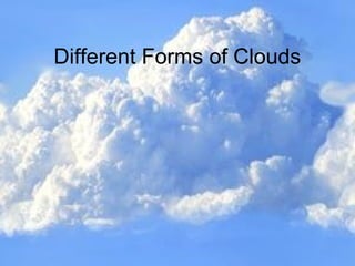
2. What are clouds?What are clouds?
It is mass of tiny water droplets or ice
crystals or both of size 20 to 60 micron
suspended in the atmosphere.
3. Importance of Clouds
• Signal to meteorologists that there will be changes
in the weather.
• Help regulate Earth's energy balance by
reflecting and scattering solar radiation and by
absorbing Earth's infrared energy.
• Essential part of the hydrologic cycle.
4. How Clouds Form
•Heating of Air near surface of the Earth
•Warmer air rises through the atmosphere
•The pressure upon it decreases as air rises
•Expansion of air with increase in height and water
vapor start cooling
•Condensation begin
••Vapour condenses into droplets on microscopic dust
particles in the atmosphere
5. Cloud Type Based On
Properties
• Four basic cloud categories:
• Cirrus --- thin, wispy cloud of ice.
• Stratus --- layered cloud
• Cumulus --- clouds having vertical development.
• Nimbus --- rain-producing cloud
• These basic cloud types can be combined to
• generate ten different cloud types, such as
• cirrostratus clouds that have the characteristics of
• cirrus clouds and stratus clouds.
6.
7. FAMILY A. High clouds (mean
lower level, 20,000 feet)
1. cirrus
2. Cirrocumulus
3. Cirrostratus
High clouds have low cloud temperature and
low water content and consist most of ice
crystal.
8. 1. Cirrus1. Cirrus
• The long stringy cirrus clouds are
called "mares' tails."
• Cirrus clouds are characterized by
a thin, wispy look to them.
Almost like strands of string in
the sky.
• Many cirrus clouds produce a
small amount of precipitation
(ice crystals) that are suspended
in the air and do NOT reach the
ground.
Fast Facts:
Typical Altitude: 16,500-
45,000 ft.
Location: Worldwide
Precipitation: None that
reaches ground
Composition: Ice crystals
Formation: Fall streaks of ice
crystals in upper troposphere
winds
9.
10. 2. Cirrocumulus Clouds
• Forms when convection currents at
high altitudes mix to produce a
cirrocumulus cloud.
• These are usually very large clouds
that include droplets of super cooled
water in them, allowing ice crystals to
form.
• Cirrus clouds are characterized by a
thin, wispy look to them. Almost like
strands of string in the sky.
Fast Facts:
Typical Altitude: 16,500-
45,000 ft.
Location: Worldwide
Precipitation: None that
reaches ground
Composition: Ice crystals
Formation: Cloudlets formed
by choppy winds anad high
moisture levels in upper
troposphere
11.
12. 3. Cirrostratus Clouds
These types of clouds never bring
precipitation with them and have a thin,
whitish, veil-like structure (just like cirrus
clouds).
Sometimes these clouds are so big that you
cannot tell them apart from one another (they
blend in).
Can form a halo, which is a glowing look that
surrounds a cloud when sunlight hits the
water vapor within the cloud.
Cirrocumulus clouds usually do not last long
and could carry small amounts of
precipitation along with them (mostly ice
because it is very cold at this altitude).
Fast Facts:
•Typical Altitude:
20,000-42,000 ft.
•Location: Worldwide
•Precipitation: None
•Composition: Ice
crystals
•Formation: Spreading
and joining of cirrus
clouds
13.
14. FAMILY B. Middle Clouds (mean
upper level, 20,000 feet; mean lower
level, 6,500 feet)
4. Altocumulus
5. Altostratus
Middle clouds are usually composite of liquid
droplets.
They block more sunlight to the surface than
the high clouds.
15. 4. Altocumulus Clouds
These types of clouds appear in
sheets, patches or bunched
together.
They are usually larger and
appear white or grey in color.
Altocumulus clouds shows that
convection is occurring in the
atmosphere.
May cause rain if they are high
enough in the atmosphere.
Fast Facts:
Typical Altitude: 6,500-18,000
ft.
Location: Worldwide
Precipitation: Very occasional
light rain
Composition: Mostly liquid
water, may also contain ice
crystals
Formation: Mid-level
atmospheric disturbances and
wave propagation (from e.g. –
mountains)
16.
17. 5. Altostratus Clouds
These clouds are usually lighter in color and
almost transparent - so sunlight can often be seen
through them.
They frequently cover the whole sky and are similar
to lower altitude stratus clouds.
• Formation: Usually formed from the thickening and
lowering of a cirrostratus cloud on its way to
becoming a nimbostratus cloud
Altostratus clouds can be potentially dangerous,
because they can cause ice to build up on the wings
of an airplane.
18.
19. FAMILY C. Low Clouds (Mean upper
level, 6500 feet; mean lower level, close
to surface)
6. Stratocumulus
7. Stratus
8. Nimbostratus
Low, thick, layered clouds with large horizontal
extends, which can exceed that of several
states.
20. 6. Stratocumulus Clouds
Usually characterized by large dark, rounded
masses of clouds – found in in groups or lines.
These clouds usually produce NO precipitation, but
are often seen at the beginning or end of a front
(before or after a storm).
• Formed by Spreading and joining of cumulus clouds
below a temperature inversion, wind turbulence in a
stratus layer
Is the most commonly seen cloud type on Earth
21.
22. 7. Stratus Clouds
More specifically, the term stratus is used to describe
flat, hazy, plain looking clouds.
Layered, sheet-like clouds.
These clouds are layered horizontally (left to right).
Can vary from dark gray to nearly white in terms of
color.
• Stratus clouds are formed when a large air mass
cools at the same time (e.g. – a warm air parcel
drifts into or above a cooler region)
23.
24. 8. Nimbostratus Clouds
• A Nimbostratus cloud has no distinct shape to it
and is almost uniformly dark gray all over.
• Usually formed from the thickening and lowering of a
altostratus cloud
• "Nimbo" is from the Latin word "nimbus", meaning
rain.
• These clouds are dark because they are storm
clouds!
25.
26. FAMILY D. Clouds with Vertical
Development (mean upper level, that of
cirrus; mean lower level, 1,600 feet)
9. Cumulus
10. Cumulonimbus
They are clouds with substantial vertical
development and occur when the air is absolute
or conditionally unstable.
27. 9. Cumulus Clouds
• They are often described as "puffy" or "cotton-like",
or "poofy" in appearance.
• Cumulus clouds can appear alone, in lines, or in
clusters (groups).
• They may be associated with severe weather such
as hail and tornadoes (cumulonimbus) but often
mean fair, sunny weather
Harmless fair weather cumulus clouds can later develop
into towering cumulonimbus clouds associated with
powerful thunderstorms.
28.
29. 10. Cumulonimbus Clouds
A tall, dense cloud that carries along
thunderstorms and other intense weather
conditions.
Cumulonimbus means "column of rain“ – so
precipitation will always be involved.
These clouds can form alone, in clusters, or along a
cold front.
They create lightning through the center of the
cloud and if conditions are right can further develop
into a super cell, which is a severe thunderstorm .
30. Three critical conditions for cumulonimbus formation:
•Ready supply of warm, moist air, which rises at speeds of up
to 25-70 mph
•
Tropospheric winds need to increase considerably with height
to encourage it to slant forward
•
The atmosphere around the cloud needs to be “unstable”
31.
32. Fog – A cloud on the ground.
Fog: Clouds at ground level
1.Radiation fog: Forms at night when cold
ground cools the air above it (in valleys)
2. Advection fog: Forms when warm, moist
air moves over colder surface and cools
(in coastal areas)
The foggiest land areas in the world are
Menomonie, Wisconsin, Point Reyes,
California, and Argentia.
33. In this fog, off the coast of Oregon, a cold ocean current cools the air to
the air’s dew point temperature. This cooling of the air created the fog.
This is called:
Advection Fog
34. Warm Water
Cold Air
Evaporation
Condensation
For the development of this fog, warm water is evaporating into cool air.
The cool air becomes saturated (its relative humidity becomes 100%) and
condensation creates the fog. This is called:
Radiation Fog
35.
36. Referece
World Meteorological Organization, Cloud Classification Summary.(15th
Sept
2017) Retrieved https://cloudatlas.wmo.int/cloud-classification-
summary.html
National Weather Service, Ten Basic Cloud Types. (15th
Sept 2017) Retrieved
http://www.srh.noaa.gov/jetstream/clouds/cloudwise/types.html
Math/Science Nucleus, Water Cycle- Weather (5) Lab. (15th
Sept2017) Retrieved
https://www.msnucleus.org/membership/html/k-
6/wc/weather/5/wcwe5_2a.html