SlideShare a Scribd company logo
1 of 16
Download to read offline
+
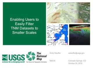
Enabling Users to
Easily Filter
TNM Datasets to
Smaller Scales
Andy Stauffer astauffer@usgs.gov
NACIS Colorado Springs, CO
October 20, 2016
2
+Agenda
 Introduce the Visibility Filter attribute
 Scope, purpose, and defining the Visibility Filter
 Generalization workflows
 Organizing generalization decisions - ScaleMaster
 Visibility Filter examples
 Hydrography
 Roads
 Airports
 Evaluating preliminary results
 Topo TNM Style Template
 Enriching the 1:24,000 scale design
 Enabling 1:24,000 scale data for 1:100,000 mapping
3
+What is the VisibilityFilter Attribute?
 Database enrichment that represents results of a generalization
process
 Intend to implement with 9 benchmark scales; focus on 1:100K and 1:250K
 Defines the smallest applicable scale of use for a feature within TNM
datasetes
 ‘Level of Content’ vs. ‘Level of Detail’
 Draft Model Definition:
The VisibilityFilter attribute represents appropriate use of individual features through scale. The
attribute does not reflect capture conditions. Data are captured per respective scale-specific
specifications. The VisibilityFilter attribute is intended only to direct appropriate end use of the data. A
given VisibilityFilter coded-value indicates that the object is appropriate for use at approximately the
defined scale and all larger scales [i.e., an object with a given VisibilityFilter is not appropriate for use
at scales smaller than the defined approximate scale]
4
+Defining the VisibilityFilter
SELECT *
FROM [dataset]
WHERE VisibilityFilter >= [scale denominator]
5
+Formalizing generalization decisions:
Developing a ScaleMaster
ScaleMaster developed by NGTOC employees
Brittany Roche and Seth Webinger, FY2016
6
+Methodology: Hydrography
 Leverage existing generalization tools
 Remove content based on estimated Upstream Drainage Area
 Data is generalized to all scales from the source High Resolution
National Hydrography Dataset (star generalization)
7
+Methodology: Roads
; from Brewer et al. 2013
 Gradually remove features based on network length (ladder
generalization)
 Leverage pre-existing Functional Road Class hierarchy to prioritize
generalization
8
+Methodology: Airports
SELECT *
FROM AirportPoint
WHERE AirportPoint.VisibilityFilter >= [scale denominator]
AND AirportRunway.VisibilityFilter < [scale denominator]
INNER JOIN AirportPoint ON AirportRunway.FAA = AirportPoint.FAA
 Measure and group length of features (apply minimum and
maximum length restrictions)
 Mimic feature collapses and dimensionality changes through table
joins
9
+Topo TNM Style Template
 Part of an ongoing effort to “Cartographically Enable TNM Data”
 ArcMap Map Document (.mxd) file
 Contains US Topo symbology and layering
 Contains US Topo-like labeling
 Contains US Topo-like map marginalia
 Configurable to any location where TNM
data is available
 Obtainable from TNM Download Portal
 7.5’ US Topo ArcMap specifications
 Configuration instructions
 http://viewer.nationalmap.gov/tools/topotemplate/
10
+Topo TNM Style Template:
Use at 1:24,000 scale
 The Topo TNM Style
Template is set up to
mimic the design of the
US Topo product
 The 1:24,000 scale
content is shown at its
native scale
 The content is clearly
displayed and only minor
symbology / labeling
problems exist in a fully
automated fashion
11
+Topo TNM Style Template
VisibilityFilter to enrich map design
Topo TNM Style Template Default VisibilityFilter – Enriched Design
12
+Topo TNM Style Template
Scale reduction to 1:100,000
 Zooming out in the Topo
TNM Style template
mimics a photoreduction
of the map
 The data and labels are
linked to the source,
1:24,000, scale.
 All 1:24,000 scale content
is visible but illegible
13
+Topo TNM Style Template:
Rendering map at 1:100,000
 By changing the display
scale to 1:100,000, the
content becomes
overwhelming
 All 1:24,000 content is
still visible, but too dense
to generate a clear map
14
+Topo TNM Style Template:
VisibilityFilter to reduce scale
15
+Accomplishments and Future Work
Accomplishments
 VisibilityFilter attribute
prototyped in many TNM
feature types
 Generalization framework for
implementing VisibilityFilter
attribute has been mocked up
for two benchmark scales
 Cartographic use of TNM data
can be used fairly easily at
smaller scales in Topo TNM
Style Template
Future Work
 Continue to evaluate use of
VisibilityFilter in other feature
types, especially boundaries
 Evaluate how to extrapolate
results to an additional seven
benchmark scales (1:50K to
1:5M)
 Document ‘best practices’ for
cartographic use of TNM data
at smaller scales, perhaps with
simplification information
+
Enabling Users to
Easily Filter
TNM Datasets to
Smaller Scales
QUESTIONS
Andy Stauffer astauffer@usgs.gov
NACIS 2016 Colorado Springs, CO
October 20, 2016

More Related Content

What's hot

Petrel introduction course guide
Petrel introduction course guidePetrel introduction course guide
Petrel introduction course guideMarc Diviu Franco
 
Belfast City Centre 3D Modelling
Belfast City Centre 3D ModellingBelfast City Centre 3D Modelling
Belfast City Centre 3D ModellingCiara MacManus
 
Land Use/Land Cover Detection
Land Use/Land Cover DetectionLand Use/Land Cover Detection
Land Use/Land Cover DetectionWansoo Im
 
Remote Sensing: Georeferencing
Remote Sensing: GeoreferencingRemote Sensing: Georeferencing
Remote Sensing: GeoreferencingKamlesh Kumar
 
Remote Sensing: Overlay Analysis
Remote Sensing: Overlay AnalysisRemote Sensing: Overlay Analysis
Remote Sensing: Overlay AnalysisKamlesh Kumar
 
PROCESS OF GEOREFERENCING IN QGIS
PROCESS OF GEOREFERENCING IN QGISPROCESS OF GEOREFERENCING IN QGIS
PROCESS OF GEOREFERENCING IN QGISCalcutta University
 
Digitization arc gis
Digitization arc gisDigitization arc gis
Digitization arc gisAshok Peddi
 
Automated change detection in grass gis
Automated change detection in grass gisAutomated change detection in grass gis
Automated change detection in grass gisCOGS Presentations
 
Non-rigid Registration of Images with Geometric and Photometric Deformation b...
Non-rigid Registration of Images with Geometric and Photometric Deformation b...Non-rigid Registration of Images with Geometric and Photometric Deformation b...
Non-rigid Registration of Images with Geometric and Photometric Deformation b...薪元 黃
 
Google Earth Web Service as a Support for GIS Mapping in Geospatial Research ...
Google Earth Web Service as a Support for GIS Mapping in Geospatial Research ...Google Earth Web Service as a Support for GIS Mapping in Geospatial Research ...
Google Earth Web Service as a Support for GIS Mapping in Geospatial Research ...Universität Salzburg
 
Q-GIS : Geo-referencing and Digitization
Q-GIS : Geo-referencing and DigitizationQ-GIS : Geo-referencing and Digitization
Q-GIS : Geo-referencing and DigitizationLakshya Pandit
 
User guide of reservoir geological modeling v2.2.0
User guide of reservoir geological modeling v2.2.0User guide of reservoir geological modeling v2.2.0
User guide of reservoir geological modeling v2.2.0Bo Sun
 

What's hot (20)

Petrel introduction course guide
Petrel introduction course guidePetrel introduction course guide
Petrel introduction course guide
 
Belfast City Centre 3D Modelling
Belfast City Centre 3D ModellingBelfast City Centre 3D Modelling
Belfast City Centre 3D Modelling
 
Land Use/Land Cover Detection
Land Use/Land Cover DetectionLand Use/Land Cover Detection
Land Use/Land Cover Detection
 
Remote Sensing: Georeferencing
Remote Sensing: GeoreferencingRemote Sensing: Georeferencing
Remote Sensing: Georeferencing
 
Remote Sensing: Overlay Analysis
Remote Sensing: Overlay AnalysisRemote Sensing: Overlay Analysis
Remote Sensing: Overlay Analysis
 
Geographical information system
Geographical  information systemGeographical  information system
Geographical information system
 
Gis Concepts 5/5
Gis Concepts 5/5Gis Concepts 5/5
Gis Concepts 5/5
 
DTM DEM Generation
DTM DEM GenerationDTM DEM Generation
DTM DEM Generation
 
PROCESS OF GEOREFERENCING IN QGIS
PROCESS OF GEOREFERENCING IN QGISPROCESS OF GEOREFERENCING IN QGIS
PROCESS OF GEOREFERENCING IN QGIS
 
Digitization arc gis
Digitization arc gisDigitization arc gis
Digitization arc gis
 
QGIS training class 2
QGIS training class 2QGIS training class 2
QGIS training class 2
 
Automated change detection in grass gis
Automated change detection in grass gisAutomated change detection in grass gis
Automated change detection in grass gis
 
Mr Share 11 Sep 2010
Mr Share 11 Sep 2010Mr Share 11 Sep 2010
Mr Share 11 Sep 2010
 
Velocity model building in Petrel
Velocity model building in PetrelVelocity model building in Petrel
Velocity model building in Petrel
 
Non-rigid Registration of Images with Geometric and Photometric Deformation b...
Non-rigid Registration of Images with Geometric and Photometric Deformation b...Non-rigid Registration of Images with Geometric and Photometric Deformation b...
Non-rigid Registration of Images with Geometric and Photometric Deformation b...
 
Google Earth Web Service as a Support for GIS Mapping in Geospatial Research ...
Google Earth Web Service as a Support for GIS Mapping in Geospatial Research ...Google Earth Web Service as a Support for GIS Mapping in Geospatial Research ...
Google Earth Web Service as a Support for GIS Mapping in Geospatial Research ...
 
Gis Concepts 4/5
Gis Concepts 4/5Gis Concepts 4/5
Gis Concepts 4/5
 
Q-GIS : Geo-referencing and Digitization
Q-GIS : Geo-referencing and DigitizationQ-GIS : Geo-referencing and Digitization
Q-GIS : Geo-referencing and Digitization
 
User guide of reservoir geological modeling v2.2.0
User guide of reservoir geological modeling v2.2.0User guide of reservoir geological modeling v2.2.0
User guide of reservoir geological modeling v2.2.0
 
Improving Dtm Accuracy
Improving Dtm AccuracyImproving Dtm Accuracy
Improving Dtm Accuracy
 

Similar to Enabling Users to Easily Filter TNM Datasets to Smaller Scales

Transport for London - London's Operations Digital Twin
Transport for London - London's Operations Digital TwinTransport for London - London's Operations Digital Twin
Transport for London - London's Operations Digital TwinNeo4j
 
CMS Flow Model SMS 13.0
CMS Flow Model SMS 13.0CMS Flow Model SMS 13.0
CMS Flow Model SMS 13.0bahar fahmi
 
Self-adaptive container monitoring with performance-aware Load-Shedding policies
Self-adaptive container monitoring with performance-aware Load-Shedding policiesSelf-adaptive container monitoring with performance-aware Load-Shedding policies
Self-adaptive container monitoring with performance-aware Load-Shedding policiesNECST Lab @ Politecnico di Milano
 
BIM, Lean & Advanced Work Packaging - How do they fit together?
BIM, Lean & Advanced Work Packaging - How do they fit together? BIM, Lean & Advanced Work Packaging - How do they fit together?
BIM, Lean & Advanced Work Packaging - How do they fit together? CCT International
 
Infotech's Spatial Conflation Tool TruShift
Infotech's Spatial Conflation Tool TruShift Infotech's Spatial Conflation Tool TruShift
Infotech's Spatial Conflation Tool TruShift Maria H
 
Winds of change from vendor lock-in to meta cloud review 1
Winds of change from  vendor lock-in to meta cloud review 1Winds of change from  vendor lock-in to meta cloud review 1
Winds of change from vendor lock-in to meta cloud review 1NAWAZ KHAN
 
2016 gisco track: creating a quick map configured to us topo specifications: ...
2016 gisco track: creating a quick map configured to us topo specifications: ...2016 gisco track: creating a quick map configured to us topo specifications: ...
2016 gisco track: creating a quick map configured to us topo specifications: ...GIS in the Rockies
 
Crossrail - Big Maps for a Big Project - Smart Infrastructure - Esri UK Annua...
Crossrail - Big Maps for a Big Project - Smart Infrastructure - Esri UK Annua...Crossrail - Big Maps for a Big Project - Smart Infrastructure - Esri UK Annua...
Crossrail - Big Maps for a Big Project - Smart Infrastructure - Esri UK Annua...Esri UK
 
Presentation_BigData_NenaMarin
Presentation_BigData_NenaMarinPresentation_BigData_NenaMarin
Presentation_BigData_NenaMarinn5712036
 
Serving and rendering huge point cloud on mobile devices and web pages.
Serving and rendering huge point cloud on mobile devices and web pages.Serving and rendering huge point cloud on mobile devices and web pages.
Serving and rendering huge point cloud on mobile devices and web pages.Manuel De La Calle
 
Facebook Comments Volume Prediction
Facebook Comments Volume PredictionFacebook Comments Volume Prediction
Facebook Comments Volume PredictionVaibhav Sharma
 
위성이미지 객체 검출 대회 - 2등
위성이미지 객체 검출 대회 - 2등위성이미지 객체 검출 대회 - 2등
위성이미지 객체 검출 대회 - 2등DACON AI 데이콘
 
AutoML for user segmentation: how to match millions of users with hundreds of...
AutoML for user segmentation: how to match millions of users with hundreds of...AutoML for user segmentation: how to match millions of users with hundreds of...
AutoML for user segmentation: how to match millions of users with hundreds of...Institute of Contemporary Sciences
 
Crafted Design - GeeCON 2014
Crafted Design - GeeCON 2014Crafted Design - GeeCON 2014
Crafted Design - GeeCON 2014Sandro Mancuso
 
FME Geo Enabling Field Sales Team
FME Geo Enabling Field Sales TeamFME Geo Enabling Field Sales Team
FME Geo Enabling Field Sales TeamSafe Software
 
Crafted Design - ITAKE 2014
Crafted Design - ITAKE 2014Crafted Design - ITAKE 2014
Crafted Design - ITAKE 2014Sandro Mancuso
 

Similar to Enabling Users to Easily Filter TNM Datasets to Smaller Scales (20)

Transport for London - London's Operations Digital Twin
Transport for London - London's Operations Digital TwinTransport for London - London's Operations Digital Twin
Transport for London - London's Operations Digital Twin
 
CMS Flow Model SMS 13.0
CMS Flow Model SMS 13.0CMS Flow Model SMS 13.0
CMS Flow Model SMS 13.0
 
Murphy presentation
Murphy presentationMurphy presentation
Murphy presentation
 
Self-adaptive container monitoring with performance-aware Load-Shedding policies
Self-adaptive container monitoring with performance-aware Load-Shedding policiesSelf-adaptive container monitoring with performance-aware Load-Shedding policies
Self-adaptive container monitoring with performance-aware Load-Shedding policies
 
BIM, Lean & Advanced Work Packaging - How do they fit together?
BIM, Lean & Advanced Work Packaging - How do they fit together? BIM, Lean & Advanced Work Packaging - How do they fit together?
BIM, Lean & Advanced Work Packaging - How do they fit together?
 
Infotech's Spatial Conflation Tool TruShift
Infotech's Spatial Conflation Tool TruShift Infotech's Spatial Conflation Tool TruShift
Infotech's Spatial Conflation Tool TruShift
 
Winds of change from vendor lock-in to meta cloud review 1
Winds of change from  vendor lock-in to meta cloud review 1Winds of change from  vendor lock-in to meta cloud review 1
Winds of change from vendor lock-in to meta cloud review 1
 
Clementine tool
Clementine toolClementine tool
Clementine tool
 
2016 gisco track: creating a quick map configured to us topo specifications: ...
2016 gisco track: creating a quick map configured to us topo specifications: ...2016 gisco track: creating a quick map configured to us topo specifications: ...
2016 gisco track: creating a quick map configured to us topo specifications: ...
 
Crossrail - Big Maps for a Big Project - Smart Infrastructure - Esri UK Annua...
Crossrail - Big Maps for a Big Project - Smart Infrastructure - Esri UK Annua...Crossrail - Big Maps for a Big Project - Smart Infrastructure - Esri UK Annua...
Crossrail - Big Maps for a Big Project - Smart Infrastructure - Esri UK Annua...
 
Presentation_BigData_NenaMarin
Presentation_BigData_NenaMarinPresentation_BigData_NenaMarin
Presentation_BigData_NenaMarin
 
Serving and rendering huge point cloud on mobile devices and web pages.
Serving and rendering huge point cloud on mobile devices and web pages.Serving and rendering huge point cloud on mobile devices and web pages.
Serving and rendering huge point cloud on mobile devices and web pages.
 
Facebook Comments Volume Prediction
Facebook Comments Volume PredictionFacebook Comments Volume Prediction
Facebook Comments Volume Prediction
 
위성이미지 객체 검출 대회 - 2등
위성이미지 객체 검출 대회 - 2등위성이미지 객체 검출 대회 - 2등
위성이미지 객체 검출 대회 - 2등
 
AutoML for user segmentation: how to match millions of users with hundreds of...
AutoML for user segmentation: how to match millions of users with hundreds of...AutoML for user segmentation: how to match millions of users with hundreds of...
AutoML for user segmentation: how to match millions of users with hundreds of...
 
Vivarana literature survey
Vivarana literature surveyVivarana literature survey
Vivarana literature survey
 
Crafted Design - GeeCON 2014
Crafted Design - GeeCON 2014Crafted Design - GeeCON 2014
Crafted Design - GeeCON 2014
 
FME Geo Enabling Field Sales Team
FME Geo Enabling Field Sales TeamFME Geo Enabling Field Sales Team
FME Geo Enabling Field Sales Team
 
Crafted Design - ITAKE 2014
Crafted Design - ITAKE 2014Crafted Design - ITAKE 2014
Crafted Design - ITAKE 2014
 
Precisely MapInfo Pro v2019 and Roadmap
Precisely MapInfo Pro v2019 and RoadmapPrecisely MapInfo Pro v2019 and Roadmap
Precisely MapInfo Pro v2019 and Roadmap
 

More from nacis_slides

Pretty maps without the price tag: Cartography with just QGIS
Pretty maps without the price tag: Cartography with just QGISPretty maps without the price tag: Cartography with just QGIS
Pretty maps without the price tag: Cartography with just QGISnacis_slides
 
Women Shaping the World: Women and Globes
Women Shaping the World: Women and GlobesWomen Shaping the World: Women and Globes
Women Shaping the World: Women and Globesnacis_slides
 
The First Geologic Maps of the U.S.
The First Geologic Maps of the U.S.The First Geologic Maps of the U.S.
The First Geologic Maps of the U.S.nacis_slides
 
Geohistory-Géohistoire Canada: Developing a partnership for historical GIS an...
Geohistory-Géohistoire Canada: Developing a partnership for historical GIS an...Geohistory-Géohistoire Canada: Developing a partnership for historical GIS an...
Geohistory-Géohistoire Canada: Developing a partnership for historical GIS an...nacis_slides
 
Historical Geocoding and the City
Historical Geocoding and the CityHistorical Geocoding and the City
Historical Geocoding and the Citynacis_slides
 
InDesign + ArcMap (Photoshop & Illustrator too)
InDesign + ArcMap (Photoshop & Illustrator too)InDesign + ArcMap (Photoshop & Illustrator too)
InDesign + ArcMap (Photoshop & Illustrator too)nacis_slides
 
The Rise and Fall of a Worldian Language: Amenity Icons from ISOTYPE to Open...
The Rise and Fall of a Worldian Language: Amenity Icons from ISOTYPE to Open...The Rise and Fall of a Worldian Language: Amenity Icons from ISOTYPE to Open...
The Rise and Fall of a Worldian Language: Amenity Icons from ISOTYPE to Open...nacis_slides
 
Nonprofit Mapping for Change
Nonprofit Mapping for ChangeNonprofit Mapping for Change
Nonprofit Mapping for Changenacis_slides
 
Hashtag to Map: Transforming Zombie Data to Living Maps
Hashtag to Map: Transforming Zombie Data to Living MapsHashtag to Map: Transforming Zombie Data to Living Maps
Hashtag to Map: Transforming Zombie Data to Living Mapsnacis_slides
 
Mapping Demographic Change with Cartes et Données
Mapping Demographic Change with Cartes et DonnéesMapping Demographic Change with Cartes et Données
Mapping Demographic Change with Cartes et Donnéesnacis_slides
 
Expressions of Place: an interdisciplinary and interactive community event se...
Expressions of Place: an interdisciplinary and interactive community event se...Expressions of Place: an interdisciplinary and interactive community event se...
Expressions of Place: an interdisciplinary and interactive community event se...nacis_slides
 
Who's on First: Adminstrative Boundaries and Localities
Who's on First: Adminstrative Boundaries and LocalitiesWho's on First: Adminstrative Boundaries and Localities
Who's on First: Adminstrative Boundaries and Localitiesnacis_slides
 
Always have a plan: Developing a data acquisition policy at the University of...
Always have a plan: Developing a data acquisition policy at the University of...Always have a plan: Developing a data acquisition policy at the University of...
Always have a plan: Developing a data acquisition policy at the University of...nacis_slides
 
Designing an atlas with a minimalist aesthetic
Designing an atlas with a minimalist aestheticDesigning an atlas with a minimalist aesthetic
Designing an atlas with a minimalist aestheticnacis_slides
 
National Geographic Magazine, Yellowstone Special Issue Cartography
National Geographic Magazine, Yellowstone Special Issue CartographyNational Geographic Magazine, Yellowstone Special Issue Cartography
National Geographic Magazine, Yellowstone Special Issue Cartographynacis_slides
 
The complete solution from data to mobile device
The complete solution from data to mobile deviceThe complete solution from data to mobile device
The complete solution from data to mobile devicenacis_slides
 
Interactive Animated Projected Elk Map and Terrain Model
Interactive Animated Projected Elk Map and Terrain Model Interactive Animated Projected Elk Map and Terrain Model
Interactive Animated Projected Elk Map and Terrain Model nacis_slides
 
3D Printed Terrain Models and Maps -- Current State of Technology and Challenges
3D Printed Terrain Models and Maps -- Current State of Technology and Challenges3D Printed Terrain Models and Maps -- Current State of Technology and Challenges
3D Printed Terrain Models and Maps -- Current State of Technology and Challengesnacis_slides
 

More from nacis_slides (20)

The Joy of Hex
The Joy of HexThe Joy of Hex
The Joy of Hex
 
Pretty maps without the price tag: Cartography with just QGIS
Pretty maps without the price tag: Cartography with just QGISPretty maps without the price tag: Cartography with just QGIS
Pretty maps without the price tag: Cartography with just QGIS
 
Women Shaping the World: Women and Globes
Women Shaping the World: Women and GlobesWomen Shaping the World: Women and Globes
Women Shaping the World: Women and Globes
 
The First Geologic Maps of the U.S.
The First Geologic Maps of the U.S.The First Geologic Maps of the U.S.
The First Geologic Maps of the U.S.
 
Geohistory-Géohistoire Canada: Developing a partnership for historical GIS an...
Geohistory-Géohistoire Canada: Developing a partnership for historical GIS an...Geohistory-Géohistoire Canada: Developing a partnership for historical GIS an...
Geohistory-Géohistoire Canada: Developing a partnership for historical GIS an...
 
Historical Geocoding and the City
Historical Geocoding and the CityHistorical Geocoding and the City
Historical Geocoding and the City
 
InDesign + ArcMap (Photoshop & Illustrator too)
InDesign + ArcMap (Photoshop & Illustrator too)InDesign + ArcMap (Photoshop & Illustrator too)
InDesign + ArcMap (Photoshop & Illustrator too)
 
The Rise and Fall of a Worldian Language: Amenity Icons from ISOTYPE to Open...
The Rise and Fall of a Worldian Language: Amenity Icons from ISOTYPE to Open...The Rise and Fall of a Worldian Language: Amenity Icons from ISOTYPE to Open...
The Rise and Fall of a Worldian Language: Amenity Icons from ISOTYPE to Open...
 
Nonprofit Mapping for Change
Nonprofit Mapping for ChangeNonprofit Mapping for Change
Nonprofit Mapping for Change
 
Hashtag to Map: Transforming Zombie Data to Living Maps
Hashtag to Map: Transforming Zombie Data to Living MapsHashtag to Map: Transforming Zombie Data to Living Maps
Hashtag to Map: Transforming Zombie Data to Living Maps
 
Mapping Demographic Change with Cartes et Données
Mapping Demographic Change with Cartes et DonnéesMapping Demographic Change with Cartes et Données
Mapping Demographic Change with Cartes et Données
 
Expressions of Place: an interdisciplinary and interactive community event se...
Expressions of Place: an interdisciplinary and interactive community event se...Expressions of Place: an interdisciplinary and interactive community event se...
Expressions of Place: an interdisciplinary and interactive community event se...
 
Expressions of Place: an interdisciplinary and interactive community event se...
Expressions of Place: an interdisciplinary and interactive community event se...Expressions of Place: an interdisciplinary and interactive community event se...
Expressions of Place: an interdisciplinary and interactive community event se...
 
Who's on First: Adminstrative Boundaries and Localities
Who's on First: Adminstrative Boundaries and LocalitiesWho's on First: Adminstrative Boundaries and Localities
Who's on First: Adminstrative Boundaries and Localities
 
Always have a plan: Developing a data acquisition policy at the University of...
Always have a plan: Developing a data acquisition policy at the University of...Always have a plan: Developing a data acquisition policy at the University of...
Always have a plan: Developing a data acquisition policy at the University of...
 
Designing an atlas with a minimalist aesthetic
Designing an atlas with a minimalist aestheticDesigning an atlas with a minimalist aesthetic
Designing an atlas with a minimalist aesthetic
 
National Geographic Magazine, Yellowstone Special Issue Cartography
National Geographic Magazine, Yellowstone Special Issue CartographyNational Geographic Magazine, Yellowstone Special Issue Cartography
National Geographic Magazine, Yellowstone Special Issue Cartography
 
The complete solution from data to mobile device
The complete solution from data to mobile deviceThe complete solution from data to mobile device
The complete solution from data to mobile device
 
Interactive Animated Projected Elk Map and Terrain Model
Interactive Animated Projected Elk Map and Terrain Model Interactive Animated Projected Elk Map and Terrain Model
Interactive Animated Projected Elk Map and Terrain Model
 
3D Printed Terrain Models and Maps -- Current State of Technology and Challenges
3D Printed Terrain Models and Maps -- Current State of Technology and Challenges3D Printed Terrain Models and Maps -- Current State of Technology and Challenges
3D Printed Terrain Models and Maps -- Current State of Technology and Challenges
 

Recently uploaded

FiveHypotheses_UIDMasterclass_18April2024.pdf
FiveHypotheses_UIDMasterclass_18April2024.pdfFiveHypotheses_UIDMasterclass_18April2024.pdf
FiveHypotheses_UIDMasterclass_18April2024.pdfShivakumar Viswanathan
 
Architecture case study India Habitat Centre, Delhi.pdf
Architecture case study India Habitat Centre, Delhi.pdfArchitecture case study India Habitat Centre, Delhi.pdf
Architecture case study India Habitat Centre, Delhi.pdfSumit Lathwal
 
Call Girls in Ashok Nagar Delhi ✡️9711147426✡️ Escorts Service
Call Girls in Ashok Nagar Delhi ✡️9711147426✡️ Escorts ServiceCall Girls in Ashok Nagar Delhi ✡️9711147426✡️ Escorts Service
Call Girls in Ashok Nagar Delhi ✡️9711147426✡️ Escorts Servicejennyeacort
 
昆士兰大学毕业证(UQ毕业证)#文凭成绩单#真实留信学历认证永久存档
昆士兰大学毕业证(UQ毕业证)#文凭成绩单#真实留信学历认证永久存档昆士兰大学毕业证(UQ毕业证)#文凭成绩单#真实留信学历认证永久存档
昆士兰大学毕业证(UQ毕业证)#文凭成绩单#真实留信学历认证永久存档208367051
 
Abu Dhabi Call Girls O58993O4O2 Call Girls in Abu Dhabi`
Abu Dhabi Call Girls O58993O4O2 Call Girls in Abu Dhabi`Abu Dhabi Call Girls O58993O4O2 Call Girls in Abu Dhabi`
Abu Dhabi Call Girls O58993O4O2 Call Girls in Abu Dhabi`dajasot375
 
办理(宾州州立毕业证书)美国宾夕法尼亚州立大学毕业证成绩单原版一比一
办理(宾州州立毕业证书)美国宾夕法尼亚州立大学毕业证成绩单原版一比一办理(宾州州立毕业证书)美国宾夕法尼亚州立大学毕业证成绩单原版一比一
办理(宾州州立毕业证书)美国宾夕法尼亚州立大学毕业证成绩单原版一比一F La
 
Dubai Calls Girl Tapes O525547819 Real Tapes Escort Services Dubai
Dubai Calls Girl Tapes O525547819 Real Tapes Escort Services DubaiDubai Calls Girl Tapes O525547819 Real Tapes Escort Services Dubai
Dubai Calls Girl Tapes O525547819 Real Tapes Escort Services Dubaikojalkojal131
 
Call Us ✡️97111⇛47426⇛Call In girls Vasant Vihar༒(Delhi)
Call Us ✡️97111⇛47426⇛Call In girls Vasant Vihar༒(Delhi)Call Us ✡️97111⇛47426⇛Call In girls Vasant Vihar༒(Delhi)
Call Us ✡️97111⇛47426⇛Call In girls Vasant Vihar༒(Delhi)jennyeacort
 
2024新版美国旧金山州立大学毕业证成绩单pdf电子版制作修改#毕业文凭制作#回国入职#diploma#degree
2024新版美国旧金山州立大学毕业证成绩单pdf电子版制作修改#毕业文凭制作#回国入职#diploma#degree2024新版美国旧金山州立大学毕业证成绩单pdf电子版制作修改#毕业文凭制作#回国入职#diploma#degree
2024新版美国旧金山州立大学毕业证成绩单pdf电子版制作修改#毕业文凭制作#回国入职#diploma#degreeyuu sss
 
Top 10 Modern Web Design Trends for 2025
Top 10 Modern Web Design Trends for 2025Top 10 Modern Web Design Trends for 2025
Top 10 Modern Web Design Trends for 2025Rndexperts
 
CREATING A POSITIVE SCHOOL CULTURE CHAPTER 10
CREATING A POSITIVE SCHOOL CULTURE CHAPTER 10CREATING A POSITIVE SCHOOL CULTURE CHAPTER 10
CREATING A POSITIVE SCHOOL CULTURE CHAPTER 10uasjlagroup
 
办理(USYD毕业证书)澳洲悉尼大学毕业证成绩单原版一比一
办理(USYD毕业证书)澳洲悉尼大学毕业证成绩单原版一比一办理(USYD毕业证书)澳洲悉尼大学毕业证成绩单原版一比一
办理(USYD毕业证书)澳洲悉尼大学毕业证成绩单原版一比一diploma 1
 
Passbook project document_april_21__.pdf
Passbook project document_april_21__.pdfPassbook project document_april_21__.pdf
Passbook project document_april_21__.pdfvaibhavkanaujia
 
Pharmaceutical Packaging for the elderly.pdf
Pharmaceutical Packaging for the elderly.pdfPharmaceutical Packaging for the elderly.pdf
Pharmaceutical Packaging for the elderly.pdfAayushChavan5
 
定制(RMIT毕业证书)澳洲墨尔本皇家理工大学毕业证成绩单原版一比一
定制(RMIT毕业证书)澳洲墨尔本皇家理工大学毕业证成绩单原版一比一定制(RMIT毕业证书)澳洲墨尔本皇家理工大学毕业证成绩单原版一比一
定制(RMIT毕业证书)澳洲墨尔本皇家理工大学毕业证成绩单原版一比一lvtagr7
 
3D Printing And Designing Final Report.pdf
3D Printing And Designing Final Report.pdf3D Printing And Designing Final Report.pdf
3D Printing And Designing Final Report.pdfSwaraliBorhade
 
Cosumer Willingness to Pay for Sustainable Bricks
Cosumer Willingness to Pay for Sustainable BricksCosumer Willingness to Pay for Sustainable Bricks
Cosumer Willingness to Pay for Sustainable Bricksabhishekparmar618
 
Untitled presedddddddddddddddddntation (1).pptx
Untitled presedddddddddddddddddntation (1).pptxUntitled presedddddddddddddddddntation (1).pptx
Untitled presedddddddddddddddddntation (1).pptxmapanig881
 
办理(UC毕业证书)查尔斯顿大学毕业证成绩单原版一比一
办理(UC毕业证书)查尔斯顿大学毕业证成绩单原版一比一办理(UC毕业证书)查尔斯顿大学毕业证成绩单原版一比一
办理(UC毕业证书)查尔斯顿大学毕业证成绩单原版一比一z xss
 

Recently uploaded (20)

Call Girls in Pratap Nagar, 9953056974 Escort Service
Call Girls in Pratap Nagar,  9953056974 Escort ServiceCall Girls in Pratap Nagar,  9953056974 Escort Service
Call Girls in Pratap Nagar, 9953056974 Escort Service
 
FiveHypotheses_UIDMasterclass_18April2024.pdf
FiveHypotheses_UIDMasterclass_18April2024.pdfFiveHypotheses_UIDMasterclass_18April2024.pdf
FiveHypotheses_UIDMasterclass_18April2024.pdf
 
Architecture case study India Habitat Centre, Delhi.pdf
Architecture case study India Habitat Centre, Delhi.pdfArchitecture case study India Habitat Centre, Delhi.pdf
Architecture case study India Habitat Centre, Delhi.pdf
 
Call Girls in Ashok Nagar Delhi ✡️9711147426✡️ Escorts Service
Call Girls in Ashok Nagar Delhi ✡️9711147426✡️ Escorts ServiceCall Girls in Ashok Nagar Delhi ✡️9711147426✡️ Escorts Service
Call Girls in Ashok Nagar Delhi ✡️9711147426✡️ Escorts Service
 
昆士兰大学毕业证(UQ毕业证)#文凭成绩单#真实留信学历认证永久存档
昆士兰大学毕业证(UQ毕业证)#文凭成绩单#真实留信学历认证永久存档昆士兰大学毕业证(UQ毕业证)#文凭成绩单#真实留信学历认证永久存档
昆士兰大学毕业证(UQ毕业证)#文凭成绩单#真实留信学历认证永久存档
 
Abu Dhabi Call Girls O58993O4O2 Call Girls in Abu Dhabi`
Abu Dhabi Call Girls O58993O4O2 Call Girls in Abu Dhabi`Abu Dhabi Call Girls O58993O4O2 Call Girls in Abu Dhabi`
Abu Dhabi Call Girls O58993O4O2 Call Girls in Abu Dhabi`
 
办理(宾州州立毕业证书)美国宾夕法尼亚州立大学毕业证成绩单原版一比一
办理(宾州州立毕业证书)美国宾夕法尼亚州立大学毕业证成绩单原版一比一办理(宾州州立毕业证书)美国宾夕法尼亚州立大学毕业证成绩单原版一比一
办理(宾州州立毕业证书)美国宾夕法尼亚州立大学毕业证成绩单原版一比一
 
Dubai Calls Girl Tapes O525547819 Real Tapes Escort Services Dubai
Dubai Calls Girl Tapes O525547819 Real Tapes Escort Services DubaiDubai Calls Girl Tapes O525547819 Real Tapes Escort Services Dubai
Dubai Calls Girl Tapes O525547819 Real Tapes Escort Services Dubai
 
Call Us ✡️97111⇛47426⇛Call In girls Vasant Vihar༒(Delhi)
Call Us ✡️97111⇛47426⇛Call In girls Vasant Vihar༒(Delhi)Call Us ✡️97111⇛47426⇛Call In girls Vasant Vihar༒(Delhi)
Call Us ✡️97111⇛47426⇛Call In girls Vasant Vihar༒(Delhi)
 
2024新版美国旧金山州立大学毕业证成绩单pdf电子版制作修改#毕业文凭制作#回国入职#diploma#degree
2024新版美国旧金山州立大学毕业证成绩单pdf电子版制作修改#毕业文凭制作#回国入职#diploma#degree2024新版美国旧金山州立大学毕业证成绩单pdf电子版制作修改#毕业文凭制作#回国入职#diploma#degree
2024新版美国旧金山州立大学毕业证成绩单pdf电子版制作修改#毕业文凭制作#回国入职#diploma#degree
 
Top 10 Modern Web Design Trends for 2025
Top 10 Modern Web Design Trends for 2025Top 10 Modern Web Design Trends for 2025
Top 10 Modern Web Design Trends for 2025
 
CREATING A POSITIVE SCHOOL CULTURE CHAPTER 10
CREATING A POSITIVE SCHOOL CULTURE CHAPTER 10CREATING A POSITIVE SCHOOL CULTURE CHAPTER 10
CREATING A POSITIVE SCHOOL CULTURE CHAPTER 10
 
办理(USYD毕业证书)澳洲悉尼大学毕业证成绩单原版一比一
办理(USYD毕业证书)澳洲悉尼大学毕业证成绩单原版一比一办理(USYD毕业证书)澳洲悉尼大学毕业证成绩单原版一比一
办理(USYD毕业证书)澳洲悉尼大学毕业证成绩单原版一比一
 
Passbook project document_april_21__.pdf
Passbook project document_april_21__.pdfPassbook project document_april_21__.pdf
Passbook project document_april_21__.pdf
 
Pharmaceutical Packaging for the elderly.pdf
Pharmaceutical Packaging for the elderly.pdfPharmaceutical Packaging for the elderly.pdf
Pharmaceutical Packaging for the elderly.pdf
 
定制(RMIT毕业证书)澳洲墨尔本皇家理工大学毕业证成绩单原版一比一
定制(RMIT毕业证书)澳洲墨尔本皇家理工大学毕业证成绩单原版一比一定制(RMIT毕业证书)澳洲墨尔本皇家理工大学毕业证成绩单原版一比一
定制(RMIT毕业证书)澳洲墨尔本皇家理工大学毕业证成绩单原版一比一
 
3D Printing And Designing Final Report.pdf
3D Printing And Designing Final Report.pdf3D Printing And Designing Final Report.pdf
3D Printing And Designing Final Report.pdf
 
Cosumer Willingness to Pay for Sustainable Bricks
Cosumer Willingness to Pay for Sustainable BricksCosumer Willingness to Pay for Sustainable Bricks
Cosumer Willingness to Pay for Sustainable Bricks
 
Untitled presedddddddddddddddddntation (1).pptx
Untitled presedddddddddddddddddntation (1).pptxUntitled presedddddddddddddddddntation (1).pptx
Untitled presedddddddddddddddddntation (1).pptx
 
办理(UC毕业证书)查尔斯顿大学毕业证成绩单原版一比一
办理(UC毕业证书)查尔斯顿大学毕业证成绩单原版一比一办理(UC毕业证书)查尔斯顿大学毕业证成绩单原版一比一
办理(UC毕业证书)查尔斯顿大学毕业证成绩单原版一比一
 

Enabling Users to Easily Filter TNM Datasets to Smaller Scales

  • 1. + Enabling Users to Easily Filter TNM Datasets to Smaller Scales Andy Stauffer astauffer@usgs.gov NACIS Colorado Springs, CO October 20, 2016
  • 2. 2 +Agenda  Introduce the Visibility Filter attribute  Scope, purpose, and defining the Visibility Filter  Generalization workflows  Organizing generalization decisions - ScaleMaster  Visibility Filter examples  Hydrography  Roads  Airports  Evaluating preliminary results  Topo TNM Style Template  Enriching the 1:24,000 scale design  Enabling 1:24,000 scale data for 1:100,000 mapping
  • 3. 3 +What is the VisibilityFilter Attribute?  Database enrichment that represents results of a generalization process  Intend to implement with 9 benchmark scales; focus on 1:100K and 1:250K  Defines the smallest applicable scale of use for a feature within TNM datasetes  ‘Level of Content’ vs. ‘Level of Detail’  Draft Model Definition: The VisibilityFilter attribute represents appropriate use of individual features through scale. The attribute does not reflect capture conditions. Data are captured per respective scale-specific specifications. The VisibilityFilter attribute is intended only to direct appropriate end use of the data. A given VisibilityFilter coded-value indicates that the object is appropriate for use at approximately the defined scale and all larger scales [i.e., an object with a given VisibilityFilter is not appropriate for use at scales smaller than the defined approximate scale]
  • 4. 4 +Defining the VisibilityFilter SELECT * FROM [dataset] WHERE VisibilityFilter >= [scale denominator]
  • 5. 5 +Formalizing generalization decisions: Developing a ScaleMaster ScaleMaster developed by NGTOC employees Brittany Roche and Seth Webinger, FY2016
  • 6. 6 +Methodology: Hydrography  Leverage existing generalization tools  Remove content based on estimated Upstream Drainage Area  Data is generalized to all scales from the source High Resolution National Hydrography Dataset (star generalization)
  • 7. 7 +Methodology: Roads ; from Brewer et al. 2013  Gradually remove features based on network length (ladder generalization)  Leverage pre-existing Functional Road Class hierarchy to prioritize generalization
  • 8. 8 +Methodology: Airports SELECT * FROM AirportPoint WHERE AirportPoint.VisibilityFilter >= [scale denominator] AND AirportRunway.VisibilityFilter < [scale denominator] INNER JOIN AirportPoint ON AirportRunway.FAA = AirportPoint.FAA  Measure and group length of features (apply minimum and maximum length restrictions)  Mimic feature collapses and dimensionality changes through table joins
  • 9. 9 +Topo TNM Style Template  Part of an ongoing effort to “Cartographically Enable TNM Data”  ArcMap Map Document (.mxd) file  Contains US Topo symbology and layering  Contains US Topo-like labeling  Contains US Topo-like map marginalia  Configurable to any location where TNM data is available  Obtainable from TNM Download Portal  7.5’ US Topo ArcMap specifications  Configuration instructions  http://viewer.nationalmap.gov/tools/topotemplate/
  • 10. 10 +Topo TNM Style Template: Use at 1:24,000 scale  The Topo TNM Style Template is set up to mimic the design of the US Topo product  The 1:24,000 scale content is shown at its native scale  The content is clearly displayed and only minor symbology / labeling problems exist in a fully automated fashion
  • 11. 11 +Topo TNM Style Template VisibilityFilter to enrich map design Topo TNM Style Template Default VisibilityFilter – Enriched Design
  • 12. 12 +Topo TNM Style Template Scale reduction to 1:100,000  Zooming out in the Topo TNM Style template mimics a photoreduction of the map  The data and labels are linked to the source, 1:24,000, scale.  All 1:24,000 scale content is visible but illegible
  • 13. 13 +Topo TNM Style Template: Rendering map at 1:100,000  By changing the display scale to 1:100,000, the content becomes overwhelming  All 1:24,000 content is still visible, but too dense to generate a clear map
  • 14. 14 +Topo TNM Style Template: VisibilityFilter to reduce scale
  • 15. 15 +Accomplishments and Future Work Accomplishments  VisibilityFilter attribute prototyped in many TNM feature types  Generalization framework for implementing VisibilityFilter attribute has been mocked up for two benchmark scales  Cartographic use of TNM data can be used fairly easily at smaller scales in Topo TNM Style Template Future Work  Continue to evaluate use of VisibilityFilter in other feature types, especially boundaries  Evaluate how to extrapolate results to an additional seven benchmark scales (1:50K to 1:5M)  Document ‘best practices’ for cartographic use of TNM data at smaller scales, perhaps with simplification information
  • 16. + Enabling Users to Easily Filter TNM Datasets to Smaller Scales QUESTIONS Andy Stauffer astauffer@usgs.gov NACIS 2016 Colorado Springs, CO October 20, 2016