
Recommended
Recommended
More Related Content
More from nacis_slides
More from nacis_slides (20)
Recently uploaded
Recently uploaded (20)
Designing an atlas with a minimalist aesthetic
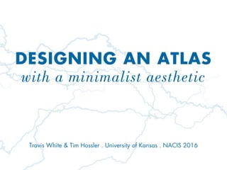
- 1. DESIGNING AN ATLAS with a minimalist aesthetic Travis White & Tim Hossler . University of Kansas . NACIS 2016
- 5. REDUCTIONISM Represent water in the simplest way possible COMPARABILITY Give the reader the means to make direct, intuitive comparisons between rivers REPRODUCIBILITY Establish rules-based styling for all water features
- 7. National Geographic . 2007 . World of Rivers
- 9. DE STIJL MOVEMENT “Harmony and order established through a reduction of elements to pure geometric forms and primary colors.” BAUHAUS SCHOOL “Functionalism through simplified, geometric forms that allows new designs to be reproduced with ease.”
- 10. Mondrian . 1920 . Composition No. II
- 11. Moholy-Nagy . 1922 . K VII
- 12. Vantongerloo . 1936 . No. 98 2478 Red/135 Green
- 14. Lin . 2015 . Silver Upper White River
- 15. Lin . 2015 . Silver Upper White River
- 17. Darton & Gardner . 1823 . Comparative chart of world mountains and rivers
- 18. Andriveau & Goujon . 1834 . Tableau comparatif
- 19. Holmes . 1995 . World’s longest rivers and highest mountains
- 20. Grootens . 2005 . Metropolitan World Atlas
- 22. REDUCTIONISM Show water features (and water features only) COMPARABILITY Use consistent map scale & alignment REPRODUCIBILITY Design must be effective in any media
- 27. REDUCTIONISM Show water features (and water features only) COMPARABILITY Use consistent map scale, coloring, & alignment REPRODUCIBILITY Design must be effective in any media
- 38. REDUCTIONISM Show water features (and water features only) COMPARABILITY Use consistent map scale, coloring, & alignment REPRODUCIBILITY Design must be easily transferable to any media
- 41. THANK YOU! TRAVIS WHITE University of Kansas tmwhite@ku.edu