1. Physical Features of India
The Himalayan Mountains
The Himalayas are the youngest mountains in the world and are; structurally; the
folded mountains. The Himalayas run along the northern border of India. The
Himalayas form an arc which is about 2,400 km long. The width varies from 400 km
in Kashmir to 150 km in Arunachal Pradesh. The altitudinal variations are greater in
the eastern part than in the western part. There are three parallel ranges in its
longitudinal extent.
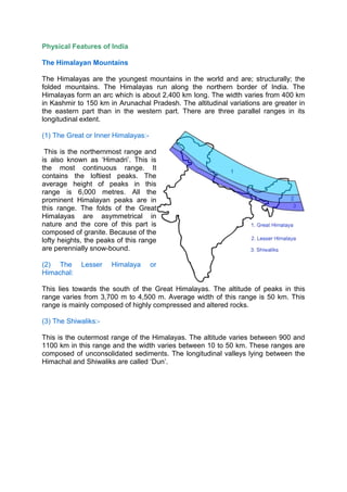
(1) The Great or Inner Himalayas:-
This is the northernmost range and
is also known as ‘Himadri’. This is
the most continuous range. It
contains the loftiest peaks. The
average height of peaks in this
range is 6,000 metres. All the
prominent Himalayan peaks are in
this range. The folds of the Great
Himalayas are asymmetrical in
nature and the core of this part is
composed of granite. Because of the
lofty heights, the peaks of this range
are perennially snow-bound.
(2) The Lesser Himalaya or
Himachal:
This lies towards the south of the Great Himalayas. The altitude of peaks in this
range varies from 3,700 m to 4,500 m. Average width of this range is 50 km. This
range is mainly composed of highly compressed and altered rocks.
(3) The Shiwaliks:-
This is the outermost range of the Himalayas. The altitude varies between 900 and
1100 km in this range and the width varies between 10 to 50 km. These ranges are
composed of unconsolidated sediments. The longitudinal valleys lying between the
Himachal and Shiwaliks are called ‘Dun’.
2. Himalayan Regions from East to West:
a. Punjab Himalayas:- This part lies between the Indus and Sutlej. From west to
east, this is also known as Kashmir Himalaya and Himachal Himalaya;
respectively.
b. Kumaon Himalayas: This part lies between Sutlej and Kali rivers.
c. Nepal Himalayas: This part lies between the Kali and Tista rivers.
d. Assam Himalayas: This part lies between the Tista and Dihang rivers.
Eastern hills and mountains: The Brahmaputra marks the eastern border of the
Himalayas. Beyond the Dihang gorge, the Himalayas bend sharply towards south
and form the Eastern hills or Purvachal. These hills run through the north eastern
states of India. They are mostly composed of sandstones. These hills are composed
of the Patkai Hills, Naga Hills, Manipuri Hills and Mizo Hills.
The Northern Plain
The northern plain of India is formed by three river systems, viz. the Indus, the
Ganga and the Brahmaputra; along with their tributaries. This plain is composed of
alluvial soil which has been deposited over millions of years. The total area of the
northern plain is about 7 lakh square kilometer. It is about 2400 km long and about
240 to 320 km broad.
The northern plain is divided into three
sections, viz. the Punjab Plain, the
Ganga Plain and the Brahmaputra Plain.
a. Punjab Plains: The Punjab plains
form the western part of the
northern plain. This is formed by
the Indus and its tributaries; like
Jhelum, Chenab, Ravi, Beas and
Sutlej. A major portion of this
3. plains is in Pakistan. Doabs abound in this plain.
b. Ganga Plains: This plain extends between Ghaggar and Tista rivers. The
northern states, Haryana, Delhi, UP, Bihar, part of Jharkhand and West
Bengal lie in the Ganga plains.
c. Brahmaputra Plains: This plain forms the eastern part of the northern plain
and lies in Assam.
Based on the relief features; the northern plain can be divided into four regions, viz.
bhabar, terai, bhangar and khadar.
a. Bhabar: After descending from the mountains, the rivers deposit pebbles in a
narrow belt. The width of this belt is about 8 to 16 km and it lies parallel to the
Shiwaliks. This region is known as bhabar. All the streams disappear in this
region.
b. Terai: The terai region lies towards south of the bhabar belt. In this region, the
streams reappear and make a wet, swampy and marshy region.
c. Bhangar: Bhangar is the largest part of the northern plain and is composed of
the oldest alluvial soil. They lie above the flood plains. They resemble
terraces. The soil of this region is locally known as kankar and is composed of
calcareous deposits.
d. Khadar: The floodplains formed by younger alluvium are called khadar. The
soil in this region is renewed every year and is thus highly fertile.