
Recommended
Recommended
More Related Content
What's hot
What's hot (20)
Similar to Baseline study for Hotel construction site
Similar to Baseline study for Hotel construction site (20)
More from Kasun Wijerathna
More from Kasun Wijerathna (15)
Recently uploaded
Recently uploaded (20)
Baseline study for Hotel construction site
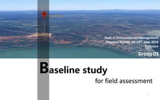
- 1. Baseline study for field assessment Group 03 Tools in Environmental Management Practical Session 14–15th June 2018 Puttalam 1
- 2. H.K.A. Ishara A.A.D.O. Arosha Adhikari E.G.I.Wasana K.N.Opatha S.I.Rajapaksha W.M.K. Kalhara Team members 2
- 3. Results and observations Methodology Study area Background 04. 03. 02. 01. Literature review Conclusion06. 05. Content 3
- 5. Location - Vanathavillu Divisional Secretariat Division Puttalam district North Western province Total extent - 2934768852 square meters (Google EarthPro) Nature of - Construction of a hotel the project 5
- 6. The overall site map (Google EarthPro) 6
- 8. Approximate study area of Group 03 (Google EarthPro) 8
- 9. Physical characteristics of study area • Extent (Approx.) - 13561.668 square kilometer (Google EarthPro) • Length of - 1Km (Google EarthPro) coastal line(Approx.) • Elevation - 20m above mean sea level • Average annual rainfall - <1100 mm • Mean annual temperature - 29.6°C • Average relative humidity - 75 % • Land use patterns - Unclassified forests, coconut cultivations, marshes, grasslands, quarry site, paddy cultivations (A. Kumarasinghe et al , 2006) 9
- 10. Topographic map of study area 10
- 11. Detailed map of study area (https://mapcarta.com) 11
- 13. 1 1 Examination of study area and Identification of important and specific sites inside the study area Google maps Mapcarta computer application 2 4 Abstraction of the maps with identified sites 3 Carryout a available literature survey Analyze the collected literature information with maps 5 Conclusion – site selection for field assessment 13
- 14. Literature review 04Literature review 14
- 15. Ecological importance Socio- economical importance Geological importance Archeological importance Study area Baseline studies based on…….. 15
- 16. Ecological Importance Main Vegetation Types:- The forest vegetation of the area Dry-mixed evergreen forest Scrub forests Sparse and Open forest Coastal forest (SLNHS Exclusive Report, 2017) • But majority of forest cover in study area still unclassifed. •Dominant tree species include Manikara hexandra, Drypetes sepiaria and Chloroxylon sweitenia • Woodlands of Borassus flabellifer are found with associated scrublands 16
- 17. Mangrove vegetation • Fringing mangroves- found along protected coastlines, islands and the exposed waters of bays • They are flooded periodically by tides (Amarasinghe and Balasubramanium, 1992) • Rare mangrove species such as Sychpora hydropyhlaceae and Sianometra iripa have been recorded from this area) 17
- 18. Coastal forest cover + mangrove forests Un-classified forest cover at south part of Aruwakkalu quarry site (https://mapcarta.com) DutchBay Aruwakkalu quarry site 18
- 19. Wetland/ villu ecosystems • The dry zone forests of the quarry site was a haven for birds • Around half of the species recorded were those associated with wetland/ villu ecosystems • Conservation of submerged grasslands known as villu habitats are critical for the protection of these species - (Wetland birds included herons, egrets, cormorants and kingfishers) • The protection of birds is important as it may be a functional link in such mosaic environments (Ekanayake et al. 2005; IUSN-SL and CEA-SL, 2006) 19
- 20. Ecosystems around the Dutch bay • Tidal flats, sea grass beds, sand dunes, coral reefs and maritime grasslands are other coastal ecosystems • Seagrass meadows Dutch bay have been reported to provide habitats for Dugongs (Dugong dugong) 20
- 21. Archaeological importance The Insee quarry site area noted for its archaeological significance, • It supports a fossil belt belonging to the Miocene period (Ma); mostly found invertebrate fossils (fossilized gastropods, corals and vertebrate species ) (Cooray 1984; Deraniyagala, 1955; Goonatilake, 2006) • On the surface are red soils deposited during the Pleistocene15 (three million years BP) 21
- 22. •Pottery fragments and iron slag were found at several sites (Goonatilake, 2006). •Proto-historic and Historic sites- iron slag and ruined monasterial structures •These sites were dispersed in the open scrub and near water bodies (Inside the 1km buffer zone outside the project boundry) •Ex:- large iron extraction site- Alam Villu area 22
- 23. St. Mary’s Church/Sena Kuddirippuwa • This church is situated on the Puttalam-Anuradhapura Road about 2 miles from Puttalam in the village of Sena Kuddirippuwa. • The church complex had been built in 1830 A.D. • The Chapel, the Pastor’s Official Residence, the Belfry and the Image of the Saint could be considered as monuments. 23
- 24. 24 Satellite view for the location of Saint Mary’s church (https://mapcarta.com
- 25. Geological importance The “Villu” wetlands: • “Villu” wetlands are the main geographical feature • Dominatd by series of natural waterholes or ‘Villu’ • Villus are several flood plain lakes, which cover a total area of 12500 ha. • Villu are supposed to be tanks where the ancient bunds still exis. • Ex:-Erana villu, Sinna Naga villu, Magala villu, Periya Naga villu • Periya Naga villu is a man made tank • It fed the paddy fields in Periya Naga Villu area 25
- 26. Erana villu satellite view (https://mapcarta.com) 26
- 27. • There are six common soil groups are recorded in the overall area. These are: 1. Reddish Brown Earths, 2. Low Humic Gley Soils, 3. Red-Yellow Latosols, 4. Regosols, 5. Alluvial Soils and 6. Solodized Solonetz (Panabokke, 1996 Geological map for study area (An Environmental and Fisheries Profile of the Puttalam Lagoon System, 2011) 27 Margin of study area
- 28. • Comprise of two strata of tertiary sandstone and Jaffna limestone (in the upper layer) • Tertiary rocks of the Miocene age14 (26 to seven million years BP) are found along the sea coast (Deraniayagala, 1955) • An estimated 18 million metric tonnes of sedimentary limestone is reported to be deposited at Insee cement quarry factory. 28
- 29. Satellite View of geological variation of the south part of Aruwakkalu quarry site (https://mapcarta.com) Reddish Brown EarthsAlluvial Soils 29
- 30. Socio-economical importance Study area belongs to… • Vanathawillu Divisional Secretariat Division • Grama niladari regions • Settakuliya • Wijayapura west • Majority of human settlements and home garden spread in the middle and south part of the study area • Terrestrial land use include • Coconut cultivation • Paddy cultivation (According to topographical map) • Banana cultivations • home gardens • Shrimp farming (An Environmental and Fisheries Profile of the Puttalam Lagoon System, 2011) 30
- 31. Coconut cultivation in study area (Google street view) 31
- 32. Satellite view of some human settlements in the middle part of the study area (https://mapcarta.com) 32
- 33. • North Western Provincial Environmental Statute The North Western Provincial Environmental Statute (North Western Provincial Council Environmental Statute, No 12 of 1990) has been enacted and the North Western Provincial Council Environmental Authority was established to implement the provisions of the statute. • Fisheries and Aquatic Resources Act no. 2 of 1996 (FARA) basically provides provisions for management, re-organisation, conservation and development of fish and aquatic resources. Law and Ordinance 33
- 34. • Fauna and Flora Protection Ordinance of 1938 and its amendments In Sri Lanka, the conservation of wetlands has been vested mostly with the wildlife. • Ramsar Convention • National Aquaculture Development Authority Act no 53 of 1998. Accordingly its mandate is to develop inland aquatic resources and aquaculture to increase fish production, employment and foreign exchange. 34
- 35. • National Aquaculture Resource Research and Development Act no 54 of 1981 Its mandate is to undertake research and research application on all living and non-living aquatic resources for the development and management of the fisheries and oceanic resource sector. • Coast Conservation Act no. 57 of 1981 Coast Conservation Department (CCD) as the primary government agency responsible for management of Coastal Zone. • Forest Ordinance and its regulations Planning and implementation of mangrove re-planting programs, Issuing permits for timber transport, Controlling encroachments to mangrove reserves. 35
- 36. Results and observation 05Results and Observation 36
- 39. 39 Selected area •Access roads • Scenic beauty of Villus & forest patches • Cultivated lands • Archaeological site
- 40. References • An attempt to reduce impacts of limestone quarries through biodiversity assessment and translocation : A case study at the Holicm Limestone Quarry Site in Puttalam, Sri Lanka http://ajcb.in/journals/full_papers_july_2013/1_AJCB-Vol2-No1- Kumarasinghe%20et%20al.pdf • Environment and Fisheries Profile of the Puttalam Lagoon System http://www.fao.org/3/a-ar443e.pdf • Sri Lanka’s Aruwakkalu fossil deposit dates to the Burdigalian Age http://www.pdn.ac.lk/cjsbs/abstract/40.2/abstract/9.%2040.2.pdf • SLNHS Excursion Report – Eluwankulama, Aruwakkalu, Promparippu & Kala Oya Estuary Sri Lanka http://www.slnhs.lk/docs/Eluvankulam.pdf 40
- 41. References • Mapcarta.com • Google Earth Pro 41
- 42. THANK YOU ! 42