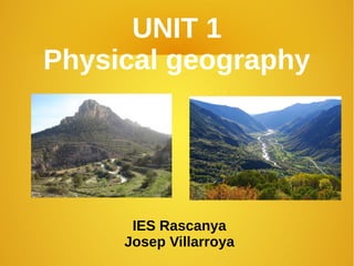
SlideShare a Scribd company logo
1 of 74
Download to read offline
UNIT 1
Physical geography
IES Rascanya
Josep Villarroya
Unit 1 – Physical geography
● Find out about:
● How relief is formed
● Types of relief
● The relief and water of the continents
● The Earth's climates and landscapes
● The physical relief of Iberian peninsula
● Learn how to:
● Use maps to link geographical features to each other.
● Analyse the effects of cyclons.
Unit 1 – Physical geography
1.1- What is
relief?
● The variations in
elevation of the
Earth's surface are
called relief.
● These variations
are found on the
surface of our
continents and on
the ocean bed.
1. Relief formation
Unit 1 – Physical geography
● Many
changes in
relief take
place over
an
extremely
long period
of time.
Unit 1 – Physical geography
1.2- How is relief
formed?
● The theory of plate
tectonics explain
relief formation.
● According to this
theory, the Eart's crust
is made up of plates
which float on the top
layer of the mantle.
● They separate, slide
against against each
other or collide.
● New types of relief are
then formed.
Unit 1 – Physical geography
A- When the plates
separate, rifts (cracks)
are formed in the
ocean's crust. The
magma inside the earth
pushes up through the
cracks. When it cools, it
forms a new crust. This
separation also takes
place on the continents.
The Great Rift Valley is a
huge fracture crossing a
large area of easter
Africa.
Unit 1 – Physical geography
B- A plate on the
ocean's crust
sometimes collides
with the edge of a
continental plate, and
is pushed down into
the Earth's interior.
High temperatures
melt the crust, and
turn it into magma.
The area where the
crust is destroyed is
called a subduction
zone.
Unit 1 – Physical geography
C- Magma
pushes up
through the
continental
crust, creating
volcanoes on
the Earth's
surface. This
was the origin of
the Andes
mountain chain.
Unit 1 – Physical geographyD- Two continental plates
sometimes collide, and
the pressure forms folds
(undulations) in the
Eart's surface. Faults
occur when the crust is
rigid and fractures. In this
case, some blocks sink
while other rise and form
mountains.
Unit 1 – Physical geography
The biggest
changes in the
Earth's crust
take place at
the boundaries
between plates.
They are areas
of intense
seismic and
volcanic activity.
Unit 1 – Physical geography
1.3- Exogenous processes
● In addition to forces beneath the earth's surface, relief
is also formed by exogenous (or external) processes.
– Erosion of rocks, which are worn away, fragmented or
dissolved.
– Transport of the eroded materials.
– Sedimentation, or the deposition of materials in another
place.
Unit 1 – Physical geography
● Erosion of rocks, which are worn away, fragmented or
dissolved.
● The erosion of rocks is caused by the interaction of
external agents over an extended period of time.
● These forces are mainly water, wind and temperature.
Unit 1 – Physical geography
● Rivers carve out deep
valleys and gorges.
Glaciers, or large masses
of ice, also cause erosion
when they move
Unit 1 – Physical geography
● The force of the sea erodes cliffs, changing
the coastline. Sea water transports the
material from the cliffs and deposits it in
other areas, forming new beaches.
Unit 1 – Physical geography
● Sharp changes in temperature can break up rocks.
Water sometimes filters down through the cracks in
hard rocks. If the waterfreezes, it then exerts
pressure on the rocks and may break them into
pieces. The scree on mountains are accumulations
of rock fragments which originated in this way.
Unit 1 – Physical geography
● Limestone and gypsum do not fragment. The
action of water dissolves them and they form
karstic relief. The karst rock formations in
caves and subterranean galleries were formed in
this way.
2- The Earth's relief
2.1- Continental relief
The main forms of continental relief are the following:
- Mountains, which may be isolated or grouped together in
mountain ridges.
- Valleys are areas of low land between mountains.
● Plains are flat
areas of land
near the coast or
in the basins of
large rivers.
● Plateaus are
high raised
plains.
● Depressions are
very low areas
that may even be
below sea level.
Unit 1 – Physical geography
● On the coast
we find other
relief forms:
● Cliffs, which
are steep
rock
formations.
● Beaches,
which are
found in flat
coastal areas.
Unit 1 – Physical geography
● Plains are flat
areas of land
near the coast or
in the basins of
large rivers.
● Plateaus are
high raised
plains.
● Depressions are
very low areas
that may even be
below sea level.
Unit 1 – Physical geography
● Gulfs and
bays (small
gulfs) are
where the sea
extends
inland.
● Capes and
peninsulas
are areas of
land that
extend into
the sea.
Unit 1 – Physical geography
2.2- Oceanic relief
Relief on the ocean floor is as varied as
continental relief.
Unit 1 – Physical geography
- A continental
shelf is a large
plateau that
surrounds a
continent, reaching
a depth of 200 m.
- A continental
slope leads down
from the
continental shelf
into the deeper
part of the ocean..
Unit 1 – Physical geography
● Abyssal plains are
vast plateaus at a
depth of 3,000-
7,000.
● Mid-ocean ridges
are long mountain
ridges that are
found on the
abyssal plains.
Some of the peaks
of underwater
mountains rise
above the ocean's
surface and form
islands..
Unit 1 – Physical geography
- Oceans
trenches are
long, deep
cracks in the
ocean floor.
The deepest
ocean trench
is Challenger
Deep (11,000
m) in the
pacific Ocean.
Unit 1 – Physical geography
2.3- The
influence of relief
on our lives
The nature and
altitude of relief
influences climate,
vegetation and
land use. It affects
both population
and economic
activity.
Unit 1 – Physical geography
● Most of the world's
population lives in flat
areas below an
altitude of 500 metres.
● These areas are
mainly near the coast
and in river valleys.
● The climate is mild,
conditions are
favourable for
agriculture and there
are good
communications.
Unit 1 – Physical geography
● Most of the world's
population lives in flat
areas below an
altitude of 500 metres.
● These areas are
mainly near the coast
and in river valleys.
● The climate is mild,
conditions are
favourable for
agriculture and there
are good
communications.
Unit 1 – Physical geography
● Mountainous
areas are usually
sparsely populated.
● The climate is cold
and wet, there is
little agriculture and
communications are
expensive.
● The economy is
often based on
livestock or mining
and, more recently,
tourism.
Unit 1 – Physical geography
However,
technological
advances have
reduced our
dependence on
the environment.
For example,
modern
communications
reduce the
isolation of
mountain
communities..
Unit 1 – Physical geography
3- The continents
● Africa. The
continent has a high
average elevation of
750 metres because
of its many plateaus.
There are great
deserts, like the
Sahara and Kalahari.
The main mountain
ranges are the Atlas
Mountains and the
Drakensberg
Mountains. The
Great Rift Valley is in
the east. The
coastline is regular.
Unit 1 – Physical geography
●
Asia. Mountain ranges are mainly in the centre. The Himalayan
mountain range contains Mount Everest, the highest peak in the
world. Plateaus include the Plateau of Tibet, the highest in the
world. Vast plains are crossed by long rivers. The main basins
contain inland seas: the Caspian, Aral and Dead Seas. The
coastline is irregular. There are many peninsulas, gulfs, islands
and archipelagos: Japan, the Philippines, Indonesia...
Unit 1 – Physical geography
America. The great
mountain ranges (the
Rocky Mountains,
Sierra Madre and the
Andes) run parallel to
the Pacific Coast. In
the interior, plateaus
include the Matto
Grosso and the
Bolivian Altiplano. The
Great Plains are in
North America. The
coastline of North
America is more
irregular than taht of
Souh America.
Unit 1 – Physical geography
Europe. Great plains occupy the centre and east of the continent.
The oldest mountains are in the north (Scandinavian mountains)
and east (Urals), but they are not high because of erosion. High,
young mountain ranges form an arc around the Mediterranean
Sea: the Pyrenees, Alps, Carpathians, Balkans and Caucasus.
The coastline is irregular. It has many peninsulas and islands like
Iceland and Sicily.
Unit 1 – Physical geography
Oceania. Relief
varies from one
island to another.
Australia has
coastal plains,
low desert in the
interior and the
Great Diving
Range in the
east. New Guinea
and New Zealand
are mountainous.
The Pacific
islands are
mainly low..
Unit 1 – Physical geography
- Antarctica. It has the highest average altitude
(2,000 metres) and is mainly covered by ice.
Unit 1 – Physical geography
4- Water
Water
covers
more than
70% of the
earth's
surface.
Some
water is
found on
the
continents,
but most of
it is in the
oceans
and seas.
4.1- Continental water
Rivers, lakes,groundwater and ice contain fresh water.
They make up about 3% of all the Earth's water
Unit 1 – Physical geography
20%
4- Continental water
Rivers are continuous
flows of water that
originates in rain,
melting ice or
groundwater. They flow
into a sea, a lake or
antoher river. Rivers
are important because
they provide water for
human consumption,
agriculture,
hydorelectric energy
and industry. They are
also important
communication routes.
Unit 1 – Physical geography
4- Continental water
Lakes are enclosed masses of water which accumulate
in depressions. Salt water lakes are called inland seas.
Unit 1 – Physical geography
4- Continental water
Groundwater accumulates when rain and river water inflitrates prous
ground. This water flows downwards until it reaches a layer of
impermeable rock and forms and underground deposti called an
aquifer. Groundwater feeds rivers and lakes, and it is our main
reserve of drinking water.
Unit 1 – Physical geography
4- Continental water
Ice is found at the polar ice caps and in mountain
glaciers. Antarctica holds most of the Earth's fresh water
in the form of ice.
Unit 1 – Physical geography
4.2- Marine water
Oceans and seas hold 97% of the Earth's water. They are
in constant movement: marine currents, tides and waves
Unit 1 – Physical geography
- Marine currents are masses of water which move like
rivers through the oceans. A warm current has a higher
temperature than the surrounding water. A cold current
has a lower temperature. Currents have a considerable
influence on the climate on coastal regions.
Unit 1 – Physical geography
- Tides are the daily rise and fall in the sea level caused
by the gravitational pull of the Moon and Sun. High tide
is when the sea level rises, and low tide is when it falls.
Unit 1 – Physical geography
- Waves are the undulating movements of
water on the surface of the sea. They are
caused by the wind.
Unit 1 – Physical geography
4.3- Water as a scarce resource
Water is a precious resource:
- Most water is not suitable for consumption. Nearly all the Earth's water
is salt water and cannot be used. Most fresh water is found in the form of
ice or deep under the ground.
Unit 1 – Physical geography
- Overexplotation
of the Earth's
water has led the
depletion of
aquifers, and a
sharp reduction in
the size on many
lakes.
Unit 1 – Physical geography
- The distribution of
water on Earth is uneven.
Its availability can vary
between seasons, and
from one year to the next.
Unit 1 – Physical geography
Hydraulic engineering (for example reservoirs,
canals, desalinations plants and wells) helps to
make water available all year round. These
infraestructres have a considerable impacton
landscapes and the environment.
Unit 1 – Physical geography
5- Rivers and lakes of the world
Africa. Among the rivers that
flow into de Mediterranean Sea,
only the Nile River has an
abundant flow. It is the longest
river in the world. The rivers
that flow into de Atlantic Ocean,
like the Niger and Congo, have
an abundant flow. So too do the
rivers that flow into the Indian
Ocean, like the Zambezi River.
There are many lakes in Africa.
The biggest is Lake Victoria.
Unit 1 – Physical geography
Asia. Many rivers are long and
have an abundant flow, which
increases when they are fed by
melting ice and monsoons rains.
Their soruces are in inland
mountains, they flow across
extensive plains and they are
partly navigable. The Artic rivers
freeze in winter. The Yangtse
River is the longest Asian river.
Lake Baikal is the deepest lake
in the world, and the Caspian
sea is the biggest lake.
Unit 1 – Physical geography
America. On
the Atlantic
side, rivers like
Mississipi and
the Amazon
are the longest
and have the
greatest flow.
On the Pacific
side, rivers are
shorter
because their
sources are in
the mountains
near the coast.
The five Great
Lakes are in
Noth America.
Unit 1 – Physical geography
Europe. The flow of
European rivers is determined
by climate. The Atlantic rivers
have the greatest flow
because they receive
abundant rainfall all year. As a
result, they are navigable. In
general, the Mediterranean
rivers have a low, irregular
flow and their water levels
decrease in the summer.
Important European rivers
include the Danube, which
flows into the Black Sea, and
the Volga, which is the
longest on the continent. The
biggest lakes are Ladoga and
Onega in north-west Russia.
Unit 1 – Physical geography
Oceania. The longest rivers are the Murray and its tributary,
the Darling, in Australia.
Unit 1 – Physical geography
6- Climates and landscapes
Equatorial
Tropical wet
Tropical dry
Desert
Mediterranean
Humid subtropical
Oceanic
Continental
Polar
High mountain
HOT CLIMATES
TEMPERATE CLIMATES
COLD CLIMATES
The Sun doesn't warm all the Earth's surface to the same extent.
When the Sun's rays are perpendicular (as in the tropical zone), the
amount of solar energy is considerable. When the Sun's rays fall at an
obliqueangle (as in the polar region), the amount of energy is very low.
Unit 1 – Physical geography
In terms of latitude, there are
five main climates zones:
- A hot zone, between the
tropics. The average annual
temperature is over 20ºC.
- Two temperate zones,
between 30º and 60º latitude
in both hemispheres. Solar
radiation is not as high, and
there is a clear seasonal
difference between summer
and winter.
- Two cold zones, from 60º
to 90º latitude in both
hemisferes. Solar radiation is
weak and temperatures are
low all year round.
Unit 1 – Physical geography
Altitude, relief and proximity to the sea also influence climate.
There are different types of climates within each main climate
zone: hot (equatorial, tropical and desert), warm (Mediterranean,
oceanic and continental) and cold (polar and mountain)
Unit 1 – Physical geography
Climate has a great
influence on humans
societies. Extreme
temperatures and
humity make life
more difficult:
deserts, forests high
mountains and the
polar regions are
sparsely populated.
More than 70% of
the world's
population lives in
temperate zones.
Unit 1 – Physical geography
Equatorial climate.
Location: Near the
Equator, between 10º N
and 10º S.
Temperatures: Average
annual temperatures are
around 25ºC, with little
variation (less than 3ºC).
It is hot all year round.
Precipitacion: Total
annual precipitacion is
higher than 2,000 mm. It
rains every month.
Landscape: Rainforest
(dense green
vegetation)
Unit 1 – Physical geography
Tropical climate.
Location: Between 10º and
30º N and S, at the same
latitude as the desert
climate.
Temperatures: Average
annual temperature is over
20ºC. Variation is between
3ºC and 10ºC, increasing
further from the Equator.
Precipitacion: The annual
total ranges between 2,000
mm (southeast Asia) and
less than 400 mm (near
deserts). Seasons alternate
between dry and wet.
Landscape: Tropical
rainforest and savannah (a
grassy plain with few trees)
Unit 1 – Physical geography
Desert climate.
Location: It shares
latitudes with the
tropical climate.
Temperatures:
Average annual
temperatures are
high, over 20ºC.
There are big
differences between
day and night.
Precipitacion: Scarce,
under 250 mm, and
irregularly distributed.
Landscape: Desert.
Vegetation is only
found at oases.
Unit 1 – Physical geography
Mediterranean climate.
Location: Between latitudes
30º and 40º.
Temperatures: Average
annual temperature
between 10ºC and 18ºC.
Temperature variation are
between 12ºC and 16ºC.
Summers are hot and
winters are mild.
Precipitacion: This ranges
between 900 mm and 300
mm a year. Distribution is
irregular and summers are
very dry.
Landscape: Mediterranean
woodland (holm oak and
cork trees) and scrub.
Unit 1 – Physical geography
Oceanic or Atlantic
climate.
Location: Between 40º
and 50º latitude (and
even up to 60º).
Temperatures: Average
annual temperature
ranges from 10ºC to
15ºC. Variation is low
(from 10ºC to 12ºC).
Winters are mild and
summers are cold.
Precipitacion: Annual
total is around 1,000
mm. It is regular
throughout the year.
Landscape: Deciduous
foprest (oak and beech)
and moorland (scrub
land with dense
vegetation)
Unit 1 – Physical geography
Continental climate.
Location: Inland, in North
America, Europe and
Asia.
Temperatures: Average
annual temperatures are
between 0ºC and 10ºC.
Variation is very high.
Winters are long and
cold, and summers are
short and hot.
Precipitacion: This
ranges between 750 mm
and 300 mm.It is
irregular, with maximum
precipitation in summer.
Landscape: Taiga o
conifer forests (evergreen
species like fir and pine
trees). Prairies and
steppes.
Unit 1 – Physical geography
Polar climate.
Location: near
the poles.
Temperatures:
Average annual
temperatures are
below 0ºC. It is
never higher than
10ºC.
Precipitacion:
This is scarce,
less than 250 mm
annually. It mainly
falls as snow.
Landscape:
Tundra (an area
of mosses and
lichens)
Unit 1 – Physical geography
High mountain
climate.
Location: High
mountainous areas.
Temperatures: These
decrease with altitude
(0.6ºC every 100
metres). Summers
are short and coll.
Winters are long and
very cold.
Precipitacion: This
increases with
altitude, especially on
the side where the
winds blows.
Landscape:
Vegetation varies
according to altitude:
trees, bushes, scrub
and prairie land.
Unit 1 – Physical geography

More Related Content

What's hot

The Geology of South Central Milos, L.Begley.
The Geology of South Central Milos, L.Begley.The Geology of South Central Milos, L.Begley.
The Geology of South Central Milos, L.Begley.
Loman Begley
 
Geographic features of the earth!
Geographic features of the earth!Geographic features of the earth!
Geographic features of the earth!
almusociales
 
Physical features
Physical featuresPhysical features
Physical features
Schneidy33
 
Geography gcse mock and examination preparation booklet
Geography gcse mock and examination preparation bookletGeography gcse mock and examination preparation booklet
Geography gcse mock and examination preparation booklet
Mr Hunt
 

What's hot (20)

Major Relief Features Of the Earth
Major Relief Features Of the EarthMajor Relief Features Of the Earth
Major Relief Features Of the Earth
 
Relief orders
Relief ordersRelief orders
Relief orders
 
Unit 2 relief
Unit 2 reliefUnit 2 relief
Unit 2 relief
 
Landforms Relief
Landforms ReliefLandforms Relief
Landforms Relief
 
The Geology of South Central Milos, L.Begley.
The Geology of South Central Milos, L.Begley.The Geology of South Central Milos, L.Begley.
The Geology of South Central Milos, L.Begley.
 
Earthforms
EarthformsEarthforms
Earthforms
 
Geographic features of the earth!
Geographic features of the earth!Geographic features of the earth!
Geographic features of the earth!
 
Asiatic theory
Asiatic theoryAsiatic theory
Asiatic theory
 
Physical features
Physical featuresPhysical features
Physical features
 
Topography
TopographyTopography
Topography
 
Major landforms of the earth
Major landforms of the earthMajor landforms of the earth
Major landforms of the earth
 
Chapter nine
Chapter nineChapter nine
Chapter nine
 
Major relief features of the world
Major relief features of the worldMajor relief features of the world
Major relief features of the world
 
Engineering geology unit i
Engineering geology unit  iEngineering geology unit  i
Engineering geology unit i
 
Landslide aw
Landslide aw Landslide aw
Landslide aw
 
Architecture Philosophy_ Geological Conditions_Factors affecting architecture
Architecture Philosophy_ Geological Conditions_Factors affecting architectureArchitecture Philosophy_ Geological Conditions_Factors affecting architecture
Architecture Philosophy_ Geological Conditions_Factors affecting architecture
 
Engineering Geology
Engineering Geology Engineering Geology
Engineering Geology
 
What is Topography
What is TopographyWhat is Topography
What is Topography
 
Geography gcse mock and examination preparation booklet
Geography gcse mock and examination preparation bookletGeography gcse mock and examination preparation booklet
Geography gcse mock and examination preparation booklet
 
Landforms..this land is our land (Teach)
Landforms..this land is our land (Teach)Landforms..this land is our land (Teach)
Landforms..this land is our land (Teach)
 

Similar to Unit 1 physical geography

Tectonics: Plate Tectonics
Tectonics: Plate TectonicsTectonics: Plate Tectonics
Tectonics: Plate Tectonics
geomillie
 
30.1 oceania landforms and resources
30.1   oceania landforms and resources30.1   oceania landforms and resources
30.1 oceania landforms and resources
John Hext
 

Similar to Unit 1 physical geography (20)

Theearthsrelief
TheearthsreliefTheearthsrelief
Theearthsrelief
 
Mountains, Plateaus and Plains
Mountains, Plateaus and PlainsMountains, Plateaus and Plains
Mountains, Plateaus and Plains
 
Unit 2 relief
Unit 2 reliefUnit 2 relief
Unit 2 relief
 
Lesson-1-locating-places.pptx
Lesson-1-locating-places.pptxLesson-1-locating-places.pptx
Lesson-1-locating-places.pptx
 
Presentation1
Presentation1Presentation1
Presentation1
 
Geosphere
GeosphereGeosphere
Geosphere
 
Mountains
MountainsMountains
Mountains
 
Unit 2. Geosphere
Unit 2. GeosphereUnit 2. Geosphere
Unit 2. Geosphere
 
04.plate tectonics
04.plate tectonics04.plate tectonics
04.plate tectonics
 
GOEGARPHY.pptx
GOEGARPHY.pptxGOEGARPHY.pptx
GOEGARPHY.pptx
 
Tectonics: Plate tectonics Introduction
Tectonics: Plate tectonics IntroductionTectonics: Plate tectonics Introduction
Tectonics: Plate tectonics Introduction
 
THE DYNAMIC-EARTH AND CONSEQUENCE
THE DYNAMIC-EARTH AND CONSEQUENCETHE DYNAMIC-EARTH AND CONSEQUENCE
THE DYNAMIC-EARTH AND CONSEQUENCE
 
Geography oceanography optional material.pptx
Geography oceanography optional material.pptxGeography oceanography optional material.pptx
Geography oceanography optional material.pptx
 
Geological oceanography 301
Geological oceanography 301Geological oceanography 301
Geological oceanography 301
 
LANDFORMS
LANDFORMSLANDFORMS
LANDFORMS
 
UNIT 2. Geosphere
UNIT 2. GeosphereUNIT 2. Geosphere
UNIT 2. Geosphere
 
UNIT 2. Geosphere
UNIT 2. GeosphereUNIT 2. Geosphere
UNIT 2. Geosphere
 
Tectonics: Plate Tectonics
Tectonics: Plate TectonicsTectonics: Plate Tectonics
Tectonics: Plate Tectonics
 
30.1 oceania landforms and resources
30.1   oceania landforms and resources30.1   oceania landforms and resources
30.1 oceania landforms and resources
 
Geosphere
GeosphereGeosphere
Geosphere
 

Recently uploaded

Transparency, Recognition and the role of eSealing - Ildiko Mazar and Koen No...
Transparency, Recognition and the role of eSealing - Ildiko Mazar and Koen No...Transparency, Recognition and the role of eSealing - Ildiko Mazar and Koen No...
Transparency, Recognition and the role of eSealing - Ildiko Mazar and Koen No...
EADTU
 
QUATER-1-PE-HEALTH-LC2- this is just a sample of unpacked lesson
QUATER-1-PE-HEALTH-LC2- this is just a sample of unpacked lessonQUATER-1-PE-HEALTH-LC2- this is just a sample of unpacked lesson
QUATER-1-PE-HEALTH-LC2- this is just a sample of unpacked lesson
httgc7rh9c
 

Recently uploaded (20)

REMIFENTANIL: An Ultra short acting opioid.pptx
REMIFENTANIL: An Ultra short acting opioid.pptxREMIFENTANIL: An Ultra short acting opioid.pptx
REMIFENTANIL: An Ultra short acting opioid.pptx
 
Interdisciplinary_Insights_Data_Collection_Methods.pptx
Interdisciplinary_Insights_Data_Collection_Methods.pptxInterdisciplinary_Insights_Data_Collection_Methods.pptx
Interdisciplinary_Insights_Data_Collection_Methods.pptx
 
Beyond_Borders_Understanding_Anime_and_Manga_Fandom_A_Comprehensive_Audience_...
Beyond_Borders_Understanding_Anime_and_Manga_Fandom_A_Comprehensive_Audience_...Beyond_Borders_Understanding_Anime_and_Manga_Fandom_A_Comprehensive_Audience_...
Beyond_Borders_Understanding_Anime_and_Manga_Fandom_A_Comprehensive_Audience_...
 
TỔNG ÔN TẬP THI VÀO LỚP 10 MÔN TIẾNG ANH NĂM HỌC 2023 - 2024 CÓ ĐÁP ÁN (NGỮ Â...
TỔNG ÔN TẬP THI VÀO LỚP 10 MÔN TIẾNG ANH NĂM HỌC 2023 - 2024 CÓ ĐÁP ÁN (NGỮ Â...TỔNG ÔN TẬP THI VÀO LỚP 10 MÔN TIẾNG ANH NĂM HỌC 2023 - 2024 CÓ ĐÁP ÁN (NGỮ Â...
TỔNG ÔN TẬP THI VÀO LỚP 10 MÔN TIẾNG ANH NĂM HỌC 2023 - 2024 CÓ ĐÁP ÁN (NGỮ Â...
 
UGC NET Paper 1 Unit 7 DATA INTERPRETATION.pdf
UGC NET Paper 1 Unit 7 DATA INTERPRETATION.pdfUGC NET Paper 1 Unit 7 DATA INTERPRETATION.pdf
UGC NET Paper 1 Unit 7 DATA INTERPRETATION.pdf
 
NO1 Top Black Magic Specialist In Lahore Black magic In Pakistan Kala Ilam Ex...
NO1 Top Black Magic Specialist In Lahore Black magic In Pakistan Kala Ilam Ex...NO1 Top Black Magic Specialist In Lahore Black magic In Pakistan Kala Ilam Ex...
NO1 Top Black Magic Specialist In Lahore Black magic In Pakistan Kala Ilam Ex...
 
Economic Importance Of Fungi In Food Additives
Economic Importance Of Fungi In Food AdditivesEconomic Importance Of Fungi In Food Additives
Economic Importance Of Fungi In Food Additives
 
VAMOS CUIDAR DO NOSSO PLANETA! .
VAMOS CUIDAR DO NOSSO PLANETA!                    .VAMOS CUIDAR DO NOSSO PLANETA!                    .
VAMOS CUIDAR DO NOSSO PLANETA! .
 
Transparency, Recognition and the role of eSealing - Ildiko Mazar and Koen No...
Transparency, Recognition and the role of eSealing - Ildiko Mazar and Koen No...Transparency, Recognition and the role of eSealing - Ildiko Mazar and Koen No...
Transparency, Recognition and the role of eSealing - Ildiko Mazar and Koen No...
 
FICTIONAL SALESMAN/SALESMAN SNSW 2024.pdf
FICTIONAL SALESMAN/SALESMAN SNSW 2024.pdfFICTIONAL SALESMAN/SALESMAN SNSW 2024.pdf
FICTIONAL SALESMAN/SALESMAN SNSW 2024.pdf
 
HMCS Vancouver Pre-Deployment Brief - May 2024 (Web Version).pptx
HMCS Vancouver Pre-Deployment Brief - May 2024 (Web Version).pptxHMCS Vancouver Pre-Deployment Brief - May 2024 (Web Version).pptx
HMCS Vancouver Pre-Deployment Brief - May 2024 (Web Version).pptx
 
Python Notes for mca i year students osmania university.docx
Python Notes for mca i year students osmania university.docxPython Notes for mca i year students osmania university.docx
Python Notes for mca i year students osmania university.docx
 
How to Manage Call for Tendor in Odoo 17
How to Manage Call for Tendor in Odoo 17How to Manage Call for Tendor in Odoo 17
How to Manage Call for Tendor in Odoo 17
 
Exploring_the_Narrative_Style_of_Amitav_Ghoshs_Gun_Island.pptx
Exploring_the_Narrative_Style_of_Amitav_Ghoshs_Gun_Island.pptxExploring_the_Narrative_Style_of_Amitav_Ghoshs_Gun_Island.pptx
Exploring_the_Narrative_Style_of_Amitav_Ghoshs_Gun_Island.pptx
 
How to setup Pycharm environment for Odoo 17.pptx
How to setup Pycharm environment for Odoo 17.pptxHow to setup Pycharm environment for Odoo 17.pptx
How to setup Pycharm environment for Odoo 17.pptx
 
Sensory_Experience_and_Emotional_Resonance_in_Gabriel_Okaras_The_Piano_and_Th...
Sensory_Experience_and_Emotional_Resonance_in_Gabriel_Okaras_The_Piano_and_Th...Sensory_Experience_and_Emotional_Resonance_in_Gabriel_Okaras_The_Piano_and_Th...
Sensory_Experience_and_Emotional_Resonance_in_Gabriel_Okaras_The_Piano_and_Th...
 
80 ĐỀ THI THỬ TUYỂN SINH TIẾNG ANH VÀO 10 SỞ GD – ĐT THÀNH PHỐ HỒ CHÍ MINH NĂ...
80 ĐỀ THI THỬ TUYỂN SINH TIẾNG ANH VÀO 10 SỞ GD – ĐT THÀNH PHỐ HỒ CHÍ MINH NĂ...80 ĐỀ THI THỬ TUYỂN SINH TIẾNG ANH VÀO 10 SỞ GD – ĐT THÀNH PHỐ HỒ CHÍ MINH NĂ...
80 ĐỀ THI THỬ TUYỂN SINH TIẾNG ANH VÀO 10 SỞ GD – ĐT THÀNH PHỐ HỒ CHÍ MINH NĂ...
 
Towards a code of practice for AI in AT.pptx
Towards a code of practice for AI in AT.pptxTowards a code of practice for AI in AT.pptx
Towards a code of practice for AI in AT.pptx
 
Jamworks pilot and AI at Jisc (20/03/2024)
Jamworks pilot and AI at Jisc (20/03/2024)Jamworks pilot and AI at Jisc (20/03/2024)
Jamworks pilot and AI at Jisc (20/03/2024)
 
QUATER-1-PE-HEALTH-LC2- this is just a sample of unpacked lesson
QUATER-1-PE-HEALTH-LC2- this is just a sample of unpacked lessonQUATER-1-PE-HEALTH-LC2- this is just a sample of unpacked lesson
QUATER-1-PE-HEALTH-LC2- this is just a sample of unpacked lesson
 

Unit 1 physical geography

  • 1. UNIT 1 Physical geography IES Rascanya Josep Villarroya
  • 2. Unit 1 – Physical geography ● Find out about: ● How relief is formed ● Types of relief ● The relief and water of the continents ● The Earth's climates and landscapes ● The physical relief of Iberian peninsula ● Learn how to: ● Use maps to link geographical features to each other. ● Analyse the effects of cyclons.
  • 3. Unit 1 – Physical geography 1.1- What is relief? ● The variations in elevation of the Earth's surface are called relief. ● These variations are found on the surface of our continents and on the ocean bed. 1. Relief formation
  • 4. Unit 1 – Physical geography ● Many changes in relief take place over an extremely long period of time.
  • 5. Unit 1 – Physical geography 1.2- How is relief formed? ● The theory of plate tectonics explain relief formation. ● According to this theory, the Eart's crust is made up of plates which float on the top layer of the mantle. ● They separate, slide against against each other or collide. ● New types of relief are then formed.
  • 6.
  • 7. Unit 1 – Physical geography A- When the plates separate, rifts (cracks) are formed in the ocean's crust. The magma inside the earth pushes up through the cracks. When it cools, it forms a new crust. This separation also takes place on the continents. The Great Rift Valley is a huge fracture crossing a large area of easter Africa.
  • 8. Unit 1 – Physical geography B- A plate on the ocean's crust sometimes collides with the edge of a continental plate, and is pushed down into the Earth's interior. High temperatures melt the crust, and turn it into magma. The area where the crust is destroyed is called a subduction zone.
  • 9. Unit 1 – Physical geography C- Magma pushes up through the continental crust, creating volcanoes on the Earth's surface. This was the origin of the Andes mountain chain.
  • 10. Unit 1 – Physical geographyD- Two continental plates sometimes collide, and the pressure forms folds (undulations) in the Eart's surface. Faults occur when the crust is rigid and fractures. In this case, some blocks sink while other rise and form mountains.
  • 11. Unit 1 – Physical geography The biggest changes in the Earth's crust take place at the boundaries between plates. They are areas of intense seismic and volcanic activity.
  • 12. Unit 1 – Physical geography 1.3- Exogenous processes ● In addition to forces beneath the earth's surface, relief is also formed by exogenous (or external) processes. – Erosion of rocks, which are worn away, fragmented or dissolved. – Transport of the eroded materials. – Sedimentation, or the deposition of materials in another place.
  • 13. Unit 1 – Physical geography ● Erosion of rocks, which are worn away, fragmented or dissolved. ● The erosion of rocks is caused by the interaction of external agents over an extended period of time. ● These forces are mainly water, wind and temperature.
  • 14. Unit 1 – Physical geography ● Rivers carve out deep valleys and gorges. Glaciers, or large masses of ice, also cause erosion when they move
  • 15. Unit 1 – Physical geography ● The force of the sea erodes cliffs, changing the coastline. Sea water transports the material from the cliffs and deposits it in other areas, forming new beaches.
  • 16. Unit 1 – Physical geography ● Sharp changes in temperature can break up rocks. Water sometimes filters down through the cracks in hard rocks. If the waterfreezes, it then exerts pressure on the rocks and may break them into pieces. The scree on mountains are accumulations of rock fragments which originated in this way.
  • 17. Unit 1 – Physical geography ● Limestone and gypsum do not fragment. The action of water dissolves them and they form karstic relief. The karst rock formations in caves and subterranean galleries were formed in this way.
  • 18. 2- The Earth's relief 2.1- Continental relief The main forms of continental relief are the following: - Mountains, which may be isolated or grouped together in mountain ridges. - Valleys are areas of low land between mountains.
  • 19. ● Plains are flat areas of land near the coast or in the basins of large rivers. ● Plateaus are high raised plains. ● Depressions are very low areas that may even be below sea level. Unit 1 – Physical geography
  • 20. ● On the coast we find other relief forms: ● Cliffs, which are steep rock formations. ● Beaches, which are found in flat coastal areas. Unit 1 – Physical geography
  • 21. ● Plains are flat areas of land near the coast or in the basins of large rivers. ● Plateaus are high raised plains. ● Depressions are very low areas that may even be below sea level. Unit 1 – Physical geography
  • 22. ● Gulfs and bays (small gulfs) are where the sea extends inland. ● Capes and peninsulas are areas of land that extend into the sea. Unit 1 – Physical geography
  • 23. 2.2- Oceanic relief Relief on the ocean floor is as varied as continental relief. Unit 1 – Physical geography
  • 24. - A continental shelf is a large plateau that surrounds a continent, reaching a depth of 200 m. - A continental slope leads down from the continental shelf into the deeper part of the ocean.. Unit 1 – Physical geography
  • 25. ● Abyssal plains are vast plateaus at a depth of 3,000- 7,000. ● Mid-ocean ridges are long mountain ridges that are found on the abyssal plains. Some of the peaks of underwater mountains rise above the ocean's surface and form islands.. Unit 1 – Physical geography
  • 26. - Oceans trenches are long, deep cracks in the ocean floor. The deepest ocean trench is Challenger Deep (11,000 m) in the pacific Ocean. Unit 1 – Physical geography
  • 27. 2.3- The influence of relief on our lives The nature and altitude of relief influences climate, vegetation and land use. It affects both population and economic activity. Unit 1 – Physical geography
  • 28. ● Most of the world's population lives in flat areas below an altitude of 500 metres. ● These areas are mainly near the coast and in river valleys. ● The climate is mild, conditions are favourable for agriculture and there are good communications. Unit 1 – Physical geography
  • 29. ● Most of the world's population lives in flat areas below an altitude of 500 metres. ● These areas are mainly near the coast and in river valleys. ● The climate is mild, conditions are favourable for agriculture and there are good communications. Unit 1 – Physical geography
  • 30. ● Mountainous areas are usually sparsely populated. ● The climate is cold and wet, there is little agriculture and communications are expensive. ● The economy is often based on livestock or mining and, more recently, tourism. Unit 1 – Physical geography
  • 31. However, technological advances have reduced our dependence on the environment. For example, modern communications reduce the isolation of mountain communities.. Unit 1 – Physical geography
  • 33. ● Africa. The continent has a high average elevation of 750 metres because of its many plateaus. There are great deserts, like the Sahara and Kalahari. The main mountain ranges are the Atlas Mountains and the Drakensberg Mountains. The Great Rift Valley is in the east. The coastline is regular. Unit 1 – Physical geography
  • 34. ● Asia. Mountain ranges are mainly in the centre. The Himalayan mountain range contains Mount Everest, the highest peak in the world. Plateaus include the Plateau of Tibet, the highest in the world. Vast plains are crossed by long rivers. The main basins contain inland seas: the Caspian, Aral and Dead Seas. The coastline is irregular. There are many peninsulas, gulfs, islands and archipelagos: Japan, the Philippines, Indonesia... Unit 1 – Physical geography
  • 35. America. The great mountain ranges (the Rocky Mountains, Sierra Madre and the Andes) run parallel to the Pacific Coast. In the interior, plateaus include the Matto Grosso and the Bolivian Altiplano. The Great Plains are in North America. The coastline of North America is more irregular than taht of Souh America. Unit 1 – Physical geography
  • 36. Europe. Great plains occupy the centre and east of the continent. The oldest mountains are in the north (Scandinavian mountains) and east (Urals), but they are not high because of erosion. High, young mountain ranges form an arc around the Mediterranean Sea: the Pyrenees, Alps, Carpathians, Balkans and Caucasus. The coastline is irregular. It has many peninsulas and islands like Iceland and Sicily. Unit 1 – Physical geography
  • 37. Oceania. Relief varies from one island to another. Australia has coastal plains, low desert in the interior and the Great Diving Range in the east. New Guinea and New Zealand are mountainous. The Pacific islands are mainly low.. Unit 1 – Physical geography
  • 38. - Antarctica. It has the highest average altitude (2,000 metres) and is mainly covered by ice. Unit 1 – Physical geography
  • 39. 4- Water Water covers more than 70% of the earth's surface. Some water is found on the continents, but most of it is in the oceans and seas.
  • 40. 4.1- Continental water Rivers, lakes,groundwater and ice contain fresh water. They make up about 3% of all the Earth's water Unit 1 – Physical geography 20%
  • 41. 4- Continental water Rivers are continuous flows of water that originates in rain, melting ice or groundwater. They flow into a sea, a lake or antoher river. Rivers are important because they provide water for human consumption, agriculture, hydorelectric energy and industry. They are also important communication routes. Unit 1 – Physical geography
  • 42. 4- Continental water Lakes are enclosed masses of water which accumulate in depressions. Salt water lakes are called inland seas. Unit 1 – Physical geography
  • 43. 4- Continental water Groundwater accumulates when rain and river water inflitrates prous ground. This water flows downwards until it reaches a layer of impermeable rock and forms and underground deposti called an aquifer. Groundwater feeds rivers and lakes, and it is our main reserve of drinking water. Unit 1 – Physical geography
  • 44. 4- Continental water Ice is found at the polar ice caps and in mountain glaciers. Antarctica holds most of the Earth's fresh water in the form of ice. Unit 1 – Physical geography
  • 45. 4.2- Marine water Oceans and seas hold 97% of the Earth's water. They are in constant movement: marine currents, tides and waves Unit 1 – Physical geography
  • 46. - Marine currents are masses of water which move like rivers through the oceans. A warm current has a higher temperature than the surrounding water. A cold current has a lower temperature. Currents have a considerable influence on the climate on coastal regions. Unit 1 – Physical geography
  • 47. - Tides are the daily rise and fall in the sea level caused by the gravitational pull of the Moon and Sun. High tide is when the sea level rises, and low tide is when it falls. Unit 1 – Physical geography
  • 48. - Waves are the undulating movements of water on the surface of the sea. They are caused by the wind. Unit 1 – Physical geography
  • 49. 4.3- Water as a scarce resource Water is a precious resource: - Most water is not suitable for consumption. Nearly all the Earth's water is salt water and cannot be used. Most fresh water is found in the form of ice or deep under the ground. Unit 1 – Physical geography
  • 50. - Overexplotation of the Earth's water has led the depletion of aquifers, and a sharp reduction in the size on many lakes. Unit 1 – Physical geography
  • 51. - The distribution of water on Earth is uneven. Its availability can vary between seasons, and from one year to the next. Unit 1 – Physical geography
  • 52. Hydraulic engineering (for example reservoirs, canals, desalinations plants and wells) helps to make water available all year round. These infraestructres have a considerable impacton landscapes and the environment. Unit 1 – Physical geography
  • 53. 5- Rivers and lakes of the world
  • 54. Africa. Among the rivers that flow into de Mediterranean Sea, only the Nile River has an abundant flow. It is the longest river in the world. The rivers that flow into de Atlantic Ocean, like the Niger and Congo, have an abundant flow. So too do the rivers that flow into the Indian Ocean, like the Zambezi River. There are many lakes in Africa. The biggest is Lake Victoria. Unit 1 – Physical geography
  • 55. Asia. Many rivers are long and have an abundant flow, which increases when they are fed by melting ice and monsoons rains. Their soruces are in inland mountains, they flow across extensive plains and they are partly navigable. The Artic rivers freeze in winter. The Yangtse River is the longest Asian river. Lake Baikal is the deepest lake in the world, and the Caspian sea is the biggest lake. Unit 1 – Physical geography
  • 56. America. On the Atlantic side, rivers like Mississipi and the Amazon are the longest and have the greatest flow. On the Pacific side, rivers are shorter because their sources are in the mountains near the coast. The five Great Lakes are in Noth America. Unit 1 – Physical geography
  • 57. Europe. The flow of European rivers is determined by climate. The Atlantic rivers have the greatest flow because they receive abundant rainfall all year. As a result, they are navigable. In general, the Mediterranean rivers have a low, irregular flow and their water levels decrease in the summer. Important European rivers include the Danube, which flows into the Black Sea, and the Volga, which is the longest on the continent. The biggest lakes are Ladoga and Onega in north-west Russia. Unit 1 – Physical geography
  • 58. Oceania. The longest rivers are the Murray and its tributary, the Darling, in Australia. Unit 1 – Physical geography
  • 59. 6- Climates and landscapes Equatorial Tropical wet Tropical dry Desert Mediterranean Humid subtropical Oceanic Continental Polar High mountain HOT CLIMATES TEMPERATE CLIMATES COLD CLIMATES
  • 60. The Sun doesn't warm all the Earth's surface to the same extent. When the Sun's rays are perpendicular (as in the tropical zone), the amount of solar energy is considerable. When the Sun's rays fall at an obliqueangle (as in the polar region), the amount of energy is very low. Unit 1 – Physical geography
  • 61. In terms of latitude, there are five main climates zones: - A hot zone, between the tropics. The average annual temperature is over 20ºC. - Two temperate zones, between 30º and 60º latitude in both hemispheres. Solar radiation is not as high, and there is a clear seasonal difference between summer and winter. - Two cold zones, from 60º to 90º latitude in both hemisferes. Solar radiation is weak and temperatures are low all year round. Unit 1 – Physical geography
  • 62. Altitude, relief and proximity to the sea also influence climate. There are different types of climates within each main climate zone: hot (equatorial, tropical and desert), warm (Mediterranean, oceanic and continental) and cold (polar and mountain) Unit 1 – Physical geography
  • 63. Unit 1 – Physical geography
  • 64. Unit 1 – Physical geography
  • 65. Unit 1 – Physical geography
  • 66. Climate has a great influence on humans societies. Extreme temperatures and humity make life more difficult: deserts, forests high mountains and the polar regions are sparsely populated. More than 70% of the world's population lives in temperate zones. Unit 1 – Physical geography
  • 67. Equatorial climate. Location: Near the Equator, between 10º N and 10º S. Temperatures: Average annual temperatures are around 25ºC, with little variation (less than 3ºC). It is hot all year round. Precipitacion: Total annual precipitacion is higher than 2,000 mm. It rains every month. Landscape: Rainforest (dense green vegetation) Unit 1 – Physical geography
  • 68. Tropical climate. Location: Between 10º and 30º N and S, at the same latitude as the desert climate. Temperatures: Average annual temperature is over 20ºC. Variation is between 3ºC and 10ºC, increasing further from the Equator. Precipitacion: The annual total ranges between 2,000 mm (southeast Asia) and less than 400 mm (near deserts). Seasons alternate between dry and wet. Landscape: Tropical rainforest and savannah (a grassy plain with few trees) Unit 1 – Physical geography
  • 69. Desert climate. Location: It shares latitudes with the tropical climate. Temperatures: Average annual temperatures are high, over 20ºC. There are big differences between day and night. Precipitacion: Scarce, under 250 mm, and irregularly distributed. Landscape: Desert. Vegetation is only found at oases. Unit 1 – Physical geography
  • 70. Mediterranean climate. Location: Between latitudes 30º and 40º. Temperatures: Average annual temperature between 10ºC and 18ºC. Temperature variation are between 12ºC and 16ºC. Summers are hot and winters are mild. Precipitacion: This ranges between 900 mm and 300 mm a year. Distribution is irregular and summers are very dry. Landscape: Mediterranean woodland (holm oak and cork trees) and scrub. Unit 1 – Physical geography
  • 71. Oceanic or Atlantic climate. Location: Between 40º and 50º latitude (and even up to 60º). Temperatures: Average annual temperature ranges from 10ºC to 15ºC. Variation is low (from 10ºC to 12ºC). Winters are mild and summers are cold. Precipitacion: Annual total is around 1,000 mm. It is regular throughout the year. Landscape: Deciduous foprest (oak and beech) and moorland (scrub land with dense vegetation) Unit 1 – Physical geography
  • 72. Continental climate. Location: Inland, in North America, Europe and Asia. Temperatures: Average annual temperatures are between 0ºC and 10ºC. Variation is very high. Winters are long and cold, and summers are short and hot. Precipitacion: This ranges between 750 mm and 300 mm.It is irregular, with maximum precipitation in summer. Landscape: Taiga o conifer forests (evergreen species like fir and pine trees). Prairies and steppes. Unit 1 – Physical geography
  • 73. Polar climate. Location: near the poles. Temperatures: Average annual temperatures are below 0ºC. It is never higher than 10ºC. Precipitacion: This is scarce, less than 250 mm annually. It mainly falls as snow. Landscape: Tundra (an area of mosses and lichens) Unit 1 – Physical geography
  • 74. High mountain climate. Location: High mountainous areas. Temperatures: These decrease with altitude (0.6ºC every 100 metres). Summers are short and coll. Winters are long and very cold. Precipitacion: This increases with altitude, especially on the side where the winds blows. Landscape: Vegetation varies according to altitude: trees, bushes, scrub and prairie land. Unit 1 – Physical geography