SlideShare a Scribd company logo
1 of 201
Download to read offline
Urban Planning and Design for Cities: Skylines
alborzka
August 16, 2017
Abstract
This document aims to serve as a comprehensive. simple guide for Cities: Skylines (C:S)
players who want to incorporate elements of professional, real-world urban planning and city
design into their cities. All information here is taken from online academic courses on urban
planning, using the latest trends and knowledge. City planning is much more complicated than
can be experienced in C:S, and urban planning can’t be summed up in a few pages. It involves
several disciplines and experts specialised in particular areas, and real cities aren’t designed by
one “Jack of all trades”. Thus, this document seeks to enable readers to learn as many aspects of
city design as can be possibly implemented in-game. Aspects such as economic policy and other
areas not touched upon in C:S are similarly not touched upon in this guide.
Contents
1 City Design History 12
1.1 Pre-Industrial Revolution . . . . . . . . . . . . . . . . . . . . . . . . . . . . . . . . 12
1.1.1 The Wall . . . . . . . . . . . . . . . . . . . . . . . . . . . . . . . . . . . . 12
1.1.2 The Grid . . . . . . . . . . . . . . . . . . . . . . . . . . . . . . . . . . . . 12
1.1.3 The Axis . . . . . . . . . . . . . . . . . . . . . . . . . . . . . . . . . . . . 12
1.1.4 The City Square . . . . . . . . . . . . . . . . . . . . . . . . . . . . . . . . 12
1.1.5 The Cloister . . . . . . . . . . . . . . . . . . . . . . . . . . . . . . . . . . 13
1.2 Cities in the Industrial Revolution . . . . . . . . . . . . . . . . . . . . . . . . . . . 13
1.3 Cities in the 1950s . . . . . . . . . . . . . . . . . . . . . . . . . . . . . . . . . . . 13
1.4 Today’s Regional City . . . . . . . . . . . . . . . . . . . . . . . . . . . . . . . . . 13
2 Different Design Schools 14
2.1 Modernist City Design . . . . . . . . . . . . . . . . . . . . . . . . . . . . . . . . . 14
2.2 Traditional City Design . . . . . . . . . . . . . . . . . . . . . . . . . . . . . . . . . 15
2.3 Green City Design . . . . . . . . . . . . . . . . . . . . . . . . . . . . . . . . . . . 15
2.4 Systems City Design . . . . . . . . . . . . . . . . . . . . . . . . . . . . . . . . . . 16
1
3 Environmental Considerations 16
3.1 Ecological Urbanism . . . . . . . . . . . . . . . . . . . . . . . . . . . . . . . . . . 16
3.2 Managing Water: Flooding and Scarcity . . . . . . . . . . . . . . . . . . . . . . . . 17
3.3 Managing Energy Consumption . . . . . . . . . . . . . . . . . . . . . . . . . . . . 17
3.4 Green Infrastructure and Urban Agriculture . . . . . . . . . . . . . . . . . . . . . . 18
4 Preserving Older Cities and Districts 19
4.1 Importance of Historic Preservation . . . . . . . . . . . . . . . . . . . . . . . . . . 19
4.2 Adaptive Re-Use of Old Buildings . . . . . . . . . . . . . . . . . . . . . . . . . . . 19
4.3 Preserving the Industrial Heritage . . . . . . . . . . . . . . . . . . . . . . . . . . . 20
5 Integrating and Improving Slums 20
5.1 Background on Informal Settlements . . . . . . . . . . . . . . . . . . . . . . . . . 20
5.2 Rapid Urbanisation and Slums . . . . . . . . . . . . . . . . . . . . . . . . . . . . . 21
5.3 Retrofitting Infrastructure and Services . . . . . . . . . . . . . . . . . . . . . . . . 21
5.4 Combating Poverty and Urban Deterioration in the Ghetto . . . . . . . . . . . . . . 22
6 Community, Neighbourhoods, and Human Interaction 23
6.1 Transformation of Urban Lifestyles . . . . . . . . . . . . . . . . . . . . . . . . . . 23
6.2 Residential Mobility and Housing Choices . . . . . . . . . . . . . . . . . . . . . . 23
6.3 Spatial Patterns that Promote Personal Communication . . . . . . . . . . . . . . . . 25
6.4 Mixing Home, Work, Culture and Recreation . . . . . . . . . . . . . . . . . . . . . 26
6.5 Walkable Neighbourhoods . . . . . . . . . . . . . . . . . . . . . . . . . . . . . . . 26
7 Designing New Cities, Districts and Neighbourhoods 26
7.1 Urban Form of New Places . . . . . . . . . . . . . . . . . . . . . . . . . . . . . . . 26
7.2 The Public Realm . . . . . . . . . . . . . . . . . . . . . . . . . . . . . . . . . . . . 27
8 Airport–City Connection 27
8.1 Airfront Model . . . . . . . . . . . . . . . . . . . . . . . . . . . . . . . . . . . . . 28
8.2 Decoplex Model . . . . . . . . . . . . . . . . . . . . . . . . . . . . . . . . . . . . 28
8.3 Airport City Model . . . . . . . . . . . . . . . . . . . . . . . . . . . . . . . . . . . 29
8.4 Airport Corridor Model . . . . . . . . . . . . . . . . . . . . . . . . . . . . . . . . 29
8.5 AIREA Model . . . . . . . . . . . . . . . . . . . . . . . . . . . . . . . . . . . . . 30
8.6 Aerotropolis Model . . . . . . . . . . . . . . . . . . . . . . . . . . . . . . . . . . . 30
9 Public Transit 30
9.1 Catch-Bin Area . . . . . . . . . . . . . . . . . . . . . . . . . . . . . . . . . . . . . 31
9.2 Understanding Modal Practices . . . . . . . . . . . . . . . . . . . . . . . . . . . . 31
9.3 The Barbeque Effect . . . . . . . . . . . . . . . . . . . . . . . . . . . . . . . . . . 33
9.4 Seductive Engineering . . . . . . . . . . . . . . . . . . . . . . . . . . . . . . . . . 34
9.5 Territories, Networks, and Forms of Urbanisation: A Note on Trams . . . . . . . . . 34
9.6 Transit Adherence . . . . . . . . . . . . . . . . . . . . . . . . . . . . . . . . . . . 34
9.7 Public Space Fragmentation: Resident Needs Vs. Visitor Wants . . . . . . . . . . . . 35
2
10 Building Design Principles 35
10.1 Frame the Public Realm . . . . . . . . . . . . . . . . . . . . . . . . . . . . . . . . 36
10.2 Ground Floor-to-Street Relationship . . . . . . . . . . . . . . . . . . . . . . . . . 36
10.3 Sense of Entry . . . . . . . . . . . . . . . . . . . . . . . . . . . . . . . . . . . . . 36
10.4 Integrate Urban Open Space . . . . . . . . . . . . . . . . . . . . . . . . . . . . . . 37
10.5 Light, View, Skyline, and Privacy . . . . . . . . . . . . . . . . . . . . . . . . . . . . 37
10.6 Prominent Sites . . . . . . . . . . . . . . . . . . . . . . . . . . . . . . . . . . . . . 39
10.7 Scale Transition . . . . . . . . . . . . . . . . . . . . . . . . . . . . . . . . . . . . . 40
10.8 Façade Treatment . . . . . . . . . . . . . . . . . . . . . . . . . . . . . . . . . . . . 40
10.9 Building Projections . . . . . . . . . . . . . . . . . . . . . . . . . . . . . . . . . . 41
10.10 Vehicular and Pedestrian Circulation . . . . . . . . . . . . . . . . . . . . . . . . . . 41
10.10.1 Pedestrian Connections . . . . . . . . . . . . . . . . . . . . . . . . . . . . 42
10.10.2 Service and Loading Areas . . . . . . . . . . . . . . . . . . . . . . . . . . 42
10.10.3 Parking . . . . . . . . . . . . . . . . . . . . . . . . . . . . . . . . . . . . 42
A Transit-Oriented Communities Design Guidelines 43
A.1 Common Terms and Definitions . . . . . . . . . . . . . . . . . . . . . . . . . . . . 43
A.2 Destinations: Coordinate Land Use and Transportation . . . . . . . . . . . . . . . . 43
A.2.1 Ensure that major destinations are lined up along a reasonably direct corridor
so they can be served by frequent transit . . . . . . . . . . . . . . . . . . . 43
A.2.2 Encourage the highest intensity of development in Urban Centres and at fre-
quent transit nodes . . . . . . . . . . . . . . . . . . . . . . . . . . . . . . 44
A.2.3 Focus additional growth toward existing and planned frequent transit corridors 44
A.3 Distance: Create a Well-Connected Street Network . . . . . . . . . . . . . . . . . . 44
A.3.1 Provide fine-grained street networks . . . . . . . . . . . . . . . . . . . . . 44
A.3.2 Make walking and cycling access to frequent transit as direct as possible . . . 44
A.3.3 Plan for coordinated, multi-modal transportation networks . . . . . . . . . 45
A.3.4 Locate frequent transit passenger facilities at accessible places on the street
network . . . . . . . . . . . . . . . . . . . . . . . . . . . . . . . . . . . . 45
A.4 Design: Create Places for People . . . . . . . . . . . . . . . . . . . . . . . . . . . . 45
A.4.1 Design multi-modal streets . . . . . . . . . . . . . . . . . . . . . . . . . . 45
A.4.2 Design great public spaces . . . . . . . . . . . . . . . . . . . . . . . . . . . 46
A.4.3 Seamlessly integrate development with frequent transit and the public realm 46
A.4.4 Design parking to support a pedestrian-oriented urban realm . . . . . . . . 46
A.5 Density: Concentrate and Intensify Activities near Frequent Transit . . . . . . . . . 46
A.5.1 Focus density in Urban Centres and around frequent transit corridors and
nodes to support a strong demand for transit service . . . . . . . . . . . . . 46
A.5.2 Plan for density that supports community character and promotes quality of life 46
A.6 Diversity: Encourage a Mix of Uses . . . . . . . . . . . . . . . . . . . . . . . . . . 47
A.6.1 Provide a mix of uses along frequent transit corridors to reduce peak crowding
and spread travel demand throughout the day . . . . . . . . . . . . . . . . . 47
A.6.2 Encourage a mix of land uses immediately adjacent to frequent transit facilities 47
A.6.3 Encourage a mix of uses around transit nodes to create complete neighbourhoods 48
3
A.6.4 Provide an active street life with a mix of community services and fine-grained
retail spaces . . . . . . . . . . . . . . . . . . . . . . . . . . . . . . . . . . 48
A.6.5 Provide a mix of housing types near frequent transit passenger facilities to
create inclusive communities and promote equitable access to transportation 48
A.7 Checklists and How The 5 D’s Relate to Transportation Outcomes . . . . . . . . . . 49
A.7.1 Corridor and Regional Level Checklist . . . . . . . . . . . . . . . . . . . . 50
A.7.2 Neighbourhood Level Checklist . . . . . . . . . . . . . . . . . . . . . . . 51
A.7.3 Site Level Checklist . . . . . . . . . . . . . . . . . . . . . . . . . . . . . . 52
A.7.4 How The 5 D’s Relate to Transportation Outcomes . . . . . . . . . . . . . . 53
B Complete Street Guidelines 57
B.1 Street Types . . . . . . . . . . . . . . . . . . . . . . . . . . . . . . . . . . . . . . 57
B.1.1 Civic Street . . . . . . . . . . . . . . . . . . . . . . . . . . . . . . . . . . 58
B.1.2 Downtown &Centres Main Street . . . . . . . . . . . . . . . . . . . . . . 60
B.1.3 Avenue &Neighbourhood Main Street . . . . . . . . . . . . . . . . . . . . 62
B.1.4 Downtown &Centres Residential Street . . . . . . . . . . . . . . . . . . . 64
B.1.5 Apartment Neighbourhood Residential Street . . . . . . . . . . . . . . . . 66
B.1.6 Neighbourhood Residential Street . . . . . . . . . . . . . . . . . . . . . . 68
B.1.7 Mixed Use Connector Street . . . . . . . . . . . . . . . . . . . . . . . . . 72
B.1.8 Residential Connector Street . . . . . . . . . . . . . . . . . . . . . . . . . 74
B.1.9 Scenic Street . . . . . . . . . . . . . . . . . . . . . . . . . . . . . . . . . . 76
B.1.10 Park Street . . . . . . . . . . . . . . . . . . . . . . . . . . . . . . . . . . . 78
B.1.11 Employment Street . . . . . . . . . . . . . . . . . . . . . . . . . . . . . . 80
B.1.12 Mixed Use Access Street . . . . . . . . . . . . . . . . . . . . . . . . . . . . 82
B.1.13 Mixed Use Shared Street . . . . . . . . . . . . . . . . . . . . . . . . . . . 84
B.1.14 Residential Shared Street . . . . . . . . . . . . . . . . . . . . . . . . . . . 86
B.1.15 Mixed Use Lane . . . . . . . . . . . . . . . . . . . . . . . . . . . . . . . . 88
B.1.16 Residential Lane . . . . . . . . . . . . . . . . . . . . . . . . . . . . . . . . 90
B.2 Common Street Design Terms . . . . . . . . . . . . . . . . . . . . . . . . . . . . . 92
B.3 Street Design for Pedestrians . . . . . . . . . . . . . . . . . . . . . . . . . . . . . . 92
B.3.1 Sidewalk Design and Streetscaping . . . . . . . . . . . . . . . . . . . . . . 92
B.3.2 Additional Accessibility and Universal Design Features . . . . . . . . . . . . 94
B.3.3 Public Realm and Placemaking: Design Great Public Spaces . . . . . . . . . 94
B.3.4 Parking and the Pedestrian Realm . . . . . . . . . . . . . . . . . . . . . . . 95
B.3.5 Safety of the Pedestrian Public . . . . . . . . . . . . . . . . . . . . . . . . 95
B.3.6 Child Mobility . . . . . . . . . . . . . . . . . . . . . . . . . . . . . . . . . 96
B.4 Street Design for Cycling . . . . . . . . . . . . . . . . . . . . . . . . . . . . . . . . 97
B.4.1 Key Cycling Elements . . . . . . . . . . . . . . . . . . . . . . . . . . . . . 97
B.4.2 Cycling Lane Infrastructure Design Principles . . . . . . . . . . . . . . . . 97
B.4.3 Bike Lane Widths . . . . . . . . . . . . . . . . . . . . . . . . . . . . . . . 99
B.4.4 Context-Sensitive Cycling Facilities . . . . . . . . . . . . . . . . . . . . . . 99
B.4.5 Bicycle Parking . . . . . . . . . . . . . . . . . . . . . . . . . . . . . . . . 100
B.5 Street Design for Transit . . . . . . . . . . . . . . . . . . . . . . . . . . . . . . . . 100
4
B.5.1 Key Transit Street Elements . . . . . . . . . . . . . . . . . . . . . . . . . . 100
B.5.2 Transit Stops . . . . . . . . . . . . . . . . . . . . . . . . . . . . . . . . . . 101
B.5.3 Transit Design Principles . . . . . . . . . . . . . . . . . . . . . . . . . . . 101
B.5.4 Context-Sensitive Transit Design . . . . . . . . . . . . . . . . . . . . . . . 102
B.6 Street Design for Green Infrastructure . . . . . . . . . . . . . . . . . . . . . . . . . 103
B.6.1 Key Green Street Elements . . . . . . . . . . . . . . . . . . . . . . . . . . 103
B.6.2 Green Infrastructure Design Principles . . . . . . . . . . . . . . . . . . . . 104
B.6.3 Context-Sensitive Green Streets . . . . . . . . . . . . . . . . . . . . . . . 105
B.7 Street Design for Roadways . . . . . . . . . . . . . . . . . . . . . . . . . . . . . . 105
B.7.1 Roadway Design Principles . . . . . . . . . . . . . . . . . . . . . . . . . . 105
B.7.2 Design for a Multi-Modal Transportation System . . . . . . . . . . . . . . . 106
B.7.3 Design for Safety of Vulnerable Users . . . . . . . . . . . . . . . . . . . . . 106
B.7.4 Design Using a Target Speed for the Street Context . . . . . . . . . . . . . . 106
B.7.5 Design to Support Placemaking and Street Context . . . . . . . . . . . . . 108
B.7.6 Rightsizing and Repurposing Roadway as Complete Streets . . . . . . . . . 108
B.7.7 Traffic Calming . . . . . . . . . . . . . . . . . . . . . . . . . . . . . . . . 109
B.7.8 Roadway Zones . . . . . . . . . . . . . . . . . . . . . . . . . . . . . . . . 109
B.8 Highway Traffic and More Lanes . . . . . . . . . . . . . . . . . . . . . . . . . . . . 110
B.9 Street Design for Intersections . . . . . . . . . . . . . . . . . . . . . . . . . . . . . 110
B.9.1 Intersection Design Principles . . . . . . . . . . . . . . . . . . . . . . . . . 110
B.9.2 Key Needs and Perspectives of Each Road User . . . . . . . . . . . . . . . . 111
B.9.3 Crosswalks . . . . . . . . . . . . . . . . . . . . . . . . . . . . . . . . . . . 113
B.9.4 Accessibility and Universal Design of Intersections . . . . . . . . . . . . . . 113
B.9.5 Context-Sensitive Intersection Design . . . . . . . . . . . . . . . . . . . . 114
B.9.6 Intersection Elements and Geometric Design . . . . . . . . . . . . . . . . . 115
B.9.7 Intersection Signals and Other Traffic Controls . . . . . . . . . . . . . . . . 116
B.10 Street Network Design . . . . . . . . . . . . . . . . . . . . . . . . . . . . . . . . . 117
B.10.1 Fine-Grained Street Networks . . . . . . . . . . . . . . . . . . . . . . . . 117
B.10.2 Coordinated, Multi-Modal Transportation Networks . . . . . . . . . . . . . 117
C Tall Building Guidelines 119
C.1 Introduction . . . . . . . . . . . . . . . . . . . . . . . . . . . . . . . . . . . . . . 119
C.2 Site Context . . . . . . . . . . . . . . . . . . . . . . . . . . . . . . . . . . . . . . 119
C.2.1 Fit and Transition in Scale . . . . . . . . . . . . . . . . . . . . . . . . . . . 119
C.2.2 Sunlight and Sky View . . . . . . . . . . . . . . . . . . . . . . . . . . . . . 120
C.2.3 Prominent Sites and Views from the Public Realm . . . . . . . . . . . . . . 122
C.3 Site Organisation . . . . . . . . . . . . . . . . . . . . . . . . . . . . . . . . . . . . 122
C.3.1 Building Placement . . . . . . . . . . . . . . . . . . . . . . . . . . . . . . 122
C.3.2 Building Address and Entrances . . . . . . . . . . . . . . . . . . . . . . . . 123
C.3.3 Site Servicing, Access, and Parking . . . . . . . . . . . . . . . . . . . . . . 123
C.3.4 Publicly Accessible Open Space . . . . . . . . . . . . . . . . . . . . . . . . 124
C.3.5 Private Open Space . . . . . . . . . . . . . . . . . . . . . . . . . . . . . . 126
C.3.6 Pedestrian and Cycling Connections . . . . . . . . . . . . . . . . . . . . . 126
5
C.3.7 Public Art . . . . . . . . . . . . . . . . . . . . . . . . . . . . . . . . . . . 127
C.4 Base Building Design . . . . . . . . . . . . . . . . . . . . . . . . . . . . . . . . . . 127
C.4.1 Base Building Height and Scale . . . . . . . . . . . . . . . . . . . . . . . . 127
C.4.2 Street Animation . . . . . . . . . . . . . . . . . . . . . . . . . . . . . . . 128
C.4.3 Public-Private Transition . . . . . . . . . . . . . . . . . . . . . . . . . . . 129
C.5 Tower Design . . . . . . . . . . . . . . . . . . . . . . . . . . . . . . . . . . . . . . 129
C.5.1 Tower Placement . . . . . . . . . . . . . . . . . . . . . . . . . . . . . . . 129
C.5.2 Separation Distances . . . . . . . . . . . . . . . . . . . . . . . . . . . . . 130
C.5.3 Tower Orientation and Articulation . . . . . . . . . . . . . . . . . . . . . . 131
C.6 Pedestrian Realm . . . . . . . . . . . . . . . . . . . . . . . . . . . . . . . . . . . . 133
C.6.1 Streetscape and Landscape Design . . . . . . . . . . . . . . . . . . . . . . 133
C.6.2 Sidewalk Zone . . . . . . . . . . . . . . . . . . . . . . . . . . . . . . . . . 133
C.6.3 Pedestrian Level Wind Effects . . . . . . . . . . . . . . . . . . . . . . . . . 134
C.6.4 Pedestrian Weather Protection . . . . . . . . . . . . . . . . . . . . . . . . 136
C.7 Glossary . . . . . . . . . . . . . . . . . . . . . . . . . . . . . . . . . . . . . . . . 136
D Mid-Rise Building Guidelines 137
D.1 Building Height . . . . . . . . . . . . . . . . . . . . . . . . . . . . . . . . . . . . . 137
D.2 Front Façades . . . . . . . . . . . . . . . . . . . . . . . . . . . . . . . . . . . . . . 137
D.2.1 Angular Plane . . . . . . . . . . . . . . . . . . . . . . . . . . . . . . . . . 137
D.2.2 Pedestrian Perception Stepback . . . . . . . . . . . . . . . . . . . . . . . . 137
D.2.3 Alignment . . . . . . . . . . . . . . . . . . . . . . . . . . . . . . . . . . . 137
D.3 Rear Transition . . . . . . . . . . . . . . . . . . . . . . . . . . . . . . . . . . . . . 138
D.3.1 Rear Transition to Neighbourhoods: Deep Properties . . . . . . . . . . . . 138
D.3.2 Rear Transition to Neighbourhoods: Shallow Properties . . . . . . . . . . . 138
D.3.3 Rear Transition to Employment Areas . . . . . . . . . . . . . . . . . . . . 139
D.3.4 Rear Transition to Apartment Neighbourhoods . . . . . . . . . . . . . . . 139
D.4 Corner Sites: Heights and Angular Planes . . . . . . . . . . . . . . . . . . . . . . . 141
D.5 Minimum Sidewalk Zones . . . . . . . . . . . . . . . . . . . . . . . . . . . . . . . 141
D.6 Side Property Lines . . . . . . . . . . . . . . . . . . . . . . . . . . . . . . . . . . . 141
D.6.1 Continuous Street Walls . . . . . . . . . . . . . . . . . . . . . . . . . . . . 141
D.6.2 Limiting Blank Side Walls . . . . . . . . . . . . . . . . . . . . . . . . . . . 142
D.6.3 Stepbacks at Upper Storeys . . . . . . . . . . . . . . . . . . . . . . . . . . 142
D.6.4 Existing Side Windows . . . . . . . . . . . . . . . . . . . . . . . . . . . . 143
D.6.5 Side Street Setbacks . . . . . . . . . . . . . . . . . . . . . . . . . . . . . . 143
D.7 Maximum Building Width . . . . . . . . . . . . . . . . . . . . . . . . . . . . . . . 143
D.8 Residential At-Grade Uses . . . . . . . . . . . . . . . . . . . . . . . . . . . . . . . 144
D.9 Balconies and Projections . . . . . . . . . . . . . . . . . . . . . . . . . . . . . . . 144
D.10 Roofs and Roofscapes . . . . . . . . . . . . . . . . . . . . . . . . . . . . . . . . . 144
D.11 Prominent Sites . . . . . . . . . . . . . . . . . . . . . . . . . . . . . . . . . . . . . 145
D.12 Façade Design and Articulation . . . . . . . . . . . . . . . . . . . . . . . . . . . . 145
D.13 Parking, Servicing, and Vehicular Access . . . . . . . . . . . . . . . . . . . . . . . . 146
D.14 Heritage Districts and Character Areas . . . . . . . . . . . . . . . . . . . . . . . . . 147
6
D.15 Business and Commercial Parks . . . . . . . . . . . . . . . . . . . . . . . . . . . . 147
E Townhouse and Low-rise Apartment Guidelines 148
E.1 Site Context . . . . . . . . . . . . . . . . . . . . . . . . . . . . . . . . . . . . . . 148
E.1.1 Heritage . . . . . . . . . . . . . . . . . . . . . . . . . . . . . . . . . . . . 148
E.1.2 Building Types . . . . . . . . . . . . . . . . . . . . . . . . . . . . . . . . 148
E.2 Site Organisation . . . . . . . . . . . . . . . . . . . . . . . . . . . . . . . . . . . . 149
E.2.1 Streets, Lanes, Mews, and Walkways . . . . . . . . . . . . . . . . . . . . . 149
E.2.2 Shared Outdoor Amenity Areas . . . . . . . . . . . . . . . . . . . . . . . . 149
E.2.3 Building Placement and Address . . . . . . . . . . . . . . . . . . . . . . . 150
E.2.4 Site Services, Access, and Parking . . . . . . . . . . . . . . . . . . . . . . . 150
E.2.5 Priority Lots . . . . . . . . . . . . . . . . . . . . . . . . . . . . . . . . . . 150
E.3 Building Design . . . . . . . . . . . . . . . . . . . . . . . . . . . . . . . . . . . . . 151
E.3.1 Fit and Transition . . . . . . . . . . . . . . . . . . . . . . . . . . . . . . . 151
E.3.2 Facing Distances and Setbacks . . . . . . . . . . . . . . . . . . . . . . . . 152
E.3.3 Primary Entrances . . . . . . . . . . . . . . . . . . . . . . . . . . . . . . . 152
E.3.4 Private Outdoor Amenity Space . . . . . . . . . . . . . . . . . . . . . . . . 152
E.3.5 Building Relationship to Grade and Street . . . . . . . . . . . . . . . . . . 153
E.4 Pedestrian Realm . . . . . . . . . . . . . . . . . . . . . . . . . . . . . . . . . . . . 154
E.4.1 Streetscape, Landscape, and Stormwater Management . . . . . . . . . . . . 154
E.4.2 Site Elements . . . . . . . . . . . . . . . . . . . . . . . . . . . . . . . . . 154
E.4.3 Building Elements . . . . . . . . . . . . . . . . . . . . . . . . . . . . . . . 155
E.4.4 Public Art . . . . . . . . . . . . . . . . . . . . . . . . . . . . . . . . . . . 155
E.5 Demonstration Plans and Case Studies . . . . . . . . . . . . . . . . . . . . . . . . 155
E.5.1 Shallow Mid-Block Site . . . . . . . . . . . . . . . . . . . . . . . . . . . . 157
E.5.2 Deep Mid-Block Site . . . . . . . . . . . . . . . . . . . . . . . . . . . . . 159
E.5.3 Site Adjacent to or with Heritage Resource . . . . . . . . . . . . . . . . . . 161
E.5.4 Site with Multiple Building Blocks . . . . . . . . . . . . . . . . . . . . . . 163
E.5.5 Large Site with Tower . . . . . . . . . . . . . . . . . . . . . . . . . . . . . 165
E.5.6 Large Site with Multiple Development Blocks . . . . . . . . . . . . . . . . 167
F Low-Rise Residential Buildings: Singles, Semis, and Duplexes 169
F.1 Frame the Public Realm . . . . . . . . . . . . . . . . . . . . . . . . . . . . . . . . 169
F.2 Ground Floor-to-Street Relationship . . . . . . . . . . . . . . . . . . . . . . . . . 169
F.3 Sense of Entry . . . . . . . . . . . . . . . . . . . . . . . . . . . . . . . . . . . . . 169
F.4 Integrate Urban Open Space . . . . . . . . . . . . . . . . . . . . . . . . . . . . . . 170
F.5 Light, View, Skyline, and Privacy . . . . . . . . . . . . . . . . . . . . . . . . . . . . 170
F.6 Prominent Sites . . . . . . . . . . . . . . . . . . . . . . . . . . . . . . . . . . . . . 170
F.7 Priority Lots . . . . . . . . . . . . . . . . . . . . . . . . . . . . . . . . . . . . . . 170
F.8 Scale Transition . . . . . . . . . . . . . . . . . . . . . . . . . . . . . . . . . . . . . 170
F.9 Façade Treatment . . . . . . . . . . . . . . . . . . . . . . . . . . . . . . . . . . . . 171
F.10 Building Projections . . . . . . . . . . . . . . . . . . . . . . . . . . . . . . . . . . 171
F.11 Vehicular and Pedestrian Circulation . . . . . . . . . . . . . . . . . . . . . . . . . . 172
7
F.12 Vehicular and Pedestrian Circulation . . . . . . . . . . . . . . . . . . . . . . . . . . 172
F.12.1 Pedestrian Connections . . . . . . . . . . . . . . . . . . . . . . . . . . . . 172
F.12.2 Service and Loading Areas . . . . . . . . . . . . . . . . . . . . . . . . . . 172
F.12.3 Parking . . . . . . . . . . . . . . . . . . . . . . . . . . . . . . . . . . . . 172
G Neighbourhood Plazas and Large Format Retail 174
G.1 Frame the Public Realm . . . . . . . . . . . . . . . . . . . . . . . . . . . . . . . . 174
G.2 Ground Floor-to-Street Relationship . . . . . . . . . . . . . . . . . . . . . . . . . 174
G.3 Sense of Entry . . . . . . . . . . . . . . . . . . . . . . . . . . . . . . . . . . . . . 174
G.4 Integrate Urban Open Space . . . . . . . . . . . . . . . . . . . . . . . . . . . . . . 176
G.5 Light, View, Skyline, and Privacy . . . . . . . . . . . . . . . . . . . . . . . . . . . . 176
G.6 Prominent Sites . . . . . . . . . . . . . . . . . . . . . . . . . . . . . . . . . . . . . 176
G.7 Scale Transition . . . . . . . . . . . . . . . . . . . . . . . . . . . . . . . . . . . . . 176
G.8 Façade Treatment . . . . . . . . . . . . . . . . . . . . . . . . . . . . . . . . . . . . 177
G.9 Building Projections . . . . . . . . . . . . . . . . . . . . . . . . . . . . . . . . . . 177
G.10 Vehicular and Pedestrian Circulation . . . . . . . . . . . . . . . . . . . . . . . . . . 177
G.10.1 Pedestrian Connections . . . . . . . . . . . . . . . . . . . . . . . . . . . . 177
G.10.2 Service and Loading Areas . . . . . . . . . . . . . . . . . . . . . . . . . . 177
G.10.3 Parking . . . . . . . . . . . . . . . . . . . . . . . . . . . . . . . . . . . . 177
H Institutional Buildings 178
H.1 Frame the Public Realm . . . . . . . . . . . . . . . . . . . . . . . . . . . . . . . . 178
H.2 Ground Floor-to-Street Relationship . . . . . . . . . . . . . . . . . . . . . . . . . 178
H.3 Sense of Entry . . . . . . . . . . . . . . . . . . . . . . . . . . . . . . . . . . . . . 178
H.4 Integrate Urban Open Space . . . . . . . . . . . . . . . . . . . . . . . . . . . . . . 179
H.5 Light, View, Skyline, and Privacy . . . . . . . . . . . . . . . . . . . . . . . . . . . . 179
H.6 Prominent Sites . . . . . . . . . . . . . . . . . . . . . . . . . . . . . . . . . . . . . 179
H.7 Scale Transition . . . . . . . . . . . . . . . . . . . . . . . . . . . . . . . . . . . . . 179
H.8 Façade Treatment . . . . . . . . . . . . . . . . . . . . . . . . . . . . . . . . . . . . 179
H.9 Building Projections . . . . . . . . . . . . . . . . . . . . . . . . . . . . . . . . . . 180
H.10 Vehicular and Pedestrian Circulation . . . . . . . . . . . . . . . . . . . . . . . . . . 180
H.10.1 Pedestrian Connections . . . . . . . . . . . . . . . . . . . . . . . . . . . . 180
H.10.2 Service and Loading Areas . . . . . . . . . . . . . . . . . . . . . . . . . . 180
H.10.3 Parking . . . . . . . . . . . . . . . . . . . . . . . . . . . . . . . . . . . . 180
H.10.4 Drop-off Areas . . . . . . . . . . . . . . . . . . . . . . . . . . . . . . . . . 181
H.11 Community Service Location and Shared Facility Use . . . . . . . . . . . . . . . . . 181
I Planning for Children in New Vertical Communities 183
I.1 Whimsy and Design for Four Seasons . . . . . . . . . . . . . . . . . . . . . . . . . 183
I.2 Building Configuration . . . . . . . . . . . . . . . . . . . . . . . . . . . . . . . . . 183
I.3 Common Indoor and Outdoor Amenity . . . . . . . . . . . . . . . . . . . . . . . . 183
8
J Parks 185
J.1 Parks and Open Spaces: Access and Type . . . . . . . . . . . . . . . . . . . . . . . 185
J.2 All Parks . . . . . . . . . . . . . . . . . . . . . . . . . . . . . . . . . . . . . . . . 186
J.3 Community Parks . . . . . . . . . . . . . . . . . . . . . . . . . . . . . . . . . . . 186
J.4 Neighbourhood Parks . . . . . . . . . . . . . . . . . . . . . . . . . . . . . . . . . 186
J.5 Urban Squares . . . . . . . . . . . . . . . . . . . . . . . . . . . . . . . . . . . . . 187
J.6 Vista Blocks . . . . . . . . . . . . . . . . . . . . . . . . . . . . . . . . . . . . . . . 187
J.7 Nature Parks and Trails . . . . . . . . . . . . . . . . . . . . . . . . . . . . . . . . . 187
K Effective Lighting 189
K.1 Lighting for Safety and Security . . . . . . . . . . . . . . . . . . . . . . . . . . . . 189
K.2 External Lighting Fixtures . . . . . . . . . . . . . . . . . . . . . . . . . . . . . . . 189
L Green Parking Lot Design 191
L.1 Location and Layout . . . . . . . . . . . . . . . . . . . . . . . . . . . . . . . . . . 191
L.1.1 General Requirements . . . . . . . . . . . . . . . . . . . . . . . . . . . . . 191
L.1.2 Site Grading . . . . . . . . . . . . . . . . . . . . . . . . . . . . . . . . . . 191
L.1.3 Lighting . . . . . . . . . . . . . . . . . . . . . . . . . . . . . . . . . . . . 192
L.2 Vehicle Access and Circulation . . . . . . . . . . . . . . . . . . . . . . . . . . . . . 192
L.3 Pedestrian Access and Circulation . . . . . . . . . . . . . . . . . . . . . . . . . . . 192
L.4 Landscaping . . . . . . . . . . . . . . . . . . . . . . . . . . . . . . . . . . . . . . 193
L.4.1 General Requirements . . . . . . . . . . . . . . . . . . . . . . . . . . . . . 193
L.4.2 Streetscape and Perimeter Landscaping . . . . . . . . . . . . . . . . . . . . 193
L.4.3 Internal Landscaping . . . . . . . . . . . . . . . . . . . . . . . . . . . . . 194
L.4.4 Stormwater Management . . . . . . . . . . . . . . . . . . . . . . . . . . . 194
L.5 Surfaces . . . . . . . . . . . . . . . . . . . . . . . . . . . . . . . . . . . . . . . . . 194
L.6 Example Diagrams . . . . . . . . . . . . . . . . . . . . . . . . . . . . . . . . . . . 195
L.6.1 Small Corner Site . . . . . . . . . . . . . . . . . . . . . . . . . . . . . . . 196
L.6.2 Long Narrow Site . . . . . . . . . . . . . . . . . . . . . . . . . . . . . . . 197
L.6.3 Large Site with Multiple Buildings . . . . . . . . . . . . . . . . . . . . . . 198
L.6.4 Additional Diagrams . . . . . . . . . . . . . . . . . . . . . . . . . . . . . 199
List of Figures
1 Transect Diagram, showing city design of the 1950’s. . . . . . . . . . . . . . . . . . 14
2 Better building and tower spacing. . . . . . . . . . . . . . . . . . . . . . . . . . . . 15
3 Traditionalist city design in New Urbanism. . . . . . . . . . . . . . . . . . . . . . . 16
4 Airfront Model. . . . . . . . . . . . . . . . . . . . . . . . . . . . . . . . . . . . . . 28
5 Decoplex Model. . . . . . . . . . . . . . . . . . . . . . . . . . . . . . . . . . . . . 28
6 Airport City Model. . . . . . . . . . . . . . . . . . . . . . . . . . . . . . . . . . . 29
7 Airport Corridor Model. . . . . . . . . . . . . . . . . . . . . . . . . . . . . . . . . 29
8 AIREA Model. . . . . . . . . . . . . . . . . . . . . . . . . . . . . . . . . . . . . . 30
9 Aerotropolis Model. . . . . . . . . . . . . . . . . . . . . . . . . . . . . . . . . . . 31
9
10 Barbeque Effect and its relationship with increased energy consumption for transport
in dense areas. . . . . . . . . . . . . . . . . . . . . . . . . . . . . . . . . . . . . . 33
11 A continuous rear lane helps transition between the rear lots fronting onto the arterial
street, and the side lots of the buildings on the local street. . . . . . . . . . . . . . . . 37
12 Examples of how height and built form can enhance or impede views of prominent
landmarks. . . . . . . . . . . . . . . . . . . . . . . . . . . . . . . . . . . . . . . . 38
13 The houses in this diagram have varied setbacks along an arc which creates a varied and
more interesting streetscape. . . . . . . . . . . . . . . . . . . . . . . . . . . . . . . 39
14 The tall building steps back to protect an important view from the public realm. . . . 39
15 Different examples of prominent sites that aren’t landmark based. . . . . . . . . . . . 40
16 The five zones of the sidewalk each have a role to play in designing streets for people. . 93
17 Considerations for Cycling Impact Analysis. . . . . . . . . . . . . . . . . . . . . . . 98
18 Different types of cycling infrastructure. . . . . . . . . . . . . . . . . . . . . . . . . 99
19 The relationship of traffic speed and volume to types of cycling facilities. . . . . . . . 100
20 Vehicle speed, stopping distance, and chance of survival. . . . . . . . . . . . . . . . 107
21 Vehicle speed and field of vision. . . . . . . . . . . . . . . . . . . . . . . . . . . . . 108
22 Avoid towers in a park. . . . . . . . . . . . . . . . . . . . . . . . . . . . . . . . . . 119
23 A progressive transition in the height and scale of tall buildings from the centre of a
growth area down to a lower-scale area. . . . . . . . . . . . . . . . . . . . . . . . . 120
24 Horizontalseparationdistance,andachangeinbasebuildingheightandformtosupport
tall building transition down to a lower-scale area. . . . . . . . . . . . . . . . . . . . 121
25 A new tall building fitting within an existing context of other tall buildings of consistent
height. Note the appropriate separation distance between buildings of similar height. 121
26 An angular plane, and direct relationship in base building height and form to support
tall building transition down to a lower-scale area. . . . . . . . . . . . . . . . . . . . 122
27 Highlight corner and mid-block entrances. . . . . . . . . . . . . . . . . . . . . . . . 123
28 Tall building sites offer a broad range of publicly accessible open space opportunities. 125
29 Tall buildings require a broad range of private open spaces to meet the needs of building
occupants. . . . . . . . . . . . . . . . . . . . . . . . . . . . . . . . . . . . . . . . 126
30 Theheightandscaleofthebasebuildingrespondstothescaleofneighbouringbuildings
and the street proportion. . . . . . . . . . . . . . . . . . . . . . . . . . . . . . . . 128
31 Public-private transition in base building design. . . . . . . . . . . . . . . . . . . . . 130
32 Tower frontage and placement. . . . . . . . . . . . . . . . . . . . . . . . . . . . . . 131
33 Tower setback on property lines with and without laneways. . . . . . . . . . . . . . 132
34 Minimum tower separation distances via arrangement of multiple towers. . . . . . . . 132
35 Minimum tower separation distance proportionate to building width, measured from
building face to building face. . . . . . . . . . . . . . . . . . . . . . . . . . . . . . . 133
36 A generous sidewalk and strategic setback supports an active street frontage and vibrant
pedestrian environment. . . . . . . . . . . . . . . . . . . . . . . . . . . . . . . . . 134
37 Issues and solutions to building wind design. . . . . . . . . . . . . . . . . . . . . . 135
38 Rear transition for deep properties abutting neighbourhoods, parks, open space, and
natural areas. . . . . . . . . . . . . . . . . . . . . . . . . . . . . . . . . . . . . . . 139
39 Rear transition for properties abutting employment areas. . . . . . . . . . . . . . . . 140
10
40 Example of corner site conditions for mid-rise buildings. . . . . . . . . . . . . . . . 142
41 Diagram illustrating the side street setback. . . . . . . . . . . . . . . . . . . . . . . 143
42 Mechanical penthouse placement within all angular planes. . . . . . . . . . . . . . . 145
43 Conserving local heritage with new building developments. . . . . . . . . . . . . . . 148
44 Examples of Priority Lots. . . . . . . . . . . . . . . . . . . . . . . . . . . . . . . . 151
45 An example of how not to place townhouses. . . . . . . . . . . . . . . . . . . . . . . 152
46 Private amenity spaces in townhouses. . . . . . . . . . . . . . . . . . . . . . . . . . 153
47 Landscaping at the level of the raised terrace (backyard) and the sidewalk provide
privacy for occupants on the terrace and an amenity for the public. . . . . . . . . . . 154
48 Building height should remain relatively constant with gentle transitions. Abrupt varia-
tions in height should be avoided. . . . . . . . . . . . . . . . . . . . . . . . . . . . 171
49 Basing new development on an internal street and block pattern can accommodate
future infill development. . . . . . . . . . . . . . . . . . . . . . . . . . . . . . . . . 175
50 This Vista Block provides a lookout over the Greenway System and includes plantings
and a paved seating area. . . . . . . . . . . . . . . . . . . . . . . . . . . . . . . . . 187
51 Differences between effective and ineffective external lighting. Lamps that emit light
horizontally and/or upwards should be avoided. . . . . . . . . . . . . . . . . . . . . 190
Introductory Remarks
This document is divided into two main parts: general information, and appendices. Going through the
document, you’ll get the hang of how this is organised and how to use it, but just a quick tip: If you’re
looking just for instructions and guidelines to follow when making cities, and don’t really care about the
theory, just read the Appendix in order as well as the Airport–City Connection section and Building
Design Principles section. If you’re interested in the theory, and want to know why you should build in
this way, read the sections that interest you and refer to the appendices for instructions and more detail.
The next two paragraphs are some introductory remarks that I didn’t know where else to put.
The primary infrastructure of a city is comprised of transport, energy, water/sewage, waste, housing,
communications, green infrastructures. Secondary infrastructures include health care, education, nu-
trition, culture, and others; these are secondary because they function only if primary infrastructures
function. We evaluate primary infrastructure using three (3) main objectives or performance indicators:
sustainable, efficient, resilient. An urban system wants to pursue quality of life, city attractiveness, and city
competitiveness. Social dimensions of infrastructure can promote equity exclusion (highway dividing
the city) and equity inclusion (highway bringing people to work). Infrastructures can go either way or
both!
Theterritorialspace-frameofacityorregionisbuiltonthree(3)thingswhosearrangementshavechanged
since the 1960s: Morphology, Functional Centralities, and Lifestyles. Until the 1960s, these three things
overlapped by snapping-in. For example, urban areas and their surroundings were regionalised, and
distinctions were drawn between country and city. Looking at a small village, you could tell people
11
lived most of their lives in it and their lifestyle revolved around it. Now, thanks to rapid transit systems,
the possibilities of location are expanding. Morphological boundaries fade (urban sprawl) — it’s now
difficult to tell where a city begins and ends, both visually and funcionally. Lifestyles change and detach
themselves from spatial proximity; ones daily life is now within a large geographic range. However, this
expansion doesn’t kill spatial differentiations! Not everything becomes urban! Mobility becomes the
link connecting Morphology, Function, and Lifetsyle. People can work and shop tens of kilometres1
away from where they live, including in large metropolitan (international) centres like Geneva.
1 City Design History
1.1 Pre-Industrial Revolution
There were five (5) main characteristics of cities prior to the Industrial Revolution across the world. Not
all historic cities have all of these characteristics, but they will more than likely have one or more of them.
1.1.1 The Wall
Defence was essential for millennia. Even after walls came down and the moats were drained, the idea
of creating limits to the city remained. This was especially true for European cities where walls created
“membership”into the city, and those outside the city (not just outside the country) were considered
foreigners.
1.1.2 The Grid
Contrary to the common belief that grid systems are mainly an American phenomenon, the first grid
system was created by the Greeks around 300 BC. As land ownership was dispersed to families and
people, the need to subdivide property in some logical way and record it onto maps became apparent.
There was also a need to define public areas like streets and squares.
1.1.3 The Axis
Some parts of the city (and some people) were more important than others throughout history. Even in
a grid city like Beijing, the importance of the Emperor was reinforced by creating a central axis that only
he was allowed to use. In Renaissance Rome, Pope Sixtus the 5th used axes as way of uniting separate
districts of city and creating important plazas and buildings.
1.1.4 The City Square
In European cities, squares were created to become the living room of city, a place for all important
events. Squares often started as open market places, and as markets moved indoors, they became spaces
for multiple purposes. In Northern Europe, squares can also function as green spaces, offering relief from
the dense city; this idea was carried over into the New World.
1
Or miles, if you’re stuck in the 1800s.
12
1.1.5 The Cloister
A cloister is a space created for monasteries, places of worship, temples, and/or shrines. These places
were often given prominent locations in the city. Bangkok’s wats define that city, and churches often
mark the centre of neighbourhoods and districts of Western cities. These places were then accompanied
by schools, meeting houses, and residences.
1.2 Cities in the Industrial Revolution
Canals were used as a primary means of transporting goods before trains were introduced. The creation
of train tracks widened the trading scope of cities and intensified development in their city centres.
During this time, workers lived right next to, and sometimes within, industrial areas and factories. This
created unhealthy living conditions. With the introduction of the car, buses, and trains, city roads became
crowded and polluted.
1.3 Cities in the 1950s
The cities of the 1950s, when people went to a single urban centre to work, shop, play, etc., are still what
many people think cities are or should be. Such cities were defined by the prominence of their Central
Business District (CBD), which functions as the city’s dominant commercial centre. This serves as
the location of central railway station(s), government, most office buildings, and the best retail, hotels,
theatres, and restaurants. Close-by were some of the most expensive residential districts fronting on
landscaped parklands.
This central city was surrounded by industry, except for fashionable streets leading to the best suburbs.
The working class lived near the industrial areas, close to the factories in which they worked. Middle
class suburbanites were connected to the CBD by tram or commuter rail. This mid-century city was
created by attempting to correct the mistakes made when cities first became industrialised.
The Transect Diagram shown in Figure 1 is used by advocates of New Urbanism as a template for
writing zone and design guidelines. It captures the organisation of a city as it was in 1950. Certain areas
that don’t fit the diagram, e.g. stockyards, are labelled as “special districts”. The problem with this diagram,
however, is that cities are no longer the way they were in 1950. These neighbourhood designs were built
on a foundation of discrimination and deed restrictions, as most people still lived in cramped slums.
1.4 Today’s Regional City
Starting in the 1950s2
, most people had personal cars, so cities began to be divided into a pre-1950’s “old
city” and a suburban “new city” which was ideal for cars. The old downtown was at the periphery of
the much more affluent new city. Buildings were emptying out and their businesses were moving to the
new city centre as well. The new city developed office and retail centres of its own, but were much more
2
This entire sub-section is US-centric. Most other developed countries had their old city centres remain dominant,
but still experienced suburbanisation enabled by cars.
13
Figure 1: Transect Diagram, showing city design of the 1950’s.
spread out compared to the old city.
Afterwards, the suburbs kept spreading to the point where it became dysfunctional for residents —
people complained about traffic congestion, long commutes to work, segregation of functional areas
made mothers work as chauffeurs for their children, shopping required driving from one destination
to another, etc. So, the old 1950’s model with a CBD and walkable neighbourhoods seemed good in
comparison. In the past few decades, the US has seen a big downtown revival and rise in real estate values
for walkable neighbourhoods and suburbs.
2 Different Design Schools
The four (4) designs discussed here aren’t opposed to each other and aren’t mutually exclusive. Rather,
some are applicable to some times and circumstances while others remain inapplicable. The idea is to
pick (and maybe blend) what designs work right for particular projects.
2.1 Modernist City Design
The modernist school of city design features elevated highways running right through cities and clearing
land around them for high-rise office towers. This has the side-effect of dividing one community into
two, one on each side of the highway. Rivers and highways divide city up into separate neat districts.
Whole sections of towers appear in rows or clusters.
The taller buildings are, the further apart they can be placed and still accommodate the same amount of
space. With the right orientation, buildings can be spaced so that sunlight falls on the full façade of the
neighbouring building, as shown in Figure 2. Such designs are actually implemented as law, known as
“Sunshine Laws” in countries such as Japan.
One feature of modernist design is that of Significant Form: buildings stand out from their neighbours.
One can make any shape buildable, such as a piece of crumpled paper.
14
Figure 2: Better building and tower spacing.
2.2 Traditional City Design
In traditionalist city design, radial avenues from squares extend in all directions. Long straight streets
connect important destinations. Important landmarks could be placed between the beginning/ends
of two radial streets converging. Important destinations, landmarks, and places within squares would
have important roads extending from them in all directions, connecting them straight to other important
squares. The spaces formed between these important avenues would then be filled with smaller streets
(grid or otherwise) and less important buildings.
The road layouts of Washington D.C. and Paris are good examples of traditionalist city design. For smaller
cities or towns, squares could be surrounded by individual houses that all look alike. Individual houses
can be used to form other grand architectural compositions, such as circles/plazas with avenues leading
to them.
Note that one may use traditional city design to connect important landmarks/places with roads that
aren’t necessarily straight. New Urbanism uses such a method, where roads are sometimes curved along
the coast (and with adjacent important roads following that curve) as shown in Figure 3. You don’t need
to use classical buildings to use traditional city design planning!
2.3 Green City Design
Green city design, also called Landscape Urbanism, integrates natural landscapes into the designs
for cities. It focuses on adaptation; learning new ways to reorganise the natural environment. This is
important for all cities dealing with climate change (aka, all cities); for example, rising sea levels will
change the way harbour cities function and look. Barriers with locks (holes that allow ships to pass
through) can be used for coastal and riverside cities to protect them from rising sea levels.
One may correct mistakes introduced by industrial cities and by misguided use of elevated highways and
railways, e.g. by converting them into streams and landscape or elevated parks. Highways next to rivers
15
Figure 3: Traditionalist city design in New Urbanism.
could be lowered with the top being landscaped, as another example. Garden cities3
help make shops
and amenities walkable, with big houses further away but the majority of the city walkable and green.
2.4 Systems City Design
A systems city design focuses on structural systems, such as walls, beams, etc. This is a new and more
futuristic design school. Structural system cities could be built with interconnecting escalators, pillars,
glass, and other components (basically like lego, made of components that are all of the same size stacked
and arranged together to build a structure).
3 Environmental Considerations
3.1 Ecological Urbanism
Landscape Urbanism, also known Ecological urbanism, emerged in the 1990s as a response to post-
modernist architecture which was retreating back to European models, as well as disasters of industrial
cities, to make them better community-wise. Ecological urbanism aims to synthesise cities and nature,
i.e. synthesise the synthetic and physical interface between buildings, infrastructure, natural ecology, and
culture. It seeks to “activate space and produce urban effects without the weighty apparatus of traditional
space making”.
3
There wasn’t much else discussed on garden cities in the courses I took, so use Google to figure out its pros and cons.
Generally, from my knowledge, not a great idea unless you incorporate bits and pieces of it here and there.
16
3.2 Managing Water: Flooding and Scarcity
The concept of Design With Nature, developed by Ian McHarg, focuses on preserving the natural
environment as much as possible, as it performs important functions for us. Such functions can include
acting as flood barriers, dispersal of air pollutants, and purifying and storing water, among others. The
following areas are listed in order of environmental importance according to this theory, i.e. from least
to most suitable for urban development: surface water, flood plains, marshes, aquifer recharge areas,
aquifers, steep slopes, forests/woodlands, and unforested lands.
Many cities use concrete structures to act as barriers to flooding. Sand dunes (with hardy grasses), how-
ever, are more sustainable flood barriers than concrete as concrete erodes over time while sand absorbs
waves. Sand dunes are good for protection from the ocean in coastal areas such as the Netherlands. For
delta regions, however, sand isn’t enough and you’ll need constructed (e.g. concrete) barriers. Marine
barrages such as those seen in Singapore4
can keep sea water out and act as a fresh-water reservoir, while
also acting as attraction with recreational parks as well as districts in new bays.
Adding barriers may not be the only solution to address rising sea levels. Very low-lying and low-density
areas prone to flooding can be relocated onto the water by using floating buildings, for example. The
modern neighbourhood of Ijburg, Netherlands, has this set-up with docks acting as sidewalks. Building
on the water with floatingbuildingsmakesa lot of sensesinceit freesup valuableland for food production,
while some waste can be used5
to feed fish and algae.
Water scarcity is a significant issue already and will only continue to grow in severity. Wetlands can be
constructed to clean polluted water for non-potable purposes like urban agriculture. These wetlands can
also be made into attractive parks by adding boardwalks along it, thus serving two functions at once!
Wetlands also help prevent flooding naturally; not as effective as barriers in very low-lying areas, but still
helpful in many other places.
3.3 Managing Energy Consumption
In 2007, the US breakdown for energy consumption was transport at 29 %, industrial at 39 %, residential
at 21 %, and commercial at 18 %. Energy consumption can be managed by
1. Reducing demand, e.g. reducing travel by implementing energy-efficient urban forms, providing
efficient modes of transport, and locally sourcing things.
2. Improving energy supply, e.g. by adding renewables, reusing waste heat, providing local heat-
ing/cooling (such as household geothermal pumps), and developing other new systems to control
and optimise energy.
Green city planning makes people act sustainably without thinking about the environment. For exam-
ple, Copenhagenhasmostofitsresidentsbikingforconvenienceandhealth, asopposedtoenvironmental
4
Not really a delta region, I know, but not sure where else to put this.
5
Not how it works in C:S though, unfortunately!
17
reasons. Making biking as convenient as possible and giving it priority in planning is what makes this
possible. Infrastructure to achieve this may include multiple bike lanes for different speeds, easy stopping
bars and ground lights at intersections, dedicated (not shared) lanes, and direct routes by bike lanes that
aren’t available to cars.
Part of green city planning is making complete streets, which “do all” by serving as many modes of
transport as possible. This is done by having space for pedestrians, bikes, public transit, and motorists.
This encourages people to walk or bike since they have the space to do so. Complete streets are discussed
in-depth in Appendix B. In some European cities, they make sure transit lines are constructed before
further urban development, so that people don’t get into the habit of driving in the first place. A great
place to start creating transit-oriented communities is Appendix A. In general, the more dense a city is,
the less energy is consumed per capita, as most facilities are a walk away and transit is close. However,
simply increasing density by itself doesn’t improve environmental health, as smog-ridden cities such as
Beijing show.
3.4 Green Infrastructure and Urban Agriculture
Urban areas tend to be 5 ∘
C warmer than surrounding areas. This is known as the urban heat island
effect. Mitigating heat island effects is important as it reduces the amount of energy spent on cooling
(e.g. air conditioning). One easy way to incorporate green infrastructure is by adding trees on roads
and elsewhere, as they help mitigate urban heat island effects by providing shade. Heat island effects can
also be mitigated by changing the colour and reflectivity of a parking lot, e.g. painting it green, which can
lower its temperatures under the hot sun. In addition, placing solar panels over water filtration plants
provides a cooling effect, which in turn increases the efficiency of solar panel output. Finally, Singapore’s
SuperTrees consist of vertical gardens that provide shade to the ground below, while generating solar
power.
Green roofs are an excellent form of green infrastructure since they absorb grey water, reduce pressure
on sewage, keep buildings cool in the summer by reducing energy consumption by 10 %, mitigate urban
heat island effects due to their green colour, increase biodiversity within the area, and actually increase
the lifespan of roofs by protecting roof membranes from UV rays and temperature fluctuations. They are
also great for serving as local parks or areas for residents to relax, significantly increasing the land available
for the city while greatly improving quality of life. In addition to being pretty, such green spaces help
address stress and improve cognitive and mental health.
Environmental literacy involves teaching children and youth environmental values to promote a re-
silient city. Contact with nature, the ravine systems, and food gardens provides physical and emotional
benefits. Studies show that nature-play leads to developing a stronger immune systems in children. When
children develop an understanding and appreciation of ecological processes they become citizens who
make more sustainable choices. Provide learning opportunities for children through elements such as
visible stormwater management, using spillways that flow into landscape beds. Explore opportunities to
develop community gardens in open space or food gardens on rooftop amenity space.
18
Urban agriculture is now being recognised for its ability to help improve the self-sustainability of a city,
especially important given growing uncertainties over reliable food supplies. It also mitigates greenhouse
gases by reducing “food miles”, which is the travel needed for food to get to stores. Concerns such as
city land being too valuable for farming are mostly unwarranted, as even areas with limited space such as
Singapore are building full scale urban farms (including vertical farms, which are great for areas with
limited space).6
An example of this is Sky Greens in Singapore, a vertical greenhouse farm which grows
80 tons of vegetables annually. Areas with urban agriculture can also serve as tourist attractions. For
example, an “agrofood tourism” trail can take visitors through farms and shops, acting as a local attraction
while serving agricultural functions.
4 Preserving Older Cities and Districts
4.1 Importance of Historic Preservation
Preserving existing infrastructure, buildings, and old cities in general is usually better than starting from
scratch. Every brick has energy used to go into its creation, and entropy7
renders energy less useful each
time it’s transformed. Once that brick is destroyed, that useful energy is gone and you have to spend
energy to make a new brick. Thus, preserving bricks (or any other material) and the things made up
of these materials, is much more energy efficient and better for the environment. Furthermore, people
grow attached to their local streets and historic buildings, and old districts create a sense of community
and sense of place that can easily be destroyed by demolishing it.
Classifying an area as a historical district doesn’t mean preserve everything the way it is! These arguments
have often been used by wealthy people to keep “the poors” out of their neighbourhoods when space
is becoming a premium. Urban renewal and change is unavoidable, but the way old buildings are re-
purposed, and the areas in which new buildings blend in with older ones, are what is important. The
character of the neighbourhood should be preserved, and this can be accomplished without turning the
area into a museum.
4.2 Adaptive Re-Use of Old Buildings
Adaptive re-use of buildings helps preserve identity and a sense of place, while making use of the embod-
ied energy of that building. When publicly accessible, adaptive reuse of historical buildings can benefit
the community. Old churches for example can be converted into lofts, book stores, or even nightclubs.
However, residential areas shouldn’t be destroyed/gentrified to make a Disney-land, touristy, fictional
historic space that ruins its true character. This has happened in many working class neighbourhoods,
and it destroys the authentic character that made that location popular in the first place.
A practice met with disdain by many preservationists (and those with good taste), facadism involves
keeping the front (just the façade) of a historical building while demolishing the rest of the building to
6
CushyCrux has recently uploaded a cool-looking vertical farm on the Workshop, great for urban areas!
7
Is it obvious that I’m a physicist yet?
19
build up on top of it. This half-assed attempt at blending old and new basically ruins the integrity and
authenticity of the building. However, an example of where adaptive reuse doesn’t devalue the building’s
authenticity is Hearst Tower in Chicago. Here, an attractive glass tower is built on top of the base of what
was supposed to be a 1930s tower, so since the original intent was to build a tower anyway, the building’s
authenticity has been kept intact.
Good adaptive reuse should preserve at least some of the floors and roof structures, making a more
authentic reminder of the history and purpose than a mere façade. Also, the new layer of construction
should be distinctly recognisable and contemporary, not an imitation of the historic style. While this may
seem somewhat counter-intuitive, this is done so that historic buildings are seen as series of layers that
accrued over time, in which each layer reflects the values of the time in which they were built. By making
clear what is new and what is old, it renders the structure as more honest. For example, the Louvre’s
new pyramid addition (surrounded by the original historic building) is made of clear glass in order to
maintain the integrity of the open courtyard. New layers can enrich the structure, especially when there’s
interesting dialogue between old and new.
4.3 Preserving the Industrial Heritage
Old industrial sites have the potential to turn into museums and even vibrant leisure and cultural parks,
while reminding people of the city’s past. They can also turn into residential or mixed-use areas, by
keeping the exterior structure intact while converting the interior into new architecture like Austria’s
Gasometer City neighbourhood. In general, the afterlife of factories built in a city should be considered,
as the new global market economy means many factories are only temporary structures. Factories could
be designed that way, dismantled when no longer needed; or, through re-purposing, they can be long-
lasting buildings with a post-industrial future in the city, serving as a reminder of the city’s industrial
heritage.
5 Integrating and Improving Slums
5.1 Background on Informal Settlements
Informal settlements are a consequence of the government failing to to provide land, shelter, infrastruc-
ture, and services for the urban poor. Thus, they are forced to squat on unserviced land, frequently on
high-risk sites, steep and unstable land, and floodplains. In time, infrastructure and services are eventually
introduced to the settlements; however, given the area’s limited accessibility, no potable water, lack of
sanitation, and no services like education or health, these areas remain in a submissive condition com-
pared to the formal city. These settlements can be demolished, only to turn up again elsewhere. Thus, the
public sector should work on aspects that individuals can’t address on their own, such as infrastructure,
mobility, accessibility, services, open spaces, income-generating opportunities, food sufficiency, and
environmental challenges.
20
5.2 Rapid Urbanisation and Slums
Medellin in Colombia had slums with limited access, which made it crime-infested. To enhance local
mobility, gondolas (otherwise known as metro cables, a form of cable car) were introduced as public
transit. Open spaces were carved out adjacent to metro cables, accompanied by schools and libraries and
workplaces. Torrents for sewer systems were created to prevent sewage from falling into ravines, with
promenades along these torrents. Homes in flood areas (e.g. flood plains of ravines) were relocated to
other areas that were still nearby so that social ties were maintained. All of this resulted in crime rates
plummeting.
Planning ahead of projected informal settlements (which typically occur around expensive real estate of
the city) can help mitigate the negative effects of slums. This fosters growth in appropriate sites while
keeping areas that should be unoccupied free (due to their environmental importance, for example).
Land should be assembled and spatial requirements of public realm envisioned, defining areas where
communities will self-construct neighbourhoods. Such areas should be determined with appropriate
spatial requirements to help settlements achieve higher socio-economic and environmental conditions,
and keep this land free from unwanted occupation.8
5.3 Retrofitting Infrastructure and Services
As mentioned earlier, many slums are located in haphazard areas, such as hillsides and areas with steep
elevation. Making services accessible to such areas therefore involves working with elevation, not simply
flattening the area and destroying the local community fabric. One great way of accomplishing this is by
having multi-level recreational buildings that have elevators between floors for different level entries to it.
Such buildings can have multiple purposes so that residents don’t have to climb steep stairs and descend
long alleys to get to where they want to go. Other ideas include:
• Making escalators (as opposed to stairs) for easy access to slopes.9
This is especially helpful for
people carrying groceries, disabled people, pregnant women, and the elderly.
• Narrow stairways with piping and electricity running underneath them, saving space.
• Adding libraries to ends of alleys.
• Adding walkways along below-sea-level areas, such as docks along Bangkok’s water markets.
One issue in making slums in C:S is that we can’t have any house that’s not directly adjacent to a road,
while informal settlements are frequently much more narrow and tightly packed. The only solution I can
see to recreate this in C:S is to have wide (and deep), high density, RICO slum buildings that can go
between actual tiny roads while having pathways within them, to solve the “needs road access” problem.
Otherwise, services such as ambulances can’t reach them even though they can walk up stairs IRL, etc.
8
Most of this would be done with the public sector and NGOs in developing countries, as governments would build
these already if they could.
9
C:S doesn’t support escalator functionality, they’d just work as stairs, but you can pretend they’re escalators!
21
5.4 Combating Poverty and Urban Deterioration in the Ghetto
People are poor for a reason, they aren’t just lazy! Furthermore, urban deterioration isn’t random. It
usually stems from a changing economy, the city losing its industry, changing commercial preferences
(people want larger stores), or people moving out causing property vacancies (feedback cycle). Turns
out that hipsters can be useful sometimes, as arts can be used to revitalise communities. Pedestrian areas
can be painted to beautify neighbourhoods, and “junk” can be used to make sculptures, benches, and
spaces for public use. Artists can move in, contribute to the community with their projects, and local
people will like the neighbourhood and speak proudly of it.
To avoid gentrification, a “wish list” can be created to reflect the needs and wants of local residents.
This could include places they don’t want demolished, stores they want kept, improvements to housing
and services etc. This can make sure local “vibe” and residents remain there. Once this is created, the
government can buy areas sought out by land developers to ensure it’s developed in accordance to local
needs. Once they add what locals want, and code for what can be zoned where, then developers can
come in and build what they want.10
To deal with urban growth, high rises can be restricted to areas on
the fringes of the land, so that local character is maintained.
Streets can be shut down and converted into public green spaces, providing locals with services while
preventing through traffic. Minimum spatial requirements for low income housing11
(provided by the
government) ensures a socially healthy mix of incomes in the neighbourhood. Places where different
incomes would come and interact are essential; otherwise, further marginalisation of the poor occurs and
they will not be affected by whatever positive changes you think you’re bringing to the neighbourhood.
In fact, you don’t even need to demolish shitty looking houses to completely change the flair of the
neighbourhood! Remove some of the road and turn it into public gardens/shrubs (Congo St in Dallas
by bcWorkshop is a great example of this, look them up in Google Images), and renovate houses to add
modern flair (for example, wood panels on the sides of shotgun houses). This involves talking with local
residents12
and seeing what needs to be improved in their homes. One way of reducing crime in ghetto
neighbourhood is by adding local community gardens on streets themselves. This reuse of street space
reduces the amount of physical space gangs can use to mark their turf, reducing street crime and thus
makingstreetssaferwhileprovidingfoodforlocalresidents,aswellasameaningfulrecreationalpastime.13
Design may not be able to eliminate poverty, but it can make a difference! It can help in economic
development, especially if the strategy is to attract tourism and other industries that are sensitive to
the quality of the place. It can help in assembly and reuse of lands, needed by expanding institutions
10
In C:S, this would basically translate into you not demolishing important buildings and retaining the local character
that you created, no matter how much better it might look with a new fancy building from the workshop.
11
In C:S, that could translate into Level 1 housing, possibly added to an existing building via sub-buildings or simply
via MoveIt!
12
Go ahead, talk to your cims, that’s totally normal behaviour!
13
In C:S, you can add 1x1 small farms if you actually want food, or you can just add some agriculture props such as
vegetable rows from the workshop. These don’t have to be too wide/deep, as you still want walking space on the
sidewalks.
22
and businesses, and provide employment opportunities. It can help ensure development targets local
unemployed residents, to ensure openings fit them. It can use abandoned lands as places for urban
agriculture or recreation. In C:S, don’t just demolish neighbourhoods and remake them with fancy
new subdivisions — you’d be destroying communities IRL! Instead, find ways to make local lives better
within the neighbourhood without displacing the poor and marginalising them further. Make it a home
for everyone, including the poor.
6 Community, Neighbourhoods, and Human Interaction
To successfully plan a city, one must understand the views of its users — their lifestyles, practices, and
appropriation of different spaces.
6.1 Transformation of Urban Lifestyles
Lifestyle is defined as a composition in time and space of daily activities and experiences that give
meaning to the life of a person. It has three (3) dimensions — functional, sensitive, and social.
1. Functional: What makes every day practical. This includes the infrastructure, services, and
accessibility available by various means of transport. Everyone has transport mode preferences
and each is characterised by an anchor in daily activities related to proximity.
2. Sensitive: What promotes well-being. This includes the morphology of the built environment
such as green spaces, quality of facilities, density, new versus old, and aesthetics. Each person feels
good in certain environments and has their preferences.
3. Social: What promotes social relations. This includes public space types, accessibility, presence
of facilities and intermediate spaces, and the possibility to articulate public/private division. We
all design specific relations to each other and of the social anchor. Community life, neighbourly
friendliness, reputation, etc., are all dimensions that refer to the social quality of a space and for
which each has specific expectations.
What has changed over the last forty years, in relation to these three dimensions, is that there is a
diversification of models of aspiration. Prior to this, people had more similar goals. Now, there exists no
singular quality of life, but rather qualities of life. One income can support several different lifestyles and
allow the recipient to live in different neighbourhoods. Thus, since lifestyles are so diversified, we can’t
identify them simply using classic variables such as income, education, and household composition.
6.2 Residential Mobility and Housing Choices
Residential mobility (where people choose to live), like lifestyle, is dependent on three (3) logics —
Rational, Social, and Sensitive.
1. Rational: Metric and economic factors. For example, the household determines where it can live
based on income, family size, and the house’s distance from work/amenities.
23
2. Social: Once the rational factors filter out inapplicable houses, the remaining choices are priori-
tised based on what values a person has. For example, it may be important for the household to
live near other family members, or have a big house for social status. People want to live in a place
that resembles us and our background (cultural or otherwise).
3. Sensitive: When deciding between two homes that align best with their social values, the house-
hold finally chooses a home based on sensitive factors such as lighting, smell, and the overall
wellness we feel in the neighbourhood.
As discussed in the previous section, one’s lifestyle can be the same even as they gain income, and one
can have a different lifestyle from someone else with the same income. Thus, lifestyle (as opposed to
income) is decisive to explain choice of residential location. Do people want to live individualistic lives
and not have to engage with neighbours every day, as in individual suburban houses? Or do they value
community and want neighbour engagement, as in small apartments?
Lifestyles can be grouped into two main categories, with corresponding residential preferences: Classic
and Contemporary.
• Classic: Lifestyles including residential aspirations similar to traditional values, regardless of
household income. These prefer quiet residential environments, typically mono-functional with
beautiful visual clearances on a human scale. Ideally within a neighbourhood that promotes
security, being between oneself, and promoting a certain social status. Tends to prefer private
individual transport over public transit. Ideal residence: single family (e.g. suburban) house that
is newly built.
• Contemporary: Less traditional lifestyles, more often led by dual-income households. Such
lifestyles advocate social diversity, living together, lighter modes of transport, public transit, active
cultural life, and ecological values. Prefer active residential environments that are intensive, mixed,
dense, urban, and where cultural and artistic activity is high. Ideal residence: apartment in old
building (loft) or in modern building.
As discussed above, different lifestyles tend to live in different areas. However, even one single building
block can host different lifestyles by having different building layouts (and adjacent alley/park layouts).
Some buildings within that block can have more alleys and laundry rooms where people can meet
(contemporary), while others can have parking next to the house for less interaction with neighbours
(classic). Having a mixture of lifestyles in one area can be beneficial as such shared spaces are critical to
de-stereotyping; when we face diverse people, we are challenged by our assumptions.
One universally desired trait across all lifestyles is serenity. All households regardless of type want
proximity to peace, nature, and green space. Homes geared for classic lifestyles can have individual yards,
while their contemporary counterparts can have a shared community garden serve as a common yard.
Each city (area) has different geographies and densities, so planning new neighbourhoods in a particular
area should take this into account. For example, Bern has its neighbourhoods close to the city centre and
in short reach with public transit, whereas Lausanne is more spread out and doesn’t have much public
24
transit between neighbourhoods. Much of this is due to constraints from local geography, and also the
history of the city. Thus, each territory (Lausanne or Bern) will attract a different target audience, living
different lifestyles.
6.3 Spatial Patterns that Promote Personal Communication
The overall city should be a space where everyone can feel at home somewhere. This doesn’t necessarily
more neighbourhoods; there may be too many already and not enough centres where they converge.
Pedestrian and social areas can interest people from all backgrounds. The centre of city shouldn’t be a
shopping mall competing with other malls, but rather a living space shared by inhabitants, commuters,
tourists, etc.
People value personal contact and crave human interaction even with technology — in fact, technology
just makes it easier for human interaction. It serves as a tool for people with common interests to gather
in groups (preferably in areas with wifi, of course). People aren’t isolated by technology as often thought.
What is needed, however, is to create spaces that promote personal contact.
If one’s “first place” is home and one’s “second place” is work, then one’s “third place” are places like
cafés, book stores, hair salons, bars, and other centres where the community congregates and hangs out.
A successful “third place” should have the following elements:
• Stand on neutral ground, and not deter from one group or another.
• Be accessible by all.
• Function as a leveller so that all are equal.
• Provide the ability for conversation to be the main activity.
• Be a home away from home, much like how a library serves as a second home for some people.
• Allow easy entry and not require major commitment to use them; for example, allow pedestrians
to walk through it, or attach it to pathways many people travel.
• Contain distractions; e.g. waterfalls which serve as a distraction from street noise while also
functioning as a conversation piece.
• Provide the ability for groups to use it for different activities, such as dance groups, exercise groups,
basketball, etc.
The idea of a third place is to function as a space where informal groups conduct activities that people
can watch, join in, or move on. Such a space needs a connecting piece for people to walk through and see
and sample all of the activities. However, the area must be made so that formal groups don’t take over.
This can be done by, e.g., making only a half-court basketball court instead of a full court, not building a
soccer field or baseball diamond (no matter how much formal groups may ask), etc. This way, the space
is kept open for all whenever not used by specific formal groups.
25
6.4 Mixing Home, Work, Culture and Recreation
Mixed-use buildings can function as places to shop, work, play, and live. They don’t need to be tall either!
A hodgepodge of small buildings (ranging from 3 to no more than 15 stories) with mixed-use functions
can work well like this. Culture is in fact created by these mixed-use spaces. These areas prevent forming
streets that look unsafe at night because they’re dead, as mixed-use areas tend to be active 24/7. In
general, they make places safer since there are eyes on the street all the time.
Well-lit buildings can further help create the vision of a safe space at night, even when not in use (e.g.
make a public library well-lit). Another benefit of having mixed-use areas is that parking can be used at
all times of day, making land use more efficient. Well designed outdoor spaces can ensure mixed-use
environments are lively even in cold climates. Roofs above shops can function as parks for local residents,
as discussed in subsection 3.4.
6.5 Walkable Neighbourhoods
Walkability is typically defined as the ability to walk (or take transit, depending on the definition) to
weekly needs like shopping, school, etc. within 20 minutes. Most people walk for 10 minutes before
deciding on another mode of transport, e.g. car or public transit. Grid street patterns allow far more
walkability than winding and circuitous streets; one can traverse a much further distance in 10 minutes
walking in a grid than long, uninterrupted curving streets without shortcuts. Aside from walking distance,
factors such as density, modest setbacks for houses, shade (from trees), and well-maintained sidewalks
with visual interests every 200 m or so all contribute to walkability.
However, the most important factor is having a walkable commercial centre within easy range of one’s
home. Old frontages may be difficult to adapt to modern supermarkets, so redevelop large vacant areas
(e.g. at the end of a street) to form a modern shopping centre. For example, a local neighbourhood can
have large stores on its north end, residential and low-commercial (for everyday needs) on its south
end, and offices/entertainment in between. As traditional sprawling shopping centres become obsolete
(which they are nowadays), you can retrofit these places to become walkable. Arterial streets can become
more pedestrian friendly boulevards, with new infield development added in front of them. People can
live above the shops with higher density development, streets become more pedestrian and bike friendly,
and the local population grows.
7 Designing New Cities, Districts and Neighbourhoods
7.1 Urban Form of New Places
Most urban development is small scale, e.g. a project on a single lot, a block that’s redeveloped, a subdivi-
sion created, etc. Over time, these pieces add up to become a city, and it’s the designer’s role to ensure it’s
the kind of city we want. One way to think about urban design is that it involves thinking in the next
larger context. For example, when designing a house you’re actually designing part of a street, when
designing a street you’re designing a part of a neighbourhood, when designing a neighbourhood you’re
26
producing a unique district of the city, etc. This line of thought prevents you from thinking that every
new piece of the city needs to be self-contained and turned inward, and also reminds you that every
project is part of a larger ecology.
Green spaces naturally maintained by rainfall in a site can form an armature (frame) for a larger density
development. Terracedhousescan be built on hills, with valleys filledwith green parks andcultural/recre-
ational areas. To ensure everyone has a view of the valley, high buildings can be restricted to forming
only on hill-tops. A good example of this arrangement is in Modi’in, Israel.
Making sure that smaller buildings are in front of taller ones on streets makes pedestrians only aware of
the small buildings as that’s all they see, even though tall towers are there too. Vancouverism insists that
streets shouldn’t have blank façades and tall towers shouldnt block views of other buildings. Continuous
front doors along residential streets are encouraged even if tall buildings tower over them; in this arrange-
ment, town houses are at the base with apartments above and set back. On busier streets, continuous
shopfronts aren’t to be broken by driveways or apartment lobbies.
Milton Keynes is a nice example of a new city in that despite being a grid layout, each square is very
uniquely laid out and through traffic in each square is discouraged. Pedestrian paths connect everything.
However, precisely because it’s so spread out, it makes car owning a necessity and makes it difficult to
provide transit services to all areas.
7.2 The Public Realm
Public spaces that are shared are critical to de-stereotyping, as when we face diverse people we are
challenged by our assumptions. Places such as theatres and stadiums are semi-public spaces — one must
pay a fee to get in. Parks are fully public, as anyone can access them at any time.
Squares and streets should stop being prioritised as places to get from A to B quickly, but rather to places
where we can stay with our kids and talk to others. Boulevards can ideally be re-atriculated to nearby
neighbourhoods. Pedestrian and semi-pedestrian areas allow residents of different income backgrounds
to share the same space/areas, gives environmental benefits, and is aesthetically pleasing. Visual beauty
with function is important as cities compete with other cities for business/growth.
Note that the consistency of the public realm makes any variations in buildings along the street seem less
important. Trees arching over sidewalks that are generous in space and offer rest areas, and interesting
shopfronts, are all more interesting for pedestrian than architecture above.
8 Airport–City Connection
This section discusses different approaches to integrating airports into your cities.
27
Figure 4: Airfront Model.
Figure 5: Decoplex Model.
8.1 Airfront Model
As shown in Figure 4, the Airfront Model involves locating the airport within the periphery of the city,
with a small business district located between the airport and the city. The district would be based on
commercial and industrial activity related to transport. Development of such a district would create jobs
and thus have a positive social impact, and would involve minimal land use as it develops on the basis of
existing economic activities that it will strengthen.
8.2 Decoplex Model
Like the Airfront Model, the Decoplex Model involves locating the airport away from the city. However,
as shown in Figure 5, a small linear industrial complex would be located by the airport. This development
would focus on airport activity, e.g. transporting people and goods, aviation operations and maintenance,
etc. Such a model develops a kind of aeropole which no longer focuses solely on transport but also
contains a series of satellite activities, and would therefore involve minimal land use. This model has very
little social and socio-economic impact, as these are often activities linked to offshore groups.
28
Figure 6: Airport City Model.
Figure 7: Airport Corridor Model.
8.3 Airport City Model
As shown in Figure 6, the Airport City Model is, in a way, an extension of the Decoplex Model. Activity
surrounding the airport is no longer exclusively linked to aviation, and may also include economic parks,
leisure parks, banks, sports centres, etc. At the spatial level, this model stretches around the airport, but
remains compact and dense. However, there is a break in social dynamics because the airport competes
with the city. It contains all the services and facilities that are normally found in the city. Sometimes
there is even a residential component, which often develops competitively, compared to what is done in
the city. In terms of governance, the airport itself plans and develops the territory.
8.4 Airport Corridor Model
Unlike the Airport City Model, the Airport Corridor Model attempts to integrate and transition between
the airport and city, as shown in Figure 7. The connection between the city and the airport is no longer a
simple linear infrastructure, but an urban development, made up of several activities and functions. It’s
an attempt at coordination between the airport, the city and the region, for the overall growth of the
region. This model corresponds to the current dynamics between the city of Amsterdam and its airport.
29
Figure 8: AIREA Model.
8.5 AIREA Model
Like the Airport Corridor Model, the AIREA Model attempts to promote regional growth by balancing
forces of the city and those of the airport. The AIREA Model proposes the development of several
economic, specialised nodes, which are connected between themselves on the one hand, and with
the airport and city on the other hand. This is better visualised in Figure 8. This model is a spatially
polycentric system as it applies modern zoning principles, where the mobility and availability of transport
infrastructures are the basic conditions for its operation. Public authorities are heavily involved in
planning and development, ensuring both international economic and local social needs are met. This
model was created to avoid the development of airport megacities common in the U.S., which will be
discussed in the next subsection. The AIREA Model corresponds to the current dynamics between the
city of Berlin and its Brandenburg airport.
8.6 Aerotropolis Model
The U.S. airport megacity model, called the Aerotropolis Model, involves the airport becoming the
centre of a new city as shown in Figure 9. The former city itself becomes an “old town” and merely a
district of this new city. The remainder of the new city is organised according to specialised zoning and
without much mixing. This model consumes a lot of land, due to its spreading and low density. It’s based
solely on economic development as the main driver. The aspects of quality of life, heritage, or other,
are relegated to the background. This type of model poses a series of problems in terms of governance,
as it encompasses different administrative jurisdictions, a diversity of actors, as well as areas that have
developed spontaneously. It implies a complexity of coordination for the overall territorial development.
9 Public Transit
This section discusses the theory behind public transit. To jump right into actual concrete guidelines, go
to Appendix A.
30
Figure 9: Aerotropolis Model.
9.1 Catch-Bin Area
Immediately around a transit stop, there are three (3) main “catch bin” or catchment areas:
• Core Area = 400 m radius (5 min walk).
• Primary Area = 800 m radius (10 min walk).
• Secondary Area = 1200 m radius (15 min walk).
In considering where people live in relation to transit, Primary and Secondary Areas are as important as
Core Areas. However, physical and geographical barriers can limit these ideally circular catchment areas,
meaning these may not be good locations for transit stations.
If stops are close together, Core Areas can become a continuous corridor of development. At the
intersection of two major transit systems (e.g. two lines sharing the same stop), the Core Area radius may
be doubled. At each node (stop), the general land distribution should ideally be as follows: Streets and
Open Space occupying ⅓ of the area, Office and Retail and Civic Uses occupying another ⅓ of the area,
and Residential Uses occupying the final ⅓. Thus, there would be only a modest increase in density.
9.2 Understanding Modal Practices
The means of transport used is a central indicator of lifestyles (see subsection 6.1) and of their diversity.
Means of transport are a way to introduce ourselves, a way to build one’s relationship to time and to space.
Thus, when planning transport, we must consider lifestyles and their different needs (and where these
31
needs are located, e.g. what lifestyle(s) lives where, where they converge, etc). One person can use differ-
ent means of transport (including walking) to accomplish different things and go to different places even
just in one city/neighbourhood. Usage of certain transport modes (rather than others) fundamentally
refers to ways of living and organising one’s daily life and not just simply choices of transport modes.
In many cases, transport modes need to be legitimised. For example, cycling may be seen by others as
something only poor people do, so new people need to feel comfortable and not feel like they’re in the
margins of society for cycling (or for using a new transport mode in general). These new transport modes
must be legitimised by the population at large before some people adopt it.
There are three (3) logics of action that cause different modal (transport mode) choices: Instrumental
(choose fastest, cheapest, or combo of both), Personal Preference, and Habit. Even if one mode is
cheaper or faster than another, some (many) people may still not choose it! Thus, one can’t assume
people will use a particular mode for instrumental reasons alone. People may associate public transit
with being slow, crowded, and/or constrained (not as independent as driving a car). So even if it’s faster
and cheaper, personal preference may still prevent them from taking transit. Also, some people simply
don’t plan on changing from car to transit (habit) because they’re so used to driving that even when
they’re comparable they just use the car anyway.
To account for the segmentation of these three logics of action, we have a typology made up of eight (8)
specific provisions on the use of transport mode. This typology is made of three (3) dimensions:
1. Size of patterns that differentiate individuals using several modes vs. those using only one.
• Only use car to move daily and hate other transport modes
• Only use car to move daily but don’t hate other transport modes
• Use other transport modes and don’t use car
2. Values that differentiate people who have a vision of transport modes according to their individual
interest or according to common interest.
• Multimodal comparators; people who are highly sensitive to mode prices and times (ratio-
nal)
• Civicenvironmentalists; peoplewhoavoidpollutingmodesasmuchaspossible(emotional)
3. Attitudes that distinguish people according to their preferences of transport mode.
• Motorists forced to use public transit (due to constraints like parking, traffic) but prefer car
whenever they can.
• People susceptible to alternative modes; prefer non-car but forced to use car sometimes.
• People afraid of any motorised transport and avoid whenever possible.
32
Figure 10: Barbeque Effect and its relationship with increased energy consumption for transport in dense
areas.
9.3 The Barbeque Effect
In Switzerland, 37 % of trips are for leisure (e.g. going to a park) as opposed to only 23 % of trips for work
and 22 % for shopping. Leisure transport is also frequently made with higher energy consumption modes
of transport, e.g. car and plane. People in urban areas actually travel more frequently for leisure than
suburbanites. This is because suburbanites already have many places nearby to spend their free time, e.g.
gardens and forests, whereas urbanites need to compensate for lack of nature in everyday environment
by travelling to it. This is called the Barbeque Effect — everyone goes out of the city to BBQ since you
can’t in city.14
Taking leisure transport into account, the normal curve of “less dense = more energy consumption for
transport” actually becomes false — the more dense you are, the more energy is consumed for transport,
as shown in Figure 10. However, while some of these movements are compensatory for lack of green
space in urban areas (and can thus be “fixed” or addressed), other movements are simply to explore other
urban areas (e.g. travel from Toronto to Ottawa by plane). Thus, the graph shown in Figure 10 may be
called into question as it doesn’t address this point. Furthermore, improved connectivity between the
city and the green spaces outside the city (e.g. train, bus, or shorter distances) can address this increased
use of transport.
Can we really build cities that compensate for the BBQ effect? What would that look like, having virtues
of both density and green space? And to what extent can we reduce leisure travel, since e.g. people go on
trips on holidays (travel is what holidays are associated with) regardless of what is around their residential
area? This is still an area being explored and these questions are still being investigated.
14
Yeah, I don’t get it either.
33
9.4 Seductive Engineering
In a system where many choices exist, for a technical solution that is introduced to be successful, it must
be attractive. It must resonate with what people want to do, their aspirations, and their constraints. In
Geneva, they had trams with multiple lines sometimes sharing one road. You could be at one stop and
take trams in multiple directions, thus avoiding having to change tram lines in the city centre since direct
paths (to destinations) throughout the city were multiplied. However, transit authorities removed some
of these multiple lines or “duplicates” to simplify the network, so that instead of one stop having 2/3
lines they’d only have 1. These lines are faster and have more trams (increased frequency). However,
ridership dropped as people hated the fact that they had to change tram lines when before it was direct!
The users in this case sought direct routes, as downtown public spaces are traffic congested so it’s un-
pleasant to change lines. Thus, even if there were improvements in speed and frequency, the old network
was still considered better by users! Therefore, if we want to make a network to expand use of transport,
we have to consider the sensitivity of the population. For new riders, it must attract/seduce their expec-
tations and in this case their expectations weren’t to go faster but to go direct.
Engineering with seduction means engineering keeping in mind public expectations and desires, not
just efficiency or technology! If it’s very efficient but poorly received by consumers, it’s a bad engineering
design!
9.5 Territories, Networks, and Forms of Urbanisation: A Note on Trams
Trams have become more popular not only for promoting use of public transit, but also for reclassifying
urban centres to make them more attractive to frequent as well as live in. Tram networks allow for a
growing number of users. They offer smooth rides (that allow you to do work on it when seated), contain
nice paths to stops, and allow for easier memorisation of the tram route due to its materialisation in the
public space via its rails.
Real estate around tramways increases in value and people want to live near them. However, trams
don’t imply significantly increased transit usage in all cases. Speed, destinations served, and frequency
are obvious factors that should be addressed. However, other factors to consider for trams include
crowdedness; if there aren’t any seats available, then its attractiveness for a smooth ride and ability to
do work on it goes down. In addition, a lack of unity with other transit modes is also problematic; if it
has, for example, a different frequency than bus/metro, it would then not be in sync with the rest of the
system and therefore people may simply continue using the bus/metro (and then maybe transfer to tram
if needed) which would leave ridership the same as before.
9.6 Transit Adherence
One of the biggest hurdles to using new transport modes is the last mile. Let’s say your house or office
is 500 m away from the metro stop. A dedicated bike lane or pedestrian path between the metro stop
and your house can make all the difference to whether you use public transit or not! These aren’t replace-
ments for transit, but rather complement and enhance it. If pedestrian pathways to bus stops are poor,
34
Urban Planning and Design Guide

More Related Content

What's hot

2.1_URBAN DESIGN PRINCIPLES, PATTERN AND SHAPE.pdf
2.1_URBAN DESIGN PRINCIPLES, PATTERN AND SHAPE.pdf2.1_URBAN DESIGN PRINCIPLES, PATTERN AND SHAPE.pdf
2.1_URBAN DESIGN PRINCIPLES, PATTERN AND SHAPE.pdfJaelaurenceCDiosana
 
Contribution of compact city to urban sustainability
Contribution of compact city to urban sustainabilityContribution of compact city to urban sustainability
Contribution of compact city to urban sustainabilityNaina Gupta
 
Socio economic-cultural aspects of urban realm
Socio economic-cultural aspects of urban realmSocio economic-cultural aspects of urban realm
Socio economic-cultural aspects of urban realmMoksha Bhatia
 
Project for Public Spaces - Streets as Places
Project for Public Spaces - Streets as PlacesProject for Public Spaces - Streets as Places
Project for Public Spaces - Streets as Placesmetroplanning
 
Regional tranport system RTP
Regional tranport system RTPRegional tranport system RTP
Regional tranport system RTPSatyam Rai
 
Vocabulary of urban design
Vocabulary of urban designVocabulary of urban design
Vocabulary of urban designAishwerya Gulati
 
Types of urban design
Types of urban designTypes of urban design
Types of urban designGoby Cracked
 
Comprehensive mobility plan jaipur
Comprehensive mobility plan jaipur Comprehensive mobility plan jaipur
Comprehensive mobility plan jaipur Satyam Rai
 
Jane Jacobs - Theory in Planning.pptx
Jane Jacobs - Theory in Planning.pptxJane Jacobs - Theory in Planning.pptx
Jane Jacobs - Theory in Planning.pptxAngelicaPaguagan1
 
Image of the city
Image of the cityImage of the city
Image of the cityCoEP
 
the concise of townscape (1).pdf
the concise of townscape (1).pdfthe concise of townscape (1).pdf
the concise of townscape (1).pdfdevil967632
 
Characteristics of urban design
Characteristics of urban designCharacteristics of urban design
Characteristics of urban designGoby Cracked
 
Town planning in india
Town planning in indiaTown planning in india
Town planning in indiagauravashist
 
Satellite town planning
Satellite town planningSatellite town planning
Satellite town planningAnuj Kumar
 
URBAN DESIGN - 2.pdf
URBAN DESIGN - 2.pdfURBAN DESIGN - 2.pdf
URBAN DESIGN - 2.pdfkareemulllah
 

What's hot (20)

urban conservation
urban conservationurban conservation
urban conservation
 
2.1_URBAN DESIGN PRINCIPLES, PATTERN AND SHAPE.pdf
2.1_URBAN DESIGN PRINCIPLES, PATTERN AND SHAPE.pdf2.1_URBAN DESIGN PRINCIPLES, PATTERN AND SHAPE.pdf
2.1_URBAN DESIGN PRINCIPLES, PATTERN AND SHAPE.pdf
 
Contribution of compact city to urban sustainability
Contribution of compact city to urban sustainabilityContribution of compact city to urban sustainability
Contribution of compact city to urban sustainability
 
Socio economic-cultural aspects of urban realm
Socio economic-cultural aspects of urban realmSocio economic-cultural aspects of urban realm
Socio economic-cultural aspects of urban realm
 
Project for Public Spaces - Streets as Places
Project for Public Spaces - Streets as PlacesProject for Public Spaces - Streets as Places
Project for Public Spaces - Streets as Places
 
Regional tranport system RTP
Regional tranport system RTPRegional tranport system RTP
Regional tranport system RTP
 
Vocabulary of urban design
Vocabulary of urban designVocabulary of urban design
Vocabulary of urban design
 
FUTURE OF PUBLIC SPACES
FUTURE OF  PUBLIC SPACESFUTURE OF  PUBLIC SPACES
FUTURE OF PUBLIC SPACES
 
Types of urban design
Types of urban designTypes of urban design
Types of urban design
 
Comprehensive mobility plan jaipur
Comprehensive mobility plan jaipur Comprehensive mobility plan jaipur
Comprehensive mobility plan jaipur
 
Jane Jacobs - Theory in Planning.pptx
Jane Jacobs - Theory in Planning.pptxJane Jacobs - Theory in Planning.pptx
Jane Jacobs - Theory in Planning.pptx
 
Image of the city
Image of the cityImage of the city
Image of the city
 
Hriday
HridayHriday
Hriday
 
Transit oriented development
Transit oriented developmentTransit oriented development
Transit oriented development
 
the concise of townscape (1).pdf
the concise of townscape (1).pdfthe concise of townscape (1).pdf
the concise of townscape (1).pdf
 
Characteristics of urban design
Characteristics of urban designCharacteristics of urban design
Characteristics of urban design
 
Town planning in india
Town planning in indiaTown planning in india
Town planning in india
 
Satellite town planning
Satellite town planningSatellite town planning
Satellite town planning
 
20 Urban Renewal Projects
20 Urban Renewal Projects20 Urban Renewal Projects
20 Urban Renewal Projects
 
URBAN DESIGN - 2.pdf
URBAN DESIGN - 2.pdfURBAN DESIGN - 2.pdf
URBAN DESIGN - 2.pdf
 

Similar to Urban Planning and Design Guide

Telecottage_Handbook__How_to_Establish_and_Run_a_Successful_Telecentre
Telecottage_Handbook__How_to_Establish_and_Run_a_Successful_TelecentreTelecottage_Handbook__How_to_Establish_and_Run_a_Successful_Telecentre
Telecottage_Handbook__How_to_Establish_and_Run_a_Successful_TelecentreYuri Misnikov
 
Tecnología para la acción climática en América Latina y el Caribe. Cómo las s...
Tecnología para la acción climática en América Latina y el Caribe. Cómo las s...Tecnología para la acción climática en América Latina y el Caribe. Cómo las s...
Tecnología para la acción climática en América Latina y el Caribe. Cómo las s...Digital Policy and Law Consulting
 
ITACA-Handbook-Realizing-Sustainable-Mobility
ITACA-Handbook-Realizing-Sustainable-MobilityITACA-Handbook-Realizing-Sustainable-Mobility
ITACA-Handbook-Realizing-Sustainable-MobilityJason Meggs
 
Metro airports
Metro airportsMetro airports
Metro airportsHSahami1
 
County of Los Angeles Park Design Guidelines
County of Los Angeles Park Design GuidelinesCounty of Los Angeles Park Design Guidelines
County of Los Angeles Park Design GuidelinesPerla Arquieta
 
walkup-wake-up-call-boston
walkup-wake-up-call-bostonwalkup-wake-up-call-boston
walkup-wake-up-call-bostonJason Li
 
Reinventing the City
Reinventing the CityReinventing the City
Reinventing the CityDean Pallen
 
1987 army-corps-wetlands-delineation-manual
1987 army-corps-wetlands-delineation-manual1987 army-corps-wetlands-delineation-manual
1987 army-corps-wetlands-delineation-manualJA Larson
 
water for rural communities
water for rural communitieswater for rural communities
water for rural communitiesStephen Musimba
 
Kenya; Water for Rural Communities: How Kenyan Rural Communities Can Create...
Kenya;  Water for Rural Communities:  How Kenyan Rural Communities Can Create...Kenya;  Water for Rural Communities:  How Kenyan Rural Communities Can Create...
Kenya; Water for Rural Communities: How Kenyan Rural Communities Can Create...V9X
 
Book2water for rural_communitiespdf
Book2water for rural_communitiespdfBook2water for rural_communitiespdf
Book2water for rural_communitiespdfsmohakhud44
 
Eugene PBMP Final small_201409161329153001
Eugene PBMP Final small_201409161329153001Eugene PBMP Final small_201409161329153001
Eugene PBMP Final small_201409161329153001Briana Orr
 

Similar to Urban Planning and Design Guide (20)

Complete streets
Complete streetsComplete streets
Complete streets
 
vanet_report
vanet_reportvanet_report
vanet_report
 
Telecottage_Handbook__How_to_Establish_and_Run_a_Successful_Telecentre
Telecottage_Handbook__How_to_Establish_and_Run_a_Successful_TelecentreTelecottage_Handbook__How_to_Establish_and_Run_a_Successful_Telecentre
Telecottage_Handbook__How_to_Establish_and_Run_a_Successful_Telecentre
 
Tecnología para la acción climática en América Latina y el Caribe. Cómo las s...
Tecnología para la acción climática en América Latina y el Caribe. Cómo las s...Tecnología para la acción climática en América Latina y el Caribe. Cómo las s...
Tecnología para la acción climática en América Latina y el Caribe. Cómo las s...
 
City of Beaufort Civic Master Plan - Adopted
City of Beaufort Civic Master Plan - AdoptedCity of Beaufort Civic Master Plan - Adopted
City of Beaufort Civic Master Plan - Adopted
 
Civic Master Plan - Nov. 4, 2013 Version
Civic Master Plan - Nov. 4, 2013 VersionCivic Master Plan - Nov. 4, 2013 Version
Civic Master Plan - Nov. 4, 2013 Version
 
ITACA-Handbook-Realizing-Sustainable-Mobility
ITACA-Handbook-Realizing-Sustainable-MobilityITACA-Handbook-Realizing-Sustainable-Mobility
ITACA-Handbook-Realizing-Sustainable-Mobility
 
Civic Master Plan - Oct. 3, 2013 Draft
Civic Master Plan - Oct. 3, 2013 DraftCivic Master Plan - Oct. 3, 2013 Draft
Civic Master Plan - Oct. 3, 2013 Draft
 
Civic Master Plan - October 18, 2013 Draft
Civic Master Plan - October 18, 2013 DraftCivic Master Plan - October 18, 2013 Draft
Civic Master Plan - October 18, 2013 Draft
 
Metro airports
Metro airportsMetro airports
Metro airports
 
County of Los Angeles Park Design Guidelines
County of Los Angeles Park Design GuidelinesCounty of Los Angeles Park Design Guidelines
County of Los Angeles Park Design Guidelines
 
Ind ii npmp revision final report
Ind ii npmp revision final reportInd ii npmp revision final report
Ind ii npmp revision final report
 
walkup-wake-up-call-boston
walkup-wake-up-call-bostonwalkup-wake-up-call-boston
walkup-wake-up-call-boston
 
Reinventing the City
Reinventing the CityReinventing the City
Reinventing the City
 
1987 army-corps-wetlands-delineation-manual
1987 army-corps-wetlands-delineation-manual1987 army-corps-wetlands-delineation-manual
1987 army-corps-wetlands-delineation-manual
 
water for rural communities
water for rural communitieswater for rural communities
water for rural communities
 
Kenya; Water for Rural Communities: How Kenyan Rural Communities Can Create...
Kenya;  Water for Rural Communities:  How Kenyan Rural Communities Can Create...Kenya;  Water for Rural Communities:  How Kenyan Rural Communities Can Create...
Kenya; Water for Rural Communities: How Kenyan Rural Communities Can Create...
 
Book2water for rural_communitiespdf
Book2water for rural_communitiespdfBook2water for rural_communitiespdf
Book2water for rural_communitiespdf
 
Eugene PBMP Final small_201409161329153001
Eugene PBMP Final small_201409161329153001Eugene PBMP Final small_201409161329153001
Eugene PBMP Final small_201409161329153001
 
Civic Master Plan Draft - August 5, 2013
Civic Master Plan Draft - August 5, 2013Civic Master Plan Draft - August 5, 2013
Civic Master Plan Draft - August 5, 2013
 

More from Jonathan Dunnemann

BOS City Guide to Sacred Spaces in Boston © Sacred Space International Sacred...
BOS City Guide to Sacred Spaces in Boston © Sacred Space International Sacred...BOS City Guide to Sacred Spaces in Boston © Sacred Space International Sacred...
BOS City Guide to Sacred Spaces in Boston © Sacred Space International Sacred...Jonathan Dunnemann
 
NYC City Guide to Sacred Spaces in New York City © Sacred Space International...
NYC City Guide to Sacred Spaces in New York City © Sacred Space International...NYC City Guide to Sacred Spaces in New York City © Sacred Space International...
NYC City Guide to Sacred Spaces in New York City © Sacred Space International...Jonathan Dunnemann
 
The Theology of Spirituality: It's Growing Importance Amid the Transformation...
The Theology of Spirituality: It's Growing Importance Amid the Transformation...The Theology of Spirituality: It's Growing Importance Amid the Transformation...
The Theology of Spirituality: It's Growing Importance Amid the Transformation...Jonathan Dunnemann
 
How children describe the fruits of meditation
How children describe the fruits of meditationHow children describe the fruits of meditation
How children describe the fruits of meditationJonathan Dunnemann
 
ASSESSMENT OF CHARACTER STRENGTHS AMONG YOUTH: THE VALUES IN ACTION INVENTORY...
ASSESSMENT OF CHARACTER STRENGTHS AMONG YOUTH: THE VALUES IN ACTION INVENTORY...ASSESSMENT OF CHARACTER STRENGTHS AMONG YOUTH: THE VALUES IN ACTION INVENTORY...
ASSESSMENT OF CHARACTER STRENGTHS AMONG YOUTH: THE VALUES IN ACTION INVENTORY...Jonathan Dunnemann
 
Youth Living A Life Of Purpose
Youth Living A Life Of Purpose Youth Living A Life Of Purpose
Youth Living A Life Of Purpose Jonathan Dunnemann
 
African American Spirituality: Through Another Lens
African American Spirituality: Through Another LensAfrican American Spirituality: Through Another Lens
African American Spirituality: Through Another LensJonathan Dunnemann
 
Strengths Building, Resilience, and the Bible: A Story-Based Curriculum for A...
Strengths Building, Resilience, and the Bible: A Story-Based Curriculum for A...Strengths Building, Resilience, and the Bible: A Story-Based Curriculum for A...
Strengths Building, Resilience, and the Bible: A Story-Based Curriculum for A...Jonathan Dunnemann
 
African American Interpretation
African American InterpretationAfrican American Interpretation
African American InterpretationJonathan Dunnemann
 
Appropriating Universality: The Coltranes and 1960s Spirituality
Appropriating Universality: The Coltranes and 1960s SpiritualityAppropriating Universality: The Coltranes and 1960s Spirituality
Appropriating Universality: The Coltranes and 1960s SpiritualityJonathan Dunnemann
 
Faith and the Sacred in African American Life
Faith and the Sacred in African American LifeFaith and the Sacred in African American Life
Faith and the Sacred in African American LifeJonathan Dunnemann
 
Transformative Pedagogy, Black Theology and Participative forms of Praxis
Transformative Pedagogy, Black Theology and Participative forms of PraxisTransformative Pedagogy, Black Theology and Participative forms of Praxis
Transformative Pedagogy, Black Theology and Participative forms of PraxisJonathan Dunnemann
 
A Biblical Basis for Social Justice
A Biblical Basis for Social JusticeA Biblical Basis for Social Justice
A Biblical Basis for Social JusticeJonathan Dunnemann
 
Development of a Program for the Empowerment of Black Single Mother Families ...
Development of a Program for the Empowerment of Black Single Mother Families ...Development of a Program for the Empowerment of Black Single Mother Families ...
Development of a Program for the Empowerment of Black Single Mother Families ...Jonathan Dunnemann
 
Black Males, Social Imagery, and the Disruption of Pathological Identities
Black Males, Social Imagery, and the Disruption of Pathological IdentitiesBlack Males, Social Imagery, and the Disruption of Pathological Identities
Black Males, Social Imagery, and the Disruption of Pathological IdentitiesJonathan Dunnemann
 
The Impact and Legacy of the BSU at 50
The Impact and Legacy of the BSU at 50The Impact and Legacy of the BSU at 50
The Impact and Legacy of the BSU at 50Jonathan Dunnemann
 

More from Jonathan Dunnemann (20)

"Black Power Statement"
"Black Power Statement""Black Power Statement"
"Black Power Statement"
 
BOS City Guide to Sacred Spaces in Boston © Sacred Space International Sacred...
BOS City Guide to Sacred Spaces in Boston © Sacred Space International Sacred...BOS City Guide to Sacred Spaces in Boston © Sacred Space International Sacred...
BOS City Guide to Sacred Spaces in Boston © Sacred Space International Sacred...
 
NYC City Guide to Sacred Spaces in New York City © Sacred Space International...
NYC City Guide to Sacred Spaces in New York City © Sacred Space International...NYC City Guide to Sacred Spaces in New York City © Sacred Space International...
NYC City Guide to Sacred Spaces in New York City © Sacred Space International...
 
The Theology of Spirituality: It's Growing Importance Amid the Transformation...
The Theology of Spirituality: It's Growing Importance Amid the Transformation...The Theology of Spirituality: It's Growing Importance Amid the Transformation...
The Theology of Spirituality: It's Growing Importance Amid the Transformation...
 
How children describe the fruits of meditation
How children describe the fruits of meditationHow children describe the fruits of meditation
How children describe the fruits of meditation
 
ASSESSMENT OF CHARACTER STRENGTHS AMONG YOUTH: THE VALUES IN ACTION INVENTORY...
ASSESSMENT OF CHARACTER STRENGTHS AMONG YOUTH: THE VALUES IN ACTION INVENTORY...ASSESSMENT OF CHARACTER STRENGTHS AMONG YOUTH: THE VALUES IN ACTION INVENTORY...
ASSESSMENT OF CHARACTER STRENGTHS AMONG YOUTH: THE VALUES IN ACTION INVENTORY...
 
Youth Living A Life Of Purpose
Youth Living A Life Of Purpose Youth Living A Life Of Purpose
Youth Living A Life Of Purpose
 
African American Spirituality: Through Another Lens
African American Spirituality: Through Another LensAfrican American Spirituality: Through Another Lens
African American Spirituality: Through Another Lens
 
Strengths Building, Resilience, and the Bible: A Story-Based Curriculum for A...
Strengths Building, Resilience, and the Bible: A Story-Based Curriculum for A...Strengths Building, Resilience, and the Bible: A Story-Based Curriculum for A...
Strengths Building, Resilience, and the Bible: A Story-Based Curriculum for A...
 
African American Interpretation
African American InterpretationAfrican American Interpretation
African American Interpretation
 
Appropriating Universality: The Coltranes and 1960s Spirituality
Appropriating Universality: The Coltranes and 1960s SpiritualityAppropriating Universality: The Coltranes and 1960s Spirituality
Appropriating Universality: The Coltranes and 1960s Spirituality
 
God of the Oppressed
God of the OppressedGod of the Oppressed
God of the Oppressed
 
Faith and the Sacred in African American Life
Faith and the Sacred in African American LifeFaith and the Sacred in African American Life
Faith and the Sacred in African American Life
 
Transformative Pedagogy, Black Theology and Participative forms of Praxis
Transformative Pedagogy, Black Theology and Participative forms of PraxisTransformative Pedagogy, Black Theology and Participative forms of Praxis
Transformative Pedagogy, Black Theology and Participative forms of Praxis
 
A Biblical Basis for Social Justice
A Biblical Basis for Social JusticeA Biblical Basis for Social Justice
A Biblical Basis for Social Justice
 
Development of a Program for the Empowerment of Black Single Mother Families ...
Development of a Program for the Empowerment of Black Single Mother Families ...Development of a Program for the Empowerment of Black Single Mother Families ...
Development of a Program for the Empowerment of Black Single Mother Families ...
 
Black Males, Social Imagery, and the Disruption of Pathological Identities
Black Males, Social Imagery, and the Disruption of Pathological IdentitiesBlack Males, Social Imagery, and the Disruption of Pathological Identities
Black Males, Social Imagery, and the Disruption of Pathological Identities
 
The Impact and Legacy of the BSU at 50
The Impact and Legacy of the BSU at 50The Impact and Legacy of the BSU at 50
The Impact and Legacy of the BSU at 50
 
Oblate School of Theology
Oblate School of TheologyOblate School of Theology
Oblate School of Theology
 
The Redemptive Self
The Redemptive SelfThe Redemptive Self
The Redemptive Self
 

Recently uploaded

SCRIP Lua HTTP PROGRACMACION PLC WECON CA
SCRIP Lua HTTP PROGRACMACION PLC  WECON CASCRIP Lua HTTP PROGRACMACION PLC  WECON CA
SCRIP Lua HTTP PROGRACMACION PLC WECON CANestorGamez6
 
Kala jadu for love marriage | Real amil baba | Famous amil baba | kala jadu n...
Kala jadu for love marriage | Real amil baba | Famous amil baba | kala jadu n...Kala jadu for love marriage | Real amil baba | Famous amil baba | kala jadu n...
Kala jadu for love marriage | Real amil baba | Famous amil baba | kala jadu n...babafaisel
 
Cosumer Willingness to Pay for Sustainable Bricks
Cosumer Willingness to Pay for Sustainable BricksCosumer Willingness to Pay for Sustainable Bricks
Cosumer Willingness to Pay for Sustainable Bricksabhishekparmar618
 
办理学位证(NUS证书)新加坡国立大学毕业证成绩单原版一比一
办理学位证(NUS证书)新加坡国立大学毕业证成绩单原版一比一办理学位证(NUS证书)新加坡国立大学毕业证成绩单原版一比一
办理学位证(NUS证书)新加坡国立大学毕业证成绩单原版一比一Fi L
 
Top 10 Modern Web Design Trends for 2025
Top 10 Modern Web Design Trends for 2025Top 10 Modern Web Design Trends for 2025
Top 10 Modern Web Design Trends for 2025Rndexperts
 
VIP Call Girls Service Kukatpally Hyderabad Call +91-8250192130
VIP Call Girls Service Kukatpally Hyderabad Call +91-8250192130VIP Call Girls Service Kukatpally Hyderabad Call +91-8250192130
VIP Call Girls Service Kukatpally Hyderabad Call +91-8250192130Suhani Kapoor
 
Dubai Call Girls Pro Domain O525547819 Call Girls Dubai Doux
Dubai Call Girls Pro Domain O525547819 Call Girls Dubai DouxDubai Call Girls Pro Domain O525547819 Call Girls Dubai Doux
Dubai Call Girls Pro Domain O525547819 Call Girls Dubai Douxkojalkojal131
 
How to Be Famous in your Field just visit our Site
How to Be Famous in your Field just visit our SiteHow to Be Famous in your Field just visit our Site
How to Be Famous in your Field just visit our Sitegalleryaagency
 
Call Girls Bapu Nagar 7397865700 Ridhima Hire Me Full Night
Call Girls Bapu Nagar 7397865700 Ridhima Hire Me Full NightCall Girls Bapu Nagar 7397865700 Ridhima Hire Me Full Night
Call Girls Bapu Nagar 7397865700 Ridhima Hire Me Full Nightssuser7cb4ff
 
Call Girls Satellite 7397865700 Ridhima Hire Me Full Night
Call Girls Satellite 7397865700 Ridhima Hire Me Full NightCall Girls Satellite 7397865700 Ridhima Hire Me Full Night
Call Girls Satellite 7397865700 Ridhima Hire Me Full Nightssuser7cb4ff
 
Kindergarten Assessment Questions Via LessonUp
Kindergarten Assessment Questions Via LessonUpKindergarten Assessment Questions Via LessonUp
Kindergarten Assessment Questions Via LessonUpmainac1
 
办理学位证(SFU证书)西蒙菲莎大学毕业证成绩单原版一比一
办理学位证(SFU证书)西蒙菲莎大学毕业证成绩单原版一比一办理学位证(SFU证书)西蒙菲莎大学毕业证成绩单原版一比一
办理学位证(SFU证书)西蒙菲莎大学毕业证成绩单原版一比一F dds
 
Call Girls Aslali 7397865700 Ridhima Hire Me Full Night
Call Girls Aslali 7397865700 Ridhima Hire Me Full NightCall Girls Aslali 7397865700 Ridhima Hire Me Full Night
Call Girls Aslali 7397865700 Ridhima Hire Me Full Nightssuser7cb4ff
 
shot list for my tv series two steps back
shot list for my tv series two steps backshot list for my tv series two steps back
shot list for my tv series two steps back17lcow074
 
3D Printing And Designing Final Report.pdf
3D Printing And Designing Final Report.pdf3D Printing And Designing Final Report.pdf
3D Printing And Designing Final Report.pdfSwaraliBorhade
 
Call Girls in Okhla Delhi 💯Call Us 🔝8264348440🔝
Call Girls in Okhla Delhi 💯Call Us 🔝8264348440🔝Call Girls in Okhla Delhi 💯Call Us 🔝8264348440🔝
Call Girls in Okhla Delhi 💯Call Us 🔝8264348440🔝soniya singh
 
call girls in Harsh Vihar (DELHI) 🔝 >༒9953330565🔝 genuine Escort Service 🔝✔️✔️
call girls in Harsh Vihar (DELHI) 🔝 >༒9953330565🔝 genuine Escort Service 🔝✔️✔️call girls in Harsh Vihar (DELHI) 🔝 >༒9953330565🔝 genuine Escort Service 🔝✔️✔️
call girls in Harsh Vihar (DELHI) 🔝 >༒9953330565🔝 genuine Escort Service 🔝✔️✔️9953056974 Low Rate Call Girls In Saket, Delhi NCR
 
NATA 2024 SYLLABUS, full syllabus explained in detail
NATA 2024 SYLLABUS, full syllabus explained in detailNATA 2024 SYLLABUS, full syllabus explained in detail
NATA 2024 SYLLABUS, full syllabus explained in detailDesigntroIntroducing
 
办理(宾州州立毕业证书)美国宾夕法尼亚州立大学毕业证成绩单原版一比一
办理(宾州州立毕业证书)美国宾夕法尼亚州立大学毕业证成绩单原版一比一办理(宾州州立毕业证书)美国宾夕法尼亚州立大学毕业证成绩单原版一比一
办理(宾州州立毕业证书)美国宾夕法尼亚州立大学毕业证成绩单原版一比一F La
 
VIP Kolkata Call Girl Gariahat 👉 8250192130 Available With Room
VIP Kolkata Call Girl Gariahat 👉 8250192130  Available With RoomVIP Kolkata Call Girl Gariahat 👉 8250192130  Available With Room
VIP Kolkata Call Girl Gariahat 👉 8250192130 Available With Roomdivyansh0kumar0
 

Recently uploaded (20)

SCRIP Lua HTTP PROGRACMACION PLC WECON CA
SCRIP Lua HTTP PROGRACMACION PLC  WECON CASCRIP Lua HTTP PROGRACMACION PLC  WECON CA
SCRIP Lua HTTP PROGRACMACION PLC WECON CA
 
Kala jadu for love marriage | Real amil baba | Famous amil baba | kala jadu n...
Kala jadu for love marriage | Real amil baba | Famous amil baba | kala jadu n...Kala jadu for love marriage | Real amil baba | Famous amil baba | kala jadu n...
Kala jadu for love marriage | Real amil baba | Famous amil baba | kala jadu n...
 
Cosumer Willingness to Pay for Sustainable Bricks
Cosumer Willingness to Pay for Sustainable BricksCosumer Willingness to Pay for Sustainable Bricks
Cosumer Willingness to Pay for Sustainable Bricks
 
办理学位证(NUS证书)新加坡国立大学毕业证成绩单原版一比一
办理学位证(NUS证书)新加坡国立大学毕业证成绩单原版一比一办理学位证(NUS证书)新加坡国立大学毕业证成绩单原版一比一
办理学位证(NUS证书)新加坡国立大学毕业证成绩单原版一比一
 
Top 10 Modern Web Design Trends for 2025
Top 10 Modern Web Design Trends for 2025Top 10 Modern Web Design Trends for 2025
Top 10 Modern Web Design Trends for 2025
 
VIP Call Girls Service Kukatpally Hyderabad Call +91-8250192130
VIP Call Girls Service Kukatpally Hyderabad Call +91-8250192130VIP Call Girls Service Kukatpally Hyderabad Call +91-8250192130
VIP Call Girls Service Kukatpally Hyderabad Call +91-8250192130
 
Dubai Call Girls Pro Domain O525547819 Call Girls Dubai Doux
Dubai Call Girls Pro Domain O525547819 Call Girls Dubai DouxDubai Call Girls Pro Domain O525547819 Call Girls Dubai Doux
Dubai Call Girls Pro Domain O525547819 Call Girls Dubai Doux
 
How to Be Famous in your Field just visit our Site
How to Be Famous in your Field just visit our SiteHow to Be Famous in your Field just visit our Site
How to Be Famous in your Field just visit our Site
 
Call Girls Bapu Nagar 7397865700 Ridhima Hire Me Full Night
Call Girls Bapu Nagar 7397865700 Ridhima Hire Me Full NightCall Girls Bapu Nagar 7397865700 Ridhima Hire Me Full Night
Call Girls Bapu Nagar 7397865700 Ridhima Hire Me Full Night
 
Call Girls Satellite 7397865700 Ridhima Hire Me Full Night
Call Girls Satellite 7397865700 Ridhima Hire Me Full NightCall Girls Satellite 7397865700 Ridhima Hire Me Full Night
Call Girls Satellite 7397865700 Ridhima Hire Me Full Night
 
Kindergarten Assessment Questions Via LessonUp
Kindergarten Assessment Questions Via LessonUpKindergarten Assessment Questions Via LessonUp
Kindergarten Assessment Questions Via LessonUp
 
办理学位证(SFU证书)西蒙菲莎大学毕业证成绩单原版一比一
办理学位证(SFU证书)西蒙菲莎大学毕业证成绩单原版一比一办理学位证(SFU证书)西蒙菲莎大学毕业证成绩单原版一比一
办理学位证(SFU证书)西蒙菲莎大学毕业证成绩单原版一比一
 
Call Girls Aslali 7397865700 Ridhima Hire Me Full Night
Call Girls Aslali 7397865700 Ridhima Hire Me Full NightCall Girls Aslali 7397865700 Ridhima Hire Me Full Night
Call Girls Aslali 7397865700 Ridhima Hire Me Full Night
 
shot list for my tv series two steps back
shot list for my tv series two steps backshot list for my tv series two steps back
shot list for my tv series two steps back
 
3D Printing And Designing Final Report.pdf
3D Printing And Designing Final Report.pdf3D Printing And Designing Final Report.pdf
3D Printing And Designing Final Report.pdf
 
Call Girls in Okhla Delhi 💯Call Us 🔝8264348440🔝
Call Girls in Okhla Delhi 💯Call Us 🔝8264348440🔝Call Girls in Okhla Delhi 💯Call Us 🔝8264348440🔝
Call Girls in Okhla Delhi 💯Call Us 🔝8264348440🔝
 
call girls in Harsh Vihar (DELHI) 🔝 >༒9953330565🔝 genuine Escort Service 🔝✔️✔️
call girls in Harsh Vihar (DELHI) 🔝 >༒9953330565🔝 genuine Escort Service 🔝✔️✔️call girls in Harsh Vihar (DELHI) 🔝 >༒9953330565🔝 genuine Escort Service 🔝✔️✔️
call girls in Harsh Vihar (DELHI) 🔝 >༒9953330565🔝 genuine Escort Service 🔝✔️✔️
 
NATA 2024 SYLLABUS, full syllabus explained in detail
NATA 2024 SYLLABUS, full syllabus explained in detailNATA 2024 SYLLABUS, full syllabus explained in detail
NATA 2024 SYLLABUS, full syllabus explained in detail
 
办理(宾州州立毕业证书)美国宾夕法尼亚州立大学毕业证成绩单原版一比一
办理(宾州州立毕业证书)美国宾夕法尼亚州立大学毕业证成绩单原版一比一办理(宾州州立毕业证书)美国宾夕法尼亚州立大学毕业证成绩单原版一比一
办理(宾州州立毕业证书)美国宾夕法尼亚州立大学毕业证成绩单原版一比一
 
VIP Kolkata Call Girl Gariahat 👉 8250192130 Available With Room
VIP Kolkata Call Girl Gariahat 👉 8250192130  Available With RoomVIP Kolkata Call Girl Gariahat 👉 8250192130  Available With Room
VIP Kolkata Call Girl Gariahat 👉 8250192130 Available With Room
 

Urban Planning and Design Guide

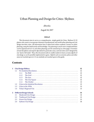
  • 1. Urban Planning and Design for Cities: Skylines alborzka August 16, 2017 Abstract This document aims to serve as a comprehensive. simple guide for Cities: Skylines (C:S) players who want to incorporate elements of professional, real-world urban planning and city design into their cities. All information here is taken from online academic courses on urban planning, using the latest trends and knowledge. City planning is much more complicated than can be experienced in C:S, and urban planning can’t be summed up in a few pages. It involves several disciplines and experts specialised in particular areas, and real cities aren’t designed by one “Jack of all trades”. Thus, this document seeks to enable readers to learn as many aspects of city design as can be possibly implemented in-game. Aspects such as economic policy and other areas not touched upon in C:S are similarly not touched upon in this guide. Contents 1 City Design History 12 1.1 Pre-Industrial Revolution . . . . . . . . . . . . . . . . . . . . . . . . . . . . . . . . 12 1.1.1 The Wall . . . . . . . . . . . . . . . . . . . . . . . . . . . . . . . . . . . . 12 1.1.2 The Grid . . . . . . . . . . . . . . . . . . . . . . . . . . . . . . . . . . . . 12 1.1.3 The Axis . . . . . . . . . . . . . . . . . . . . . . . . . . . . . . . . . . . . 12 1.1.4 The City Square . . . . . . . . . . . . . . . . . . . . . . . . . . . . . . . . 12 1.1.5 The Cloister . . . . . . . . . . . . . . . . . . . . . . . . . . . . . . . . . . 13 1.2 Cities in the Industrial Revolution . . . . . . . . . . . . . . . . . . . . . . . . . . . 13 1.3 Cities in the 1950s . . . . . . . . . . . . . . . . . . . . . . . . . . . . . . . . . . . 13 1.4 Today’s Regional City . . . . . . . . . . . . . . . . . . . . . . . . . . . . . . . . . 13 2 Different Design Schools 14 2.1 Modernist City Design . . . . . . . . . . . . . . . . . . . . . . . . . . . . . . . . . 14 2.2 Traditional City Design . . . . . . . . . . . . . . . . . . . . . . . . . . . . . . . . . 15 2.3 Green City Design . . . . . . . . . . . . . . . . . . . . . . . . . . . . . . . . . . . 15 2.4 Systems City Design . . . . . . . . . . . . . . . . . . . . . . . . . . . . . . . . . . 16 1
  • 2. 3 Environmental Considerations 16 3.1 Ecological Urbanism . . . . . . . . . . . . . . . . . . . . . . . . . . . . . . . . . . 16 3.2 Managing Water: Flooding and Scarcity . . . . . . . . . . . . . . . . . . . . . . . . 17 3.3 Managing Energy Consumption . . . . . . . . . . . . . . . . . . . . . . . . . . . . 17 3.4 Green Infrastructure and Urban Agriculture . . . . . . . . . . . . . . . . . . . . . . 18 4 Preserving Older Cities and Districts 19 4.1 Importance of Historic Preservation . . . . . . . . . . . . . . . . . . . . . . . . . . 19 4.2 Adaptive Re-Use of Old Buildings . . . . . . . . . . . . . . . . . . . . . . . . . . . 19 4.3 Preserving the Industrial Heritage . . . . . . . . . . . . . . . . . . . . . . . . . . . 20 5 Integrating and Improving Slums 20 5.1 Background on Informal Settlements . . . . . . . . . . . . . . . . . . . . . . . . . 20 5.2 Rapid Urbanisation and Slums . . . . . . . . . . . . . . . . . . . . . . . . . . . . . 21 5.3 Retrofitting Infrastructure and Services . . . . . . . . . . . . . . . . . . . . . . . . 21 5.4 Combating Poverty and Urban Deterioration in the Ghetto . . . . . . . . . . . . . . 22 6 Community, Neighbourhoods, and Human Interaction 23 6.1 Transformation of Urban Lifestyles . . . . . . . . . . . . . . . . . . . . . . . . . . 23 6.2 Residential Mobility and Housing Choices . . . . . . . . . . . . . . . . . . . . . . 23 6.3 Spatial Patterns that Promote Personal Communication . . . . . . . . . . . . . . . . 25 6.4 Mixing Home, Work, Culture and Recreation . . . . . . . . . . . . . . . . . . . . . 26 6.5 Walkable Neighbourhoods . . . . . . . . . . . . . . . . . . . . . . . . . . . . . . . 26 7 Designing New Cities, Districts and Neighbourhoods 26 7.1 Urban Form of New Places . . . . . . . . . . . . . . . . . . . . . . . . . . . . . . . 26 7.2 The Public Realm . . . . . . . . . . . . . . . . . . . . . . . . . . . . . . . . . . . . 27 8 Airport–City Connection 27 8.1 Airfront Model . . . . . . . . . . . . . . . . . . . . . . . . . . . . . . . . . . . . . 28 8.2 Decoplex Model . . . . . . . . . . . . . . . . . . . . . . . . . . . . . . . . . . . . 28 8.3 Airport City Model . . . . . . . . . . . . . . . . . . . . . . . . . . . . . . . . . . . 29 8.4 Airport Corridor Model . . . . . . . . . . . . . . . . . . . . . . . . . . . . . . . . 29 8.5 AIREA Model . . . . . . . . . . . . . . . . . . . . . . . . . . . . . . . . . . . . . 30 8.6 Aerotropolis Model . . . . . . . . . . . . . . . . . . . . . . . . . . . . . . . . . . . 30 9 Public Transit 30 9.1 Catch-Bin Area . . . . . . . . . . . . . . . . . . . . . . . . . . . . . . . . . . . . . 31 9.2 Understanding Modal Practices . . . . . . . . . . . . . . . . . . . . . . . . . . . . 31 9.3 The Barbeque Effect . . . . . . . . . . . . . . . . . . . . . . . . . . . . . . . . . . 33 9.4 Seductive Engineering . . . . . . . . . . . . . . . . . . . . . . . . . . . . . . . . . 34 9.5 Territories, Networks, and Forms of Urbanisation: A Note on Trams . . . . . . . . . 34 9.6 Transit Adherence . . . . . . . . . . . . . . . . . . . . . . . . . . . . . . . . . . . 34 9.7 Public Space Fragmentation: Resident Needs Vs. Visitor Wants . . . . . . . . . . . . 35 2
  • 3. 10 Building Design Principles 35 10.1 Frame the Public Realm . . . . . . . . . . . . . . . . . . . . . . . . . . . . . . . . 36 10.2 Ground Floor-to-Street Relationship . . . . . . . . . . . . . . . . . . . . . . . . . 36 10.3 Sense of Entry . . . . . . . . . . . . . . . . . . . . . . . . . . . . . . . . . . . . . 36 10.4 Integrate Urban Open Space . . . . . . . . . . . . . . . . . . . . . . . . . . . . . . 37 10.5 Light, View, Skyline, and Privacy . . . . . . . . . . . . . . . . . . . . . . . . . . . . 37 10.6 Prominent Sites . . . . . . . . . . . . . . . . . . . . . . . . . . . . . . . . . . . . . 39 10.7 Scale Transition . . . . . . . . . . . . . . . . . . . . . . . . . . . . . . . . . . . . . 40 10.8 Façade Treatment . . . . . . . . . . . . . . . . . . . . . . . . . . . . . . . . . . . . 40 10.9 Building Projections . . . . . . . . . . . . . . . . . . . . . . . . . . . . . . . . . . 41 10.10 Vehicular and Pedestrian Circulation . . . . . . . . . . . . . . . . . . . . . . . . . . 41 10.10.1 Pedestrian Connections . . . . . . . . . . . . . . . . . . . . . . . . . . . . 42 10.10.2 Service and Loading Areas . . . . . . . . . . . . . . . . . . . . . . . . . . 42 10.10.3 Parking . . . . . . . . . . . . . . . . . . . . . . . . . . . . . . . . . . . . 42 A Transit-Oriented Communities Design Guidelines 43 A.1 Common Terms and Definitions . . . . . . . . . . . . . . . . . . . . . . . . . . . . 43 A.2 Destinations: Coordinate Land Use and Transportation . . . . . . . . . . . . . . . . 43 A.2.1 Ensure that major destinations are lined up along a reasonably direct corridor so they can be served by frequent transit . . . . . . . . . . . . . . . . . . . 43 A.2.2 Encourage the highest intensity of development in Urban Centres and at fre- quent transit nodes . . . . . . . . . . . . . . . . . . . . . . . . . . . . . . 44 A.2.3 Focus additional growth toward existing and planned frequent transit corridors 44 A.3 Distance: Create a Well-Connected Street Network . . . . . . . . . . . . . . . . . . 44 A.3.1 Provide fine-grained street networks . . . . . . . . . . . . . . . . . . . . . 44 A.3.2 Make walking and cycling access to frequent transit as direct as possible . . . 44 A.3.3 Plan for coordinated, multi-modal transportation networks . . . . . . . . . 45 A.3.4 Locate frequent transit passenger facilities at accessible places on the street network . . . . . . . . . . . . . . . . . . . . . . . . . . . . . . . . . . . . 45 A.4 Design: Create Places for People . . . . . . . . . . . . . . . . . . . . . . . . . . . . 45 A.4.1 Design multi-modal streets . . . . . . . . . . . . . . . . . . . . . . . . . . 45 A.4.2 Design great public spaces . . . . . . . . . . . . . . . . . . . . . . . . . . . 46 A.4.3 Seamlessly integrate development with frequent transit and the public realm 46 A.4.4 Design parking to support a pedestrian-oriented urban realm . . . . . . . . 46 A.5 Density: Concentrate and Intensify Activities near Frequent Transit . . . . . . . . . 46 A.5.1 Focus density in Urban Centres and around frequent transit corridors and nodes to support a strong demand for transit service . . . . . . . . . . . . . 46 A.5.2 Plan for density that supports community character and promotes quality of life 46 A.6 Diversity: Encourage a Mix of Uses . . . . . . . . . . . . . . . . . . . . . . . . . . 47 A.6.1 Provide a mix of uses along frequent transit corridors to reduce peak crowding and spread travel demand throughout the day . . . . . . . . . . . . . . . . . 47 A.6.2 Encourage a mix of land uses immediately adjacent to frequent transit facilities 47 A.6.3 Encourage a mix of uses around transit nodes to create complete neighbourhoods 48 3
  • 4. A.6.4 Provide an active street life with a mix of community services and fine-grained retail spaces . . . . . . . . . . . . . . . . . . . . . . . . . . . . . . . . . . 48 A.6.5 Provide a mix of housing types near frequent transit passenger facilities to create inclusive communities and promote equitable access to transportation 48 A.7 Checklists and How The 5 D’s Relate to Transportation Outcomes . . . . . . . . . . 49 A.7.1 Corridor and Regional Level Checklist . . . . . . . . . . . . . . . . . . . . 50 A.7.2 Neighbourhood Level Checklist . . . . . . . . . . . . . . . . . . . . . . . 51 A.7.3 Site Level Checklist . . . . . . . . . . . . . . . . . . . . . . . . . . . . . . 52 A.7.4 How The 5 D’s Relate to Transportation Outcomes . . . . . . . . . . . . . . 53 B Complete Street Guidelines 57 B.1 Street Types . . . . . . . . . . . . . . . . . . . . . . . . . . . . . . . . . . . . . . 57 B.1.1 Civic Street . . . . . . . . . . . . . . . . . . . . . . . . . . . . . . . . . . 58 B.1.2 Downtown &Centres Main Street . . . . . . . . . . . . . . . . . . . . . . 60 B.1.3 Avenue &Neighbourhood Main Street . . . . . . . . . . . . . . . . . . . . 62 B.1.4 Downtown &Centres Residential Street . . . . . . . . . . . . . . . . . . . 64 B.1.5 Apartment Neighbourhood Residential Street . . . . . . . . . . . . . . . . 66 B.1.6 Neighbourhood Residential Street . . . . . . . . . . . . . . . . . . . . . . 68 B.1.7 Mixed Use Connector Street . . . . . . . . . . . . . . . . . . . . . . . . . 72 B.1.8 Residential Connector Street . . . . . . . . . . . . . . . . . . . . . . . . . 74 B.1.9 Scenic Street . . . . . . . . . . . . . . . . . . . . . . . . . . . . . . . . . . 76 B.1.10 Park Street . . . . . . . . . . . . . . . . . . . . . . . . . . . . . . . . . . . 78 B.1.11 Employment Street . . . . . . . . . . . . . . . . . . . . . . . . . . . . . . 80 B.1.12 Mixed Use Access Street . . . . . . . . . . . . . . . . . . . . . . . . . . . . 82 B.1.13 Mixed Use Shared Street . . . . . . . . . . . . . . . . . . . . . . . . . . . 84 B.1.14 Residential Shared Street . . . . . . . . . . . . . . . . . . . . . . . . . . . 86 B.1.15 Mixed Use Lane . . . . . . . . . . . . . . . . . . . . . . . . . . . . . . . . 88 B.1.16 Residential Lane . . . . . . . . . . . . . . . . . . . . . . . . . . . . . . . . 90 B.2 Common Street Design Terms . . . . . . . . . . . . . . . . . . . . . . . . . . . . . 92 B.3 Street Design for Pedestrians . . . . . . . . . . . . . . . . . . . . . . . . . . . . . . 92 B.3.1 Sidewalk Design and Streetscaping . . . . . . . . . . . . . . . . . . . . . . 92 B.3.2 Additional Accessibility and Universal Design Features . . . . . . . . . . . . 94 B.3.3 Public Realm and Placemaking: Design Great Public Spaces . . . . . . . . . 94 B.3.4 Parking and the Pedestrian Realm . . . . . . . . . . . . . . . . . . . . . . . 95 B.3.5 Safety of the Pedestrian Public . . . . . . . . . . . . . . . . . . . . . . . . 95 B.3.6 Child Mobility . . . . . . . . . . . . . . . . . . . . . . . . . . . . . . . . . 96 B.4 Street Design for Cycling . . . . . . . . . . . . . . . . . . . . . . . . . . . . . . . . 97 B.4.1 Key Cycling Elements . . . . . . . . . . . . . . . . . . . . . . . . . . . . . 97 B.4.2 Cycling Lane Infrastructure Design Principles . . . . . . . . . . . . . . . . 97 B.4.3 Bike Lane Widths . . . . . . . . . . . . . . . . . . . . . . . . . . . . . . . 99 B.4.4 Context-Sensitive Cycling Facilities . . . . . . . . . . . . . . . . . . . . . . 99 B.4.5 Bicycle Parking . . . . . . . . . . . . . . . . . . . . . . . . . . . . . . . . 100 B.5 Street Design for Transit . . . . . . . . . . . . . . . . . . . . . . . . . . . . . . . . 100 4
  • 5. B.5.1 Key Transit Street Elements . . . . . . . . . . . . . . . . . . . . . . . . . . 100 B.5.2 Transit Stops . . . . . . . . . . . . . . . . . . . . . . . . . . . . . . . . . . 101 B.5.3 Transit Design Principles . . . . . . . . . . . . . . . . . . . . . . . . . . . 101 B.5.4 Context-Sensitive Transit Design . . . . . . . . . . . . . . . . . . . . . . . 102 B.6 Street Design for Green Infrastructure . . . . . . . . . . . . . . . . . . . . . . . . . 103 B.6.1 Key Green Street Elements . . . . . . . . . . . . . . . . . . . . . . . . . . 103 B.6.2 Green Infrastructure Design Principles . . . . . . . . . . . . . . . . . . . . 104 B.6.3 Context-Sensitive Green Streets . . . . . . . . . . . . . . . . . . . . . . . 105 B.7 Street Design for Roadways . . . . . . . . . . . . . . . . . . . . . . . . . . . . . . 105 B.7.1 Roadway Design Principles . . . . . . . . . . . . . . . . . . . . . . . . . . 105 B.7.2 Design for a Multi-Modal Transportation System . . . . . . . . . . . . . . . 106 B.7.3 Design for Safety of Vulnerable Users . . . . . . . . . . . . . . . . . . . . . 106 B.7.4 Design Using a Target Speed for the Street Context . . . . . . . . . . . . . . 106 B.7.5 Design to Support Placemaking and Street Context . . . . . . . . . . . . . 108 B.7.6 Rightsizing and Repurposing Roadway as Complete Streets . . . . . . . . . 108 B.7.7 Traffic Calming . . . . . . . . . . . . . . . . . . . . . . . . . . . . . . . . 109 B.7.8 Roadway Zones . . . . . . . . . . . . . . . . . . . . . . . . . . . . . . . . 109 B.8 Highway Traffic and More Lanes . . . . . . . . . . . . . . . . . . . . . . . . . . . . 110 B.9 Street Design for Intersections . . . . . . . . . . . . . . . . . . . . . . . . . . . . . 110 B.9.1 Intersection Design Principles . . . . . . . . . . . . . . . . . . . . . . . . . 110 B.9.2 Key Needs and Perspectives of Each Road User . . . . . . . . . . . . . . . . 111 B.9.3 Crosswalks . . . . . . . . . . . . . . . . . . . . . . . . . . . . . . . . . . . 113 B.9.4 Accessibility and Universal Design of Intersections . . . . . . . . . . . . . . 113 B.9.5 Context-Sensitive Intersection Design . . . . . . . . . . . . . . . . . . . . 114 B.9.6 Intersection Elements and Geometric Design . . . . . . . . . . . . . . . . . 115 B.9.7 Intersection Signals and Other Traffic Controls . . . . . . . . . . . . . . . . 116 B.10 Street Network Design . . . . . . . . . . . . . . . . . . . . . . . . . . . . . . . . . 117 B.10.1 Fine-Grained Street Networks . . . . . . . . . . . . . . . . . . . . . . . . 117 B.10.2 Coordinated, Multi-Modal Transportation Networks . . . . . . . . . . . . . 117 C Tall Building Guidelines 119 C.1 Introduction . . . . . . . . . . . . . . . . . . . . . . . . . . . . . . . . . . . . . . 119 C.2 Site Context . . . . . . . . . . . . . . . . . . . . . . . . . . . . . . . . . . . . . . 119 C.2.1 Fit and Transition in Scale . . . . . . . . . . . . . . . . . . . . . . . . . . . 119 C.2.2 Sunlight and Sky View . . . . . . . . . . . . . . . . . . . . . . . . . . . . . 120 C.2.3 Prominent Sites and Views from the Public Realm . . . . . . . . . . . . . . 122 C.3 Site Organisation . . . . . . . . . . . . . . . . . . . . . . . . . . . . . . . . . . . . 122 C.3.1 Building Placement . . . . . . . . . . . . . . . . . . . . . . . . . . . . . . 122 C.3.2 Building Address and Entrances . . . . . . . . . . . . . . . . . . . . . . . . 123 C.3.3 Site Servicing, Access, and Parking . . . . . . . . . . . . . . . . . . . . . . 123 C.3.4 Publicly Accessible Open Space . . . . . . . . . . . . . . . . . . . . . . . . 124 C.3.5 Private Open Space . . . . . . . . . . . . . . . . . . . . . . . . . . . . . . 126 C.3.6 Pedestrian and Cycling Connections . . . . . . . . . . . . . . . . . . . . . 126 5
  • 6. C.3.7 Public Art . . . . . . . . . . . . . . . . . . . . . . . . . . . . . . . . . . . 127 C.4 Base Building Design . . . . . . . . . . . . . . . . . . . . . . . . . . . . . . . . . . 127 C.4.1 Base Building Height and Scale . . . . . . . . . . . . . . . . . . . . . . . . 127 C.4.2 Street Animation . . . . . . . . . . . . . . . . . . . . . . . . . . . . . . . 128 C.4.3 Public-Private Transition . . . . . . . . . . . . . . . . . . . . . . . . . . . 129 C.5 Tower Design . . . . . . . . . . . . . . . . . . . . . . . . . . . . . . . . . . . . . . 129 C.5.1 Tower Placement . . . . . . . . . . . . . . . . . . . . . . . . . . . . . . . 129 C.5.2 Separation Distances . . . . . . . . . . . . . . . . . . . . . . . . . . . . . 130 C.5.3 Tower Orientation and Articulation . . . . . . . . . . . . . . . . . . . . . . 131 C.6 Pedestrian Realm . . . . . . . . . . . . . . . . . . . . . . . . . . . . . . . . . . . . 133 C.6.1 Streetscape and Landscape Design . . . . . . . . . . . . . . . . . . . . . . 133 C.6.2 Sidewalk Zone . . . . . . . . . . . . . . . . . . . . . . . . . . . . . . . . . 133 C.6.3 Pedestrian Level Wind Effects . . . . . . . . . . . . . . . . . . . . . . . . . 134 C.6.4 Pedestrian Weather Protection . . . . . . . . . . . . . . . . . . . . . . . . 136 C.7 Glossary . . . . . . . . . . . . . . . . . . . . . . . . . . . . . . . . . . . . . . . . 136 D Mid-Rise Building Guidelines 137 D.1 Building Height . . . . . . . . . . . . . . . . . . . . . . . . . . . . . . . . . . . . . 137 D.2 Front Façades . . . . . . . . . . . . . . . . . . . . . . . . . . . . . . . . . . . . . . 137 D.2.1 Angular Plane . . . . . . . . . . . . . . . . . . . . . . . . . . . . . . . . . 137 D.2.2 Pedestrian Perception Stepback . . . . . . . . . . . . . . . . . . . . . . . . 137 D.2.3 Alignment . . . . . . . . . . . . . . . . . . . . . . . . . . . . . . . . . . . 137 D.3 Rear Transition . . . . . . . . . . . . . . . . . . . . . . . . . . . . . . . . . . . . . 138 D.3.1 Rear Transition to Neighbourhoods: Deep Properties . . . . . . . . . . . . 138 D.3.2 Rear Transition to Neighbourhoods: Shallow Properties . . . . . . . . . . . 138 D.3.3 Rear Transition to Employment Areas . . . . . . . . . . . . . . . . . . . . 139 D.3.4 Rear Transition to Apartment Neighbourhoods . . . . . . . . . . . . . . . 139 D.4 Corner Sites: Heights and Angular Planes . . . . . . . . . . . . . . . . . . . . . . . 141 D.5 Minimum Sidewalk Zones . . . . . . . . . . . . . . . . . . . . . . . . . . . . . . . 141 D.6 Side Property Lines . . . . . . . . . . . . . . . . . . . . . . . . . . . . . . . . . . . 141 D.6.1 Continuous Street Walls . . . . . . . . . . . . . . . . . . . . . . . . . . . . 141 D.6.2 Limiting Blank Side Walls . . . . . . . . . . . . . . . . . . . . . . . . . . . 142 D.6.3 Stepbacks at Upper Storeys . . . . . . . . . . . . . . . . . . . . . . . . . . 142 D.6.4 Existing Side Windows . . . . . . . . . . . . . . . . . . . . . . . . . . . . 143 D.6.5 Side Street Setbacks . . . . . . . . . . . . . . . . . . . . . . . . . . . . . . 143 D.7 Maximum Building Width . . . . . . . . . . . . . . . . . . . . . . . . . . . . . . . 143 D.8 Residential At-Grade Uses . . . . . . . . . . . . . . . . . . . . . . . . . . . . . . . 144 D.9 Balconies and Projections . . . . . . . . . . . . . . . . . . . . . . . . . . . . . . . 144 D.10 Roofs and Roofscapes . . . . . . . . . . . . . . . . . . . . . . . . . . . . . . . . . 144 D.11 Prominent Sites . . . . . . . . . . . . . . . . . . . . . . . . . . . . . . . . . . . . . 145 D.12 Façade Design and Articulation . . . . . . . . . . . . . . . . . . . . . . . . . . . . 145 D.13 Parking, Servicing, and Vehicular Access . . . . . . . . . . . . . . . . . . . . . . . . 146 D.14 Heritage Districts and Character Areas . . . . . . . . . . . . . . . . . . . . . . . . . 147 6
  • 7. D.15 Business and Commercial Parks . . . . . . . . . . . . . . . . . . . . . . . . . . . . 147 E Townhouse and Low-rise Apartment Guidelines 148 E.1 Site Context . . . . . . . . . . . . . . . . . . . . . . . . . . . . . . . . . . . . . . 148 E.1.1 Heritage . . . . . . . . . . . . . . . . . . . . . . . . . . . . . . . . . . . . 148 E.1.2 Building Types . . . . . . . . . . . . . . . . . . . . . . . . . . . . . . . . 148 E.2 Site Organisation . . . . . . . . . . . . . . . . . . . . . . . . . . . . . . . . . . . . 149 E.2.1 Streets, Lanes, Mews, and Walkways . . . . . . . . . . . . . . . . . . . . . 149 E.2.2 Shared Outdoor Amenity Areas . . . . . . . . . . . . . . . . . . . . . . . . 149 E.2.3 Building Placement and Address . . . . . . . . . . . . . . . . . . . . . . . 150 E.2.4 Site Services, Access, and Parking . . . . . . . . . . . . . . . . . . . . . . . 150 E.2.5 Priority Lots . . . . . . . . . . . . . . . . . . . . . . . . . . . . . . . . . . 150 E.3 Building Design . . . . . . . . . . . . . . . . . . . . . . . . . . . . . . . . . . . . . 151 E.3.1 Fit and Transition . . . . . . . . . . . . . . . . . . . . . . . . . . . . . . . 151 E.3.2 Facing Distances and Setbacks . . . . . . . . . . . . . . . . . . . . . . . . 152 E.3.3 Primary Entrances . . . . . . . . . . . . . . . . . . . . . . . . . . . . . . . 152 E.3.4 Private Outdoor Amenity Space . . . . . . . . . . . . . . . . . . . . . . . . 152 E.3.5 Building Relationship to Grade and Street . . . . . . . . . . . . . . . . . . 153 E.4 Pedestrian Realm . . . . . . . . . . . . . . . . . . . . . . . . . . . . . . . . . . . . 154 E.4.1 Streetscape, Landscape, and Stormwater Management . . . . . . . . . . . . 154 E.4.2 Site Elements . . . . . . . . . . . . . . . . . . . . . . . . . . . . . . . . . 154 E.4.3 Building Elements . . . . . . . . . . . . . . . . . . . . . . . . . . . . . . . 155 E.4.4 Public Art . . . . . . . . . . . . . . . . . . . . . . . . . . . . . . . . . . . 155 E.5 Demonstration Plans and Case Studies . . . . . . . . . . . . . . . . . . . . . . . . 155 E.5.1 Shallow Mid-Block Site . . . . . . . . . . . . . . . . . . . . . . . . . . . . 157 E.5.2 Deep Mid-Block Site . . . . . . . . . . . . . . . . . . . . . . . . . . . . . 159 E.5.3 Site Adjacent to or with Heritage Resource . . . . . . . . . . . . . . . . . . 161 E.5.4 Site with Multiple Building Blocks . . . . . . . . . . . . . . . . . . . . . . 163 E.5.5 Large Site with Tower . . . . . . . . . . . . . . . . . . . . . . . . . . . . . 165 E.5.6 Large Site with Multiple Development Blocks . . . . . . . . . . . . . . . . 167 F Low-Rise Residential Buildings: Singles, Semis, and Duplexes 169 F.1 Frame the Public Realm . . . . . . . . . . . . . . . . . . . . . . . . . . . . . . . . 169 F.2 Ground Floor-to-Street Relationship . . . . . . . . . . . . . . . . . . . . . . . . . 169 F.3 Sense of Entry . . . . . . . . . . . . . . . . . . . . . . . . . . . . . . . . . . . . . 169 F.4 Integrate Urban Open Space . . . . . . . . . . . . . . . . . . . . . . . . . . . . . . 170 F.5 Light, View, Skyline, and Privacy . . . . . . . . . . . . . . . . . . . . . . . . . . . . 170 F.6 Prominent Sites . . . . . . . . . . . . . . . . . . . . . . . . . . . . . . . . . . . . . 170 F.7 Priority Lots . . . . . . . . . . . . . . . . . . . . . . . . . . . . . . . . . . . . . . 170 F.8 Scale Transition . . . . . . . . . . . . . . . . . . . . . . . . . . . . . . . . . . . . . 170 F.9 Façade Treatment . . . . . . . . . . . . . . . . . . . . . . . . . . . . . . . . . . . . 171 F.10 Building Projections . . . . . . . . . . . . . . . . . . . . . . . . . . . . . . . . . . 171 F.11 Vehicular and Pedestrian Circulation . . . . . . . . . . . . . . . . . . . . . . . . . . 172 7
  • 8. F.12 Vehicular and Pedestrian Circulation . . . . . . . . . . . . . . . . . . . . . . . . . . 172 F.12.1 Pedestrian Connections . . . . . . . . . . . . . . . . . . . . . . . . . . . . 172 F.12.2 Service and Loading Areas . . . . . . . . . . . . . . . . . . . . . . . . . . 172 F.12.3 Parking . . . . . . . . . . . . . . . . . . . . . . . . . . . . . . . . . . . . 172 G Neighbourhood Plazas and Large Format Retail 174 G.1 Frame the Public Realm . . . . . . . . . . . . . . . . . . . . . . . . . . . . . . . . 174 G.2 Ground Floor-to-Street Relationship . . . . . . . . . . . . . . . . . . . . . . . . . 174 G.3 Sense of Entry . . . . . . . . . . . . . . . . . . . . . . . . . . . . . . . . . . . . . 174 G.4 Integrate Urban Open Space . . . . . . . . . . . . . . . . . . . . . . . . . . . . . . 176 G.5 Light, View, Skyline, and Privacy . . . . . . . . . . . . . . . . . . . . . . . . . . . . 176 G.6 Prominent Sites . . . . . . . . . . . . . . . . . . . . . . . . . . . . . . . . . . . . . 176 G.7 Scale Transition . . . . . . . . . . . . . . . . . . . . . . . . . . . . . . . . . . . . . 176 G.8 Façade Treatment . . . . . . . . . . . . . . . . . . . . . . . . . . . . . . . . . . . . 177 G.9 Building Projections . . . . . . . . . . . . . . . . . . . . . . . . . . . . . . . . . . 177 G.10 Vehicular and Pedestrian Circulation . . . . . . . . . . . . . . . . . . . . . . . . . . 177 G.10.1 Pedestrian Connections . . . . . . . . . . . . . . . . . . . . . . . . . . . . 177 G.10.2 Service and Loading Areas . . . . . . . . . . . . . . . . . . . . . . . . . . 177 G.10.3 Parking . . . . . . . . . . . . . . . . . . . . . . . . . . . . . . . . . . . . 177 H Institutional Buildings 178 H.1 Frame the Public Realm . . . . . . . . . . . . . . . . . . . . . . . . . . . . . . . . 178 H.2 Ground Floor-to-Street Relationship . . . . . . . . . . . . . . . . . . . . . . . . . 178 H.3 Sense of Entry . . . . . . . . . . . . . . . . . . . . . . . . . . . . . . . . . . . . . 178 H.4 Integrate Urban Open Space . . . . . . . . . . . . . . . . . . . . . . . . . . . . . . 179 H.5 Light, View, Skyline, and Privacy . . . . . . . . . . . . . . . . . . . . . . . . . . . . 179 H.6 Prominent Sites . . . . . . . . . . . . . . . . . . . . . . . . . . . . . . . . . . . . . 179 H.7 Scale Transition . . . . . . . . . . . . . . . . . . . . . . . . . . . . . . . . . . . . . 179 H.8 Façade Treatment . . . . . . . . . . . . . . . . . . . . . . . . . . . . . . . . . . . . 179 H.9 Building Projections . . . . . . . . . . . . . . . . . . . . . . . . . . . . . . . . . . 180 H.10 Vehicular and Pedestrian Circulation . . . . . . . . . . . . . . . . . . . . . . . . . . 180 H.10.1 Pedestrian Connections . . . . . . . . . . . . . . . . . . . . . . . . . . . . 180 H.10.2 Service and Loading Areas . . . . . . . . . . . . . . . . . . . . . . . . . . 180 H.10.3 Parking . . . . . . . . . . . . . . . . . . . . . . . . . . . . . . . . . . . . 180 H.10.4 Drop-off Areas . . . . . . . . . . . . . . . . . . . . . . . . . . . . . . . . . 181 H.11 Community Service Location and Shared Facility Use . . . . . . . . . . . . . . . . . 181 I Planning for Children in New Vertical Communities 183 I.1 Whimsy and Design for Four Seasons . . . . . . . . . . . . . . . . . . . . . . . . . 183 I.2 Building Configuration . . . . . . . . . . . . . . . . . . . . . . . . . . . . . . . . . 183 I.3 Common Indoor and Outdoor Amenity . . . . . . . . . . . . . . . . . . . . . . . . 183 8
  • 9. J Parks 185 J.1 Parks and Open Spaces: Access and Type . . . . . . . . . . . . . . . . . . . . . . . 185 J.2 All Parks . . . . . . . . . . . . . . . . . . . . . . . . . . . . . . . . . . . . . . . . 186 J.3 Community Parks . . . . . . . . . . . . . . . . . . . . . . . . . . . . . . . . . . . 186 J.4 Neighbourhood Parks . . . . . . . . . . . . . . . . . . . . . . . . . . . . . . . . . 186 J.5 Urban Squares . . . . . . . . . . . . . . . . . . . . . . . . . . . . . . . . . . . . . 187 J.6 Vista Blocks . . . . . . . . . . . . . . . . . . . . . . . . . . . . . . . . . . . . . . . 187 J.7 Nature Parks and Trails . . . . . . . . . . . . . . . . . . . . . . . . . . . . . . . . . 187 K Effective Lighting 189 K.1 Lighting for Safety and Security . . . . . . . . . . . . . . . . . . . . . . . . . . . . 189 K.2 External Lighting Fixtures . . . . . . . . . . . . . . . . . . . . . . . . . . . . . . . 189 L Green Parking Lot Design 191 L.1 Location and Layout . . . . . . . . . . . . . . . . . . . . . . . . . . . . . . . . . . 191 L.1.1 General Requirements . . . . . . . . . . . . . . . . . . . . . . . . . . . . . 191 L.1.2 Site Grading . . . . . . . . . . . . . . . . . . . . . . . . . . . . . . . . . . 191 L.1.3 Lighting . . . . . . . . . . . . . . . . . . . . . . . . . . . . . . . . . . . . 192 L.2 Vehicle Access and Circulation . . . . . . . . . . . . . . . . . . . . . . . . . . . . . 192 L.3 Pedestrian Access and Circulation . . . . . . . . . . . . . . . . . . . . . . . . . . . 192 L.4 Landscaping . . . . . . . . . . . . . . . . . . . . . . . . . . . . . . . . . . . . . . 193 L.4.1 General Requirements . . . . . . . . . . . . . . . . . . . . . . . . . . . . . 193 L.4.2 Streetscape and Perimeter Landscaping . . . . . . . . . . . . . . . . . . . . 193 L.4.3 Internal Landscaping . . . . . . . . . . . . . . . . . . . . . . . . . . . . . 194 L.4.4 Stormwater Management . . . . . . . . . . . . . . . . . . . . . . . . . . . 194 L.5 Surfaces . . . . . . . . . . . . . . . . . . . . . . . . . . . . . . . . . . . . . . . . . 194 L.6 Example Diagrams . . . . . . . . . . . . . . . . . . . . . . . . . . . . . . . . . . . 195 L.6.1 Small Corner Site . . . . . . . . . . . . . . . . . . . . . . . . . . . . . . . 196 L.6.2 Long Narrow Site . . . . . . . . . . . . . . . . . . . . . . . . . . . . . . . 197 L.6.3 Large Site with Multiple Buildings . . . . . . . . . . . . . . . . . . . . . . 198 L.6.4 Additional Diagrams . . . . . . . . . . . . . . . . . . . . . . . . . . . . . 199 List of Figures 1 Transect Diagram, showing city design of the 1950’s. . . . . . . . . . . . . . . . . . 14 2 Better building and tower spacing. . . . . . . . . . . . . . . . . . . . . . . . . . . . 15 3 Traditionalist city design in New Urbanism. . . . . . . . . . . . . . . . . . . . . . . 16 4 Airfront Model. . . . . . . . . . . . . . . . . . . . . . . . . . . . . . . . . . . . . . 28 5 Decoplex Model. . . . . . . . . . . . . . . . . . . . . . . . . . . . . . . . . . . . . 28 6 Airport City Model. . . . . . . . . . . . . . . . . . . . . . . . . . . . . . . . . . . 29 7 Airport Corridor Model. . . . . . . . . . . . . . . . . . . . . . . . . . . . . . . . . 29 8 AIREA Model. . . . . . . . . . . . . . . . . . . . . . . . . . . . . . . . . . . . . . 30 9 Aerotropolis Model. . . . . . . . . . . . . . . . . . . . . . . . . . . . . . . . . . . 31 9
  • 10. 10 Barbeque Effect and its relationship with increased energy consumption for transport in dense areas. . . . . . . . . . . . . . . . . . . . . . . . . . . . . . . . . . . . . . 33 11 A continuous rear lane helps transition between the rear lots fronting onto the arterial street, and the side lots of the buildings on the local street. . . . . . . . . . . . . . . . 37 12 Examples of how height and built form can enhance or impede views of prominent landmarks. . . . . . . . . . . . . . . . . . . . . . . . . . . . . . . . . . . . . . . . 38 13 The houses in this diagram have varied setbacks along an arc which creates a varied and more interesting streetscape. . . . . . . . . . . . . . . . . . . . . . . . . . . . . . . 39 14 The tall building steps back to protect an important view from the public realm. . . . 39 15 Different examples of prominent sites that aren’t landmark based. . . . . . . . . . . . 40 16 The five zones of the sidewalk each have a role to play in designing streets for people. . 93 17 Considerations for Cycling Impact Analysis. . . . . . . . . . . . . . . . . . . . . . . 98 18 Different types of cycling infrastructure. . . . . . . . . . . . . . . . . . . . . . . . . 99 19 The relationship of traffic speed and volume to types of cycling facilities. . . . . . . . 100 20 Vehicle speed, stopping distance, and chance of survival. . . . . . . . . . . . . . . . 107 21 Vehicle speed and field of vision. . . . . . . . . . . . . . . . . . . . . . . . . . . . . 108 22 Avoid towers in a park. . . . . . . . . . . . . . . . . . . . . . . . . . . . . . . . . . 119 23 A progressive transition in the height and scale of tall buildings from the centre of a growth area down to a lower-scale area. . . . . . . . . . . . . . . . . . . . . . . . . 120 24 Horizontalseparationdistance,andachangeinbasebuildingheightandformtosupport tall building transition down to a lower-scale area. . . . . . . . . . . . . . . . . . . . 121 25 A new tall building fitting within an existing context of other tall buildings of consistent height. Note the appropriate separation distance between buildings of similar height. 121 26 An angular plane, and direct relationship in base building height and form to support tall building transition down to a lower-scale area. . . . . . . . . . . . . . . . . . . . 122 27 Highlight corner and mid-block entrances. . . . . . . . . . . . . . . . . . . . . . . . 123 28 Tall building sites offer a broad range of publicly accessible open space opportunities. 125 29 Tall buildings require a broad range of private open spaces to meet the needs of building occupants. . . . . . . . . . . . . . . . . . . . . . . . . . . . . . . . . . . . . . . . 126 30 Theheightandscaleofthebasebuildingrespondstothescaleofneighbouringbuildings and the street proportion. . . . . . . . . . . . . . . . . . . . . . . . . . . . . . . . 128 31 Public-private transition in base building design. . . . . . . . . . . . . . . . . . . . . 130 32 Tower frontage and placement. . . . . . . . . . . . . . . . . . . . . . . . . . . . . . 131 33 Tower setback on property lines with and without laneways. . . . . . . . . . . . . . 132 34 Minimum tower separation distances via arrangement of multiple towers. . . . . . . . 132 35 Minimum tower separation distance proportionate to building width, measured from building face to building face. . . . . . . . . . . . . . . . . . . . . . . . . . . . . . . 133 36 A generous sidewalk and strategic setback supports an active street frontage and vibrant pedestrian environment. . . . . . . . . . . . . . . . . . . . . . . . . . . . . . . . . 134 37 Issues and solutions to building wind design. . . . . . . . . . . . . . . . . . . . . . 135 38 Rear transition for deep properties abutting neighbourhoods, parks, open space, and natural areas. . . . . . . . . . . . . . . . . . . . . . . . . . . . . . . . . . . . . . . 139 39 Rear transition for properties abutting employment areas. . . . . . . . . . . . . . . . 140 10
  • 11. 40 Example of corner site conditions for mid-rise buildings. . . . . . . . . . . . . . . . 142 41 Diagram illustrating the side street setback. . . . . . . . . . . . . . . . . . . . . . . 143 42 Mechanical penthouse placement within all angular planes. . . . . . . . . . . . . . . 145 43 Conserving local heritage with new building developments. . . . . . . . . . . . . . . 148 44 Examples of Priority Lots. . . . . . . . . . . . . . . . . . . . . . . . . . . . . . . . 151 45 An example of how not to place townhouses. . . . . . . . . . . . . . . . . . . . . . . 152 46 Private amenity spaces in townhouses. . . . . . . . . . . . . . . . . . . . . . . . . . 153 47 Landscaping at the level of the raised terrace (backyard) and the sidewalk provide privacy for occupants on the terrace and an amenity for the public. . . . . . . . . . . 154 48 Building height should remain relatively constant with gentle transitions. Abrupt varia- tions in height should be avoided. . . . . . . . . . . . . . . . . . . . . . . . . . . . 171 49 Basing new development on an internal street and block pattern can accommodate future infill development. . . . . . . . . . . . . . . . . . . . . . . . . . . . . . . . . 175 50 This Vista Block provides a lookout over the Greenway System and includes plantings and a paved seating area. . . . . . . . . . . . . . . . . . . . . . . . . . . . . . . . . 187 51 Differences between effective and ineffective external lighting. Lamps that emit light horizontally and/or upwards should be avoided. . . . . . . . . . . . . . . . . . . . . 190 Introductory Remarks This document is divided into two main parts: general information, and appendices. Going through the document, you’ll get the hang of how this is organised and how to use it, but just a quick tip: If you’re looking just for instructions and guidelines to follow when making cities, and don’t really care about the theory, just read the Appendix in order as well as the Airport–City Connection section and Building Design Principles section. If you’re interested in the theory, and want to know why you should build in this way, read the sections that interest you and refer to the appendices for instructions and more detail. The next two paragraphs are some introductory remarks that I didn’t know where else to put. The primary infrastructure of a city is comprised of transport, energy, water/sewage, waste, housing, communications, green infrastructures. Secondary infrastructures include health care, education, nu- trition, culture, and others; these are secondary because they function only if primary infrastructures function. We evaluate primary infrastructure using three (3) main objectives or performance indicators: sustainable, efficient, resilient. An urban system wants to pursue quality of life, city attractiveness, and city competitiveness. Social dimensions of infrastructure can promote equity exclusion (highway dividing the city) and equity inclusion (highway bringing people to work). Infrastructures can go either way or both! Theterritorialspace-frameofacityorregionisbuiltonthree(3)thingswhosearrangementshavechanged since the 1960s: Morphology, Functional Centralities, and Lifestyles. Until the 1960s, these three things overlapped by snapping-in. For example, urban areas and their surroundings were regionalised, and distinctions were drawn between country and city. Looking at a small village, you could tell people 11
  • 12. lived most of their lives in it and their lifestyle revolved around it. Now, thanks to rapid transit systems, the possibilities of location are expanding. Morphological boundaries fade (urban sprawl) — it’s now difficult to tell where a city begins and ends, both visually and funcionally. Lifestyles change and detach themselves from spatial proximity; ones daily life is now within a large geographic range. However, this expansion doesn’t kill spatial differentiations! Not everything becomes urban! Mobility becomes the link connecting Morphology, Function, and Lifetsyle. People can work and shop tens of kilometres1 away from where they live, including in large metropolitan (international) centres like Geneva. 1 City Design History 1.1 Pre-Industrial Revolution There were five (5) main characteristics of cities prior to the Industrial Revolution across the world. Not all historic cities have all of these characteristics, but they will more than likely have one or more of them. 1.1.1 The Wall Defence was essential for millennia. Even after walls came down and the moats were drained, the idea of creating limits to the city remained. This was especially true for European cities where walls created “membership”into the city, and those outside the city (not just outside the country) were considered foreigners. 1.1.2 The Grid Contrary to the common belief that grid systems are mainly an American phenomenon, the first grid system was created by the Greeks around 300 BC. As land ownership was dispersed to families and people, the need to subdivide property in some logical way and record it onto maps became apparent. There was also a need to define public areas like streets and squares. 1.1.3 The Axis Some parts of the city (and some people) were more important than others throughout history. Even in a grid city like Beijing, the importance of the Emperor was reinforced by creating a central axis that only he was allowed to use. In Renaissance Rome, Pope Sixtus the 5th used axes as way of uniting separate districts of city and creating important plazas and buildings. 1.1.4 The City Square In European cities, squares were created to become the living room of city, a place for all important events. Squares often started as open market places, and as markets moved indoors, they became spaces for multiple purposes. In Northern Europe, squares can also function as green spaces, offering relief from the dense city; this idea was carried over into the New World. 1 Or miles, if you’re stuck in the 1800s. 12
  • 13. 1.1.5 The Cloister A cloister is a space created for monasteries, places of worship, temples, and/or shrines. These places were often given prominent locations in the city. Bangkok’s wats define that city, and churches often mark the centre of neighbourhoods and districts of Western cities. These places were then accompanied by schools, meeting houses, and residences. 1.2 Cities in the Industrial Revolution Canals were used as a primary means of transporting goods before trains were introduced. The creation of train tracks widened the trading scope of cities and intensified development in their city centres. During this time, workers lived right next to, and sometimes within, industrial areas and factories. This created unhealthy living conditions. With the introduction of the car, buses, and trains, city roads became crowded and polluted. 1.3 Cities in the 1950s The cities of the 1950s, when people went to a single urban centre to work, shop, play, etc., are still what many people think cities are or should be. Such cities were defined by the prominence of their Central Business District (CBD), which functions as the city’s dominant commercial centre. This serves as the location of central railway station(s), government, most office buildings, and the best retail, hotels, theatres, and restaurants. Close-by were some of the most expensive residential districts fronting on landscaped parklands. This central city was surrounded by industry, except for fashionable streets leading to the best suburbs. The working class lived near the industrial areas, close to the factories in which they worked. Middle class suburbanites were connected to the CBD by tram or commuter rail. This mid-century city was created by attempting to correct the mistakes made when cities first became industrialised. The Transect Diagram shown in Figure 1 is used by advocates of New Urbanism as a template for writing zone and design guidelines. It captures the organisation of a city as it was in 1950. Certain areas that don’t fit the diagram, e.g. stockyards, are labelled as “special districts”. The problem with this diagram, however, is that cities are no longer the way they were in 1950. These neighbourhood designs were built on a foundation of discrimination and deed restrictions, as most people still lived in cramped slums. 1.4 Today’s Regional City Starting in the 1950s2 , most people had personal cars, so cities began to be divided into a pre-1950’s “old city” and a suburban “new city” which was ideal for cars. The old downtown was at the periphery of the much more affluent new city. Buildings were emptying out and their businesses were moving to the new city centre as well. The new city developed office and retail centres of its own, but were much more 2 This entire sub-section is US-centric. Most other developed countries had their old city centres remain dominant, but still experienced suburbanisation enabled by cars. 13
  • 14. Figure 1: Transect Diagram, showing city design of the 1950’s. spread out compared to the old city. Afterwards, the suburbs kept spreading to the point where it became dysfunctional for residents — people complained about traffic congestion, long commutes to work, segregation of functional areas made mothers work as chauffeurs for their children, shopping required driving from one destination to another, etc. So, the old 1950’s model with a CBD and walkable neighbourhoods seemed good in comparison. In the past few decades, the US has seen a big downtown revival and rise in real estate values for walkable neighbourhoods and suburbs. 2 Different Design Schools The four (4) designs discussed here aren’t opposed to each other and aren’t mutually exclusive. Rather, some are applicable to some times and circumstances while others remain inapplicable. The idea is to pick (and maybe blend) what designs work right for particular projects. 2.1 Modernist City Design The modernist school of city design features elevated highways running right through cities and clearing land around them for high-rise office towers. This has the side-effect of dividing one community into two, one on each side of the highway. Rivers and highways divide city up into separate neat districts. Whole sections of towers appear in rows or clusters. The taller buildings are, the further apart they can be placed and still accommodate the same amount of space. With the right orientation, buildings can be spaced so that sunlight falls on the full façade of the neighbouring building, as shown in Figure 2. Such designs are actually implemented as law, known as “Sunshine Laws” in countries such as Japan. One feature of modernist design is that of Significant Form: buildings stand out from their neighbours. One can make any shape buildable, such as a piece of crumpled paper. 14
  • 15. Figure 2: Better building and tower spacing. 2.2 Traditional City Design In traditionalist city design, radial avenues from squares extend in all directions. Long straight streets connect important destinations. Important landmarks could be placed between the beginning/ends of two radial streets converging. Important destinations, landmarks, and places within squares would have important roads extending from them in all directions, connecting them straight to other important squares. The spaces formed between these important avenues would then be filled with smaller streets (grid or otherwise) and less important buildings. The road layouts of Washington D.C. and Paris are good examples of traditionalist city design. For smaller cities or towns, squares could be surrounded by individual houses that all look alike. Individual houses can be used to form other grand architectural compositions, such as circles/plazas with avenues leading to them. Note that one may use traditional city design to connect important landmarks/places with roads that aren’t necessarily straight. New Urbanism uses such a method, where roads are sometimes curved along the coast (and with adjacent important roads following that curve) as shown in Figure 3. You don’t need to use classical buildings to use traditional city design planning! 2.3 Green City Design Green city design, also called Landscape Urbanism, integrates natural landscapes into the designs for cities. It focuses on adaptation; learning new ways to reorganise the natural environment. This is important for all cities dealing with climate change (aka, all cities); for example, rising sea levels will change the way harbour cities function and look. Barriers with locks (holes that allow ships to pass through) can be used for coastal and riverside cities to protect them from rising sea levels. One may correct mistakes introduced by industrial cities and by misguided use of elevated highways and railways, e.g. by converting them into streams and landscape or elevated parks. Highways next to rivers 15
  • 16. Figure 3: Traditionalist city design in New Urbanism. could be lowered with the top being landscaped, as another example. Garden cities3 help make shops and amenities walkable, with big houses further away but the majority of the city walkable and green. 2.4 Systems City Design A systems city design focuses on structural systems, such as walls, beams, etc. This is a new and more futuristic design school. Structural system cities could be built with interconnecting escalators, pillars, glass, and other components (basically like lego, made of components that are all of the same size stacked and arranged together to build a structure). 3 Environmental Considerations 3.1 Ecological Urbanism Landscape Urbanism, also known Ecological urbanism, emerged in the 1990s as a response to post- modernist architecture which was retreating back to European models, as well as disasters of industrial cities, to make them better community-wise. Ecological urbanism aims to synthesise cities and nature, i.e. synthesise the synthetic and physical interface between buildings, infrastructure, natural ecology, and culture. It seeks to “activate space and produce urban effects without the weighty apparatus of traditional space making”. 3 There wasn’t much else discussed on garden cities in the courses I took, so use Google to figure out its pros and cons. Generally, from my knowledge, not a great idea unless you incorporate bits and pieces of it here and there. 16
  • 17. 3.2 Managing Water: Flooding and Scarcity The concept of Design With Nature, developed by Ian McHarg, focuses on preserving the natural environment as much as possible, as it performs important functions for us. Such functions can include acting as flood barriers, dispersal of air pollutants, and purifying and storing water, among others. The following areas are listed in order of environmental importance according to this theory, i.e. from least to most suitable for urban development: surface water, flood plains, marshes, aquifer recharge areas, aquifers, steep slopes, forests/woodlands, and unforested lands. Many cities use concrete structures to act as barriers to flooding. Sand dunes (with hardy grasses), how- ever, are more sustainable flood barriers than concrete as concrete erodes over time while sand absorbs waves. Sand dunes are good for protection from the ocean in coastal areas such as the Netherlands. For delta regions, however, sand isn’t enough and you’ll need constructed (e.g. concrete) barriers. Marine barrages such as those seen in Singapore4 can keep sea water out and act as a fresh-water reservoir, while also acting as attraction with recreational parks as well as districts in new bays. Adding barriers may not be the only solution to address rising sea levels. Very low-lying and low-density areas prone to flooding can be relocated onto the water by using floating buildings, for example. The modern neighbourhood of Ijburg, Netherlands, has this set-up with docks acting as sidewalks. Building on the water with floatingbuildingsmakesa lot of sensesinceit freesup valuableland for food production, while some waste can be used5 to feed fish and algae. Water scarcity is a significant issue already and will only continue to grow in severity. Wetlands can be constructed to clean polluted water for non-potable purposes like urban agriculture. These wetlands can also be made into attractive parks by adding boardwalks along it, thus serving two functions at once! Wetlands also help prevent flooding naturally; not as effective as barriers in very low-lying areas, but still helpful in many other places. 3.3 Managing Energy Consumption In 2007, the US breakdown for energy consumption was transport at 29 %, industrial at 39 %, residential at 21 %, and commercial at 18 %. Energy consumption can be managed by 1. Reducing demand, e.g. reducing travel by implementing energy-efficient urban forms, providing efficient modes of transport, and locally sourcing things. 2. Improving energy supply, e.g. by adding renewables, reusing waste heat, providing local heat- ing/cooling (such as household geothermal pumps), and developing other new systems to control and optimise energy. Green city planning makes people act sustainably without thinking about the environment. For exam- ple, Copenhagenhasmostofitsresidentsbikingforconvenienceandhealth, asopposedtoenvironmental 4 Not really a delta region, I know, but not sure where else to put this. 5 Not how it works in C:S though, unfortunately! 17
  • 18. reasons. Making biking as convenient as possible and giving it priority in planning is what makes this possible. Infrastructure to achieve this may include multiple bike lanes for different speeds, easy stopping bars and ground lights at intersections, dedicated (not shared) lanes, and direct routes by bike lanes that aren’t available to cars. Part of green city planning is making complete streets, which “do all” by serving as many modes of transport as possible. This is done by having space for pedestrians, bikes, public transit, and motorists. This encourages people to walk or bike since they have the space to do so. Complete streets are discussed in-depth in Appendix B. In some European cities, they make sure transit lines are constructed before further urban development, so that people don’t get into the habit of driving in the first place. A great place to start creating transit-oriented communities is Appendix A. In general, the more dense a city is, the less energy is consumed per capita, as most facilities are a walk away and transit is close. However, simply increasing density by itself doesn’t improve environmental health, as smog-ridden cities such as Beijing show. 3.4 Green Infrastructure and Urban Agriculture Urban areas tend to be 5 ∘ C warmer than surrounding areas. This is known as the urban heat island effect. Mitigating heat island effects is important as it reduces the amount of energy spent on cooling (e.g. air conditioning). One easy way to incorporate green infrastructure is by adding trees on roads and elsewhere, as they help mitigate urban heat island effects by providing shade. Heat island effects can also be mitigated by changing the colour and reflectivity of a parking lot, e.g. painting it green, which can lower its temperatures under the hot sun. In addition, placing solar panels over water filtration plants provides a cooling effect, which in turn increases the efficiency of solar panel output. Finally, Singapore’s SuperTrees consist of vertical gardens that provide shade to the ground below, while generating solar power. Green roofs are an excellent form of green infrastructure since they absorb grey water, reduce pressure on sewage, keep buildings cool in the summer by reducing energy consumption by 10 %, mitigate urban heat island effects due to their green colour, increase biodiversity within the area, and actually increase the lifespan of roofs by protecting roof membranes from UV rays and temperature fluctuations. They are also great for serving as local parks or areas for residents to relax, significantly increasing the land available for the city while greatly improving quality of life. In addition to being pretty, such green spaces help address stress and improve cognitive and mental health. Environmental literacy involves teaching children and youth environmental values to promote a re- silient city. Contact with nature, the ravine systems, and food gardens provides physical and emotional benefits. Studies show that nature-play leads to developing a stronger immune systems in children. When children develop an understanding and appreciation of ecological processes they become citizens who make more sustainable choices. Provide learning opportunities for children through elements such as visible stormwater management, using spillways that flow into landscape beds. Explore opportunities to develop community gardens in open space or food gardens on rooftop amenity space. 18
  • 19. Urban agriculture is now being recognised for its ability to help improve the self-sustainability of a city, especially important given growing uncertainties over reliable food supplies. It also mitigates greenhouse gases by reducing “food miles”, which is the travel needed for food to get to stores. Concerns such as city land being too valuable for farming are mostly unwarranted, as even areas with limited space such as Singapore are building full scale urban farms (including vertical farms, which are great for areas with limited space).6 An example of this is Sky Greens in Singapore, a vertical greenhouse farm which grows 80 tons of vegetables annually. Areas with urban agriculture can also serve as tourist attractions. For example, an “agrofood tourism” trail can take visitors through farms and shops, acting as a local attraction while serving agricultural functions. 4 Preserving Older Cities and Districts 4.1 Importance of Historic Preservation Preserving existing infrastructure, buildings, and old cities in general is usually better than starting from scratch. Every brick has energy used to go into its creation, and entropy7 renders energy less useful each time it’s transformed. Once that brick is destroyed, that useful energy is gone and you have to spend energy to make a new brick. Thus, preserving bricks (or any other material) and the things made up of these materials, is much more energy efficient and better for the environment. Furthermore, people grow attached to their local streets and historic buildings, and old districts create a sense of community and sense of place that can easily be destroyed by demolishing it. Classifying an area as a historical district doesn’t mean preserve everything the way it is! These arguments have often been used by wealthy people to keep “the poors” out of their neighbourhoods when space is becoming a premium. Urban renewal and change is unavoidable, but the way old buildings are re- purposed, and the areas in which new buildings blend in with older ones, are what is important. The character of the neighbourhood should be preserved, and this can be accomplished without turning the area into a museum. 4.2 Adaptive Re-Use of Old Buildings Adaptive re-use of buildings helps preserve identity and a sense of place, while making use of the embod- ied energy of that building. When publicly accessible, adaptive reuse of historical buildings can benefit the community. Old churches for example can be converted into lofts, book stores, or even nightclubs. However, residential areas shouldn’t be destroyed/gentrified to make a Disney-land, touristy, fictional historic space that ruins its true character. This has happened in many working class neighbourhoods, and it destroys the authentic character that made that location popular in the first place. A practice met with disdain by many preservationists (and those with good taste), facadism involves keeping the front (just the façade) of a historical building while demolishing the rest of the building to 6 CushyCrux has recently uploaded a cool-looking vertical farm on the Workshop, great for urban areas! 7 Is it obvious that I’m a physicist yet? 19
  • 20. build up on top of it. This half-assed attempt at blending old and new basically ruins the integrity and authenticity of the building. However, an example of where adaptive reuse doesn’t devalue the building’s authenticity is Hearst Tower in Chicago. Here, an attractive glass tower is built on top of the base of what was supposed to be a 1930s tower, so since the original intent was to build a tower anyway, the building’s authenticity has been kept intact. Good adaptive reuse should preserve at least some of the floors and roof structures, making a more authentic reminder of the history and purpose than a mere façade. Also, the new layer of construction should be distinctly recognisable and contemporary, not an imitation of the historic style. While this may seem somewhat counter-intuitive, this is done so that historic buildings are seen as series of layers that accrued over time, in which each layer reflects the values of the time in which they were built. By making clear what is new and what is old, it renders the structure as more honest. For example, the Louvre’s new pyramid addition (surrounded by the original historic building) is made of clear glass in order to maintain the integrity of the open courtyard. New layers can enrich the structure, especially when there’s interesting dialogue between old and new. 4.3 Preserving the Industrial Heritage Old industrial sites have the potential to turn into museums and even vibrant leisure and cultural parks, while reminding people of the city’s past. They can also turn into residential or mixed-use areas, by keeping the exterior structure intact while converting the interior into new architecture like Austria’s Gasometer City neighbourhood. In general, the afterlife of factories built in a city should be considered, as the new global market economy means many factories are only temporary structures. Factories could be designed that way, dismantled when no longer needed; or, through re-purposing, they can be long- lasting buildings with a post-industrial future in the city, serving as a reminder of the city’s industrial heritage. 5 Integrating and Improving Slums 5.1 Background on Informal Settlements Informal settlements are a consequence of the government failing to to provide land, shelter, infrastruc- ture, and services for the urban poor. Thus, they are forced to squat on unserviced land, frequently on high-risk sites, steep and unstable land, and floodplains. In time, infrastructure and services are eventually introduced to the settlements; however, given the area’s limited accessibility, no potable water, lack of sanitation, and no services like education or health, these areas remain in a submissive condition com- pared to the formal city. These settlements can be demolished, only to turn up again elsewhere. Thus, the public sector should work on aspects that individuals can’t address on their own, such as infrastructure, mobility, accessibility, services, open spaces, income-generating opportunities, food sufficiency, and environmental challenges. 20
  • 21. 5.2 Rapid Urbanisation and Slums Medellin in Colombia had slums with limited access, which made it crime-infested. To enhance local mobility, gondolas (otherwise known as metro cables, a form of cable car) were introduced as public transit. Open spaces were carved out adjacent to metro cables, accompanied by schools and libraries and workplaces. Torrents for sewer systems were created to prevent sewage from falling into ravines, with promenades along these torrents. Homes in flood areas (e.g. flood plains of ravines) were relocated to other areas that were still nearby so that social ties were maintained. All of this resulted in crime rates plummeting. Planning ahead of projected informal settlements (which typically occur around expensive real estate of the city) can help mitigate the negative effects of slums. This fosters growth in appropriate sites while keeping areas that should be unoccupied free (due to their environmental importance, for example). Land should be assembled and spatial requirements of public realm envisioned, defining areas where communities will self-construct neighbourhoods. Such areas should be determined with appropriate spatial requirements to help settlements achieve higher socio-economic and environmental conditions, and keep this land free from unwanted occupation.8 5.3 Retrofitting Infrastructure and Services As mentioned earlier, many slums are located in haphazard areas, such as hillsides and areas with steep elevation. Making services accessible to such areas therefore involves working with elevation, not simply flattening the area and destroying the local community fabric. One great way of accomplishing this is by having multi-level recreational buildings that have elevators between floors for different level entries to it. Such buildings can have multiple purposes so that residents don’t have to climb steep stairs and descend long alleys to get to where they want to go. Other ideas include: • Making escalators (as opposed to stairs) for easy access to slopes.9 This is especially helpful for people carrying groceries, disabled people, pregnant women, and the elderly. • Narrow stairways with piping and electricity running underneath them, saving space. • Adding libraries to ends of alleys. • Adding walkways along below-sea-level areas, such as docks along Bangkok’s water markets. One issue in making slums in C:S is that we can’t have any house that’s not directly adjacent to a road, while informal settlements are frequently much more narrow and tightly packed. The only solution I can see to recreate this in C:S is to have wide (and deep), high density, RICO slum buildings that can go between actual tiny roads while having pathways within them, to solve the “needs road access” problem. Otherwise, services such as ambulances can’t reach them even though they can walk up stairs IRL, etc. 8 Most of this would be done with the public sector and NGOs in developing countries, as governments would build these already if they could. 9 C:S doesn’t support escalator functionality, they’d just work as stairs, but you can pretend they’re escalators! 21
  • 22. 5.4 Combating Poverty and Urban Deterioration in the Ghetto People are poor for a reason, they aren’t just lazy! Furthermore, urban deterioration isn’t random. It usually stems from a changing economy, the city losing its industry, changing commercial preferences (people want larger stores), or people moving out causing property vacancies (feedback cycle). Turns out that hipsters can be useful sometimes, as arts can be used to revitalise communities. Pedestrian areas can be painted to beautify neighbourhoods, and “junk” can be used to make sculptures, benches, and spaces for public use. Artists can move in, contribute to the community with their projects, and local people will like the neighbourhood and speak proudly of it. To avoid gentrification, a “wish list” can be created to reflect the needs and wants of local residents. This could include places they don’t want demolished, stores they want kept, improvements to housing and services etc. This can make sure local “vibe” and residents remain there. Once this is created, the government can buy areas sought out by land developers to ensure it’s developed in accordance to local needs. Once they add what locals want, and code for what can be zoned where, then developers can come in and build what they want.10 To deal with urban growth, high rises can be restricted to areas on the fringes of the land, so that local character is maintained. Streets can be shut down and converted into public green spaces, providing locals with services while preventing through traffic. Minimum spatial requirements for low income housing11 (provided by the government) ensures a socially healthy mix of incomes in the neighbourhood. Places where different incomes would come and interact are essential; otherwise, further marginalisation of the poor occurs and they will not be affected by whatever positive changes you think you’re bringing to the neighbourhood. In fact, you don’t even need to demolish shitty looking houses to completely change the flair of the neighbourhood! Remove some of the road and turn it into public gardens/shrubs (Congo St in Dallas by bcWorkshop is a great example of this, look them up in Google Images), and renovate houses to add modern flair (for example, wood panels on the sides of shotgun houses). This involves talking with local residents12 and seeing what needs to be improved in their homes. One way of reducing crime in ghetto neighbourhood is by adding local community gardens on streets themselves. This reuse of street space reduces the amount of physical space gangs can use to mark their turf, reducing street crime and thus makingstreetssaferwhileprovidingfoodforlocalresidents,aswellasameaningfulrecreationalpastime.13 Design may not be able to eliminate poverty, but it can make a difference! It can help in economic development, especially if the strategy is to attract tourism and other industries that are sensitive to the quality of the place. It can help in assembly and reuse of lands, needed by expanding institutions 10 In C:S, this would basically translate into you not demolishing important buildings and retaining the local character that you created, no matter how much better it might look with a new fancy building from the workshop. 11 In C:S, that could translate into Level 1 housing, possibly added to an existing building via sub-buildings or simply via MoveIt! 12 Go ahead, talk to your cims, that’s totally normal behaviour! 13 In C:S, you can add 1x1 small farms if you actually want food, or you can just add some agriculture props such as vegetable rows from the workshop. These don’t have to be too wide/deep, as you still want walking space on the sidewalks. 22
  • 23. and businesses, and provide employment opportunities. It can help ensure development targets local unemployed residents, to ensure openings fit them. It can use abandoned lands as places for urban agriculture or recreation. In C:S, don’t just demolish neighbourhoods and remake them with fancy new subdivisions — you’d be destroying communities IRL! Instead, find ways to make local lives better within the neighbourhood without displacing the poor and marginalising them further. Make it a home for everyone, including the poor. 6 Community, Neighbourhoods, and Human Interaction To successfully plan a city, one must understand the views of its users — their lifestyles, practices, and appropriation of different spaces. 6.1 Transformation of Urban Lifestyles Lifestyle is defined as a composition in time and space of daily activities and experiences that give meaning to the life of a person. It has three (3) dimensions — functional, sensitive, and social. 1. Functional: What makes every day practical. This includes the infrastructure, services, and accessibility available by various means of transport. Everyone has transport mode preferences and each is characterised by an anchor in daily activities related to proximity. 2. Sensitive: What promotes well-being. This includes the morphology of the built environment such as green spaces, quality of facilities, density, new versus old, and aesthetics. Each person feels good in certain environments and has their preferences. 3. Social: What promotes social relations. This includes public space types, accessibility, presence of facilities and intermediate spaces, and the possibility to articulate public/private division. We all design specific relations to each other and of the social anchor. Community life, neighbourly friendliness, reputation, etc., are all dimensions that refer to the social quality of a space and for which each has specific expectations. What has changed over the last forty years, in relation to these three dimensions, is that there is a diversification of models of aspiration. Prior to this, people had more similar goals. Now, there exists no singular quality of life, but rather qualities of life. One income can support several different lifestyles and allow the recipient to live in different neighbourhoods. Thus, since lifestyles are so diversified, we can’t identify them simply using classic variables such as income, education, and household composition. 6.2 Residential Mobility and Housing Choices Residential mobility (where people choose to live), like lifestyle, is dependent on three (3) logics — Rational, Social, and Sensitive. 1. Rational: Metric and economic factors. For example, the household determines where it can live based on income, family size, and the house’s distance from work/amenities. 23
  • 24. 2. Social: Once the rational factors filter out inapplicable houses, the remaining choices are priori- tised based on what values a person has. For example, it may be important for the household to live near other family members, or have a big house for social status. People want to live in a place that resembles us and our background (cultural or otherwise). 3. Sensitive: When deciding between two homes that align best with their social values, the house- hold finally chooses a home based on sensitive factors such as lighting, smell, and the overall wellness we feel in the neighbourhood. As discussed in the previous section, one’s lifestyle can be the same even as they gain income, and one can have a different lifestyle from someone else with the same income. Thus, lifestyle (as opposed to income) is decisive to explain choice of residential location. Do people want to live individualistic lives and not have to engage with neighbours every day, as in individual suburban houses? Or do they value community and want neighbour engagement, as in small apartments? Lifestyles can be grouped into two main categories, with corresponding residential preferences: Classic and Contemporary. • Classic: Lifestyles including residential aspirations similar to traditional values, regardless of household income. These prefer quiet residential environments, typically mono-functional with beautiful visual clearances on a human scale. Ideally within a neighbourhood that promotes security, being between oneself, and promoting a certain social status. Tends to prefer private individual transport over public transit. Ideal residence: single family (e.g. suburban) house that is newly built. • Contemporary: Less traditional lifestyles, more often led by dual-income households. Such lifestyles advocate social diversity, living together, lighter modes of transport, public transit, active cultural life, and ecological values. Prefer active residential environments that are intensive, mixed, dense, urban, and where cultural and artistic activity is high. Ideal residence: apartment in old building (loft) or in modern building. As discussed above, different lifestyles tend to live in different areas. However, even one single building block can host different lifestyles by having different building layouts (and adjacent alley/park layouts). Some buildings within that block can have more alleys and laundry rooms where people can meet (contemporary), while others can have parking next to the house for less interaction with neighbours (classic). Having a mixture of lifestyles in one area can be beneficial as such shared spaces are critical to de-stereotyping; when we face diverse people, we are challenged by our assumptions. One universally desired trait across all lifestyles is serenity. All households regardless of type want proximity to peace, nature, and green space. Homes geared for classic lifestyles can have individual yards, while their contemporary counterparts can have a shared community garden serve as a common yard. Each city (area) has different geographies and densities, so planning new neighbourhoods in a particular area should take this into account. For example, Bern has its neighbourhoods close to the city centre and in short reach with public transit, whereas Lausanne is more spread out and doesn’t have much public 24
  • 25. transit between neighbourhoods. Much of this is due to constraints from local geography, and also the history of the city. Thus, each territory (Lausanne or Bern) will attract a different target audience, living different lifestyles. 6.3 Spatial Patterns that Promote Personal Communication The overall city should be a space where everyone can feel at home somewhere. This doesn’t necessarily more neighbourhoods; there may be too many already and not enough centres where they converge. Pedestrian and social areas can interest people from all backgrounds. The centre of city shouldn’t be a shopping mall competing with other malls, but rather a living space shared by inhabitants, commuters, tourists, etc. People value personal contact and crave human interaction even with technology — in fact, technology just makes it easier for human interaction. It serves as a tool for people with common interests to gather in groups (preferably in areas with wifi, of course). People aren’t isolated by technology as often thought. What is needed, however, is to create spaces that promote personal contact. If one’s “first place” is home and one’s “second place” is work, then one’s “third place” are places like cafés, book stores, hair salons, bars, and other centres where the community congregates and hangs out. A successful “third place” should have the following elements: • Stand on neutral ground, and not deter from one group or another. • Be accessible by all. • Function as a leveller so that all are equal. • Provide the ability for conversation to be the main activity. • Be a home away from home, much like how a library serves as a second home for some people. • Allow easy entry and not require major commitment to use them; for example, allow pedestrians to walk through it, or attach it to pathways many people travel. • Contain distractions; e.g. waterfalls which serve as a distraction from street noise while also functioning as a conversation piece. • Provide the ability for groups to use it for different activities, such as dance groups, exercise groups, basketball, etc. The idea of a third place is to function as a space where informal groups conduct activities that people can watch, join in, or move on. Such a space needs a connecting piece for people to walk through and see and sample all of the activities. However, the area must be made so that formal groups don’t take over. This can be done by, e.g., making only a half-court basketball court instead of a full court, not building a soccer field or baseball diamond (no matter how much formal groups may ask), etc. This way, the space is kept open for all whenever not used by specific formal groups. 25
  • 26. 6.4 Mixing Home, Work, Culture and Recreation Mixed-use buildings can function as places to shop, work, play, and live. They don’t need to be tall either! A hodgepodge of small buildings (ranging from 3 to no more than 15 stories) with mixed-use functions can work well like this. Culture is in fact created by these mixed-use spaces. These areas prevent forming streets that look unsafe at night because they’re dead, as mixed-use areas tend to be active 24/7. In general, they make places safer since there are eyes on the street all the time. Well-lit buildings can further help create the vision of a safe space at night, even when not in use (e.g. make a public library well-lit). Another benefit of having mixed-use areas is that parking can be used at all times of day, making land use more efficient. Well designed outdoor spaces can ensure mixed-use environments are lively even in cold climates. Roofs above shops can function as parks for local residents, as discussed in subsection 3.4. 6.5 Walkable Neighbourhoods Walkability is typically defined as the ability to walk (or take transit, depending on the definition) to weekly needs like shopping, school, etc. within 20 minutes. Most people walk for 10 minutes before deciding on another mode of transport, e.g. car or public transit. Grid street patterns allow far more walkability than winding and circuitous streets; one can traverse a much further distance in 10 minutes walking in a grid than long, uninterrupted curving streets without shortcuts. Aside from walking distance, factors such as density, modest setbacks for houses, shade (from trees), and well-maintained sidewalks with visual interests every 200 m or so all contribute to walkability. However, the most important factor is having a walkable commercial centre within easy range of one’s home. Old frontages may be difficult to adapt to modern supermarkets, so redevelop large vacant areas (e.g. at the end of a street) to form a modern shopping centre. For example, a local neighbourhood can have large stores on its north end, residential and low-commercial (for everyday needs) on its south end, and offices/entertainment in between. As traditional sprawling shopping centres become obsolete (which they are nowadays), you can retrofit these places to become walkable. Arterial streets can become more pedestrian friendly boulevards, with new infield development added in front of them. People can live above the shops with higher density development, streets become more pedestrian and bike friendly, and the local population grows. 7 Designing New Cities, Districts and Neighbourhoods 7.1 Urban Form of New Places Most urban development is small scale, e.g. a project on a single lot, a block that’s redeveloped, a subdivi- sion created, etc. Over time, these pieces add up to become a city, and it’s the designer’s role to ensure it’s the kind of city we want. One way to think about urban design is that it involves thinking in the next larger context. For example, when designing a house you’re actually designing part of a street, when designing a street you’re designing a part of a neighbourhood, when designing a neighbourhood you’re 26
  • 27. producing a unique district of the city, etc. This line of thought prevents you from thinking that every new piece of the city needs to be self-contained and turned inward, and also reminds you that every project is part of a larger ecology. Green spaces naturally maintained by rainfall in a site can form an armature (frame) for a larger density development. Terracedhousescan be built on hills, with valleys filledwith green parks andcultural/recre- ational areas. To ensure everyone has a view of the valley, high buildings can be restricted to forming only on hill-tops. A good example of this arrangement is in Modi’in, Israel. Making sure that smaller buildings are in front of taller ones on streets makes pedestrians only aware of the small buildings as that’s all they see, even though tall towers are there too. Vancouverism insists that streets shouldn’t have blank façades and tall towers shouldnt block views of other buildings. Continuous front doors along residential streets are encouraged even if tall buildings tower over them; in this arrange- ment, town houses are at the base with apartments above and set back. On busier streets, continuous shopfronts aren’t to be broken by driveways or apartment lobbies. Milton Keynes is a nice example of a new city in that despite being a grid layout, each square is very uniquely laid out and through traffic in each square is discouraged. Pedestrian paths connect everything. However, precisely because it’s so spread out, it makes car owning a necessity and makes it difficult to provide transit services to all areas. 7.2 The Public Realm Public spaces that are shared are critical to de-stereotyping, as when we face diverse people we are challenged by our assumptions. Places such as theatres and stadiums are semi-public spaces — one must pay a fee to get in. Parks are fully public, as anyone can access them at any time. Squares and streets should stop being prioritised as places to get from A to B quickly, but rather to places where we can stay with our kids and talk to others. Boulevards can ideally be re-atriculated to nearby neighbourhoods. Pedestrian and semi-pedestrian areas allow residents of different income backgrounds to share the same space/areas, gives environmental benefits, and is aesthetically pleasing. Visual beauty with function is important as cities compete with other cities for business/growth. Note that the consistency of the public realm makes any variations in buildings along the street seem less important. Trees arching over sidewalks that are generous in space and offer rest areas, and interesting shopfronts, are all more interesting for pedestrian than architecture above. 8 Airport–City Connection This section discusses different approaches to integrating airports into your cities. 27
  • 28. Figure 4: Airfront Model. Figure 5: Decoplex Model. 8.1 Airfront Model As shown in Figure 4, the Airfront Model involves locating the airport within the periphery of the city, with a small business district located between the airport and the city. The district would be based on commercial and industrial activity related to transport. Development of such a district would create jobs and thus have a positive social impact, and would involve minimal land use as it develops on the basis of existing economic activities that it will strengthen. 8.2 Decoplex Model Like the Airfront Model, the Decoplex Model involves locating the airport away from the city. However, as shown in Figure 5, a small linear industrial complex would be located by the airport. This development would focus on airport activity, e.g. transporting people and goods, aviation operations and maintenance, etc. Such a model develops a kind of aeropole which no longer focuses solely on transport but also contains a series of satellite activities, and would therefore involve minimal land use. This model has very little social and socio-economic impact, as these are often activities linked to offshore groups. 28
  • 29. Figure 6: Airport City Model. Figure 7: Airport Corridor Model. 8.3 Airport City Model As shown in Figure 6, the Airport City Model is, in a way, an extension of the Decoplex Model. Activity surrounding the airport is no longer exclusively linked to aviation, and may also include economic parks, leisure parks, banks, sports centres, etc. At the spatial level, this model stretches around the airport, but remains compact and dense. However, there is a break in social dynamics because the airport competes with the city. It contains all the services and facilities that are normally found in the city. Sometimes there is even a residential component, which often develops competitively, compared to what is done in the city. In terms of governance, the airport itself plans and develops the territory. 8.4 Airport Corridor Model Unlike the Airport City Model, the Airport Corridor Model attempts to integrate and transition between the airport and city, as shown in Figure 7. The connection between the city and the airport is no longer a simple linear infrastructure, but an urban development, made up of several activities and functions. It’s an attempt at coordination between the airport, the city and the region, for the overall growth of the region. This model corresponds to the current dynamics between the city of Amsterdam and its airport. 29
  • 30. Figure 8: AIREA Model. 8.5 AIREA Model Like the Airport Corridor Model, the AIREA Model attempts to promote regional growth by balancing forces of the city and those of the airport. The AIREA Model proposes the development of several economic, specialised nodes, which are connected between themselves on the one hand, and with the airport and city on the other hand. This is better visualised in Figure 8. This model is a spatially polycentric system as it applies modern zoning principles, where the mobility and availability of transport infrastructures are the basic conditions for its operation. Public authorities are heavily involved in planning and development, ensuring both international economic and local social needs are met. This model was created to avoid the development of airport megacities common in the U.S., which will be discussed in the next subsection. The AIREA Model corresponds to the current dynamics between the city of Berlin and its Brandenburg airport. 8.6 Aerotropolis Model The U.S. airport megacity model, called the Aerotropolis Model, involves the airport becoming the centre of a new city as shown in Figure 9. The former city itself becomes an “old town” and merely a district of this new city. The remainder of the new city is organised according to specialised zoning and without much mixing. This model consumes a lot of land, due to its spreading and low density. It’s based solely on economic development as the main driver. The aspects of quality of life, heritage, or other, are relegated to the background. This type of model poses a series of problems in terms of governance, as it encompasses different administrative jurisdictions, a diversity of actors, as well as areas that have developed spontaneously. It implies a complexity of coordination for the overall territorial development. 9 Public Transit This section discusses the theory behind public transit. To jump right into actual concrete guidelines, go to Appendix A. 30
  • 31. Figure 9: Aerotropolis Model. 9.1 Catch-Bin Area Immediately around a transit stop, there are three (3) main “catch bin” or catchment areas: • Core Area = 400 m radius (5 min walk). • Primary Area = 800 m radius (10 min walk). • Secondary Area = 1200 m radius (15 min walk). In considering where people live in relation to transit, Primary and Secondary Areas are as important as Core Areas. However, physical and geographical barriers can limit these ideally circular catchment areas, meaning these may not be good locations for transit stations. If stops are close together, Core Areas can become a continuous corridor of development. At the intersection of two major transit systems (e.g. two lines sharing the same stop), the Core Area radius may be doubled. At each node (stop), the general land distribution should ideally be as follows: Streets and Open Space occupying ⅓ of the area, Office and Retail and Civic Uses occupying another ⅓ of the area, and Residential Uses occupying the final ⅓. Thus, there would be only a modest increase in density. 9.2 Understanding Modal Practices The means of transport used is a central indicator of lifestyles (see subsection 6.1) and of their diversity. Means of transport are a way to introduce ourselves, a way to build one’s relationship to time and to space. Thus, when planning transport, we must consider lifestyles and their different needs (and where these 31
  • 32. needs are located, e.g. what lifestyle(s) lives where, where they converge, etc). One person can use differ- ent means of transport (including walking) to accomplish different things and go to different places even just in one city/neighbourhood. Usage of certain transport modes (rather than others) fundamentally refers to ways of living and organising one’s daily life and not just simply choices of transport modes. In many cases, transport modes need to be legitimised. For example, cycling may be seen by others as something only poor people do, so new people need to feel comfortable and not feel like they’re in the margins of society for cycling (or for using a new transport mode in general). These new transport modes must be legitimised by the population at large before some people adopt it. There are three (3) logics of action that cause different modal (transport mode) choices: Instrumental (choose fastest, cheapest, or combo of both), Personal Preference, and Habit. Even if one mode is cheaper or faster than another, some (many) people may still not choose it! Thus, one can’t assume people will use a particular mode for instrumental reasons alone. People may associate public transit with being slow, crowded, and/or constrained (not as independent as driving a car). So even if it’s faster and cheaper, personal preference may still prevent them from taking transit. Also, some people simply don’t plan on changing from car to transit (habit) because they’re so used to driving that even when they’re comparable they just use the car anyway. To account for the segmentation of these three logics of action, we have a typology made up of eight (8) specific provisions on the use of transport mode. This typology is made of three (3) dimensions: 1. Size of patterns that differentiate individuals using several modes vs. those using only one. • Only use car to move daily and hate other transport modes • Only use car to move daily but don’t hate other transport modes • Use other transport modes and don’t use car 2. Values that differentiate people who have a vision of transport modes according to their individual interest or according to common interest. • Multimodal comparators; people who are highly sensitive to mode prices and times (ratio- nal) • Civicenvironmentalists; peoplewhoavoidpollutingmodesasmuchaspossible(emotional) 3. Attitudes that distinguish people according to their preferences of transport mode. • Motorists forced to use public transit (due to constraints like parking, traffic) but prefer car whenever they can. • People susceptible to alternative modes; prefer non-car but forced to use car sometimes. • People afraid of any motorised transport and avoid whenever possible. 32
  • 33. Figure 10: Barbeque Effect and its relationship with increased energy consumption for transport in dense areas. 9.3 The Barbeque Effect In Switzerland, 37 % of trips are for leisure (e.g. going to a park) as opposed to only 23 % of trips for work and 22 % for shopping. Leisure transport is also frequently made with higher energy consumption modes of transport, e.g. car and plane. People in urban areas actually travel more frequently for leisure than suburbanites. This is because suburbanites already have many places nearby to spend their free time, e.g. gardens and forests, whereas urbanites need to compensate for lack of nature in everyday environment by travelling to it. This is called the Barbeque Effect — everyone goes out of the city to BBQ since you can’t in city.14 Taking leisure transport into account, the normal curve of “less dense = more energy consumption for transport” actually becomes false — the more dense you are, the more energy is consumed for transport, as shown in Figure 10. However, while some of these movements are compensatory for lack of green space in urban areas (and can thus be “fixed” or addressed), other movements are simply to explore other urban areas (e.g. travel from Toronto to Ottawa by plane). Thus, the graph shown in Figure 10 may be called into question as it doesn’t address this point. Furthermore, improved connectivity between the city and the green spaces outside the city (e.g. train, bus, or shorter distances) can address this increased use of transport. Can we really build cities that compensate for the BBQ effect? What would that look like, having virtues of both density and green space? And to what extent can we reduce leisure travel, since e.g. people go on trips on holidays (travel is what holidays are associated with) regardless of what is around their residential area? This is still an area being explored and these questions are still being investigated. 14 Yeah, I don’t get it either. 33
  • 34. 9.4 Seductive Engineering In a system where many choices exist, for a technical solution that is introduced to be successful, it must be attractive. It must resonate with what people want to do, their aspirations, and their constraints. In Geneva, they had trams with multiple lines sometimes sharing one road. You could be at one stop and take trams in multiple directions, thus avoiding having to change tram lines in the city centre since direct paths (to destinations) throughout the city were multiplied. However, transit authorities removed some of these multiple lines or “duplicates” to simplify the network, so that instead of one stop having 2/3 lines they’d only have 1. These lines are faster and have more trams (increased frequency). However, ridership dropped as people hated the fact that they had to change tram lines when before it was direct! The users in this case sought direct routes, as downtown public spaces are traffic congested so it’s un- pleasant to change lines. Thus, even if there were improvements in speed and frequency, the old network was still considered better by users! Therefore, if we want to make a network to expand use of transport, we have to consider the sensitivity of the population. For new riders, it must attract/seduce their expec- tations and in this case their expectations weren’t to go faster but to go direct. Engineering with seduction means engineering keeping in mind public expectations and desires, not just efficiency or technology! If it’s very efficient but poorly received by consumers, it’s a bad engineering design! 9.5 Territories, Networks, and Forms of Urbanisation: A Note on Trams Trams have become more popular not only for promoting use of public transit, but also for reclassifying urban centres to make them more attractive to frequent as well as live in. Tram networks allow for a growing number of users. They offer smooth rides (that allow you to do work on it when seated), contain nice paths to stops, and allow for easier memorisation of the tram route due to its materialisation in the public space via its rails. Real estate around tramways increases in value and people want to live near them. However, trams don’t imply significantly increased transit usage in all cases. Speed, destinations served, and frequency are obvious factors that should be addressed. However, other factors to consider for trams include crowdedness; if there aren’t any seats available, then its attractiveness for a smooth ride and ability to do work on it goes down. In addition, a lack of unity with other transit modes is also problematic; if it has, for example, a different frequency than bus/metro, it would then not be in sync with the rest of the system and therefore people may simply continue using the bus/metro (and then maybe transfer to tram if needed) which would leave ridership the same as before. 9.6 Transit Adherence One of the biggest hurdles to using new transport modes is the last mile. Let’s say your house or office is 500 m away from the metro stop. A dedicated bike lane or pedestrian path between the metro stop and your house can make all the difference to whether you use public transit or not! These aren’t replace- ments for transit, but rather complement and enhance it. If pedestrian pathways to bus stops are poor, 34