
Recommended
More Related Content
What's hot
What's hot (20)
Similar to Air Masses and Fronts
Similar to Air Masses and Fronts (20)
More from dwinter1
More from dwinter1 (20)
Recently uploaded
Recently uploaded (20)
Air Masses and Fronts
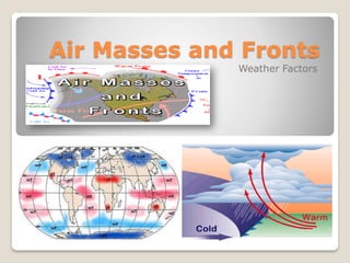
- 1. Air Masses and Fronts Weather Factors
- 3. Properties of Air Air has weight Air takes up space Air is all around us Air pulls and pushes
- 4. Air Masses A large body of air with similar… Temperature Warm Cold Humidity Dry Humid TROPICS POLAR Over Water Over Land
- 5. Air masses… Air masses DO NOT mix because of differences in densities (warm air rises, and cold air sinks) Cold air is heavy- high pressure- high density Warm air is light- low pressure- low density
- 6. Air Masses’ Characteristics Source Regions Over warm area: the warm area makes the air above warm. Over water: water evaporates into the air above and makes it moist.
- 7. Types of Air Masses 1. Maritime: (m) moist (marina/water) 2. Continental: (c) dry (continents/land) 3. Tropical: (T) warm (tropics) 4. Polar: (P) cold (poles) DESCRIPTION CONDITION LOCATION FORMED
- 8. Types of Air Masses Maritime Tropical (mT) Continental Tropical (cT) Maritime Polar (mP) Continental Polar (cP)
- 9. FOR EACH AIR MASS – ID 1. Name of Air Mass 2. Temperature – COLD or WARM 3. Moisture - Humid or Dry 4. Origin 5. Wind – Where does it originate?
- 10. mP Maritime Polar Moist, cold air to west coast of the US. mT Maritime Tropical Moist, warm air to west coast of the Mexico. mT Maritime Tropical Moist, warm air to south east coast of the US.Dry, warm to Desert SW mP Maritime Polar Moist, cold air to east areas of the Canada cP Continental Polar Dry, cold air to central and eastern US. Types of Air Masses
- 11. Air Mass Modification mP Maritime Polar Moist, cold air to west coast of the US. mT Maritime Tropical Moist, warm air to south east coast of the US. Air masses move by prevailing winds. The winds cause the air masses to move over land and water. As the air masses move, they change. This is called air mass modification. The air masses becomes more like the area it is moving over… ….. And At the same time, the area the air mass is moving over becomes more like the air mass.
- 12. Maritime tropical air masses (mT) form over the warm waters of the tropics and Gulf of Mexico. The northward movement of these air masses brings warm moist air into the United States Maritime tropical Air Mass (mT)
- 13. Those who live in the northern United States expect cold weather during the winter months. These conditions usually result from the invasion of cold arctic air masses that form from the snow covered regions of northern Canada.
- 14. Notice the edge of the cold air mass is shown by the blue line. The center of this air mass is a high pressure center located in northern Montana (indicated by the blue "H").
- 15. The leading edge of a tropical air mass surging northward is shown by red line. Southerly winds behind the boundary indicate the northward movement of warm moist air.
- 17. Fronts COLD FRONTS WARM FRONTS STATIONARY FRONTS OCCLUDED FRONTS A boundary between two air masses:
- 18. Mr. Fetch’s Earth Science Classroom When air masses meet… mT Maritime Tropical Moist, warm air to south east coast of the US. mP Maritime Polar Moist, cold air to west coast of the US.
- 19. Cold air masses move southward and encounter warm air masses. When these air masses collide, various types of weather will result. The type of precipitation that might result from this collision depends on the air temperature.
- 20. Cold Fronts Description: • Cold air mass moves in to take the place of a warm air mass. • Warm air is forced up violently. • Steep Frontal Lifting Slope Associated Clouds: Cumulonimbus Clouds (Thunderstorm Clouds) Precipitation: • Heavy Precipitation over short periods of time due to steep frontal slope. • Sometimes produce hail/tornadoes Weather Map Symbol:
- 22. Cold Fronts
- 23. Cold Fronts
- 24. Cold Fronts
- 26. Warm Fronts Description: • Warm air mass moves in to take the place of a colder air mass. • Warm air gently glides up over the colder air. • Gentle Frontal Lifting Slope. Associated Clouds: • Nimbostratus Clouds (dark rain clouds) Precipitation: • Light to moderate precipitation over longer periods of time due to gentle frontal slope. Weather Map Symbol:
- 29. Warm Fronts
- 32. Occluded Fronts Description: • A cold front that catches up to a warm front by a developing cyclone. • Warm air is forced up gently over a cooler air mass on one side. • On the other side, the warm air is forced violently up by a colder air mass • This cut’s off the warm are from the surface. • A gently and steep Frontal Lifting Slope forms Associated Clouds: • Nimbostratus Clouds (dark rain clouds) • Cumulonimbus Cloud s (Thunderstorm Clouds) Precipitation: • Light to moderate precipitation over longer periods of time due to gentle frontal slope followed by heavy thunderstorms. Weather Map Symbol:
- 34. Stationary Front Description: • When a warm or cold front stops moving, it becomes a stationary front. • Can last several days (clouds and showers) • Once this boundary resumes its forward motion, it once again becomes a warm or cold front. Associated Clouds: • Depends on the type of front: • Warm Front - Nimbostratus • Cold Front - Cumulonimbus Precipitation: • Rain and showers last several days. Weather Map Symbol: