Role of climate in crop productivity in salt affected soils-Bhaskar.pptx
•Download as PPTX, PDF•
0 likes•17 views

climate role in crop productivity in salt affected soil

Recommended
Recommended
More Related Content
Similar to Role of climate in crop productivity in salt affected soils-Bhaskar.pptx
Similar to Role of climate in crop productivity in salt affected soils-Bhaskar.pptx (20)
Recently uploaded
Recently uploaded (20)
Role of climate in crop productivity in salt affected soils-Bhaskar.pptx
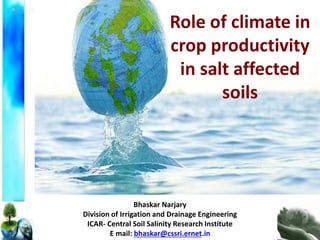
- 1. Role of climate in crop productivity in salt affected soils Bhaskar Narjary Division of Irrigation and Drainage Engineering ICAR- Central Soil Salinity Research Institute E mail: bhaskar@cssri.ernet.in
- 2. WEATHER AND CLIMATE Are Weather and Climate the Same? Weather is defined as the state of the atmosphere at some place and time, usually expressed in terms of temperature, air pressure, humidity, wind speed and direction, precipitation, and cloudiness. Meteorologists study weather. Climate is defined in terms of the average (mean) of weather elements (such as temperature and precipitation) over a specified period of time (30 years according to the World Meteorological Organization).
- 3. Weather Impacts on Agriculture Rainfall drives water availability and determines Sowing time (rain fed crops) Temperature drives crop growth, duration; influences milk production in animals and spawning in fish Temperature , RH influence pest and diseases incidence on crops, livestock and poultry Radiation influences the photosynthetic productivity Wet & dry spells cause significant impact on standing crops, physiology, loss of economic products (eg. fruit drop) Extreme events (eg. high rainfall/floods/heat wave/cold wave/cyclone /hail/frost) cause enormous losses of standing crops, live stock and fisheries
- 4. All plants have maximum, optimum and minimum temperature limits. The limits are cardinal temperature points. Optimum temperature range is very important. Wheat 3 – 4°C minimum 25° optimum 30° - 32°C maximum Rice 10-12°C minimum 30-32°C optimum 36-38°C maximum Significance of temperature Low temperature: Low temperature affects several aspects of crop growth viz., survival, cell division, photosynthesis, water transport, growth and finally yield. Chilling injury If the plants grown in hot temperature are exposed to low temperature, they will be killed (or) severely injured. When the night temperature is below 15°C field crops may show yellowing symptoms (eg) Tropical annuals. Freezing injury When the plants are exposed to extreme low temperature, water freezes into ice crystals in the intercellular spaces. (eg) Cell dehydration Temperate crops (potato, tea etc.,)
- 5. Significance of temperature Higher T causes faster crop development and thus shorter crop duration, which in most cases is associated with lower yields T impacts the rates of photosynthesis, respiration, and grain filling Warming leads to an exponential increase in the saturation vapor pressure of air. Increased VPD leads to reduced water-use efficiency, because plants lose more water per unit of carbon gain. Plants respond to very high VPD by closing their stomata’s, but at the cost of reduced photosynthesis rates and an increase in canopy T, which in turn may increase heat-related impacts. (Ray et al., 2002). warming increases the likelihood of heat stress during the critical reproductive period, which can lead to sterility, lower yields, and the risk of complete crop failure
- 6. HIGH TEMPERATURE INJURIES High temperature adversely affects mineral nutrition, shoot growth and pollen development resulting in low yield. Mineral Nutrition • High temperature stress causes reduction in absorption and subsequent assimilation of nutrients. • Absorption of calcium is reduced at temperature of 28º C in Maize. • Nutrient uptake is affected by both soil and air temperature in rice. • Nitrate reductase activity decrease under high temperature. Shoot growth • High temperature, even for short period, affects crop growth especially in temperate crops like wheat. • High air temperature reduces the growth of shoots and in turn reduces root growth. • High soil temperature is more crucial as damage to the roots is severe resulting in substantial reduction in shoot growth. • High temperature at 38º C in rice reduced plant height, root elongation and smaller roots. Significance of temperature
- 7. Significance of Moisture Crop plants will respond to reduced soil moisture by closing their stomata and slowing carbon uptake to avoid water stress, thereby raising canopy T and potentially increasing heat-related impacts. More intense rainfall events may lead to flooding and waterlogged soils, also pathways for damaged crop production.
- 8. Significance of CO2 Rising atmospheric CO2 concentrations provide some counteracting tendencies to the otherwise negative impacts of rising T and reduced soil moisture. Higher CO2 has a fertilization effect in C3 species such as wheat, rice, and most fruit and vegetable crops, given that photo respiratory costs in the C3 photosynthesis pathway are alleviated by higher CO2 Impact of atmospheric CO2 enrichment on Photosynthetic assimilation and bio molecular composition in berseem (Trifolium alexandrium) Saha et al., 2014
- 9. Elevated CO2 impact on crop yield of two pigeon pea cultivars (a) Pusa-992 and (b) PS-2009 (*significant at 5% level; **significant at 1% level). Saha et al., 2012
- 10. Relationship between crop water use and biomass under elevated and ambient CO2 levels (Saha et al., 2011). Relationship between aboveground biomass and cumulative under elevated and ambient CO2 (Saha et al., 2012) Impact on resource utilization efficiency under semi arid condition of New Delhi in pigeon pea
- 11. Influence of atmospheric CO2 enrichment on the oil content and fatty acid composition in castor bean Vanaja et al., 2008
- 12. Climate and salt salinity and sodicity
- 13. High temperature and high ET has been found to cause accumulation of salts in the upper soil horizon with decreased rate of downward leaching resulting into soil salinization/alkalization even in places that were not found affected earlier Climate plays an important role in maintaining the soil properties. It can have adverse effects on all type of soils yet can have even more deleterious effects on sodic lands. Increased sodicity affects the soil physical properties like dispersion and slaking, and cause dispersion of aggregates and loss of carbon within aggregates and physically protected from decomposition Altered pattern of rainfall can affect the capacity of soil to maintain the required level of organic carbon and also the soil structure. Sodic soils suffer from ponding on surface due to their lower infiltration rates. Climate and salt salinity and sodicity
- 14. Climate variability Climatic variability refers to Variation in Climate In the mean State In other statistics such as standard deviation and the occurrence of extremes Variability around the mean as a characteristics of climate
- 15. Climate change refers to a statistically significant variation in either the mean state of the climate or in its variability, persisting for an extended period (typically decades or longer). Climate change may be due to natural internal processes or external forcings, or to persistent anthropogenic changes in the composition of the atmosphere or in land use. Climate change Observed change in surface temperature 1901-2012 IPCC, 2013
- 16. Observed globally averaged combined land and ocean surface temperature anomaly 1850-2012 IPCC, 2013 According to the IPCC,2013 an increase in the average global temperature is very likely to lead to changes in precipitation and atmospheric moisture because of changes in atmospheric circulation and increases in evaporation and water vapor.
- 17. Impact of Climate Changes On Agriculture Shifts in Agro ecological zones Impact on crop production and productivity Salinization and alkalization Effect on soil organic matter and soil fertility Soil erosion and sediment transport Reduced soil water availability Pest , Diseases and Weeds Effect on biological health of soil Reduced ground water recharge
- 18. Impacts of climate change are expected to be severe in India due to its large population, predominance in agriculture, and its limited water resources. Haryana, one of the green revolutionary state, facing the tremendous challenges to agriculture due to changing climatic scenario. Moreover, both saline and fresh ground water resources further diversified the challenges for agriculture to cope up with changing climate.
- 19. Total Monsoon Summer Post Monsoon Rainfall Rainy Days Rainfall Rainy Days Rainfall Rainy days Rainfall Rainy days Mean 757.6 47.6 595.9 32.0 67.7 6.9 94.0 8.7 Standard Error 41.6 2.2 38.2 1.6 9.0 0.8 8.8 0.6 Median 706.3 45.0 585.1 29.0 55.0 5.0 84.5 9.0 Standard Deviation 259.8 14.0 238.8 10.3 56.2 5.0 55.0 3.7 Minimum 340.7 24.0 215.3 11.0 0.2 0.0 14.9 1.0 Maximum 1399.9 81.0 1271.3 51.0 252.9 20.0 233.0 16.0 CV 34.3 29.5 40.1 32.1 83.0 72.3 58.5 42.4 Statistical analysis of long period rainfall (mm) distribution and number of rainy days at Karnal (1972-2010) Narjary et al., 2014
- 20. 0 200 400 600 800 1000 1200 1400 1972 1974 1976 1978 1980 1982 1984 1986 1988 1990 1992 1994 1996 1998 2000 2002 2004 2006 2008 2010 2012 Monsoon Rainfall (mm) Year Exces Deficit Monsoon 0 50 100 150 200 250 300 1972 1977 1982 1987 1992 1997 2002 2007 2012 1 day maximum rainfall, mm Year June July August September Monsoon rainfall categorization as deficient, normal and Excess at Karnal, Haryana Categorization of monsoon rainfall based on long period average (LPA) and coefficient of variation (CV) indicates during last 10 years (2004-2013), 6 years during the received deficient rainfall (18-57% lower than LPA), 2 years normal rainfall and 2 years excess rainfall (9-70% higher than LPA). Frequency of one day maximum rainfall in monsoon months at Karnal, Haryana. In early two decades (1981-1990 and 1991- 2000), one day maximum rainfall (≥ 50 mm) mainly confined in June and July months but in last 13 years decades (2001-2013) it was shifted in August and September months. Narjary et al., 2014
- 21. Changes in monthly rainfall and reference evapotranspiration in Karnal in last decade (2001-2010) as compare to average (1972-2010) Season Months Rainfall ETo Rainfall ETo Rainfall ETo Average Value (1972- 2010) Average Value (1980- 2010) Average Value (2001- 2010) Average Value (2001- 2010) Change in % over average (1972- 2010) value Change in % over average (1980- 2010) value Winter January 26 47.07 23 45.45 -12 -3.43 February 31 65.44 40 67.23 +29 2.74 Summer March 27 112.07 19 114.22 -30 1.93 April 14 162.64 11 167.63 -21 3.07 May 28 202.34 37 203.40 +32 0.52 Monsoon June 92 187.12 101 185.69 +9 -0.76 July 198 155.01 137 155.88 -31 0.57 August 189 137.90 131 140.51 -31 1.90 September 106 121.76 150 119.56 +41 -1.80 Post Monsoon October 16 94.89 10 94.73 -37 -0.16 November 6 60.89 3 61.67 -50 1.29 December 14 45.31 8 46.32 -43 2.25 Narjary et al., 2014
- 22. Kendall's tau Sen' slope p-value (Two-tailed) alpha Jan -0.33 -0.04 0.00 0.10 Feb 0.08 0.01 0.48 0.10 Mar 0.22 0.06 0.05 0.10 Apr 0.25 0.06 0.03 0.10 May -0.11 -0.03 0.32 0.10 Jun -0.15 -0.03 0.18 0.10 Jul 0.16 0.02 0.17 0.10 Aug 0.12 0.01 0.28 0.10 Sep -0.21 -0.03 0.07 0.10 Oct 0.02 0.00 0.84 0.10 Nov 0.21 0.02 0.06 0.10 Dec -0.11 -0.02 0.31 0.10 Average 0.10 0.01 0.39 0.10 Mann- Kendall trend test for Maximum Temperature Narjary et al., 2014
- 23. Kendall's tau Sen' slope p-value (Two-tailed) alpha Jan -0.02 0.00 0.86 0.10 Feb 0.20 0.04 0.08 0.10 Mar 0.19 0.03 0.09 0.10 Apr 0.10 0.01 0.39 0.10 May 0.12 0.02 0.29 0.10 Jun -0.04 0.00 0.72 0.10 Jul 0.25 0.02 0.03 0.10 Aug 0.27 0.01 0.02 0.10 Sep 0.15 0.01 0.20 0.10 Oct 0.09 0.02 0.40 0.10 Nov 0.09 0.02 0.40 0.10 Dec 0.17 0.03 0.14 0.10 Average 0.33 0.02 0.00 0.10 Mann- Kendall trend test for Minimum Temperature Narjary et al., 2014
- 24. Sinha et al., (1998 ) observed that there was a 10 % decline in solar radiation in northwestern India during last two decades. It is widely perceived that in all the major cities of India, aerosol concentration has been increasing, resulting in decreased solar radiation and increased minimum temperature Hundal and Kaur, 1996; Aggarwal et al., 2000 Trend analysis of BSS during 1981- 2010 y = -0.0604x + 128.1 R² = 0.7415 5.0 5.5 6.0 6.5 7.0 7.5 8.0 8.5 9.0 1980 1985 1990 1995 2000 2005 2010 BSS (hr) Year
- 25. Mann- Kendall trend test for Rainfall, Rainy days and Evapotranspiration Rainfall Evapotranspiration Kendall's tau Sen's slope p-value (Two- tailed) Kendall's tau Sen's slope p-value (Two-tailed) Jan 0.07 0.17 0.53 -0.26 -0.27 0.05 Feb 0.08 0.20 0.47 0.11 0.14 0.40 Mar -0.10 -0.11 0.40 0.04 0.03 0.78 Apr -0.03 0.00 0.81 0.05 0.12 0.72 May 0.13 0.34 0.26 0.03 0.09 0.80 Jun 0.10 0.77 0.36 -0.13 -0.43 0.32 Jul -0.19 -2.17 0.09 -0.10 -0.15 0.44 Aug -0.14 -2.41 0.23 -0.06 -0.13 0.65 Sep 0.24 2.64 0.03 -0.23 -0.36 0.08 Oct -0.21 0.00 0.08 0.03 0.02 0.83 Nov 0.01 0.00 0.98 0.09 0.09 0.52 Dec -0.10 -0.03 0.37 0.02 0.01 0.92 Total -0.03 -0.70 0.81 -0.07 -0.76 0.62 SW -0.09 -2.50 0.43 -0.14 -1.02 0.30 W 0.12 0.73 0.30 -0.03 -0.04 0.86 Summer 0.02 0.11 0.84 0.07 0.41 0.62 post -0.16 -0.45 0.15 0.08 0.23 0.55 Rainy days -0.33 -0.57 0.00 Narjary and Kamra, 2013
- 27. A1 World: Market oriented Economic: Rapid Economic Growth Population : Peaks in 2050 and then gradually declines Governance: A convergent world, income and way of life converge between regions. Extensive social and cultural interaction worldwide. Technology: There are three subsets to the A1 family A1FI - fossil-fuels intensive. A1B - balanced on all energy sources. A1T - non-fossil energy sources. A2 World: Divided World Economy: Regionally Oriented, lowest per capita income Population: Continuously increasing population. Governance: Independently operating, self-reliant nations Technology: slower and more fragmented B1 World: convergent Economy: Service and information based, lower growth than A1 Population: Same as A1 Governance: Global solutions to economic, Social and environmental stability Technology: Clean and resource efficient technologies B2 World: Local Solutions Economy: intermediate levels of economic development Population: continuously increasing population, but at a slower rate than A2 Governance: Local solutions to economic, Social and environmental stability Technology: more rapid A2, less rapid more diverse A1/B1 IPCC, 2007 IPCC SRES Scenarios (Old Concept)
- 28. Climate models : Mathematic models used to simulate the behaviour of climate system. They incorporate information regarding climate processes, current climate variability and the response of the climate to the human-induced drivers. Global Circulation Models (GCM): Incorporate oceanic and atmospheric physics and dynamics and represent the general circulation of the planetary atmosphere or ocean. Usually coarse resolution 30 X30 Regional Circulation Models (RCM): Incorporation of local factors Usually higher resolution 0.50 X0.50
- 29. GCM: Hadley Centre’s Coupled Model (HadCM3) RCM: Providing Regional Climate for Impact Studies (PRECIS) Resolution : 0.440 x 0.440 State action plan on climate change Haryana, 2012
- 30. Projected Change in mean annual precipitation and temperature in Haryana State action plan on climate change Haryana, 2012
- 31. Mean Daily Maximum Temperature (0C) JF MAM JJAS OND Annual Haryana Baseline 21.4 38.2 34.5 24.5 29.7 Haryana Mid Century 22.6 40.3 36.2 24.9 31.0 Haryana End Century 25.7 42.8 38.8 28.2 33.9 Mean Daily Minimum Temperature (0C) Haryana Baseline 5.8 21.2 26.5 11.7 16.3 Haryana Mid Century 7.6 23.7 28.3 13.8 18.4 Haryana End Century 10.3 26.5 30.6 16.7 21.0 Comparison of projected changes in temperatures for IPCC SRES scenario with respect to baseline ** Change in Mean Daily Maximum Temperature (0C) JF MAM JJAS OND Annual Change from Baseline to Mid Century 1.2 2.1 1.7 0.4 1.3 Change from Baseline to End Century 4.3 4.6 4.3 3.7 4.2 Change in Mean Daily Minimum Temperature (0C) Change from Baseline to Mid Century 1.8 2.5 1.8 2.1 2.1 Change from Baseline to End Century 4.5 5.3 4.1 5 4.7 Temperature for IPCC SRES baseline and A1B scenario as simulated by PRECIS for Haryana State action plan on climate change Haryana, 2012
- 32. Projected Change in seasonal precipitation in Haryana State action plan on climate change Haryana, 2012
- 33. Projected Change in seasonal precipitation in Haryana State action plan on climate change Haryana, 2012
- 34. Projected Change in precipitation in Haryana State action plan on climate change Haryana, 2012
- 35. Description of the Representative Concentration Pathways (RCPs) and their SRES equivalents Name Radiative forcing Developed by CO2 Equiv (ppm) Temperatu re anomaly (0C) Pathway SRES* temperatur e anomaly equivalent RCP8.5 8.5 W/m2 in 2100. It is characterized by increasing greenhouse gas emission over time representative of scenarios in the literature leading to high greenhouse gas concentration levels. MESSAGE modeling team and the IIASA Integrated Assessment Framework at the International Institute for Applied Systems Analysis (IIASA), Austria. 1370 4.9 Rising SRES A1F1 RCP6.0 6 W/m2 post 2100. It is a stabilization scenario where total radiative forcing is stabilized after 2100 without overshoot by employing a range of technologies and strategies for reducing greenhouse gas emissions. AIM modeling team at the National Institute for Environment Studies, Japan. 850 3.0 Stabilizati on without overshoot SRES B2 IPCC,2013
- 36. Name Radiative forcing Developed by CO2 Equiv (ppm) Temperature anomaly (0C) Pathway SRES* temperature anomaly equivalent RCP4.5 4.5 W/m2 post 2100. It is a stabilization scenario where total radiative forcing is stabilized before 2100 by employing a range of technologies and strategies for reducing greenhouse gas emissions MiniCAM modeling team at the Pacific Northwest National Laboratory’s Joint Global Change Research Institute. 650 2.4 Stabilizati on without overshoot SRES B1 RCP2.6 (RCP3P D) 3 W/m2 before 2100, declining to 2.6 W/m2 by 2100. Its radiative forcing level first reaches a value around 3.1 W/m2 mid-century, returning to 2.6 W/m2 by 2100. Under this scenario greenhouse gas emissions and emissions of air pollutants are reduced substantially over time. IMAGE modeling team of the Netherlands Environmental Assessment Agency. 490 1.5 Peak and decline None Source: Chaturvedi et al. (2012); Rogelj et al. (2012)
- 37. Comparison of observed and simulated climate change All Figures © IPCC 2013 IPCC,2013
- 38. Mean Temp. Change (◦C)- CMIP5 Model Scenarios 2030s 2060 2080 RCP2.6 1.70 1.92 1.95 RCP4.5 1.85 2.49 2.87 RCP6.0 1.72 2.37 3.27 RCP8.5 2.02 3.31 4.78 Under the business as usual scenarios (RCP6.0 & RCP8.5), projected increase in the mean temperature in the range of 1.7-2.0 C by 2030s and 3.3-4.8 C by 2080s Source: Chaturvedi et al. (2012)
- 39. Precipitation Change (%)- CMIP5 Model Scenarios 2030s 2060 2080 RCP2.6 1.2 2.7 3.5 RCP4.5 0.8 4.3 7.0 RCP6.0 1.6 3.5 6.8 RCP8.5 2.4 6.6 11.3 Under the business as usual scenarios (RCP6.0 & RCP8.5), precipitation is projected to increase in the range of 4-5% by 2030s and 6-14% by 2080s Positive trend in frequency of extreme precipitation days (40 mm/day) for decades 2060 and beyond Source: Chaturvedi et al. (2012)
- 40. Extreme events becoming a matter of concern Year SWM Rainfall Departure (%) 2000 -8 2001 -15 2002 -19 2003 +2 2004 -13 2005 -1 2006 -1 2007 +5 2008 -2 2009 -23 2010 +2 2011 +1 2012 -8 2013 +6 2014 -12 (upto 30.9.2014) 2002 drought 20 day heat wave during May 2003 in Andhra Pradesh Extreme cold winter in the year 2002-03 Drought like situation in India in July 2004 Abnormal temperatures during March 2004 and Jan 2005 Floods in 2005 Cold wave 2005 - 06 Floods in arid Rajasthan & AP and drought in NE regions in 2006 Abnormal temperatures during 3rd week of Jan to 1st week of Feb 2007 All India Severe drought 2009 2010 – One of warmest years 2011 – Failure of September rains in AP 2012 – Drought in Punjab, Haryana, Gujarat and Karnataka. Neelam cyclone, AP floods 2013- Uttarakhand Floods, and hailstorms 2014- J & K Flood, Cyclones:Hudhud,Nilofur
- 41. Source: Chaturvedi et al. (2012) Projected change in the frequency of extreme rainfall days for future decades relative to the 1861–1870 Based on the MIROC-ESM-CHEM model for RCP4.5 scenario.
- 42. Trends in GHGs Emissions from Indian Agriculture In 2010, World emitted 50 billion tons CO2 eq. India emitted ~5% of global GHGs. Indian agriculture ~1% of global GHGs. From 1970 to 2010, GHGs emission from Indian agriculture increased by 70%. Emission per ha increased by 90%, but per ton food grain production decreased by 15%. 0 5 10 15 20 25 30 35 0 100 200 300 400 500 1970 1980 1990 2000 2010 Emission (% total GHGs) Emission (Mt CO 2 eq.) Emission from Indian agriculture Relative to India's total GHGs 0.0 0.2 0.4 0.6 0.8 1.0 1.2 1970 1980 1990 2000 2010 Emission (t CO 2 eq.) Emission per hectare Emission per ton foodgrain Pathak et al. (2014)
- 43. HadCM3, CSIRO-Mk2 and CCCMA- CGCM2 Crop-Syst Rice, Wheat 7%, 15% and 25% decrease in rice and 10%, 20% and 34% in wheat for the years 2020, 2050 and 2080 respectively in Central Punjab Jalota et al. (2013) A1FI scenario of IPCC WOFOST Potato In 2055, a mean decrease of 17.9 (Kufri Badshah), 21.1 (Kufri Jyoti) and 22% (Kufri Pukhraj) is likely in the productivity due to rise in temperature in Punjab Dua et al. (2013), Climatic model Crop model Objective crop Predicted impacts Researchers Summary of crop models used for the study of climate change impacts
- 44. Climatic model Crop model Objective crop Predicted impacts Researchers PRECIS GLAM Rice, Wheat Extreme temperature has a negative effect on crop yield Challinor et al. (2007) CERES-Rice CERES-Wheat Rice, Wheat Increase in minimum temperature up to 1.0 to 3.0 degrees Celsius above normal has led to decline in productivity of rice and wheat by 3% and 10% respectively in Punjab. Hundal and Prabhjyot-Kaur (2007) Global climate model (MIROC3.2.HI) and a regional climate model (PRECIS) InfoCrop-rice model Rice In the 2050 scenario, projected yield loss is expected to stand at 15–17 % in Punjab and Haryana Soora et al. (2011) Summary of crop models used for the study of climate change impacts
- 45. Estimated crop water requirement (mm) of two crops in major growing districts of the Haryana, and Punjab under climate change scenario District (State) 1990 2020 2050 % Change over 1990 2020 2050 Mustard Bharatpur (Raj) 276.2 283.8 295.1 2.8 6.8 Hisar (Haryana) 357.0 369.6 380.8 3.5 6.7 Wheat Sirsa (Haryana) 281.8 293.1 301.4 4.0 7.0 Sangrur (Punjab) 391.1 405.4 416.3 3.7 6.4
- 46. Crop water requirements to increase (wheat) S. No State Area (ha) Crop water requirement (mm) water requirement (million cubic meter) % Deviatio n (2020- 1990) % Deviation (2050- 1990) 1990 2020 2050 1990 2020 2050 1 J&K 253023 217.4 224.3 229.7 823.9 851.7 874.5 3.1 5.3 2 HP 367770 281.8 291.8 299.1 1051.1 1089.7 1119.2 3.7 6.3 3 Punjab 3468000 359.1 371.8 380.8 12553.6 13002.5 13317.5 3.6 6.1 4 Haryana 2316674 452.1 467.1 480.9 10475.4 10825.4 11158.0 3.4 6.4 5 UP 9443104 423.7 434.6 447.9 39717.8 40750.1 41990.4 2.6 5.8 6 Bihar 2076727 438.6 449.3 465.0 9046.2 9271.1 9593.9 2.5 6.1 7 West Bengal 366729 399.8 407.2 425.2 1449.5 1479.8 1543.1 1.9 6.4 8 Rajasthan 2010241 485.3 498.6 511.6 9923.6 10208.4 10479.5 2.7 5.4 9 Gujarat 727400 604.7 614.7 630.9 4603.3 4683.2 4807.1 1.7 4.3 10 Madhya Pradesh 4188248 502.0 513.3 526.2 21176.9 21655.3 22200.1 2.3 4.9 11 Maharashtra 932800 606.417 617.82 633.5 5613.8 5718.3 5859.4 1.9 4.5 AICRPAM - CRIDA
- 47. What to Do?
- 48. Climate change: Twin challenges Lower capacity to adapt Impacts are worse
- 49. Mitigation • Not Easy Adaptation Mitigation + Adoption Resilient
- 50. Achieve layers of resilience through Institutional and policy Responses to policies and institutions Technological adaptation: micro-irrigation technologies, water harvesting, flood mitigation, land drainage Social adaptation: Group action - social networks, information dissemination o SHGs, community projects, coping strategies, o local water management techniques, in-house conflict resolution, Farm level o changes in inputs, timings, tillage, o irrigation practices, o crop rotation, crop choice, crop diversification, o crop harvesting and processing
- 51. More water More labour More methane Mitigating methane emission from rice Puddled, transplanted, continuously submerged Aerobic rice SRI Direct seeded rice Less water, Less labour Less methane
- 52. About 70% of GWP in transplanted rice was due to methane. The GWP in rice was 728.1 kg CO2 eq. ha-1 in DSR vs. 1922.6 kg CO2 eq. ha-1 in transplanted rice. The GWP in DSR was only 38% of transplanted rice. GHG mitigation potential of DSR
- 53. Direct-seeded rice (DSR) and zero-till wheat (ZTW) gave similar yield with less irrigation water and lower global warming potential. Conservation Agriculture for Climate Change Adaptation and GHGs Mitigation 0.0 0.5 1.0 1.5 2.0 2.5 0 5 10 15 20 25 TPR- CTW TPR -ZTW DSR - ZTW DSR- ZTW+RR Global warming potential Rice eq. yield; System water demand Rice eq. yield (t) System water demand (cm) Global warming potential (t CO2 eq.)
- 54. Comparison of DSR and conventional transplanted rice (TPR) Parameter TPR DSR Yield (t ha-1) 4.1-7.7 4.0-7.4 Irrigation water (cm) 16-22 12-16 Labour (man days) 55-60 35-40 Tractor (hours) 10-12 5-6 GWP (kg CO2) 1661-1922 409-728
- 55. GWP of transplanted (TPR) and direct-seeded rice (DSR) in different districts of Punjab GWP in TPR GWP in DSR Legends GWP_TPR (t CO2/ha) GWP-DSR (t CO2/ha) 2.0-2.5 1.3-1.5 2.5-3.0 1.5-2.0 3.0-4.5 2.0-3.0
- 56. Sources of nitrous oxide Soil and Fertilizer Manure management Burning of crop residue
- 57. Leaf colour chart Urea tablet/ Nitrification inhibitor Smart Nitrogen Management Mitigation Options for Nitrous Oxide Emission from Agricultural Soils
- 58. What if CA is implemented partly, wrongly or discntinued after some time? Conservation agriculture (CA) promotes mitigation and C sequestration
- 59. When CA are implemented partly Happy seeder in wheat • No residue burning • C sequestration • Less GHG emission • But extra N? more N2O Puddling/submergence of C & N rich soil in rice •More methane •More nitrous oxide
- 60. Pathways for Development Developing Countries Developed Countries Climate-Smart Development Low carbon Low nitrogen Low energy Low profit Low interest of stakeholders
Editor's Notes
- seed yield (weight of seed per plant) increased marginally by 12% (Pusa 992) In PS-2009, pod weight and seed yield decreased by 38.2% and 33.3%, respectively The magnitude of decrease over control was 19.1% in Pusa-992 and 37.4% in PS-2009.
- Increase in RUE by 52.3% and WUE by 22.1%
- The oil content and quality of castor bean has not changed significantly under elevated CO2 levels compared to the ambient level. The content of major fatty acid, i.e. ricinoleic acid, in castor bean oil was reduced to 1.5% with 700 ppm CO2 concentration; the fraction of palmitic, stearic, oleic and linolenic acids however increased with enhanced levels of CO2.
- Figure SPM.1, Panel a Complete caption of Figure SPM.1: Figure SPM.1 | (a) Observed global mean combined land and ocean surface temperature anomalies, from 1850 to 2012 from three data sets. Top panel: annual mean values. Bottom panel: decadal mean values including the estimate of uncertainty for one dataset (black). Anomalies are relative to the mean of 1961−1990. (b) Map of the observed surface temperature change from 1901 to 2012 derived from temperature trends determined by linear regression from one dataset (orange line in panel a). Trends have been calculated where data availability permits a robust estimate (i.e., only for grid boxes with greater than 70% complete records and more than 20% data availability in the first and last 10% of the time period). Other areas are white. Grid boxes where the trend is significant at the 10% level are indicated by a + sign. For a listing of the datasets and further technical details see the Technical Summary Supplementary Material. {Figures 2.19–2.21; Figure TS.2}
- Figure SPM.6 | Comparison of observed and simulated climate change based on three large-scale indicators in the atmosphere, the cryosphere and the ocean: change in continental land surface air temperatures (yellow panels), Arctic and Antarctic September sea ice extent (white panels), and upper ocean heat content in the major ocean basins (blue panels). Global average changes are also given. Anomalies are given relative to 1880–1919 for surface temperatures, 1960–1980 for ocean heat content and 1979–1999 for sea ice. All time-series are decadal averages, plotted at the centre of the decade. For temperature panels, observations are dashed lines if the spatial coverage of areas being examined is below 50%. For ocean heat content and sea ice panels the solid line is where the coverage of data is good and higher in quality, and the dashed line is where the data coverage is only adequate, and thus, uncertainty is larger. Model results shown are Coupled Model Intercomparison Project Phase 5 (CMIP5) multi-model ensemble ranges, with shaded bands indicating the 5 to 95% confidence intervals. For further technical details, including region definitions see the Technical Summary Supplementary Material. {Figure 10.21; Figure TS.12}
- 40