Download as PDF, PPTX

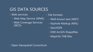
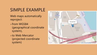
![SIMPLE EXAMPLE
<!DOCTYPE html>
<html>
<head>
<link rel="stylesheet” href="https://unpkg.com/leaflet
@1.3.3/dist/leaflet.css" />
<script src="https://unpkg.com/leaflet@1.3.3 /dist/leaflet.js"></script>
</head>
<body>
<div id="map" style="width: 600px; height:
400px;"></div>
<script>
var map = L.map('map').setView([-33.8733, 151.1991],
19);
L.tileLayer(
'https://{s}.tile.openstreetmap.org/{z}/{x}/{y}.png’
,{attribution: 'OpenStreetMap contributors’}
).addTo(map);
L.marker([-33.8733, 151.1991]).addTo(map)
.bindPopup('You are here.')
.openPopup();
</script>
</body>
</html>](https://image.slidesharecdn.com/atravellersguidetomappingtechnologiesindjango-180827010519/85/A-travellers-guide-to-mapping-technologies-in-django-38-320.jpg)


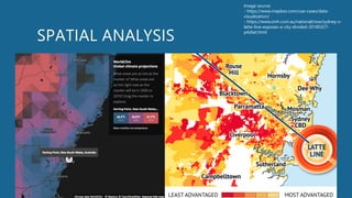
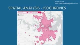
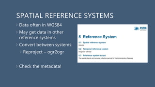
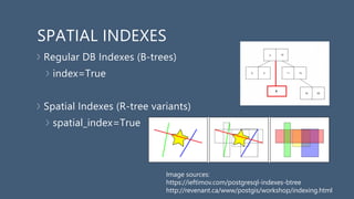
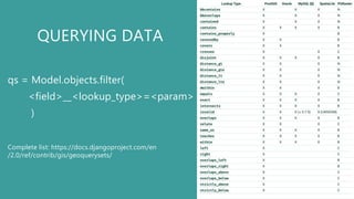
The document is a comprehensive guide on mapping technologies in Django, covering topics such as the fundamentals of mapping, storing and querying geospatial data, and displaying this data using various web mapping libraries. It emphasizes the importance of understanding geographic coordinate systems, data formats, and the functionality provided by Django's GIS capabilities. Additionally, the document explores future directions for geospatial technologies, highlighting mobile and augmented reality trends while encouraging the use of existing libraries and careful consideration of data sources and licenses.


![Getting Started with Apache Spark: Big Data Made Simple [Free Meetup]](https://cdn.slidesharecdn.com/ss_thumbnails/apachesparkgettingstarted-260203175547-8361bcc3-thumbnail.jpg?width=640&height=640&fit=bounds)


