1. See the energy at TGS.com
Spec sheet
Click to place
your Image
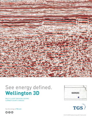
WELLINGTON COMPLEX 3D
MULTI-CLIENT 3D SURVEY 400.4 mi2
Sumner County, Kansas
2. See the energy at TGS.com
Spec sheet
ACQUISITION PARAMETERS
Wayne Millice
wayne.millice@tgs.com
Office: 713-860-2146
Main: 713-860-2100
John Sadler
john.sadler@tgs.com
Office: 713-860-2105
Mobile: 281-794-5039
Dennis Langlois
dennis.langlois@tgs.com
Office: 713-860-2129
Mobile: 713-703-6830
PROCESSING
STANDARD DELIVERABLES OPTIONAL PRODUCTS (additional costs may apply)
Acquisition Date:
Receiver Interval:
Source Interval:
Receiver Line Spacing:
Source Line Spacing:
Geophones:
Record Length:
Sample Interval:
Fold:
Recorded Bin Size:
Source Type:
Maximum Offset:
Recording Patch:
Receiver Orientation:
Surface Area:
Acquired By:
May 2012 - January 2013/March 2014
165 ft
165 ft
330 ft / 660 ft
495 ft / 660 ft
3
3000 ms
2 ms
182 / 56
82.5 x 82.5 ft
3 Vibrators, 1 sweep x 14 sec / 2 Vibrators, 1 sweep x 16 sec
8,284 ft / 6,899 ft
26 lines x 84 receivers / 14 lines x 64 receivers
North - South
303 sq. miles / 103.5 sq. miles
Dawson / Geokinetics
Processed by TGS/Arcis - Completed August 2016
Raw PSTM migration
Enhanced processed PSTM migration
3D Migration velocity trace volume
Processing report
PSTM gathers with NMO
PSTM gathers
Pre-migrated gathers
Stacking velocity trace volume
Field data
LAS well logs
Validated well headers
Mississippi Lime Basin Temperature Model