Oil and Mining
•
0 likes•53 views

Automatically avoiding roads restricted to hazardous materials

Recommended
Recommended
More Related Content
What's hot
What's hot (14)
Similar to Oil and Mining
Similar to Oil and Mining (20)
More from Sygic Enterprise Solutions
Recently uploaded
Recently uploaded (20)
Oil and Mining
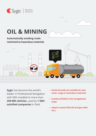
- 1. Sygic has become the world’s leader in Professional Navigation with SDK installed to more than 250 000 vehicles, used by 1 500+ satisfied companies in field. OIL & MINING Automatically avoiding roads restricted to hazardous materials ―― Avoid all roads not suitable for your truck, cargo or hazardous materials ―― Include oil fields in the navigational maps ―― Import custom POIs (oil and gas wells etc.)
- 2. Automatically avoids all roads not suitable for your truck, car- go, or hazardous materials by setting the vehicle’s parameters. SYGIC TRUCK NAVIGATION SELECTED INTEGRATING PARTNERS SELECTED FLEETS USING SYGIC PROFESSIONAL NAVIGATION –– ETA based on speed profiles for better accuracy –– Truck-specific database of Points of interest (POIs) such as parking and service stations –– Guided routes –– Multi stop planning and Waypoints –– Geofences and custom map overlays –– Rest stop planning Sygic Truck Navigation is integrated with MiX Telematics’ MiX Rovi, a rugged Android-based driver terminal. Sygic APIs were used to create geofences with speed limits, helping MiX Telematics to perform advanced speed monitoring and generate accurate over-speeding alerts to improve the behavior of the customers’ fleet drivers. “Working with Sygic means we can add best-of-breed on-board navigation and geofence capabilities to the MiX Rovi, in addition to other functionality like Hours of Service (HOS), driver feed- back and jobs and messaging,” Catherine Lewis, Executive Vice President Technology, MiX Telematics. “Reliable product and exceptional support from the Sygic Business Solutions team is the most compelling reason why we would recommend the Sygic Navigation,” Gavin Harvett, Head of Product Management, MiX Telematics. TOTAL, a major oil and gas corporation based in France, in- tegrated over 1000 trucks with Sygic Professional Navigation. Drivers have customized navigation menu and vehicle at- tributes are set up remotely over-the-air by dispatchers through “ChangeApplicationOption” API. Dispatchers also use the API function “GetItineraryList” enabling them to visualize real time drivers’ statuses, which waypoints have been already visited, which haven’t and what is the remaining distance to the final destination. Drivers are adding road restrictions directly into the navigation. In the navigation menu they have the option to mark the roads which are closed or problematic. These changes are then distributed to all other devices, and the navigation takes this into account when computing the route resulting in increased quality of routing for the whole fleet.