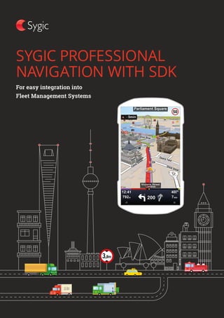
Sygic Professional Navigation with SDK
•
1 like•256 views

No internet connection needed. Maps are stored on the device. Software Development Kit (SDK) available for Android, Windows and Linux. Configurable for any large scale deployment. 60+ well documented APIs.

Recommended
More Related Content
Similar to Sygic Professional Navigation with SDK
Similar to Sygic Professional Navigation with SDK (20)
More from Sygic Enterprise Solutions
Recently uploaded
Recently uploaded (20)
Sygic Professional Navigation with SDK
- 2. No internet connection needed. Maps are stored on the device. Software Development Kit (SDK) available for Android, Windows and Linux. Configurable for any large scale deployment. 60+ well documented APIs.
- 3. SYGIC ENTERPRISE SOLUTIONSPROFESSIONAL NAVIGATION 1 #1 publisher on Google Play and iOS by Revenue in the Navigation category. 200M + consumer downloads. 5 million added each month. 110 + countries around the world. 1 M + professional drivers are using Sygic Professional Navigation every day. 200 employees. 2000 + Sygic North America Toronto, Canada Sygic Enterprise Solutions focuses on developing Professional Naviga- - portation, logistics, parcel delivery, automotive, utilities, emergency and municipal services. WE DEVELOP THE WORLD’S MOST INSTALLED AND MOST ADVANCED OFFLINE NAVIGATION APP. Sygic Headquarters Bratislava, Slovakia Sygic Sales Agency Shenzhen, China SYGIC ENTERPRISE SOLUTIONS
- 4. SYGIC ENTERPRISE SOLUTIONSPROFESSIONAL NAVIGATION 2 ENHANCING EFFICIENCY ACCROSS MULTIPLE INDUSTRIES DELIVERY Optimized itinerary management PUBLIC TRANSPORT Arrive safely with guided routes TAXI SERVICE Millions of POIs LONG HAUL Up to 10 % less km driven FIELD WORK Up to 20% increase in Productivity OIL & MINING Navigate on your own maps EMERGENCY Get to the incident faster MUNICIPAL SERVICES Save on New drivers training CONSTRUCTION Find construction sites on time
- 5. SYGIC ENTERPRISE SOLUTIONSPROFESSIONAL NAVIGATION 3 Sygic Professional Navigation can enhance the operational efficiency of your fleet with precise routing, a first class user experience and set of features specially designed for company fleets. Sygic Professional Navigation can add value to your fleet or transport management solution with minimum effort. SDK APIs, event call-backs and customizable configuration files help meet the specific requirements of various fleets. FIRST CLASS USER EXPERIENCE AND SET OF FEATURES SPECIALLY DESIGNED FOR COMPANY FLEETS ++
- 6. SYGIC ENTERPRISE SOLUTIONSPROFESSIONAL NAVIGATION 4 NAVIGATION OPTIONS GLOBAL MAP COVERAGE AND REGULAR MAP UPDATES Allowing vehicles with special permission to enter pedestrian zones and roads closed to regular vehicles. For enhanced efficiency of delivery, field work or any other commercial fleets. Sygic Professional Navigation maps cover almost all countries in the world using data from renowned global and local map providers or GIS systems. OUR PARTNERS The navigation has a built-in map downloader to provide always up-to-date maps over cellular or Wi-Fi networks. The map update can be triggered over the air using custom URL commands. Using truck-specific routing that automatically avoids roads not suitable for trucks, buses or special cargoes. Truck Navigation With special maps that contain taxi lanes and other features for better and faster service. Taxi Navigation Emergency Vehicles Navigation Fleet Navigation OpenStreetMap
- 7. SYGIC ENTERPRISE SOLUTIONSPROFESSIONAL NAVIGATION 5
- 8. SYGIC ENTERPRISE SOLUTIONSPROFESSIONAL NAVIGATION 6 AVAILABLE FEATURES Truck restricted roads Truck restriction signs Residential area Industrial area Map zoom in/out Exact address number Speed cameras
- 9. SYGIC ENTERPRISE SOLUTIONSPROFESSIONAL NAVIGATION 7 Lane assistant Next maneuver Distance to next change of direction POIs on route Current road/street/city Current speed Current speed limit Upcoming speed limit change Custom defined alerts Traffic information GRAPHICS OPTIMIZED FOR TABLET & HD DISPLAY
- 10. SYGIC ENTERPRISE SOLUTIONSPROFESSIONAL NAVIGATION 8 NAVIGATION Turn-by-turn voice instructions and automatic rerouting Timely turn indicators with the precise distance to each maneu- ver will guide you to your des- tination. If you miss a turn, our smart algorithm will immediately recalculate to get you back on your way. Spoken Street Names – TTS Sygic Professional Navigation provides voice instructions using TTS technology, including street names, so the driver’s eyes never have to leave the road. AUTOMATICALLY AVOIDS ALL ROADS UNSUITABLE FOR TRUCKS OR SPECIAL CARGOES
- 11. SYGIC ENTERPRISE SOLUTIONSPROFESSIONAL NAVIGATION 9 Truck attributes Automatically avoids all roads unsuitable for trucks, special cargoes, or hazardous materials by setting the vehicle’s parameters and truck-related attributes. Avoid toll roads on part or on entire route, avoid motorways Calculates routes taking into consideration toll costs. Guided routes The guided routes feature converts any geometry into a navigational route, which can be enhanced with additional instructions for drivers. 90 Pre-planned routes from any source (optimization systems, planning tools) can be pushed directly into the navigation.
- 12. SYGIC ENTERPRISE SOLUTIONSPROFESSIONAL NAVIGATION TIME EFFICIENCY Most accurate Estimated Time of Arrival (ETA) The calculation of the arrival time is based on historical data measurements of traffic intensity for different times of day, which makes the ETA highly accurate. Time domains for delivery Sygic Professional Navigation will guide the driver to the delivery location within the allowed time period. In the event that the delivery zone is not accessible to vehicles, the navigation will suggest the closest reachable destination. Real time traffic information Real-time warnings about traffic jams and the duration of the delay are provided. These help the driver to avoid delays on the route, save fuel and have exact ETAs for time-critical assignments. UP TO 10 % REDUCTION IN DISTANCES DRIVEN 10
- 13. SYGIC ENTERPRISE SOLUTIONSPROFESSIONAL NAVIGATION Most powerful Cloud-based Route Optimization The fastest and most effective route optimization for an unlimited number of waypoints accessible directly from Sygic Navigation. Sygic Professional Navigation route optimization promises up to 10 % reduction in distances driven. Itineraries with Time Windows Easy management of routes with multiple waypoints, where each waypoint can have a predefined time window and a stop time. The improved route summary window displays the list of way- points with provided time win- dows, stop times, ETA information to each waypoint and alerts in case of delays. AFTEROPTIMALIZATION BEFOREOPTIMIZATION 11
- 14. SYGIC ENTERPRISE SOLUTIONSPROFESSIONAL NAVIGATION Reach the destination on the right side of the road When specifying a house number while inputting a destination, the navigation can calculate the route in order to allow the driver to reach the destination on the right side of the road. Preferred right turn The preferred right turn (left in countries and territories with left- hand traffic) functionality of the Sygic Professional Navigation routing algorithm suggests routes that avoid time-consuming and dangerous left turns at intersec- tions against incoming traffic. Speed cameras database If the driver exceeds the speed limit while approaching a fixed speed camera, Sygic Professional Navigation alerts the driver and indicates the speed limit. The feature is also available in online mode, where it constantly updates the driver about new mo- bile camera locations and warns him whenever a new speed trap appears on the route. 50 12
- 15. SYGIC ENTERPRISE SOLUTIONSPROFESSIONAL NAVIGATION Screensaver Enables a screensaver mode that turns off the navigation screen on highways to reduce battery drain. The navigation screen reappears 5 km before the next turn or can be reactivated by simple tap on the screen. Night mode When driving at night, Sygic Professional Navigation Night mode turns on automatically to preserve night vision while driving. HUD interface Allows vehicle hardware pro- ducers to bring the navigation interface into the driver’s line of sight by linking directly with the navigation functions, and project- ing the route information onto a built-in screen on the dash- board or other display systems. PREFERREDRIGHTTURN 50 13
- 16. SYGIC ENTERPRISE SOLUTIONSPROFESSIONAL NAVIGATION 14 GEO FEATURES Geofences Allows areas on a map (geofence polygons) to be highlighted and to track vehicles and assets present in this area. The navigation notifies the driver and the dispatcher in real time if the driver crosses the border and about his presence inside the geofence. Custom map overlays Visualize various GIS layers (e.g. infrastructure lines, pipe network, or unmapped roads, etc.) on the Sygic Navigation map using the custom geometry files. Map conflation Companies, which need to nav- igate their drivers on roads not mapped on standard maps, such as private or lease roads, can im- port their map content onto Sygic Professional Navigation. Conflated maps can provide cus- tomers with voice-guided naviga- tion from the city directly to assets on your own roads like oil wells.
- 17. SYGIC ENTERPRISE SOLUTIONSPROFESSIONAL NAVIGATION 15 Import custom POIs Add custom points of interest (POIs) to the navigation maps. You can very easily find the nearest POI from your current position and get navigated to this waypoint. Workmates Fleets that need mutual visibility of vehicles can share the position of other co-workers directly on the navigation screen while navigating. YOU CAN IMPORT YOUR MAP CONTENT ONTO SYGIC PROFESSIONAL NAVIGATION
- 18. 1010101010011010101010101010101110101 1010101001101010101010101010111010111 101010011010101010101010 001101010101010101010111 1010011010 0011010101 SYGIC ENTERPRISE SOLUTIONSPROFESSIONAL NAVIGATION 16 SOFTWARE DEVELPOMENT KIT (SDK) SDK is a comprehensive and well-documented set of API functions for easy integration of Sygic Professional Navigation into any fleet and workforce mobility solution. Over 60 easy-to-use API functions allow flexible customization to help integrators and solution providers to meet the needs of different fleets. Functionality the API offers ―― Navigate by destination or by itinerary ―― Use stand-alone or plug-in Sygic Professional Navigation ―― Remotely install, manage and control the navigation ―― Communicate with drivers directly via the navigation Sygic navigation for fleets can be easily installed on any personal navigation device, MFD or in-dash hardware. Sygic SDK allows development in different programming languages and tools. ―― Add user-defined content to existing maps ―― Monitor driver and route status by accessing information from navigation ―― Text-to-speech converted messages sent from enterprise servers to drivers
- 19. SYGIC ENTERPRISE SOLUTIONSPROFESSIONAL NAVIGATION 17 INTEGRATION Sidebar with widgets Stand-alone The navigation may run as sepa- rate application, but it is fully con- trolled by integrators’ application. As needed, the navigation screen can be “hidden” by the applica- tion (allowing the driver to access other instructions as he reaches his destination) or brought on top (to navigate the driver to the next waypoint). This method benefits from full online functionality, including automatic activation and updates. Embedded In complex systems, where it is required, the navigation can be a part of integrators’ application, taking only a portion of the screen. With this method the integrator covers the activation and applica- tion management. Sygic Professional Navigation may run in embedded mode inside an application both in Windows and Android operating systems. Sidebar with widgets Sidebar represents a hybrid way of integration where integrators’ application is embedded inside navigation screen and is designed by means of configurable set of widgets and call-backs (to display information about driving time, driving behavior, information about tasks to perform).
- 20. SYGIC ENTERPRISE SOLUTIONSPROFESSIONAL NAVIGATION 18 CUSTOMIZATIONS AND SUPPORT Our business partners and clients have access to Business License System (BLS) which provides an overview of orders history and licenses and allows to manage li- censes, e.g. activate, deactivate or transfer licenses and many more useful functionalities. BLS allows to manage licenses online using a web portal or even using integration functionality to interconnect it with 3rd party billing systems and completely automate the licensing life-cycle. Sygic provides professional technical support to developers and software vendors integrat- SAN FRANCISCO NEW YORK ABU DHABI HONG KONG ing the navigation using our SDK. Resources for developers can be also found online on www.sygic.com/developers Bigger projects may require functionality that is not part of the standard Sygic Professional Navigation. Please contact our professional technical support team to dis- cuss your on-demand customi- zation requirements, and we are sure our highly skilled developers will provide you with a high quality solution to meet your very specific needs and standards. JAVA C++
- 21. SYGIC ENTERPRISE SOLUTIONSPROFESSIONAL NAVIGATION 19 TECHNICAL SPECIFICATIONS 2D version 3D version Device memory min 128 MB memory min 512 MB memory Storage map stored on SD card or internal memory map stored on SD card or internal memory Supported processors min 600 MHz min 1GHz 3D chip not required required Screen resolution min 240x240 min 480x320 Supported platforms Android, Windows CE, Windows Mobile, Windows XP, 7, 8.1, 10, Linux Android, Windows CE, Windows XP, 7, 8.1, 10, iOS European Middle Eastern Asian Bulgarian Lithuanian Arabic Azerbaijani Catalan Norwegian Farsi Hindi Croatian Polish Hebrew Chinese Czech Portuguese Chinese Traditional (HKG) Danish Portuguese (Brazil) Chinese Traditional (TWN) Dutch Romanian Indonesian English Russian Kazakh Estonian Serbian Kurdish Finish Slovak Malay (Bahasa) French Slovene Thai German Spanish Urdu Greek Swedish Vietnamese Hungarian Turkish Italian Ukrainian Latvian AVAILABLE IN MORE THAN 40 LANGUAGES HARDWARE COMPATIBILITY
- 22. ENHANCE PROFESSIONAL NAVIGATION WITH COMPATIBLE SYGIC MAPS Using a single source of map data in Sygic Professional Navigation on the drivers‘ device and Sygic Maps in the back office means that distances driven on the road are the same as planned in the office. This results in much more efficient operational cost planning. SYGIC MAPS Online Maps API, Geocoding & Search, Routing and Optimization APIs for web development of Enterprise solutions • Here, TomTom, OSM & local maps and data under one roof • Easy to integrate – intuitive maps APIs and outstanding support • Commercial routing & optimization algorithm for Truck, Emergency, Bus, Van, Taxi used by +500k professional drivers worldwide • Single source of map data and routing on web and on mobile device • Transparent pricing per asset PROFESSIONAL NAVIGATIONSYGIC ENTERPRISE SOLUTIONS 20 Features • MAPS API Embed raster map tiles or fast vector maps with any information and graphics using Custom Layers. • GEOCODING & SEARCH API Find places and addresses, convert them to geo-coordinates, or just see suggestions as you type using Autocomplete. • ROUTING API Pedestrian, car, truck, bus, delivery van or RV routing algorithms used by more than 150 million drivers worldwide. • ROUTE OPTIMIZATION API Multi-vehicle and multi-stop sequence optimization using various restrictions and attributes.
- 24. SYGIC BUSINESS SOLUTIONSPROFESSIONAL NAVIGATION 22 www.sygic.com/business Sygic HQ (Europe) Mlynské Nivy 16 821 09 Bratislava, SK Ph. +421 2 321 153 54 Sygic Sales Agency (China) Rm 1501, 2-2 Tian Yu Xiang Shan Futian District, Shenzhen 518000 Ph. +86-13902958292 Sygic North America 340 King Street East, 2nd Floor Toronto, ON M5A 1K8 Ph. 416 885 5539