
Recommended
More Related Content
Similar to Patna
Similar to Patna (20)
Recently uploaded
Recently uploaded (20)
Patna
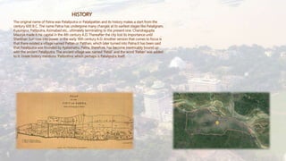
- 1. The original name of Patna was Pataliputra or Patalipattan and its history makes a start from the century 600 B.C. The name Patna has undergone many changes at its earliest stages like Pataligram, Kusumpur, Patliputra, Azimabad etc., ultimately terminating to the present one. Chandragupta Maurya made it his capital in the 4th century A.D. Thereafter the city lost its importance until Sherkhan Suri rose into power in the early 16th century A.D. Another version that comes to focus is that there existed a village named Pattan or Patthan, which later turned into Patna.It has been said that Pataliputra was founded by Ajatashatru. Patna, therefore, has become inextricably bound up with the ancient Pataliputra. The ancient village was named ‘Patali’ and the word ‘Pattan’ was added to it. Greek history mentions ‘Palibothra’ which perhaps is Pataliputra itself. HISTORY
- 2. THE CITY Patna is the capital and largest city of the state of Bihar in India. The second largest city in eastern India, had an estimated population of 1.68 million in 2011, making it the 19th largest city in India. Its urban agglomeration is the 18th largest in India, with over 2 million people. Patna also serves as seat of Patna High Court. One of the oldest continuously inhabited places in the world. Patna was founded in 490 BCE by the king of Magadha. Ancient Patna, known as Pataliputra, was the capital of the Magadha Empire under the Haryanka, Nanda, Mauryan, Sunga, Gupta and Pala. Pataliputra was a seat of learning and fine arts. Its population during the Maurya period (around 300 BCE) was about 400,000. Patna is located on the south bank of the Ganges River in Eastern India. The total area of Patna is 136 km2 (53 sq mi). Of this, the municipal area spans 99 km2 (38 sq mi), while the suburban area spans 36 km2 (14 sq mi). The exact cartographic co-ordinates of Patna are 25.6°N 85.1°E. It has an average elevation of 53 m (174 ft). A characteristic of the geography of Patna is its confluence of rivers. A narrow strip of somewhat high land about 8 kilometers in width along the southern bank of the Ganges having very fertile soil and alluvial fertile plains in the remaining portions. During the British Raj, Patna was part of the Bengal Presidency. After Nalanda district was split from Patna district in 1976,Patna does not contain of any hilly regions. It has an entirely alluvial and flat region. The land in the district is too fertile to be left for wild growth. The district is devoid of any forest wealth of consequences. The alluvial text of land yields rice, sugarcane and other foodgrains. The area under cultivation is studded with mango orchads and bamboo clumps. In the fields adjoining the Ganges weeds such as ammannia, citriculari, hygrophile and sesbania grow. But palmyra and date palm and mango orchards are found near habitations. Dry shrub jungles are sometimes seen in the villages away from the rivers. Trees commonly met with are bel, siris, jack fruits and the red cotton tree It is joined by four other rivers: Ghaghara, Gandak, Punpun and Sone. Patna is unique in having four large rivers in its vicinity. It is the largest riverine city in the world. The bridge over the river Ganges named Mahatma Gandhi Setu is 5575m long and is the longest river bridge in the India.