

Recommended
More Related Content
What's hot
What's hot (20)
Similar to Brasilia & Jaipur
Similar to Brasilia & Jaipur (20)
More from Mitiksha Jain
Recently uploaded
Recently uploaded (20)
Brasilia & Jaipur
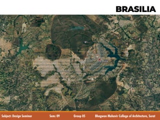
- 1. BRASILIA Subject: Design Seminar Sem: 09 Group 05 Bhagwan Mahavir College of Architecture, Surat
- 2. INTRODUCTION • Brasilia is the capital of Brazil • Brasília often refers to the Distrito Federal (Federal District), • Area of federal district is of 5,802 sq.m. • Climate is Tropical savannah climate and the average temperature is 20.5 °C (68.9 °F). • The population of Brasilian federal district is of 26,06,885. Population density was 435.98 inhabitants per square kilometer. (According to IBGE 2009 census) • Brasilia is the largest city (by population) in the world at the close of the 20th century that didn't exist at the beginning of the century. • The Human Development Index in the city is at 0.936 in the year 2000, (developed nation level), and the illiteracy rate is around 4.35%. • Brasilia is listed as a World Heritage Site by UNESCO. The city is a world reference for urban planning.
- 3. Federal District BRASILIA Territorial Area 5,8 thousand km² Population 2,5 million Cities 29 Economic Areas 33 BRASILIA: LOCATION AND STATISTICS
- 4. HISTORY • From 1763 to 1960, Rio de Janeiro was the capital of Brazil. • At this time, resources tended to be centered in Brazil's south east region near Rio de Janeiro. But geographically Brasilia is in central location. • Dating back to 1891 stated that the capital should be moved from Rio de Janeiro to a place close to the centre of the country. • plan was originally conceived in 1827 by José Bonifácio, an advisor to Emperor Pedro I. He presented a plan to the General Assembly of Brazil for a new city called Brasília with the idea of moving the capital westward from the heavily populated south eastern corridor. The bill was not enacted because Pedro I dissolved the Assembly. • uscelino Kubitschek , President of Brazil from 1956 to 1961, ordered the construction of Brasília. • Lúcio Costa won a contest and was the main urban planner in 1957, with 5550 people competing. Oscar Niemeyer, a close friend, was the chief architect of most public buildings and Roberto Brule Marx was the landscape designer. • Brasília was built in 41 months, from 1956 to April 21, 1960, when it was officially inaugurated. Oscar Niemeyer Lúcio Costa
- 5. CLIMATE • Dry and Humid Season The average temperature is 20.5 °c. • Highest average maximum temperature, 28 °c (82 °f). PURPOSE OF CITY • Locate the capital to an inland location. • Fear of invasions to previous capital Rio de Janeiro, To relieve the pressure of overpopulation from the old capital Rio de Janeiro. • To create a renewed sense of national pride. A completely modern 21st century city • To create a growth center. • To enhance a spirit of national unity. CULTURE • Diverse Culture: Portuguese , Africans, Italian, German, Other European, Japanese, Amerindian. • Architecture : Cubist ideas , abstract forms, baroque, colonial, modern, combination of skills rather than one. •Portuguese legacy: language , religion and law.
- 6. • The pilot plan for Brasília was built to conform to Le Corbusier's Letter of Athens , which, according to the Modernists, embodied the ideal qualities of a city. The Letter had four basic beliefs for the ideal city: • Well-ventilated residences near green spaces; • the separation of residences from workplaces, with industries excluded from the city proper; • exclusive space for cultural activities, near residencies; and • the separation of the circulation of vehicles and pedestrians. COMMERCIAL ADMINISTRATIVE PILOT PLAN ENTERTAINMENT RESIDENCIAL
- 7. • The basis of the plan of the city was a simple cross; • The cross had to be adapted to the local topography due to prior plans of an artificial lake and the city gained the shape of an aero plane; • The aero plane symbolizing the fastest way out of the town; City pointing like an arrow in to the future; Two intersecting axes: 1. A monumental scale, 2. A residential scale, 3. A gregarious (or social) scale, and 4. A bucolic scale. LAYOUT PLAN
- 8. LAND USE MAP
- 10. RESIDENTIAL AXIS: Twin houses Super blocks Residential zone Embassies and legations Individual residence north Individual residence south Sub-urban residences
- 11. GREEN AREAS: Wide open green areas Infront of residential zone.
- 12. ROAD NETWORK Vast highway network-access to Brasília from practically everywhere in Brazil. Application of principles of highway engineering • elimination of intersections • Fast central lanes • Side lanes for local traffic • This is the most important expressway in Brasilia is called as EIXAO • Pair of roads in the middle • Parallel to the EIXAO, at both sides, there are the small axes which give access to the residential blocks.
- 13. ROAD NETWORK There are two major avenues that crosses Brasília: • Eixo Rodoviário from South to North; it is usually called “Eixão”, which means “big axis” and it passes through the “wings” of the airplane figure of Brasília map; • Eixo Monumental from West to East, so called because the main monuments of Brasília are located there. There are two series of routes parallel to “Eixo Rodoviário”: W, W2, W3 and so on to the West; L, L2, L3 and so on to the East.
- 14. Location of the Airport, the Hotel Zones and the University Most hotels in Brasília are located in the zones called SHS (“Setor Hoteleiro Sul”) and SHN (“Setor Hoteleiro Norte”). Some hostels (“pousadas”) are located along the Southern half of W3 (“W3 Sul”). Touristic hotels are found at the edge of the lake “Lago Paranoá”.
- 16. RATIONALE Two axes crossing at right-angles in such a manner so as to gain maximum out of the local topographical conditions, the natural drainage of the area, by designing to suit the best possible orientation. Fig. 1 EQUILATERAL TRIANGLE The curved axis crossing the monumental axis because of the geographical constraints (to fit in triangle). Fig 2. FREE PRINCIPLES OF HIGHWAY ENGINEERING No intersections. Fig 3. MONUMENTAL AXIS Civic and administrative centers (transverse axis), cultural, entertainment and sporting centers, municipal administration facilities - barracks, the storage and supply zones, small local industries and railway station. Fig 4. INTERSECTION Appertaining functionally and in terms of urbanized composition to the monumental axis. Placement of banking, commercial districts, offices for private business, liberal professions and retail trade.
- 17. Paranoá Lakeis a large artificial lake that was built to increase the amount of water available and the region's humidity. The city's design divides it into numbered blocks as well as sectors for specified activities, such as: •the Hotel Sector, •the Banking Sector and •the Embassy Sector ARTIFICIAL LAKE
- 18. Super blocks Each block 280m square occupied by long. six-storey slab apartment buildings. Each group should have • A church • A secondary school • A movie house • A youth club • Adequate field space for children to play Lower building for commercial business in between super blocks.
- 19. • housing for 600,000 people; • grouped in a very orderly manner; • Between the superblocks commercial businesses;
- 20. Institution areas Commercial areas Residential areas Green space in super block - - - - - - - - - Vehicular axis - Pedestrian axis The master plan of Brasilia lacks consideration of pedestrian movement as most of spaces are planned according to concept of radiant city which is more of vehicular oriented planning. Super Blocks
- 21. Super Blocks
- 22. • Design for Brasilia brilliantly bound together the symbolic conception of the modern and ancient city. • The city has been acclaimed for its use of modernist architecture on a grand scale and for its utopian city plan. • The concept of super blocks : where people are allowed to live in high quality of life and also close to nature. • The Brazilian capital is the only city in the world built in the 20th century to be awarded (in 1987) the status of Historical and Cultural Heritage of Humanity by UNESCO, an agency of the United Nations. It also holds the distinction of waiting the shortest amount of time to be designated a World Heritage Site of any UNESCO entry, which occurred just 27 years after its completion in 1960. • Good planning policies : division of sectors and location of them (ex: residential buildings around expansive urban areas) Same life together. • City initially designed for 6 lakh people, but now the population is 26 lakh people. • Public transportation is inefficient. • Great distance between the buildings. • Traditional livelihood is missing. • Newer satellite town have very few green areas unlike the pilot plan. • The city was not designed on a pedestrian scale. • The displacement of poor residents too far away in satellite towns. • Class based differences. PROS CONS
- 23. Level of crime 70.93 High Crime increasing in the past 3 years 76.34 High Worries home broken and things stolen 45.58 Moderate Worries being mugged or robbed 68.46 High Worries car stolen 60.69 High Worries things from car stolen 71.35 High Worries attacked 47.71 Moderate Worries being insulted 36.40 Low Worries being subject to a physical attack because of your skin color, ethnic origin, gender or religion 22.76 Low Problem people using or dealing drugs 62.90 High Problem property crimes such as vandalism and theft 66.73 High Problem violent crimes such as assault and armed robbery 71.06 High Problem corruption and bribery 80.33 Very High CRIME RATE Safety walking alone during daylight 61.17 High Safety walking alone during night 26.91 Low
- 24. Comparison Region Climate Altitude Purpose of City • Locate the capital to an inland location. • Fear of invasions to previous capital Rio de Janeiro, To relieve the pressure of overpopulation from the old capital Rio de Janeiro. • To create a renewed sense of national pride. A completely modern 21st century city • To create a growth center. • To enhance a spirit of national unity. Economy Business Density
- 25. Comparison Ways of Transportation Migration rate Open bulit Landmarks
- 26. JAIPUR
- 27. INTRODUCTION Jaipur is the capital and the largest city of the Indian state of Rajasthan. It was founded on 18 November 1727 by Maharaja Sawai Jai Singh 2, the city has been named after him. Jaipur is also known as pink city and Paris of India. • Location: 26.92n, 75.82e • Altitude: 431 m above msl • Area: 484.64 km2 • Population: 3,046,189 • Density: 6300/km2 • Jaipur city is Rajasthan's capital and largest city. • It is situated in the eastern border of Thar desert. • It is 258 kms from Delhi and 232 kms from Agra, it forms a golden triangle to attract tourists. • Languages: – Official: Hindi – Regional: Rajasthani
- 28. HISTORY • 10th century onwards : the district Dhoondhar formed one of the four distinguishable politico- cultural regions of Eastern Rajasthan, in addition to Mewat, Hadauti and Mewar. • Dhoondhar region was roughly comprised of current districts of Jaipur, Dausa and Tonk, with Jaipur and Amber further constituting Dhoondhar subzone within the larger tract of Dhoondhar region. • The region was held by Badgujars, Rajputs and Minas till the 11th century. • From the 11th century onwards, however, the Dhoondhar region was increasingly under the power of Kachchwaha dynasty of Rajputs. • Sawai Jai Singh II (1700 1743) the Kachchwaha dynasty established the city of Jaipur and strengthened the boundaries of Dhoondhar.
- 29. HISTORY • In ancient history Jaipur makes appearance through Bairath. Bairat’s history goes back to the time of the Mahabharata and Mahabhashya , when it was known as “Viratnagar”. Viratnagar was the capital of Matsya Mahajanapada. The kingdom came under the control of the neighboring Chedi Kingdom in the 5th century BCE and was later part of the Mauryan Empire. • During medieval times, Amber, currently a subdivision of Jaipur, was the predecessor to Jaipur. • The city of jaipur was founded im 1726 by jai singh 2, the raja of amer who ruled from 1699 to 1743. • He planned to shift his capital from amer, 11 kms from jaipur to accommodate the growing population and increasing scarcity of water. • Unber the architectural guidance of vidyadhar bhattacharya, jaipur was planned based on the principles of vastu-shastra and shilpa shastra. • The city was divided into nine blocks, two of which contained the state buildings and palaces, with the remaining seven alloted to the public. • Huge ramparts were built, pierced by seven fortified gates.
- 30. REASONS TO CHANGE HIS CAPITAL FROM AMBER TO JAIPUR (1727) MILITARY REASONS • Defence • A site at the South of Amber ensured greater distance from Delhi. • the out skirting hill ranges (Nahargarh hills) shaped as a horseshoe would allow the new city to expand only in the South. • It was an open plain bounded on the northwest and east by hills. GEOGRAPHICAL REASONS • The rocky terrain of Amber restricted expansion. • Jaipur had the potentialities of developing into a city with adequate drinking water due to the presence of a perennial stream nearby and good drainage system. • Its rugged hills also ensured a constant supply a of building material.
- 31. TWO SIGNIFICANT FACTS RESPONSIBLE FOR THE ORIGIN OF THE CITY AND ITS SUBSEQUENT LAYOUT: • The need of a new capital for 18th century Dhoondhar as the earlier one of Amber built on a hill was getting congested. • Sawai Raja Jai Singh’s vision of the new capital as a strong political statement at par with Mughal cities and as a thriving trade and commerce hub for the region. SITE : avalley located south of Amber and the plains beyond, aterrain that wasthe bedof a dried lake;dense forest cover tothe north and the east of thesite. PHYSICAL CONSTRAINTS: hills on the north that housed the fort of Jaigarh and the Amber palace beyond, and the hills on the east, which contained the sacred spot of Galtaji.
- 32. • The medieval towns of Rajasthan were of military, agrarian, mercantile or religious nature. • The presence of a deity marked the reference point for the ruler’s abode and the rest of thecity. • The name of the town was usually associated with the political or religious centre (with the Ambikeshwar temple in the case of Amber and with Sawai Jai Singh in the case of Jaipur). The hill town of Dausa with an organic layout guided by the topography
- 33. Planned according to vastu shastra and Shilpa shastra. Plan of Jaipur is a grid of 3x3 with gridlines being the city’s main street. The primary streets from the sector which are then subdivided into smaller blocks by secondary and tertiary streets. The main artery runs east to west and is intersected by three primary streets running south and north. Intersection made prominent by the formation of cross. The main street keeps the palace at the focal point. The important functions are located on the main artery. PLANNING OF WALLED CITY
- 34. PLANNING OF WALLED CITY
- 35. CONCEPTUAL PLANNING It is a model of town planning the first planned city in India. It is based on Hindu systems of town planning and followed the principles prescribed in the Shilpa-shastra, an ancient Indian treatise on architecture .according to this shastra the site should be divided into grids or mandalas ranging from 2x 2 to 10 x 10. Planned according to the Prastara type of layout, which gives prominence to the cardinal directions. Thus plan of jaipur is a grid of 3x3 with gridlines being the city’s main streets.
- 36. • The central axis of the town was laid from East to West between the gates of the Sun(Suraj pol) and the moon(Chandpol) . • This was crossed by two roads at right angles dividing the town into nine almost square, almost equally sized blocks, which were further sub divided by lanes and alleys all at right angles. • By building the western boundary of the city right up to the hill’s southern apex, it provided a continuous line of defense. • The mandala could not be complete in the NW due to the presence of the hills. • On the other hand in the SE an extra square has been added that plugged the gap between the city and the eastern hills CONCEPTUAL PLANNING
- 37. • South of the main road were four almost equal rectangles. The rectangle opposite the palace has been broken up into two equal and smaller rectangles by the Chaura Rasta.Thus altogether there are now five rectangles on the south of the main road called Chowkris. • On the North of the main road from West to East are the Purani Basti, the Palace and Ramchandraji. • The principal bazaar leads from the western gate in the city wall, The Chandpole, passing in front of the Tripolia Gate, to the eastern city gate, the Surajpole. CONCEPTUAL PLANNING
- 38. PLANNING OF WALLED CITY
- 39. DEVELOPMENT OF WALLED CITY
- 40. DEVELOPMENT OF WALLED CITY
- 41. DEVELOPMENT OF THE CITY
- 42. DEVELOPMENT OF THE CITY
- 43. GROWTH OF JAIPUR OVER YEARS YEAR AREA ENVIAGED DEVIATIONS APPROXIMATE DEVELOPED AREA % INCREASE IN AREA AGAINST PLANNED AREA IF % GROWTH MAINTAINED 1971 - - 60 SQ. KM - - 1991 156 SQ. KM AREAS DEVELOPED WHICH WERE NOT ENVISAGED: PRN, PRATAPNAGAR, SITAPURA, SOUTH OF JAIPUR ( TOTAL APPROX. 5 SQ. KM) 214 SQ. KM 37.18% - 2011 326 SQ. KM PLANNED INTERVENTIONS IN TERMS OF NEW SECTORS, NRI COLONY, LAGALPURA, ETC 600 SQ. KM (AS OF 2009) 84.05% 400 SQ. KM River Course
- 44. ROAD NETWORK WITH IMPORTANT PLACES The study of urbanization shows that built-up area is increasing at very fast rate and acquires the area of crop and grass land. Maximum expansion of urban is found on fertile agricultural land in northern west and southern east direction (figure 3). Crop land, scrub/grass land and waste land is showing decreasing trend. This changing pattern is alarm for natural environment.
- 45. CLIMATE: • Jaipur has a semi-arid type of climate. Temperatures vary in different seasons. May and June are the hottest months in Jaipur. Temperature reaches up to 40- 45oC in these months. Annual rainfall is concentrated in the monsoon months between June (Last of June) and September. • The winter months of November to February are mild and pleasant, with average temperatures in the 15-18oC range and little or no humidity. December and January are the coldest months in Jaipur. Temperature varies between 5- 10oC in these months but there are however occasional cold waves.
- 46. Population: • While, the current population of Jaipur is estimated to be around 80 Lacs, its population, according to census of 2011, was 66,26,178. • Its population growth rate over the decade 2001-2011 was 26.91%. • Jaipur has a sex ratio of 909 females for every 1000 males and a literacy rate of 76.44%. • The district has a population density of 598 inhabitants per square kilometer. DEMOGRAPHICS YEAR POPULATION [IN LAKHS] 1991 15.18 2001 23.23 2011 36.02 2021 55.19 2025 64.95 YEAR ADDITION BY NATURAL GROWTH INCREASE BY MIGRATION NET INCREASE POPULATION % POPULATION % 1981 2.08 55.47 1.67 44.53 3.75 1991 3.00 59.64 2.03 40.36 5.03 2001 5.45 67.78 2.59 32.21 8.04 2011 6.77 52.93 6.02 47.07 12.79 2021 9.14 50.30 9.03 49.70 18.17 2025 5.40 50.00 5.63 50.00 10.76
- 47. CRIME RATE Level of crime 38.34 Low Crime increasing in the past 3 years 56.88 Moderate Worries home broken and things stolen 41.05 Moderate Worries being mugged or robbed 34.03 Low Worries car stolen 37.05 Low Worries things from car stolen 37.91 Low Worries attacked 33.60 Low Worries being insulted 25.47 Low Worries being subject to a physical attack because of your skin color, ethnic origin, gender or religion 16.04 Very Low Problem people using or dealing drugs 29.25 Low Problem property crimes such as vandalism and theft 41.79 Moderate Problem violent crimes such as assault and armed robbery 29.44 Low Problem corruption and bribery 61.79 High Index Crime Index: 36.10 Safety Index: 63.90
- 49. By Rutva Devani Mitiksha Jain Janvi Patel Madhvi Patel Dhruvin Guided By Dhruvita Mahida Nirav Khandwala Pooja Dhariawala