Downloaded 10 times

![Coastal & Estuarine Processes
Md Ibrahim, Oceanography, CU 23
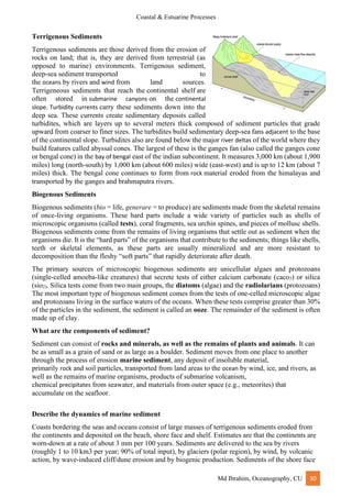
Capillary wave
Capillary wave, small, free, surface-water wave with such a short wavelength that its restoring force
is the water’s surface tension, which causes the wave to have a rounded crest and a V-shaped trough.
Capillary waves represent the initial stage of wave generation. They are the first waves produced by
small vortices in a completely flat sea, and they have a very short wavelength.
The maximum wavelength of a capillary wave is 1.73 centimeters (0.68 inch); longer waves are
controlled by gravity and are appropriately termed gravity waves. Unlike the velocity of gravity
waves, the velocity of capillary waves increases with decreasing wavelength, the minimum velocity
being 23.1 centimeters per second (9.09 inches per second), where the wavelength is the maximum
1.73 cm.
Gravity waves
Gravity waves are waves generated in a fluid medium or at the interface between two media when
the force of gravity or buoyancy tries to restore equilibrium. An example of such an interface is that
between the atmosphere and the ocean, which gives rise to wind waves.
A gravity wave results when fluid is displaced from a position of equilibrium. The restoration of the
fluid to equilibrium will produce a movement of the fluid back and forth, called a wave orbit.[1]
gravity
waves on an air–sea interface of the ocean are called surface gravity waves or surface waves, while
gravity waves that are within the body of the water (such as between parts of different densities) are
called internal waves. Wind-generated waves on the water surface are examples of gravity waves, as
are tsunamis and ocean tides.
wind-waves would catch your attention instead. They may start small-amplitude out at sea, but when
they meet a continental shelf, their wave height increases dramatically, creating a wall of water
approaching the shore.](https://image.slidesharecdn.com/coastaloceanographybyibrahim-221022145230-48ead07d/85/Coastal-Oceanography-Notes-23-320.jpg)

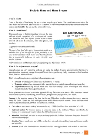
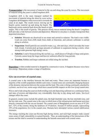
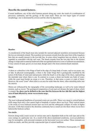
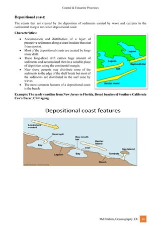
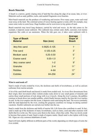
Coastal zones are dynamic environments where erosion, transportation, and deposition occur due to forces like waves, tides, currents, and sea level rise. Erosion breaks down land, transportation moves eroded materials elsewhere, and deposition occurs when materials are dropped off. Coastal features include beaches, cliffs, stacks, arches, and dunes, which are shaped by these processes. Weathering and erosion also influence coasts; weathering breaks down rock material without moving it while erosion physically moves material. Physical and chemical weathering break down rocks through freeze-thaw cycling, exfoliation, oxidation, and carbonation.


![谷歌留痕技术 [ 𝙩𝙤𝙥 𝟮𝟯𝟯. 𝙘 𝙤𝙢 ]](https://cdn.slidesharecdn.com/ss_thumbnails/top233-260130174328-3833018c-thumbnail.jpg?width=640&height=640&fit=bounds)


