Effect of climate variability on prosopis spread, vegetation and livestock by richard kyuma
•Download as PPTX, PDF•
3 likes•813 views


Recommended
Recommended
More Related Content
What's hot
What's hot (12)
Viewers also liked
Viewers also liked (20)
Similar to Effect of climate variability on prosopis spread, vegetation and livestock by richard kyuma
Similar to Effect of climate variability on prosopis spread, vegetation and livestock by richard kyuma (20)
More from AFRICAN LIVESTOCK CONFERENCE AND EXHIBITION (ALiCE 2014)
More from AFRICAN LIVESTOCK CONFERENCE AND EXHIBITION (ALiCE 2014) (20)
Recently uploaded
Recently uploaded (20)
Effect of climate variability on prosopis spread, vegetation and livestock by richard kyuma
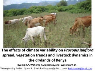
- 1. Kyuma R.*, Wahome R., Kinama J. and Wasonga V. O. *Corresponding Author: Kyuma R., Email: kavilakyuma@yahoo.com or kavilakyuma@gmail.com The effects of climate variability on Prosopis juliflora spread, vegetation trends and livestock dynamics in the drylands of Kenya
- 2. Introduction • Prosopis was introduced in Africa in the 1820s and in Kenya in the 1970’s and 1980’s • Prosopis juliflora (Sw.) DC has been aggressively taking over grazing lands in pastoral areas • Efforts to eradicate it have not succeeded anywhere in the world. • Due to its very hardiness and versatility, it grows fast in dry degraded lands and wastelands
- 3. Prosopis Juliflora – an aggressive invader It forms impenetrable thickets if not well managed
- 4. 4 It is evergreen It is a prolific producer
- 5. Problem statement • The relationships between climate variability and Prosopis invasion on pastoral livestock production systems and livelihoods is not well understood. Justification • There is no evidence that Prosopis spread patterns are related to climate variability and how that in turn affects vegetation trends and livestock population dynamics in the ASALs. Objective • To determine the effect of climate variability on Prosopis spread patterns, other vegetation trends and livestock population dynamics
- 7. Magadi SHOMPOLE OLKIRAMATIAN MAGADI OLDONYO-NYOIKE 36°30'0"E 36°30'0"E 36°20'0"E 36°20'0"E 36°10'0"E 36°10'0"E 36°0'0"E 36°0'0"E S 1°40'0"S S 1°50'0"S S 2°0'0"S S 2°10'0"S Legend Magadi Locations L. Magadi 0 10 205 KM WAJIR TURKANA MARSABIT KITUI GARISSA ISIOLO TANA RIVER MANDERA NAROK KAJIADO KILIFI SAMBURU TAITA TAVETA BARINGO KWALE LAMU WEST POKOT Legend L. Magadi Magadi Locations Dryland Counties with Prosopis Kenya Boundary 0 140 28070 KM Study site – Magadi Division of Kajiado County - Kenya Represents about 8% of the drylands of Kenya affected by Prosopis. Located in the southern rangelands; lowland agroecological zone Two landscape types were delineated (plains and hillslopes)
- 8. Materials and methods Cont’d Data types and sources • Time series rainfall and temperature data were extracted from the climate data collected from meteorological stations climate data for 20 years • Vegetation and Prosopis productivity data was derived from the Terra MODIS (250m) series vegetation indices Normalized Difference Vegetation Index (NDVI) satellite data • NDVI data was downloaded from the ENDELEO website (http://endeleo.vgt.vito.be/), • Livestock population data was collected and collated from livestock offices – Magadi and Kajiado and KNBS
- 9. GIS and remote sensing methods of vegetation biomass estimations • MODIS (250m) satellite derived NDVI images were used to establish the spread patterns of Prosopis in the area. • The 250m NDVI images were used to identify the vegetation types which were photosynthetically active during the drought periods. • These vegetation types were most likely Prosopis plants.
- 10. GIS and remote sensing methods cont’d • Participatory mapping of Prosopis clusters using community opinion leaders was done and focused group discussions were used in the plains and the hillslopes landscapes. • Land cover and land use data, soil data, GPS data, GIS databases were used to identify areas with the suitability characteristics for Prosopis to thrive. • The disappearance of other plant species was tracked using NDVI from MODIS (250m) satellite images, land use, land cover soil data and GPS data.
- 11. Data Analysis • Monthly total rainfall and average temperature trends for 20 years were established using Ms. Excel • Vegetation and Prosopis productivity (NDVI) for the plains and hillslopes (2000 – 2014) for the dry seasons’ trends were established • Livestock population trends (20 years) was established
- 12. Data analysis • Comparisons and relationships of the trends was done in the plains and the hillslopes landscapes • Correlation coefficients were determined for the relationships between rainfall and temperature, Prosopis spread patterns, other vegetation cover trends and livestock population.
- 13. Results Annual rainfall totals trend in Magadi, Kajiado Monthly rainfall totals in Magadi, Kajiado
- 14. Annual average temperatures in Magadi, Kajiado
- 15. Land cover change trends (1987-2008). Prosopis invasion in 2014
- 16. Olkiramatian plains short dry season (January to February) Prosopis NDVI trends Olkiramatian plains long dry season (June to September) Prosopis NDVI trends
- 17. Ngurumani hill slopes short dry season (January to February) Prosopis NDVI trends Ngurumani hill slopes long dry season (June to September) Prosopis NDVI trends
- 18. Olkiramatian all vegetation short dry season (January to February) NDVI trends Olkiramatian all vegetation long dry season (June to September) NDVI trends
- 19. Ngurumani all vegetation short dry season (January to February) NDVI trends Ngurumani all vegetation long dry season (June to September) NDVI trends
- 21. Olkiramatian location livestock population trends
- 22. Conclusions • The study revealed decreasing and variable rainfall amounts and patterns; and an increase in mean annual temperatures in the study area • vegetation cover was noted to decline especially during the long dry seasons when livestock feed supply is limited • Prosopis cover was increasing during the same period. The cattle populations were also on the decline over a 20 year period while the sheep and goats populations were on the increase.
- 23. Recommendations • It is recommended that viable Prosopis utilization options be explored to take advantage of the highly adaptable Prosopis to climate variability. • The economics of Prosopis pods and Prosopis carbon stocks as an alternative source of animal feeds and Prosopis based carbon trade need further studies.
- 24. References • Wahome et al., 2008; • Choge and Pasiecznik, 2006 • Tewari et al., 2000; • Pasiecznik et al., 2001 • Silva, 1986 • UNEP/CBD, 2010 • GOK- Kenya PDNA, 2012 • Kazmi et al., 2010 • Galvin et al., 2004; IPCC 2007 • Resilience Alliance, 2010; • Tennigkeit T. and Wilkes A., 2008; • WISP Policy Note No. 04, 2007