SlideShare a Scribd company logo
1 of 46
CONTENTS
Chapter I Introduction
1.1 Importance of field work 01
1.2 Choice of field area 02
1.3 Field work experience 04
Chapter II Study area 05
2.1 At a Glance 05
2.1.1 Topography 05
2.1.2 Drainage 07
2.1.3 Climate 08
2.1.4 Seasons 09
2.1.5 Environment 09
2.1.6 Forests 10
2.1.7 Economics 11
2.2 Transit Table 14
2.2.2Transit Maps 16
2.3 Disaster scenario of Nepal 17
2.3.1 Causes of Landslide 18
2.3.2 Impact 19
2.3.3 Landslidestriggeredbynepal earthquake 22
Chapter III Objectives & Methodology
3.1 Objectives 26
3.2 Methodology 27
Chapter IV Literature review 28
Chapter V Snaps from the field 31
Chapter VI Data Analysis 33
Chapter VII Findings and Suggestions 42
Chapter VIII Conclusions 43
Chapter IX Bibliography 44
Page1
CHAPTER I
1.1 IMPORTANCE OF FIELD WORK IN GEOGRAPHY
Field work is one of the unique attributes of Geography. As a subject concerned with the study
of phenomena in relation to the physical environment, it is mostly limited to the classrooms
only ultimately failing to make it more realistic, meaningful and intellectually challenging. This
is where the role of field work is emphasized the most. Geographers regard fieldwork as a vital
instrument for understanding our world through direct experience, for gathering basic data
about this world, and as a fundamental method for enacting geographical education. It allows
students to gather their own (primary) data, provide opportunities to extend classroom learning
through direct observation and experience, and allow for scientific research through field
experiments. It involves the process of observing and collecting data about people, cultures,
and natural environments. It is important in both the social and natural sciences. Social
sciences, such as economics or history, focus on people, culture, and society. Natural sciences,
such as biology or chemistry, focus on physical characteristics of nature and natural
environments.
As the term suggests, field works are learning experiences outside of the classroom. Field
studies allow students to gather their own (primary) data, provide opportunities to extend
classroom learning through direct observation and experience, and allow for scientific research
through field experiments. Field study trips include effective learning experience like
Activating, Acquiring, and Applying Strategies helping the students to involve in learning
rather than being passive spectators on a trip. It requires careful planning for meaningful
learning experiences before, during, and after the trip.
Field work helps in improving knowledge of geography and understanding giving us a chance
to learn skills in data collection and analysis, map work, observational and investigative skills,
computer and technology skills, communication and mathematical skills; gives a chance to
experience and enjoy a wide range of environments and landscapes; helps us understand other
peoples and cultures, and introspect our own views about social, political or environmental
issues which can’t be gained from reading books. In short it utilizes every knowledge a student
has gained through various different subjects of Geography. It also develops our leadership,
communication skills and teamwork spirits and moreover its enjoyable. These qualities have
made field work an integral part of the geography and a vital and valuable component of the
compulsory phase of every student’s Geography experience.
The basic principal of geography may be learned by indoor study of the subject but it is only
with systematic knowledge of various geographical elements that a geographic sense can be
inculcated. When the student has picked up the basic principles he can be proceed of facts;
their analysis may be done and the main geographical factors which are operating there may
be thoroughly apprehended.
Page2
1.2 CHOICE OF FIELD AREA
Field work is the process of observing and collecting data about people, cultures, and
natural environments. Field work is conducted in the wild of our everyday surroundings rather
than in the semi-controlled environments of a lab or classroom. This allows researchers to
collect data about the dynamic places, people, and species around them. Field work enables
students and researchers to examine the way scientific theories interact with real life. Field
work is important in both the social and natural sciences. Social sciences, such
as economics or history, focus on people, culture, and society. Natural sciences, such
as biology or chemistry, focus on physical characteristics of nature and natural environments.
Field area of Kathmandu, Chautara and Barhabise (Nepal) were selected by the students taking
consideration the following aspects:
 Geographical vividness (Rural- Urban dichotomy)
 Proximity to India
 Affordability
 Appropriate for the study themes (Disaster prone zone)
Nepal, country of Asia, lying along the southern slopes of the Himalayan mountain ranges. It
is a landlocked country located between India to the east, south, and west and the Tibet
Autonomous Region of China to the north. Its territory extends roughly 500 miles (800
kilometres) from east to west and 90 to 150 miles from north to south. Nepal is a very popular
tourist destination apart from its history, culture and scenic locations, it is also known for its
Buddhist places. Many perennial rivers flow in the state, and numerous hydroelectricity
projects set up.
Kathmandu is a pupil-dilating experience, a riot of sights, sounds and smells that can quickly
lead to sensory overload. Whether you’re barrelling through the traffic-jammed alleyways of
the old town in a rickshaw, marvelling at the medieval temples or dodging trekking touts in
the backpacker district of Thamel, Kathmandu can be an intoxicating, amazing and
exhausting place. The metropolitan city area is 50.67 square kilometres (19.56 sq mi) and has
a population density of 3000per km² and 17000 per km square in city. The city stands at an
elevation of approximately 1,400 metres (4,600 ft) in the bowl-shaped Kathmandu Valley of
central Nepal. It is surrounded by four major mountains: Shivapuri, Phulchoki, Nagarjun, and
Chandragiri. Kathmandu Valley is part of three districts (Kathmandu, Lalitpur, and
Bhaktapur), has the highest population density in the country, and is home to about a twelfth
of Nepal's population. This endlessly fascinating, sometimes infuriating city has enough
sights to keep you busy for a week, but be sure to leave its backpacker comforts and explore
the ‘real Nepal’ before your time runs out. Fine mountain views and warm days until
December, with high-season crowds. March brings the Seto Machhendranath festival. Days
can be hot in May. Hot days and frequent monsoon showers, but also the spectacular Indra
Jatra festival in June- September. The 2015 earthquake destroyed several temples in
Kathmandu's Unesco-listed Durbar Sq, but most areas emerged unscathed. Stroll through the
backstreets and Kathmandu’s timeless cultural and artistic heritage still reveals itself in
hidden temples overflowing with marigolds, courtyards full of drying chillies and rice, and
tiny hobbit-sized workshops.
Chautara is a municipality in Sindhupalchowk District in the Bagmati Zone of
central Nepal. It is now divided to 14 wards. This is the district headquarters of the
Page3
Sindhupalchowk District. The municipality stands at the elevation of approximately 1,600 m
above sea level. Religious and cultural festivities form a major part of the lives of people
residing in Chautara. There are people of various religious beliefs, Hinduism, Buddhism and
Christianity as well, giving Chautara a cosmopolitan culture. Nepali is the most commonly
spoken language in the municipality. Likewise, Newari and other languages such as Tamang
is also spoken as the Newars and Tamangs dominate the settlement in population. Chautara is
in the Deciduous Monsoon Forest Zone, one of five vegetation zones defined for Nepal. The
dominant tree species in this zone are oak, pine, beech, maple and others, with coniferous
trees at higher altitude. The town was severely affected by the earthquake on 25 April 2015.
Over ninety percent of the homes in the town had been destroyed. The main hospital of the
town had collapsed. The town suffered from water shortages.[2] Relief workers and the Nepali
army met government officials in Chautara to discuss the emergency response to the
humanitarian crisis. However, government officials have stayed out of sight due to the anger
of the residents of the town. Dozens of people crowded in front of the administrative office in
Chautara, demanding that officials deliver more tents to earthquake survivors sleeping
without shelter. The government had tents, but they were not given to the residents of the
town.
Bahrabise is a city in Sindhupalchok District in the Bagmati Zone of central Nepal. It
consists of nine wards. t is lies on Araniko Highway - the 114 km-long highway which
connects the capital city Kathmandu to the Chinese border in the north. The village was
affected by the earthquake on 25 April 2015. A joint coordination committee among all
political parties in the three constituencies of the Sindhupalchok district was formed to carry
out a rescue mission in the village.
Page4
1.3 FIELD WORK EXPERIENCE
It’s a great experience. It broadened my perception in many ways and it too helped me improve
some of my skills. My field placement has been an incredible avenue for me to learn and
practice. Under the guidance of two brilliant supervisors, I have had the opportunity to grow
both as an individual and a future field work researcher. This experience has completely
exceeded my expectations of what I thought I would learn in the field. I was fortunate to have
highlighted the numerous strengths of the community through various spheres.
Got to know the
diversity and
dichotomy of socio-
cultural, spatial
features in the
study area
Got to know
the
implementation
of Government
policies
Developed
interaction skills
Recreation
Increasein
Knowledge
base
Enhancement
in Analytical
skills
Developed
team spirit
Page5
CHAPTER II
STUDY AREA
2.1 AT A GLACE
Nepal, country of Asia, lying along the southern slopes of
the Himalayan
mountain ranges. It is a
landlocked country
located between India
to the east, south, and
west and the Tibet
Autonomous Region of
China to the north. Its
territory extends
roughly 500 miles (800
kilometres) from east
to west and 90 to 150
miles from north to south. The capital is Kathmandu. Nepal,
long under the rule of hereditary prime ministers favouring
a policy of isolation, remained closed to the outside world
until a palace revolt in 1950 restored the crown’s authority
in 1951; the country gained admission to the United Nations
in 1955. In 1991 the kingdom established a multiparty
parliamentary system. In 2008, however, after a decadelong
period of violence and turbulent negotiation with a strong
Maoist insurgency, the monarchy was dissolved, and Nepal
was declared a democratic republic.
Wedged between two giants, India and China, Nepal seeks
to keep a balance between the two countries in its foreign
policy—and thus to remain independent. A factor that
contributes immensely to the geopolitical importance of the
country is the fact that a strong Nepal can deny China access
to the rich Gangetic Plain; Nepal thus marks the southern
boundary of the Chinese sphere north of the Himalayas in
Asia.
2.1.1 TOPOGRAPHY
Despite being such a small country, Nepal is extensively
diverse in terms of topography. Mountains and rugged hills
cover almost 75% of Nepal's land area, and beyond the
perpetual snow lined mountains exists the tropical region of
Tarai. The Tarai Region (in the south) along the border with
India, is a low stretch of land, containing Nepal's lowest
point: Kanchan Kalan at 229 ft. (70 m). This area is Nepal's
most significant agricultural region.
In addition to Tarai, Nepal is home to two more distinct
horizontal regions:
The Hill Region (central) consists of mountains, hills, flatlands and deep valleys, with elevations
ranging from 1,968 to 9,842 ft. (600 to 3,000 m).
Land Area 143,351 km2
Water Area 3,830 km2
Total Area 147,181km2 (#93)
Population 29,033,914 (#45)
Population
Density
202.54/km2
Government
Type
Federal Parliamentary
Republic
GDP (PPP) $71.52 Billion
GDP Per
Capita
2,500$
Currency Rupee (NPR)
Population
living on
$1.25 per
day
25%
Capital Kathmandu
Human
Developmen
t Index
Nepal ranks among the
poorest — 145 out of
188 countries
Risk of
earthquakes
Nepal ranks 11th in the
world for vulnerability
to earthquakes
Percentage
of
population
in urban
areas
19%
Page6
The Himalayan Region (north) contains 202 mountains rising to more than 19,685 ft. (6,000 m)
and 13 mountains rising to more than 26,246 ft. (8,000 m) high, including, of course, Mt. Everest,
the world's highest mountain at 29,035 ft. (8,850 m), and the enormous Annapurna massif.
Also within the Himalayan region is the Kali Gandaki Gorge, which by some measures is
considered the deepest gorge in the world, and (over the past several centuries) has been utilized
as a trade route between India and Tibet.
The snow-covered mountains of Nepal are replete with cold water rivers; the four major ones
(from west to east) are the Kail, Karnali, Narayani and Kosi. As a result of its years of
geographic and self-imposed isolation, Nepal is one of the least developed nations of the world.
In recent years many countries, including India, China, the United States, the United Kingdom,
Japan, Denmark, Germany, Canada, and Switzerland, have provided economic assistance to
Nepal. The extent of foreign aid to Nepal has been influenced to a considerable degree by the
strategic position of the country between India and China.
Natural Resouces Quartz, water, timber, hydropower, scenic beauty, small deposits of
lignite, copper, cobalt, iron ore
Land use Arable land: 16%
Permanent rops: 0.8%
Irrigated land: 11,680 km² (2003) Nearly 50% of arable land
Others: 83.2%
Renewable water resource 2 10.2 km3 (2011)
Natural Hazard Earthquake, severe thunderstorms, flooding, landslides, drought,
and famine depending on the timing, intensity and duration of the
summer monsoons
Environmental issues Deforestation overuse of wood for fuel and lack of alternatives);
contaminated water (with human and animal wastes, agricultural
runoff, and industrial effluents); wildlife conservation; vehicular
emissions
International Agreements
(Environmental)
Biodiversity, Climate Change, Climate Change-Kyoto Protocol,
Desertification, Endangered Species, Hazardous Wastes, Law of the
Sea, Ozone Layer Protection, Tropical Timber 83, Tropical Timber
94, Wetlands
Signed but not ratified: Marine life conservation
Existing and proposed dams, barrages and canals for flood control,
irrigation and hydroelectric generation.
Page7
2.1.2
DRAINAGE
The
Kāthmāndu
Valley, the
political and
cultural hub of
the nation, is
drained by the
Bāghmati
River, flowing
southward,
which washes
the steps of the
sacred temple
of
Paśupatinātha
(Pashupatinath) and rushes out of the valley through the deeply cut Chhobar gorge. Some sandy
layers of the lacustrine beds act as aquifers (water-bearing strata of permeable rock, sand, or
gravel), and springs occur in the Kāthmāndu Valley where the sands outcrop. The springwater
often gushes out of dragon-shaped mouths of stone made by the Nepalese; it is then collected in
tanks for drinking and washing and also for raising paddy nurseries in May, before the monsoon.
Drained by the Seti River, the Pokharā Valley, 96 miles west of Kāthmāndu, is also a flat
lacustrine basin. There are a few remnant lakes in the Pokharā basin, the largest being Phewa
Lake, which is about two miles long and nearly a mile wide. North of the basin lies the
Annapūrna massif of the Great Himalaya Range.
The major rivers of Nepal—the Kosi, Nārāyani (Gandak), and Karnāli, running southward
across the strike of the Himalayan ranges—form transverse valleys with deep gorges, which are
generally several thousand feet in depth from the crest of the bordering ranges. The watershed
of these rivers lies not along the line of highest peaks in the Himalayas but to the north of it,
usually in Tibet.
The rivers have considerable potential for development of hydroelectric power. Two irrigation-
hydroelectric projects have been undertaken jointly with India on the Kosi and Nārāyani rivers.
Discussions have been held to develop the enormous potential of the Karnāli River. A 60,000-
kilowatt hydroelectric project at Kulekhani, funded by the World Bank, Kuwait, and Japan,
began operation in 1982.
In the upper courses of all Nepalese rivers, which run through mountain regions, there are little
or no flood problems. In low-lying areas of the Tarai plain, however, serious floods occur.
The rivers and small streams of the Tarai, especially those in which the dry season discharge
is small, are polluted by large quantities of domestic waste thrown into them. Towns and
villages have expanded without proper provision for sewage disposal facilities, and more
industries have been established at selected centres in the Tarai. The polluted surface water in
the Kāthmāndu and Pokharā valleys, as well as in the Tarai, are unacceptable for drinking.
Page8
2.1.3 CLIMATE
Altitudinal Belts
Nepal's latitude is about the same as that of Florida, however with elevations ranging from less
than 100 meters (300 ft) to over 8,000 meters (26,000 ft) and precipitation from 160 millimeters
(6 in) to over 5,000 millimeters (16 ft) the country has eight climate zones from tropical to
perpetual snow.[2]
The tropical zone below 1,000 meters (3,300 ft) experiences frost less than once per decade.
It can be subdivided into lower tropical (below 300 meters or 1,000 ft.) with 18% of the nation's
land area) and upper (18% of land area) tropical zones. The best mangoes and well as papaya
and banana are largely confined to the lower zone. Other fruit such as litchee, jackfruit,
citrusand mangoes of lower quality grow in the upper tropical zone as well. Winter crops
include grains and vegetables typically grown in temperate climates. The Outer Terai is
virtually all in the lower tropical zone. Inner Terai valleys span both tropical zones. The Sivalik
Hills are mostly upper tropical. Tropical climate zones extend far up river valleys across the
Middle Hills and even into the Mountain regions.
The subtropical climate zone from 1,000 to 2,000 meters (3,300 to 6,600 ft) occupies 22% of
Nepal's land area and is the most prevalent climate of the Middle Hills above river valleys. It
experiences frost up to 53 days per year, however this varies greatly with elevation, proximity
to high mountains and terrain either draining or ponding cold air drainage. Crops include rice,
maize, millet, wheat, potato, stone fruits and citrus.
The great majority of Nepal's population occupies the tropical and subtropical climate zones.
In the Middle Hills, upper-caste Hindus are concentrated in tropical valleys which are well
suited for rice cultivation while Janajati ethnic groups mostly live above in the subtropical
zone and grow other grains more than rice.
The Temperate climate zone from 2,000 to 3,000 meters (6,600 to 9,800 ft) occupies 12% of
Nepal's land area and has up to 153 annual days of frost. It is encountered in higher parts of the
Middle Hills and throughout much of the Mountain region. Crops include cold-tolerant rice,
maize, wheat, barley, potato, apple, walnut, peach, various cole, amaranthus and buckwheat.
The Subalpine zone from 3,000 to 4,000 meters (9,800 to 13,100 ft) occupies 9% of Nepal's
land area, mainly in the Mountain and Himalayan regions. It has permanent settlements in the
Himalaya, but further
south it is only
seasonally occupied as
pasture for sheep,
goats, yak and hybrids
in warmer months.
There are up to 229
annual days of frost
here. Crops include
barley, potato,
cabbage, cauliflower,
amaranthus,
buckwheat and apple.
Medicinal plants are
gathered.
The Alpine zone from
4,000 to 5,000 meters (13,100 to 16,400 ft) occupies 8% of the country's land area. There are a
Page9
few permanent settlements above 4,000 meters. There is virtually no plant cultivation although
medicinal herbs are gathered. Sheep, goats, yaks and hybrids are pastured in warmer months.
Above 5,000 meters the climate becomes Nival and there is no human habitation or even
seasonal use. Arid and semi-arid land in the rainshadow of high ranges have a Transhimalayan
climate. Population density is very low. Cultivation and husbandry conform to subalpine and
alpine patterns but depend on snowmelt and streams for irrigation.
Precipitation generally decreases from east to west with increasing distance from the Bay of
Bengal, source of the summer monsoon. Eastern Nepal gets about 2,500 mm (100 in) annually;
the Kathmandu area about 1,400 mm (55 in) and western Nepal about 1,000 mm (40 in). This
pattern is modified by adiabatic effects as rising air masses cool and drop their moisture content
on windward slopes, then warm up as they descend so relative humidity drops. Annual
precipitation reaches 5,500 mm (18 ft) on windward slopes in the Annapurna Himalaya beyond
a relatively low stretch of the Mahabharat Range. In rainshadows beyond the high mountains,
annual precipitation drops as low as 160 mm (6 in).
2.1.4 SEASONS
The year is divided into a wet season from June to September—as summer warmth over Inner
Asia creates a low-pressure zone that draws in moist air from the Indian Ocean—and a dry
season from October to June as cold temperatures in the vast interior creates a high-pressure
zone causing dry air to flow outward. April and May are months of intense water stress when
cumulative effects of the long dry season are exacerbated by temperatures rising over 40 °C
(104 °F) in the tropical climate belt. Seasonal drought further intensifies in the Siwaliks hills
consisting of poorly consolidated, coarse, permeable sediments that do not retain water, so
hillsides are often covered with drought-tolerant scrub forest. In fact, much of Nepal's native
vegetation adapted to withstand drought, but less so at higher elevations where cooler
temperatures mean less water stress.
The summer monsoon may be preceded by a buildup of thunderstorm activity that provides
water for rice seedbeds. Sustained rain on average arrives in mid-June as rising temperatures
over Inner Asia creates a low-pressure zone that draws in moist air from the Indian Ocean, but
this can vary up to a month. Significant failure of monsoon rains historically meant drought and
famine while above-normal rains still cause flooding and landslides with losses in human lives,
farmland and buildings.
The monsoon also complicates transportation with roads and trails washing out while unpaved
roads and airstrips may become unusable and cloud cover reduces safety margins for aviation.
Rains diminish in September and generally end by mid-October, ushering in generally cool,
clear, and dry weather, as well as the most relaxed and jovial period in Nepal. By this time, the
harvest is completed and people are in a festive mood. The two biggest and most important
Hindu festivals Dashain and Tihar (Dipawali) arrive during this period, about one month apart.
The post monsoon season lasts until about December.
After the post monsoon comes the winter monsoon, a strong north easterly flow marked by
occasional, short rainfalls in the lowlands and plains and snowfalls in the high-altitude areas. In
this season the Himalayas function as a barrier to cold air masses from Inner Asia, so southern
Nepal and northern India have warmer winters than would otherwise be the case. April and May
are dry and hot, especially below 1,200 meters (4,000 ft) where afternoon temperatures may
exceed 40 °C (104 °F).
2.1.5 ENVIRONMENT
The dramatic changes in elevation along this transect result in a variety of biomes, from tropical
savannas along the Indian border, to subtropical broadleaf and coniferous forests in the hills,
Page10
to temperate broadleaf and coniferous forests on the slopes of the Himalaya, to montane
grasslands and shrublands, and finally rock and ice at the highest elevations. This corresponds
to the Terai-Duar savanna and grasslands ecoregion. Subtropical forests dominate the lower
elevations of the Hill Region. They form a mosaic running east-west across Nepal, with
Himalayan subtropical broadleaf forests between 500 and 1,000 meters (1,600 and 3,300 ft)
and Himalayan subtropical pine forests between 1,000 and 2,000 meters (3,300 and 6,600 ft).
At higher elevations, to 3,000 meters (10,000 ft), are found temperate broadleaf forests: eastern
Himalayan broadleaf forests to the east of the Gandaki River and western Himalayan broadleaf
forests to the west. The native forests of the Mountain Region change from east to west as
precipitation decreases. They can be broadly classified by their relation to the Gandaki River.
From 3,000 to 4,000 meters (10,000 to 13,000 ft) are the eastern and western Himalayan
subalpine conifer forests. To 5,500 meters (18,000 ft) are the eastern and western Himalayan
alpine shrub and meadows.
ICIMOD’s first and most complete national land cover[16] database of Nepal prepared using
public domain Landsat TM data of 2010 shows that show that forest is the dominant form of
land cover in Nepal covering 57,538 km2 with a contribution of 39.09% to the total
geographical area of the country. Most of this forest cover is broadleaved closed and open
forest, which covers 21,200 km2 or 14.4% of the geographical area. Needle leaved open forest
is the least common of the forest areas covering 8267 km2 (5.62%). Agriculture area is
significant extending over 43,910 km2 (29.83%). As would be expected, the high mountain
area is largely covered by snow and glaciers and barren land. The Hill region constitutes the
largest portion of Nepal, covering 29.5% of the geographical area, and has a large area (19,783
km2) of cultivated or managed lands, natural and semi natural vegetation (22,621 km2) and
artificial surfaces (200 km2). The Tarai region has more cultivated or managed land (14,104
km2) and comparatively less natural and semi natural vegetation (4280 km2). The Tarai has
only 267 km2 of natural water bodies. The High mountain region has 12,062 km2 of natural
water bodies, snow/glaciers and 13,105 km2 barren areas.
2.1.6 FORESTS
25.4% of Nepal's land area, or about 36,360 km2 (14,039 sq mi) is covered with forest
according to FAO figures from 2005. FAO estimates that around 9.6% of Nepal's forest cover
Page11
consists of primary forest which is relatively intact. About 12.1% Nepal's forest is classified as
protected while about 21.4% is conserved according to FAO. About 5.1% Nepal's forests are
classified as production forest. Between 2000 and 2005, Nepal lost about 2,640 km2 (1,019 sq
mi) of forest. Nepal's 2000–2005 total deforestation rate was about 1.4% per year meaning it
lost an average of 530 km2 (205 sq mi) of forest annually. Nepal's total deforestation rate from
1990 to 2000 was 920 km2 (355 sq mi) or 2.1% per year. The 2000–2005 true deforestation
rate in Nepal, defined as the loss of primary forest, is -0.4% or 70 km2 (27 sq mi) per year.
Forest is not changing in the plan land of Nepal, forest fragmenting on the Roof of the World.
According to ICIMOD figures from 2010, forest is the dominant form of land cover in Nepal
covering 57,538 km2 with a contribution of 39.09% to the total geographical area of the
country.[18] Most of this forest cover is broadleaved closed and open forest, which covers
21,200 km2 or 14.4% of the geographical area. Needleleaved open forest is the least common
of the forest areas covering 8,267 km2 (5.62%). At national level 64.8% area is covered by
core forests of > 500 ha size and 23.8% forests belong to patch and edge category forests. The
patch forest constituted 748 km2 at national level, out of which 494 km2 of patch forests are
present in hill regions. Middle mountains, Siwaliks and Terai regions have more than 70% of
the forest area under core forest category > 500 ha size. The edge forests constituted around
30% of forest area of High Mountain and Hill regions.[18] Forest Resource Assessment (FRA)
which was conducted between 2010 to 2014 by the Ministry of Forest and Soil conservation
with the financial and technical help of Government of Finland shows that 40.36% land of
Nepal is forested. And 4.40% land have Shrubs and bushes. Deforestation is driven by multiple
processes. Virtually throughout the nation, over-harvest of firewood remains problematic.
Despite the availability of liquefied petroleum gas in towns and cities, firewood is sold more
at energy-competitive prices because cutting and selling it is a fallback when better
employment opportunities aren't forthcoming. Firewood still supplies 80% of Nepal's energy
for heating and cooking. Harvesting construction timber and lopping branches for fodder for
cattle and other farm animals are also deforestation/degradation drivers in all geographic zones
Illegal logging is a problems in the Siwaliks, with sawlogs smuggled into India. Clearing for
resettlement and agriculture expansion also causes deforestation as does urban expansion,
building infrastructure such as schools, hospitals, electric transmission lines, water tanks,
police and army barracks, temples and picnic areas.
In the Middle Hills road construction, reservoirs, transmission lines and extractive
manufacturing such as cement factories cause deforestation. In the mountains building hotels,
monasteries and trekking trails cause deforestation while timber-smuggling into the Tibet
Autonomous Region and over-grazing cause degradation.
2.1.7 ECONOMICS
Nepal is a low income country39 and is on track to achieve most of their Millennium
Development Goals (MDGs) by 2015. The United Nations Development Programme (UNDP)
2013 Human Development Index (HDI) value for Nepal is 0.463, placing them in the low
human development category, and positioning them 157 out of 187 countries. In the Gender
Inequality Index (GII) which reflects gender-based inequalities (reproductive health,
empowerment, and economic activity), Nepal was categorized as 102 out of 148 countries in
the 2012 index. Nepal’s economic freedom score is 51.3, classifying its economy the 152nd
freest in the 2015 index. Their score has increased by 1.2 points from the prior year mostly due
to improvements in freedom from corruption. Out of the 42 countries in the Asia-Pacific region,
the country ranked 34th, below the world and regional average.
The GDP in Nepal grew around 5 percent in fiscal year 2014 which is up from 3.5 percent the
previous year. Monsoon rains helped to boost agriculture by 4.7 percent and a large growth in
remittance inflows drove growth in services to 6.1 percent. For fiscal year 2015, growth is
Page12
expected to slow due to disappointing monsoons. The economy is dependent on imports of
basic materials and on foreign markets for forest and agricultural products. Nepal imports
essential commodities such as fuel, construction materials, fertilizers, and consumer goods
such as rice, jute, timber and textiles. Agriculture, primarily rice, corn and wheat accounts for
half of the country’s export earnings. Productivity is low due to shortages of fertilizers and
improved seed along with ineffective techniques. Tourism in Nepal is a growing industry and
is generally confined to the Kathmandu Valley. This area is able to provide hotels, food,
supplies, road and international transportation services.
Other tourism spots include: Pokhara and the Mount Everest area. The tourism sector is a key
contributor for the country’s economic growth and provides over 750,000 jobs. In 2012, Nepal
hosted almost 600,000 foreign tourists which contributed to 3 percent of the country’s GDP.
Kathmandu is a pupil-dilating experience, a riot of sights, sounds and smells that can quickly
lead to sensory overload. Whether you’re barrelling through the traffic-jammed alleyways of
the old town in a rickshaw, marvelling at the medieval temples or dodging trekking touts in
the backpacker district of Thamel, Kathmandu can be an intoxicating, amazing and
exhausting place. The metropolitan city area is 50.67 square kilometres (19.56 sq mi) and has
a population density of 3000per km² and 17000 per km square in city. The city stands at an
elevation of approximately 1,400 metres (4,600 ft) in the bowl-shaped Kathmandu Valley of
central Nepal. It is surrounded by four major mountains: Shivapuri, Phulchoki, Nagarjun, and
Chandragiri. Kathmandu Valley is part of three districts (Kathmandu, Lalitpur, and
Bhaktapur), has the highest population density in the country, and is home to about a twelfth
of Nepal's population. This endlessly fascinating, sometimes infuriating city has enough
sights to keep you busy for a week, but be sure to leave its backpacker comforts and explore
the ‘real Nepal’ before your time runs out. Fine mountain views and warm days until
December, with high-season crowds. March brings the Seto Machhendranath festival. Days
can be hot in May. Hot days and frequent monsoon showers, but also the spectacular Indra
Page13
Jatra festival in June- September. The 2015 earthquake destroyed several temples in
Kathmandu's Unesco-listed Durbar Sq, but most areas emerged unscathed. Stroll through the
backstreets and Kathmandu’s timeless cultural and artistic heritage still reveals itself in
hidden temples overflowing with marigolds, courtyards full of drying chillies and rice, and
tiny hobbit-sized workshops.
Chautara is a municipality in Sindhupalchowk District in the Bagmati Zone of
central Nepal. It is now divided to 14 wards. This is the district headquarters of the
Sindhupalchowk District. The municipality stands at the elevation of approximately 1,600 m
above sea level. Religious and cultural festivities form a major part of the lives of people
residing in Chautara. There are people of various religious beliefs, Hinduism, Buddhism and
Christianity as well, giving Chautara a cosmopolitan culture. Nepali is the most commonly
spoken language in the municipality. Likewise, Newari and other languages such as Tamang
is also spoken as the Newars and Tamangs dominate the settlement in population. Chautara is
in the Deciduous Monsoon Forest Zone, one of five vegetation zones defined for Nepal. The
dominant tree species in this zone are oak, pine, beech, maple and others, with coniferous
trees at higher altitude. The town was severely affected by the earthquake on 25 April 2015.
Over ninety percent of the homes in the town had been destroyed. The main hospital of the
town had collapsed. The town suffered from water shortages. Relief workers and the Nepali
army met government officials in Chautara to discuss the emergency response to the
humanitarian crisis. However, government officials have stayed out of sight due to the anger
of the residents of the town. Dozens of people crowded in front of the administrative office in
Chautara, demanding that officials deliver more tents to earthquake survivors sleeping
without shelter. The government had tents, but they were not given to the residents of the
town.
Bahrabise is a city in Sindhupalchok District in the Bagmati Zone of central Nepal. It
consists of nine wards. t is lies on Araniko Highway - the 114 km-long highway which
connects the capital city Kathmandu to the Chinese border in the north. The village was
affected by the earthquake on 25 April 2015. A joint coordination committee among all
political parties in the three constituencies of the Sindhupalchok district was formed to carry
out a rescue mission in the village.
Page14
2.2 TRANSIT
2.2.1 TRANSIT TABLE
Date Time Place Altitude Graticule
10th March 8:45 PM College, Delhi 221 m 2840’58” N
7712’31” E
9:50 PM Jhilmil Road, Dilshad
Garden, Delhi
207 m 2840’58” N
7712’29” E
11:55 PM Hotel Starlite, Gharh
Mukteshwar, U.P.
218 m 2846’55” N
7803’36” E
11th March 7:17 AM Jhunkat, Khatima,
Uttarakhand
215 m 2856’23” N
7953’53” E
9:16 AM Banbasa Canal Range 226 m 2859’45” N
8005’38” E
2:42 PM Chisapani Bank, Kanriala
R. Bank, Nepal
200 m 28.6305 N
81.2811 E
12th March 8:06 AM Kathmandu 1359 m 2741’52” N
8516’51” E
10:50 AM Hotel Destination,
Kathmandu
1341 m 27.6708 N
85.3386 E
3:15 PM Ratna Park 1311 m 2742’25” N
8518’51” E
13th March 11 AM Pashupatinath Temple
4:09 PM KFC, Bhaktapur 1328 m 2739’52” N
8525’32” E
9:44 PM Chautara
Hotel Namaste
1432 m 2746’28” N
8542’52” E
Page15
14th March 12:11 PM Chaap 1421 m 27 46’ 23” N
15 43’ 01” E
3:15 PM Sanu Siruwari 1479 m 27.7586N
85.7094 E
4:25 PM Banjo Khot 1479 m 27.7715 N
85.7010 E
15th March 1:30 PM Cheka thok 27.776 N
85.710 E
16th March 1:36 PM Tekanpur (Sunkoshi R.
Bank)
27.763 N
85.874 E
3:23 PM Bahrabise 27.79 N
85.89 E
17th March 3:30 PM Trekking 27.783 N
85.901 E
18th March 9:52 AM Thakre, Kathmandu 778 m 27 44’ 11” N
85 07’ 46” E
12:13 PM Nalang 384 m 27 48’ 44” N
84 45’ 55” E
2:58 PM Manakamana (Trishuli R.
Bank)
27.8561 N
84.5589 E
8:43 PM India Nepal Border, Sonauli 27.47 N
83.47 E
19th March 10:33 AM Vrindavan, India 178 m 27 36’ 46” N
77 44’ 29” E
1:40 PM Delhi 220 m 28.6 N
77.2 E
Page16
2.2.2 TRANSIT MAPS
Page17
2.3 DISASTER SCENARIO OF NEPAL
Nepal is facing the wrath of natural and human induced disasters with greater frequency and
intensity. It is one of the highest risk countries in the world due to various types of disasters.
Disasters are so penetrative in every Nepalese geographic and societal framework that they are
constantly under threat of a multitude of natural disasters. Nepal doesn’t face some cal amities
like volcanic eruptions; otherwise all most all kinds of disasters are prevalent in Nepal.
Therefore, it is a great challenge to protect infrastructure and property from frequent disasters
such as: landslides, floods and fires. Each year flood, landslide, fire, epidemics, avalanche and
various other natural and human induced disasters lead to the casualty of thousands of human
Page18
lives and destruction of physical property worth billions of rupees. The earthquakes of 1934
A.D., 1980 A.D. 1988 A.D., 2015 A.D. and the flood of July, 1993 A.D., 2008 A.D., 2014
A.D. are the most devastating disasters which not only caused heavy losses of human lives and
physical properties but also adversely affected the development process of the country as a
whole. Recent time climate change due to global warming has become a major concern and in
the climate change vulnerability index Nepal is ranked as the 4th most climate vulnerable
country in the world (World Bank 2011). Fire is another disaster which occurs on a regular
basis and wild fires are damaging to already severely depleted forests and biodiversity of Nepal
which results in economic loss, land degradation and environmental pollution. Thus, Nepal has
been found to be a disaster-prone country. Being a developing country, Nepal lacks strong
mechanism to widely share the knowledge and the information to the poor communities. More
importantly, the vulnerable communities and poor people have not been able to mitigate,
prepare for, effectively respond and overcome the impact of multiple hazards in various parts
of the country. Often women, children, elderly and disadvantaged persons become unable to
cope with the disasters as their capability and resilience is meagre. Therefore, it is highly
necessary to build the capacity of the vulnerable communities in order to reduce the losses of
human lives and physical properties in the time of disasters. According to the Ministry of Home
Affairs, since 2000, each year, an average of 329 people lost their lives due to various disasters
and property loss of more than 1 billion rupees.
Landslides are prevalent in the hills and mountains of Nepal. Steep gradients and the heavily
fragmented surface rocks, along with an abundance of triggers (such as river erosion, glacial
melting, saturation by snowmelt or heavy rains, seismic activity, excess weight from
accumulation of rain or snow, and groundwater pressure acting to destabilize the slope) are
present. Human impacts such as road construction (including the wide use of explosives),
intensive deforestation, inappropriate agriculture and irrigation practices, overgrazing on
slopes, quarrying for construction materials, and construction of infrastructure beyond the
bearing capacities of the hill slopes as well as the removal of deep-rooted vegetation that
binds the soil to bedrock are also intense.
2.3.2 CAUSES OF LANDSLIDE IN NEPAL
Landslides are a common phenomenon in the Hindu Kush Himalayan Region and in the
Sunkoshi valley in particular due to weak geological formations and steep topology.
The Jure landslide occurred after two days of torrential rainfall (141 mm) that seeped through
cracks and gullies in the mountain surface and built up pressure inside the mountain. The
average annual rainfall in the study area amounts to 3,000 mm, 80 per cent of which is
registered during the monsoon season. 1 July and August are the wettest months, with
approximately 780 mm of rain falling during each month. The maximum amount of rain within
24 hours ever registered in the area was 166 mm on 29 July 1982. In the immediate prelude to
the 2014 landslide, the torrential rainfall nearly reached this historical benchmark. This raises
the question of whether global warming influences the frequency and severity of extreme
rainfall events.
Geological causes of landslides:
 Weathered materials
 Sheared materials
 Jointed or fissured materials
 Adversely orientated discontinuities
 Permeability contrasts
 Material contrasts
 Rainfall and snow fall
 Earthquakes
Page19
Morphological causes:
 Slope angle
 Uplift
 Rebound
 Fluvial erosion
 Wave erosion
 Glacial erosion
 Erosion of lateral margins
 Subterranean erosion
 Slope loading
 Vegetation change
 Erosion
Physical causes:
Topography
 Slope Aspect and Gradient
Geological Factors
 Discontinuity Factors (Dip Spacing, Asparity,
Dip and length)
 Physical Characteristics of the Rock (Rock
Strength etc.)
Tectonic Activity
 Seismic activity (Earthquakes)
 Volcanic eruption
Physical Weathering
 Thawing
 Freeze-thaw
 Soil erosion
Hydrogeological Factors
 Intense rainfall
 Rapid snow melt
 Prolonged precipitation
 Ground water changes (Rapid drawdown)
 Soil pore water pressure
 Surface runoff
Human causes:
 Deforestation
 Excavation
 Loading
 Water management (Groundwater Draw-down
and Water leakage)
 Land use (e.g. construction of roads, houses
etc.)
 Mining and Quarrying
 Vibration
Spatial Distribution
Apart from the Terai, all hilly and mountainous parts of the country experience landslides. Snow
and rock avalanches explain the high occurence in the mountainous northern districts, while the
central and eastern regions have the highest number of landslides.
2.3.3 IMPACTS
Human casualties and population affected
Page20
Apart from the Terai and western parts of the high Himalaya, the entire country shows almost
uniform distribution of deaths due from landlsides and avalances. There are roughly 100 people
affected by lanslides for every one person killed – a relationship that is particularly strong in the
eastern hills.
Building destruction and damage
The entire middle Hills and the eastern high Himalaya region experience the highest damage
to buildings from landslides and avalanches.
Page21
Page22
2.3.4 LANDSLIDES TRIGGERED BY NEPAL EARTHQUAKE
Earthquakes are often followed by landslides and rock avalanches and glacier avalanches in
Himalayan hilly areas. The quake caused avalanches on Mount Everest, making the climbers
running for cover and killing at least 18 people at the start of the main climbing season. At
least 1000 climbers had been at the base camp of the Everest when the earthquake struck. The
base camp had been severely damaged and the teams were trapped.
Earthquakes are often followed by landslides and rock avalanches and glacier avalanches in
Himalayan hilly areas. The quake caused avalanches on Mount Everest, making the climbers
running for cover and killing at least 18 people at the start of the main climbing season. At
least 1000 climbers had been at the base camp of the Everest when the earthquake struck. The
base camp had been severely damaged and the teams were trapped. Those at the high camps
were soon airlifted to Base Camp, and all the climbers either hiked off the mountain or were
flown out to other locations.
The earthquake produced landslides that devastated rural villages and some of the most
densely populated parts of the city of Kathmandu. Initial damage estimates ranged from $5
billion to $10 billion. Inside Kathmandu, bricks and other debris from collapsed and partially
collapsed buildings, which included parts of the famous Taleju Temple and the entire nine-
story Dharahara Tower, filled the streets.
The Gorkha earthquake (Nepal, 2015, Mw 7.9) triggered many landslides. The most
catastrophic mass movement was a debris avalanche that buried several villages in the
Langtang valley. In this study, questions are raised about its volume and initiation. I investigate
the possibility of high-resolution digital surface models computed from tri-stereo SPOT6/7
images to resolve this issue. This high-resolution dataset enables me to derive an inventory of
160 landslides triggered by this earthquake. I analyze the source of errors and estimate the
uncertainties in the landslide volumes. The vegetation prevents to correctly estimate the
volumes of landslides that occured in vegetated areas. However, I evaluate the volume and
thickness of 73 landslides developing in vegetated-free areas, showing a power law between
their surface areas and volumes with exponent of 1.20. Accumulations and depletion volumes
are also well constrained for larger landslides, and I find that the main debris avalanches
Page23
accumulated 6.95 × 10⁶ m3 of deposits in the valley with thicknesses reaching 60 m, and 9.66
× 106 m3 in the glaciated part above 5000 m asl. The large amount of sediments is explained
by an initiation of the debris avalanche due to serac falls and snow avalanches from five
separate places between 6800 and 7200 m asl over 3 km length.
Almost a year after the devastating 7.8 magnitude earthquake hit Nepal, a new international
report said a staggering 4,312 landslides were triggered by the temblor and its aftershocks. It
said the major destruction by the landslides was of newly-developed settlements, and that the
total loss and damage was estimated at $7 billion. The report “Impact of Nepal’s 2015 Gorkha
Earthquake-Induced Geohazards” said the lives of eight million people, almost one-third of
Nepal’s population, were impacted. But the damage due to landslides and glacier lake floods
was less than anticipated, it added. Supported by Skoll Global Threats Fund, the Kathmandu-
headquartered International Centre for Integrated Mountain Development (ICIMOD), along
with scientists from the US, Europe and the region prepared the report by mapping the
landslides using satellite images, aerial surveys and field visits. In Nepal, home to more than
one-third of the Himalayan range, the damage by the quake was devastating, compared to the
Tibet Autonomous Region in China or India and Bangladesh. Within Nepal, more than 8,800
people died, 22,000 were injured and 100,000 displaced. The earthquake on April 25, 2015,
pushed an additional 2.5 to 3.5 percent of the Nepalese population into poverty in 2015-16, the
researchers wrote in their 36-page report that aims to improve the management of geohazards.
Scientists have discovered that there was major destruction to the newly-developed human
settlements compared to older ones. These settlements were along the Pasang Lamu highway in
the Trishuli valley and Kodari highway in the Bhotekoshi and Sunkoshi valleys. Tatopani
village, bordering China, too was hit by rock falls. According to the report, the temblor induced
two disastrous avalanches -- one in Langtang valley and another at the Mount Everest base
camp. The most destructive and probably the largest landslide triggered was a massive one
initiated nearly 7,000 metres above mean sea level which completely buried Langtang village.
The Mount Everest base camp was also hit by an earthquake-induced ice avalanche, even though
the shaking at this point was light. The collapsing icy mass swept away a part of the Everest
base camp and claimed 22 lives. It was the worst single day in the history of Everest and
occurred a year after the previous worst day in the mountain’s history on April 18, 2014, when
ice avalanches hit the Everest climbing route over the Khumbu glacier, killing 16 people, the
researchers wrote. The indication is that ice on the mountain was ready to collapse. Springtime
melting triggered the collapse in 2014 and probably conditioned the ice for collapse in 2015 so
that only a light shaking was needed to break it loose, they said. The saving grace is that the
earthquake did not cause floods from the outburst of glacial lakes. “This was both fortunate and
surprising. The good news, however, does not necessarily indicate that future earthquakes will
have a similarly low impact as they could strike closer to and more directly beneath the glacial
lakes,” said the researchers.
They warned that many of the landslides and landslide dams and possibly the increased
instability of glacial lakes have the potential to lead to a chain of hazards in the future. The
situation of Himalayan glacial lakes needs to be observed carefully in China, India and Nepal
to confirm the preliminary conclusions that the risk of floods from the outburst of glacial lakes
has not been visibly heightened by the earthquake, says the report.
“After the earthquake we joined hands with regional and international experts to map the
positions of landslides and debris flows. We undertook several studies to assess its impact,”
ICIMOD director general David J. Molden said.
Thousands of people have fled to safety following a landslide in western Nepal which blocked
the flow of a river. The Kali Gandaki River in Myagdi district, about 140km (90 miles) north-
Page24
west of the capital, Kathmandu, has created a deep and growing new lake. There are no reports
of casualties. Army soldiers are being sent to help. A number of landslides have hit Nepal since
the 7.8-magnitude earthquake on 25 April which killed more than 8,000 people and injured
many more. The landslide around midnight on Sunday (19:00 GMT on Saturday) has caused
water levels to rise by about 200m (600ft). "We have asked villagers along the riverside in
these districts to move to safer places," interior ministry official Laxmi Prasad Dhakal told
Reuters news agency. One of Nepal's largest hydroelectric power plants in the area could be at
risk, officials have warned. Army helicopter were surveying the area with troops being sent to
siphon off the water from the fast-growing lake. Authorities say large areas could be at risk of
flooding if the collected waters burst. Kaligandaki River flows into India where it eventually
joins the Ganges. “While the landslides are not as severe as we initially feared, they caused a
lot of damage to the landscape that is prone to future failures,” says Alexander Densmore, who
studies landslides at Durham University, UK. During this year’s monsoon season, from June
to September, landslides occurred ten times more frequently than normal, he says. (The
analysis by Kargel's team does not cover the time of the monsoon; the researchers looked at
satellite images taken up to mid-June, before the rains began). Hovius estimates that slopes will
continue to fail at a heightened rate for some four to five years because of the Gorkha quake.
Historically, landslides after earthquakes have drastically reshaped the geography of Nepal.
The country’s second-largest city, Pokhara, is built on between 4 billion and 5 billion cubic
metres of debris from landslides triggered by three medieval earthquakes, each greater than
magnitude 8, according to an analysis in a separate paper published today in Science by a team
led by geomorphologist Wolfgang Schwanghart of the University of Potsdam.
SINDHUPALCHOWK
On 2 August 2014 a major landslide struck in a densely populated area 80 km northeast of
Kathmandu, capital of Nepal. With a death toll of 156, it was one of the deadliest landslides in
Nepalese history. The landslide had a length of 1.26 km and was 0.81 km wide at the bottom.
It destroyed all land, houses, properties and infrastructure in its path and created a 55-metre-
high dam in the Sunkoshi river. Behind the debris dam, a three-kilometre-long lake inundated
Page25
houses, farms and a hydropower plant. The Araniko Highway – Nepal’s only road connection
to China – was severely damaged, which had nationwide impacts. For nine hours after the
landslide, the river flow stopped entirely. Downstream, people had to be evacuated due to the
risk of an outburst flood. In the days after the landslide, army engineers forced openings in the
dam through digging and controlled blasting. This limited the size of the landslide dam lake
and prevented more extensive damage upstream, where the town of Bahrabise was at risk. The
objective of the controlled blasts was also to prevent a dangerous outburst flood, which could
have wreaked havoc in hundreds of settlements downstream, all the way to Bihar State in
Northern India, affecting an estimated 400,000 people. On 7 September 2014, after 36 days,
part of the dam breached, reducing the water level in the lake by 18 metres. Just like the
landslide, this happened in the middle of the night, at 2.30 a.m. Thanks to preventive
evacuations there were no casualties, but riverside farmland and houses downstream were
damaged by the outburst flood.
Page26
CHAPTER III
OBJECTIVES & METHODOLOGY
3.1 OBJECTIVES
The world is an ever-changing place, and sometimes the changes are not for the better.
Things like natural disasters, riots and coups can appear quite suddenly and have wide-
ranging consequences for the people they affect. The impacts of such events are often
dramatically worse in the developing world, where security forces are less capable and there
is less infrastructure to aid in responding to a crisis or restore order in its wake. Landslide
hazard assessment is an important step towards landslide hazard and risk management. There
are several methods of Landslide Hazard Zonation (LHZ) viz. heuristic, semi quantitative,
quantitative, probabilistic and multi-criteria decision-making process. However, no one
method is accepted universally for effective assessment of landslide hazards. In recent years,
several attempts have been made to apply different methods of LHZ and to compare results in
order to find the best suited model. This paper presents the review of researches on landslide
hazard mapping published in recent years. The advanced multivariate techniques are proved
to be effective in spatial prediction of landslides with high degree of accuracy. Physical
process based models also perform well in LHZ mapping even in the areas with poor
database. Multi-criteria decision-making approach also play significant role in determining
relative importance of landslide causative factors in slope instability process. Remote Sensing
and Geographical Information System (GIS) are powerful tools to assess landslide hazards
and are being used extensively in landslide researches since last decade. Aerial photographs
and high-resolution satellite data are useful in detection, mapping and monitoring landslide
processes. GIS based LHZ models helps not only to map and monitor landslides but also to
predict future slope failures. The advancements in Geo-spatial technologies have opened the
doors for detailed and accurate assessment of landslide hazards. Major objectives are:
 Identify the locations of the occurrence of the disaster.
 Evaluate the effect of the disaster to life and property.
 Find out about the level of awareness of the local people regarding the disaster.
 Assess the role of Governmental as well as non-governmental institutions in helping
the persecuted in rehabilitation.
Page27
3.2 METHODOLOGY
 Questionnaire
 Observation
 Secondary Data sources
To study the social aspects of our assigned areas –Sindhupalchowk, Nepal. A variety of
methods were used such as space survey, questionnaires, interviews, direct observation.
We conducted a fire evacuation plan assessment in the college to get acquainted with the
emergency disaster scenario. Space survey was conducted by preparing transact maps of the
whole journey. GPS technology was used and the android applications helped us in noting
down the latitudes, longitudes and altitude of various locations with the nearest possible
accuracy.
A questionnaire was prepared which covered questions related to the policies concerned, socio-
economic, general, political interests of the sample and the institutional initiatives regarding
disaster management. Personal interviews were conducted among people belonging to different
age groups and occupational backgrounds to get an insight about their experiences and
awareness regarding disaster management aspects. Subsequently the questionnaires were
filled, sometimes by the respondents themselves. The filled questionnaires were then grouped
according to the localities, analysed and interpreted.
Another method used to collect information regarding our theme was through direct
observation. Sign boards, posters and notices were studied. Photographs of our observations
were clicked and videos were made.
Additional data was collected from the official website of Nepal Government and through other
research articles related to our field of study. A literature review was prepared further so as to
facilitate easy access to necessary information.
So, these were the methods which were used for getting better results in the following pages
we will study the analysis work of our gathered data. We shall come to know very interesting
figures about Nepal, its society and techniques of disaster management practiced by them.
Page28
CHAPTER IV
LITERATURE REVIEW
Landslide in Nepal during and post 2015 earthquake
The devastating magnitude-7.8 earthquake that struck Nepal in April caused surprisingly few
landslides, researchers say — confirming the early impressions of scientists who raced to
map collapsed terrain in the quake’s aftermath. However, there is still hot debate over just
how severe the event’s impacts were. Large earthquakes in mountainous areas typically cause
tens or hundreds of thousands of landslides, as ground on steep slopes is loosened by shaking.
But after scouring thousands of satellite images taken before and after Nepal’s Gorkha quake,
a 64-member team counted only 4,312 landslides, it reports in Science on 15 December.
Nepal earthquake caused fewer landslides than feared by Jane Qiu, Nature, 16th December 2015.1
As Nepal struggles to deal with the aftermath of a magnitude 7.3 earthquake which struck
earlier today, video has emerged of a landslide in the north of the country. The footage was
filmed by a team working for the Canadian Red Cross near Dhunche, and was posted on
social media by the International Federation of Red Cross and Red Crescent Societies.
Landslide triggered by new Nepal earthquake by James Shaw/Canadian Red Cross, The
Telegraph, 12th May, 2015.2
Kodari is a ghost town on an empty Nepalese highway that cuts through some of the steepest
slopes of the Himalayas. One year after the magnitude-7.8 Gorkha earthquake killed nearly
9,000 people, the once-buzzing trade centre looks like a battlefield where armies of giants
once waged war. The road is littered with rusting cars and trucks smashed into bizarre shapes.
Massive boulders rest on the wreckage of homes. Killer landslides: The lasting legacy of Nepal’s
quake by Jane Qiu, Nature, 25th April 2016.3
Almost a year after the devastating 7.8 magnitude earthquake hit Nepal, a new international
report said a staggering 4,312 landslides were triggered by the temblor and its aftershocks. It
said the major destruction by the landslides was of newly-developed settlements, and that the
total loss and damage was estimated at $7 billion. The report “Impact of Nepal’s 2015
Gorkha Earthquake-Induced Geohazards” said the lives of eight million people, almost one-
third of Nepal’s population, were impacted. But the damage due to landslides and glacier lake
floods was less than anticipated, it added. Nepal quake caused 4,312 landslides: Report by
IANS, Hindustan Times, 16th May, 2016.4
Since 1 June, 37 of the 75 districts in Nepal have been impacted by floods and landslides
triggered by heavy monsoon rains. Solukhumbu and Palpa districts were particularly affected
by the combined effects of flooding, landslides and heavy monsoon rains. To date, authorities
confirmed at least 34 deaths. The Government has provided cash grants to families in Saptari
District whose houses were destroyed by the floods. A rapid needs assessment is ongoing in
Saptari. Nepal: Floods and Landslides - Jun 2017, ReliefWeb, 17th July, 2017.5
Effect of landslide on other physical features and normal day-to-day life
Page29
Thousands of people have fled to safety following a landslide in western Nepal which
blocked the flow of a river. The Kali Gandaki River in Myagdi district, about 140km (90
miles) north-west of the capital, Kathmandu, has created a deep and growing new lake. There
are no reports of casualties. Army soldiers are being sent to help. A number of landslides
have hit Nepal since the 7.8-magnitude earthquake on 25 April which killed more than 8,000
people and injured many more. Nepal earthquake: People flee as landslide blocks river, BBC
News, 24th May 2015.6
Thousands of people have been told to evacuate their homes in Nepal after massive landslides
blocked a river in the west of the country, sparking fears of flash flooding. Two powerful
earthquakes devastated Nepal on 25 April and 12 May, killing nearly 8,700 people and
injuring 16,800 others. Authorities fear tremors could unleash a flash flood that could destroy
dozens of villages in the remote Myagdi district, 80 miles (130km) north-west of Kathmandu,
the capital. Nepal earthquake spark fear of flash floods by Jason Burke & Ishwar Rauniyar,
The Guardian, 24th May, 2015.7
Landslides triggered by torrential rain in Nepal have buried three villages killing more than
30 people - just three months after a powerful earthquake devastated the region and claimed
more than 8,800 lives. Rescuers are desperately searching through rubble for survivors after
the natural disaster hit the western district of Kaski in the foothills of the Himalayas this
morning. At least 30 people died and more than 30 people are still missing after the
landslides which were triggered by recent heavy rains during monsoon season. Eighteen
people have injured in the disaster have been rushed to local hospitals for treatment. In the
village of Lumle, which is just 15 km (9 miles) from the start of popular hiking route
Annapurna Circuit which attracts around 100,000 tourists a year, half of all the homes were
buried or destroyed by a torrent of mud and rocks. Landslides in a mountain area of Nepal
bury two villages killing at least 30 people by Hannah Parry, Mail Online, 30th July, 2015.8
Heading towards normalcy & post landslide developments
Construction activities at Larcha dry port have resumed, raising hopes that the Tatopani
transit point on the Nepal-China border northeast of Kathmandu will be reopened. Tatopani
was shut down due to extensive damage following the April 2015 earthquake. The Chinese
government has appointed Chinese Railway Construction Company (CRCC) to build the dry
port at Larcha near Tatopani. The project is slated to be completed in eight months. CRCC
has deployed seven excavators, 10 tippers and other equipment to expedite construction
work, according to Raj
Kumar Paudel, chairman of Bhote Koshi Rural Municipality. Construction activities at
Larcha dry port resume by Anish Tiwari, The Kathmandu Post, 9th April, 2018.9
The Tatopani transit point on the Nepal-China border may be reopened soon as the Chinese
government has started reconstruction work in the area, officials said. The border crossing
northeast of Kathmandu has been closed since the April 2015 earthquakes due to extensive
damage to the infrastructure. The Chinese government has been holding discussions on
reopening the border point, said Member of Parliament Agni Sapkota, following an
Page30
interaction with Chinese authorities in Khasa, China on Monday. Sapkota added that the
Chinese delegation had said that the border point would remain closed until the necessary
physical infrastructure had been reconstructed. Building activities hint reopening of Tatopani
by Aneesh Tiwari, The Kathmandu Post, 11th April, 2018.10
REFERENCES
1. https://www.nature.com/news/nepal-earthquake-caused-fewer-landslides-than-feared-
1.19038
2. https://www.telegraph.co.uk/news/worldnews/asia/nepal/11599551/Watch-Landslide-
triggered-by-new-Nepal-earthquake.html
3. https://www.nature.com/news/killer-landslides-the-lasting-legacy-of-nepal-s-quake-
1.19803
4. https://www.hindustantimes.com/world/nepal-quake-caused-4-312-landslides-report/story-
5yjXyaGyJ7mC4m0nAmHOCN.html
5. https://reliefweb.int/disaster/fl-2017-000107-npl
6. http://www.bbc.com/news/world-asia-32859353
7. https://www.theguardian.com/world/2015/may/24/nepal-landslides-flash-floods-feared
8. http://www.dailymail.co.uk/news/article-3179594/Landslides-mountain-area-Nepal-bury-
two-villages-killing-16-people-devastated-country-reeling-April-s-powerful-earthquake-
claimed-8-800-lives.html
9. http://kathmandupost.ekantipur.com/news/2018-04-09/construction-activities-at-larcha-dry-
port-resume.html
10. http://kathmandupost.ekantipur.com/news/2018-04-11/building-activities-hint-reopening-
of-tatopani.html
Page31
CHAPTER V
Page32
Page33
CHAPTER VI
DATA ANALYSIS
Table 5.1: OCCUPATIONAL STRUCTURE
SI.NO. Occupation No. of persons
1 Farmer 45
2 Shopkeeper 5
3 Daily Wage Labourers 20
4 Salesman 10
5 Doctor 2
6 Teacher 3
7 Other 6
Table 5.1: POSITION DURING EARTHQUAKE
Sl No. Study Area Inside building In open Total
1 Kathmandu 10 10 20
2 Chautara 5 13 18
3 Chaap 3 14 17
4 Sanu Siruwari 9 8 17
49%
6%
22%
11%
2%
3%
7%
Fig 5.1 Occupational Structure
Farmer
Shopkeeper
Daily Wage Labourers
Salesman
Doctor
Teacher
Other
Page34
5 Cheka Thok 8 11 19
Total 35 56 91
Table.5.3: Number of households facing infrastructural Damage
SI.NO. Study Area No. of households facing infrastructural
Damage
1 Kathmandu 23
2 Chautara 18
3 Chaap 15
4 Sanu siruwari 17
5 Cheka thok 18
6 TOTAL 91
0
5
10
15
20
25
Kathmandu Chautara Chaap Sanu Siruwari Cheka thok
Fig.5.2 Position during Earthquake
Inside Building In Open
Page35
Table 5.4 Households facing livestock loss
SI.
NO.
Study Area Household facing
loss of livestock
Household not
facing loss of
livestock
TOTAL
1 Kathmandu 10 9 19
2 Chautara 7 8 15
3 Chaap 7 8 15
4 Sanu Siruwari 11 9 20
5 Cheka Thok 8 14 22
TOTAL 43 48 91
25%
19%
19%
18%
19%
Fig.5.3 Numberof households facing
infrastructural damage
Kathmandu
Chautara
Chaap
Sanu siruwari
Cheka Thok
Page36
҂ Any laws made to give land control to the women, law caste landless people and
socially excluded groups.
91 household said No
҂ People facing permanent damage due to the disaster given more policy grants than
people facing damage.
91 household said No
Table 5.5: Were only Nepali citizens given official ownership of land?
STUDY AREA YES NO NOT SURE TOTAL
TOTAL 67 18 6 91
0
2
4
6
8
10
12
14
16
Kathmandu chautara Chaap Sanu siruwari Cheka thok
Fig. 5.4 Householdsfacing livestockloss
Households facing loss of livestock Households not facing loss of livestock
0
10
20
30
40
50
60
70
80
Total
Fig 5.5: Exclusiveright over land to Nepali Citizens
Yes No Not Sure
Page37
Table 5.6: Was there any obligation for women from claiming inheritance of land in the
family after the disaster?
STUDY AREA YES NO NOT SURE TOTAL
TOTAL 9 79 3 91
Table 5.7: SATISFACTION LEVEL
High Medium Low
33 40 18
High
36%
Medium
44%
Low
20%
Fig. 5.7 Satisfaction Level
High
Medium
Low
Yes
10%
No
87%
Not sure
3%
Fig. 5.6: Obligation to women in inheritance of
land in family after disaster
Yes
No
Not sure
Page38
Table 5.8: GOVERNMENT ASSISTANCE
Table 5.9: Official Visit
҂ Are there any valid ID proof for Earthquake affected victims to avail special services?
91 household answered that they got ID proof.
89
2
Yes Category 2
Fig.5.8 Govt. assistance
72
2.5
YES NO
Fig 5.9 Official Visit
Yes No
89 02
Yes No
72 19
Page39
Table 5.10: Time taken to claim relief
Table 5.11: Enough Information regarding relief
Yes No Somewhat
29 22 40
20
43
12
15
WITHIN 6 MONTHS WITHIN 1 YEAR WITHIN 1.5 WITHIN 2 YEARS
Fig 5.10 Time to get Relief
29, 32%
22, 24%
40, 44%
Fig 5.11 Enough information
Yes
No
Somewhat
Within 6 months Within 1 year Within 1.5 Year Within 2 years
20 43 12 15
Page40
Table 5.12: Knowledge about International Aid
91%
9%
Fig 5.12 Getting Intrenational Aid
Yes No
31
60
YES NO
Fig. 5.13 Efficiency of the relief
Relief Sufficient ?
Yes No
34 57
Page41
Fig. 5.14 Should rules for relief
distribution be Strict?
Table 5.15: Has life come back to normalcy?
44%
56%
Fig. 5.15 Normalcy
Yes No
Flexible,
60
Slightly
strictier,
16
AS strict
as they
are , 15
Page42
CHAPTER VII
FINDINGS & SUGGESTIONS
FINDINGS:
 We found that majority of people living in the areas of Chautara, Bahrabise are
relatively vulnerable as compared to the population of Kathmandu or Lalitpur.
 Moreover, the awareness towards the hazards is also more towards the capital and very
little to meager towards the hilly areas of Sindhupalchok District.
 And also, the degree of intensity of relief work carried out at areas in an around the
capital was pretty high while in case of the remote areas of Chautara and Bahrabise, it
took days to off the roads blocked with the debris and rocks.
We cannot stop disaster but minimize its impact by preparing ourselves better for landslides.
The Government of India has made plans to identify the areas where landslides occur
repeatedly. This is achieved through Landslide Hazard Zonation (LHZ) maps which shows or
demarcates areas by different colors. NDMA has published a guideline on Landslides and
Snow Avalanches as given on its website. Following are the precautionary measures for
landslides in the form of do's and dont's as given below.
Do's
 Prepare tour to hilly region according to information given by weather department or news
channel.
 Move away from landslide path or downstream valleys quickly without wasting time.
 Keep drains clean
 Inspect drains for - litter, leaves, plastic bags, rubble etc.
 Grow more trees that can hold the soil through roots,
 Identify areas of rock fall and subsidence of buildings, cracks that indicate landslides and
move to safer areas. Even muddy river waters indicate landslides upstream.
 Notice such signals and contact the nearest Tehsil or District Head Quarters.
 Ensure that toe of slope is not cut, remains protected, don't uproot trees unless re-vegetation
is planned.
 Listen for unusual sounds such as trees cracking or boulders knocking together.
 Stay alert, awake and active (3A's) during the impact or probability of impact.
 Locate and go to shelters,
 Try to stay with your family and companions.
 Check for injured and trapped persons.
 Mark path of tracking so that you can't be lost in middle of the forest.
 Know how to give signs or how to communicate during emergency time to flying helicopters
and rescue team.
Don'ts
 Try to avoid construction and staying in vulnerable areas.
 Do not panic and loose energy by crying.
 Do not touch or walk over loose material and electrical wiring or pole.
 Do not built houses near steep slopes and near drainage path.
 Do not drink contaminated water directly from rivers, springs, wells but rain water if
collected directly without is fine.
 Do not move an injured person without rendering first aid unless the casualty is in immediate
danger.
Page43
CHAPTER VIII
CONCLUSIONS
As we all know disaster can’t be prevented all at once. We can just be alerted
prior hand with regards to the change or abnormalities in any weather and
atmospheric conditions with the help of modern devices powered by modern
satellite technology. And this character of disaster is responsible to a great
extent why we call them a disaster. Nearly everything goes out of our controlat
the time of disasters like earthquake, landslide or flood.
The only thing which can help is better understanding of this paper as a specific
and mainstream course and a diligent use of software in term of hazard mapping
of our region or other may upto a large extent help in disaster planning during
and postdisaster in that area.
Besides the matter should be raised before the stakeholders of any society i.e.
the community and the government as well as public representatives, that co-
ordinated efforts are taken in times of disaster. Also awareness programmes can
be conducted at both levels – schoolgoing students and old aged parents of the
society, so that they know the Dos and Don’ts and could apply them when and
where required.
The areas with undulating and rugged mountain topographytends to be affected
more by a disaster of the same magnitude if compared to its effect on places
with flat terrain. In the meanwhile, to make everyone from the streets to homes
be educated about the disasters, be it earthquake, landslide or fast revolving air
mass – cyclones – should be the main priority of people engaged in the field of
Disaster Management.
Page44
CHAPTER IX
BIBLIOGRAPHY
INTERNET WEBSITES & SECONDARY SOURCES
 Google Maps
 https://www.lonelyplanet.com/nepal/kathmandu
 https://wikitravel.org/en/Kathmandu
 https://www.slideshare.net/pramodgpramod/disaster-management-landslide
 http://www.emeraldinsight.com/doi/abs/10.1108/09653561011022180?mobileUi=0&jour
nalCode=dpm
 www.ndma.gov.in
 Disaster Preparedness for natural Hazards: Current Status of Nepal
(International Centre for Integrated Mountain development & European Commission
Humanitarian Aid)
 Nepal: Disaster Management Reference handbook
 Nepal Country report: Global Assessment of Risk
OTHER SOURCES
 QGIS Application
 Arc GIS
 Android applications: Accurate Altimeter, Compass.
 Different sources for literature review.
 Guidance given by subject teachers’ time to time.
 Information gathering from the friends from study area ie. Kathmandu, Chautara and
Bahrabise.
 Help and cooperation taken from other group members.

More Related Content

What's hot

Disasters:Risk & Management_Dr R K Sood, Himachal Institute of Public Admini...
Disasters:Risk & Management_Dr R K Sood, Himachal Institute of Public Admini...Disasters:Risk & Management_Dr R K Sood, Himachal Institute of Public Admini...
Disasters:Risk & Management_Dr R K Sood, Himachal Institute of Public Admini...India Water Portal
 
Disaster preparedness and mitigation
Disaster preparedness and mitigation Disaster preparedness and mitigation
Disaster preparedness and mitigation Dr. Mamta Gehlawat
 
Environmental Impact Evaluation of Mining
Environmental Impact Evaluation of MiningEnvironmental Impact Evaluation of Mining
Environmental Impact Evaluation of Miningijtsrd
 
Nepal: Climate Change and NAP’s experience
Nepal: Climate Change and NAP’s experienceNepal: Climate Change and NAP’s experience
Nepal: Climate Change and NAP’s experienceFAO
 
Vulnerability analysis and experience of vulnerability in india
Vulnerability analysis and experience of vulnerability in indiaVulnerability analysis and experience of vulnerability in india
Vulnerability analysis and experience of vulnerability in indiaShubham Agrawal
 
Inclusive Disaster and Development
Inclusive Disaster and DevelopmentInclusive Disaster and Development
Inclusive Disaster and DevelopmentYeasir Arafat Alve
 
STRATEGIC ENVIRONMENTAL ASSESSMENT (SEA)
STRATEGIC ENVIRONMENTAL ASSESSMENT (SEA) STRATEGIC ENVIRONMENTAL ASSESSMENT (SEA)
STRATEGIC ENVIRONMENTAL ASSESSMENT (SEA) eAmbiente
 
6.3.1 CLIMADA model demo
6.3.1 CLIMADA model demo6.3.1 CLIMADA model demo
6.3.1 CLIMADA model demoNAP Events
 
Technologies for Disaster Management
Technologies for Disaster ManagementTechnologies for Disaster Management
Technologies for Disaster ManagementBrandon Greenberg
 
Floods in bangladesh
Floods in bangladeshFloods in bangladesh
Floods in bangladeshHanif Bhuian
 
Climate Resilient Pathways, Adaptation, Mitigation and Sustainable Development
Climate Resilient Pathways, Adaptation, Mitigation and Sustainable DevelopmentClimate Resilient Pathways, Adaptation, Mitigation and Sustainable Development
Climate Resilient Pathways, Adaptation, Mitigation and Sustainable Developmentipcc-media
 
Natural Hazard in Bangladesh
Natural Hazard in BangladeshNatural Hazard in Bangladesh
Natural Hazard in BangladeshMinhaz Hasan
 
Earthquakes and landslides
Earthquakes and landslidesEarthquakes and landslides
Earthquakes and landslidesSudeep Saxena
 
Presentation on Disaster Management process in Nepal
Presentation on Disaster Management process in NepalPresentation on Disaster Management process in Nepal
Presentation on Disaster Management process in NepalAriful Hasan
 
Flood risk assessment and management
Flood risk assessment and managementFlood risk assessment and management
Flood risk assessment and managementfloodimpat project
 

What's hot (20)

Disasters:Risk & Management_Dr R K Sood, Himachal Institute of Public Admini...
Disasters:Risk & Management_Dr R K Sood, Himachal Institute of Public Admini...Disasters:Risk & Management_Dr R K Sood, Himachal Institute of Public Admini...
Disasters:Risk & Management_Dr R K Sood, Himachal Institute of Public Admini...
 
Disaster preparedness and mitigation
Disaster preparedness and mitigation Disaster preparedness and mitigation
Disaster preparedness and mitigation
 
Environmental Impact Evaluation of Mining
Environmental Impact Evaluation of MiningEnvironmental Impact Evaluation of Mining
Environmental Impact Evaluation of Mining
 
Nepal: Climate Change and NAP’s experience
Nepal: Climate Change and NAP’s experienceNepal: Climate Change and NAP’s experience
Nepal: Climate Change and NAP’s experience
 
Vulnerability analysis and experience of vulnerability in india
Vulnerability analysis and experience of vulnerability in indiaVulnerability analysis and experience of vulnerability in india
Vulnerability analysis and experience of vulnerability in india
 
Causes of flooding
Causes of floodingCauses of flooding
Causes of flooding
 
Inclusive Disaster and Development
Inclusive Disaster and DevelopmentInclusive Disaster and Development
Inclusive Disaster and Development
 
STRATEGIC ENVIRONMENTAL ASSESSMENT (SEA)
STRATEGIC ENVIRONMENTAL ASSESSMENT (SEA) STRATEGIC ENVIRONMENTAL ASSESSMENT (SEA)
STRATEGIC ENVIRONMENTAL ASSESSMENT (SEA)
 
6.3.1 CLIMADA model demo
6.3.1 CLIMADA model demo6.3.1 CLIMADA model demo
6.3.1 CLIMADA model demo
 
Natural hazards and disaster management
Natural hazards and disaster managementNatural hazards and disaster management
Natural hazards and disaster management
 
Technologies for Disaster Management
Technologies for Disaster ManagementTechnologies for Disaster Management
Technologies for Disaster Management
 
Floods in bangladesh
Floods in bangladeshFloods in bangladesh
Floods in bangladesh
 
Nepal earthquake 2015
Nepal earthquake 2015Nepal earthquake 2015
Nepal earthquake 2015
 
Climate Resilient Pathways, Adaptation, Mitigation and Sustainable Development
Climate Resilient Pathways, Adaptation, Mitigation and Sustainable DevelopmentClimate Resilient Pathways, Adaptation, Mitigation and Sustainable Development
Climate Resilient Pathways, Adaptation, Mitigation and Sustainable Development
 
Natural Hazard in Bangladesh
Natural Hazard in BangladeshNatural Hazard in Bangladesh
Natural Hazard in Bangladesh
 
6 disaster management act
6 disaster management act6 disaster management act
6 disaster management act
 
Earthquakes and landslides
Earthquakes and landslidesEarthquakes and landslides
Earthquakes and landslides
 
Disaster management
Disaster managementDisaster management
Disaster management
 
Presentation on Disaster Management process in Nepal
Presentation on Disaster Management process in NepalPresentation on Disaster Management process in Nepal
Presentation on Disaster Management process in Nepal
 
Flood risk assessment and management
Flood risk assessment and managementFlood risk assessment and management
Flood risk assessment and management
 

Similar to Disaster Prevention & Preparedness: Landslide in Nepal

Disaster Prevention & Preparedness: Earthquake in Nepal
Disaster Prevention & Preparedness: Earthquake in NepalDisaster Prevention & Preparedness: Earthquake in Nepal
Disaster Prevention & Preparedness: Earthquake in NepalKamlesh Kumar
 
Paradox of Government Initiatives: Demonetization & Ujjwala Scheme
Paradox of Government Initiatives: Demonetization & Ujjwala SchemeParadox of Government Initiatives: Demonetization & Ujjwala Scheme
Paradox of Government Initiatives: Demonetization & Ujjwala SchemeKamlesh Kumar
 
Paradox of government initiatives Demonetization & Ujjwala Yojana
Paradox of government initiatives Demonetization & Ujjwala YojanaParadox of government initiatives Demonetization & Ujjwala Yojana
Paradox of government initiatives Demonetization & Ujjwala YojanaKamlesh Kumar
 
Kedar Acharya Thesis on Ecotourism Final pdf verson
Kedar Acharya Thesis on Ecotourism Final pdf versonKedar Acharya Thesis on Ecotourism Final pdf verson
Kedar Acharya Thesis on Ecotourism Final pdf versonKedar Acharya
 
Landscape conservation article 2011 amulya sir
Landscape conservation article 2011 amulya sirLandscape conservation article 2011 amulya sir
Landscape conservation article 2011 amulya siramulya123
 
B.ed. 1st sem nepalese studies
B.ed. 1st sem nepalese studiesB.ed. 1st sem nepalese studies
B.ed. 1st sem nepalese studiesDammar Singh Saud
 
Socio economic survey on siswan by charu jaiswal
Socio economic survey on siswan by charu jaiswalSocio economic survey on siswan by charu jaiswal
Socio economic survey on siswan by charu jaiswalCharu Jaiswal
 
file_artikel_0d6f933e-b096-4313-97ba-940441284e10.pdf
file_artikel_0d6f933e-b096-4313-97ba-940441284e10.pdffile_artikel_0d6f933e-b096-4313-97ba-940441284e10.pdf
file_artikel_0d6f933e-b096-4313-97ba-940441284e10.pdfEdiSuryadi12
 
CV3003 - Environmental Studies.pdf
CV3003 - Environmental Studies.pdfCV3003 - Environmental Studies.pdf
CV3003 - Environmental Studies.pdfYatiTank
 
Conference Report - RARA2014
Conference Report - RARA2014Conference Report - RARA2014
Conference Report - RARA2014Tek Jung Mahat
 
DISSLAS-First-Quarter.pdf
DISSLAS-First-Quarter.pdfDISSLAS-First-Quarter.pdf
DISSLAS-First-Quarter.pdfReynanteGalapon
 
environment science
environment scienceenvironment science
environment scienceehrika
 
Extending Agricultural Advancements to Rural Bengal: Tools and Techniques
Extending Agricultural Advancements to Rural Bengal: Tools and TechniquesExtending Agricultural Advancements to Rural Bengal: Tools and Techniques
Extending Agricultural Advancements to Rural Bengal: Tools and TechniquesIRJET Journal
 
Kumpulan Informasi Teknis- A process and tool to obtain, build on, and dissem...
Kumpulan Informasi Teknis- A process and tool to obtain, build on, and dissem...Kumpulan Informasi Teknis- A process and tool to obtain, build on, and dissem...
Kumpulan Informasi Teknis- A process and tool to obtain, build on, and dissem...Tom Dierolf
 

Similar to Disaster Prevention & Preparedness: Landslide in Nepal (20)

Disaster Prevention & Preparedness: Earthquake in Nepal
Disaster Prevention & Preparedness: Earthquake in NepalDisaster Prevention & Preparedness: Earthquake in Nepal
Disaster Prevention & Preparedness: Earthquake in Nepal
 
Paradox of Government Initiatives: Demonetization & Ujjwala Scheme
Paradox of Government Initiatives: Demonetization & Ujjwala SchemeParadox of Government Initiatives: Demonetization & Ujjwala Scheme
Paradox of Government Initiatives: Demonetization & Ujjwala Scheme
 
Paradox of government initiatives Demonetization & Ujjwala Yojana
Paradox of government initiatives Demonetization & Ujjwala YojanaParadox of government initiatives Demonetization & Ujjwala Yojana
Paradox of government initiatives Demonetization & Ujjwala Yojana
 
Kedar Acharya Thesis on Ecotourism Final pdf verson
Kedar Acharya Thesis on Ecotourism Final pdf versonKedar Acharya Thesis on Ecotourism Final pdf verson
Kedar Acharya Thesis on Ecotourism Final pdf verson
 
Landscape conservation article 2011 amulya sir
Landscape conservation article 2011 amulya sirLandscape conservation article 2011 amulya sir
Landscape conservation article 2011 amulya sir
 
Participatory Rural Appraisal
Participatory Rural AppraisalParticipatory Rural Appraisal
Participatory Rural Appraisal
 
B.ed. 1st sem nepalese studies
B.ed. 1st sem nepalese studiesB.ed. 1st sem nepalese studies
B.ed. 1st sem nepalese studies
 
Please find-details-about-bhumlichok-bhairabi-home-stay-trip-at-Gorkha
Please find-details-about-bhumlichok-bhairabi-home-stay-trip-at-GorkhaPlease find-details-about-bhumlichok-bhairabi-home-stay-trip-at-Gorkha
Please find-details-about-bhumlichok-bhairabi-home-stay-trip-at-Gorkha
 
Socio economic survey on siswan by charu jaiswal
Socio economic survey on siswan by charu jaiswalSocio economic survey on siswan by charu jaiswal
Socio economic survey on siswan by charu jaiswal
 
file_artikel_0d6f933e-b096-4313-97ba-940441284e10.pdf
file_artikel_0d6f933e-b096-4313-97ba-940441284e10.pdffile_artikel_0d6f933e-b096-4313-97ba-940441284e10.pdf
file_artikel_0d6f933e-b096-4313-97ba-940441284e10.pdf
 
0. Contents.pdf
0. Contents.pdf0. Contents.pdf
0. Contents.pdf
 
CV3003 - Environmental Studies.pdf
CV3003 - Environmental Studies.pdfCV3003 - Environmental Studies.pdf
CV3003 - Environmental Studies.pdf
 
Conference Report - RARA2014
Conference Report - RARA2014Conference Report - RARA2014
Conference Report - RARA2014
 
DISS(LAS) First Quarter.pdf
DISS(LAS) First Quarter.pdfDISS(LAS) First Quarter.pdf
DISS(LAS) First Quarter.pdf
 
DISSLAS-First-Quarter.pdf
DISSLAS-First-Quarter.pdfDISSLAS-First-Quarter.pdf
DISSLAS-First-Quarter.pdf
 
PRA
PRAPRA
PRA
 
E05533242
E05533242E05533242
E05533242
 
environment science
environment scienceenvironment science
environment science
 
Extending Agricultural Advancements to Rural Bengal: Tools and Techniques
Extending Agricultural Advancements to Rural Bengal: Tools and TechniquesExtending Agricultural Advancements to Rural Bengal: Tools and Techniques
Extending Agricultural Advancements to Rural Bengal: Tools and Techniques
 
Kumpulan Informasi Teknis- A process and tool to obtain, build on, and dissem...
Kumpulan Informasi Teknis- A process and tool to obtain, build on, and dissem...Kumpulan Informasi Teknis- A process and tool to obtain, build on, and dissem...
Kumpulan Informasi Teknis- A process and tool to obtain, build on, and dissem...
 

More from Kamlesh Kumar

Migration Profile of Odisha with focus on Bhubaneswar
Migration Profile of Odisha with focus on BhubaneswarMigration Profile of Odisha with focus on Bhubaneswar
Migration Profile of Odisha with focus on BhubaneswarKamlesh Kumar
 
Population Projection of Khordha District, ODISHA 2021-51
Population Projection of Khordha District, ODISHA 2021-51Population Projection of Khordha District, ODISHA 2021-51
Population Projection of Khordha District, ODISHA 2021-51Kamlesh Kumar
 
DEMOGRAPHIC PROFILE OF CONTINENTAL ODISHA
DEMOGRAPHIC PROFILE OF CONTINENTAL ODISHADEMOGRAPHIC PROFILE OF CONTINENTAL ODISHA
DEMOGRAPHIC PROFILE OF CONTINENTAL ODISHAKamlesh Kumar
 
COMMUNAL HARMONY: PUNJABI & TIBETANS IN DELHI
COMMUNAL HARMONY: PUNJABI & TIBETANS IN DELHICOMMUNAL HARMONY: PUNJABI & TIBETANS IN DELHI
COMMUNAL HARMONY: PUNJABI & TIBETANS IN DELHIKamlesh Kumar
 
Remote Sensing: Overlay Analysis
Remote Sensing: Overlay AnalysisRemote Sensing: Overlay Analysis
Remote Sensing: Overlay AnalysisKamlesh Kumar
 
Remote Sensing: Change Detection
Remote Sensing: Change DetectionRemote Sensing: Change Detection
Remote Sensing: Change DetectionKamlesh Kumar
 
Remote sensing: Accuracy Assesment
Remote sensing: Accuracy AssesmentRemote sensing: Accuracy Assesment
Remote sensing: Accuracy AssesmentKamlesh Kumar
 
Remote Sensing: Image Classification
Remote Sensing: Image ClassificationRemote Sensing: Image Classification
Remote Sensing: Image ClassificationKamlesh Kumar
 
Remote Sensing: Interppolation
Remote Sensing: InterppolationRemote Sensing: Interppolation
Remote Sensing: InterppolationKamlesh Kumar
 
Remote Sensing: Georeferencing
Remote Sensing: GeoreferencingRemote Sensing: Georeferencing
Remote Sensing: GeoreferencingKamlesh Kumar
 
Remote Sensing: Resolution Merge
Remote Sensing: Resolution MergeRemote Sensing: Resolution Merge
Remote Sensing: Resolution MergeKamlesh Kumar
 
Remote Sensing: Normalized Difference Vegetation Index (NDVI)
Remote Sensing: Normalized Difference Vegetation Index (NDVI)Remote Sensing: Normalized Difference Vegetation Index (NDVI)
Remote Sensing: Normalized Difference Vegetation Index (NDVI)Kamlesh Kumar
 
Remote Sensing: Principal Component Analysis
Remote Sensing: Principal Component AnalysisRemote Sensing: Principal Component Analysis
Remote Sensing: Principal Component AnalysisKamlesh Kumar
 
Remote Sensing:. Image Filtering
Remote Sensing:. Image FilteringRemote Sensing:. Image Filtering
Remote Sensing:. Image FilteringKamlesh Kumar
 
Geosystem Approach: El Nino Southern Oscillation Effects
Geosystem Approach: El Nino Southern Oscillation EffectsGeosystem Approach: El Nino Southern Oscillation Effects
Geosystem Approach: El Nino Southern Oscillation EffectsKamlesh Kumar
 
Fire Safety Report, Kirori Mal College
Fire Safety Report, Kirori Mal CollegeFire Safety Report, Kirori Mal College
Fire Safety Report, Kirori Mal CollegeKamlesh Kumar
 

More from Kamlesh Kumar (20)

Migration Profile of Odisha with focus on Bhubaneswar
Migration Profile of Odisha with focus on BhubaneswarMigration Profile of Odisha with focus on Bhubaneswar
Migration Profile of Odisha with focus on Bhubaneswar
 
Population Projection of Khordha District, ODISHA 2021-51
Population Projection of Khordha District, ODISHA 2021-51Population Projection of Khordha District, ODISHA 2021-51
Population Projection of Khordha District, ODISHA 2021-51
 
DEMOGRAPHIC PROFILE OF CONTINENTAL ODISHA
DEMOGRAPHIC PROFILE OF CONTINENTAL ODISHADEMOGRAPHIC PROFILE OF CONTINENTAL ODISHA
DEMOGRAPHIC PROFILE OF CONTINENTAL ODISHA
 
Fashion
FashionFashion
Fashion
 
COMMUNAL HARMONY: PUNJABI & TIBETANS IN DELHI
COMMUNAL HARMONY: PUNJABI & TIBETANS IN DELHICOMMUNAL HARMONY: PUNJABI & TIBETANS IN DELHI
COMMUNAL HARMONY: PUNJABI & TIBETANS IN DELHI
 
Remote Sensing: Overlay Analysis
Remote Sensing: Overlay AnalysisRemote Sensing: Overlay Analysis
Remote Sensing: Overlay Analysis
 
Remote Sensing: Change Detection
Remote Sensing: Change DetectionRemote Sensing: Change Detection
Remote Sensing: Change Detection
 
Remote sensing: Accuracy Assesment
Remote sensing: Accuracy AssesmentRemote sensing: Accuracy Assesment
Remote sensing: Accuracy Assesment
 
Remote Sensing: Image Classification
Remote Sensing: Image ClassificationRemote Sensing: Image Classification
Remote Sensing: Image Classification
 
Remote Sensing: Interppolation
Remote Sensing: InterppolationRemote Sensing: Interppolation
Remote Sensing: Interppolation
 
Remote Sensing: Georeferencing
Remote Sensing: GeoreferencingRemote Sensing: Georeferencing
Remote Sensing: Georeferencing
 
Remote Sensing: Resolution Merge
Remote Sensing: Resolution MergeRemote Sensing: Resolution Merge
Remote Sensing: Resolution Merge
 
Remote Sensing: Normalized Difference Vegetation Index (NDVI)
Remote Sensing: Normalized Difference Vegetation Index (NDVI)Remote Sensing: Normalized Difference Vegetation Index (NDVI)
Remote Sensing: Normalized Difference Vegetation Index (NDVI)
 
Remote Sensing: Principal Component Analysis
Remote Sensing: Principal Component AnalysisRemote Sensing: Principal Component Analysis
Remote Sensing: Principal Component Analysis
 
Remote Sensing:. Image Filtering
Remote Sensing:. Image FilteringRemote Sensing:. Image Filtering
Remote Sensing:. Image Filtering
 
Mountain ecosystem
Mountain ecosystemMountain ecosystem
Mountain ecosystem
 
Hydrological cycle
Hydrological cycleHydrological cycle
Hydrological cycle
 
TEMPERATE ECOSYSTEM
TEMPERATE ECOSYSTEMTEMPERATE ECOSYSTEM
TEMPERATE ECOSYSTEM
 
Geosystem Approach: El Nino Southern Oscillation Effects
Geosystem Approach: El Nino Southern Oscillation EffectsGeosystem Approach: El Nino Southern Oscillation Effects
Geosystem Approach: El Nino Southern Oscillation Effects
 
Fire Safety Report, Kirori Mal College
Fire Safety Report, Kirori Mal CollegeFire Safety Report, Kirori Mal College
Fire Safety Report, Kirori Mal College
 

Recently uploaded

ECONOMIC CONTEXT - PAPER 1 Q3: NEWSPAPERS.pptx
ECONOMIC CONTEXT - PAPER 1 Q3: NEWSPAPERS.pptxECONOMIC CONTEXT - PAPER 1 Q3: NEWSPAPERS.pptx
ECONOMIC CONTEXT - PAPER 1 Q3: NEWSPAPERS.pptxiammrhaywood
 
Types of Journalistic Writing Grade 8.pptx
Types of Journalistic Writing Grade 8.pptxTypes of Journalistic Writing Grade 8.pptx
Types of Journalistic Writing Grade 8.pptxEyham Joco
 
Organic Name Reactions for the students and aspirants of Chemistry12th.pptx
Organic Name Reactions  for the students and aspirants of Chemistry12th.pptxOrganic Name Reactions  for the students and aspirants of Chemistry12th.pptx
Organic Name Reactions for the students and aspirants of Chemistry12th.pptxVS Mahajan Coaching Centre
 
Crayon Activity Handout For the Crayon A
Crayon Activity Handout For the Crayon ACrayon Activity Handout For the Crayon A
Crayon Activity Handout For the Crayon AUnboundStockton
 
Full Stack Web Development Course for Beginners
Full Stack Web Development Course  for BeginnersFull Stack Web Development Course  for Beginners
Full Stack Web Development Course for BeginnersSabitha Banu
 
Proudly South Africa powerpoint Thorisha.pptx
Proudly South Africa powerpoint Thorisha.pptxProudly South Africa powerpoint Thorisha.pptx
Proudly South Africa powerpoint Thorisha.pptxthorishapillay1
 
“Oh GOSH! Reflecting on Hackteria's Collaborative Practices in a Global Do-It...
“Oh GOSH! Reflecting on Hackteria's Collaborative Practices in a Global Do-It...“Oh GOSH! Reflecting on Hackteria's Collaborative Practices in a Global Do-It...
“Oh GOSH! Reflecting on Hackteria's Collaborative Practices in a Global Do-It...Marc Dusseiller Dusjagr
 
Earth Day Presentation wow hello nice great
Earth Day Presentation wow hello nice greatEarth Day Presentation wow hello nice great
Earth Day Presentation wow hello nice greatYousafMalik24
 
Meghan Sutherland In Media Res Media Component
Meghan Sutherland In Media Res Media ComponentMeghan Sutherland In Media Res Media Component
Meghan Sutherland In Media Res Media ComponentInMediaRes1
 
Capitol Tech U Doctoral Presentation - April 2024.pptx
Capitol Tech U Doctoral Presentation - April 2024.pptxCapitol Tech U Doctoral Presentation - April 2024.pptx
Capitol Tech U Doctoral Presentation - April 2024.pptxCapitolTechU
 
Enzyme, Pharmaceutical Aids, Miscellaneous Last Part of Chapter no 5th.pdf
Enzyme, Pharmaceutical Aids, Miscellaneous Last Part of Chapter no 5th.pdfEnzyme, Pharmaceutical Aids, Miscellaneous Last Part of Chapter no 5th.pdf
Enzyme, Pharmaceutical Aids, Miscellaneous Last Part of Chapter no 5th.pdfSumit Tiwari
 
Hierarchy of management that covers different levels of management
Hierarchy of management that covers different levels of managementHierarchy of management that covers different levels of management
Hierarchy of management that covers different levels of managementmkooblal
 
CARE OF CHILD IN INCUBATOR..........pptx
CARE OF CHILD IN INCUBATOR..........pptxCARE OF CHILD IN INCUBATOR..........pptx
CARE OF CHILD IN INCUBATOR..........pptxGaneshChakor2
 
Introduction to AI in Higher Education_draft.pptx
Introduction to AI in Higher Education_draft.pptxIntroduction to AI in Higher Education_draft.pptx
Introduction to AI in Higher Education_draft.pptxpboyjonauth
 
DATA STRUCTURE AND ALGORITHM for beginners
DATA STRUCTURE AND ALGORITHM for beginnersDATA STRUCTURE AND ALGORITHM for beginners
DATA STRUCTURE AND ALGORITHM for beginnersSabitha Banu
 
Solving Puzzles Benefits Everyone (English).pptx
Solving Puzzles Benefits Everyone (English).pptxSolving Puzzles Benefits Everyone (English).pptx
Solving Puzzles Benefits Everyone (English).pptxOH TEIK BIN
 
Painted Grey Ware.pptx, PGW Culture of India
Painted Grey Ware.pptx, PGW Culture of IndiaPainted Grey Ware.pptx, PGW Culture of India
Painted Grey Ware.pptx, PGW Culture of IndiaVirag Sontakke
 

Recently uploaded (20)

ECONOMIC CONTEXT - PAPER 1 Q3: NEWSPAPERS.pptx
ECONOMIC CONTEXT - PAPER 1 Q3: NEWSPAPERS.pptxECONOMIC CONTEXT - PAPER 1 Q3: NEWSPAPERS.pptx
ECONOMIC CONTEXT - PAPER 1 Q3: NEWSPAPERS.pptx
 
Types of Journalistic Writing Grade 8.pptx
Types of Journalistic Writing Grade 8.pptxTypes of Journalistic Writing Grade 8.pptx
Types of Journalistic Writing Grade 8.pptx
 
Organic Name Reactions for the students and aspirants of Chemistry12th.pptx
Organic Name Reactions  for the students and aspirants of Chemistry12th.pptxOrganic Name Reactions  for the students and aspirants of Chemistry12th.pptx
Organic Name Reactions for the students and aspirants of Chemistry12th.pptx
 
Crayon Activity Handout For the Crayon A
Crayon Activity Handout For the Crayon ACrayon Activity Handout For the Crayon A
Crayon Activity Handout For the Crayon A
 
Full Stack Web Development Course for Beginners
Full Stack Web Development Course  for BeginnersFull Stack Web Development Course  for Beginners
Full Stack Web Development Course for Beginners
 
Proudly South Africa powerpoint Thorisha.pptx
Proudly South Africa powerpoint Thorisha.pptxProudly South Africa powerpoint Thorisha.pptx
Proudly South Africa powerpoint Thorisha.pptx
 
“Oh GOSH! Reflecting on Hackteria's Collaborative Practices in a Global Do-It...
“Oh GOSH! Reflecting on Hackteria's Collaborative Practices in a Global Do-It...“Oh GOSH! Reflecting on Hackteria's Collaborative Practices in a Global Do-It...
“Oh GOSH! Reflecting on Hackteria's Collaborative Practices in a Global Do-It...
 
Earth Day Presentation wow hello nice great
Earth Day Presentation wow hello nice greatEarth Day Presentation wow hello nice great
Earth Day Presentation wow hello nice great
 
Meghan Sutherland In Media Res Media Component
Meghan Sutherland In Media Res Media ComponentMeghan Sutherland In Media Res Media Component
Meghan Sutherland In Media Res Media Component
 
Capitol Tech U Doctoral Presentation - April 2024.pptx
Capitol Tech U Doctoral Presentation - April 2024.pptxCapitol Tech U Doctoral Presentation - April 2024.pptx
Capitol Tech U Doctoral Presentation - April 2024.pptx
 
Enzyme, Pharmaceutical Aids, Miscellaneous Last Part of Chapter no 5th.pdf
Enzyme, Pharmaceutical Aids, Miscellaneous Last Part of Chapter no 5th.pdfEnzyme, Pharmaceutical Aids, Miscellaneous Last Part of Chapter no 5th.pdf
Enzyme, Pharmaceutical Aids, Miscellaneous Last Part of Chapter no 5th.pdf
 
Model Call Girl in Tilak Nagar Delhi reach out to us at 🔝9953056974🔝
Model Call Girl in Tilak Nagar Delhi reach out to us at 🔝9953056974🔝Model Call Girl in Tilak Nagar Delhi reach out to us at 🔝9953056974🔝
Model Call Girl in Tilak Nagar Delhi reach out to us at 🔝9953056974🔝
 
Hierarchy of management that covers different levels of management
Hierarchy of management that covers different levels of managementHierarchy of management that covers different levels of management
Hierarchy of management that covers different levels of management
 
CARE OF CHILD IN INCUBATOR..........pptx
CARE OF CHILD IN INCUBATOR..........pptxCARE OF CHILD IN INCUBATOR..........pptx
CARE OF CHILD IN INCUBATOR..........pptx
 
Introduction to AI in Higher Education_draft.pptx
Introduction to AI in Higher Education_draft.pptxIntroduction to AI in Higher Education_draft.pptx
Introduction to AI in Higher Education_draft.pptx
 
9953330565 Low Rate Call Girls In Rohini Delhi NCR
9953330565 Low Rate Call Girls In Rohini  Delhi NCR9953330565 Low Rate Call Girls In Rohini  Delhi NCR
9953330565 Low Rate Call Girls In Rohini Delhi NCR
 
DATA STRUCTURE AND ALGORITHM for beginners
DATA STRUCTURE AND ALGORITHM for beginnersDATA STRUCTURE AND ALGORITHM for beginners
DATA STRUCTURE AND ALGORITHM for beginners
 
ESSENTIAL of (CS/IT/IS) class 06 (database)
ESSENTIAL of (CS/IT/IS) class 06 (database)ESSENTIAL of (CS/IT/IS) class 06 (database)
ESSENTIAL of (CS/IT/IS) class 06 (database)
 
Solving Puzzles Benefits Everyone (English).pptx
Solving Puzzles Benefits Everyone (English).pptxSolving Puzzles Benefits Everyone (English).pptx
Solving Puzzles Benefits Everyone (English).pptx
 
Painted Grey Ware.pptx, PGW Culture of India
Painted Grey Ware.pptx, PGW Culture of IndiaPainted Grey Ware.pptx, PGW Culture of India
Painted Grey Ware.pptx, PGW Culture of India
 

Disaster Prevention & Preparedness: Landslide in Nepal

  • 1.
  • 2. CONTENTS Chapter I Introduction 1.1 Importance of field work 01 1.2 Choice of field area 02 1.3 Field work experience 04 Chapter II Study area 05 2.1 At a Glance 05 2.1.1 Topography 05 2.1.2 Drainage 07 2.1.3 Climate 08 2.1.4 Seasons 09 2.1.5 Environment 09 2.1.6 Forests 10 2.1.7 Economics 11 2.2 Transit Table 14 2.2.2Transit Maps 16 2.3 Disaster scenario of Nepal 17 2.3.1 Causes of Landslide 18 2.3.2 Impact 19 2.3.3 Landslidestriggeredbynepal earthquake 22 Chapter III Objectives & Methodology 3.1 Objectives 26 3.2 Methodology 27 Chapter IV Literature review 28 Chapter V Snaps from the field 31 Chapter VI Data Analysis 33 Chapter VII Findings and Suggestions 42 Chapter VIII Conclusions 43 Chapter IX Bibliography 44
  • 3. Page1 CHAPTER I 1.1 IMPORTANCE OF FIELD WORK IN GEOGRAPHY Field work is one of the unique attributes of Geography. As a subject concerned with the study of phenomena in relation to the physical environment, it is mostly limited to the classrooms only ultimately failing to make it more realistic, meaningful and intellectually challenging. This is where the role of field work is emphasized the most. Geographers regard fieldwork as a vital instrument for understanding our world through direct experience, for gathering basic data about this world, and as a fundamental method for enacting geographical education. It allows students to gather their own (primary) data, provide opportunities to extend classroom learning through direct observation and experience, and allow for scientific research through field experiments. It involves the process of observing and collecting data about people, cultures, and natural environments. It is important in both the social and natural sciences. Social sciences, such as economics or history, focus on people, culture, and society. Natural sciences, such as biology or chemistry, focus on physical characteristics of nature and natural environments. As the term suggests, field works are learning experiences outside of the classroom. Field studies allow students to gather their own (primary) data, provide opportunities to extend classroom learning through direct observation and experience, and allow for scientific research through field experiments. Field study trips include effective learning experience like Activating, Acquiring, and Applying Strategies helping the students to involve in learning rather than being passive spectators on a trip. It requires careful planning for meaningful learning experiences before, during, and after the trip. Field work helps in improving knowledge of geography and understanding giving us a chance to learn skills in data collection and analysis, map work, observational and investigative skills, computer and technology skills, communication and mathematical skills; gives a chance to experience and enjoy a wide range of environments and landscapes; helps us understand other peoples and cultures, and introspect our own views about social, political or environmental issues which can’t be gained from reading books. In short it utilizes every knowledge a student has gained through various different subjects of Geography. It also develops our leadership, communication skills and teamwork spirits and moreover its enjoyable. These qualities have made field work an integral part of the geography and a vital and valuable component of the compulsory phase of every student’s Geography experience. The basic principal of geography may be learned by indoor study of the subject but it is only with systematic knowledge of various geographical elements that a geographic sense can be inculcated. When the student has picked up the basic principles he can be proceed of facts; their analysis may be done and the main geographical factors which are operating there may be thoroughly apprehended.
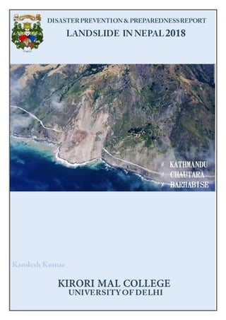
  • 4. Page2 1.2 CHOICE OF FIELD AREA Field work is the process of observing and collecting data about people, cultures, and natural environments. Field work is conducted in the wild of our everyday surroundings rather than in the semi-controlled environments of a lab or classroom. This allows researchers to collect data about the dynamic places, people, and species around them. Field work enables students and researchers to examine the way scientific theories interact with real life. Field work is important in both the social and natural sciences. Social sciences, such as economics or history, focus on people, culture, and society. Natural sciences, such as biology or chemistry, focus on physical characteristics of nature and natural environments. Field area of Kathmandu, Chautara and Barhabise (Nepal) were selected by the students taking consideration the following aspects:  Geographical vividness (Rural- Urban dichotomy)  Proximity to India  Affordability  Appropriate for the study themes (Disaster prone zone) Nepal, country of Asia, lying along the southern slopes of the Himalayan mountain ranges. It is a landlocked country located between India to the east, south, and west and the Tibet Autonomous Region of China to the north. Its territory extends roughly 500 miles (800 kilometres) from east to west and 90 to 150 miles from north to south. Nepal is a very popular tourist destination apart from its history, culture and scenic locations, it is also known for its Buddhist places. Many perennial rivers flow in the state, and numerous hydroelectricity projects set up. Kathmandu is a pupil-dilating experience, a riot of sights, sounds and smells that can quickly lead to sensory overload. Whether you’re barrelling through the traffic-jammed alleyways of the old town in a rickshaw, marvelling at the medieval temples or dodging trekking touts in the backpacker district of Thamel, Kathmandu can be an intoxicating, amazing and exhausting place. The metropolitan city area is 50.67 square kilometres (19.56 sq mi) and has a population density of 3000per km² and 17000 per km square in city. The city stands at an elevation of approximately 1,400 metres (4,600 ft) in the bowl-shaped Kathmandu Valley of central Nepal. It is surrounded by four major mountains: Shivapuri, Phulchoki, Nagarjun, and Chandragiri. Kathmandu Valley is part of three districts (Kathmandu, Lalitpur, and Bhaktapur), has the highest population density in the country, and is home to about a twelfth of Nepal's population. This endlessly fascinating, sometimes infuriating city has enough sights to keep you busy for a week, but be sure to leave its backpacker comforts and explore the ‘real Nepal’ before your time runs out. Fine mountain views and warm days until December, with high-season crowds. March brings the Seto Machhendranath festival. Days can be hot in May. Hot days and frequent monsoon showers, but also the spectacular Indra Jatra festival in June- September. The 2015 earthquake destroyed several temples in Kathmandu's Unesco-listed Durbar Sq, but most areas emerged unscathed. Stroll through the backstreets and Kathmandu’s timeless cultural and artistic heritage still reveals itself in hidden temples overflowing with marigolds, courtyards full of drying chillies and rice, and tiny hobbit-sized workshops. Chautara is a municipality in Sindhupalchowk District in the Bagmati Zone of central Nepal. It is now divided to 14 wards. This is the district headquarters of the
  • 5. Page3 Sindhupalchowk District. The municipality stands at the elevation of approximately 1,600 m above sea level. Religious and cultural festivities form a major part of the lives of people residing in Chautara. There are people of various religious beliefs, Hinduism, Buddhism and Christianity as well, giving Chautara a cosmopolitan culture. Nepali is the most commonly spoken language in the municipality. Likewise, Newari and other languages such as Tamang is also spoken as the Newars and Tamangs dominate the settlement in population. Chautara is in the Deciduous Monsoon Forest Zone, one of five vegetation zones defined for Nepal. The dominant tree species in this zone are oak, pine, beech, maple and others, with coniferous trees at higher altitude. The town was severely affected by the earthquake on 25 April 2015. Over ninety percent of the homes in the town had been destroyed. The main hospital of the town had collapsed. The town suffered from water shortages.[2] Relief workers and the Nepali army met government officials in Chautara to discuss the emergency response to the humanitarian crisis. However, government officials have stayed out of sight due to the anger of the residents of the town. Dozens of people crowded in front of the administrative office in Chautara, demanding that officials deliver more tents to earthquake survivors sleeping without shelter. The government had tents, but they were not given to the residents of the town. Bahrabise is a city in Sindhupalchok District in the Bagmati Zone of central Nepal. It consists of nine wards. t is lies on Araniko Highway - the 114 km-long highway which connects the capital city Kathmandu to the Chinese border in the north. The village was affected by the earthquake on 25 April 2015. A joint coordination committee among all political parties in the three constituencies of the Sindhupalchok district was formed to carry out a rescue mission in the village.
  • 6. Page4 1.3 FIELD WORK EXPERIENCE It’s a great experience. It broadened my perception in many ways and it too helped me improve some of my skills. My field placement has been an incredible avenue for me to learn and practice. Under the guidance of two brilliant supervisors, I have had the opportunity to grow both as an individual and a future field work researcher. This experience has completely exceeded my expectations of what I thought I would learn in the field. I was fortunate to have highlighted the numerous strengths of the community through various spheres. Got to know the diversity and dichotomy of socio- cultural, spatial features in the study area Got to know the implementation of Government policies Developed interaction skills Recreation Increasein Knowledge base Enhancement in Analytical skills Developed team spirit
  • 7. Page5 CHAPTER II STUDY AREA 2.1 AT A GLACE Nepal, country of Asia, lying along the southern slopes of the Himalayan mountain ranges. It is a landlocked country located between India to the east, south, and west and the Tibet Autonomous Region of China to the north. Its territory extends roughly 500 miles (800 kilometres) from east to west and 90 to 150 miles from north to south. The capital is Kathmandu. Nepal, long under the rule of hereditary prime ministers favouring a policy of isolation, remained closed to the outside world until a palace revolt in 1950 restored the crown’s authority in 1951; the country gained admission to the United Nations in 1955. In 1991 the kingdom established a multiparty parliamentary system. In 2008, however, after a decadelong period of violence and turbulent negotiation with a strong Maoist insurgency, the monarchy was dissolved, and Nepal was declared a democratic republic. Wedged between two giants, India and China, Nepal seeks to keep a balance between the two countries in its foreign policy—and thus to remain independent. A factor that contributes immensely to the geopolitical importance of the country is the fact that a strong Nepal can deny China access to the rich Gangetic Plain; Nepal thus marks the southern boundary of the Chinese sphere north of the Himalayas in Asia. 2.1.1 TOPOGRAPHY Despite being such a small country, Nepal is extensively diverse in terms of topography. Mountains and rugged hills cover almost 75% of Nepal's land area, and beyond the perpetual snow lined mountains exists the tropical region of Tarai. The Tarai Region (in the south) along the border with India, is a low stretch of land, containing Nepal's lowest point: Kanchan Kalan at 229 ft. (70 m). This area is Nepal's most significant agricultural region. In addition to Tarai, Nepal is home to two more distinct horizontal regions: The Hill Region (central) consists of mountains, hills, flatlands and deep valleys, with elevations ranging from 1,968 to 9,842 ft. (600 to 3,000 m). Land Area 143,351 km2 Water Area 3,830 km2 Total Area 147,181km2 (#93) Population 29,033,914 (#45) Population Density 202.54/km2 Government Type Federal Parliamentary Republic GDP (PPP) $71.52 Billion GDP Per Capita 2,500$ Currency Rupee (NPR) Population living on $1.25 per day 25% Capital Kathmandu Human Developmen t Index Nepal ranks among the poorest — 145 out of 188 countries Risk of earthquakes Nepal ranks 11th in the world for vulnerability to earthquakes Percentage of population in urban areas 19%
  • 8. Page6 The Himalayan Region (north) contains 202 mountains rising to more than 19,685 ft. (6,000 m) and 13 mountains rising to more than 26,246 ft. (8,000 m) high, including, of course, Mt. Everest, the world's highest mountain at 29,035 ft. (8,850 m), and the enormous Annapurna massif. Also within the Himalayan region is the Kali Gandaki Gorge, which by some measures is considered the deepest gorge in the world, and (over the past several centuries) has been utilized as a trade route between India and Tibet. The snow-covered mountains of Nepal are replete with cold water rivers; the four major ones (from west to east) are the Kail, Karnali, Narayani and Kosi. As a result of its years of geographic and self-imposed isolation, Nepal is one of the least developed nations of the world. In recent years many countries, including India, China, the United States, the United Kingdom, Japan, Denmark, Germany, Canada, and Switzerland, have provided economic assistance to Nepal. The extent of foreign aid to Nepal has been influenced to a considerable degree by the strategic position of the country between India and China. Natural Resouces Quartz, water, timber, hydropower, scenic beauty, small deposits of lignite, copper, cobalt, iron ore Land use Arable land: 16% Permanent rops: 0.8% Irrigated land: 11,680 km² (2003) Nearly 50% of arable land Others: 83.2% Renewable water resource 2 10.2 km3 (2011) Natural Hazard Earthquake, severe thunderstorms, flooding, landslides, drought, and famine depending on the timing, intensity and duration of the summer monsoons Environmental issues Deforestation overuse of wood for fuel and lack of alternatives); contaminated water (with human and animal wastes, agricultural runoff, and industrial effluents); wildlife conservation; vehicular emissions International Agreements (Environmental) Biodiversity, Climate Change, Climate Change-Kyoto Protocol, Desertification, Endangered Species, Hazardous Wastes, Law of the Sea, Ozone Layer Protection, Tropical Timber 83, Tropical Timber 94, Wetlands Signed but not ratified: Marine life conservation Existing and proposed dams, barrages and canals for flood control, irrigation and hydroelectric generation.
  • 9. Page7 2.1.2 DRAINAGE The Kāthmāndu Valley, the political and cultural hub of the nation, is drained by the Bāghmati River, flowing southward, which washes the steps of the sacred temple of Paśupatinātha (Pashupatinath) and rushes out of the valley through the deeply cut Chhobar gorge. Some sandy layers of the lacustrine beds act as aquifers (water-bearing strata of permeable rock, sand, or gravel), and springs occur in the Kāthmāndu Valley where the sands outcrop. The springwater often gushes out of dragon-shaped mouths of stone made by the Nepalese; it is then collected in tanks for drinking and washing and also for raising paddy nurseries in May, before the monsoon. Drained by the Seti River, the Pokharā Valley, 96 miles west of Kāthmāndu, is also a flat lacustrine basin. There are a few remnant lakes in the Pokharā basin, the largest being Phewa Lake, which is about two miles long and nearly a mile wide. North of the basin lies the Annapūrna massif of the Great Himalaya Range. The major rivers of Nepal—the Kosi, Nārāyani (Gandak), and Karnāli, running southward across the strike of the Himalayan ranges—form transverse valleys with deep gorges, which are generally several thousand feet in depth from the crest of the bordering ranges. The watershed of these rivers lies not along the line of highest peaks in the Himalayas but to the north of it, usually in Tibet. The rivers have considerable potential for development of hydroelectric power. Two irrigation- hydroelectric projects have been undertaken jointly with India on the Kosi and Nārāyani rivers. Discussions have been held to develop the enormous potential of the Karnāli River. A 60,000- kilowatt hydroelectric project at Kulekhani, funded by the World Bank, Kuwait, and Japan, began operation in 1982. In the upper courses of all Nepalese rivers, which run through mountain regions, there are little or no flood problems. In low-lying areas of the Tarai plain, however, serious floods occur. The rivers and small streams of the Tarai, especially those in which the dry season discharge is small, are polluted by large quantities of domestic waste thrown into them. Towns and villages have expanded without proper provision for sewage disposal facilities, and more industries have been established at selected centres in the Tarai. The polluted surface water in the Kāthmāndu and Pokharā valleys, as well as in the Tarai, are unacceptable for drinking.
  • 10. Page8 2.1.3 CLIMATE Altitudinal Belts Nepal's latitude is about the same as that of Florida, however with elevations ranging from less than 100 meters (300 ft) to over 8,000 meters (26,000 ft) and precipitation from 160 millimeters (6 in) to over 5,000 millimeters (16 ft) the country has eight climate zones from tropical to perpetual snow.[2] The tropical zone below 1,000 meters (3,300 ft) experiences frost less than once per decade. It can be subdivided into lower tropical (below 300 meters or 1,000 ft.) with 18% of the nation's land area) and upper (18% of land area) tropical zones. The best mangoes and well as papaya and banana are largely confined to the lower zone. Other fruit such as litchee, jackfruit, citrusand mangoes of lower quality grow in the upper tropical zone as well. Winter crops include grains and vegetables typically grown in temperate climates. The Outer Terai is virtually all in the lower tropical zone. Inner Terai valleys span both tropical zones. The Sivalik Hills are mostly upper tropical. Tropical climate zones extend far up river valleys across the Middle Hills and even into the Mountain regions. The subtropical climate zone from 1,000 to 2,000 meters (3,300 to 6,600 ft) occupies 22% of Nepal's land area and is the most prevalent climate of the Middle Hills above river valleys. It experiences frost up to 53 days per year, however this varies greatly with elevation, proximity to high mountains and terrain either draining or ponding cold air drainage. Crops include rice, maize, millet, wheat, potato, stone fruits and citrus. The great majority of Nepal's population occupies the tropical and subtropical climate zones. In the Middle Hills, upper-caste Hindus are concentrated in tropical valleys which are well suited for rice cultivation while Janajati ethnic groups mostly live above in the subtropical zone and grow other grains more than rice. The Temperate climate zone from 2,000 to 3,000 meters (6,600 to 9,800 ft) occupies 12% of Nepal's land area and has up to 153 annual days of frost. It is encountered in higher parts of the Middle Hills and throughout much of the Mountain region. Crops include cold-tolerant rice, maize, wheat, barley, potato, apple, walnut, peach, various cole, amaranthus and buckwheat. The Subalpine zone from 3,000 to 4,000 meters (9,800 to 13,100 ft) occupies 9% of Nepal's land area, mainly in the Mountain and Himalayan regions. It has permanent settlements in the Himalaya, but further south it is only seasonally occupied as pasture for sheep, goats, yak and hybrids in warmer months. There are up to 229 annual days of frost here. Crops include barley, potato, cabbage, cauliflower, amaranthus, buckwheat and apple. Medicinal plants are gathered. The Alpine zone from 4,000 to 5,000 meters (13,100 to 16,400 ft) occupies 8% of the country's land area. There are a
  • 11. Page9 few permanent settlements above 4,000 meters. There is virtually no plant cultivation although medicinal herbs are gathered. Sheep, goats, yaks and hybrids are pastured in warmer months. Above 5,000 meters the climate becomes Nival and there is no human habitation or even seasonal use. Arid and semi-arid land in the rainshadow of high ranges have a Transhimalayan climate. Population density is very low. Cultivation and husbandry conform to subalpine and alpine patterns but depend on snowmelt and streams for irrigation. Precipitation generally decreases from east to west with increasing distance from the Bay of Bengal, source of the summer monsoon. Eastern Nepal gets about 2,500 mm (100 in) annually; the Kathmandu area about 1,400 mm (55 in) and western Nepal about 1,000 mm (40 in). This pattern is modified by adiabatic effects as rising air masses cool and drop their moisture content on windward slopes, then warm up as they descend so relative humidity drops. Annual precipitation reaches 5,500 mm (18 ft) on windward slopes in the Annapurna Himalaya beyond a relatively low stretch of the Mahabharat Range. In rainshadows beyond the high mountains, annual precipitation drops as low as 160 mm (6 in). 2.1.4 SEASONS The year is divided into a wet season from June to September—as summer warmth over Inner Asia creates a low-pressure zone that draws in moist air from the Indian Ocean—and a dry season from October to June as cold temperatures in the vast interior creates a high-pressure zone causing dry air to flow outward. April and May are months of intense water stress when cumulative effects of the long dry season are exacerbated by temperatures rising over 40 °C (104 °F) in the tropical climate belt. Seasonal drought further intensifies in the Siwaliks hills consisting of poorly consolidated, coarse, permeable sediments that do not retain water, so hillsides are often covered with drought-tolerant scrub forest. In fact, much of Nepal's native vegetation adapted to withstand drought, but less so at higher elevations where cooler temperatures mean less water stress. The summer monsoon may be preceded by a buildup of thunderstorm activity that provides water for rice seedbeds. Sustained rain on average arrives in mid-June as rising temperatures over Inner Asia creates a low-pressure zone that draws in moist air from the Indian Ocean, but this can vary up to a month. Significant failure of monsoon rains historically meant drought and famine while above-normal rains still cause flooding and landslides with losses in human lives, farmland and buildings. The monsoon also complicates transportation with roads and trails washing out while unpaved roads and airstrips may become unusable and cloud cover reduces safety margins for aviation. Rains diminish in September and generally end by mid-October, ushering in generally cool, clear, and dry weather, as well as the most relaxed and jovial period in Nepal. By this time, the harvest is completed and people are in a festive mood. The two biggest and most important Hindu festivals Dashain and Tihar (Dipawali) arrive during this period, about one month apart. The post monsoon season lasts until about December. After the post monsoon comes the winter monsoon, a strong north easterly flow marked by occasional, short rainfalls in the lowlands and plains and snowfalls in the high-altitude areas. In this season the Himalayas function as a barrier to cold air masses from Inner Asia, so southern Nepal and northern India have warmer winters than would otherwise be the case. April and May are dry and hot, especially below 1,200 meters (4,000 ft) where afternoon temperatures may exceed 40 °C (104 °F). 2.1.5 ENVIRONMENT The dramatic changes in elevation along this transect result in a variety of biomes, from tropical savannas along the Indian border, to subtropical broadleaf and coniferous forests in the hills,
  • 12. Page10 to temperate broadleaf and coniferous forests on the slopes of the Himalaya, to montane grasslands and shrublands, and finally rock and ice at the highest elevations. This corresponds to the Terai-Duar savanna and grasslands ecoregion. Subtropical forests dominate the lower elevations of the Hill Region. They form a mosaic running east-west across Nepal, with Himalayan subtropical broadleaf forests between 500 and 1,000 meters (1,600 and 3,300 ft) and Himalayan subtropical pine forests between 1,000 and 2,000 meters (3,300 and 6,600 ft). At higher elevations, to 3,000 meters (10,000 ft), are found temperate broadleaf forests: eastern Himalayan broadleaf forests to the east of the Gandaki River and western Himalayan broadleaf forests to the west. The native forests of the Mountain Region change from east to west as precipitation decreases. They can be broadly classified by their relation to the Gandaki River. From 3,000 to 4,000 meters (10,000 to 13,000 ft) are the eastern and western Himalayan subalpine conifer forests. To 5,500 meters (18,000 ft) are the eastern and western Himalayan alpine shrub and meadows. ICIMOD’s first and most complete national land cover[16] database of Nepal prepared using public domain Landsat TM data of 2010 shows that show that forest is the dominant form of land cover in Nepal covering 57,538 km2 with a contribution of 39.09% to the total geographical area of the country. Most of this forest cover is broadleaved closed and open forest, which covers 21,200 km2 or 14.4% of the geographical area. Needle leaved open forest is the least common of the forest areas covering 8267 km2 (5.62%). Agriculture area is significant extending over 43,910 km2 (29.83%). As would be expected, the high mountain area is largely covered by snow and glaciers and barren land. The Hill region constitutes the largest portion of Nepal, covering 29.5% of the geographical area, and has a large area (19,783 km2) of cultivated or managed lands, natural and semi natural vegetation (22,621 km2) and artificial surfaces (200 km2). The Tarai region has more cultivated or managed land (14,104 km2) and comparatively less natural and semi natural vegetation (4280 km2). The Tarai has only 267 km2 of natural water bodies. The High mountain region has 12,062 km2 of natural water bodies, snow/glaciers and 13,105 km2 barren areas. 2.1.6 FORESTS 25.4% of Nepal's land area, or about 36,360 km2 (14,039 sq mi) is covered with forest according to FAO figures from 2005. FAO estimates that around 9.6% of Nepal's forest cover
  • 13. Page11 consists of primary forest which is relatively intact. About 12.1% Nepal's forest is classified as protected while about 21.4% is conserved according to FAO. About 5.1% Nepal's forests are classified as production forest. Between 2000 and 2005, Nepal lost about 2,640 km2 (1,019 sq mi) of forest. Nepal's 2000–2005 total deforestation rate was about 1.4% per year meaning it lost an average of 530 km2 (205 sq mi) of forest annually. Nepal's total deforestation rate from 1990 to 2000 was 920 km2 (355 sq mi) or 2.1% per year. The 2000–2005 true deforestation rate in Nepal, defined as the loss of primary forest, is -0.4% or 70 km2 (27 sq mi) per year. Forest is not changing in the plan land of Nepal, forest fragmenting on the Roof of the World. According to ICIMOD figures from 2010, forest is the dominant form of land cover in Nepal covering 57,538 km2 with a contribution of 39.09% to the total geographical area of the country.[18] Most of this forest cover is broadleaved closed and open forest, which covers 21,200 km2 or 14.4% of the geographical area. Needleleaved open forest is the least common of the forest areas covering 8,267 km2 (5.62%). At national level 64.8% area is covered by core forests of > 500 ha size and 23.8% forests belong to patch and edge category forests. The patch forest constituted 748 km2 at national level, out of which 494 km2 of patch forests are present in hill regions. Middle mountains, Siwaliks and Terai regions have more than 70% of the forest area under core forest category > 500 ha size. The edge forests constituted around 30% of forest area of High Mountain and Hill regions.[18] Forest Resource Assessment (FRA) which was conducted between 2010 to 2014 by the Ministry of Forest and Soil conservation with the financial and technical help of Government of Finland shows that 40.36% land of Nepal is forested. And 4.40% land have Shrubs and bushes. Deforestation is driven by multiple processes. Virtually throughout the nation, over-harvest of firewood remains problematic. Despite the availability of liquefied petroleum gas in towns and cities, firewood is sold more at energy-competitive prices because cutting and selling it is a fallback when better employment opportunities aren't forthcoming. Firewood still supplies 80% of Nepal's energy for heating and cooking. Harvesting construction timber and lopping branches for fodder for cattle and other farm animals are also deforestation/degradation drivers in all geographic zones Illegal logging is a problems in the Siwaliks, with sawlogs smuggled into India. Clearing for resettlement and agriculture expansion also causes deforestation as does urban expansion, building infrastructure such as schools, hospitals, electric transmission lines, water tanks, police and army barracks, temples and picnic areas. In the Middle Hills road construction, reservoirs, transmission lines and extractive manufacturing such as cement factories cause deforestation. In the mountains building hotels, monasteries and trekking trails cause deforestation while timber-smuggling into the Tibet Autonomous Region and over-grazing cause degradation. 2.1.7 ECONOMICS Nepal is a low income country39 and is on track to achieve most of their Millennium Development Goals (MDGs) by 2015. The United Nations Development Programme (UNDP) 2013 Human Development Index (HDI) value for Nepal is 0.463, placing them in the low human development category, and positioning them 157 out of 187 countries. In the Gender Inequality Index (GII) which reflects gender-based inequalities (reproductive health, empowerment, and economic activity), Nepal was categorized as 102 out of 148 countries in the 2012 index. Nepal’s economic freedom score is 51.3, classifying its economy the 152nd freest in the 2015 index. Their score has increased by 1.2 points from the prior year mostly due to improvements in freedom from corruption. Out of the 42 countries in the Asia-Pacific region, the country ranked 34th, below the world and regional average. The GDP in Nepal grew around 5 percent in fiscal year 2014 which is up from 3.5 percent the previous year. Monsoon rains helped to boost agriculture by 4.7 percent and a large growth in remittance inflows drove growth in services to 6.1 percent. For fiscal year 2015, growth is
  • 14. Page12 expected to slow due to disappointing monsoons. The economy is dependent on imports of basic materials and on foreign markets for forest and agricultural products. Nepal imports essential commodities such as fuel, construction materials, fertilizers, and consumer goods such as rice, jute, timber and textiles. Agriculture, primarily rice, corn and wheat accounts for half of the country’s export earnings. Productivity is low due to shortages of fertilizers and improved seed along with ineffective techniques. Tourism in Nepal is a growing industry and is generally confined to the Kathmandu Valley. This area is able to provide hotels, food, supplies, road and international transportation services. Other tourism spots include: Pokhara and the Mount Everest area. The tourism sector is a key contributor for the country’s economic growth and provides over 750,000 jobs. In 2012, Nepal hosted almost 600,000 foreign tourists which contributed to 3 percent of the country’s GDP. Kathmandu is a pupil-dilating experience, a riot of sights, sounds and smells that can quickly lead to sensory overload. Whether you’re barrelling through the traffic-jammed alleyways of the old town in a rickshaw, marvelling at the medieval temples or dodging trekking touts in the backpacker district of Thamel, Kathmandu can be an intoxicating, amazing and exhausting place. The metropolitan city area is 50.67 square kilometres (19.56 sq mi) and has a population density of 3000per km² and 17000 per km square in city. The city stands at an elevation of approximately 1,400 metres (4,600 ft) in the bowl-shaped Kathmandu Valley of central Nepal. It is surrounded by four major mountains: Shivapuri, Phulchoki, Nagarjun, and Chandragiri. Kathmandu Valley is part of three districts (Kathmandu, Lalitpur, and Bhaktapur), has the highest population density in the country, and is home to about a twelfth of Nepal's population. This endlessly fascinating, sometimes infuriating city has enough sights to keep you busy for a week, but be sure to leave its backpacker comforts and explore the ‘real Nepal’ before your time runs out. Fine mountain views and warm days until December, with high-season crowds. March brings the Seto Machhendranath festival. Days can be hot in May. Hot days and frequent monsoon showers, but also the spectacular Indra
  • 15. Page13 Jatra festival in June- September. The 2015 earthquake destroyed several temples in Kathmandu's Unesco-listed Durbar Sq, but most areas emerged unscathed. Stroll through the backstreets and Kathmandu’s timeless cultural and artistic heritage still reveals itself in hidden temples overflowing with marigolds, courtyards full of drying chillies and rice, and tiny hobbit-sized workshops. Chautara is a municipality in Sindhupalchowk District in the Bagmati Zone of central Nepal. It is now divided to 14 wards. This is the district headquarters of the Sindhupalchowk District. The municipality stands at the elevation of approximately 1,600 m above sea level. Religious and cultural festivities form a major part of the lives of people residing in Chautara. There are people of various religious beliefs, Hinduism, Buddhism and Christianity as well, giving Chautara a cosmopolitan culture. Nepali is the most commonly spoken language in the municipality. Likewise, Newari and other languages such as Tamang is also spoken as the Newars and Tamangs dominate the settlement in population. Chautara is in the Deciduous Monsoon Forest Zone, one of five vegetation zones defined for Nepal. The dominant tree species in this zone are oak, pine, beech, maple and others, with coniferous trees at higher altitude. The town was severely affected by the earthquake on 25 April 2015. Over ninety percent of the homes in the town had been destroyed. The main hospital of the town had collapsed. The town suffered from water shortages. Relief workers and the Nepali army met government officials in Chautara to discuss the emergency response to the humanitarian crisis. However, government officials have stayed out of sight due to the anger of the residents of the town. Dozens of people crowded in front of the administrative office in Chautara, demanding that officials deliver more tents to earthquake survivors sleeping without shelter. The government had tents, but they were not given to the residents of the town. Bahrabise is a city in Sindhupalchok District in the Bagmati Zone of central Nepal. It consists of nine wards. t is lies on Araniko Highway - the 114 km-long highway which connects the capital city Kathmandu to the Chinese border in the north. The village was affected by the earthquake on 25 April 2015. A joint coordination committee among all political parties in the three constituencies of the Sindhupalchok district was formed to carry out a rescue mission in the village.
  • 16. Page14 2.2 TRANSIT 2.2.1 TRANSIT TABLE Date Time Place Altitude Graticule 10th March 8:45 PM College, Delhi 221 m 2840’58” N 7712’31” E 9:50 PM Jhilmil Road, Dilshad Garden, Delhi 207 m 2840’58” N 7712’29” E 11:55 PM Hotel Starlite, Gharh Mukteshwar, U.P. 218 m 2846’55” N 7803’36” E 11th March 7:17 AM Jhunkat, Khatima, Uttarakhand 215 m 2856’23” N 7953’53” E 9:16 AM Banbasa Canal Range 226 m 2859’45” N 8005’38” E 2:42 PM Chisapani Bank, Kanriala R. Bank, Nepal 200 m 28.6305 N 81.2811 E 12th March 8:06 AM Kathmandu 1359 m 2741’52” N 8516’51” E 10:50 AM Hotel Destination, Kathmandu 1341 m 27.6708 N 85.3386 E 3:15 PM Ratna Park 1311 m 2742’25” N 8518’51” E 13th March 11 AM Pashupatinath Temple 4:09 PM KFC, Bhaktapur 1328 m 2739’52” N 8525’32” E 9:44 PM Chautara Hotel Namaste 1432 m 2746’28” N 8542’52” E
  • 17. Page15 14th March 12:11 PM Chaap 1421 m 27 46’ 23” N 15 43’ 01” E 3:15 PM Sanu Siruwari 1479 m 27.7586N 85.7094 E 4:25 PM Banjo Khot 1479 m 27.7715 N 85.7010 E 15th March 1:30 PM Cheka thok 27.776 N 85.710 E 16th March 1:36 PM Tekanpur (Sunkoshi R. Bank) 27.763 N 85.874 E 3:23 PM Bahrabise 27.79 N 85.89 E 17th March 3:30 PM Trekking 27.783 N 85.901 E 18th March 9:52 AM Thakre, Kathmandu 778 m 27 44’ 11” N 85 07’ 46” E 12:13 PM Nalang 384 m 27 48’ 44” N 84 45’ 55” E 2:58 PM Manakamana (Trishuli R. Bank) 27.8561 N 84.5589 E 8:43 PM India Nepal Border, Sonauli 27.47 N 83.47 E 19th March 10:33 AM Vrindavan, India 178 m 27 36’ 46” N 77 44’ 29” E 1:40 PM Delhi 220 m 28.6 N 77.2 E
  • 19. Page17 2.3 DISASTER SCENARIO OF NEPAL Nepal is facing the wrath of natural and human induced disasters with greater frequency and intensity. It is one of the highest risk countries in the world due to various types of disasters. Disasters are so penetrative in every Nepalese geographic and societal framework that they are constantly under threat of a multitude of natural disasters. Nepal doesn’t face some cal amities like volcanic eruptions; otherwise all most all kinds of disasters are prevalent in Nepal. Therefore, it is a great challenge to protect infrastructure and property from frequent disasters such as: landslides, floods and fires. Each year flood, landslide, fire, epidemics, avalanche and various other natural and human induced disasters lead to the casualty of thousands of human
  • 20. Page18 lives and destruction of physical property worth billions of rupees. The earthquakes of 1934 A.D., 1980 A.D. 1988 A.D., 2015 A.D. and the flood of July, 1993 A.D., 2008 A.D., 2014 A.D. are the most devastating disasters which not only caused heavy losses of human lives and physical properties but also adversely affected the development process of the country as a whole. Recent time climate change due to global warming has become a major concern and in the climate change vulnerability index Nepal is ranked as the 4th most climate vulnerable country in the world (World Bank 2011). Fire is another disaster which occurs on a regular basis and wild fires are damaging to already severely depleted forests and biodiversity of Nepal which results in economic loss, land degradation and environmental pollution. Thus, Nepal has been found to be a disaster-prone country. Being a developing country, Nepal lacks strong mechanism to widely share the knowledge and the information to the poor communities. More importantly, the vulnerable communities and poor people have not been able to mitigate, prepare for, effectively respond and overcome the impact of multiple hazards in various parts of the country. Often women, children, elderly and disadvantaged persons become unable to cope with the disasters as their capability and resilience is meagre. Therefore, it is highly necessary to build the capacity of the vulnerable communities in order to reduce the losses of human lives and physical properties in the time of disasters. According to the Ministry of Home Affairs, since 2000, each year, an average of 329 people lost their lives due to various disasters and property loss of more than 1 billion rupees. Landslides are prevalent in the hills and mountains of Nepal. Steep gradients and the heavily fragmented surface rocks, along with an abundance of triggers (such as river erosion, glacial melting, saturation by snowmelt or heavy rains, seismic activity, excess weight from accumulation of rain or snow, and groundwater pressure acting to destabilize the slope) are present. Human impacts such as road construction (including the wide use of explosives), intensive deforestation, inappropriate agriculture and irrigation practices, overgrazing on slopes, quarrying for construction materials, and construction of infrastructure beyond the bearing capacities of the hill slopes as well as the removal of deep-rooted vegetation that binds the soil to bedrock are also intense. 2.3.2 CAUSES OF LANDSLIDE IN NEPAL Landslides are a common phenomenon in the Hindu Kush Himalayan Region and in the Sunkoshi valley in particular due to weak geological formations and steep topology. The Jure landslide occurred after two days of torrential rainfall (141 mm) that seeped through cracks and gullies in the mountain surface and built up pressure inside the mountain. The average annual rainfall in the study area amounts to 3,000 mm, 80 per cent of which is registered during the monsoon season. 1 July and August are the wettest months, with approximately 780 mm of rain falling during each month. The maximum amount of rain within 24 hours ever registered in the area was 166 mm on 29 July 1982. In the immediate prelude to the 2014 landslide, the torrential rainfall nearly reached this historical benchmark. This raises the question of whether global warming influences the frequency and severity of extreme rainfall events. Geological causes of landslides:  Weathered materials  Sheared materials  Jointed or fissured materials  Adversely orientated discontinuities  Permeability contrasts  Material contrasts  Rainfall and snow fall  Earthquakes
  • 21. Page19 Morphological causes:  Slope angle  Uplift  Rebound  Fluvial erosion  Wave erosion  Glacial erosion  Erosion of lateral margins  Subterranean erosion  Slope loading  Vegetation change  Erosion Physical causes: Topography  Slope Aspect and Gradient Geological Factors  Discontinuity Factors (Dip Spacing, Asparity, Dip and length)  Physical Characteristics of the Rock (Rock Strength etc.) Tectonic Activity  Seismic activity (Earthquakes)  Volcanic eruption Physical Weathering  Thawing  Freeze-thaw  Soil erosion Hydrogeological Factors  Intense rainfall  Rapid snow melt  Prolonged precipitation  Ground water changes (Rapid drawdown)  Soil pore water pressure  Surface runoff Human causes:  Deforestation  Excavation  Loading  Water management (Groundwater Draw-down and Water leakage)  Land use (e.g. construction of roads, houses etc.)  Mining and Quarrying  Vibration Spatial Distribution Apart from the Terai, all hilly and mountainous parts of the country experience landslides. Snow and rock avalanches explain the high occurence in the mountainous northern districts, while the central and eastern regions have the highest number of landslides. 2.3.3 IMPACTS Human casualties and population affected
  • 22. Page20 Apart from the Terai and western parts of the high Himalaya, the entire country shows almost uniform distribution of deaths due from landlsides and avalances. There are roughly 100 people affected by lanslides for every one person killed – a relationship that is particularly strong in the eastern hills. Building destruction and damage The entire middle Hills and the eastern high Himalaya region experience the highest damage to buildings from landslides and avalanches.
  • 24. Page22 2.3.4 LANDSLIDES TRIGGERED BY NEPAL EARTHQUAKE Earthquakes are often followed by landslides and rock avalanches and glacier avalanches in Himalayan hilly areas. The quake caused avalanches on Mount Everest, making the climbers running for cover and killing at least 18 people at the start of the main climbing season. At least 1000 climbers had been at the base camp of the Everest when the earthquake struck. The base camp had been severely damaged and the teams were trapped. Earthquakes are often followed by landslides and rock avalanches and glacier avalanches in Himalayan hilly areas. The quake caused avalanches on Mount Everest, making the climbers running for cover and killing at least 18 people at the start of the main climbing season. At least 1000 climbers had been at the base camp of the Everest when the earthquake struck. The base camp had been severely damaged and the teams were trapped. Those at the high camps were soon airlifted to Base Camp, and all the climbers either hiked off the mountain or were flown out to other locations. The earthquake produced landslides that devastated rural villages and some of the most densely populated parts of the city of Kathmandu. Initial damage estimates ranged from $5 billion to $10 billion. Inside Kathmandu, bricks and other debris from collapsed and partially collapsed buildings, which included parts of the famous Taleju Temple and the entire nine- story Dharahara Tower, filled the streets. The Gorkha earthquake (Nepal, 2015, Mw 7.9) triggered many landslides. The most catastrophic mass movement was a debris avalanche that buried several villages in the Langtang valley. In this study, questions are raised about its volume and initiation. I investigate the possibility of high-resolution digital surface models computed from tri-stereo SPOT6/7 images to resolve this issue. This high-resolution dataset enables me to derive an inventory of 160 landslides triggered by this earthquake. I analyze the source of errors and estimate the uncertainties in the landslide volumes. The vegetation prevents to correctly estimate the volumes of landslides that occured in vegetated areas. However, I evaluate the volume and thickness of 73 landslides developing in vegetated-free areas, showing a power law between their surface areas and volumes with exponent of 1.20. Accumulations and depletion volumes are also well constrained for larger landslides, and I find that the main debris avalanches
  • 25. Page23 accumulated 6.95 × 10⁶ m3 of deposits in the valley with thicknesses reaching 60 m, and 9.66 × 10⁶ m3 in the glaciated part above 5000 m asl. The large amount of sediments is explained by an initiation of the debris avalanche due to serac falls and snow avalanches from five separate places between 6800 and 7200 m asl over 3 km length. Almost a year after the devastating 7.8 magnitude earthquake hit Nepal, a new international report said a staggering 4,312 landslides were triggered by the temblor and its aftershocks. It said the major destruction by the landslides was of newly-developed settlements, and that the total loss and damage was estimated at $7 billion. The report “Impact of Nepal’s 2015 Gorkha Earthquake-Induced Geohazards” said the lives of eight million people, almost one-third of Nepal’s population, were impacted. But the damage due to landslides and glacier lake floods was less than anticipated, it added. Supported by Skoll Global Threats Fund, the Kathmandu- headquartered International Centre for Integrated Mountain Development (ICIMOD), along with scientists from the US, Europe and the region prepared the report by mapping the landslides using satellite images, aerial surveys and field visits. In Nepal, home to more than one-third of the Himalayan range, the damage by the quake was devastating, compared to the Tibet Autonomous Region in China or India and Bangladesh. Within Nepal, more than 8,800 people died, 22,000 were injured and 100,000 displaced. The earthquake on April 25, 2015, pushed an additional 2.5 to 3.5 percent of the Nepalese population into poverty in 2015-16, the researchers wrote in their 36-page report that aims to improve the management of geohazards. Scientists have discovered that there was major destruction to the newly-developed human settlements compared to older ones. These settlements were along the Pasang Lamu highway in the Trishuli valley and Kodari highway in the Bhotekoshi and Sunkoshi valleys. Tatopani village, bordering China, too was hit by rock falls. According to the report, the temblor induced two disastrous avalanches -- one in Langtang valley and another at the Mount Everest base camp. The most destructive and probably the largest landslide triggered was a massive one initiated nearly 7,000 metres above mean sea level which completely buried Langtang village. The Mount Everest base camp was also hit by an earthquake-induced ice avalanche, even though the shaking at this point was light. The collapsing icy mass swept away a part of the Everest base camp and claimed 22 lives. It was the worst single day in the history of Everest and occurred a year after the previous worst day in the mountain’s history on April 18, 2014, when ice avalanches hit the Everest climbing route over the Khumbu glacier, killing 16 people, the researchers wrote. The indication is that ice on the mountain was ready to collapse. Springtime melting triggered the collapse in 2014 and probably conditioned the ice for collapse in 2015 so that only a light shaking was needed to break it loose, they said. The saving grace is that the earthquake did not cause floods from the outburst of glacial lakes. “This was both fortunate and surprising. The good news, however, does not necessarily indicate that future earthquakes will have a similarly low impact as they could strike closer to and more directly beneath the glacial lakes,” said the researchers. They warned that many of the landslides and landslide dams and possibly the increased instability of glacial lakes have the potential to lead to a chain of hazards in the future. The situation of Himalayan glacial lakes needs to be observed carefully in China, India and Nepal to confirm the preliminary conclusions that the risk of floods from the outburst of glacial lakes has not been visibly heightened by the earthquake, says the report. “After the earthquake we joined hands with regional and international experts to map the positions of landslides and debris flows. We undertook several studies to assess its impact,” ICIMOD director general David J. Molden said. Thousands of people have fled to safety following a landslide in western Nepal which blocked the flow of a river. The Kali Gandaki River in Myagdi district, about 140km (90 miles) north-
  • 26. Page24 west of the capital, Kathmandu, has created a deep and growing new lake. There are no reports of casualties. Army soldiers are being sent to help. A number of landslides have hit Nepal since the 7.8-magnitude earthquake on 25 April which killed more than 8,000 people and injured many more. The landslide around midnight on Sunday (19:00 GMT on Saturday) has caused water levels to rise by about 200m (600ft). "We have asked villagers along the riverside in these districts to move to safer places," interior ministry official Laxmi Prasad Dhakal told Reuters news agency. One of Nepal's largest hydroelectric power plants in the area could be at risk, officials have warned. Army helicopter were surveying the area with troops being sent to siphon off the water from the fast-growing lake. Authorities say large areas could be at risk of flooding if the collected waters burst. Kaligandaki River flows into India where it eventually joins the Ganges. “While the landslides are not as severe as we initially feared, they caused a lot of damage to the landscape that is prone to future failures,” says Alexander Densmore, who studies landslides at Durham University, UK. During this year’s monsoon season, from June to September, landslides occurred ten times more frequently than normal, he says. (The analysis by Kargel's team does not cover the time of the monsoon; the researchers looked at satellite images taken up to mid-June, before the rains began). Hovius estimates that slopes will continue to fail at a heightened rate for some four to five years because of the Gorkha quake. Historically, landslides after earthquakes have drastically reshaped the geography of Nepal. The country’s second-largest city, Pokhara, is built on between 4 billion and 5 billion cubic metres of debris from landslides triggered by three medieval earthquakes, each greater than magnitude 8, according to an analysis in a separate paper published today in Science by a team led by geomorphologist Wolfgang Schwanghart of the University of Potsdam. SINDHUPALCHOWK On 2 August 2014 a major landslide struck in a densely populated area 80 km northeast of Kathmandu, capital of Nepal. With a death toll of 156, it was one of the deadliest landslides in Nepalese history. The landslide had a length of 1.26 km and was 0.81 km wide at the bottom. It destroyed all land, houses, properties and infrastructure in its path and created a 55-metre- high dam in the Sunkoshi river. Behind the debris dam, a three-kilometre-long lake inundated
  • 27. Page25 houses, farms and a hydropower plant. The Araniko Highway – Nepal’s only road connection to China – was severely damaged, which had nationwide impacts. For nine hours after the landslide, the river flow stopped entirely. Downstream, people had to be evacuated due to the risk of an outburst flood. In the days after the landslide, army engineers forced openings in the dam through digging and controlled blasting. This limited the size of the landslide dam lake and prevented more extensive damage upstream, where the town of Bahrabise was at risk. The objective of the controlled blasts was also to prevent a dangerous outburst flood, which could have wreaked havoc in hundreds of settlements downstream, all the way to Bihar State in Northern India, affecting an estimated 400,000 people. On 7 September 2014, after 36 days, part of the dam breached, reducing the water level in the lake by 18 metres. Just like the landslide, this happened in the middle of the night, at 2.30 a.m. Thanks to preventive evacuations there were no casualties, but riverside farmland and houses downstream were damaged by the outburst flood.
  • 28. Page26 CHAPTER III OBJECTIVES & METHODOLOGY 3.1 OBJECTIVES The world is an ever-changing place, and sometimes the changes are not for the better. Things like natural disasters, riots and coups can appear quite suddenly and have wide- ranging consequences for the people they affect. The impacts of such events are often dramatically worse in the developing world, where security forces are less capable and there is less infrastructure to aid in responding to a crisis or restore order in its wake. Landslide hazard assessment is an important step towards landslide hazard and risk management. There are several methods of Landslide Hazard Zonation (LHZ) viz. heuristic, semi quantitative, quantitative, probabilistic and multi-criteria decision-making process. However, no one method is accepted universally for effective assessment of landslide hazards. In recent years, several attempts have been made to apply different methods of LHZ and to compare results in order to find the best suited model. This paper presents the review of researches on landslide hazard mapping published in recent years. The advanced multivariate techniques are proved to be effective in spatial prediction of landslides with high degree of accuracy. Physical process based models also perform well in LHZ mapping even in the areas with poor database. Multi-criteria decision-making approach also play significant role in determining relative importance of landslide causative factors in slope instability process. Remote Sensing and Geographical Information System (GIS) are powerful tools to assess landslide hazards and are being used extensively in landslide researches since last decade. Aerial photographs and high-resolution satellite data are useful in detection, mapping and monitoring landslide processes. GIS based LHZ models helps not only to map and monitor landslides but also to predict future slope failures. The advancements in Geo-spatial technologies have opened the doors for detailed and accurate assessment of landslide hazards. Major objectives are:  Identify the locations of the occurrence of the disaster.  Evaluate the effect of the disaster to life and property.  Find out about the level of awareness of the local people regarding the disaster.  Assess the role of Governmental as well as non-governmental institutions in helping the persecuted in rehabilitation.
  • 29. Page27 3.2 METHODOLOGY  Questionnaire  Observation  Secondary Data sources To study the social aspects of our assigned areas –Sindhupalchowk, Nepal. A variety of methods were used such as space survey, questionnaires, interviews, direct observation. We conducted a fire evacuation plan assessment in the college to get acquainted with the emergency disaster scenario. Space survey was conducted by preparing transact maps of the whole journey. GPS technology was used and the android applications helped us in noting down the latitudes, longitudes and altitude of various locations with the nearest possible accuracy. A questionnaire was prepared which covered questions related to the policies concerned, socio- economic, general, political interests of the sample and the institutional initiatives regarding disaster management. Personal interviews were conducted among people belonging to different age groups and occupational backgrounds to get an insight about their experiences and awareness regarding disaster management aspects. Subsequently the questionnaires were filled, sometimes by the respondents themselves. The filled questionnaires were then grouped according to the localities, analysed and interpreted. Another method used to collect information regarding our theme was through direct observation. Sign boards, posters and notices were studied. Photographs of our observations were clicked and videos were made. Additional data was collected from the official website of Nepal Government and through other research articles related to our field of study. A literature review was prepared further so as to facilitate easy access to necessary information. So, these were the methods which were used for getting better results in the following pages we will study the analysis work of our gathered data. We shall come to know very interesting figures about Nepal, its society and techniques of disaster management practiced by them.
  • 30. Page28 CHAPTER IV LITERATURE REVIEW Landslide in Nepal during and post 2015 earthquake The devastating magnitude-7.8 earthquake that struck Nepal in April caused surprisingly few landslides, researchers say — confirming the early impressions of scientists who raced to map collapsed terrain in the quake’s aftermath. However, there is still hot debate over just how severe the event’s impacts were. Large earthquakes in mountainous areas typically cause tens or hundreds of thousands of landslides, as ground on steep slopes is loosened by shaking. But after scouring thousands of satellite images taken before and after Nepal’s Gorkha quake, a 64-member team counted only 4,312 landslides, it reports in Science on 15 December. Nepal earthquake caused fewer landslides than feared by Jane Qiu, Nature, 16th December 2015.1 As Nepal struggles to deal with the aftermath of a magnitude 7.3 earthquake which struck earlier today, video has emerged of a landslide in the north of the country. The footage was filmed by a team working for the Canadian Red Cross near Dhunche, and was posted on social media by the International Federation of Red Cross and Red Crescent Societies. Landslide triggered by new Nepal earthquake by James Shaw/Canadian Red Cross, The Telegraph, 12th May, 2015.2 Kodari is a ghost town on an empty Nepalese highway that cuts through some of the steepest slopes of the Himalayas. One year after the magnitude-7.8 Gorkha earthquake killed nearly 9,000 people, the once-buzzing trade centre looks like a battlefield where armies of giants once waged war. The road is littered with rusting cars and trucks smashed into bizarre shapes. Massive boulders rest on the wreckage of homes. Killer landslides: The lasting legacy of Nepal’s quake by Jane Qiu, Nature, 25th April 2016.3 Almost a year after the devastating 7.8 magnitude earthquake hit Nepal, a new international report said a staggering 4,312 landslides were triggered by the temblor and its aftershocks. It said the major destruction by the landslides was of newly-developed settlements, and that the total loss and damage was estimated at $7 billion. The report “Impact of Nepal’s 2015 Gorkha Earthquake-Induced Geohazards” said the lives of eight million people, almost one- third of Nepal’s population, were impacted. But the damage due to landslides and glacier lake floods was less than anticipated, it added. Nepal quake caused 4,312 landslides: Report by IANS, Hindustan Times, 16th May, 2016.4 Since 1 June, 37 of the 75 districts in Nepal have been impacted by floods and landslides triggered by heavy monsoon rains. Solukhumbu and Palpa districts were particularly affected by the combined effects of flooding, landslides and heavy monsoon rains. To date, authorities confirmed at least 34 deaths. The Government has provided cash grants to families in Saptari District whose houses were destroyed by the floods. A rapid needs assessment is ongoing in Saptari. Nepal: Floods and Landslides - Jun 2017, ReliefWeb, 17th July, 2017.5 Effect of landslide on other physical features and normal day-to-day life
  • 31. Page29 Thousands of people have fled to safety following a landslide in western Nepal which blocked the flow of a river. The Kali Gandaki River in Myagdi district, about 140km (90 miles) north-west of the capital, Kathmandu, has created a deep and growing new lake. There are no reports of casualties. Army soldiers are being sent to help. A number of landslides have hit Nepal since the 7.8-magnitude earthquake on 25 April which killed more than 8,000 people and injured many more. Nepal earthquake: People flee as landslide blocks river, BBC News, 24th May 2015.6 Thousands of people have been told to evacuate their homes in Nepal after massive landslides blocked a river in the west of the country, sparking fears of flash flooding. Two powerful earthquakes devastated Nepal on 25 April and 12 May, killing nearly 8,700 people and injuring 16,800 others. Authorities fear tremors could unleash a flash flood that could destroy dozens of villages in the remote Myagdi district, 80 miles (130km) north-west of Kathmandu, the capital. Nepal earthquake spark fear of flash floods by Jason Burke & Ishwar Rauniyar, The Guardian, 24th May, 2015.7 Landslides triggered by torrential rain in Nepal have buried three villages killing more than 30 people - just three months after a powerful earthquake devastated the region and claimed more than 8,800 lives. Rescuers are desperately searching through rubble for survivors after the natural disaster hit the western district of Kaski in the foothills of the Himalayas this morning. At least 30 people died and more than 30 people are still missing after the landslides which were triggered by recent heavy rains during monsoon season. Eighteen people have injured in the disaster have been rushed to local hospitals for treatment. In the village of Lumle, which is just 15 km (9 miles) from the start of popular hiking route Annapurna Circuit which attracts around 100,000 tourists a year, half of all the homes were buried or destroyed by a torrent of mud and rocks. Landslides in a mountain area of Nepal bury two villages killing at least 30 people by Hannah Parry, Mail Online, 30th July, 2015.8 Heading towards normalcy & post landslide developments Construction activities at Larcha dry port have resumed, raising hopes that the Tatopani transit point on the Nepal-China border northeast of Kathmandu will be reopened. Tatopani was shut down due to extensive damage following the April 2015 earthquake. The Chinese government has appointed Chinese Railway Construction Company (CRCC) to build the dry port at Larcha near Tatopani. The project is slated to be completed in eight months. CRCC has deployed seven excavators, 10 tippers and other equipment to expedite construction work, according to Raj Kumar Paudel, chairman of Bhote Koshi Rural Municipality. Construction activities at Larcha dry port resume by Anish Tiwari, The Kathmandu Post, 9th April, 2018.9 The Tatopani transit point on the Nepal-China border may be reopened soon as the Chinese government has started reconstruction work in the area, officials said. The border crossing northeast of Kathmandu has been closed since the April 2015 earthquakes due to extensive damage to the infrastructure. The Chinese government has been holding discussions on reopening the border point, said Member of Parliament Agni Sapkota, following an
  • 32. Page30 interaction with Chinese authorities in Khasa, China on Monday. Sapkota added that the Chinese delegation had said that the border point would remain closed until the necessary physical infrastructure had been reconstructed. Building activities hint reopening of Tatopani by Aneesh Tiwari, The Kathmandu Post, 11th April, 2018.10 REFERENCES 1. https://www.nature.com/news/nepal-earthquake-caused-fewer-landslides-than-feared- 1.19038 2. https://www.telegraph.co.uk/news/worldnews/asia/nepal/11599551/Watch-Landslide- triggered-by-new-Nepal-earthquake.html 3. https://www.nature.com/news/killer-landslides-the-lasting-legacy-of-nepal-s-quake- 1.19803 4. https://www.hindustantimes.com/world/nepal-quake-caused-4-312-landslides-report/story- 5yjXyaGyJ7mC4m0nAmHOCN.html 5. https://reliefweb.int/disaster/fl-2017-000107-npl 6. http://www.bbc.com/news/world-asia-32859353 7. https://www.theguardian.com/world/2015/may/24/nepal-landslides-flash-floods-feared 8. http://www.dailymail.co.uk/news/article-3179594/Landslides-mountain-area-Nepal-bury- two-villages-killing-16-people-devastated-country-reeling-April-s-powerful-earthquake- claimed-8-800-lives.html 9. http://kathmandupost.ekantipur.com/news/2018-04-09/construction-activities-at-larcha-dry- port-resume.html 10. http://kathmandupost.ekantipur.com/news/2018-04-11/building-activities-hint-reopening- of-tatopani.html
  • 35. Page33 CHAPTER VI DATA ANALYSIS Table 5.1: OCCUPATIONAL STRUCTURE SI.NO. Occupation No. of persons 1 Farmer 45 2 Shopkeeper 5 3 Daily Wage Labourers 20 4 Salesman 10 5 Doctor 2 6 Teacher 3 7 Other 6 Table 5.1: POSITION DURING EARTHQUAKE Sl No. Study Area Inside building In open Total 1 Kathmandu 10 10 20 2 Chautara 5 13 18 3 Chaap 3 14 17 4 Sanu Siruwari 9 8 17 49% 6% 22% 11% 2% 3% 7% Fig 5.1 Occupational Structure Farmer Shopkeeper Daily Wage Labourers Salesman Doctor Teacher Other
  • 36. Page34 5 Cheka Thok 8 11 19 Total 35 56 91 Table.5.3: Number of households facing infrastructural Damage SI.NO. Study Area No. of households facing infrastructural Damage 1 Kathmandu 23 2 Chautara 18 3 Chaap 15 4 Sanu siruwari 17 5 Cheka thok 18 6 TOTAL 91 0 5 10 15 20 25 Kathmandu Chautara Chaap Sanu Siruwari Cheka thok Fig.5.2 Position during Earthquake Inside Building In Open
  • 37. Page35 Table 5.4 Households facing livestock loss SI. NO. Study Area Household facing loss of livestock Household not facing loss of livestock TOTAL 1 Kathmandu 10 9 19 2 Chautara 7 8 15 3 Chaap 7 8 15 4 Sanu Siruwari 11 9 20 5 Cheka Thok 8 14 22 TOTAL 43 48 91 25% 19% 19% 18% 19% Fig.5.3 Numberof households facing infrastructural damage Kathmandu Chautara Chaap Sanu siruwari Cheka Thok
  • 38. Page36 ҂ Any laws made to give land control to the women, law caste landless people and socially excluded groups. 91 household said No ҂ People facing permanent damage due to the disaster given more policy grants than people facing damage. 91 household said No Table 5.5: Were only Nepali citizens given official ownership of land? STUDY AREA YES NO NOT SURE TOTAL TOTAL 67 18 6 91 0 2 4 6 8 10 12 14 16 Kathmandu chautara Chaap Sanu siruwari Cheka thok Fig. 5.4 Householdsfacing livestockloss Households facing loss of livestock Households not facing loss of livestock 0 10 20 30 40 50 60 70 80 Total Fig 5.5: Exclusiveright over land to Nepali Citizens Yes No Not Sure
  • 39. Page37 Table 5.6: Was there any obligation for women from claiming inheritance of land in the family after the disaster? STUDY AREA YES NO NOT SURE TOTAL TOTAL 9 79 3 91 Table 5.7: SATISFACTION LEVEL High Medium Low 33 40 18 High 36% Medium 44% Low 20% Fig. 5.7 Satisfaction Level High Medium Low Yes 10% No 87% Not sure 3% Fig. 5.6: Obligation to women in inheritance of land in family after disaster Yes No Not sure
  • 40. Page38 Table 5.8: GOVERNMENT ASSISTANCE Table 5.9: Official Visit ҂ Are there any valid ID proof for Earthquake affected victims to avail special services? 91 household answered that they got ID proof. 89 2 Yes Category 2 Fig.5.8 Govt. assistance 72 2.5 YES NO Fig 5.9 Official Visit Yes No 89 02 Yes No 72 19
  • 41. Page39 Table 5.10: Time taken to claim relief Table 5.11: Enough Information regarding relief Yes No Somewhat 29 22 40 20 43 12 15 WITHIN 6 MONTHS WITHIN 1 YEAR WITHIN 1.5 WITHIN 2 YEARS Fig 5.10 Time to get Relief 29, 32% 22, 24% 40, 44% Fig 5.11 Enough information Yes No Somewhat Within 6 months Within 1 year Within 1.5 Year Within 2 years 20 43 12 15
  • 42. Page40 Table 5.12: Knowledge about International Aid 91% 9% Fig 5.12 Getting Intrenational Aid Yes No 31 60 YES NO Fig. 5.13 Efficiency of the relief Relief Sufficient ? Yes No 34 57
  • 43. Page41 Fig. 5.14 Should rules for relief distribution be Strict? Table 5.15: Has life come back to normalcy? 44% 56% Fig. 5.15 Normalcy Yes No Flexible, 60 Slightly strictier, 16 AS strict as they are , 15
  • 44. Page42 CHAPTER VII FINDINGS & SUGGESTIONS FINDINGS:  We found that majority of people living in the areas of Chautara, Bahrabise are relatively vulnerable as compared to the population of Kathmandu or Lalitpur.  Moreover, the awareness towards the hazards is also more towards the capital and very little to meager towards the hilly areas of Sindhupalchok District.  And also, the degree of intensity of relief work carried out at areas in an around the capital was pretty high while in case of the remote areas of Chautara and Bahrabise, it took days to off the roads blocked with the debris and rocks. We cannot stop disaster but minimize its impact by preparing ourselves better for landslides. The Government of India has made plans to identify the areas where landslides occur repeatedly. This is achieved through Landslide Hazard Zonation (LHZ) maps which shows or demarcates areas by different colors. NDMA has published a guideline on Landslides and Snow Avalanches as given on its website. Following are the precautionary measures for landslides in the form of do's and dont's as given below. Do's  Prepare tour to hilly region according to information given by weather department or news channel.  Move away from landslide path or downstream valleys quickly without wasting time.  Keep drains clean  Inspect drains for - litter, leaves, plastic bags, rubble etc.  Grow more trees that can hold the soil through roots,  Identify areas of rock fall and subsidence of buildings, cracks that indicate landslides and move to safer areas. Even muddy river waters indicate landslides upstream.  Notice such signals and contact the nearest Tehsil or District Head Quarters.  Ensure that toe of slope is not cut, remains protected, don't uproot trees unless re-vegetation is planned.  Listen for unusual sounds such as trees cracking or boulders knocking together.  Stay alert, awake and active (3A's) during the impact or probability of impact.  Locate and go to shelters,  Try to stay with your family and companions.  Check for injured and trapped persons.  Mark path of tracking so that you can't be lost in middle of the forest.  Know how to give signs or how to communicate during emergency time to flying helicopters and rescue team. Don'ts  Try to avoid construction and staying in vulnerable areas.  Do not panic and loose energy by crying.  Do not touch or walk over loose material and electrical wiring or pole.  Do not built houses near steep slopes and near drainage path.  Do not drink contaminated water directly from rivers, springs, wells but rain water if collected directly without is fine.  Do not move an injured person without rendering first aid unless the casualty is in immediate danger.
  • 45. Page43 CHAPTER VIII CONCLUSIONS As we all know disaster can’t be prevented all at once. We can just be alerted prior hand with regards to the change or abnormalities in any weather and atmospheric conditions with the help of modern devices powered by modern satellite technology. And this character of disaster is responsible to a great extent why we call them a disaster. Nearly everything goes out of our controlat the time of disasters like earthquake, landslide or flood. The only thing which can help is better understanding of this paper as a specific and mainstream course and a diligent use of software in term of hazard mapping of our region or other may upto a large extent help in disaster planning during and postdisaster in that area. Besides the matter should be raised before the stakeholders of any society i.e. the community and the government as well as public representatives, that co- ordinated efforts are taken in times of disaster. Also awareness programmes can be conducted at both levels – schoolgoing students and old aged parents of the society, so that they know the Dos and Don’ts and could apply them when and where required. The areas with undulating and rugged mountain topographytends to be affected more by a disaster of the same magnitude if compared to its effect on places with flat terrain. In the meanwhile, to make everyone from the streets to homes be educated about the disasters, be it earthquake, landslide or fast revolving air mass – cyclones – should be the main priority of people engaged in the field of Disaster Management.
  • 46. Page44 CHAPTER IX BIBLIOGRAPHY INTERNET WEBSITES & SECONDARY SOURCES  Google Maps  https://www.lonelyplanet.com/nepal/kathmandu  https://wikitravel.org/en/Kathmandu  https://www.slideshare.net/pramodgpramod/disaster-management-landslide  http://www.emeraldinsight.com/doi/abs/10.1108/09653561011022180?mobileUi=0&jour nalCode=dpm  www.ndma.gov.in  Disaster Preparedness for natural Hazards: Current Status of Nepal (International Centre for Integrated Mountain development & European Commission Humanitarian Aid)  Nepal: Disaster Management Reference handbook  Nepal Country report: Global Assessment of Risk OTHER SOURCES  QGIS Application  Arc GIS  Android applications: Accurate Altimeter, Compass.  Different sources for literature review.  Guidance given by subject teachers’ time to time.  Information gathering from the friends from study area ie. Kathmandu, Chautara and Bahrabise.  Help and cooperation taken from other group members.