SlideShare a Scribd company logo
1 of 15
Presented By: Indranil chakraborty
M.Sc in Geospatial Science
The University Of Burdwan
Content
 Geographic information system
 Web GIS
 Elements of web GIS
 Web-GIS Architecture
 Differents layers of Web-GIS
 Basic Components of Web-GIS
 Characteristics of Web-GIS
 WMS, WFS, WPS
 Data for Web GIS
 Examples Of Web GIS using QGIS
 Examples Of Web GIS using Google My Map
 Reference
A geographic information system (GIS) is a framework for gathering, managing, and analyzing data.
Rooted in the science of geography, GIS integrates many types of data. It analyzes spatial location and
organizes layers of information into visualizations using maps and 3D scenes.
What do you think about GIS
GIS
Desktop GIS Web GIS Mobile GIS
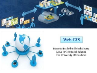
Web GIS is a type of distributed information system, comprising at least a server and a client,
where the server is a GIS server and the client is a web browser, desktop application, or
mobile application.
Web GIS
Here are a few key elements essential to web GIS:
 The server has a URL so that clients can find it on the web.
 The client relies on HTTP specifications to send requests to the server.
 The server performs the requested GIS operations and sends responses to the client via
HTTP.
 The format of the response sent to the client can be in many formats, such as HTML,
binary image, XML (Extensible Markup Language), or JSON (JavaScript Object
Notation).
key elements of web GIS
Thick client architectureThin client architecture
Web-GIS Architecture
The generic layered architecture of Web GIS, consists of three layers namely user
Interface layer:
The clients access the system by interacting with the user interface layers that takes the input
and shows, the output of the system.
Application layer:
The application layer provides the map visualization functions like panning, zooming etc. It
provides the others functions also.
Database layer :
The database layer handles the data present at distributed sources.
 These three elements may reside in the same machine or in different machines.
Differents layers of Web-GIS
Basic Components of Web-GIS
 A global reach
 A large number of users
 Better cross-platform capability
 Low cost
 Easy to use for end users
 Unified update
 Diverse applications
Characteristics of Web-GIS
WMS, WFS, WPS
1. Web Map Service (WMS)
2. Web Feature Service (WFS)
3. Web Processing Service (WPS)
(1) (2)
Data for Web GIS
Examples Of Web GIS using QGIS
Examples Of Web GIS using Google My Map
Reference
https://www.esri.com/en-us/what-is-gis/overview
https://grindgis.com/blog/components-of-gis
https://enterprise.arcgis.com/en/server/latest/create-web-apps/windows/about-web-
gis.htm
https://drive.google.com/open?id=1DmvlhvjFzCNjKzCDYff5OqUaJdrDp6oD
https://www.slideshare.net/StigArneKristoffersen/web-based-gis
Web GIS using Google Map and QGIS

More Related Content

What's hot

Surface Representations using GIS AND Topographical Mapping
Surface Representations using GIS AND Topographical MappingSurface Representations using GIS AND Topographical Mapping
Surface Representations using GIS AND Topographical Mapping
NAXA-Developers
 

What's hot (20)

Introduction to GIS
Introduction to GISIntroduction to GIS
Introduction to GIS
 
introduction to GIS
introduction to GIS introduction to GIS
introduction to GIS
 
My ppt on gis
My ppt on gisMy ppt on gis
My ppt on gis
 
Arc gis desktop_and_geoprocessing
Arc gis desktop_and_geoprocessingArc gis desktop_and_geoprocessing
Arc gis desktop_and_geoprocessing
 
Geo-spatial Analysis and Modelling
Geo-spatial Analysis and ModellingGeo-spatial Analysis and Modelling
Geo-spatial Analysis and Modelling
 
Enterprise GIS
Enterprise GIS Enterprise GIS
Enterprise GIS
 
TYBSC IT PGIS Unit I Chapter II Geographic Information and Spacial Database
TYBSC IT PGIS Unit I Chapter II Geographic Information and Spacial DatabaseTYBSC IT PGIS Unit I Chapter II Geographic Information and Spacial Database
TYBSC IT PGIS Unit I Chapter II Geographic Information and Spacial Database
 
Introduction to GIS
Introduction to GISIntroduction to GIS
Introduction to GIS
 
An introduction to geographic information systems (gis) m goulbourne 2007
An introduction to geographic information systems (gis)   m goulbourne 2007An introduction to geographic information systems (gis)   m goulbourne 2007
An introduction to geographic information systems (gis) m goulbourne 2007
 
DATA in GIS and DATA Query
DATA in GIS and DATA QueryDATA in GIS and DATA Query
DATA in GIS and DATA Query
 
Getting started with GIS
Getting started with GISGetting started with GIS
Getting started with GIS
 
Application of gis in urban planning
Application of gis in urban planningApplication of gis in urban planning
Application of gis in urban planning
 
Chap1 introduction to geographic information system (gis)
Chap1 introduction to geographic information system (gis)Chap1 introduction to geographic information system (gis)
Chap1 introduction to geographic information system (gis)
 
Surface Representations using GIS AND Topographical Mapping
Surface Representations using GIS AND Topographical MappingSurface Representations using GIS AND Topographical Mapping
Surface Representations using GIS AND Topographical Mapping
 
Arcgis training day_1
Arcgis training day_1Arcgis training day_1
Arcgis training day_1
 
Web Mapping 101: What Is It and Making It Work For You
Web Mapping 101: What Is It and Making It Work For YouWeb Mapping 101: What Is It and Making It Work For You
Web Mapping 101: What Is It and Making It Work For You
 
Introduction to ArcGIS 10.1
Introduction to ArcGIS 10.1Introduction to ArcGIS 10.1
Introduction to ArcGIS 10.1
 
Gis
GisGis
Gis
 
Introduction to GIS and its Applications
Introduction to GIS and its ApplicationsIntroduction to GIS and its Applications
Introduction to GIS and its Applications
 
GIS
GISGIS
GIS
 

Similar to Web GIS using Google Map and QGIS

Volume 2-issue-6-2030-2033
Volume 2-issue-6-2030-2033Volume 2-issue-6-2030-2033
Volume 2-issue-6-2030-2033
Editor IJARCET
 
Volume 2-issue-6-2030-2033
Volume 2-issue-6-2030-2033Volume 2-issue-6-2030-2033
Volume 2-issue-6-2030-2033
Editor IJARCET
 
Final presentation
Final presentationFinal presentation
Final presentation
SKRizvi
 
Not Just Dots on a Map: How Geography Influences Real World Decisions Part 2
Not Just Dots on a Map: How Geography Influences Real World Decisions Part 2Not Just Dots on a Map: How Geography Influences Real World Decisions Part 2
Not Just Dots on a Map: How Geography Influences Real World Decisions Part 2
American Public Gardens Association
 
Getting your Data Out There: An Introduction to Distributed GIS
Getting your Data Out There:An Introduction to Distributed GISGetting your Data Out There:An Introduction to Distributed GIS
Getting your Data Out There: An Introduction to Distributed GIS
John Reiser
 
Cloud MicroService Architecture
Cloud MicroService ArchitectureCloud MicroService Architecture
Cloud MicroService Architecture
Yakov Liskoff
 
Using OGC Standards To Link BI and Spatial
Using OGC Standards To Link BI and SpatialUsing OGC Standards To Link BI and Spatial
Using OGC Standards To Link BI and Spatial
MISNet - Integeo SE Asia
 
DSL (Domain Specific Language) for Maps Mashups
DSL (Domain Specific Language) for Maps MashupsDSL (Domain Specific Language) for Maps Mashups
DSL (Domain Specific Language) for Maps Mashups
aliraza786
 
Dotted Eyes - Open Software, Standards and Data
Dotted Eyes - Open Software, Standards and DataDotted Eyes - Open Software, Standards and Data
Dotted Eyes - Open Software, Standards and Data
Dotted Eyes
 
Building mobile apps with the ArcGIS api for Javascript, Esri, Andy Gup and A...
Building mobile apps with the ArcGIS api for Javascript, Esri, Andy Gup and A...Building mobile apps with the ArcGIS api for Javascript, Esri, Andy Gup and A...
Building mobile apps with the ArcGIS api for Javascript, Esri, Andy Gup and A...
Esri Nederland
 
JeffWalkerResume2016
JeffWalkerResume2016JeffWalkerResume2016
JeffWalkerResume2016
Jeff Walker
 

Similar to Web GIS using Google Map and QGIS (20)

Volume 2-issue-6-2030-2033
Volume 2-issue-6-2030-2033Volume 2-issue-6-2030-2033
Volume 2-issue-6-2030-2033
 
Volume 2-issue-6-2030-2033
Volume 2-issue-6-2030-2033Volume 2-issue-6-2030-2033
Volume 2-issue-6-2030-2033
 
THE OGC STANDARDS AND GEO-PLATFORM BASED WEB APPLICATION FOR SEISMIC EVENTS M...
THE OGC STANDARDS AND GEO-PLATFORM BASED WEB APPLICATION FOR SEISMIC EVENTS M...THE OGC STANDARDS AND GEO-PLATFORM BASED WEB APPLICATION FOR SEISMIC EVENTS M...
THE OGC STANDARDS AND GEO-PLATFORM BASED WEB APPLICATION FOR SEISMIC EVENTS M...
 
Super map gis 8c
Super map gis 8cSuper map gis 8c
Super map gis 8c
 
Final presentation
Final presentationFinal presentation
Final presentation
 
Mobile gis
Mobile gisMobile gis
Mobile gis
 
GI2013 ppt buono_seismic_geo_sdi
GI2013 ppt buono_seismic_geo_sdiGI2013 ppt buono_seismic_geo_sdi
GI2013 ppt buono_seismic_geo_sdi
 
Not Just Dots on a Map: How Geography Influences Real World Decisions Part 2
Not Just Dots on a Map: How Geography Influences Real World Decisions Part 2Not Just Dots on a Map: How Geography Influences Real World Decisions Part 2
Not Just Dots on a Map: How Geography Influences Real World Decisions Part 2
 
Getting your Data Out There: An Introduction to Distributed GIS
Getting your Data Out There:An Introduction to Distributed GISGetting your Data Out There:An Introduction to Distributed GIS
Getting your Data Out There: An Introduction to Distributed GIS
 
Cloud MicroService Architecture
Cloud MicroService ArchitectureCloud MicroService Architecture
Cloud MicroService Architecture
 
Gtkwebgis third ch_one_reduced
Gtkwebgis third ch_one_reducedGtkwebgis third ch_one_reduced
Gtkwebgis third ch_one_reduced
 
Intro GIS.pptx
Intro GIS.pptxIntro GIS.pptx
Intro GIS.pptx
 
LSIVIEWER 2.0-A CLIENT-ORIENTED ONLINE VISUALIZATION TOOL FOR GEOSPATIAL VECT...
LSIVIEWER 2.0-A CLIENT-ORIENTED ONLINE VISUALIZATION TOOL FOR GEOSPATIAL VECT...LSIVIEWER 2.0-A CLIENT-ORIENTED ONLINE VISUALIZATION TOOL FOR GEOSPATIAL VECT...
LSIVIEWER 2.0-A CLIENT-ORIENTED ONLINE VISUALIZATION TOOL FOR GEOSPATIAL VECT...
 
webgis architecture and practices patterns
webgis architecture and practices patternswebgis architecture and practices patterns
webgis architecture and practices patterns
 
Using OGC Standards To Link BI and Spatial
Using OGC Standards To Link BI and SpatialUsing OGC Standards To Link BI and Spatial
Using OGC Standards To Link BI and Spatial
 
DSL (Domain Specific Language) for Maps Mashups
DSL (Domain Specific Language) for Maps MashupsDSL (Domain Specific Language) for Maps Mashups
DSL (Domain Specific Language) for Maps Mashups
 
Dotted Eyes - Open Software, Standards and Data
Dotted Eyes - Open Software, Standards and DataDotted Eyes - Open Software, Standards and Data
Dotted Eyes - Open Software, Standards and Data
 
3 Approaches to Mobile - An A to Z Primer.
3 Approaches to Mobile - An A to Z Primer.3 Approaches to Mobile - An A to Z Primer.
3 Approaches to Mobile - An A to Z Primer.
 
Building mobile apps with the ArcGIS api for Javascript, Esri, Andy Gup and A...
Building mobile apps with the ArcGIS api for Javascript, Esri, Andy Gup and A...Building mobile apps with the ArcGIS api for Javascript, Esri, Andy Gup and A...
Building mobile apps with the ArcGIS api for Javascript, Esri, Andy Gup and A...
 
JeffWalkerResume2016
JeffWalkerResume2016JeffWalkerResume2016
JeffWalkerResume2016
 

Recently uploaded

Cloud Frontiers: A Deep Dive into Serverless Spatial Data and FME
Cloud Frontiers:  A Deep Dive into Serverless Spatial Data and FMECloud Frontiers:  A Deep Dive into Serverless Spatial Data and FME
Cloud Frontiers: A Deep Dive into Serverless Spatial Data and FME
Safe Software
 
Finding Java's Hidden Performance Traps @ DevoxxUK 2024
Finding Java's Hidden Performance Traps @ DevoxxUK 2024Finding Java's Hidden Performance Traps @ DevoxxUK 2024
Finding Java's Hidden Performance Traps @ DevoxxUK 2024
Victor Rentea
 

Recently uploaded (20)

Cloud Frontiers: A Deep Dive into Serverless Spatial Data and FME
Cloud Frontiers:  A Deep Dive into Serverless Spatial Data and FMECloud Frontiers:  A Deep Dive into Serverless Spatial Data and FME
Cloud Frontiers: A Deep Dive into Serverless Spatial Data and FME
 
JavaScript Usage Statistics 2024 - The Ultimate Guide
JavaScript Usage Statistics 2024 - The Ultimate GuideJavaScript Usage Statistics 2024 - The Ultimate Guide
JavaScript Usage Statistics 2024 - The Ultimate Guide
 
Decarbonising Commercial Real Estate: The Role of Operational Performance
Decarbonising Commercial Real Estate: The Role of Operational PerformanceDecarbonising Commercial Real Estate: The Role of Operational Performance
Decarbonising Commercial Real Estate: The Role of Operational Performance
 
Connector Corner: Accelerate revenue generation using UiPath API-centric busi...
Connector Corner: Accelerate revenue generation using UiPath API-centric busi...Connector Corner: Accelerate revenue generation using UiPath API-centric busi...
Connector Corner: Accelerate revenue generation using UiPath API-centric busi...
 
ChatGPT and Beyond - Elevating DevOps Productivity
ChatGPT and Beyond - Elevating DevOps ProductivityChatGPT and Beyond - Elevating DevOps Productivity
ChatGPT and Beyond - Elevating DevOps Productivity
 
DEV meet-up UiPath Document Understanding May 7 2024 Amsterdam
DEV meet-up UiPath Document Understanding May 7 2024 AmsterdamDEV meet-up UiPath Document Understanding May 7 2024 Amsterdam
DEV meet-up UiPath Document Understanding May 7 2024 Amsterdam
 
Vector Search -An Introduction in Oracle Database 23ai.pptx
Vector Search -An Introduction in Oracle Database 23ai.pptxVector Search -An Introduction in Oracle Database 23ai.pptx
Vector Search -An Introduction in Oracle Database 23ai.pptx
 
The Zero-ETL Approach: Enhancing Data Agility and Insight
The Zero-ETL Approach: Enhancing Data Agility and InsightThe Zero-ETL Approach: Enhancing Data Agility and Insight
The Zero-ETL Approach: Enhancing Data Agility and Insight
 
AI+A11Y 11MAY2024 HYDERBAD GAAD 2024 - HelloA11Y (11 May 2024)
AI+A11Y 11MAY2024 HYDERBAD GAAD 2024 - HelloA11Y (11 May 2024)AI+A11Y 11MAY2024 HYDERBAD GAAD 2024 - HelloA11Y (11 May 2024)
AI+A11Y 11MAY2024 HYDERBAD GAAD 2024 - HelloA11Y (11 May 2024)
 
CNIC Information System with Pakdata Cf In Pakistan
CNIC Information System with Pakdata Cf In PakistanCNIC Information System with Pakdata Cf In Pakistan
CNIC Information System with Pakdata Cf In Pakistan
 
Navigating Identity and Access Management in the Modern Enterprise
Navigating Identity and Access Management in the Modern EnterpriseNavigating Identity and Access Management in the Modern Enterprise
Navigating Identity and Access Management in the Modern Enterprise
 
TrustArc Webinar - Unlock the Power of AI-Driven Data Discovery
TrustArc Webinar - Unlock the Power of AI-Driven Data DiscoveryTrustArc Webinar - Unlock the Power of AI-Driven Data Discovery
TrustArc Webinar - Unlock the Power of AI-Driven Data Discovery
 
TEST BANK For Principles of Anatomy and Physiology, 16th Edition by Gerard J....
TEST BANK For Principles of Anatomy and Physiology, 16th Edition by Gerard J....TEST BANK For Principles of Anatomy and Physiology, 16th Edition by Gerard J....
TEST BANK For Principles of Anatomy and Physiology, 16th Edition by Gerard J....
 
Introduction to Multilingual Retrieval Augmented Generation (RAG)
Introduction to Multilingual Retrieval Augmented Generation (RAG)Introduction to Multilingual Retrieval Augmented Generation (RAG)
Introduction to Multilingual Retrieval Augmented Generation (RAG)
 
API Governance and Monetization - The evolution of API governance
API Governance and Monetization -  The evolution of API governanceAPI Governance and Monetization -  The evolution of API governance
API Governance and Monetization - The evolution of API governance
 
Finding Java's Hidden Performance Traps @ DevoxxUK 2024
Finding Java's Hidden Performance Traps @ DevoxxUK 2024Finding Java's Hidden Performance Traps @ DevoxxUK 2024
Finding Java's Hidden Performance Traps @ DevoxxUK 2024
 
Less Is More: Utilizing Ballerina to Architect a Cloud Data Platform
Less Is More: Utilizing Ballerina to Architect a Cloud Data PlatformLess Is More: Utilizing Ballerina to Architect a Cloud Data Platform
Less Is More: Utilizing Ballerina to Architect a Cloud Data Platform
 
DBX First Quarter 2024 Investor Presentation
DBX First Quarter 2024 Investor PresentationDBX First Quarter 2024 Investor Presentation
DBX First Quarter 2024 Investor Presentation
 
Elevate Developer Efficiency & build GenAI Application with Amazon Q​
Elevate Developer Efficiency & build GenAI Application with Amazon Q​Elevate Developer Efficiency & build GenAI Application with Amazon Q​
Elevate Developer Efficiency & build GenAI Application with Amazon Q​
 
Polkadot JAM Slides - Token2049 - By Dr. Gavin Wood
Polkadot JAM Slides - Token2049 - By Dr. Gavin WoodPolkadot JAM Slides - Token2049 - By Dr. Gavin Wood
Polkadot JAM Slides - Token2049 - By Dr. Gavin Wood
 

Web GIS using Google Map and QGIS