Big data helps pedestrian planning take a big step forward
•
2 likes•855 views

Technical article reproduced with permission from Transportation Professional - the magazine of the Chartered Institution of Highways & Transportation www.ciht.org.uk/en/knowledge/publications/transportation-professional/index.cfm

Recommended
Recommended
More Related Content
What's hot
What's hot (20)
Similar to Big data helps pedestrian planning take a big step forward
Similar to Big data helps pedestrian planning take a big step forward (20)
More from Institute for Transport Studies (ITS)
More from Institute for Transport Studies (ITS) (20)
Recently uploaded
Recently uploaded (20)
Big data helps pedestrian planning take a big step forward
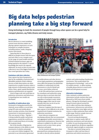
- 1. Technical Paper Transportation Professional April 201526 Introduction Recent advances in crowd modelling systems mean decision makers are placing a greater importance on such techniques at complex locations including stations, stadia, shopping centres and schools. Capturing data in these places is difficult as people interact with the space and each other in very complex ways. As the range of crowd models and level of detail required increases, gaps are being exposed in the industry´s current knowledge that need to be urgently addressed. So much so that accurate data collection is one of the biggest limitations that crowd specialists face today. Limitations with data collection Data capture has been hampered to date by the availability of practical and affordable methods of data collation. Surveys or field observations are often impractical at complex locations where a large amount of information about route choice, flows, speed, spatial distribution patterns and behaviours are required. A lack of large scale real world data on pedestrian movements and behaviours is impeding how new models are developed. Feasibility of mobile phone data Excitement is being generated by the relatively recent ability to record data using GPS units and mobile phone about everyday activities, from financial transactions to movement patterns. This vast amount of data – ‘big data’ – is being studied by public and private organisations around the world in an effort to understand facets of everyday life in greater detail. One of the benefits of big data for transport planners is the ability to track movements of vehicles and people on a scale never before imagined. The potential to use information generated by mobile phones and other devices across large populations and geographic areas offers the prospect for pedestrian modellers to understand city wide movements at a level of detail and accuracy never before achieved. In the UK work has been carried out by consultants and authorities using telecoms data to ascertain what that can tell us about people movement, regardless of transport mode. Initial findings suggest there may be some valuable data that can be of use for vehicle based studies. However it appears that this type of data capture is very difficult to use at the required level of spatial resolution for pedestrian movements. Some telecom companies are developing software that use anonymised and aggregated mobile network data to understand crowd patterns. However this software is unlikely to be able to track patterns such as route choice, group behaviour and speed. For the moment mobile phone data generated from existing networks is not able to directly inform detailed analysis and understanding of pedestrian movements. This would require the development of technology – such as the 5G mobile network – to allow tracking of mobile phone devices in much more detail and with greater accuracy. Alternative technologies Other methods to obtain pedestrian information include scanners that track Bluetooth or WiFi traces from mobile phones. Chicago has developed a project using 50 sensors placed around the city to collect real time data relating to environment, infrastructure and activity. They are attached to street lights and use sensors to collect pedestrian flows within a 30m range. However sample sizes are still small, around 10-15%. A recent exciting development that claims to capture nearly 100% of pedestrian movements and track phones to within 1m uses locating sensors that pick up signals from all phones regardless of network, signal strength or connection. This idea is currently being used in Liverpool to collect real time data of pedestrian and vehicle movement in Using technology to track the movement of people through busy urban spaces can be a great help for transport planners, say Pablo Alvarez and Andy Leeson. Big data helps pedestrian planning take a big step forward By 2050 over 70% of the world’s population is predicted to live in cities, putting increased strain on urban infrastructure and transport systems AntoonKuper(Flickr)
- 2. Technical PaperTransportation Professional April 2015 27 order to enhance the urban transport network. Alternatives to mobile phone data include using smartcards like Oyster in London or the CEPAS card in Singapore to track people when using public transport. However outputs are of limited use for tracking pedestrian movements other than to establish general daily or weekly commuting patterns. This method can also be used to inform transport users’ decisions about public transport services, taking into account strategic information about route choice, journey times, in-vehicle time or number of transfers. Using CCTV for big data collection Video cameras can also be used to record and understand detailed pedestrian movements. They can track size, shape, clothing texture and colour or type of movement rather than facial recognition to preserve anonymity. Collecting data in this manner is perhaps not ‘big data’ as defined by many. But if the technology was applied to a network of existing cameras, such as CCTV, there would be potential for citywide movements to be captured and understood more clearly than ever before. Researchers from the University of Washington are developing a project using cameras mounted in cars to take a video of the scene, then identify and track people and overlay them into a virtual 3D map on a GPS screen. This could help pick out people crossing in busy intersections to improve safety. If the different cars using this technology uploaded the data to the ‘cloud’, it could be used to see real time flow dynamics of city streets on a platform like Google Earth. Swiss experience Video technology was also used by Swiss Federal Railways to track hundreds of thousands of pedestrians at Lausanne train station over a prolonged period of time to determine how pedestrian flow was distributed along different platforms. Using around 100 sensors located throughout the station trajectories were created for each pedestrian. Anonymised data were used to inform the planning process for future transport infrastructure developments by providing an understanding of behaviour, interaction with other pedestrians, flow dynamics and use of space. Concerns over invasion of privacy should be considered but the benefits of this technology could enable accurate origin destination matrices to be developed and seasonal fluctuations to be understood. Additional benefits include the ability to determine differences associated with changing weather, as well as behavioural traits such as group behaviour, dwell times, walking speeds and route choices. London has about 500,000 CCTV cameras, so there is the potential for this technology to be expanded at scale. However one of the biggest limitations to using the existing CCTV network for this Pablo Alvarez has a Masters in Civil Engineering and a Masters in Transport Planning & Engineering from the Institute for Transport Studies, Leeds. Based within AECOM’s transport planning team he has worked on several major pedestrian planning projects including the Glasgow 2014 Commonwealth Games, FIFA World Cup Qatar 2022 and Riyadh Metro. Andy Leeson is a principal consultant at AECOM and a project manager overseeing crowd modelling projects. Andy has worked in transport planning for over 10 years and has specialised in pedestrian modelling for the last seven. He has worked on the Glasgow Commonwealth Games, Qatar 2022 World Cup and on over 100 rail station assessments. purpose is the placement of each camera. The location of a camera may not be effective for pedestrian flow analysis, or the coverage of the CCTV network could be poor with large gaps between cameras. Classic cameras may also only be efficient in daylight. Limitations can be overcome by adding thermal sensors. Conclusion It is an exciting time for the crowd modelling sector. The need to understand and predict pedestrian volumes, movements and behaviours for cities, ‘mega events’ and emergency planning will continue to increase in prominence in order to design more efficient and safer cities for pedestrians. Big data stands out as the next necessary step for pedestrian planners. It is vital that the industry recognises the opportunities that are emerging through technology and engage with those involved to ensure that it can effectively and efficiently shape future developments. Acknowledgement This paper has been reviewed by CIHT’s Sustainable Transport, Network Management & Operations and Urban Design panels. Video cameras were used to track pedestrians at Lausanne station to investigate what can be done to manage daily flows, set to increase from 50,000 to 100,000 by 2030. Source: VisioSafe