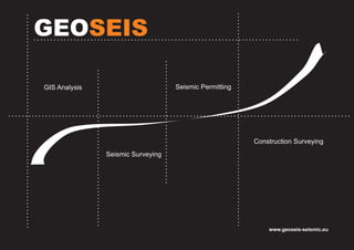
3. GEOSEIS About Us
GEOSEIS, provides an extensive variety of surveying, permitting,
and inspection capabilities to the oil and gas industry. Our clients have
come to expect our professional accuracy and timely delivery of
information that is needed for down-stream data flow to the end-user.
Romania | Cluj-Napoca
Address: 10 Portile de Fier
E-mail: office@geoseis-seismic.eu
4. GEOSEIS GIS Analysis
A geographic information system (GIS) is a system designed to capture, store,
manipulate, analyze, manage, and present all types of spatial or geographical data.
The acronym GIS is sometimes used for geographical information science or
geospatial information studies to refer to the academic discipline or career of
working with geographic information systems and is a large domain within the
broader academic discipline of Geoinformatics.[1] What goes beyond a GIS is a
spatial data infrastructure, a concept that has no such restrictive boundaries.
In a general sense, the term describes any information system that integrates,
stores, edits, analyzes, shares, and displays geographic information. GIS
applications are tools that allow users to create interactive queries (user-created
searches), analyze spatial information, edit data in maps, and present the results of
all these operations.[2][3] Geographic information science is the science underlying
geographic concepts, applications, and systems.[4]
GIS is a broad term that can refer to a number of different technologies, processes,
and methods. It is attached to many operations and has many applications related to
engineering, planning, management, transport/logistics, insurance,
telecommunications, and business.[3] For that reason, GIS and location intelligence
applications can be the foundation for many location-enabled services that rely on
analysis and visualization.
GIS can relate unrelated information by using location as the key index variable.
Locations or extents in the Earth space–time may be recorded as dates/times of
occurrence, and x, y, and z coordinates representing, longitude, latitude, and
elevation, respectively. All Earth-based spatial–temporal location and extent
references should, ideally, be relatable to one another and ultimately to a "real"
physical location or extent. This key characteristic of GIS has begun to open new
avenues of scientific inquiry. Romania | Cluj-Napoca
Address: 10 Portile de Fier
E-mail: office@geoseis-seismic.eu
[spatial analysis] The process of
examining the locations, attributes,
and relationships of features in
spatial data through overlay and
other analytical techniques in order
to address a question or gain
useful knowledge. Spatial analysis
extracts or creates new information
from spatial data.
We offer:
Slope and aspect analysis
Data analysis
Topological modeling
Geometric networks
Hydrological modeling
Cartographic modeling
Map overlay
Geostatistics
5. GEOSEIS Seismic Surveying
Clients have come to expect the professional accuracy and timely delivery of
information that is needed for down-stream data flow to the end-user.
GEOSEIS has assembled a very knowledgeable group of people. This
combination of professionalism and years of experience in all aspects of the
industry ensures us to adequately complete any and all projects. We have
employees that have managed and worked on projects being performed under
heavily environmental, time, and high target constraints.
Our surveyors are experienced in all types of environments.
We have worked inside the city limits of large cities, marshes, swamps, shallow
water, open plains, heavily wooded areas and mountainous terrains.
EQUIPMENT
Surveying with the most up to date technology is a standard at GEOSEIS.
We use Leica instruments when doing conventional surveying. GPS surveying
is done using the latest Trimble series survey grade equipment for static and
RTK .
MAPPING
Our project managers are the industry leaders in graphical information
systems. We use our custom designed workstations to digitally recreate our client
projects and link all aspects of the project together. Whether its creating data linked
drill logs, dynamic hazard databases, or analyzing digital elevation models to
determine slope,GEOSEIS has the technology and know how to get the job done.
Romania | Cluj-Napoca
Address: 10 Portile de Fier
E-mail: office@geoseis-seismic.eu
6. GEOSEIS Seismic Permitting
Depending on the clients' requirements, we maintain an onsite field office for
the duration of each project and provide a project manager, permit agents, mineral
agents, research and lease check agents, mapping and database agents.
Seismic permitting requires a great deal of planning and coordination. It often
involves working with private, public, and corporate landowners, each with their
own peculiar requirements. GEOSEIS can provide a complete solution to your
seismic permitting needs. It is our experience that a seismic survey goes off faster,
and with less problems, if the impacted community, its businesses, and its leaders
develop a trusting relationship with the exploration company and its agents.
GEOSEIS permit agents are also experienced in field support, such as
assisting with gate access for drills and surveyors and damage settlement
negotiations. We can also handle your seismic permitting budget needs, including
budget scheduling and tracking.
Our Permit Agents can negotiate all the surface and mineral permits and
options you need. They are trained to be in the field, knocking on doors, and building
that ever important relationship with the community.
Mapping/Database Administration using state of the art ESRI and ArcView
Map Geographic Information Systems Software combined with large format/high
definition plotting capabilities linked with a web based database. We have the ability
to help with program design and pre-plot moves.
Romania | Cluj-Napoca
Address: 10 Portile de Fier
E-mail: office@geoseis-seismic.eu
7. GEOSEIS Construction Surveying
Construction surveying or building surveying (otherwise known as "lay-out"
or "setting-out") is to stake out reference points and markers that will guide the
construction of new structures such as roads or buildings. These markers are
usually staked out according to a suitable coordinate system selected for the
project.
Survey existing conditions of the future work site, including topography,
existing buildings and infrastructure, and underground infrastructure whenever
possible (for example, measuring invert elevations and diameters of sewers at
manholes);
Stake out lot corners, stake limit of work and stake location of construction
trailer(clear of all excavation and construction)
Stake out reference points and markers that will guide the construction of
new structures
Verify the location of structures during construction;
Provide horizontal control on multiple floors.
Conduct an As-Built survey: a survey conducted at the end of the
construction project to verify that the work authorized was completed to the
specifications set on plans.
Romania | Cluj-Napoca
Address: 10 Portile de Fier
E-mail: office@geoseis-seismic.eu