SlideShare a Scribd company logo
1 of 16
Download to read offline
EDUCATION EVENT REPORT AND
RECOMMENDATIONS
Attendee's and Report Writer’s Name:
Joseph Kerski
Events:
1. Geographical Association 2002
Annual Conference, University of
Manchester, UK
2. GIS Workshop for Educators,
University of Leeds, UK
3. Meeting at University of London
Institute of Education, London, UK
4. Meeting at Royal Geographical
Society, London, UK
5. Meeting at Geological Society of
London, UK
Locations: Manchester, Leeds, London, UK
Other USGS Attendees: None.
Event Date: 2-12 April 2002.
Executive Summary
I attended the 2002 Annual Conference of the
Geographical Association (GA) as a
representative of the USGS. I attended also
as a member of the Research and External
Relations Board of the National Council for
Geographic Education (NCGE), where my
term lasts from 2002-2004. I did so to begin
investigating ways for the USGS, NCGE, and
the GA to partner in educational endeavors.
I operated a USGS exhibit at the conference
and met with the GA board and many GA
members individually. I then conducted a
GIS workshop for educators across England
at the University of Leeds. I met with faculty
from the University of London’s Institute of
Education. I met with education staff from the
Royal Geographical Society, and with exhibits
staff of the Geological Society of London.
I pursued this effort as a USGS and NCGE
representative because of both of the
organizations’ (1) continuing emphasis on
international activities; and (2) increasing
emphasis on educational partnerships. The
GA is the largest geography education
association in the world, and it is an
international organization. The NCGE is
probably the second largest geography
education association in the world. The
USGS is one of the world’s largest science
organizations. I sought to meet these
international and educational goals at once
among three large, respected organizations.
I sought and obtained 4 funding sources for
this trip: 1) The University of Leeds, 2) the
National Council for Geographic Education, 3)
the USGS, and 4) my own funds.
Geographical Association Conference
Joseph Kerski at the Geographical
Association conference. The conference
rotates each year, usually to a university
campus. The 2002 conference and exhibits
were held at the University of Manchester
Institute of Science and Technology, in the
building directly behind the sign.
Geographical Association and GIS Institute - 2002 Report - Joseph J. Kerski - April 2002 - Page 1 of 16
The Geographical Association (GA)
(www.geography.org.uk) is an international
association centered in the UK for geography
teachers, with a membership of 10,000,
providing information and resources to
teachers and students furthering the study
and teaching of geography and promoting its
contribution to education.
This was the second year in which I
participated in the GA conference. Last year
at the University of Sussex, I conducted a GIS
in education presentation and operated a
USGS exhibit. I joined the GA in 2001. I
preferred this year’s conference logistics to
2001, because sessions and exhibits were
largely confined to two buildings on campus,
rather than scattered throughout the campus
as in 2001. This ensured multiple visits in the
exhibit hall and an excellent opportunity to
meet many more GA staff than I had met in
2001. The conference theme this year was
“Life in the Global Village.”
Jeremy Krause, 2002 President of the
Geographical Association. His Presidential
Address was entitled “Tell the World About
Learning Geography.” Krause said we need
to tell the world about its richness as a
subject, its contribution to the learning
debate, and how we learned our geography.
Like the NCGE, the GA is dedicated to
promoting the development of geography as a
subject. The GA believes that geography
makes both a distinctive and a wide
contribution to education and that it is an
essential component in preparing young
people for life in the 21st century. The GA is
also committed to providing support to all
those who are engaged with it—either for
professional reasons or personal affinity with
the subject.
Approximately 750 people participated in
this year’s Geographical Association
conference. This gathering was to hear the
Presidential Address by Jeremy Krause.
During the Annual General Meeting following
the Presidential Address, Jeremy Krause
invited me to state my intentions for being at
the conference—namely, to form partnerships
among the GA, NCGE, and USGS. This was
well received and I had numerous people talk
with me about it afterwards. This was a
fantastic opportunity to speak to most of the
conference attendees at once, and I do
appreciate President Krause for inviting me to
speak.
Opportunities for partnerships with the NCGE
range from allowing GA members to purchase
NCGE publications at a discount, showcasing
NCGE publications in GA literature, formally
sponsoring each other’s members for our
annual meetings, and working on curricular
development projects. Opportunities with the
USGS include research in geographic
education and creating lessons for the
Geographical Association and GIS Institute - 2002 Report - Joseph J. Kerski - April 2002 - Page 2 of 16
educational community.
Each GA conference offers 8 professional
development “pathways” to help attendees
select the lectures, workshops, and field trips.
These included leading and managing
geography at the primary, secondary, and
post-16 level, curriculum development for the
new geography teacher at the three levels,
Geography and ICT (Information and
Communications Technology), and Improving
Your Geographical Understanding.
Approximately 80 vendors exhibited at the
2002 Geographical Association conference,
including textbook publishers, aerial
photography companies, fieldwork centers,
educational associations, software vendors,
assessment and curriculum companies,
scientific instrument companies, and
nonprofit organizations.
Other exhibitors included the Ordnance
Survey, the Royal Geographical Society, the
Remote Sensing Society, the Geomantic
Society, and the UK meteorological agency
Met Office. In addition, the GA itself was an
exhibitor, which displayed a vast series of
resources as well as highlighted activities of
its many subgroups.
This year, my travel approvals came in too
late for me to submit a proposal to conduct a
workshop. However, I attended and enjoyed
the following sessions at the conference:
1) Interactive Mapping with AEGIS 3. AEGIS
is a GIS software package created for
educators.
2) Presidential Address, “Tell the World
About Learning Geography.”
3) The Annual General Meeting of the GA.
During this meeting.
4) Atlases and Digital Atlases, by Dr Patrick
Wiegand.
A branch of the government, DFID, is granting
the GA 60,000 pounds per year for three
years for its “Learning Places” project. This
shows how active the GA is in obtaining
funding for its research projects. The GA is
currently without an executive director but
nevertheless seems to have a clear vision of
where it is headed.
The GA seems fairly well known, even among
the general public, no doubt in part due to
high visibility projects involving standards-
based education and field projects such as
the 1996 Land Use UK. This involved 10,000
students who mapped one square kilometer
cells for the entire country.
Geographical Association and GIS Institute - 2002 Report - Joseph J. Kerski - April 2002 - Page 3 of 16
Sarah Clarke, conference organizer, seated
at right, works with undergraduate students.
Most of these students were from the
University of Manchester, which has one of
the largest geography programs in the
country--in fact, it is an entire School of
Geography, not just a department. I was
impressed at how many students work at
GA conferences and how seriously they
take their responsibilities.
It was a pleasure to see students competing
in the final round of the “Worldwide Quiz, “ a
geography competition for secondary
schools, roughly equivalent to the
International Geography Bee.
The 2003 GA conference will be at the
University of Derby (pronounced “Darby”) from
23-25 April 2003 with the theme “Valuing
Geography.”
USGS Exhibit
Joseph Kerski at USGS exhibit. The
paragraph I submitted to describe the exhibit
was, “The US Geological Survey publishes
nearly 100,000 titles of topographic and
thematic maps, books, and satellite images,
aerial photographs in paper and digital form,
excellent for teaching about watersheds,
earthquakes, volcanoes, population, coastal
processes, geology, biodiversity, landforms,
historical settlement, and water resources.
Despite the position of the USGS exhibit
near the end of the exhibit hall, it was almost
continually crowded with conference
attendees. Many of these attendees came
back each day and some stayed for over 25
minutes.
The official “stand” spaces (they are called
“stands” in the UK, not “booths”) are 2 meters
Geographical Association and GIS Institute - 2002 Report - Joseph J. Kerski - April 2002 - Page 4 of 16
by 1 meter. The GA gave us a discount on
the exhibit from 180 pounds to 120 pounds.
Fortunately, the conference was held in a
university, thus avoiding the usual restrictions
in convention centers about being “over the
line” and extending our exhibit outside the
allotted space. I had been wondering how to
squeeze into a space that was only 1 meter
wide, and so I used a tri-fold tabletop display.
This worked out wonderfully, as the curved
backdrop I typically use would have been too
wide. I had too much variety of materials to
display on only one table, so I placed two
tables together, forming a deeper exhibit, but
the attendees could still reach all materials.
Fortunately, I was able to use the tables
underneath for storage.
Word-of-mouth quickly spread about our
exhibit. At least 30 people took time to
personally thank me for our resources and
exhibit at the conference.
International Conference Logistics
Coordinating internationally for a conference
is a bit more difficult than in the USA, as I
expected and experienced in 2001. I bought
plenty of surge suppressors and outlet
converters to bring with me (some from
Magellan’s Travel Incorporated).
I found is that it is difficult to use university
resources such as Internet access in the UK
without being enrolled as a student.
Fortunately, I was able to get an unused T1
line working in our exhibit space.
Shipping to an international conference was
less problematic than in 2001, when Box
Global delayed the delivery of our materials to
the conference in customs and FedEx lost our
exhibit on the way back to the USA. I
experienced two hours of stress when I
arrived and the materials were nowhere to be
found. After several international calls, I
located them in a back closet of the
conference center. It cost me $250 to ship
the tabletop exhibit and 1 map tube back to
the USA, which was unfortunate because that
came out of my travel expenses.
Nevertheless, despite these minor challenges,
the conference was definitely worthwhile. The
knowledge learned from international
collaboration is fantastic and will no doubt
contribute to our future USGS educational
outreach as well as working with the GA from
the NCGE perspective.
For Day 1 of the conference, I displayed
posters from several teachers’ packets
along with several natural hazards
photographs. I distributed information
sheets, teacher’s packets, surplus maps,
booklets, and circulars that featured some
aspect of cultural or physical geography and
the tools to study geography. Because of
the shipping cost on the return, I
recommend that in the future, we ship or
purchase gator board and construct our own
backdrop on site.
Geographical Association and GIS Institute - 2002 Report - Joseph J. Kerski - April 2002 - Page 5 of 16
We often talk about changing the exhibit
each day of a conference, but rarely have I
done it. At Day 2 and 3 of this conference, I
changed the backdrop to feature a poster I
created for the conference entitled, “What
Can Students Do With USGS Resources?”
shown here.
Publications:
For obvious reasons, I downplayed North
America data and resources at the
conference, even though I learned that
American Studies is a big part of the
curriculum, particularly in universities. This
was a good opportunity for me to rediscover
that the USGS really does have a good
selection of data and maps for other
countries. I brought world, Europe, and Asia
maps, and such items as the new Europe
digital data DDS CD. I displayed USGS
booklets, fact sheets, posters, and CDs that
emphasized geography education. These
included water education posters, aerial
photograph, web information, fact sheets on
educational resources, GIS in education
papers I have authored, and Gyps, posters,
and teacher’s packets.
Everything besides “Scientists in Action” was
disbursed very rapidly, but carefully examined
by the attendees, who in many cases returned
to the exhibit two or three times.
GIS Institute
Dr Wiegand of the University of Leeds School
of Education and I conducted a GIS institute
at the University. The reason we did so was
that we believe that GIS is the biggest
contribution that geographers have made to
society and economy since the Age of
Discovery. As Dr Wiegand stated in the flyer
advertising the institute, it underpins all of
today’s spatial decision making. Participants
were charge 199 pounds for the 2-day
institute.
Geographical Association and GIS Institute - 2002 Report - Joseph J. Kerski - April 2002 - Page 6 of 16
Dr Patrick Wiegand and I conducted a GIS
institute together at the University of Leeds,
one of the largest universities in the UK.
Leeds is the most popular university among
students applying for undergraduate
courses. During the current academic year,
24,000 students are attached to 570
different first-degree programs and 720
postgraduate degree programs. A further
24,000 are enrolled in short courses with the
University.
The GIS Institute was held at the University
of Leeds School of Education. Part of the
School of Education can be seen in the
background.
Agenda:
In the institute, we emphasized ArcView GIS
because it is more powerful than the other
software packages we examined. However,
we presented the other packages as well.
Day 1
Exploring World Geography
Exploring World Earthquakes and Volcanoes
Quality of Life in Brazil
Comparing UK Cities, with 3D
Historical USA County Population Analysis
Day 2
Exploring Hurricanes in the Atlantic
Using Ordnance Survey digital map data
Collecting coordinates with GPS Receivers
Bringing in GPS-collected data into GIS
Tour of other (non ArcView) packages: Local
Studies, Aegis 3, Mapmaker Pro, Map
Explorer
Next steps: Where Do we go from Here?
The emphasis on the GIS institute was to
provide hands-on activities where
participants explored real-world data sets in
cultural and physical geography.
GIS software available for educational use in
the UK includes, but are not limited to:
ArcView, from ESRI UK, AEGIS, Local
Studies, and MapMaker Pro. We had limited
success with Mapmaker Pro, which includes
an application called “SafeRoutes to School.”
ArcView sells for 395 pounds for a school site
license. ESRI UK also makes MapExplorer, a
free educational tool, with a goal similar to
ArcVoyager in the USA—provide a ramping
up approach into GIS. A company called
Wildgoose provides aerial imagery for a
discount for educators.
As in the USA, educators in the UK face
curricular constraints to running GIS in the
classroom. Training and data are critical
factors in its success. However, the National
Curriculum includes GIS and spatial analysis.
A book published last year entitled “GIS: A
Sourcebook for Schools”, edited by David
Green, as well as support from the
Association for Geographical Information
(AGI), and the new Geomatics Society all
indicate that the disparate forces may be
coming together for the use of GIS in UK
schools.
Geographical Association and GIS Institute - 2002 Report - Joseph J. Kerski - April 2002 - Page 7 of 16
As expected, I found the institute
participants to be extremely well grounded
in geography—most had a geography
degree, and were enthusiastic about
integrating GIS tools and methods into their
curricula. We spent time in the institute
showing some of the participants how to use
MapManager, free software from ESRI that
converts Ordnance Survey landline data
(vectors) to ArcView shapefiles and
coverages.
Dr Patrick Wiegand works with participants.
Dr Wiegand is Reader in Geography
Education and is the author of many
research papers on children’s thinking with
maps. He is also the editor of numerous
school atlases. This academic year, he is
the recipient of a Leverhulme Research
Grant to pursue GIS in education.
Dr. Patrick Wiegand tests GPS receivers
and writes data CDs for participants before
the workshop begins.
Participants collect coordinates with GPS
receivers and collect data in the field at the
University of Leeds campus. We
encountered what appeared to be a datum
issue between the Ordnance Survey base
maps and the coordinates from the GPS
receivers that we are still investigating.
GIS and the use of digital data face a
challenge not only in education, but also
everywhere in the UK, because of the fact that
very little free government data exists. This is
the case with most other countries in Europe
and around the world; the notable exception
in Europe being The Netherlands.
Nevertheless, the interest and the potential of
GIS and remote sensing in the curriculum are
Geographical Association and GIS Institute - 2002 Report - Joseph J. Kerski - April 2002 - Page 8 of 16
high, because the National Curriculum
emphasizes real-world data in a problem-
solving, inquiry-based (except in the UK it is
“enquiry!”) environment. And, things are
changing: The Ordnance Survey, for
example, is giving away a free map to all 11
year old students in the country, and they give
away free local digital map data to schools.
Collecting GPS coordinates at 1 degree
West Longitude was a special thrill for me!
The teachers at the GIS institute were a
wonderful group to work with—willing to take
on new challenges despite their busy
schedules and academic pressures. I
learned a great deal from working with them.
I have already had several email
exchanges with participants since the
workshop was held.
Part of the planning for the GIS institute at
the University of Leeds was done in
beautiful North Yorkshire National Park.
Village residents in the National Park are
strictly regulated in terms of what and where
they may build to preserve the natural and
cultural beauty of the Park.
University of London Institute of
Education
At the University of London, on staff are
several faculty members who are world
leaders in geography education. I visited
several of these professors, including Ashley
Kent and David Lambert, from whom I had
read books and articles during my research in
geography education over the past two
decades. As usual, they were very kind to me
and spoke with me about their work.
Dr Kent invited me to a conference of the
International Geographical Union in April
2003, following the Geographical Association
conference. I would like very much to attend
both of these conferences and work further
with the international community. In addition,
the IGU’s next biennial conference (following
Durban South Africa in 2002) will be in
Glasgow Scotland in 2004.
Geographical Association and GIS Institute - 2002 Report - Joseph J. Kerski - April 2002 - Page 9 of 16
The University of London Institute of
Education has on its faculty several world
leaders in geography education.
The Institute of Education has been offering a
master’s distance learning program for at
least a year in Geography Education. Dr Kent
described the program to me at the
Association of American Geographers (AAG)
meeting in 2001 and I must say that the
program sounds most excellent; one of the
very few of its kind if not absolutely unique in
the world.
Meeting at the Royal Geographical
Society
Entrance to the Royal Geographical Society,
in Kensington Gore, Southwest London,
across from Hyde Park and near the Royal
Albert Hall—quite a neighborhood!
The Royal Geographical Society
(www.rgs.org) has, since its founding in 1830,
been a national and international focus of
geographical research, information, and
exploration. It merged during the 1990s with
the Institute of British Geographers to create
the largest geographical society in Europe,
with a membership of 15,000. This would be
roughly equivalent to if the Association of
American Geographers and the National
Geographic Society merged in the USA.
The RGS goals are to stimulate awareness,
interest, and enjoyment of geography and
environmental matters, act as an authoritative
voice promoting geography, act as a focus for
geographical research, promote the value of
geography in education, provide a national
geographical information source, and give
training and advice to those organizing
expeditions.
During the GA conference in 2001, the
education coordinator of the Royal
Geographical Society (RGS) invited me to
their headquarters. I could not make it then,
and decided to take her up on her offer this
year. My goal was to discuss education
strategies, as we both work for large,
historical, scientific organizations. Judith
Mansell and Felicity Thorne, education
program, told me about a conference that
RGS is holding in fall 2003.
Geographical Association and GIS Institute - 2002 Report - Joseph J. Kerski - April 2002 - Page 10 of 16
A dog “guards” the entrance to the Royal
Geographical Society’s map room. The
collection of over 900,000 maps is the
largest private collection of maps in the
world. It is being re-cataloged and
organized to make it more accessible to
researchers. The picture library contains
over 500,000 images from all corners of the
world over three centuries.
The front hall in the Royal Geographical
Society containing wonderful portraits of
some of the Society’s famous explorers—
Speke, Shackleton, Sir Edmund Hillary, and
David Livingstone. The RGS facility also
contains numerous wonderful historical
globes.
Judith Mansell, Education Coordinator for
the Royal Geographical Society.
Regular journals of RGS include:
1) The Geographical Journal, first published
in 1831.
2) The Geographical Magazine.
3) Transactions of the Institute of British
Geographers.
4) Area
The RGS President is Lord Selborne, elected
in 1997, and its director is Dr Rita Gardner.
Perspectives
One of my goals in the USGS
communications and education program is to
form formal partnerships with geography
education organizations around the world.
Geography education in the USA has been
subsumed in the social studies since the
1920s and has only since the 1980s emerged
as a science that society recognizes as a real
need. In the UK, geography education never
lost its prominence from the days when the
Royal Geographical Society was sending
explorers to the South Pole and beyond.
Geographical Association and GIS Institute - 2002 Report - Joseph J. Kerski - April 2002 - Page 11 of 16
There is a great deal of potential recognition
and publicity in educational outreach and
partnerships that I sought at the GA
conference, not just with the GA, but with
other groups there such as the Ordnance
Survey [see below].
The GA's counterpart organization in the USA
is the National Council Geographic Education
(NCGE). Although I've conducted exhibits
and workshops at every NCGE conference
since 1995, I kept thinking that there was
more we could be doing. I petitioned the
NCGE board to be on the ballot and was
elected for the 2002-2004 term.
Working in education is an excellent way of
starting long-term relationships with people
and organizations. For example, I’ve worked
on a grant involving conservation biology that
has links to the Colorado Division of Wildlife
and the University of Colorado EPOB
Department, and through that, perhaps to
others and even to our own USGS biology
discipline. These relationships could lead to
USGS staff being included in major research
projects, for interns, or even funding for data
production by one of these groups.
Similarly, I spoke with the Ordnance Survey,
the UK’s national mapping agency, about their
efforts and ours in education.
(4) Since 2000, Dr Groat has several times
stressed the building up of international
partners and relationships. He mentioned
this again at our educational team meeting in
Reston in November 2000. I have been
finding out who are key players in the UK in
terms of GIS and education since that time.
The GA is slightly older than the NCGE,
beginning in 1893, I believe. The GA is highly
respected as one of the leading subject
teaching associations and regularly consulted
on a wide range of issues concerning
geography in education. It is a major provider
of quality resources to the profession.
Members receive journals on a regular basis
and the GA publishes books and other
resources to support geography teaching at
every phase. It also provides curriculum
advice, professional development,
conferences and other networking
opportunities. The journals include
Geography (research), Primary Geographer
(elementary school), Teaching Geography
(secondary school), and a quarterly newsletter
“GA News.”
I was impressed by the numbers of people
who told me that they did some work for the
GA. This volunteer effort is amazing,
considering that teachers are among the
busiest folks on Earth. The GA is run by its
members and its work is determined and
monitored by a structure of committees that
focus on and develop pieces of the subject.
These committees are supported by a
Headquarters staff based in Sheffield UK. The
GA is a national association, but its regional
and local structures provide a significant
opportunity for the views of the geographical
community to be heard and represented. The
GA is locally active, maintaining over 40
branches that stimulate local activity
throughout England, Wales and Northern
Ireland.
Project-based activities include the Worldwise
Quiz and Geography Action Week, both of
which enjoy high reputations for quality and
school involvement. GAW was the basis for
our own Geography Action Week in the USA!
By participating in this meeting, we
demonstrated the leadership that the USGS
and NCGE have in partnering with
educational associations on teacher training,
development of curricular resources, and in
resources for Geography Education that are
high quality, science-based, project-based,
and interdisciplinary. The fact that the
conference chair, the GA president, and other
GA executives took time to talk with me about
Geographical Association and GIS Institute - 2002 Report - Joseph J. Kerski - April 2002 - Page 12 of 16
future partnership opportunities demonstrated
that their interest is genuine in doing so.
I recommend that we pursue these
opportunities for collaboration between the
NCGE and GA, and between the GA and the
USGS. The GA is non-partisan and
unbiased, concerned with education and
scientific literacy, just as the NCGE and
USGS are. This conference also opened the
door with other organizations, such as with
the RGS, on educational and other projects. I
made a great many contacts that will be
useful for pursuing these initiatives in the
future. I need to reassemble my notes and
figure out “who’s who” in the GA to pursue
these discussions. I met the 2003 incoming
GA President as well, who was quite excellent
and even owns his own publishing company.
The challenges facing geography education in
the UK, despite their leadership in the world,
are real. As in the USA, geography faces stiff
competition Therefore, I believe that the GA
conference is a worthwhile one for the USGS
to participate in, particularly as we seek to
concentrate efforts on targeted audiences and
de-emphasize “general public” events where
the benefit is questionable for the resources
expended.
Geography Education in the UK
The following is my own interpretation of UK
geography education; unintentional
interpretation errors may exist. The UK has
had a National Curriculum since 1991. The
curriculum is analogous to national standards
in the USA, but is somewhat stronger. The
core subjects are English, science, and
mathematics. These are taken by all
students. Foundation subjects, such as
geography, are compulsory from Year (Grade)
1 to 9, after which they are optional.
Nevertheless, geography is a popular option
and is taken by approximately 60% of
students. The General Certificate of
Secondary Education (GCSE) examination is
taken at the age of 16 (Year 11), and students
who pass in geography may go on to “A
Levels” in Years 12 and 13. Local Education
Authorities (LEAs)--the UK’s equivalent to the
USA’s school districts--have curriculum
advisor’s in different subject matters.
Because the GCSE is so important, the 2
vendors on either side of our exhibit marketed
the test materials. This is roughly analogous
to the ACT or SAT, but it is given during the
middle, rather than at the end of, high school.
At age 11, students go to secondary school,
which is from age 11 to age 16; these are the
“O levels/O grades”. The old terms were
lower 6th form and then upper 6th which was
age 17/18. Age 18 is when students in
England go to University, which where tuition
was free until just a few years ago, graduating
when they are 21 (after a three year degree
program.
In Scotland, 16 is the age when some
students go to University. However, it is
usually done after a further year when they
have done higher secondary at age 17. They
then do a 4 year degree.
Recommended Books
A book I consider to be essential reading has
just been published by long-time GA member
and Oxford University research associate and
Geography Principal Officer with the
Qualifications and Curriculum Authority
Eleanor Rawling, entitled “Changing the
Subject—The Impact of National Policy on
School Geography 1980-2000.”
Another book I recommend is Thinking
Through Geography by David Leat.
Educational Observations
1) Physical Geography is very strong in the
UK, and thus USGS hazards and water
resources information were incredibly popular.
I would say that approximately 70% of the
Geographical Association and GIS Institute - 2002 Report - Joseph J. Kerski - April 2002 - Page 13 of 16
attendees were very familiar with at least one
USGS resource. Of these, the near-real time
earthquake bulletin seemed to be the
resource about which attendees were most
knowledgeable. The UK geography
curriculum is also much more focused on the
world at large than seems USA geography.
Still, local studies and data are still valued and
important to educators.
2) Field work is required of all geography
students, and I counted at least 4 exhibitors
that were private and nonprofit organizations
that ran fieldwork centers. These, including a
center in Wales featuring multi-language
studies in the highlands and another island off
the Scotland coast, were fascinating
programs that I’d love to share with anyone
who is interested. I’d also love to visit these
places for first-hand experience!
3) Very few attendees knew specifically about
the NCGE. Most knew that there was a
geography education counterpart to the GA in
North America, but the NCGE had no bearing
on what they did on the job everyday. So, it is
an appropriate time to pursue this outreach
effort.
Geological Society of London Visit
I met with exhibits representatives from the
Geological Society of London. They sent
me a list of their upcoming conferences.
Several USGS managers were involved with
a Geological Society meeting about two
years ago in Ireland or Scotland.
The Geological Society of London was
founded in 1807 and is the oldest geological
society in the world. Its web site is
www.geolsoc.org.uk.
The Society has over 9000 members and is
the largest national geoscience society in
Europe. There are several categories of
membership, each appropriate to the various
stages of a geoscientist's career from student
to retirement.
The Society exists to provide the working
geoscientist with lifelong continuity, offering
scientific and professional advice and support
at all stages. It seems like an organization we
should definitely keep in touch with. The
Society’s buildings themselves were
wonderful, first constructed in 1670.
Geographical Association and GIS Institute - 2002 Report - Joseph J. Kerski - April 2002 - Page 14 of 16
Joseph Kerski stands next to painting and
statue of William Smith. Known as the
“Father of English Geology,” he was the first
recipient of the Wollaston Medal, the
Society’s highest award, in 1831. I had read
about William Smith in a book I highly
recommend by Simon Winchester entitled
“The Map That Changed the World.” Up the
stairs from this picture is his map, one that
took him 20 years to make, the world’s first
geologic map! I was not allowed to take a
picture of it, but … I did see it, and it is
wonderful.
Acknowledgements
I would especially like to thank Dr. Patrick
Wiegand for his professionalism, hard work,
and amiable nature that made the GIS
institute a success. I thank him and the
University’s role in funding part of my travel
expenses.
I thank the teachers who attended the GIS
institute and the GA conference for their
enthusiasm and dedication. I appreciated the
time that GA staff spent with me during a busy
conference.
I thank the National Council for Geographic
Education (NCGE) Board, and particularly
Susan Hardwick and Connie McCardle, who
funded part of my travel.
I would like to thank all those who helped me
with international travel, especially Jennifer
Booras and Sandra Piksa, RMMC. I also
thank those at RMMC who approved my travel
to this event, especially Mark Eaton. I
appreciated Dan Fossen’s help with tracking
down the exhibit materials.
Pilgrimage to the Royal Observatory and
the Prime Meridian at Greenwich
After meeting with the Geological Survey of
London staff and with a geography education
colleague from the University of Barcelona,
Spain, I took the train to Greenwich and hiked
up the hill to…
At the Royal Observatory in Greenwich,
where the official clock for “Greenwich Mean
Time” resides. An Ordnance Survey
benchmark is on the small dark gray
rectangle in the lower right of the
photograph.
Geographical Association and GIS Institute - 2002 Report - Joseph J. Kerski - April 2002 - Page 15 of 16
Marker at the Prime Meridian. I feel quite
“centered” now that I have made the
pilgrimage!
Tower Bridge in the distance and the River
Thames, taken from the pedestrian
footbridge built for the Millennium
celebration.
*** End of Geographical Association-GIS
Institute-Report ***
Geographical Association and GIS Institute - 2002 Report - Joseph J. Kerski - April 2002 - Page 16 of 16

More Related Content

Similar to GA Conference 2002

Everyday Engagement with Place
Everyday Engagement with PlaceEveryday Engagement with Place
Everyday Engagement with PlaceGeoBlogs
 
GSDI presentation at CEOS WGISS 43 meeting by Dr Gabor Remetey
GSDI presentation at CEOS WGISS 43 meeting by Dr Gabor RemeteyGSDI presentation at CEOS WGISS 43 meeting by Dr Gabor Remetey
GSDI presentation at CEOS WGISS 43 meeting by Dr Gabor RemeteyGSDI Association
 
Regions as geographical learning resources in Higher Education: Using the loc...
Regions as geographical learning resources in Higher Education: Using the loc...Regions as geographical learning resources in Higher Education: Using the loc...
Regions as geographical learning resources in Higher Education: Using the loc...Prof Simon Haslett
 
GIS: Bringing Geography to the World & the World to Geography; Slide Presenta...
GIS: Bringing Geography to the World & the World to Geography; Slide Presenta...GIS: Bringing Geography to the World & the World to Geography; Slide Presenta...
GIS: Bringing Geography to the World & the World to Geography; Slide Presenta...Barry Wellar
 
Enhancing User Engagement and Experiences through the Development of UCD Libr...
Enhancing User Engagement and Experiences through the Development of UCD Libr...Enhancing User Engagement and Experiences through the Development of UCD Libr...
Enhancing User Engagement and Experiences through the Development of UCD Libr...UCD Library
 
Enhancing user engagement and experiences through the development of UCD Libr...
Enhancing user engagement and experiences through the development of UCD Libr...Enhancing user engagement and experiences through the development of UCD Libr...
Enhancing user engagement and experiences through the development of UCD Libr...CONUL Conference
 
Geoethicsnews112 junebasic
Geoethicsnews112 junebasicGeoethicsnews112 junebasic
Geoethicsnews112 junebasicFábio Coltro
 
Geographical Association's resources to encourage excellence in teaching and ...
Geographical Association's resources to encourage excellence in teaching and ...Geographical Association's resources to encourage excellence in teaching and ...
Geographical Association's resources to encourage excellence in teaching and ...West Midlands Regional Observatory
 
GIS: Bringing Geography to the World & the World to Geography
GIS: Bringing Geography to the World & the World to GeographyGIS: Bringing Geography to the World & the World to Geography
GIS: Bringing Geography to the World & the World to GeographyBarry Wellar
 
GA Branches - a celebration
GA Branches - a celebrationGA Branches - a celebration
GA Branches - a celebrationGeoBlogs
 
GSDI Liaison report on Earth Observation-related activities for the CEOS WGISS
GSDI Liaison report on Earth Observation-related activities for the CEOS WGISSGSDI Liaison report on Earth Observation-related activities for the CEOS WGISS
GSDI Liaison report on Earth Observation-related activities for the CEOS WGISSRemetey-Fülöpp Gábor
 
National Geographic
National GeographicNational Geographic
National GeographicAshesh R
 
Worlds Different Landscapes
Worlds Different LandscapesWorlds Different Landscapes
Worlds Different Landscapestonybattista
 
Primary Newsbites - October 2022
Primary Newsbites - October 2022Primary Newsbites - October 2022
Primary Newsbites - October 2022GeoBlogs
 
Goddard_View_V11_I3_web
Goddard_View_V11_I3_webGoddard_View_V11_I3_web
Goddard_View_V11_I3_webClare Skelly
 
GA Pilot GCSE Pilot #1
GA Pilot GCSE Pilot #1GA Pilot GCSE Pilot #1
GA Pilot GCSE Pilot #1GeoBlogs
 
Geography Brochure legal size print (Updated June 2016)
Geography Brochure legal size print (Updated June 2016)Geography Brochure legal size print (Updated June 2016)
Geography Brochure legal size print (Updated June 2016)Adam BellCorelli
 
Research Studies Quantitative or Qualitative
Research Studies Quantitative or QualitativeResearch Studies Quantitative or Qualitative
Research Studies Quantitative or QualitativeLyca Mae
 

Similar to GA Conference 2002 (20)

Everyday Engagement with Place
Everyday Engagement with PlaceEveryday Engagement with Place
Everyday Engagement with Place
 
GSDI presentation at CEOS WGISS 43 meeting by Dr Gabor Remetey
GSDI presentation at CEOS WGISS 43 meeting by Dr Gabor RemeteyGSDI presentation at CEOS WGISS 43 meeting by Dr Gabor Remetey
GSDI presentation at CEOS WGISS 43 meeting by Dr Gabor Remetey
 
Regions as geographical learning resources in Higher Education: Using the loc...
Regions as geographical learning resources in Higher Education: Using the loc...Regions as geographical learning resources in Higher Education: Using the loc...
Regions as geographical learning resources in Higher Education: Using the loc...
 
GIS: Bringing Geography to the World & the World to Geography; Slide Presenta...
GIS: Bringing Geography to the World & the World to Geography; Slide Presenta...GIS: Bringing Geography to the World & the World to Geography; Slide Presenta...
GIS: Bringing Geography to the World & the World to Geography; Slide Presenta...
 
Enhancing User Engagement and Experiences through the Development of UCD Libr...
Enhancing User Engagement and Experiences through the Development of UCD Libr...Enhancing User Engagement and Experiences through the Development of UCD Libr...
Enhancing User Engagement and Experiences through the Development of UCD Libr...
 
Enhancing user engagement and experiences through the development of UCD Libr...
Enhancing user engagement and experiences through the development of UCD Libr...Enhancing user engagement and experiences through the development of UCD Libr...
Enhancing user engagement and experiences through the development of UCD Libr...
 
Geoethicsnews112 junebasic
Geoethicsnews112 junebasicGeoethicsnews112 junebasic
Geoethicsnews112 junebasic
 
Geographical Association's resources to encourage excellence in teaching and ...
Geographical Association's resources to encourage excellence in teaching and ...Geographical Association's resources to encourage excellence in teaching and ...
Geographical Association's resources to encourage excellence in teaching and ...
 
GIS: Bringing Geography to the World & the World to Geography
GIS: Bringing Geography to the World & the World to GeographyGIS: Bringing Geography to the World & the World to Geography
GIS: Bringing Geography to the World & the World to Geography
 
GA Branches - a celebration
GA Branches - a celebrationGA Branches - a celebration
GA Branches - a celebration
 
GSDI Liaison report on Earth Observation-related activities for the CEOS WGISS
GSDI Liaison report on Earth Observation-related activities for the CEOS WGISSGSDI Liaison report on Earth Observation-related activities for the CEOS WGISS
GSDI Liaison report on Earth Observation-related activities for the CEOS WGISS
 
National Geographic
National GeographicNational Geographic
National Geographic
 
Worlds Different Landscapes
Worlds Different LandscapesWorlds Different Landscapes
Worlds Different Landscapes
 
GN117
GN117GN117
GN117
 
Primary Newsbites - October 2022
Primary Newsbites - October 2022Primary Newsbites - October 2022
Primary Newsbites - October 2022
 
Goddard_View_V11_I3_web
Goddard_View_V11_I3_webGoddard_View_V11_I3_web
Goddard_View_V11_I3_web
 
11.30 lai
11.30 lai11.30 lai
11.30 lai
 
GA Pilot GCSE Pilot #1
GA Pilot GCSE Pilot #1GA Pilot GCSE Pilot #1
GA Pilot GCSE Pilot #1
 
Geography Brochure legal size print (Updated June 2016)
Geography Brochure legal size print (Updated June 2016)Geography Brochure legal size print (Updated June 2016)
Geography Brochure legal size print (Updated June 2016)
 
Research Studies Quantitative or Qualitative
Research Studies Quantitative or QualitativeResearch Studies Quantitative or Qualitative
Research Studies Quantitative or Qualitative
 

More from GeoBlogs

Paris 2024 Olympic Geographies - an activity
Paris 2024 Olympic Geographies - an activityParis 2024 Olympic Geographies - an activity
Paris 2024 Olympic Geographies - an activityGeoBlogs
 
Resetting KS2 - a Teachmeet presentation
Resetting KS2 - a Teachmeet presentationResetting KS2 - a Teachmeet presentation
Resetting KS2 - a Teachmeet presentationGeoBlogs
 
GA Conference Book Club 2024 - Jay Owens' 'Dust'
GA Conference Book Club 2024 - Jay Owens' 'Dust'GA Conference Book Club 2024 - Jay Owens' 'Dust'
GA Conference Book Club 2024 - Jay Owens' 'Dust'GeoBlogs
 
'Exploring Everyday Curriculum Influences'..pdf
'Exploring Everyday Curriculum Influences'..pdf'Exploring Everyday Curriculum Influences'..pdf
'Exploring Everyday Curriculum Influences'..pdfGeoBlogs
 
Chris Cunningham on Hilaire Belloc
Chris Cunningham on Hilaire BellocChris Cunningham on Hilaire Belloc
Chris Cunningham on Hilaire BellocGeoBlogs
 
YPG Ways of Working
YPG Ways of WorkingYPG Ways of Working
YPG Ways of WorkingGeoBlogs
 
Exploring Leicester
Exploring LeicesterExploring Leicester
Exploring LeicesterGeoBlogs
 
Young People's Geographies 3
Young People's Geographies 3Young People's Geographies 3
Young People's Geographies 3GeoBlogs
 
Young People's Geographies 1
Young People's Geographies 1Young People's Geographies 1
Young People's Geographies 1GeoBlogs
 
Young People's Geographies 2
Young People's Geographies 2Young People's Geographies 2
Young People's Geographies 2GeoBlogs
 
Alice Coleman
Alice ColemanAlice Coleman
Alice ColemanGeoBlogs
 
YGOTY 2023.pptx
YGOTY 2023.pptxYGOTY 2023.pptx
YGOTY 2023.pptxGeoBlogs
 
Coronation Weather Forecast
Coronation Weather ForecastCoronation Weather Forecast
Coronation Weather ForecastGeoBlogs
 
Geography for Comic Effect
Geography for Comic EffectGeography for Comic Effect
Geography for Comic EffectGeoBlogs
 
Book Club Discussion Prompts
Book Club Discussion PromptsBook Club Discussion Prompts
Book Club Discussion PromptsGeoBlogs
 
GA Conference Book Club
GA Conference Book ClubGA Conference Book Club
GA Conference Book ClubGeoBlogs
 
offline activities.pdf
offline activities.pdfoffline activities.pdf
offline activities.pdfGeoBlogs
 
Why are food prices rising?
Why are food prices rising?Why are food prices rising?
Why are food prices rising?GeoBlogs
 
Alan P - Drinking deep from the Fawcett.pdf
Alan P - Drinking deep from the Fawcett.pdfAlan P - Drinking deep from the Fawcett.pdf
Alan P - Drinking deep from the Fawcett.pdfGeoBlogs
 
1953 Flooding - 70th Anniversary
1953 Flooding - 70th Anniversary1953 Flooding - 70th Anniversary
1953 Flooding - 70th AnniversaryGeoBlogs
 

More from GeoBlogs (20)

Paris 2024 Olympic Geographies - an activity
Paris 2024 Olympic Geographies - an activityParis 2024 Olympic Geographies - an activity
Paris 2024 Olympic Geographies - an activity
 
Resetting KS2 - a Teachmeet presentation
Resetting KS2 - a Teachmeet presentationResetting KS2 - a Teachmeet presentation
Resetting KS2 - a Teachmeet presentation
 
GA Conference Book Club 2024 - Jay Owens' 'Dust'
GA Conference Book Club 2024 - Jay Owens' 'Dust'GA Conference Book Club 2024 - Jay Owens' 'Dust'
GA Conference Book Club 2024 - Jay Owens' 'Dust'
 
'Exploring Everyday Curriculum Influences'..pdf
'Exploring Everyday Curriculum Influences'..pdf'Exploring Everyday Curriculum Influences'..pdf
'Exploring Everyday Curriculum Influences'..pdf
 
Chris Cunningham on Hilaire Belloc
Chris Cunningham on Hilaire BellocChris Cunningham on Hilaire Belloc
Chris Cunningham on Hilaire Belloc
 
YPG Ways of Working
YPG Ways of WorkingYPG Ways of Working
YPG Ways of Working
 
Exploring Leicester
Exploring LeicesterExploring Leicester
Exploring Leicester
 
Young People's Geographies 3
Young People's Geographies 3Young People's Geographies 3
Young People's Geographies 3
 
Young People's Geographies 1
Young People's Geographies 1Young People's Geographies 1
Young People's Geographies 1
 
Young People's Geographies 2
Young People's Geographies 2Young People's Geographies 2
Young People's Geographies 2
 
Alice Coleman
Alice ColemanAlice Coleman
Alice Coleman
 
YGOTY 2023.pptx
YGOTY 2023.pptxYGOTY 2023.pptx
YGOTY 2023.pptx
 
Coronation Weather Forecast
Coronation Weather ForecastCoronation Weather Forecast
Coronation Weather Forecast
 
Geography for Comic Effect
Geography for Comic EffectGeography for Comic Effect
Geography for Comic Effect
 
Book Club Discussion Prompts
Book Club Discussion PromptsBook Club Discussion Prompts
Book Club Discussion Prompts
 
GA Conference Book Club
GA Conference Book ClubGA Conference Book Club
GA Conference Book Club
 
offline activities.pdf
offline activities.pdfoffline activities.pdf
offline activities.pdf
 
Why are food prices rising?
Why are food prices rising?Why are food prices rising?
Why are food prices rising?
 
Alan P - Drinking deep from the Fawcett.pdf
Alan P - Drinking deep from the Fawcett.pdfAlan P - Drinking deep from the Fawcett.pdf
Alan P - Drinking deep from the Fawcett.pdf
 
1953 Flooding - 70th Anniversary
1953 Flooding - 70th Anniversary1953 Flooding - 70th Anniversary
1953 Flooding - 70th Anniversary
 

Recently uploaded

Organic Name Reactions for the students and aspirants of Chemistry12th.pptx
Organic Name Reactions  for the students and aspirants of Chemistry12th.pptxOrganic Name Reactions  for the students and aspirants of Chemistry12th.pptx
Organic Name Reactions for the students and aspirants of Chemistry12th.pptxVS Mahajan Coaching Centre
 
BAG TECHNIQUE Bag technique-a tool making use of public health bag through wh...
BAG TECHNIQUE Bag technique-a tool making use of public health bag through wh...BAG TECHNIQUE Bag technique-a tool making use of public health bag through wh...
BAG TECHNIQUE Bag technique-a tool making use of public health bag through wh...Sapna Thakur
 
The byproduct of sericulture in different industries.pptx
The byproduct of sericulture in different industries.pptxThe byproduct of sericulture in different industries.pptx
The byproduct of sericulture in different industries.pptxShobhayan Kirtania
 
Disha NEET Physics Guide for classes 11 and 12.pdf
Disha NEET Physics Guide for classes 11 and 12.pdfDisha NEET Physics Guide for classes 11 and 12.pdf
Disha NEET Physics Guide for classes 11 and 12.pdfchloefrazer622
 
Accessible design: Minimum effort, maximum impact
Accessible design: Minimum effort, maximum impactAccessible design: Minimum effort, maximum impact
Accessible design: Minimum effort, maximum impactdawncurless
 
Interactive Powerpoint_How to Master effective communication
Interactive Powerpoint_How to Master effective communicationInteractive Powerpoint_How to Master effective communication
Interactive Powerpoint_How to Master effective communicationnomboosow
 
POINT- BIOCHEMISTRY SEM 2 ENZYMES UNIT 5.pptx
POINT- BIOCHEMISTRY SEM 2 ENZYMES UNIT 5.pptxPOINT- BIOCHEMISTRY SEM 2 ENZYMES UNIT 5.pptx
POINT- BIOCHEMISTRY SEM 2 ENZYMES UNIT 5.pptxSayali Powar
 
The basics of sentences session 2pptx copy.pptx
The basics of sentences session 2pptx copy.pptxThe basics of sentences session 2pptx copy.pptx
The basics of sentences session 2pptx copy.pptxheathfieldcps1
 
BASLIQ CURRENT LOOKBOOK LOOKBOOK(1) (1).pdf
BASLIQ CURRENT LOOKBOOK  LOOKBOOK(1) (1).pdfBASLIQ CURRENT LOOKBOOK  LOOKBOOK(1) (1).pdf
BASLIQ CURRENT LOOKBOOK LOOKBOOK(1) (1).pdfSoniaTolstoy
 
microwave assisted reaction. General introduction
microwave assisted reaction. General introductionmicrowave assisted reaction. General introduction
microwave assisted reaction. General introductionMaksud Ahmed
 
Russian Call Girls in Andheri Airport Mumbai WhatsApp 9167673311 đź’ž Full Nigh...
Russian Call Girls in Andheri Airport Mumbai WhatsApp  9167673311 đź’ž Full Nigh...Russian Call Girls in Andheri Airport Mumbai WhatsApp  9167673311 đź’ž Full Nigh...
Russian Call Girls in Andheri Airport Mumbai WhatsApp 9167673311 đź’ž Full Nigh...Pooja Nehwal
 
CARE OF CHILD IN INCUBATOR..........pptx
CARE OF CHILD IN INCUBATOR..........pptxCARE OF CHILD IN INCUBATOR..........pptx
CARE OF CHILD IN INCUBATOR..........pptxGaneshChakor2
 
Student login on Anyboli platform.helpin
Student login on Anyboli platform.helpinStudent login on Anyboli platform.helpin
Student login on Anyboli platform.helpinRaunakKeshri1
 
Sports & Fitness Value Added Course FY..
Sports & Fitness Value Added Course FY..Sports & Fitness Value Added Course FY..
Sports & Fitness Value Added Course FY..Disha Kariya
 
JAPAN: ORGANISATION OF PMDA, PHARMACEUTICAL LAWS & REGULATIONS, TYPES OF REGI...
JAPAN: ORGANISATION OF PMDA, PHARMACEUTICAL LAWS & REGULATIONS, TYPES OF REGI...JAPAN: ORGANISATION OF PMDA, PHARMACEUTICAL LAWS & REGULATIONS, TYPES OF REGI...
JAPAN: ORGANISATION OF PMDA, PHARMACEUTICAL LAWS & REGULATIONS, TYPES OF REGI...anjaliyadav012327
 
Grant Readiness 101 TechSoup and Remy Consulting
Grant Readiness 101 TechSoup and Remy ConsultingGrant Readiness 101 TechSoup and Remy Consulting
Grant Readiness 101 TechSoup and Remy ConsultingTechSoup
 
Separation of Lanthanides/ Lanthanides and Actinides
Separation of Lanthanides/ Lanthanides and ActinidesSeparation of Lanthanides/ Lanthanides and Actinides
Separation of Lanthanides/ Lanthanides and ActinidesFatimaKhan178732
 

Recently uploaded (20)

Organic Name Reactions for the students and aspirants of Chemistry12th.pptx
Organic Name Reactions  for the students and aspirants of Chemistry12th.pptxOrganic Name Reactions  for the students and aspirants of Chemistry12th.pptx
Organic Name Reactions for the students and aspirants of Chemistry12th.pptx
 
BAG TECHNIQUE Bag technique-a tool making use of public health bag through wh...
BAG TECHNIQUE Bag technique-a tool making use of public health bag through wh...BAG TECHNIQUE Bag technique-a tool making use of public health bag through wh...
BAG TECHNIQUE Bag technique-a tool making use of public health bag through wh...
 
The byproduct of sericulture in different industries.pptx
The byproduct of sericulture in different industries.pptxThe byproduct of sericulture in different industries.pptx
The byproduct of sericulture in different industries.pptx
 
Disha NEET Physics Guide for classes 11 and 12.pdf
Disha NEET Physics Guide for classes 11 and 12.pdfDisha NEET Physics Guide for classes 11 and 12.pdf
Disha NEET Physics Guide for classes 11 and 12.pdf
 
Accessible design: Minimum effort, maximum impact
Accessible design: Minimum effort, maximum impactAccessible design: Minimum effort, maximum impact
Accessible design: Minimum effort, maximum impact
 
Interactive Powerpoint_How to Master effective communication
Interactive Powerpoint_How to Master effective communicationInteractive Powerpoint_How to Master effective communication
Interactive Powerpoint_How to Master effective communication
 
POINT- BIOCHEMISTRY SEM 2 ENZYMES UNIT 5.pptx
POINT- BIOCHEMISTRY SEM 2 ENZYMES UNIT 5.pptxPOINT- BIOCHEMISTRY SEM 2 ENZYMES UNIT 5.pptx
POINT- BIOCHEMISTRY SEM 2 ENZYMES UNIT 5.pptx
 
The basics of sentences session 2pptx copy.pptx
The basics of sentences session 2pptx copy.pptxThe basics of sentences session 2pptx copy.pptx
The basics of sentences session 2pptx copy.pptx
 
BASLIQ CURRENT LOOKBOOK LOOKBOOK(1) (1).pdf
BASLIQ CURRENT LOOKBOOK  LOOKBOOK(1) (1).pdfBASLIQ CURRENT LOOKBOOK  LOOKBOOK(1) (1).pdf
BASLIQ CURRENT LOOKBOOK LOOKBOOK(1) (1).pdf
 
microwave assisted reaction. General introduction
microwave assisted reaction. General introductionmicrowave assisted reaction. General introduction
microwave assisted reaction. General introduction
 
INDIA QUIZ 2024 RLAC DELHI UNIVERSITY.pptx
INDIA QUIZ 2024 RLAC DELHI UNIVERSITY.pptxINDIA QUIZ 2024 RLAC DELHI UNIVERSITY.pptx
INDIA QUIZ 2024 RLAC DELHI UNIVERSITY.pptx
 
Russian Call Girls in Andheri Airport Mumbai WhatsApp 9167673311 đź’ž Full Nigh...
Russian Call Girls in Andheri Airport Mumbai WhatsApp  9167673311 đź’ž Full Nigh...Russian Call Girls in Andheri Airport Mumbai WhatsApp  9167673311 đź’ž Full Nigh...
Russian Call Girls in Andheri Airport Mumbai WhatsApp 9167673311 đź’ž Full Nigh...
 
CARE OF CHILD IN INCUBATOR..........pptx
CARE OF CHILD IN INCUBATOR..........pptxCARE OF CHILD IN INCUBATOR..........pptx
CARE OF CHILD IN INCUBATOR..........pptx
 
Student login on Anyboli platform.helpin
Student login on Anyboli platform.helpinStudent login on Anyboli platform.helpin
Student login on Anyboli platform.helpin
 
Sports & Fitness Value Added Course FY..
Sports & Fitness Value Added Course FY..Sports & Fitness Value Added Course FY..
Sports & Fitness Value Added Course FY..
 
JAPAN: ORGANISATION OF PMDA, PHARMACEUTICAL LAWS & REGULATIONS, TYPES OF REGI...
JAPAN: ORGANISATION OF PMDA, PHARMACEUTICAL LAWS & REGULATIONS, TYPES OF REGI...JAPAN: ORGANISATION OF PMDA, PHARMACEUTICAL LAWS & REGULATIONS, TYPES OF REGI...
JAPAN: ORGANISATION OF PMDA, PHARMACEUTICAL LAWS & REGULATIONS, TYPES OF REGI...
 
Grant Readiness 101 TechSoup and Remy Consulting
Grant Readiness 101 TechSoup and Remy ConsultingGrant Readiness 101 TechSoup and Remy Consulting
Grant Readiness 101 TechSoup and Remy Consulting
 
CĂłdigo Creativo y Arte de Software | Unidad 1
CĂłdigo Creativo y Arte de Software | Unidad 1CĂłdigo Creativo y Arte de Software | Unidad 1
CĂłdigo Creativo y Arte de Software | Unidad 1
 
Separation of Lanthanides/ Lanthanides and Actinides
Separation of Lanthanides/ Lanthanides and ActinidesSeparation of Lanthanides/ Lanthanides and Actinides
Separation of Lanthanides/ Lanthanides and Actinides
 
Mattingly "AI & Prompt Design: Structured Data, Assistants, & RAG"
Mattingly "AI & Prompt Design: Structured Data, Assistants, & RAG"Mattingly "AI & Prompt Design: Structured Data, Assistants, & RAG"
Mattingly "AI & Prompt Design: Structured Data, Assistants, & RAG"
 

GA Conference 2002

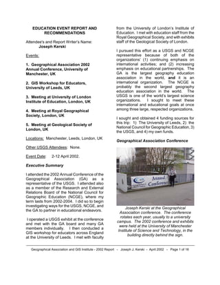
  • 1. EDUCATION EVENT REPORT AND RECOMMENDATIONS Attendee's and Report Writer’s Name: Joseph Kerski Events: 1. Geographical Association 2002 Annual Conference, University of Manchester, UK 2. GIS Workshop for Educators, University of Leeds, UK 3. Meeting at University of London Institute of Education, London, UK 4. Meeting at Royal Geographical Society, London, UK 5. Meeting at Geological Society of London, UK Locations: Manchester, Leeds, London, UK Other USGS Attendees: None. Event Date: 2-12 April 2002. Executive Summary I attended the 2002 Annual Conference of the Geographical Association (GA) as a representative of the USGS. I attended also as a member of the Research and External Relations Board of the National Council for Geographic Education (NCGE), where my term lasts from 2002-2004. I did so to begin investigating ways for the USGS, NCGE, and the GA to partner in educational endeavors. I operated a USGS exhibit at the conference and met with the GA board and many GA members individually. I then conducted a GIS workshop for educators across England at the University of Leeds. I met with faculty from the University of London’s Institute of Education. I met with education staff from the Royal Geographical Society, and with exhibits staff of the Geological Society of London. I pursued this effort as a USGS and NCGE representative because of both of the organizations’ (1) continuing emphasis on international activities; and (2) increasing emphasis on educational partnerships. The GA is the largest geography education association in the world, and it is an international organization. The NCGE is probably the second largest geography education association in the world. The USGS is one of the world’s largest science organizations. I sought to meet these international and educational goals at once among three large, respected organizations. I sought and obtained 4 funding sources for this trip: 1) The University of Leeds, 2) the National Council for Geographic Education, 3) the USGS, and 4) my own funds. Geographical Association Conference Joseph Kerski at the Geographical Association conference. The conference rotates each year, usually to a university campus. The 2002 conference and exhibits were held at the University of Manchester Institute of Science and Technology, in the building directly behind the sign. Geographical Association and GIS Institute - 2002 Report - Joseph J. Kerski - April 2002 - Page 1 of 16
  • 2. The Geographical Association (GA) (www.geography.org.uk) is an international association centered in the UK for geography teachers, with a membership of 10,000, providing information and resources to teachers and students furthering the study and teaching of geography and promoting its contribution to education. This was the second year in which I participated in the GA conference. Last year at the University of Sussex, I conducted a GIS in education presentation and operated a USGS exhibit. I joined the GA in 2001. I preferred this year’s conference logistics to 2001, because sessions and exhibits were largely confined to two buildings on campus, rather than scattered throughout the campus as in 2001. This ensured multiple visits in the exhibit hall and an excellent opportunity to meet many more GA staff than I had met in 2001. The conference theme this year was “Life in the Global Village.” Jeremy Krause, 2002 President of the Geographical Association. His Presidential Address was entitled “Tell the World About Learning Geography.” Krause said we need to tell the world about its richness as a subject, its contribution to the learning debate, and how we learned our geography. Like the NCGE, the GA is dedicated to promoting the development of geography as a subject. The GA believes that geography makes both a distinctive and a wide contribution to education and that it is an essential component in preparing young people for life in the 21st century. The GA is also committed to providing support to all those who are engaged with it—either for professional reasons or personal affinity with the subject. Approximately 750 people participated in this year’s Geographical Association conference. This gathering was to hear the Presidential Address by Jeremy Krause. During the Annual General Meeting following the Presidential Address, Jeremy Krause invited me to state my intentions for being at the conference—namely, to form partnerships among the GA, NCGE, and USGS. This was well received and I had numerous people talk with me about it afterwards. This was a fantastic opportunity to speak to most of the conference attendees at once, and I do appreciate President Krause for inviting me to speak. Opportunities for partnerships with the NCGE range from allowing GA members to purchase NCGE publications at a discount, showcasing NCGE publications in GA literature, formally sponsoring each other’s members for our annual meetings, and working on curricular development projects. Opportunities with the USGS include research in geographic education and creating lessons for the Geographical Association and GIS Institute - 2002 Report - Joseph J. Kerski - April 2002 - Page 2 of 16
  • 3. educational community. Each GA conference offers 8 professional development “pathways” to help attendees select the lectures, workshops, and field trips. These included leading and managing geography at the primary, secondary, and post-16 level, curriculum development for the new geography teacher at the three levels, Geography and ICT (Information and Communications Technology), and Improving Your Geographical Understanding. Approximately 80 vendors exhibited at the 2002 Geographical Association conference, including textbook publishers, aerial photography companies, fieldwork centers, educational associations, software vendors, assessment and curriculum companies, scientific instrument companies, and nonprofit organizations. Other exhibitors included the Ordnance Survey, the Royal Geographical Society, the Remote Sensing Society, the Geomantic Society, and the UK meteorological agency Met Office. In addition, the GA itself was an exhibitor, which displayed a vast series of resources as well as highlighted activities of its many subgroups. This year, my travel approvals came in too late for me to submit a proposal to conduct a workshop. However, I attended and enjoyed the following sessions at the conference: 1) Interactive Mapping with AEGIS 3. AEGIS is a GIS software package created for educators. 2) Presidential Address, “Tell the World About Learning Geography.” 3) The Annual General Meeting of the GA. During this meeting. 4) Atlases and Digital Atlases, by Dr Patrick Wiegand. A branch of the government, DFID, is granting the GA 60,000 pounds per year for three years for its “Learning Places” project. This shows how active the GA is in obtaining funding for its research projects. The GA is currently without an executive director but nevertheless seems to have a clear vision of where it is headed. The GA seems fairly well known, even among the general public, no doubt in part due to high visibility projects involving standards- based education and field projects such as the 1996 Land Use UK. This involved 10,000 students who mapped one square kilometer cells for the entire country. Geographical Association and GIS Institute - 2002 Report - Joseph J. Kerski - April 2002 - Page 3 of 16
  • 4. Sarah Clarke, conference organizer, seated at right, works with undergraduate students. Most of these students were from the University of Manchester, which has one of the largest geography programs in the country--in fact, it is an entire School of Geography, not just a department. I was impressed at how many students work at GA conferences and how seriously they take their responsibilities. It was a pleasure to see students competing in the final round of the “Worldwide Quiz, “ a geography competition for secondary schools, roughly equivalent to the International Geography Bee. The 2003 GA conference will be at the University of Derby (pronounced “Darby”) from 23-25 April 2003 with the theme “Valuing Geography.” USGS Exhibit Joseph Kerski at USGS exhibit. The paragraph I submitted to describe the exhibit was, “The US Geological Survey publishes nearly 100,000 titles of topographic and thematic maps, books, and satellite images, aerial photographs in paper and digital form, excellent for teaching about watersheds, earthquakes, volcanoes, population, coastal processes, geology, biodiversity, landforms, historical settlement, and water resources. Despite the position of the USGS exhibit near the end of the exhibit hall, it was almost continually crowded with conference attendees. Many of these attendees came back each day and some stayed for over 25 minutes. The official “stand” spaces (they are called “stands” in the UK, not “booths”) are 2 meters Geographical Association and GIS Institute - 2002 Report - Joseph J. Kerski - April 2002 - Page 4 of 16
  • 5. by 1 meter. The GA gave us a discount on the exhibit from 180 pounds to 120 pounds. Fortunately, the conference was held in a university, thus avoiding the usual restrictions in convention centers about being “over the line” and extending our exhibit outside the allotted space. I had been wondering how to squeeze into a space that was only 1 meter wide, and so I used a tri-fold tabletop display. This worked out wonderfully, as the curved backdrop I typically use would have been too wide. I had too much variety of materials to display on only one table, so I placed two tables together, forming a deeper exhibit, but the attendees could still reach all materials. Fortunately, I was able to use the tables underneath for storage. Word-of-mouth quickly spread about our exhibit. At least 30 people took time to personally thank me for our resources and exhibit at the conference. International Conference Logistics Coordinating internationally for a conference is a bit more difficult than in the USA, as I expected and experienced in 2001. I bought plenty of surge suppressors and outlet converters to bring with me (some from Magellan’s Travel Incorporated). I found is that it is difficult to use university resources such as Internet access in the UK without being enrolled as a student. Fortunately, I was able to get an unused T1 line working in our exhibit space. Shipping to an international conference was less problematic than in 2001, when Box Global delayed the delivery of our materials to the conference in customs and FedEx lost our exhibit on the way back to the USA. I experienced two hours of stress when I arrived and the materials were nowhere to be found. After several international calls, I located them in a back closet of the conference center. It cost me $250 to ship the tabletop exhibit and 1 map tube back to the USA, which was unfortunate because that came out of my travel expenses. Nevertheless, despite these minor challenges, the conference was definitely worthwhile. The knowledge learned from international collaboration is fantastic and will no doubt contribute to our future USGS educational outreach as well as working with the GA from the NCGE perspective. For Day 1 of the conference, I displayed posters from several teachers’ packets along with several natural hazards photographs. I distributed information sheets, teacher’s packets, surplus maps, booklets, and circulars that featured some aspect of cultural or physical geography and the tools to study geography. Because of the shipping cost on the return, I recommend that in the future, we ship or purchase gator board and construct our own backdrop on site. Geographical Association and GIS Institute - 2002 Report - Joseph J. Kerski - April 2002 - Page 5 of 16
  • 6. We often talk about changing the exhibit each day of a conference, but rarely have I done it. At Day 2 and 3 of this conference, I changed the backdrop to feature a poster I created for the conference entitled, “What Can Students Do With USGS Resources?” shown here. Publications: For obvious reasons, I downplayed North America data and resources at the conference, even though I learned that American Studies is a big part of the curriculum, particularly in universities. This was a good opportunity for me to rediscover that the USGS really does have a good selection of data and maps for other countries. I brought world, Europe, and Asia maps, and such items as the new Europe digital data DDS CD. I displayed USGS booklets, fact sheets, posters, and CDs that emphasized geography education. These included water education posters, aerial photograph, web information, fact sheets on educational resources, GIS in education papers I have authored, and Gyps, posters, and teacher’s packets. Everything besides “Scientists in Action” was disbursed very rapidly, but carefully examined by the attendees, who in many cases returned to the exhibit two or three times. GIS Institute Dr Wiegand of the University of Leeds School of Education and I conducted a GIS institute at the University. The reason we did so was that we believe that GIS is the biggest contribution that geographers have made to society and economy since the Age of Discovery. As Dr Wiegand stated in the flyer advertising the institute, it underpins all of today’s spatial decision making. Participants were charge 199 pounds for the 2-day institute. Geographical Association and GIS Institute - 2002 Report - Joseph J. Kerski - April 2002 - Page 6 of 16 Dr Patrick Wiegand and I conducted a GIS institute together at the University of Leeds, one of the largest universities in the UK. Leeds is the most popular university among students applying for undergraduate courses. During the current academic year, 24,000 students are attached to 570 different first-degree programs and 720 postgraduate degree programs. A further 24,000 are enrolled in short courses with the University.
  • 7. The GIS Institute was held at the University of Leeds School of Education. Part of the School of Education can be seen in the background. Agenda: In the institute, we emphasized ArcView GIS because it is more powerful than the other software packages we examined. However, we presented the other packages as well. Day 1 Exploring World Geography Exploring World Earthquakes and Volcanoes Quality of Life in Brazil Comparing UK Cities, with 3D Historical USA County Population Analysis Day 2 Exploring Hurricanes in the Atlantic Using Ordnance Survey digital map data Collecting coordinates with GPS Receivers Bringing in GPS-collected data into GIS Tour of other (non ArcView) packages: Local Studies, Aegis 3, Mapmaker Pro, Map Explorer Next steps: Where Do we go from Here? The emphasis on the GIS institute was to provide hands-on activities where participants explored real-world data sets in cultural and physical geography. GIS software available for educational use in the UK includes, but are not limited to: ArcView, from ESRI UK, AEGIS, Local Studies, and MapMaker Pro. We had limited success with Mapmaker Pro, which includes an application called “SafeRoutes to School.” ArcView sells for 395 pounds for a school site license. ESRI UK also makes MapExplorer, a free educational tool, with a goal similar to ArcVoyager in the USA—provide a ramping up approach into GIS. A company called Wildgoose provides aerial imagery for a discount for educators. As in the USA, educators in the UK face curricular constraints to running GIS in the classroom. Training and data are critical factors in its success. However, the National Curriculum includes GIS and spatial analysis. A book published last year entitled “GIS: A Sourcebook for Schools”, edited by David Green, as well as support from the Association for Geographical Information (AGI), and the new Geomatics Society all indicate that the disparate forces may be coming together for the use of GIS in UK schools. Geographical Association and GIS Institute - 2002 Report - Joseph J. Kerski - April 2002 - Page 7 of 16
  • 8. As expected, I found the institute participants to be extremely well grounded in geography—most had a geography degree, and were enthusiastic about integrating GIS tools and methods into their curricula. We spent time in the institute showing some of the participants how to use MapManager, free software from ESRI that converts Ordnance Survey landline data (vectors) to ArcView shapefiles and coverages. Dr Patrick Wiegand works with participants. Dr Wiegand is Reader in Geography Education and is the author of many research papers on children’s thinking with maps. He is also the editor of numerous school atlases. This academic year, he is the recipient of a Leverhulme Research Grant to pursue GIS in education. Dr. Patrick Wiegand tests GPS receivers and writes data CDs for participants before the workshop begins. Participants collect coordinates with GPS receivers and collect data in the field at the University of Leeds campus. We encountered what appeared to be a datum issue between the Ordnance Survey base maps and the coordinates from the GPS receivers that we are still investigating. GIS and the use of digital data face a challenge not only in education, but also everywhere in the UK, because of the fact that very little free government data exists. This is the case with most other countries in Europe and around the world; the notable exception in Europe being The Netherlands. Nevertheless, the interest and the potential of GIS and remote sensing in the curriculum are Geographical Association and GIS Institute - 2002 Report - Joseph J. Kerski - April 2002 - Page 8 of 16
  • 9. high, because the National Curriculum emphasizes real-world data in a problem- solving, inquiry-based (except in the UK it is “enquiry!”) environment. And, things are changing: The Ordnance Survey, for example, is giving away a free map to all 11 year old students in the country, and they give away free local digital map data to schools. Collecting GPS coordinates at 1 degree West Longitude was a special thrill for me! The teachers at the GIS institute were a wonderful group to work with—willing to take on new challenges despite their busy schedules and academic pressures. I learned a great deal from working with them. I have already had several email exchanges with participants since the workshop was held. Part of the planning for the GIS institute at the University of Leeds was done in beautiful North Yorkshire National Park. Village residents in the National Park are strictly regulated in terms of what and where they may build to preserve the natural and cultural beauty of the Park. University of London Institute of Education At the University of London, on staff are several faculty members who are world leaders in geography education. I visited several of these professors, including Ashley Kent and David Lambert, from whom I had read books and articles during my research in geography education over the past two decades. As usual, they were very kind to me and spoke with me about their work. Dr Kent invited me to a conference of the International Geographical Union in April 2003, following the Geographical Association conference. I would like very much to attend both of these conferences and work further with the international community. In addition, the IGU’s next biennial conference (following Durban South Africa in 2002) will be in Glasgow Scotland in 2004. Geographical Association and GIS Institute - 2002 Report - Joseph J. Kerski - April 2002 - Page 9 of 16
  • 10. The University of London Institute of Education has on its faculty several world leaders in geography education. The Institute of Education has been offering a master’s distance learning program for at least a year in Geography Education. Dr Kent described the program to me at the Association of American Geographers (AAG) meeting in 2001 and I must say that the program sounds most excellent; one of the very few of its kind if not absolutely unique in the world. Meeting at the Royal Geographical Society Entrance to the Royal Geographical Society, in Kensington Gore, Southwest London, across from Hyde Park and near the Royal Albert Hall—quite a neighborhood! The Royal Geographical Society (www.rgs.org) has, since its founding in 1830, been a national and international focus of geographical research, information, and exploration. It merged during the 1990s with the Institute of British Geographers to create the largest geographical society in Europe, with a membership of 15,000. This would be roughly equivalent to if the Association of American Geographers and the National Geographic Society merged in the USA. The RGS goals are to stimulate awareness, interest, and enjoyment of geography and environmental matters, act as an authoritative voice promoting geography, act as a focus for geographical research, promote the value of geography in education, provide a national geographical information source, and give training and advice to those organizing expeditions. During the GA conference in 2001, the education coordinator of the Royal Geographical Society (RGS) invited me to their headquarters. I could not make it then, and decided to take her up on her offer this year. My goal was to discuss education strategies, as we both work for large, historical, scientific organizations. Judith Mansell and Felicity Thorne, education program, told me about a conference that RGS is holding in fall 2003. Geographical Association and GIS Institute - 2002 Report - Joseph J. Kerski - April 2002 - Page 10 of 16
  • 11. A dog “guards” the entrance to the Royal Geographical Society’s map room. The collection of over 900,000 maps is the largest private collection of maps in the world. It is being re-cataloged and organized to make it more accessible to researchers. The picture library contains over 500,000 images from all corners of the world over three centuries. The front hall in the Royal Geographical Society containing wonderful portraits of some of the Society’s famous explorers— Speke, Shackleton, Sir Edmund Hillary, and David Livingstone. The RGS facility also contains numerous wonderful historical globes. Judith Mansell, Education Coordinator for the Royal Geographical Society. Regular journals of RGS include: 1) The Geographical Journal, first published in 1831. 2) The Geographical Magazine. 3) Transactions of the Institute of British Geographers. 4) Area The RGS President is Lord Selborne, elected in 1997, and its director is Dr Rita Gardner. Perspectives One of my goals in the USGS communications and education program is to form formal partnerships with geography education organizations around the world. Geography education in the USA has been subsumed in the social studies since the 1920s and has only since the 1980s emerged as a science that society recognizes as a real need. In the UK, geography education never lost its prominence from the days when the Royal Geographical Society was sending explorers to the South Pole and beyond. Geographical Association and GIS Institute - 2002 Report - Joseph J. Kerski - April 2002 - Page 11 of 16
  • 12. There is a great deal of potential recognition and publicity in educational outreach and partnerships that I sought at the GA conference, not just with the GA, but with other groups there such as the Ordnance Survey [see below]. The GA's counterpart organization in the USA is the National Council Geographic Education (NCGE). Although I've conducted exhibits and workshops at every NCGE conference since 1995, I kept thinking that there was more we could be doing. I petitioned the NCGE board to be on the ballot and was elected for the 2002-2004 term. Working in education is an excellent way of starting long-term relationships with people and organizations. For example, I’ve worked on a grant involving conservation biology that has links to the Colorado Division of Wildlife and the University of Colorado EPOB Department, and through that, perhaps to others and even to our own USGS biology discipline. These relationships could lead to USGS staff being included in major research projects, for interns, or even funding for data production by one of these groups. Similarly, I spoke with the Ordnance Survey, the UK’s national mapping agency, about their efforts and ours in education. (4) Since 2000, Dr Groat has several times stressed the building up of international partners and relationships. He mentioned this again at our educational team meeting in Reston in November 2000. I have been finding out who are key players in the UK in terms of GIS and education since that time. The GA is slightly older than the NCGE, beginning in 1893, I believe. The GA is highly respected as one of the leading subject teaching associations and regularly consulted on a wide range of issues concerning geography in education. It is a major provider of quality resources to the profession. Members receive journals on a regular basis and the GA publishes books and other resources to support geography teaching at every phase. It also provides curriculum advice, professional development, conferences and other networking opportunities. The journals include Geography (research), Primary Geographer (elementary school), Teaching Geography (secondary school), and a quarterly newsletter “GA News.” I was impressed by the numbers of people who told me that they did some work for the GA. This volunteer effort is amazing, considering that teachers are among the busiest folks on Earth. The GA is run by its members and its work is determined and monitored by a structure of committees that focus on and develop pieces of the subject. These committees are supported by a Headquarters staff based in Sheffield UK. The GA is a national association, but its regional and local structures provide a significant opportunity for the views of the geographical community to be heard and represented. The GA is locally active, maintaining over 40 branches that stimulate local activity throughout England, Wales and Northern Ireland. Project-based activities include the Worldwise Quiz and Geography Action Week, both of which enjoy high reputations for quality and school involvement. GAW was the basis for our own Geography Action Week in the USA! By participating in this meeting, we demonstrated the leadership that the USGS and NCGE have in partnering with educational associations on teacher training, development of curricular resources, and in resources for Geography Education that are high quality, science-based, project-based, and interdisciplinary. The fact that the conference chair, the GA president, and other GA executives took time to talk with me about Geographical Association and GIS Institute - 2002 Report - Joseph J. Kerski - April 2002 - Page 12 of 16
  • 13. future partnership opportunities demonstrated that their interest is genuine in doing so. I recommend that we pursue these opportunities for collaboration between the NCGE and GA, and between the GA and the USGS. The GA is non-partisan and unbiased, concerned with education and scientific literacy, just as the NCGE and USGS are. This conference also opened the door with other organizations, such as with the RGS, on educational and other projects. I made a great many contacts that will be useful for pursuing these initiatives in the future. I need to reassemble my notes and figure out “who’s who” in the GA to pursue these discussions. I met the 2003 incoming GA President as well, who was quite excellent and even owns his own publishing company. The challenges facing geography education in the UK, despite their leadership in the world, are real. As in the USA, geography faces stiff competition Therefore, I believe that the GA conference is a worthwhile one for the USGS to participate in, particularly as we seek to concentrate efforts on targeted audiences and de-emphasize “general public” events where the benefit is questionable for the resources expended. Geography Education in the UK The following is my own interpretation of UK geography education; unintentional interpretation errors may exist. The UK has had a National Curriculum since 1991. The curriculum is analogous to national standards in the USA, but is somewhat stronger. The core subjects are English, science, and mathematics. These are taken by all students. Foundation subjects, such as geography, are compulsory from Year (Grade) 1 to 9, after which they are optional. Nevertheless, geography is a popular option and is taken by approximately 60% of students. The General Certificate of Secondary Education (GCSE) examination is taken at the age of 16 (Year 11), and students who pass in geography may go on to “A Levels” in Years 12 and 13. Local Education Authorities (LEAs)--the UK’s equivalent to the USA’s school districts--have curriculum advisor’s in different subject matters. Because the GCSE is so important, the 2 vendors on either side of our exhibit marketed the test materials. This is roughly analogous to the ACT or SAT, but it is given during the middle, rather than at the end of, high school. At age 11, students go to secondary school, which is from age 11 to age 16; these are the “O levels/O grades”. The old terms were lower 6th form and then upper 6th which was age 17/18. Age 18 is when students in England go to University, which where tuition was free until just a few years ago, graduating when they are 21 (after a three year degree program. In Scotland, 16 is the age when some students go to University. However, it is usually done after a further year when they have done higher secondary at age 17. They then do a 4 year degree. Recommended Books A book I consider to be essential reading has just been published by long-time GA member and Oxford University research associate and Geography Principal Officer with the Qualifications and Curriculum Authority Eleanor Rawling, entitled “Changing the Subject—The Impact of National Policy on School Geography 1980-2000.” Another book I recommend is Thinking Through Geography by David Leat. Educational Observations 1) Physical Geography is very strong in the UK, and thus USGS hazards and water resources information were incredibly popular. I would say that approximately 70% of the Geographical Association and GIS Institute - 2002 Report - Joseph J. Kerski - April 2002 - Page 13 of 16
  • 14. attendees were very familiar with at least one USGS resource. Of these, the near-real time earthquake bulletin seemed to be the resource about which attendees were most knowledgeable. The UK geography curriculum is also much more focused on the world at large than seems USA geography. Still, local studies and data are still valued and important to educators. 2) Field work is required of all geography students, and I counted at least 4 exhibitors that were private and nonprofit organizations that ran fieldwork centers. These, including a center in Wales featuring multi-language studies in the highlands and another island off the Scotland coast, were fascinating programs that I’d love to share with anyone who is interested. I’d also love to visit these places for first-hand experience! 3) Very few attendees knew specifically about the NCGE. Most knew that there was a geography education counterpart to the GA in North America, but the NCGE had no bearing on what they did on the job everyday. So, it is an appropriate time to pursue this outreach effort. Geological Society of London Visit I met with exhibits representatives from the Geological Society of London. They sent me a list of their upcoming conferences. Several USGS managers were involved with a Geological Society meeting about two years ago in Ireland or Scotland. The Geological Society of London was founded in 1807 and is the oldest geological society in the world. Its web site is www.geolsoc.org.uk. The Society has over 9000 members and is the largest national geoscience society in Europe. There are several categories of membership, each appropriate to the various stages of a geoscientist's career from student to retirement. The Society exists to provide the working geoscientist with lifelong continuity, offering scientific and professional advice and support at all stages. It seems like an organization we should definitely keep in touch with. The Society’s buildings themselves were wonderful, first constructed in 1670. Geographical Association and GIS Institute - 2002 Report - Joseph J. Kerski - April 2002 - Page 14 of 16
  • 15. Joseph Kerski stands next to painting and statue of William Smith. Known as the “Father of English Geology,” he was the first recipient of the Wollaston Medal, the Society’s highest award, in 1831. I had read about William Smith in a book I highly recommend by Simon Winchester entitled “The Map That Changed the World.” Up the stairs from this picture is his map, one that took him 20 years to make, the world’s first geologic map! I was not allowed to take a picture of it, but … I did see it, and it is wonderful. Acknowledgements I would especially like to thank Dr. Patrick Wiegand for his professionalism, hard work, and amiable nature that made the GIS institute a success. I thank him and the University’s role in funding part of my travel expenses. I thank the teachers who attended the GIS institute and the GA conference for their enthusiasm and dedication. I appreciated the time that GA staff spent with me during a busy conference. I thank the National Council for Geographic Education (NCGE) Board, and particularly Susan Hardwick and Connie McCardle, who funded part of my travel. I would like to thank all those who helped me with international travel, especially Jennifer Booras and Sandra Piksa, RMMC. I also thank those at RMMC who approved my travel to this event, especially Mark Eaton. I appreciated Dan Fossen’s help with tracking down the exhibit materials. Pilgrimage to the Royal Observatory and the Prime Meridian at Greenwich After meeting with the Geological Survey of London staff and with a geography education colleague from the University of Barcelona, Spain, I took the train to Greenwich and hiked up the hill to… At the Royal Observatory in Greenwich, where the official clock for “Greenwich Mean Time” resides. An Ordnance Survey benchmark is on the small dark gray rectangle in the lower right of the photograph. Geographical Association and GIS Institute - 2002 Report - Joseph J. Kerski - April 2002 - Page 15 of 16
  • 16. Marker at the Prime Meridian. I feel quite “centered” now that I have made the pilgrimage! Tower Bridge in the distance and the River Thames, taken from the pedestrian footbridge built for the Millennium celebration. *** End of Geographical Association-GIS Institute-Report *** Geographical Association and GIS Institute - 2002 Report - Joseph J. Kerski - April 2002 - Page 16 of 16