Viewshed Analysis Guides Dillon Redevelopment

This project was completed as a Capstone Project was submitted in partial satisfaction of the requirements for the degree of Master of Urban and Regional Planning, College of Architecture and Planning, University of Colorado Denver. The objective of this Capstone Project is to provide the Town of Dillon a visual framework to guide its community engagement and redevelopment. The Town of Dillon is in the process of redeveloping 1.59 acres of the Core Area, and wants to be careful to make sure redevelopment enhances views from public areas. A viewshed analysis was completed with ArcPro from valued observation points in public spaces and a model was created for four scenarios: no development, existing conditions, zoning buildout, and development with no constraints. A height analysis provided the existing conditions model, using Lidar data calculated elevation points at the ground level and at the top of buildings to find their elevation and placed on top of a basemap displaying ground elevation. The zoning height models were created using the same building footprints as currently exist, but extruded to the height allowed in the Town of Dillon zoning code. The constraints removed was created by adding large building footprints or multiple building footprints on every developable parcel. Each new building footprint was extruded to a height above the height allowed in the Town of Dillon zoning code.

Recommended
Recommended
More Related Content
Similar to Viewshed Analysis Guides Dillon Redevelopment
Similar to Viewshed Analysis Guides Dillon Redevelopment (20)
More from GIS in the Rockies
More from GIS in the Rockies (20)
Recently uploaded
Recently uploaded (20)
Viewshed Analysis Guides Dillon Redevelopment
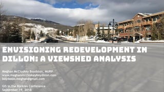
- 1. Envisioning Redevelopment in Dillon: A Viewshed Analysis Meghan McCloskey Boydston, MURP www.meghanmccloskeyboydston.com boydston.meghan@gmail.com GIS in the Rockies Conference September 19, 2018
- 2. Introduction Project completed as a Capstone project in partial satisfaction for the requirements of the Master’s of Urban and Regional Planning for University of Colorado Denver.
- 3. The Town of Dillon is located in Summit County and has a population of approximately 1,000 people. Dillon, Colorado
- 4. • The objective of the project was to provide the Town of Dillon a visual framework to guide its community engagement surrounding redevelopment. • Dillon has prioritized redevelopment and wants to add more retail and housing, including workforce housing. Source: Summitdaily.com
- 5. DILLON’S CORE AREA Redevelopment will be concentrated in Dillon’s Core Area, which includes 1.59 acres.
- 6. Core Area Vision Statement The purpose of Dillon Town Core Revitalization is to create a vibrant, mixed-use destination that reflects our Mountain Lakestyle identity; is the preferred location for new and existing businesses, residents, and guests, and enhances the quality of life for all who venture here. In order to diversify our existing business base, drive density, and solidify Dillon as a year round destination with a lively, pedestrian atmosphere and a preferred location for community experiences; we encourage the addition of year-round residential units, commercial amusement uses such as indoor play and entertainment, taverns, restaurants, retail, education and community centers. Source: Summitdaily.com
- 7. A survey with community members and businesses showed that 95% of residents and second home owners and 86% of business owners found the scenic/visual quality of the town to be important.
- 8. How can Dillon redevelop and densify its Core Area while preserving the scenic and visual quality of the town? Problem Statement
- 9. • Olympia, Washington was used as a case study. • Through community engagement, the city identified valued observation points from public spaces, de- emphasizing preserving views from private property. Prioritizing Views Source: Livability.com
- 10. Observation Points • Government officials identified valued observation points in a survey. • The observation points were on the exterior of the Core Area. • These points became the basis for the viewshed analysis and the focus for the models.
- 11. Methodology 1) Preparing Input Data • Using recent orthorectified aerial imagery, I created building footprints in GIS by tracing over the images of buildings. • I then interpolated a 10-foot cell size bare-earth DEM and a 10-foot cell size first return DEM from Lidar data.
- 12. Methodology 2) Scenario 1: Existing Conditions • To create the existing conditions layer, I calculated the existing height of each building. • I used Lidar data and selected ten random points within each building polygon. • For each point, I found both the bare-earth elevation and the first-return elevation at the top of the building, and averaged the 10 points resulting in one figure for ground elevation and another for the top of the building. • I used the difference to find the approximate height of each building.
- 14. Methodology 3) Scenario 2: Zoning Height Buildout • To create the zoning height layer, I attributed the zoning heights from Dillon’s zoning code to the building footprints overlaying each of the nine zoning districts. There are four different height limitations in Dillon’s zoning code, including 30ft, 35ft, 40ft and 50ft, depending on the zoning district.
- 16. Methodology 4) Scenario 3: Constraints Removed • I drew in additional building polygons where buildings don’t currently exist and where development is not currently allowed per zoning. • I also included higher building heights in certain districts, up to 70 ft. This was based on the town’s consideration to allow buildings above the zoning height or to amend the zoning code in some areas.
- 18. Methodology 5) Building Massings in ArcPro • In ArcPro, I created 3D models by extruding each polygon layer to the building heights attributed to each building. • I added “building skins” to the building massings, which were photographs from buildings at Copper Mountain resort, to incorporate mountain architectural features.
- 19. Methodology 6) Scenes • I created a scene from each of the eight valued observation points for each buildout scenario. • Each scene is viewed from a human scale observation point, from 5-6.5 feet from the ground.
- 20. Lake Dillon Drive and Highway 6 Looking SouthEast
- 22. NO BUILDINGS Lake Dillon Drive and Highway 6 Looking Southeast
- 23. EXISTING CONDITIONS Lake Dillon Drive and Highway 6 Looking Southeast
- 24. ZONING BUILDOUT Lake Dillon Drive and Highway 6 Looking Southeast
- 25. CONSTRAINTS REMOVED Lake Dillon Drive and Highway 6 Looking Southeast
- 28. NO BUILDINGS Town Park Looking Northeast
- 29. EXISTING CONDITIONS Town Park Looking Northeast
- 30. ZONING BUILDOUT Town Park Looking Northeast
- 31. CONSTRAINTS REMOVED Town Park Looking Northeast
- 34. NO BUILDINGS Town Park Looking Southwest
- 35. EXISTING CONDITIONS Town Park Looking Southwest
- 36. ZONING BUILDOUT Town Park Looking Southwest
- 37. CONSTRAINTS REMOVED Town Park Looking Southwest
- 38. Lake Dillon Drive and La bonte Street Looking NorthWEST
- 40. NO BUILDINGS Lake Dillon Drive and La Bonte Street Looking Northwest
- 41. EXISTING CONDITIONS Lake Dillon Drive and La Bonte Street Looking Northwest
- 42. ZONING BUILDOUT Lake Dillon Drive and La Bonte Street Looking Northwest
- 43. CONSTRAINTS REMOVED Lake Dillon Drive and La Bonte Street Looking Northwest
- 44. Lake Dillon Drive and La bonte Street Looking South
- 46. NO BUILDINGS Lake Dillon Drive and La Bonte Street Looking South
- 47. EXISTING CONDITIONS Lake Dillon Drive and La Bonte Street Looking South
- 48. ZONING BUILDOUT Lake Dillon Drive and La Bonte Street Looking South
- 49. CONSTRAINTS REMOVED Lake Dillon Drive and La Bonte Street Looking South
- 50. Conclusion • For many scenarios, the current zoning buildout did not differ much from existing conditions, and it didn’t drastically impact viewsheds or change the character of the town. Dillon could accommodate additional density but should be cautious about allowing development at additional height above zoning. Some of the constraints removed models demonstrated that views would be blocked. • These scenarios can be very effective in starting a conversation and engaging with the community about how they envision Dillon’s redevelopment.
- 51. “Following the presentation, town residents had a chance to inject their own values and ideas into the conversation surrounding the future of the town core. Though few specifics were discussed, residents were clearly able to form something of a consensus in terms of what they want to preserve in town, and what they hope to see in the future town core”
- 52. Thank you! Meghan McCloskey Boydston, MURP www.meghanmccloskeyboydston.com boydston.meghan@gmail.com