session 5 underwater archaeology field school 2001, Paulo presentation
•Download as PPTX, PDF•
1 like•431 views


Recommended
Recommended
More Related Content
Viewers also liked
Viewers also liked (8)
Similar to session 5 underwater archaeology field school 2001, Paulo presentation
Similar to session 5 underwater archaeology field school 2001, Paulo presentation (20)
More from Ecomuseum Cavalleria
More from Ecomuseum Cavalleria (20)
Recently uploaded
Recently uploaded (20)
session 5 underwater archaeology field school 2001, Paulo presentation
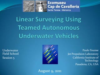
- 1. Linear Surveying Using Teamed Autonomous Underwater Vehicles Paulo Younse Jet Propulsion Laboratory California Institute of Technology Pasadena, CA, USA Underwater Field School Session 5 August 9, 2011
- 2. Overview Linear surveying of Port Sanitja for artifacts is currently done using rope swim lines Swim lines contain inherent challenges stemming from maintaining formations, diver limitations, and environmental obstacles Linear surveying using a team of autonomous underwater vehicles can improve effectiveness of linear surveying in Port Sanitja
- 3. Port Sanitja, Menorca Ceramics Shipwrecks Anchors Net Rings
- 6. Position fix (measurements, flags)(A. Bowens, 2009)
- 7. Challenges using a Swim Line Observed difficulties in Port Sanitja from field school Snagging of line due to rugged terrain interfering with search Nonlinear search patterns due to fixed rope positions and elevation gradients along swim line Difficulty holding heading if ground line not used Difficulty maintaining tension in long swim lines Communication to allow smooth advancement of line Limited search capability due to diving limitations (no decompression time, air supply, time and resource availability, variations between divers)
- 9. Cameras
- 11. Compass
- 12. IMU
- 14. AcousticComputer
- 15. Examples of AUVs AUV (University of California San Diego Scripps Institution of Oceanography) Remus 100 (Kongsberg Maritime AS)
- 16. Examples of AUVs Solar Powered Autonomous Underwater Vehicle (Sauv II) (Autonomous Undersea Systems Institute) Long-term Mine Reconnaissance System (LMRS) (The Boeing Company)
- 17. AUV Field Campaign Planning Phase Method, Instruments Logistics, Prep, Schedule, Team What, Where Environment
- 18. AUV Field Campaign Operation Phase Deployment Upload Program to AUV Path Planning Finish Start
- 19. AUV Field Campaign Analysis Phase Post-processing Data Download from AUV Scientific Analysis
- 20. Linear Survey With Teamed AUVs Virtual Swim Line AUV Spacing Communication Surface Height Scan Overlap
- 21. Communication Acoustic Radio Navigation Inertial measurement unit (IMU) Visual odometry Doppler velocity log Compass Depth sensor GPS (surface) Reference buoy or node Instrumentation Cameras Sonar Sub-bottom profilers Magnetometers Power sources Batteries Recharging techniques Technology Requirements
- 22. Advantages of Linear Surveying with Teamed AUVs Teamed AUVs advantages over traditional dive team Autonomy Greater bottom time per survey at depth Communication effectiveness same regardless of number of AUVs Freedom from rope Ability to use various instrumentation Performance consistency throughout survey Teamed AUVs advantages over single AUV Increased surface coverage per survey Increased path accuracy from multiple sensor feedback Redundancy
- 23. Linear Surveying ofPort Sanitja with AUVs Survey scenario Deployment of AUVs from cove in the morning Preprogrammed linear survey of Port throughout day Autonomous return to cove when complete for pickup and download of data Recharge AUVs overnight and repeat operation for subsequent survey the following morning Analysis of data by archaeologists Challenges Current, sea grass, sand coverage Boat and diver traffic Adaption of instrumentation to local artifacts
- 24. Summary Current linear surveying of Port Sanitja is done using a swim line of divers Swim lines possess inherent difficulties and limitations A team of autonomous underwater vehicles (AUVs) can improve surveying performance and efficiency AUVs can potentially be configured and deployed to perform linear surveys in Port Sanitja
- 25. References A. Bowens, Underwater Archaeology: The NASA Guide to Principles and Practice, 2nd ed., Nautical Archaeological Society, 2009.