
Recommended
Recommended
More Related Content
What's hot
What's hot (20)
Similar to Complexity Neural Networks for Estimating Flood Process in Internet-of-Things Empowered Smart City
Similar to Complexity Neural Networks for Estimating Flood Process in Internet-of-Things Empowered Smart City (20)
More from Dr. Amarjeet Singh
More from Dr. Amarjeet Singh (20)
Recently uploaded
Recently uploaded (20)
Complexity Neural Networks for Estimating Flood Process in Internet-of-Things Empowered Smart City
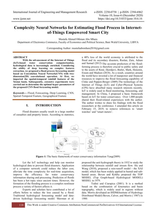
- 1. International Journal of Engineering and Management Research e-ISSN: 2250-0758 | p-ISSN: 2394-6962 Volume-10, Issue-6 (December 2020) www.ijemr.net https://doi.org/10.31033/ijemr.10.6.16 118 This Work is under Creative Commons Attribution-NonCommercial-NoDerivatives 4.0 International License. Complexity Neural Networks for Estimating Flood Process in Internet- of-Things Empowered Smart City Mustafa Ahmed Othman Abo Mhara Department of Electronics Commerce, Faculty of Economics and Political Science, Bani Walid University, LIBYA Corresponding Author: mustafaabomhara2018@gmail.com ABSTRACT With the advancement of the Internet of Things (IoT)-based water conservation computerization, hydrological data is increasingly enriched. Considering the ability of deep learning on complex features extraction, we proposed a flood process forecasting model based on Convolution Neural Network(CNN) with two- dimension(2D) convolutional operation. At first, we imported the spatial-temporal rainfall features of the Xixian basin. Subsequently, extensive experiments were carried out to determine the optimal hyper parameters of the proposed CNN flood forecasting model. Keywords— Flood, Forecasting, Deep Learning, CNN, Spatial-Temporal Feature, Geographical Feature I. INTRODUCTION Flood disasters usually result in a large number of casualties and property losses. According to statistics, a 40% loss of the world economy is attributed to the flood and its secondary disasters, Ruslan, Zain, Adnan and Samad (2012).The accurate prediction of the flood- forming process is therefore crucial to public safety and to the assets of René, Djordjevi, Butler, Mark, Henonin, Eisum and Madsen (2018). As a result, countries around the world have invested a lot of manpower and financial resources to improve the flood forecasting capability of Cloke and Pappen-Berger (2009).The technology of the Internet of Things (IoT) and Cyber-Physical Systems (CPS) have absorbed many research interests recently. IoT is widely used in flood monitoring, forecasting, and management. In China, I proposed a basic framework based on IoT for water conservancy. Over 1,000 people shared their flood-related experiences with the author. The author wishes to share his findings with the flood researchers at the conference. I amended this article on February 15, 2019, to remove references to ‘smart watches’ and “smart meters’. Figure 1: The basic framework of water conservancy information Yang(2009) Let the IoT technology and help can monitor hydrological data to prevent flood disasters. Application of a computer network could reduce the labor cost, alleviate the time complexity for real-time acquisition, improve the efficiency for water conservancy information sharing and processing. Prediction of floods has been a hot topic since ancient times. However, the formation of the flooding process is a complex nonlinear process a variety of factors affects it. Experts and scholars have contributed a lot of efforts before to reduce the loss caused by a flood. Traditional hydrological forecasting model and data- driven hydrology forecasting model. Sherman et al. proposed the unit hydrograph theory in 1932 to study the relationship between rainfall and stream flow. Hu and Wang (2010), proposed a rain-runoff model - the XAJ model, which has been widely applied in humid and sub- humid areas. Beven and Kirkby proposed the TOP MODEL (Top Graph-based Hydrological MODEL) MODEL in 1979. Todini and Ciarapica (2001). It is a method based on the combination of kinematics and basin topography, which is widely used in regions without data. Morris developed an IHDM(Institute of Hydrology Distributed Model) Beven, Calver, and Morris ( 1987) in 1980.
- 2. International Journal of Engineering and Management Research e-ISSN: 2250-0758 | p-ISSN: 2394-6962 Volume-10, Issue-6 (December 2020) www.ijemr.net https://doi.org/10.31033/ijemr.10.6.16 119 This Work is under Creative Commons Attribution-NonCommercial-NoDerivatives 4.0 International License. The traditional hydrological forecasting model still absorbs many efforts that analyze the principle of flood formation. Yangbo Chen et al. proposed a physically based flood forecasting model named Liuxihe model in 2011. Charles Luo proposed the coastal fall flood ensemble estimation(COFFEE) model in 2018 for real timed flood forecasting for the coastal dominated watersheds in British Columbia during the fall-winter season. There are many parameters in these models which usually need artificial calibration. If the mapping relationship is studied directly from the data, the artificial calibration of parameters can be avoided, the efficiency of prediction can be improved, and the labor cost can be reduced. Artificial Neural Network(ANN) has been widely used in the field of flood prediction because of its good performance in solving nonlinear problems. Some experts and scholars have designed a large number of data-driven flood prediction models. Ji Youn Sung et al. built flood forecasting models with lead times of 1, 2, and 3 hours respectively by using three-layer ANN. Adnan, Ruslan, Samad and Zain (2013) introduced Kalman filter to correct the output of ANN. Tan guanghua and Liu (2002) introduced the adaptive backward propagation algorithm into the one-step flood prediction model. With the brilliant success of deep learning network in computer vision, natural language processing, and speech, some scholars introduced some algorithms and methods rely on deep learning to flood prediction task. Using dynamic attention mechanism and LSTM method to establish the model, the model has a high accuracy for large river basins, but the input of the model is only rainfall and flow, without considering geographical factors. The results will change after each tracing. So it is necessary to run the average multiple times to get the best results. The current model is not suitable for complex river bashes. It uses a traditional machine learning model based on support vector regression (SVR) and BP neural network. The traditional model requires a lot of parameters to be calibrated and the data-driven model cannot predict the flood pro- ness. In this paper, we introduced the 2D convolutional operation into the field of flood forecasting. We fuse spatial-temporal distribution features of rainfall, geographical features, and trend features by the ability of Convolutional Neural Network(CNN) on complex feature extraction. The numerical results show that the model proposed in this paper meets the requirements of flood forecasts. 1) We proposed a novel flood process forecasting model based on CNN which can consider rainfall spatial- temporal feature, geographical feature and trend feature. 2) A new way of thinking to add more features into flood forecasting model by basin gridding was proposed in this paper. 3) We conducted extensive experiments on the proposed model, including the correlated analysis and the deter- mining of hyper parameters of the model. The flood forecasting model by using CNN based on IoT was demonstrated in section 3. In section 4 extensive experiments were used to determine the better hyper-parameters of the proposed model and we tested the result. I will put the specific explanation in the part of related work. I introduced the study area and data processing in sections 2 and 3.2. II. RELATED WORK CNN has been widely used in the field of computer vision because of its sparse connection and parameter sharing. Yann LeCun et al. firstly introduced the convolutional operation into neural network and proposed the famous LeNet-5 model in 1998. In the same year, Google team proposed GoogLeNet Szegedy, Liu, Jia, Sermanet, Reed, Anguelov, Erhan, Vanhoucke and Rabinovich (2015) and won the first prize in ILSVRC2014. Based on these backbone networks, many excellent models and algorithms have emerged in the fields of image classification, detection, semantic segmentation and tracking. Backbone networks can be used to train computers to recognize objects in images. For more information, please visit: http://www.com.In recent years, some researchers began to apply CNN to the field of time series prediction, such as solar energy prediction, power load prediction and so on. The reason for convolutional neural network can also perform well in time series prediction is that it can extract the implied repeating patterns from the time series; On the other hand, convolution operation can automatically extract features from data without additional feature engineering and prior knowledge; In addition, in terms of noisy time series, convolutional neural network can also eliminate noise in data and extract useful features by constructing hierarchical features Koprinska, Wu and Wang (2018). Irena Koprinska et al. proposed an energy time series prediction model based on CNN with two convolutional layers and two full connections layers. Shaojie Bai and his colleagues proposed a Temporal Convolutional Network (TCN) architecture to address the problem of information leakage from future through 1D causal convolution. Qian K, Mohamed A, Claudel's Kun Qian and Claudel ( 2019) work boost the computational speed of a physics-based 2-D urban flood prediction method, governed by the Shallow Water Equation (SWE). CNN is used to recover the dynamics of the 2D SWE. Zhao, Pang, Xu, Peng, and Zuo (2020) proposed to use two CNN networks to forecast floods, SCNN and LeNet-5. Time series prediction methods based on CNN all use the 1D convolutional operation to study the trend of the time series, instead of considering additional features such as rainfall, topography, vegetation, and soil. They propose a flood process forecasting model that can fuse rainfall spatial, temporal feature, geographical feature, and geographical features. The eight synthetic hydrographs at each of the upstream points input and I predict the flood according to the relationship between
- 3. International Journal of Engineering and Management Research e-ISSN: 2250-0758 | p-ISSN: 2394-6962 Volume-10, Issue-6 (December 2020) www.ijemr.net https://doi.org/10.31033/ijemr.10.6.16 120 This Work is under Creative Commons Attribution-NonCommercial-NoDerivatives 4.0 International License. water level and flow. They use point-based array-based and imaged based strategies. Figure 2: Distribution map of the rainfall and hydrological stations in Xixian Basin where Xixian Hydrological Station is on the right-most side of the map Figure 3: A geographic map with digital elevations of different hydrological stations in Xixian Basin. trend feature III. METHODS 3.1 Study Area and Data analysis The data used in this paper refers to the Xixian basin, in Henan province, China. The overall area is about 10190 km2 and includes 50 rainfall stations and one hydrological station. In order to collect data from these sensors, an IoT-based platform was established shown in Fig.4. We introduced the 2D convolutional operation to the filed of flood process forecasting. Figure4: The IoT system of Xixian basin
- 4. International Journal of Engineering and Management Research e-ISSN: 2250-0758 | p-ISSN: 2394-6962 Volume-10, Issue-6 (December 2020) www.ijemr.net https://doi.org/10.31033/ijemr.10.6.16 121 This Work is under Creative Commons Attribution-NonCommercial-NoDerivatives 4.0 International License. Figure5: Rainfall data processing flowchart The data recorded from January 1, 2010 to September 7, 2018 were used in this paper. Rainfall stations in different regions of the IoT-based platform record data only if it rains in that region. We designed a rainfall data processing flow to integrate data from all rainfall stations. We estimated the missing rainfall data by using IDW(Inverse Distance Weighting) method Suhaila, Sayang and Jemain (2008) which is the most commonly used method in flood forecasting. The value of p usually ranges from 1.0 to 6.0, which is set as 2.0 in the paper. Figure6: Stream flow data processing flowchart
- 5. International Journal of Engineering and Management Research e-ISSN: 2250-0758 | p-ISSN: 2394-6962 Volume-10, Issue-6 (December 2020) www.ijemr.net https://doi.org/10.31033/ijemr.10.6.16 122 This Work is under Creative Commons Attribution-NonCommercial-NoDerivatives 4.0 International License. Figure7: Processed data of Xixian basin The missing stream flow data is filled by linear interpolation Chen, Mei, Xu, Yu and Huang ( 2018) because of its continuity. The correlation coefficient is a statistical index. There is a certain time interval between the stream flow process and the rainfall process due to the influence of confluence process. The confluence time varies in different basin which is influenced by the area, topography, geology, soil and vegetation of the basin. Figure8: Correlation coefficients between rainfall and stream flow 3.2 Construct dataset The average annual rainfall of 50 rainfall stations was shown in Fig. 9 which means that rainfall varies in different regions. Traditional methods obtain the rainfall of the whole basin by weighted summation of different rainfall stations, which could lose the spatial distribution information. Gridding method was used in this basin to get a relatively accurate spatial distribution of rainfall. A two-dimensional distribution matrix of rainfall in one hour with length of 144 and width of 103 can be obtained by gridding the Xixian watershed. The length of forecast rainfall process needs to fit the length of the final output. Five models with the output length of 24, 36, 48, 60 and 72 were discussed in this paper. In addition, topography is also one of the most important factors affecting flood formation. We downloaded the SRTM-90m DEM(Digit Elevation Model) data from the Geospatial Data Cloud.
- 6. International Journal of Engineering and Management Research e-ISSN: 2250-0758 | p-ISSN: 2394-6962 Volume-10, Issue-6 (December 2020) www.ijemr.net https://doi.org/10.31033/ijemr.10.6.16 123 This Work is under Creative Commons Attribution-NonCommercial-NoDerivatives 4.0 International License. Figure9: The average annual rainfall of 50 rainfall stations Figure10: Basing ridding We can get the geographical feature of the Xixian basin which can combine with the rainfall spatial-temporal feature. Meanwhile, the previous stream flow process with the same length of historical rainfall process in rainfall temporal feature is added to 3.3 Model Design We designed a novel flood process forecasting model based on A convolutional network with three layers was used to extract complicated features from rainfall spatial-temporal feature and geographical feature. Figure11: Rainfall spatial-temporal feature
- 7. International Journal of Engineering and Management Research e-ISSN: 2250-0758 | p-ISSN: 2394-6962 Volume-10, Issue-6 (December 2020) www.ijemr.net https://doi.org/10.31033/ijemr.10.6.16 124 This Work is under Creative Commons Attribution-NonCommercial-NoDerivatives 4.0 International License. Figure12: Processing the DEM data Figure13: The structure of the flood forecasting model based on CNN A network with two layers was used to predict the stream flow of the next T hours. The number of convolutional kernels and neurons in a fully connected layer are hyper-parameters that need to be determined by experiments. IV. EXPERIMENT AND RESULT 4.1 Network Optimization The input of convolutional network of the model proposed in this paper is a multi-channel input composed of the rainfall spatial-temporal features and geographical feature. Therefore, the number of convolutional kernels is designed. Table 3: The performance statistics of different parameter sets of convolutional layers EC 500-200 TRAIN RMSE R2 TEST RMSE R A 1512.67 0.227 6086.2 0.418 B 1062.07 0.945 4835.47 0.537 C 8167.09 0.958 4646.72 5 0.55 D 1316.96 0.9328 5287.11 0.494 The purpose of a convolution neural network is to extract and fuse features from the spatiotemporal distribution data represented by multi-channel. In this paper, it reduces the size of the input from the three dimensions of height, width, and channel. The convolution layer is used for feature extraction and fusion, and finally, the abstract spatial-temporal characteristics of rainfall containing geographic
- 8. International Journal of Engineering and Management Research e-ISSN: 2250-0758 | p-ISSN: 2394-6962 Volume-10, Issue-6 (December 2020) www.ijemr.net https://doi.org/10.31033/ijemr.10.6.16 125 This Work is under Creative Commons Attribution-NonCommercial-NoDerivatives 4.0 International License. information are formed. They set the output of the network as 72; the optimizer is Adam and the learning rate is 0.005. I fix the number of neurons of the full connection layer at 500 and 200. Figure 14: The RMSE and R2 of different parameter sets of convolutional layers Table 5: The performance statistics of different parameter sets off unll connection layers. EC 500-200 TRAIN RMSE R2 TEST RMSE R E 560.68 0.713 1095.88 -0.0478 F 6205.89 0.968 4596 0.578 G 8167.09 0.958 1646.72 -4. 0.55 Figure 15: The RMSE and R2 of different parameter sets of full connection layers In order to further improve the performance of the proposed model, we poola variety of ideas from the past work such as BN(Batch Normalization) Ioffe and Szegedy (2015b), Dropout Krizhevsky, Sutskever and Hinton (2012b) and L1, L2 regularization Huiand Hastie(2005). We carefully added these methods to the network and generated four models as shown in TABLE 6 and set the output length as 24. The performance statistics as shown in TABLE 7 and Fig.16. As we gradually add these methods to the network, the R2 score of training set begins to decline, while the R2 score of testing set begins to rise, which means that the generalization ability of the model has been improved. 4.2 Discuss the Results Through extensive experiments, we finally determined the relatively better parameter combination of the hyper-Parameters of the model proposed in this paper. In order to study the influence of lead time on model performance, the length of the output was set as 24, 36, 48, 60, 72 respectively. The performance
- 9. International Journal of Engineering and Management Research e-ISSN: 2250-0758 | p-ISSN: 2394-6962 Volume-10, Issue-6 (December 2020) www.ijemr.net https://doi.org/10.31033/ijemr.10.6.16 126 This Work is under Creative Commons Attribution-NonCommercial-NoDerivatives 4.0 International License. statistics as shown in TABEL 8 and Figure 17 show that the performance of the model decreases gradually as the output length increases. o further verify the effect of the model, 10 historical flood processes from 2010 to 2018 were used in this paper Figure 16: The RMSE and R2 of four models with different methods To verify the accuracy of the model in predicting the flood peak and arrival occasion as shown in Figure 18. The number of convolution kernels is designed to decrease layer by layer, and the input size is reduced from the three dimensions of length, width and channel. The convolution layer is used for feature extraction and fusion, and finally the abstract spatial- temporal characteristics of rainfall containing geographic information are formed. The statistics are represented by multi-channel. The permissible errors of flood peak is 20% of the measured flood peak flow. Figure 17: The RMSE and R2 of 5 models with different output length
- 10. International Journal of Engineering and Management Research e-ISSN: 2250-0758 | p-ISSN: 2394-6962 Volume-10, Issue-6 (December 2020) www.ijemr.net https://doi.org/10.31033/ijemr.10.6.16 127 This Work is under Creative Commons Attribution-NonCommercial-NoDerivatives 4.0 International License. The accuracy of flood peak and arrival occasion can be shown in TABLE 9. When the lead time is 24 hours, the accuracy of flood peak and arrival occasion is 90% and 100%; When the lead time was 36 hours, the accuracy varied by 80% and 100%. When the lead time was longer than 48 hours, the flood peak accuracy dropped to less than 70%. Therefore, the model proposed in this paper can accurately predict the flood process in the next 24 or 36 hours. Figure 18: The performance of different leadtime models in 10 historical flood processes 4.3 Discuss the Errors The errors of the model proposed in this paper come from three aspects. In Fig. 19, a small amount of rainfall caused a large-scale streamflow change, while some large- scale rainfall processes didn't. This phenomenon may be due to the sensor damage, data transmission lost or human factors such as reservoir storage and drainage. V. CONCLUSION With nearly 10 years’ historical data of Xixian basin collected by IoT, this paper proposed a flood process fore- casting model based on CNN, which can accurately predict the peak of flood and arrival occasion by comprehensively considering the rainfall spatial- temporal features, geographical feature and trend feature. The rainfall spatial-temporal feature was obtained by gridding the basin to obtain the spatial distribution matrix of rainfall, and then stacking the spatial distribution matrix of rainfall in different time periods. The DEM data of the basin is splicing into the spatial- temporal features of rainfall as a channel after the average pooling operation. Then, the historical stream flow process of the basin as the trend feature combined with the complicated features extract by CNN; Finally, a full connection network with 2 layers was used to predict stream flow in multiple periods in the future. In addition, a large number of experiments are designed to determine the optimal model parameters. Through the verification of 10 historical flood processes, it is ultimately proved that the model proposed in this paper meets the requirements of flood prediction. In this paper, CNN is introduced into the field of flood forecasting, proposed a new way to consider a variety of factors. In our future work, more features such as evaporation,
- 11. International Journal of Engineering and Management Research e-ISSN: 2250-0758 | p-ISSN: 2394-6962 Volume-10, Issue-6 (December 2020) www.ijemr.net https://doi.org/10.31033/ijemr.10.6.16 128 This Work is under Creative Commons Attribution-NonCommercial-NoDerivatives 4.0 International License. vegetation, soil and other factors will be introduced to further improve the performance of flood forecasting model. In addition, we will introduce edge computing Liu, Chen, Pei, Maharjan and Zhang (2020); Gao, Huang and Duan (2020a) and nodal caching strategies Chen, Wang, Qiu, Atiquzzaman and Wu (2020b) into the water conservation system to speed up the flooding monitoring and management. REFERENCES [1] Adnan, R., Ruslan, F.A., Samad, A.M., & Zain, Z.M. (2013). New artificial neural network and extended kalman filter hybrid model of flood prediction system. In: IEEE 9th International Colloquium on Signal Processing and its Applications, IEEE. pp. 252– 257. [2] Ancona, Massimo, Dellacasa, Andrea, & Delzanno, Giorgio. (2015). An internet of things vision of the flood monitoring problem. In: AMBIENT 2015, The Fifth International Conference on Ambient Computing, Applications, Services and Technologies. [3] Bai, S., Kolter, J.Z., & Koltun, V. (2018). An empirical evaluation of generic convolutional and recurrent networks for sequence modeling. arXiv Preprint, arXiv:1803.01271 . [4] Beven, K. (1997). Topmodel: A critique. Hydrological Processes, 11, 1069–1085. [5] Binkowski, M., Marti, G., & Donnat, P. (2017). Autoregressive convolutional neural networks for asynchronous time series. arXiv Preprint arXiv:1703.04122 . [6] Chen, C., Liu, X., Qiu, T., & Sangaiah, A.K. (2020a). A short-term traffic prediction model in the vehicular cyber–physical systems. Future Generation Computer Systems, 105, 894–903. [7] Chen, C., Wang, C., Qiu, T., Atiquzzaman, M., & Wu, D.O. (2020b). Caching in vehicular named data networking: Architecture, schemes and future directions. IEEE Communications Surveys & Tutorials. DOI: 10.1109/COMST.2020.3005361. [8] Chen, X., Mei, C., Xu, B., Yu, K., & Huang, X. (2018). Quadratic interpolation based teaching- learning-based optimization for chemical dynamic system optimization. Knowledge-Based Systems, 145, 250–263. [9] Chen, Y., Ren, Q., Huang, F., Xu, H., & Cluckie, I. (2011). Liuxihe model and its modeling to river basin flood. Journal of Hydrologic Engineering, 16, 33–50. [10] Cheng, J., Yuan, G., Zhou, M., Gao, S., Liu, C., Duan, H., & Zeng, Q. (2020). Accessibility analysis and modeling for iov in an urban scene. IEEE Transactions on Vehicular Technology, 69, 4246– 4256. [11] Cloke, H. & Pappenberger, F. (2009). Ensemble flood forecasting: A review. Journal of hydrology, 375, 613–626. [12] Doswell III, C.A., Brooks, H.E., & Maddox, R.A. (1996). Flash flood forecasting: An ingredients-based methodology. Weather and Forecasting, 11, 560–581. [13] Gao, H., Huang, W., & Duan, Y. (2020a). The cloud-edge based dynamic reconfiguration to service workflow for mobile ecommerce environments: A qos prediction perspective. ACM Trans. Internet Technol. [14] Gao, H., Kuang, L., Yin, Y., Guo, B., & Dou, K. (2020b). Mining consuming behaviors with temporal evolution for personalized recommendation in mobile marketing apps. Proc. ACM / Springer Mobile Netw. Appl. (MONET). [15] Gao, H., Liu, C., Li, Y., & Yang, X. (2020). V2vr: Reliable hybrid-network-oriented v2v data transmission and routing considering rsus and connectivity probability. IEEE Transactions on Intelligent Transportation Systems, 1–14. DOI: 10.1109/TITS.2020.2983835. [16] Guan, J., Lai, R., Xiong, A., Liu, Z., & Gu, L. (2020). Fixed pattern noise reduction for infrared images based on cascade residual attention cnn. Neuro Computing, 377, 301–313. [17] He, K., Zhang, X., Ren, S., & Sun, J. (2016). Deep residual learning for image recognition. In: Proceedings of the IEEE Conference on Computer Vision and Pattern Recognition, pp. 770–778. [18] Hu, C. & Wang, J. (Eds.). (2010). LIUYU CHANHUILIU MOXING JI SHUIWEN MOXING. The yellow river water conservancy press, Zhenzhou. Hui, Z., Hastie, T., 2005. Regularization and variable selection via the elastic net. Journal of the Royal Statistical Society, 67, 301–320. [19] Ioffe, S. & Szegedy, C. (2015a). Batch normalization: Accelerating deep network training by reducing internal covariate shift. arXiv Preprint arXiv:1502.03167. [20] Ioffe, S. & Szegedy, C. (2015b). Batch normalization: Accelerating deep network training by reducing internal covariate shift. arXiv Preprint arXiv:1502.03167. [21] Kabir, S., Patidar, S., Xia, X., Liang, Q., Neal, J., & Pender, G. (2020). A deep convolutional neural network for rapid fluvial flood inundation modeling. arXiv Preprint arXiv:2006.11555 590. [22] Kitagami, S., Thanh, V.T., Bac, D.H., Urano, Y., Miyanishi, Y., & Shiratori, N. (2016). Proposal of a distributed cooperative IoT system for flood disaster prevention and its field trial evaluation. International Journal of Internet of Things, 5, 9–16. [23] Koprinska, I., Wu, D., & Wang, Z. (2018). Convolutional neural networks for energy time series forecasting. In: International Joint Conference on Neural Networks (IJCNN), pp. 1–8. [24] Kouwen, N. (2016). Watflood/charm Canadian hydrological and routing model. Department of Civil Engineering, University of Waterloo, Waterloo, Ontario, Canada.
- 12. International Journal of Engineering and Management Research e-ISSN: 2250-0758 | p-ISSN: 2394-6962 Volume-10, Issue-6 (December 2020) www.ijemr.net https://doi.org/10.31033/ijemr.10.6.16 129 This Work is under Creative Commons Attribution-NonCommercial-NoDerivatives 4.0 International License. [25] Krizhevsky, A., Sutskever, I., & Hinton, G.E. (2012a). Imagenet classification with deep convolutional neural networks. In: Advances in Neural Information Processing Systems, pp.1097–1105. [26] Krizhevsky, A., Sutskever, I., & Hinton, G.E. (2012b). Imagenet classification with deep convolutional neural networks. In: Advances in Neural Information Processing Systems, pp.1097–1105. [27] Kun Qian, A.M. & Claudel, C. (2019). Physics informed data driven model for flood prediction: Application of deep learning in prediction of urban flood development. arXiv Preprint arXiv:1908.10312. [28] Le, X.H., Ho, H.V., Lee, G., & Jung, S. (2019). Application of long short-term memory (lstm) neural network for flood forecasting. Water, 11, 1387. [29] Liu, L., Chen, C., Pei, Q., Maharjan, S., & Zhang, Y. (2020). Vehicular edge computing and networking: A survey. Mobile Networks and Applications, 1–24. [30] Liu, Z., Xu, W., Feng, J., Palaiahnakote, S., &Lu, T. et al. (2018). Context-aware attention lstm network for flood prediction. In: 24th International Conference on Pattern Recognition (ICPR), pp. 1301–1306. [31] Luo, C. & Eng, P. (2018). Operational real-time flood forecasting under climate change impacts: The coffee model for coastal storm dominated watersheds in British Columbia. [32] Ly, A., Marsman, M., & Wagenmakers, E.J. (2018). Analytic posteriors for pearson’s correlation coefficient. Statistica Neerlandica, 72, 4–13. [33] Ma Yunjun, Z.X. (2018). Study on flood forecasting methods of small and middle rivers based on depp learning. Foreign Electronic Measurement Technology, 37, 7–13. [34] Mitra, P., Ray, R., Chatterjee, R., Basu, R., Saha, P., Raha, S., Barman, R., Patra, S., Biswas, S.S., & Saha, S. (2016). Flood forecasting using Internet of things and artificial neural networks. In: 7th IEEE Annual Information Technology, Electronics and Mobile Communication Conference. [35] Palash, W., Jiang, Y., Akanda, A.S., Small, D.L., Nozari, A., & Islam, S. (2018). A stream flow and water level forecasting model for the ganges, brahmaputra, and meghna rivers with requisite simplicity. Journal of Hydrometeorology, 19, 201–225. [36] René, J.R., Djordjevis, S., Butler, D., Mark, O., Henonin, J., Eisum, N., Madsen, H., 2018. A real-time pluvial flood forecasting system for castries, st. lucia. Journal of Flood Risk Management, 11, S269–S283. [37] Ruslan, F.A., Zain, Z.M., Adnan, R., & Samad, A.M. (2012). Flood water level prediction and tracking using particle filter algorithm. In: IEEE 8th International Colloquium on Signal Processing and its Applications, pp. 431–435. [38] Scitovski, R., Marišis, S., & Scitovski, S. (2012). Short-term and long-term water level prediction at one river measurement location. Croatian Operational Research Review, 3, 80–90. [39] Sherman, L.K. (1932). Streamflow from rainfall by the unit-graph method. Eng. News Record, 108, 501–505. [40] Simonyan, K. & Zisserman, A. (2014). Very deep convolutional networks for large-scale image recognition. arXiv Preprint arXiv:1409.1556. [41] Sun, J., Zhang, J., Wang, J., Liang, J., Zhang, S., Chen, S., Le, J., Rui, X., Ge, S., & Li, L., et al. (2008). Standard for hydrological information and hydrological forecasting. [42] Sun, Y., Bao, W., Jiang, P., Ji, X., Gao, S., Xu, Y., Zhang, Q., & Si, W. (2018). Development of multivariable dynamic system response curve method for real-time flood forecasting correction. Water Resources Research, 54, 4730–4749. [43] Sun, Y., Wang, B., Li, S., Sun, Z., Nguyen, H.M., & Duong, T.Q. (2019). Manipulation with domino effect for cache-and buffer-enabled social iiot: Preserving stability in tripartite graphs. IEEE Transactions on Industrial Informatics, 16, 5389– 5400. [44] Sung, J.Y., Lee, J., Chung, I.M., & Heo, J.H. (2017). Hourly water level forecasting at tributary affected by main river condition. Water, 9, 644. [45] Tan, G., Ding, J., & Liu, G. (2002). Adaptive bp algorithm and its application in river flood forecast. Advances in Water Science, 13, 37–41. [46] Todini, E. & Ciarapica, L. (2001). The topkapi model. Mathematical Models of Large Watershed Hydrology, 471–506. [47] Wan, S. & Goudos, S. (2020). Faster r-cnn for multi-class fruit detection using a robotic vision system. Computer Networks, 168, 107036. [48] Wan, S., Xu, X., Wang, T., & Gu, Z. (2020). An intelligent video analysis method for abnormal event detection in intelligent transportation systems. IEEE Transactions on Intelligent Transportation Systems, 1– 9. DOI: 10.1109/TITS.2020.3017505. [49] Yang, C. (2009). Modern information technology and water resources informatization. Water resource and Hydropower Engineering, 40, 133–138. [50] Zhao, G., Pang, B., Xu, Z., Peng, D., & Zuo, D. (2020). Urban flood susceptibility assessment based on convolutional neural networks. Journal of Hydrology, 590. [51] Zhou, Y. (2019). The application of WA-ANN model in long term forecasting of hydrological time series. Ph.D Thesis. Nanjing: Nanjing University.