
Recommended
Recommended
More Related Content
Similar to Thames New Zealand and Sea Level Rise
Similar to Thames New Zealand and Sea Level Rise (20)
Recently uploaded
Recently uploaded (20)
Thames New Zealand and Sea Level Rise
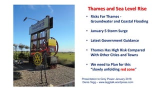
- 1. • Risks For Thames - Groundwater and Coastal Flooding • January 5 Storm Surge • Latest Government Guidance • Thames Has High Risk Compared With Other Cities and Towns • We need to Plan for this “slowly unfolding red zone” Thames and Sea Level Rise Presentation to Grey Power January 2018 Denis Tegg – www.teggtalk.wordpress.com
- 2. NewsHub 20 January 2018
- 3. Temperatures and Sea Are Rising Faster
- 5. Relative to 2000, globally the sea is very likely to rise:- ▪ 0.1m – 0.2m by 2030 (*locked in) ▪ 0.2m – 0.4m by 2050 (*locked in) ▪ 0.3 – 1.3m by 2100 – up to 2.5m is “plausible” * “future pathways have little effect in first half of this century” November 2017 Very Latest Projections
- 6. Sea Level Rise Poses Two Threats to Thames Rising Groundwater Rising groundwater flooding on Thames’ foreshore, forced up by rising sea level/storm surges Coastal Flooding Rising sea levels will lead to much more frequent storm surge events like 5 January - eventually to permanent flooding
- 8. WRC Inundation Tool maps to here plus sea level rise Waikato Regional Council Inundation Tool http://coastalinundation.waikatoregion.govt.nz/
- 9. Thames with present day storm tide and 0.2m of sea level rise (2030?) has extensive groundwater affected areas http://coastalinundation.waikatoregion.govt.nz/
- 10. Thames with mid range storm tide and 0.5m of sea level rise but no wave effects http://coastalinundation.waikatoregion.govt.nz/
- 11. Regional Council Sea Flood Simulator
- 12. Whitianga Sea Level Rise Cooks Beach Sea Level Rise
- 13. Professor Tim Naish - Climate Scientist – Thames is Sinking
- 14. Thames Foreshore Is Sinking Adds to Risk of Rising Seas Location Rate of Settlement 1991 KRTA Report Richmond St 300-500mm since 1977 1995 Frank Millington Burke St 500mm Ferguson Drive 16mm a year 1997 TCDC Memo NW Corner Moanataiari subdivision Slumped 1m since 1968 2017 Richmond Apartment block site 13mm a year Sea Level Rise is Added to Subsidence Rate to Calculate Local Sea Level Rise 5mm + 5mm =10mm a year - 0.5m in 50 years 10mm + 10mm = 20mm a year - 1.0m in 50 years
- 15. Present Day 1-in-100 Year Extreme Storm Tides Become a 6-Monthly Event With a 50cm Rise Daily Event With 1m of Sea Level Rise Extreme Sea Floods More Frequent
- 16. when we get 2 or more extreme events in 20 years or less ? How Soon Before Insurance Companies Withdraw Cover ? How soon might that be ? - with about 15 cm of sea level rise How soon for 15 cm of sea level rise? In 15 – 22 years depending on rate of sea rise?
- 17. Update on Climate Change Adaptation work program • Updated to include latest science on sea level rise • 285 pages - substantial new content on: • Risk assessment • Community engagement • Adaptive planning • Outlines a ten-step decision-making process that councils and communities can follow when planning for the effects of climate change on coastal hazards. 2017 MfE Guidance to Councils The Guidance should be adopted as Council’s Strategy on Coastal Hazards Draft copy available – https://www.greens.org.nz/sites/default/files/CH_Guide_Draft4-webversion.pdf
- 18. Guidelines provide minimum transitional values provided to assist councils in the short-term. Major new developments or intensification of existing development (Category A) need to consider a high sea-level rise value of 1.9 metres and timeframe to 2150
- 19. 1.9 m Category A :- ➢ greenfield development ➢ change in land use ➢ intensification ➢ major new infrastructure proposed new swimming pool? How will this effect new major development west of red line? < 1.9m line
- 20. Building use count for Thames for the 0 – 0.5 m zone Building count comparison for the 0 – 0.5 m zone Residential 176 Commercial 1 Industrial 16 Critical 0 Community 17 Other 107 Thames 302 Tauranga 141 Nelson 125 Lower Hutt 102 Whakatane 495 Total 302 NIWA Report - 2015
- 21. Count of buildings in the 0m – 1.5m above sea level zone Thames is ranked the 8th at risk urban area in New Zealand. Whitianga is 14th
- 22. Building use count for Thames for the 0 – 1.5 m zone Building use count for Thames Coromandel District for the 0 – 1.5 m zone Residential 863 Commercial 108 Industrial 102 Critical 7 Community 17 Other 499 Residential 2,314 Commercial 142 Industrial 278 Critical 10 Community 35 Other 1180 Total 1,596 Total 3,959
- 23. On a buildings per capita per town basis Napier and Thames are the most at risk urban areas in New Zealand. Whitianga is third.
- 24. Replacement Cost $2011 of Buildings for Thames 0m to 0.5m $43,868,520 0.5m to 1.0m $192,707,219 1.0m to 1.5m $148,777,225 0m to 1.5m $384,752,964 0m to 3.0m $557,533,142 Figures do not include:- • land value • water and waste systems • power, telecom, fibre • sewage treatment plant • roads • airfield = $0.4 billion = $0.6 billion
- 25. Nationwide
- 26. Thames has a very strong case for funding and advice from Central Government and LGNZ Our community, TCDC and our MP need to combine forces to ensure Thames gets the help it needs Thames has a Groundwater Problem PLUS a Direct Sea Flooding Problem
- 27. New Government Has Promised Help Climate Change will be a top priority “Commence an urban redevelopment and adaptation programme, with a focus on urban communities subject to sea level rise – working with those communities, their local authorities and other stakeholders.” * * Labour Party Manifesto 2017
- 28. Actions for Grey Power ? Ask Council to:- • sign LGNZ Climate Change Declaration • adopt 2017 MfE Guidance as Coastal Hazard Strategy • ensure Council has funds for:- ➢ urgent mapping and expert risk assessment ➢ engagement with community ➢ review District Plan/LIMs ➢ adaption planning • lobby new Government for funds/expertise Leadership
- 29. “Slowly Unfolding Red Zone” Denial/Inaction leads to … No Need to Panic But it’s Reckless to Delay Careful Planning and Adaptation