DSD-INT 2016 Regional to local modeling for dyke stability -The Schoonhovenseveer-Langerak case - Van der Veen
•
1 like•258 views

Presentation by Roel van der Veen (WSRL) at the iMOD International User Day, during Delft Software Days 2016. Tuesday 1 November 2016, Delft.

Recommended
Recommended
More Related Content
What's hot
What's hot (20)
Viewers also liked
Viewers also liked (18)
Similar to DSD-INT 2016 Regional to local modeling for dyke stability -The Schoonhovenseveer-Langerak case - Van der Veen
Similar to DSD-INT 2016 Regional to local modeling for dyke stability -The Schoonhovenseveer-Langerak case - Van der Veen (20)
More from Deltares
More from Deltares (20)
Recently uploaded
Recently uploaded (20)
DSD-INT 2016 Regional to local modeling for dyke stability -The Schoonhovenseveer-Langerak case - Van der Veen
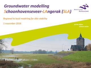
- 1. Groundwater modelling Schoonhovenseveer-LAngerak (SLA) Regional to local modeling for dike stability 1 november 2016
- 4. Overview area with location of instable dikes
- 5. Dike instability Water pressure exceeds weight of dyke body
- 6. Problem • Sandy layers form connection between river and dike • Water board Rivierenland prepares dike stability improvement • Increasing height and width of dikes not always possible • Other measures needed to lower water pressure • Effect and efficiency of measures estimated in scenarios • 3D dynamic groundwater model is needed • Existing model (MORIA model) not suitable yet • → Deltares refined the MORIA model
- 7. Stability under normal conditions River Sand layer First aquifer Dike
- 8. Instability under extreme conditions River Sand layer First aquifer Dike Dike may become instable
- 9. Possible measure (1): increase river bed resistance Sand layer First aquifer Dike
- 10. Possible measure (2): dam walls River Sand layer First aquifer Dike
- 11. Possible measure (3): horizontal drainage River Sand layer First aquifer Dike
- 12. Groundwatermodelling Waterschap Rivierenland • Modellering Ondergrond Rivierenland Interactief en Actueel (since 2009) • iMOD/ modeldatabase • MORIA consortium: Waterschap Rivierenland, Provincie Gelderland, Vitens • Several improvements have been made in recent years MORIA versie 3.2
- 13. Used on regional scale level Average highest groundwaterlevel (m below groundsurface) Regional Exploration Freshwater Rivierenland (Delta program)
- 14. For local applications: further detailing necessary Sand extraction
- 15. Refinement of MORIA for the SLA project • Holocene from 1 to 7 hydrogeological layers → 4 quasi-3D model layers • From 25x25 to 5x5 meter resolution • More detail in riverbed elevation • More detail in other water courses • Stability measure could be modelled (Grontmij, 2013) • Groundwater monitoring filters • Allocated vertically in the new layers
- 18. GeoTOP and channel belts (sand) • GeoTOP (TNO, 2012) • Horizontal extent of hydrogeological units • Basic parameter values (K-values) • Channel belts (“zandbanen”) (Cohen et al., 2012)
- 20. Model layers Hydogeological unit Sand (yellow) or clay/peat (gray) MORIA model SLA model 1 Antropogenic AN 1 1 2 Echteld sand/clay 1 EC1 2 3 Nieuwkoop peat NV 4 Echteld sand/clay 2a EC2a 3 5 Echteld sand/clay 2b EC2b 46 Basic peat (“basisveen”) BV 7 Wijchen clay WK 8 First aquifer (“WVP1”) WVP 2 5 3 4 6 5 6 7 7 8 8 9 9 Model layers 10 t/m 18
- 21. Vertical schematisation: use of iMOD GEOTOP profiel SECTION8KR.SPF (o.b.v. geotechnisch lengteprofiel, geïnterpoleerd met iMOD) GeoTOP Cross section iMOD
- 22. Vertical schematisation Insnijding in belangrijke tussenzandlaag Old MORIA model New SLA model
- 23. Surface water kolkgaten Old MORIA model New SLA model
- 24. Residuals: d(model, monitoringdata) • Green: after calibration • Red: before calibration • Average: 0.018 meter
- 25. Scenario riverbed adjustment (Grontmij) Effect during MHW (extremely high river level) on head in sandy layer
- 26. Scenario horizontal drainage (Grontmij)
- 27. Scenario dam walls (Grontmij)
- 28. Scenarios (Grontmij, 2013) • River bed adjustment (closing holes) is only effective at one location • Horizontal drainage has 20-50 cm effect on hydraulic head underneath the dike • This is potentially a usefull measure • Dam walls are highly effective • Effect is strongest at centre of dam wall
- 29. Discussion • Model suitable to evaluate scenarios • Always local research needed before measures are constructed / carried out • Resistance between river bed bottom and first aquifer is very low: • Erosion holes occur probably more frequently • The basic peat layer is discontinuous? • There still is a gap between monitoring data and model results: • Still not enough detail? • Problems in monitoring wells: position, construction, leaks?