How Does GPS Work? And Why Do You Need To Understand It?
•Download as PPTX, PDF•
0 likes•23 views

Understanding how GPS works will give you insight into how effective it is, how accurate and how much you rely on it. Why does your car get your location faster at certain times? How many satellites are there? Does your cell phone GPS need reception for the GPS to work?

Recommended
More Related Content
Similar to How Does GPS Work? And Why Do You Need To Understand It?
Similar to How Does GPS Work? And Why Do You Need To Understand It? (20)
Recently uploaded
Recently uploaded (20)
How Does GPS Work? And Why Do You Need To Understand It?
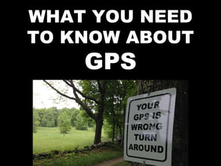
- 1. WHAT YOU NEED TO KNOW ABOUT GPS
- 2. GPS is the Global Positioning System, also called NavStar. It was built by the US Military and has been operational since 1995. Most GPS receivers utilize a combination of both NavStar and the Russian GLONOSS satellites for best results.
- 3. GPS currently has 31 active satellites in orbits inclined 55 degrees to the equator.
- 4. You need to reach 3 GPS satellites for a 2D fix (i.e. no altitude) or 4 satellites for a 3D fix. This could be significant if you are in the mountains at higher altitudes, making it less accurate.
- 5. The satellites orbit about 20,000 kilometers up and make two revolutions per day. The orbits are designed so that there are always 6 satellites in range from most places on the earth.
- 6. The GPS receiver gets a signal from each GPS satellite with the exact time the signal is sent. By subtracting the time the signal was transmitted from the time it was received, the GPS can tell how far it is from each satellite. The receiver knows the exact position in the sky of the satellites. Given the travel time of the GPS signals from three satellites and their exact position, the GPS receiver can determine your position in three dimensions - east-west (longitude), north-south (latitude) and
- 7. An easy way to remember which is which for latitude and longitude, think of latitude as a ladder on the globe running east-west. Thus, longitude is vertical.
- 8. To calculate the time the GPS signals took to arrive, the GPS receiver needs to know the time very accurately. GPS satellites have atomic clocks that keep precise time, however it's not feasible to equip a GPS receiver with an atomic clock. The GPS receiver uses the signal from the satellite to determine the exact time.
- 9. When you switch your GPS on, the time-to- first-fix depends on how long it is since you last used the GPS. If the GPS has been recently used you should get a fix almost immediately. If it hasn't, put the GPS outside with a clear view of the sky. If you have a GPS in a vehicle, it's better to wait for the unit to get a fix before driving off. Receiving data from a satellite takes 30 seconds. If you drive in an area with tall buildings or other obstructions it may take longer to get the data from four satellites, needed for the first fix.
- 10. The accuracy of the position your GPS reports is influenced by a number of factors, such as the positions of the satellites in the sky, atmospheric effects, satellite clock errors, etc. GPS units often show on the screen an accuracy figure. Under ideal conditions, this usually is within 5 meters.
- 11. Cellphone GPS units get a fix almost immediately. They use Assisted GPS (A-GPS) off of cell phone towers to improve the time to first fix, and even allow a fix in conditions where the GPS might not otherwise be able to function. As long as you are in range of a tower.
- 12. Once you are out of cellphone and WiFi coverage, a cellphone GPS unit has to rely on the satellites to provide the ephemeris & almanac data so, like a standard recreational GPS, it takes a minute or so to get a fix from a cold start.
- 13. Things to consider about GPS: Make sure you have whatever maps you might need for your navigating app pre-loaded in the memory in case you can’t download them. Remember, GPS works only as long as the power works. It also only works as long as the satellites are transmitting. Always back up with paper maps and know how to navigate. See my slideshow on MAPS
- 14. Solar Flares can also interfere with the GPS System. Commercial planes are required to have back up navigation to the GPS system.
- 15. I carry a SpotX 2 Way Satellite messenging system. While going to Hole in the Rock in Grand Staircase-Escalante National Monument, my clutch began to burn out. 120 miles from the nearest civilization. Luckily I managed to sustain in third gear out of there but it made me consider the situation. There are places all over the country, including in the Smoky Mountains, with no cell coverage. I view this as a potentially life-saving investment. It will give me my grid location so that, in fact, I will never be actually “lost”. Also peace of mind as my family can get hold of me any time and I can update them on my progress.
- 16. Download the contour map for your area for free, then print it out, or order the map sheets. A link for USGS free downloadable topo maps i son my web site in the pop up. I also have a series of National Geographic area specific maps for various National Forests and Parks Map
- 17. Location Apps There are several topo map Apps you can get. I’ve used a number over the years but the best one I’ve found is Gaia. The basic app is free and then there are two levels of membership. The premium, which is discounted 20% via my affiliate link on my web site, is $32 for a year but for the number and types of maps you get, it is definitely worth it. One useful thing to using any map app is to download the map tiles you want to use beforehand (when you’re out in the wilds with no signal) and you learn how to use the app. They also send interesting email updates on various outdoor activities that are very informative from outdoor
- 18. To the left is an example of some of the many maps you can download and use. You can have multiple maps on screen at the same time, adjusting them as you need. In this case, I have the US Forestry Service Map at max along with USFS roads and trails along with public lands. I can bring up hidden layers as needed. Also note the Historic Topo for 1930 which is fun to play with. You also have National Park Service Visitor, topo maps, streets maps, weather and more. There are dozens of different types of maps available to premium members.
- 19. More Free Information I constantly update free, downloadable slideshows like this on my web site for preparation and survival and other topics. Use Your Camera on this QR Code
- 20. More Free Information If you want to go directly to a document with live links to all free apps, gear, library, and Jeep stuff, use your camera on this QR Code. Or copy and paste: https://www.dropbox.com/scl/fi/vwgilkne2vsq4jrhkp gic/GEAR- LINKS.docx?dl=0&rlkey=i858w1e2zd3irup2lcvhvlb ma
- 22. New York Times bestselling author, is a graduate of West Point and former Green Beret. He’s had over 80 books published, including the #1 bestselling series Green Berets, Time Patrol, Area 51, Survival, and Atlantis. He’s sold over 5 million books. He’s hit bestsellers lists in thriller, science fiction, romance, historical fiction and nonfiction. He was born in the Bronx and has traveled the world. He’s lived on an island off the east coast, an island off the west coast, in the Rocky Mountains, the Smoky Mountains and other places, including time in East Asia studying martial arts. They haven’t caught him yet. www.bobmayer.com
Editor's Notes
- There’s a common image of a red and white sign for Area 51 you can find
- There’s a common image of a red and white sign for Area 51 you can find
- There’s a common image of a red and white sign for Area 51 you can find
- There’s a common image of a red and white sign for Area 51 you can find
- There’s a common image of a red and white sign for Area 51 you can find
- There’s a common image of a red and white sign for Area 51 you can find
- There’s a common image of a red and white sign for Area 51 you can find
- There’s a common image of a red and white sign for Area 51 you can find
- There’s a common image of a red and white sign for Area 51 you can find
- There’s a common image of a red and white sign for Area 51 you can find
- There’s a common image of a red and white sign for Area 51 you can find
- There’s a common image of a red and white sign for Area 51 you can find
- There’s a common image of a red and white sign for Area 51 you can find