SlideShare a Scribd company logo
1 of 14
Download to read offline
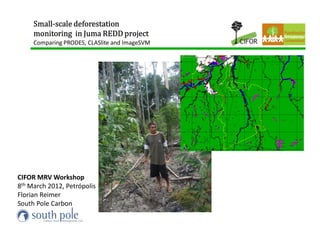
Small-
     Small-scale deforestation
     monitoring in Juma REDD project
     Comparing PRODES, CLASlite and ImageSVM


CIFOR MRV Workshop
8th March 2012, Petrópolis
Florian Reimer
South Pole Carbon
Study Area


             • 5890 km² of which roughly 4720 km²
               are old-growthrainforest

             • Sustainable Development Reserve (RDS)
              created in 2006

             • 2008 start of Bolsa Floresta and
              CCBS Validation by TÜV Süd
              as REDD project

             • Land-use by traditional non-indigenous
              communities legalized

             • 339 families of traditional shifting
              cultivators

             • Low historic Deforestation pressure inside
               the reserve, but high in southern area of
               extensive cattle-ranching
Framework of the study
Comparisson of Small-scale Deforestation Classifiers


•   PRODES (Projeto Desmatamento) of INPE operational Wall-to-Wall
    Mapping since 1988. Landsat-Pixels (30m) aggregated to 60m Pixels.
    Minimal-Mapping Area > 3 ha.
•   CLASlite 2.3 developed by Carnegie Institute for Science, Standford
    University, Asner et al. 2009. Minimal-Mapping Area < 1 ha.
•   imageSVM – Support Vector Machine developed by Rabe, van der Linden,
    & Hostert of TU Berlin Geomatics. Minimal-Mapping Area < 1 ha.

•   Data Basis: Landsat 5 TM images 1997, 2006, 2007, 2008, 2009, 2010
•   Training & Validation data: SPOT 2,4, & 5, HRC CBERS2 & Field data


•   SPOT images, ENVI & ArcGIS Licenses provided by
imageSVM
                                 Pros
                                 Can map any landcover and forest type
                                 Can be adjusted if erroneous
                                 Highest accuracy over all years

                                 Cons
                                 Needs GPS ground-truthing data
                                 Needs high input in time, expertise and
                                 computer power
                                     PRODES
CLASlite v2.3                        Pros
Pros                                 Easy download
Semi-Automated                       Needs only GIS
Needs only georeferenced image
Works for entire Amazon              Cons
                                     Only for Brazilian Amazon
Cons                                 Maps nothing smaller 3 ha
Maps only Deforestation              Sometimes 1-2 years behind
Degradation not very reliable
Closed system, no adjustments
Time Step 1                                          Time Step 2

              Single-Year Layerstacks


                                        Multi-Year
                                        Layerstack

                                          e.g.
                                          2007
                                        & 2008
Every Image gets classified for Forest / Non-Forest and the maps
compared to get change „Deforestation“
Results


                          3.

   1.                                            2.


                                            4.


1. Deforestation in Reserve much lower than in Buffer
2. Sharp decline from 2008 to following years – stop of single large cattle ranch clearing
3. Overdetection CLASlite 2008 due to seasonally drying wetlands
4. Underdetection PRODES 2009 due to small-scale deforestation dominance
• PRODES detected only 33 % of the
  deforestation detected by ImageSVM in the
  Juma reserve over the observation period
  (214 ha vs. 655 ha).
• The average margin of error of ImageSVM
  ‘New Deforestation Class’ was +/- 8.7 %
  (average accuracy 91.3 %)
• 655 ha – 214 ha – (655 ha*8.7%) = 384.1 ha;
  Multiply emission factor 529.43 tCO2 / ha =
  203,354 tCO2
• Multiply with a price of 5 US$ / tCO2 =
  1,016,505 US$.
Conclusion and synthesis I


• Deforestation   inside the Juma Reserve has historically been low

• Trend continued during our study period, possibly effect of Reserve, PES &
REDD project

• High predicted baseline for future deforestation in the REDD project reflects
external pressure from extensive pastures south of the Reserve

• The drop of deforestation in the buffer zone after 2008 related to a slow
down in the expansion of a single large-scale land clearing east to the reserve

• External actors (e.g. cattle ranchers of Apuí) do not benefit from the REDD
project
Conclusion and synthesis II


• In low-deforestation, small-holder deforestation settings like the
Juma Reserve, classification must have adequate minimal-mapping
area.

• In the specific case of the Juma Reserve, using ImageSVM instead
of PRODES, would have avoided underdetection worth roughly US$
1 million over four years

• Supervised classifications fulfill the VCS REDD methodology
requirement of monitoring various forest types and land uses

• Advanced image classification (SVM) using all satellite bands can
better differentiate similar forest types or landcovers than simpler
approaches like Maximum Likelihood or using 3 bands only
Small-
Small-scale deforestation
monitoring in Juma REDD project
Comparing PRODES, CLASlite and ImageSVM


          Thank you for your attention    Florian Reimer
                                          South Pole Carbon

More Related Content

What's hot

Global positioning system (gps) and its application in precision farming
Global positioning system (gps) and its application in precision farmingGlobal positioning system (gps) and its application in precision farming
Global positioning system (gps) and its application in precision farmingDr. M. Kumaresan Hort.
 
Urban Land Cover Change Detection Analysis and Modelling Spatio-Temporal Grow...
Urban Land Cover Change Detection Analysis and Modelling Spatio-Temporal Grow...Urban Land Cover Change Detection Analysis and Modelling Spatio-Temporal Grow...
Urban Land Cover Change Detection Analysis and Modelling Spatio-Temporal Grow...Bayes Ahmed
 
Landuse landcover mapping
Landuse landcover mappingLanduse landcover mapping
Landuse landcover mappingAditya Kushwaha
 
Alao poster-aeg2007(1)
Alao poster-aeg2007(1)Alao poster-aeg2007(1)
Alao poster-aeg2007(1)David Alao
 
An expert system model for identifying and mapping tropical wetlands and peat...
An expert system model for identifying and mapping tropical wetlands and peat...An expert system model for identifying and mapping tropical wetlands and peat...
An expert system model for identifying and mapping tropical wetlands and peat...CIFOR-ICRAF
 
Use of remote sensing for land cover monitoring servir science applications
Use of remote sensing for land cover monitoring servir science applicationsUse of remote sensing for land cover monitoring servir science applications
Use of remote sensing for land cover monitoring servir science applicationsKabir Uddin
 
Gps in farming by hemant ghemeray
Gps in farming by hemant ghemerayGps in farming by hemant ghemeray
Gps in farming by hemant ghemerayHemant Ghemeray
 
Urban Landuse/ Landcover change analysis using Remote Sensing and GIS
Urban Landuse/ Landcover change analysis using Remote Sensing and GISUrban Landuse/ Landcover change analysis using Remote Sensing and GIS
Urban Landuse/ Landcover change analysis using Remote Sensing and GISHarshvardhan Vashistha
 
Soil mapping approach in gis
Soil mapping approach in gisSoil mapping approach in gis
Soil mapping approach in gisSakthivel R
 
Methods & types of soil survey
Methods & types of soil surveyMethods & types of soil survey
Methods & types of soil surveysethupathi siva
 
Land Use and Land Cover change monitoring of Surajpur Wetland, Uttar Pradesh:...
Land Use and Land Cover change monitoring of Surajpur Wetland, Uttar Pradesh:...Land Use and Land Cover change monitoring of Surajpur Wetland, Uttar Pradesh:...
Land Use and Land Cover change monitoring of Surajpur Wetland, Uttar Pradesh:...Arnab Saha
 
Land Use/Land Cover Mapping Of Allahabad City by Using Remote Sensing & GIS
Land Use/Land Cover Mapping Of Allahabad City by Using  Remote Sensing & GIS Land Use/Land Cover Mapping Of Allahabad City by Using  Remote Sensing & GIS
Land Use/Land Cover Mapping Of Allahabad City by Using Remote Sensing & GIS IJMER
 
GPS IN PRECISION AGRICULTURE
GPS IN PRECISION AGRICULTUREGPS IN PRECISION AGRICULTURE
GPS IN PRECISION AGRICULTUREAmbuja Mohanty
 
The status, research progress, and new application of soil inventory in Japan...
The status, research progress, and new application of soil inventory in Japan...The status, research progress, and new application of soil inventory in Japan...
The status, research progress, and new application of soil inventory in Japan...FAO
 
Is an expert-based model able to map erosion in agricultural catchment?
 Is an expert-based model able to map erosion in agricultural catchment?  Is an expert-based model able to map erosion in agricultural catchment?
Is an expert-based model able to map erosion in agricultural catchment? ExternalEvents
 
Soil data needs for agronomists - Achim Dobermann, International Rice Resarch...
Soil data needs for agronomists - Achim Dobermann, International Rice Resarch...Soil data needs for agronomists - Achim Dobermann, International Rice Resarch...
Soil data needs for agronomists - Achim Dobermann, International Rice Resarch...FAO
 
Status of global soil information, Adopting new technology and rebuilding ins...
Status of global soil information, Adopting new technology and rebuilding ins...Status of global soil information, Adopting new technology and rebuilding ins...
Status of global soil information, Adopting new technology and rebuilding ins...FAO
 
Predicting and mapping soil properties using proximal/remote sensing by Zhou ...
Predicting and mapping soil properties using proximal/remote sensing by Zhou ...Predicting and mapping soil properties using proximal/remote sensing by Zhou ...
Predicting and mapping soil properties using proximal/remote sensing by Zhou ...FAO
 

What's hot (20)

Global positioning system (gps) and its application in precision farming
Global positioning system (gps) and its application in precision farmingGlobal positioning system (gps) and its application in precision farming
Global positioning system (gps) and its application in precision farming
 
Inventory and monitoring of tree resources in agroecosystems
Inventory and monitoring of tree resources in agroecosystemsInventory and monitoring of tree resources in agroecosystems
Inventory and monitoring of tree resources in agroecosystems
 
Urban Land Cover Change Detection Analysis and Modelling Spatio-Temporal Grow...
Urban Land Cover Change Detection Analysis and Modelling Spatio-Temporal Grow...Urban Land Cover Change Detection Analysis and Modelling Spatio-Temporal Grow...
Urban Land Cover Change Detection Analysis and Modelling Spatio-Temporal Grow...
 
Landuse landcover mapping
Landuse landcover mappingLanduse landcover mapping
Landuse landcover mapping
 
Alao poster-aeg2007(1)
Alao poster-aeg2007(1)Alao poster-aeg2007(1)
Alao poster-aeg2007(1)
 
An expert system model for identifying and mapping tropical wetlands and peat...
An expert system model for identifying and mapping tropical wetlands and peat...An expert system model for identifying and mapping tropical wetlands and peat...
An expert system model for identifying and mapping tropical wetlands and peat...
 
Use of remote sensing for land cover monitoring servir science applications
Use of remote sensing for land cover monitoring servir science applicationsUse of remote sensing for land cover monitoring servir science applications
Use of remote sensing for land cover monitoring servir science applications
 
Gps in farming by hemant ghemeray
Gps in farming by hemant ghemerayGps in farming by hemant ghemeray
Gps in farming by hemant ghemeray
 
Urban Landuse/ Landcover change analysis using Remote Sensing and GIS
Urban Landuse/ Landcover change analysis using Remote Sensing and GISUrban Landuse/ Landcover change analysis using Remote Sensing and GIS
Urban Landuse/ Landcover change analysis using Remote Sensing and GIS
 
Soil mapping approach in gis
Soil mapping approach in gisSoil mapping approach in gis
Soil mapping approach in gis
 
Methods & types of soil survey
Methods & types of soil surveyMethods & types of soil survey
Methods & types of soil survey
 
Land Use and Land Cover change monitoring of Surajpur Wetland, Uttar Pradesh:...
Land Use and Land Cover change monitoring of Surajpur Wetland, Uttar Pradesh:...Land Use and Land Cover change monitoring of Surajpur Wetland, Uttar Pradesh:...
Land Use and Land Cover change monitoring of Surajpur Wetland, Uttar Pradesh:...
 
Land Use/Land Cover Mapping Of Allahabad City by Using Remote Sensing & GIS
Land Use/Land Cover Mapping Of Allahabad City by Using  Remote Sensing & GIS Land Use/Land Cover Mapping Of Allahabad City by Using  Remote Sensing & GIS
Land Use/Land Cover Mapping Of Allahabad City by Using Remote Sensing & GIS
 
GPS IN PRECISION AGRICULTURE
GPS IN PRECISION AGRICULTUREGPS IN PRECISION AGRICULTURE
GPS IN PRECISION AGRICULTURE
 
The status, research progress, and new application of soil inventory in Japan...
The status, research progress, and new application of soil inventory in Japan...The status, research progress, and new application of soil inventory in Japan...
The status, research progress, and new application of soil inventory in Japan...
 
Is an expert-based model able to map erosion in agricultural catchment?
 Is an expert-based model able to map erosion in agricultural catchment?  Is an expert-based model able to map erosion in agricultural catchment?
Is an expert-based model able to map erosion in agricultural catchment?
 
Soil data needs for agronomists - Achim Dobermann, International Rice Resarch...
Soil data needs for agronomists - Achim Dobermann, International Rice Resarch...Soil data needs for agronomists - Achim Dobermann, International Rice Resarch...
Soil data needs for agronomists - Achim Dobermann, International Rice Resarch...
 
Status of global soil information, Adopting new technology and rebuilding ins...
Status of global soil information, Adopting new technology and rebuilding ins...Status of global soil information, Adopting new technology and rebuilding ins...
Status of global soil information, Adopting new technology and rebuilding ins...
 
Predicting and mapping soil properties using proximal/remote sensing by Zhou ...
Predicting and mapping soil properties using proximal/remote sensing by Zhou ...Predicting and mapping soil properties using proximal/remote sensing by Zhou ...
Predicting and mapping soil properties using proximal/remote sensing by Zhou ...
 
A change detection tool for vegetation disturbances on Irish Peatlands
A change detection tool for vegetation disturbances on Irish PeatlandsA change detection tool for vegetation disturbances on Irish Peatlands
A change detection tool for vegetation disturbances on Irish Peatlands
 

Viewers also liked

Financial incentive benchmark for REDD+
Financial incentive benchmark for REDD+Financial incentive benchmark for REDD+
Financial incentive benchmark for REDD+CIFOR-ICRAF
 
Smallholder livelihoods and land use in the Eastern Brazilian Amazon: Lessons...
Smallholder livelihoods and land use in the Eastern Brazilian Amazon: Lessons...Smallholder livelihoods and land use in the Eastern Brazilian Amazon: Lessons...
Smallholder livelihoods and land use in the Eastern Brazilian Amazon: Lessons...CIFOR-ICRAF
 
Alto Mayo Protected Forest REDD Initiative, Peru
Alto Mayo Protected Forest REDD Initiative, PeruAlto Mayo Protected Forest REDD Initiative, Peru
Alto Mayo Protected Forest REDD Initiative, PeruCIFOR-ICRAF
 
REDD+ as performance-based aid
REDD+ as performance-based aidREDD+ as performance-based aid
REDD+ as performance-based aidCIFOR-ICRAF
 
Dead-lock or transformational change – a comparison of REDD+ politics in the ...
Dead-lock or transformational change – a comparison of REDD+ politics in the ...Dead-lock or transformational change – a comparison of REDD+ politics in the ...
Dead-lock or transformational change – a comparison of REDD+ politics in the ...CIFOR-ICRAF
 
REDD+ in the Cameroon policy arena: Perceptions, power and politics
REDD+ in the Cameroon policy arena: Perceptions, power and politicsREDD+ in the Cameroon policy arena: Perceptions, power and politics
REDD+ in the Cameroon policy arena: Perceptions, power and politicsCIFOR-ICRAF
 
Step-wise progress for REDD+ monitoring
Step-wise progress for REDD+ monitoringStep-wise progress for REDD+ monitoring
Step-wise progress for REDD+ monitoringCIFOR-ICRAF
 
Acre State System of Incentives for Environmental Services
Acre State System of Incentives for Environmental Services Acre State System of Incentives for Environmental Services
Acre State System of Incentives for Environmental Services CIFOR-ICRAF
 

Viewers also liked (8)

Financial incentive benchmark for REDD+
Financial incentive benchmark for REDD+Financial incentive benchmark for REDD+
Financial incentive benchmark for REDD+
 
Smallholder livelihoods and land use in the Eastern Brazilian Amazon: Lessons...
Smallholder livelihoods and land use in the Eastern Brazilian Amazon: Lessons...Smallholder livelihoods and land use in the Eastern Brazilian Amazon: Lessons...
Smallholder livelihoods and land use in the Eastern Brazilian Amazon: Lessons...
 
Alto Mayo Protected Forest REDD Initiative, Peru
Alto Mayo Protected Forest REDD Initiative, PeruAlto Mayo Protected Forest REDD Initiative, Peru
Alto Mayo Protected Forest REDD Initiative, Peru
 
REDD+ as performance-based aid
REDD+ as performance-based aidREDD+ as performance-based aid
REDD+ as performance-based aid
 
Dead-lock or transformational change – a comparison of REDD+ politics in the ...
Dead-lock or transformational change – a comparison of REDD+ politics in the ...Dead-lock or transformational change – a comparison of REDD+ politics in the ...
Dead-lock or transformational change – a comparison of REDD+ politics in the ...
 
REDD+ in the Cameroon policy arena: Perceptions, power and politics
REDD+ in the Cameroon policy arena: Perceptions, power and politicsREDD+ in the Cameroon policy arena: Perceptions, power and politics
REDD+ in the Cameroon policy arena: Perceptions, power and politics
 
Step-wise progress for REDD+ monitoring
Step-wise progress for REDD+ monitoringStep-wise progress for REDD+ monitoring
Step-wise progress for REDD+ monitoring
 
Acre State System of Incentives for Environmental Services
Acre State System of Incentives for Environmental Services Acre State System of Incentives for Environmental Services
Acre State System of Incentives for Environmental Services
 

Similar to Small-scale deforestation monitoring in Juma REDD project

Jeofizik Tarımsal Toprak İncelemesi
Jeofizik Tarımsal Toprak İncelemesiJeofizik Tarımsal Toprak İncelemesi
Jeofizik Tarımsal Toprak İncelemesiAli Osman Öncel
 
Site Suitability For Construction(Dam)
Site Suitability For Construction(Dam)Site Suitability For Construction(Dam)
Site Suitability For Construction(Dam)Luv Singh
 
Monitoring, reporting and verification (MRV) of activities for reducing fores...
Monitoring, reporting and verification (MRV) of activities for reducing fores...Monitoring, reporting and verification (MRV) of activities for reducing fores...
Monitoring, reporting and verification (MRV) of activities for reducing fores...John Davis
 
The Cool Farm Tool | Jon Hillier
The Cool Farm Tool | Jon HillierThe Cool Farm Tool | Jon Hillier
The Cool Farm Tool | Jon Hilliericarb
 
GFW Partner Meeting 2017 - Parallel Discussions 3: Monitoring Beyond Forests
GFW Partner Meeting 2017 - Parallel Discussions 3: Monitoring Beyond ForestsGFW Partner Meeting 2017 - Parallel Discussions 3: Monitoring Beyond Forests
GFW Partner Meeting 2017 - Parallel Discussions 3: Monitoring Beyond ForestsWorld Resources Institute (WRI)
 
Muyambi Benda FORTUNATE "Land degradation assessment in the IGAD Region - Its...
Muyambi Benda FORTUNATE "Land degradation assessment in the IGAD Region - Its...Muyambi Benda FORTUNATE "Land degradation assessment in the IGAD Region - Its...
Muyambi Benda FORTUNATE "Land degradation assessment in the IGAD Region - Its...Global Risk Forum GRFDavos
 
Landmap CETIS 2012
Landmap CETIS 2012Landmap CETIS 2012
Landmap CETIS 2012Bharti Gupta
 
Caldwell community sustainability and land use policy
Caldwell community sustainability and land use policyCaldwell community sustainability and land use policy
Caldwell community sustainability and land use policyGeCo in the Rockies
 
GIS & RS in Forest Mapping
GIS & RS in Forest MappingGIS & RS in Forest Mapping
GIS & RS in Forest MappingKamlesh Kumar
 
G-Range: An intermediate complexity model for simulating and forecasting ecos...
G-Range: An intermediate complexity model for simulating and forecasting ecos...G-Range: An intermediate complexity model for simulating and forecasting ecos...
G-Range: An intermediate complexity model for simulating and forecasting ecos...ILRI
 
Indufor ..forest intelligence ..remote sensing and gis .... bau with a bit mo...
Indufor ..forest intelligence ..remote sensing and gis .... bau with a bit mo...Indufor ..forest intelligence ..remote sensing and gis .... bau with a bit mo...
Indufor ..forest intelligence ..remote sensing and gis .... bau with a bit mo...Nelson Gapare
 
OverviewofGCOM.pdf
OverviewofGCOM.pdfOverviewofGCOM.pdf
OverviewofGCOM.pdfgrssieee
 
 Gigapixel resolution imaging for near-remote sensing and phenomics
 Gigapixel resolution imaging for near-remote sensing and phenomics Gigapixel resolution imaging for near-remote sensing and phenomics
 Gigapixel resolution imaging for near-remote sensing and phenomicsTimeScience
 
7. Global Forest Watch & Monitoring Forests Using Remote Sensing
7. Global Forest Watch & Monitoring Forests Using Remote Sensing7. Global Forest Watch & Monitoring Forests Using Remote Sensing
7. Global Forest Watch & Monitoring Forests Using Remote SensingENPI FLEG
 
The REDD+ satellite based land cover monitoring system for Mexico
The REDD+ satellite based land cover monitoring system for MexicoThe REDD+ satellite based land cover monitoring system for Mexico
The REDD+ satellite based land cover monitoring system for MexicoCIMMYT
 

Similar to Small-scale deforestation monitoring in Juma REDD project (20)

Jeofizik Tarımsal Toprak İncelemesi
Jeofizik Tarımsal Toprak İncelemesiJeofizik Tarımsal Toprak İncelemesi
Jeofizik Tarımsal Toprak İncelemesi
 
Site Suitability For Construction(Dam)
Site Suitability For Construction(Dam)Site Suitability For Construction(Dam)
Site Suitability For Construction(Dam)
 
Monitoring, reporting and verification (MRV) of activities for reducing fores...
Monitoring, reporting and verification (MRV) of activities for reducing fores...Monitoring, reporting and verification (MRV) of activities for reducing fores...
Monitoring, reporting and verification (MRV) of activities for reducing fores...
 
study of dams
study of damsstudy of dams
study of dams
 
The Cool Farm Tool | Jon Hillier
The Cool Farm Tool | Jon HillierThe Cool Farm Tool | Jon Hillier
The Cool Farm Tool | Jon Hillier
 
GFW Partner Meeting 2017 - Parallel Discussions 3: Monitoring Beyond Forests
GFW Partner Meeting 2017 - Parallel Discussions 3: Monitoring Beyond ForestsGFW Partner Meeting 2017 - Parallel Discussions 3: Monitoring Beyond Forests
GFW Partner Meeting 2017 - Parallel Discussions 3: Monitoring Beyond Forests
 
Muyambi Benda FORTUNATE "Land degradation assessment in the IGAD Region - Its...
Muyambi Benda FORTUNATE "Land degradation assessment in the IGAD Region - Its...Muyambi Benda FORTUNATE "Land degradation assessment in the IGAD Region - Its...
Muyambi Benda FORTUNATE "Land degradation assessment in the IGAD Region - Its...
 
Landmap CETIS 2012
Landmap CETIS 2012Landmap CETIS 2012
Landmap CETIS 2012
 
Caldwell community sustainability and land use policy
Caldwell community sustainability and land use policyCaldwell community sustainability and land use policy
Caldwell community sustainability and land use policy
 
Mitigation strategy and the REDD: Application of the GLOBIOM model to the Con...
Mitigation strategy and the REDD: Application of the GLOBIOM model to the Con...Mitigation strategy and the REDD: Application of the GLOBIOM model to the Con...
Mitigation strategy and the REDD: Application of the GLOBIOM model to the Con...
 
GIS & RS in Forest Mapping
GIS & RS in Forest MappingGIS & RS in Forest Mapping
GIS & RS in Forest Mapping
 
G-Range: An intermediate complexity model for simulating and forecasting ecos...
G-Range: An intermediate complexity model for simulating and forecasting ecos...G-Range: An intermediate complexity model for simulating and forecasting ecos...
G-Range: An intermediate complexity model for simulating and forecasting ecos...
 
Indufor ..forest intelligence ..remote sensing and gis .... bau with a bit mo...
Indufor ..forest intelligence ..remote sensing and gis .... bau with a bit mo...Indufor ..forest intelligence ..remote sensing and gis .... bau with a bit mo...
Indufor ..forest intelligence ..remote sensing and gis .... bau with a bit mo...
 
Carbon Benefits4
Carbon Benefits4Carbon Benefits4
Carbon Benefits4
 
Carbon Benefits4
Carbon Benefits4Carbon Benefits4
Carbon Benefits4
 
Land use cover pptx.
Land use cover pptx.Land use cover pptx.
Land use cover pptx.
 
OverviewofGCOM.pdf
OverviewofGCOM.pdfOverviewofGCOM.pdf
OverviewofGCOM.pdf
 
 Gigapixel resolution imaging for near-remote sensing and phenomics
 Gigapixel resolution imaging for near-remote sensing and phenomics Gigapixel resolution imaging for near-remote sensing and phenomics
 Gigapixel resolution imaging for near-remote sensing and phenomics
 
7. Global Forest Watch & Monitoring Forests Using Remote Sensing
7. Global Forest Watch & Monitoring Forests Using Remote Sensing7. Global Forest Watch & Monitoring Forests Using Remote Sensing
7. Global Forest Watch & Monitoring Forests Using Remote Sensing
 
The REDD+ satellite based land cover monitoring system for Mexico
The REDD+ satellite based land cover monitoring system for MexicoThe REDD+ satellite based land cover monitoring system for Mexico
The REDD+ satellite based land cover monitoring system for Mexico
 

More from CIFOR-ICRAF

Delivering nature-based solution outcomes by addressing policy, institutiona...
Delivering nature-based solution outcomes by addressing  policy, institutiona...Delivering nature-based solution outcomes by addressing  policy, institutiona...
Delivering nature-based solution outcomes by addressing policy, institutiona...CIFOR-ICRAF
 
Policy Dialogue Three Key Priorities
Policy Dialogue Three Key PrioritiesPolicy Dialogue Three Key Priorities
Policy Dialogue Three Key PrioritiesCIFOR-ICRAF
 
The Second Roadmap on ASEAN Cooperation towards Transboundary Haze Pollution ...
The Second Roadmap on ASEAN Cooperation towards Transboundary Haze Pollution ...The Second Roadmap on ASEAN Cooperation towards Transboundary Haze Pollution ...
The Second Roadmap on ASEAN Cooperation towards Transboundary Haze Pollution ...CIFOR-ICRAF
 
The role of forest in climate change mitigation: Introduction to REDD+ initia...
The role of forest in climate change mitigation: Introduction to REDD+ initia...The role of forest in climate change mitigation: Introduction to REDD+ initia...
The role of forest in climate change mitigation: Introduction to REDD+ initia...CIFOR-ICRAF
 
REDD+ et marche du carbone. Instrument de developpement ou marche de dupes de...
REDD+ et marche du carbone. Instrument de developpement ou marche de dupes de...REDD+ et marche du carbone. Instrument de developpement ou marche de dupes de...
REDD+ et marche du carbone. Instrument de developpement ou marche de dupes de...CIFOR-ICRAF
 
La RDC dans le paysage des projets et des programmes juridictionnels REDD+
La RDC dans le paysage des projets et des programmes juridictionnels REDD+La RDC dans le paysage des projets et des programmes juridictionnels REDD+
La RDC dans le paysage des projets et des programmes juridictionnels REDD+CIFOR-ICRAF
 
Cadre légal et réglementaire du marché carbone en RDC
Cadre légal et réglementaire du marché carbone en RDCCadre légal et réglementaire du marché carbone en RDC
Cadre légal et réglementaire du marché carbone en RDCCIFOR-ICRAF
 
Exploitation minière artisanale, moyens de subsistance et déforestation dans ...
Exploitation minière artisanale, moyens de subsistance et déforestation dans ...Exploitation minière artisanale, moyens de subsistance et déforestation dans ...
Exploitation minière artisanale, moyens de subsistance et déforestation dans ...CIFOR-ICRAF
 
Qu'est-ce qui influence l'efficacité des interventions de conservation des fo...
Qu'est-ce qui influence l'efficacité des interventions de conservation des fo...Qu'est-ce qui influence l'efficacité des interventions de conservation des fo...
Qu'est-ce qui influence l'efficacité des interventions de conservation des fo...CIFOR-ICRAF
 
Industries miniéres et justice climatique en Afrique centrale : étude de droi...
Industries miniéres et justice climatique en Afrique centrale : étude de droi...Industries miniéres et justice climatique en Afrique centrale : étude de droi...
Industries miniéres et justice climatique en Afrique centrale : étude de droi...CIFOR-ICRAF
 
Enjeux de la future politique forestière de la République Démocratique du Congo
Enjeux de la future politique forestière de la République Démocratique du CongoEnjeux de la future politique forestière de la République Démocratique du Congo
Enjeux de la future politique forestière de la République Démocratique du CongoCIFOR-ICRAF
 
Incentive Scheme for Smallholders
Incentive Scheme for Smallholders Incentive Scheme for Smallholders
Incentive Scheme for Smallholders CIFOR-ICRAF
 
Capacity Building in oil palm trade and sustainability
Capacity Building in oil palm trade and sustainabilityCapacity Building in oil palm trade and sustainability
Capacity Building in oil palm trade and sustainabilityCIFOR-ICRAF
 
Monitoring songbirds' online market
Monitoring songbirds' online market Monitoring songbirds' online market
Monitoring songbirds' online market CIFOR-ICRAF
 
Supporting Farmer Transition to Produce Deforestation-Free Coffee
Supporting Farmer Transition to Produce Deforestation-Free CoffeeSupporting Farmer Transition to Produce Deforestation-Free Coffee
Supporting Farmer Transition to Produce Deforestation-Free CoffeeCIFOR-ICRAF
 
Pathways to sustainable trade and system dynamic simulation
Pathways to sustainable trade and system dynamic simulationPathways to sustainable trade and system dynamic simulation
Pathways to sustainable trade and system dynamic simulationCIFOR-ICRAF
 
Cenários de desmatamento para o Brasil Plataforma REDD BRASIL
Cenários de desmatamento para o Brasil Plataforma REDD BRASILCenários de desmatamento para o Brasil Plataforma REDD BRASIL
Cenários de desmatamento para o Brasil Plataforma REDD BRASILCIFOR-ICRAF
 
A Plataforma REDD+ Brasil: contexto
A Plataforma REDD+ Brasil: contexto   A Plataforma REDD+ Brasil: contexto
A Plataforma REDD+ Brasil: contexto CIFOR-ICRAF
 
Research priorities in seagrass ecosystems to enhance blue carbon as Natural...
Research priorities in seagrass ecosystems to enhance blue carbon  as Natural...Research priorities in seagrass ecosystems to enhance blue carbon  as Natural...
Research priorities in seagrass ecosystems to enhance blue carbon as Natural...CIFOR-ICRAF
 
The role of mangrove blue carbon research to support national climate mitigat...
The role of mangrove blue carbon research to support national climate mitigat...The role of mangrove blue carbon research to support national climate mitigat...
The role of mangrove blue carbon research to support national climate mitigat...CIFOR-ICRAF
 

More from CIFOR-ICRAF (20)

Delivering nature-based solution outcomes by addressing policy, institutiona...
Delivering nature-based solution outcomes by addressing  policy, institutiona...Delivering nature-based solution outcomes by addressing  policy, institutiona...
Delivering nature-based solution outcomes by addressing policy, institutiona...
 
Policy Dialogue Three Key Priorities
Policy Dialogue Three Key PrioritiesPolicy Dialogue Three Key Priorities
Policy Dialogue Three Key Priorities
 
The Second Roadmap on ASEAN Cooperation towards Transboundary Haze Pollution ...
The Second Roadmap on ASEAN Cooperation towards Transboundary Haze Pollution ...The Second Roadmap on ASEAN Cooperation towards Transboundary Haze Pollution ...
The Second Roadmap on ASEAN Cooperation towards Transboundary Haze Pollution ...
 
The role of forest in climate change mitigation: Introduction to REDD+ initia...
The role of forest in climate change mitigation: Introduction to REDD+ initia...The role of forest in climate change mitigation: Introduction to REDD+ initia...
The role of forest in climate change mitigation: Introduction to REDD+ initia...
 
REDD+ et marche du carbone. Instrument de developpement ou marche de dupes de...
REDD+ et marche du carbone. Instrument de developpement ou marche de dupes de...REDD+ et marche du carbone. Instrument de developpement ou marche de dupes de...
REDD+ et marche du carbone. Instrument de developpement ou marche de dupes de...
 
La RDC dans le paysage des projets et des programmes juridictionnels REDD+
La RDC dans le paysage des projets et des programmes juridictionnels REDD+La RDC dans le paysage des projets et des programmes juridictionnels REDD+
La RDC dans le paysage des projets et des programmes juridictionnels REDD+
 
Cadre légal et réglementaire du marché carbone en RDC
Cadre légal et réglementaire du marché carbone en RDCCadre légal et réglementaire du marché carbone en RDC
Cadre légal et réglementaire du marché carbone en RDC
 
Exploitation minière artisanale, moyens de subsistance et déforestation dans ...
Exploitation minière artisanale, moyens de subsistance et déforestation dans ...Exploitation minière artisanale, moyens de subsistance et déforestation dans ...
Exploitation minière artisanale, moyens de subsistance et déforestation dans ...
 
Qu'est-ce qui influence l'efficacité des interventions de conservation des fo...
Qu'est-ce qui influence l'efficacité des interventions de conservation des fo...Qu'est-ce qui influence l'efficacité des interventions de conservation des fo...
Qu'est-ce qui influence l'efficacité des interventions de conservation des fo...
 
Industries miniéres et justice climatique en Afrique centrale : étude de droi...
Industries miniéres et justice climatique en Afrique centrale : étude de droi...Industries miniéres et justice climatique en Afrique centrale : étude de droi...
Industries miniéres et justice climatique en Afrique centrale : étude de droi...
 
Enjeux de la future politique forestière de la République Démocratique du Congo
Enjeux de la future politique forestière de la République Démocratique du CongoEnjeux de la future politique forestière de la République Démocratique du Congo
Enjeux de la future politique forestière de la République Démocratique du Congo
 
Incentive Scheme for Smallholders
Incentive Scheme for Smallholders Incentive Scheme for Smallholders
Incentive Scheme for Smallholders
 
Capacity Building in oil palm trade and sustainability
Capacity Building in oil palm trade and sustainabilityCapacity Building in oil palm trade and sustainability
Capacity Building in oil palm trade and sustainability
 
Monitoring songbirds' online market
Monitoring songbirds' online market Monitoring songbirds' online market
Monitoring songbirds' online market
 
Supporting Farmer Transition to Produce Deforestation-Free Coffee
Supporting Farmer Transition to Produce Deforestation-Free CoffeeSupporting Farmer Transition to Produce Deforestation-Free Coffee
Supporting Farmer Transition to Produce Deforestation-Free Coffee
 
Pathways to sustainable trade and system dynamic simulation
Pathways to sustainable trade and system dynamic simulationPathways to sustainable trade and system dynamic simulation
Pathways to sustainable trade and system dynamic simulation
 
Cenários de desmatamento para o Brasil Plataforma REDD BRASIL
Cenários de desmatamento para o Brasil Plataforma REDD BRASILCenários de desmatamento para o Brasil Plataforma REDD BRASIL
Cenários de desmatamento para o Brasil Plataforma REDD BRASIL
 
A Plataforma REDD+ Brasil: contexto
A Plataforma REDD+ Brasil: contexto   A Plataforma REDD+ Brasil: contexto
A Plataforma REDD+ Brasil: contexto
 
Research priorities in seagrass ecosystems to enhance blue carbon as Natural...
Research priorities in seagrass ecosystems to enhance blue carbon  as Natural...Research priorities in seagrass ecosystems to enhance blue carbon  as Natural...
Research priorities in seagrass ecosystems to enhance blue carbon as Natural...
 
The role of mangrove blue carbon research to support national climate mitigat...
The role of mangrove blue carbon research to support national climate mitigat...The role of mangrove blue carbon research to support national climate mitigat...
The role of mangrove blue carbon research to support national climate mitigat...
 

Recently uploaded

The Most Excellent Way | 1 Corinthians 13
The Most Excellent Way | 1 Corinthians 13The Most Excellent Way | 1 Corinthians 13
The Most Excellent Way | 1 Corinthians 13Steve Thomason
 
A Critique of the Proposed National Education Policy Reform
A Critique of the Proposed National Education Policy ReformA Critique of the Proposed National Education Policy Reform
A Critique of the Proposed National Education Policy ReformChameera Dedduwage
 
SOCIAL AND HISTORICAL CONTEXT - LFTVD.pptx
SOCIAL AND HISTORICAL CONTEXT - LFTVD.pptxSOCIAL AND HISTORICAL CONTEXT - LFTVD.pptx
SOCIAL AND HISTORICAL CONTEXT - LFTVD.pptxiammrhaywood
 
Presiding Officer Training module 2024 lok sabha elections
Presiding Officer Training module 2024 lok sabha electionsPresiding Officer Training module 2024 lok sabha elections
Presiding Officer Training module 2024 lok sabha electionsanshu789521
 
POINT- BIOCHEMISTRY SEM 2 ENZYMES UNIT 5.pptx
POINT- BIOCHEMISTRY SEM 2 ENZYMES UNIT 5.pptxPOINT- BIOCHEMISTRY SEM 2 ENZYMES UNIT 5.pptx
POINT- BIOCHEMISTRY SEM 2 ENZYMES UNIT 5.pptxSayali Powar
 
Incoming and Outgoing Shipments in 1 STEP Using Odoo 17
Incoming and Outgoing Shipments in 1 STEP Using Odoo 17Incoming and Outgoing Shipments in 1 STEP Using Odoo 17
Incoming and Outgoing Shipments in 1 STEP Using Odoo 17Celine George
 
Sanyam Choudhary Chemistry practical.pdf
Sanyam Choudhary Chemistry practical.pdfSanyam Choudhary Chemistry practical.pdf
Sanyam Choudhary Chemistry practical.pdfsanyamsingh5019
 
Kisan Call Centre - To harness potential of ICT in Agriculture by answer farm...
Kisan Call Centre - To harness potential of ICT in Agriculture by answer farm...Kisan Call Centre - To harness potential of ICT in Agriculture by answer farm...
Kisan Call Centre - To harness potential of ICT in Agriculture by answer farm...Krashi Coaching
 
Accessible design: Minimum effort, maximum impact
Accessible design: Minimum effort, maximum impactAccessible design: Minimum effort, maximum impact
Accessible design: Minimum effort, maximum impactdawncurless
 
Paris 2024 Olympic Geographies - an activity
Paris 2024 Olympic Geographies - an activityParis 2024 Olympic Geographies - an activity
Paris 2024 Olympic Geographies - an activityGeoBlogs
 
Industrial Policy - 1948, 1956, 1973, 1977, 1980, 1991
Industrial Policy - 1948, 1956, 1973, 1977, 1980, 1991Industrial Policy - 1948, 1956, 1973, 1977, 1980, 1991
Industrial Policy - 1948, 1956, 1973, 1977, 1980, 1991RKavithamani
 
Concept of Vouching. B.Com(Hons) /B.Compdf
Concept of Vouching. B.Com(Hons) /B.CompdfConcept of Vouching. B.Com(Hons) /B.Compdf
Concept of Vouching. B.Com(Hons) /B.CompdfUmakantAnnand
 
Presentation by Andreas Schleicher Tackling the School Absenteeism Crisis 30 ...
Presentation by Andreas Schleicher Tackling the School Absenteeism Crisis 30 ...Presentation by Andreas Schleicher Tackling the School Absenteeism Crisis 30 ...
Presentation by Andreas Schleicher Tackling the School Absenteeism Crisis 30 ...EduSkills OECD
 
mini mental status format.docx
mini    mental       status     format.docxmini    mental       status     format.docx
mini mental status format.docxPoojaSen20
 
APM Welcome, APM North West Network Conference, Synergies Across Sectors
APM Welcome, APM North West Network Conference, Synergies Across SectorsAPM Welcome, APM North West Network Conference, Synergies Across Sectors
APM Welcome, APM North West Network Conference, Synergies Across SectorsAssociation for Project Management
 
Employee wellbeing at the workplace.pptx
Employee wellbeing at the workplace.pptxEmployee wellbeing at the workplace.pptx
Employee wellbeing at the workplace.pptxNirmalaLoungPoorunde1
 

Recently uploaded (20)

The Most Excellent Way | 1 Corinthians 13
The Most Excellent Way | 1 Corinthians 13The Most Excellent Way | 1 Corinthians 13
The Most Excellent Way | 1 Corinthians 13
 
A Critique of the Proposed National Education Policy Reform
A Critique of the Proposed National Education Policy ReformA Critique of the Proposed National Education Policy Reform
A Critique of the Proposed National Education Policy Reform
 
SOCIAL AND HISTORICAL CONTEXT - LFTVD.pptx
SOCIAL AND HISTORICAL CONTEXT - LFTVD.pptxSOCIAL AND HISTORICAL CONTEXT - LFTVD.pptx
SOCIAL AND HISTORICAL CONTEXT - LFTVD.pptx
 
Model Call Girl in Bikash Puri Delhi reach out to us at 🔝9953056974🔝
Model Call Girl in Bikash Puri  Delhi reach out to us at 🔝9953056974🔝Model Call Girl in Bikash Puri  Delhi reach out to us at 🔝9953056974🔝
Model Call Girl in Bikash Puri Delhi reach out to us at 🔝9953056974🔝
 
Presiding Officer Training module 2024 lok sabha elections
Presiding Officer Training module 2024 lok sabha electionsPresiding Officer Training module 2024 lok sabha elections
Presiding Officer Training module 2024 lok sabha elections
 
Código Creativo y Arte de Software | Unidad 1
Código Creativo y Arte de Software | Unidad 1Código Creativo y Arte de Software | Unidad 1
Código Creativo y Arte de Software | Unidad 1
 
POINT- BIOCHEMISTRY SEM 2 ENZYMES UNIT 5.pptx
POINT- BIOCHEMISTRY SEM 2 ENZYMES UNIT 5.pptxPOINT- BIOCHEMISTRY SEM 2 ENZYMES UNIT 5.pptx
POINT- BIOCHEMISTRY SEM 2 ENZYMES UNIT 5.pptx
 
Incoming and Outgoing Shipments in 1 STEP Using Odoo 17
Incoming and Outgoing Shipments in 1 STEP Using Odoo 17Incoming and Outgoing Shipments in 1 STEP Using Odoo 17
Incoming and Outgoing Shipments in 1 STEP Using Odoo 17
 
Sanyam Choudhary Chemistry practical.pdf
Sanyam Choudhary Chemistry practical.pdfSanyam Choudhary Chemistry practical.pdf
Sanyam Choudhary Chemistry practical.pdf
 
Model Call Girl in Tilak Nagar Delhi reach out to us at 🔝9953056974🔝
Model Call Girl in Tilak Nagar Delhi reach out to us at 🔝9953056974🔝Model Call Girl in Tilak Nagar Delhi reach out to us at 🔝9953056974🔝
Model Call Girl in Tilak Nagar Delhi reach out to us at 🔝9953056974🔝
 
TataKelola dan KamSiber Kecerdasan Buatan v022.pdf
TataKelola dan KamSiber Kecerdasan Buatan v022.pdfTataKelola dan KamSiber Kecerdasan Buatan v022.pdf
TataKelola dan KamSiber Kecerdasan Buatan v022.pdf
 
Kisan Call Centre - To harness potential of ICT in Agriculture by answer farm...
Kisan Call Centre - To harness potential of ICT in Agriculture by answer farm...Kisan Call Centre - To harness potential of ICT in Agriculture by answer farm...
Kisan Call Centre - To harness potential of ICT in Agriculture by answer farm...
 
Accessible design: Minimum effort, maximum impact
Accessible design: Minimum effort, maximum impactAccessible design: Minimum effort, maximum impact
Accessible design: Minimum effort, maximum impact
 
Paris 2024 Olympic Geographies - an activity
Paris 2024 Olympic Geographies - an activityParis 2024 Olympic Geographies - an activity
Paris 2024 Olympic Geographies - an activity
 
Industrial Policy - 1948, 1956, 1973, 1977, 1980, 1991
Industrial Policy - 1948, 1956, 1973, 1977, 1980, 1991Industrial Policy - 1948, 1956, 1973, 1977, 1980, 1991
Industrial Policy - 1948, 1956, 1973, 1977, 1980, 1991
 
Concept of Vouching. B.Com(Hons) /B.Compdf
Concept of Vouching. B.Com(Hons) /B.CompdfConcept of Vouching. B.Com(Hons) /B.Compdf
Concept of Vouching. B.Com(Hons) /B.Compdf
 
Presentation by Andreas Schleicher Tackling the School Absenteeism Crisis 30 ...
Presentation by Andreas Schleicher Tackling the School Absenteeism Crisis 30 ...Presentation by Andreas Schleicher Tackling the School Absenteeism Crisis 30 ...
Presentation by Andreas Schleicher Tackling the School Absenteeism Crisis 30 ...
 
mini mental status format.docx
mini    mental       status     format.docxmini    mental       status     format.docx
mini mental status format.docx
 
APM Welcome, APM North West Network Conference, Synergies Across Sectors
APM Welcome, APM North West Network Conference, Synergies Across SectorsAPM Welcome, APM North West Network Conference, Synergies Across Sectors
APM Welcome, APM North West Network Conference, Synergies Across Sectors
 
Employee wellbeing at the workplace.pptx
Employee wellbeing at the workplace.pptxEmployee wellbeing at the workplace.pptx
Employee wellbeing at the workplace.pptx
 

Small-scale deforestation monitoring in Juma REDD project

  • 1. Small- Small-scale deforestation monitoring in Juma REDD project Comparing PRODES, CLASlite and ImageSVM CIFOR MRV Workshop 8th March 2012, Petrópolis Florian Reimer South Pole Carbon
  • 2. Study Area • 5890 km² of which roughly 4720 km² are old-growthrainforest • Sustainable Development Reserve (RDS) created in 2006 • 2008 start of Bolsa Floresta and CCBS Validation by TÜV Süd as REDD project • Land-use by traditional non-indigenous communities legalized • 339 families of traditional shifting cultivators • Low historic Deforestation pressure inside the reserve, but high in southern area of extensive cattle-ranching
  • 4. Comparisson of Small-scale Deforestation Classifiers • PRODES (Projeto Desmatamento) of INPE operational Wall-to-Wall Mapping since 1988. Landsat-Pixels (30m) aggregated to 60m Pixels. Minimal-Mapping Area > 3 ha. • CLASlite 2.3 developed by Carnegie Institute for Science, Standford University, Asner et al. 2009. Minimal-Mapping Area < 1 ha. • imageSVM – Support Vector Machine developed by Rabe, van der Linden, & Hostert of TU Berlin Geomatics. Minimal-Mapping Area < 1 ha. • Data Basis: Landsat 5 TM images 1997, 2006, 2007, 2008, 2009, 2010 • Training & Validation data: SPOT 2,4, & 5, HRC CBERS2 & Field data • SPOT images, ENVI & ArcGIS Licenses provided by
  • 5. imageSVM Pros Can map any landcover and forest type Can be adjusted if erroneous Highest accuracy over all years Cons Needs GPS ground-truthing data Needs high input in time, expertise and computer power PRODES CLASlite v2.3 Pros Pros Easy download Semi-Automated Needs only GIS Needs only georeferenced image Works for entire Amazon Cons Only for Brazilian Amazon Cons Maps nothing smaller 3 ha Maps only Deforestation Sometimes 1-2 years behind Degradation not very reliable Closed system, no adjustments
  • 6. Time Step 1 Time Step 2 Single-Year Layerstacks Multi-Year Layerstack e.g. 2007 & 2008
  • 7. Every Image gets classified for Forest / Non-Forest and the maps compared to get change „Deforestation“
  • 8. Results 3. 1. 2. 4. 1. Deforestation in Reserve much lower than in Buffer 2. Sharp decline from 2008 to following years – stop of single large cattle ranch clearing 3. Overdetection CLASlite 2008 due to seasonally drying wetlands 4. Underdetection PRODES 2009 due to small-scale deforestation dominance
  • 9.
  • 10.
  • 11. • PRODES detected only 33 % of the deforestation detected by ImageSVM in the Juma reserve over the observation period (214 ha vs. 655 ha). • The average margin of error of ImageSVM ‘New Deforestation Class’ was +/- 8.7 % (average accuracy 91.3 %) • 655 ha – 214 ha – (655 ha*8.7%) = 384.1 ha; Multiply emission factor 529.43 tCO2 / ha = 203,354 tCO2 • Multiply with a price of 5 US$ / tCO2 = 1,016,505 US$.
  • 12. Conclusion and synthesis I • Deforestation inside the Juma Reserve has historically been low • Trend continued during our study period, possibly effect of Reserve, PES & REDD project • High predicted baseline for future deforestation in the REDD project reflects external pressure from extensive pastures south of the Reserve • The drop of deforestation in the buffer zone after 2008 related to a slow down in the expansion of a single large-scale land clearing east to the reserve • External actors (e.g. cattle ranchers of Apuí) do not benefit from the REDD project
  • 13. Conclusion and synthesis II • In low-deforestation, small-holder deforestation settings like the Juma Reserve, classification must have adequate minimal-mapping area. • In the specific case of the Juma Reserve, using ImageSVM instead of PRODES, would have avoided underdetection worth roughly US$ 1 million over four years • Supervised classifications fulfill the VCS REDD methodology requirement of monitoring various forest types and land uses • Advanced image classification (SVM) using all satellite bands can better differentiate similar forest types or landcovers than simpler approaches like Maximum Likelihood or using 3 bands only
  • 14. Small- Small-scale deforestation monitoring in Juma REDD project Comparing PRODES, CLASlite and ImageSVM Thank you for your attention Florian Reimer South Pole Carbon