SlideShare a Scribd company logo
1 of 83
Historic Cities Support Programme

                                                            CONSERVATION AND DEVELOPMENT IN HUNZA AND BALTISTAN


 AGA KHAN TRUST FOR CULTURE
     1-3 Avenue de la Paix, 1202 Geneva, Switzerland
Telephone: (41.22) 909 72 00 Facsimile: (41.22) 909 72 92
                     www. akdn.org


                                                                      AGA KHAN TRUST FOR CULTURE
THE IMAMAT

                                                                                                    AGA KHAN DEVELOPMENT NETWORK


                                                                                   Economic                                       Social
                                                                                                                                                                                          Culture
                                                                                  Development                                  Development


                                                                             Aga Khan Fund for       Aga Khan Agency      Aga Khan     Aga Khan       University of                   Aga Khan Trust
                                                                           Economic Development       for Microfinance     Foundation   University     Central Asia                      for Culture


                                                                  Tourism Promotion      Industrial Promotion           Aga Khan Education Services                   Aga Khan Award                  Historic Cities
                                                                      Services                  Services                                                               for Architecture          Support Programme
                                                                                                                         Aga Khan Health Services
                                                                      Financial                  Media                                                                                  Education and
                                                                       Services                 Services                  Aga Khan Planning and                                      Culture Programme
                                                                                                                             Building Services

                                                                                                                                                                       Music        ArchNet    Humanities       Museum
                                                                                                                                                                      Initiative                    Project     Projects

                                                                                                                                                                                    Aga Khan Program
                                                                                                                                                                               for Islamic Architecture at
                                                                                                                                                                                   Harvard University and
                                                                                                                                                                       Massachusetts Institute of Technology


Cover photograph: view of Altit Fort, Hunza, by Gary Otte, 2004                                                              www. akdn.org
TABLE OF CONTENTS


                    2    INTRODUCTION
                         Stefano Bianca

                    7    THE CONSERVATION OF BALTIT FORT
                         Richard Hughes

                    25   BALTIT FORT MUSEUM
                         AND CULTURAL CENTRE
                         Didier Lefort

                    31   S T E E R I N G T H E T R A N S F O R M AT I O N O F
                         THE PHYSICAL ENVIRONMENT IN HUNZA
                         Masood Khan

                    53   CULTURAL DEVELOPMENT PROJECTS
                         IN BALTISTAN
                         Izhar Hunzai and Salman Beg

                    65   THE REHABILITATION OF
                         SHIGAR PALACE
                         Masood Khan and Stefano Bianca


                                                                        1
INTRODUCTION                           Stefano Bianca, Director, Historic Cities Support Programme


H
                          unza and Baltistan, two high valleys located in the upper catchment area of the River
                          Indus and deep within the Karakoram mountain range, abound with spectacular
                          treasures of nature: 8000-metre-high mountain peaks, endless glaciers, rare flora
                          and fauna, as well as beautiful, terraced fields using ingenious irrigation techniques,
                          which attest to the efforts of man to make the best use of nature under harsh living
                          conditions. In spite of their relative seclusion and inaccessibility, the valleys have
provided the scene for important movements of cultural exchange. In Hunza, tales about Alexander the Great
and his army are still part of living oral traditions transmitted by the village elders, and relations with China,
as part of the centuries-old Silk Route system, have remained strong. In Baltistan, there is evidence of old
cultural connections with Tibet and with Kashmir, both traditions leaving their imprint on its architectural
heritage, which has, in its turn influenced the historic building styles of Hunza.

This unique blend of nature’s pristine splendour and the wealth of local building traditions did not escape
the curiosity of early Western explorers and scientists, nor has the geopolitical importance of the area gone
unnoticed. In the late-nineteenth century, Hunza was an important arena of the “Great Game” – the power
struggle between Russia, China and the British Empire. It was not until the late 1970s, however, that the
Northern Areas of Pakistan became widely accessible through the construction of the Karakoram Highway
between Islamabad and Kashgar. Within just a few years, the new road exposed the inhabitants to the impact
of modern Western civilisation.

Today’s situation is characterised by the inevitable clash between, on the one hand, an archaic, inward-
looking mountain society (whose feudal traditions had lasted until 1974), and, on the other hand, a modern


2
industrial civilisation with the combined impact of its secular governance systems, mechanisation, capitalist
economy and powerful, omnipresent communication tools. Whenever precious but endangered local tradi-
tions are exposed to a new (and often disruptive) type of development, fundamental questions arise, such
as: How can the shock resulting from the sudden, compressed impact of modern civilisation be absorbed
without destroying intrinsic traditional values and achievements? How can the dynamic forces of “progress”
be tamed, adapted and integrated into local customs and living traditions? How can the existing cultural
resources and social assets of local communities, rather than being ignored or suppressed, be enhanced to
become driving factors of a controlled and fruitful evolution?

The projects and activities presented in this publication do not claim to have definitive answers to these
pressing issues, nor are they based on any specific ideological premises. Yet, they are conscious of the given
context and respectful of the values at stake, and they try to respond in a pragmatic manner to perceived needs
and opportunities that emerge through continued dialogue with local communities. Any intervention in such
circumstances is experimental by necessity, insofar as it is without precedent. Strategies and procedures have
to evolve on the basis of continuous feed-back from the field, because they apply to an environment which
is in full transition, moving rapidly from an ancient rural way of life towards more urban living conditions.
Moreover, no such intervention can rely on a “static” framework of given parameters, since the reference
points are constantly changing as part of ongoing worldwide development trends.

The underlying changes in social and cultural paradigms may not always be explicit but constitute important
factors in ongoing development trends. Many of the traditional social conventions, which use to hold the
community together in the past have been weakened over the last few decades. Meanwhile, modern governance


                                                                                                             3
tools of a much more abstract nature tend to be substituted for them but are far from being absorbed and
internalised by local communities, and are hence not fully effective. The current planning effort, then, has
had to operate in a sort of ambiguous institutional vacuum. Arising problems could, however, be overcome
by drawing on the cooperation, goodwill and insight of the community and its representatives, and this has
added a distinctive social quality to the development process.

In such a situation of transition and uncertainty, cultural heritage has a particular role to play, since it can
inspire the self-confidence, social coherence and emotional stability needed to achieve cultural continuity.
This, however, presupposes that local communities are put into a position to view their tradition with new
eyes: Instead of taking it for granted, they need to assess it and to retain what is of value by conscious choice
– which may also involve an initial detachment. Occasionally, they may need to free inherited traditions of
old, obsolete and even oppressive connotations, in order to reclaim their deeper meaning and to re-activate
vital energies from within. Outsiders can often help in this process of reclaiming cultural identity, precisely
because they are detached enough to discern and appreciate values, which those still immersed in old prac-
tices may tend to overlook when suddenly confronted with radically new lifestyles and attitudes.

To help release consciousness about the deeper values of a local society’s own tradition thus appears to
be a matter of dialogue; but an abstract, theoretical discourse will hardly be effective, particularly when it
comes to the crucial interaction between people and their built environment. Tangible projects are needed
which visualise and demonstrate how certain aspects of a contemporary lifestyle can be reconciled with
and incorporated into traditional patterns of life. While strict conservation principles may apply to unique
landmark buildings, the traditional historic fabric must be allowed to evolve and to assimilate modern
technical facilities, such as electricity and sanitation.

To become productive and socially acceptable, conservation must therefore be made an integral part of
development, and vice-versa. This deceptively simple statement is at the very heart of the philosophy of the
Historic Cities Support Programme and has guided all its interventions since 1992. The restoration of Baltit
Fort as a renewed symbol of cultural identity and civic pride served as the springboard for these efforts. It
not only brought employment to the area but also helped revive meaningful traditional building techniques
which are now being replicated by people in the rehabilitation of their own houses. Saving the old village of
Baltit, beneath the Fort, from being abandoned in favour of scattered and unsuitable modern construction
in the precious fields and terraced orchards around the village was the next important step. Moving out the
cattle from the houses, paving the streets and providing proper sanitation to each house was a negotiated
collective rehabilitation effort which directly engaged the local community in terms of both thinking pro-
cesses and using their own hands. Eventually, the project became a living demonstration of the fact that
old cultural traditions and modern technical resources need not be incompatible.

These endeavours have been highly successful and motivated the community to start thinking about strategic
development issues, such as planning of roads and public facilities, general land use, the impact of tourism and
the preservation of precious cultural and natural assets as a basis for sustainable economic development. Through
this very effort, it has been possible to nurture new institutions such as the Karimabad Town Management Society
(TMS) and the Karakoram Area Development Organisation (KADO), followed by the Shigar Town Management
Society and the Baltistan Cultural Foundation (BCF). The active participation and follow-up provided by these
community-based institutions has been and remains essential to the success of the various projects.


4
Without going into any more detail here, it is
                                                                worth noting that the implemented projects
                                                                have set in motion a self-propelled reha-
                                                                bilitation process, which will gain momentum
                                                                with each step forward. Staff training and
                                                                education of local communities through the
                                                                very implementation process has been a
                                                                major factor in its success. Another factor is
                                                                the continued support by a great number of
                                                                institutions and individuals who have been
                                                                involved over the past years. In particular, I
                                                                would like to thank the partner agencies who
                                                                have – conceptually and financially – sup-
                                                                ported this innovative cultural development
                                                                endeavour. The Norwegian Development Agency
                                                                (NORAD) contributed significantly to the
                                                                village rehabilitation projects in Karimabad
                                                                and Ganish. It also co-financed the restora-
                                                                tion of Shigar Fort and was instrumental in
                                                                setting up a donor coalition for Baltistan.
                                                                The Japanese Embassy in Islamabad has
                                                                generously contributed to the rehabilitation
                                                                programme in Altit and several historic set-
                                                                tlements in Baltistan through its Grass-Roots
                                                                Assistance Programme. The Swiss Develop-
                                                                ment Agency (SDC ) was instrumental in
launching handicraft development projects in both Hunza and Baltistan and in nurturing the growth of
corresponding local institutions. Financial contributions from the Getty Grant Program towards the con-
servation of Baltit Fort are gratefully acknowledged. Finally, cooperation with the International Union for
the Conservation of Nature (IUCN) under the sponsorship of NORAD resulted in an innovative linkage
between natural and cultural heritage inventories.

While direct community involvement was essential for the successful implementation of the various projects
described in this publication, support from local government agencies was equally important. Their relevance
will increase in the future, particularly regarding legal back-up for the decisions of the Town Management
Societies and public-sector investments in infrastructure, schools, hospitals, etc. In this respect, a fruitful
cooperation with successive Chief Secretaries of the Northern Areas and the Public Works Department has
already been put in place over the past years. Without their continued cooperation and support, many of
the presented programme achievements would have been impossible.


Panorama of the Hunza valley (Courtesy of the National Geographic Society).
Map of the Northern Region of Pakistan, with Hunza located north and Baltistan south-east of Gilgit.


                                                                                                             5
6
THE CONSERVATION OF BALTIT FORT

Richard Hughes, Conservation Engineer


                                        THE ENVIRONMENT


                                        T      he Hunza Valley, a region within the Northern Areas of Pakistan,
                                               close to the border with China, reflects the dramatic terrain of the
                                        Karakoram Mountain Range, one of the world’s most actively forming
                                        landscapes. The Karakoram mountains, created by tectonic forces asso-
                                        ciated with continental drift, are raised by more than one centimetre each
                                        year. At the same time, geomorphological erosion processes continue
                                        to take place, making the Indus river one of the world’s greatest trans-
                                        porters of stone and sediment. Prone to natural disasters – floods, rock
                                        falls, avalanches and land slides – the area also offers spectacular and
                                        ever-varying vistas of steep slopes, rugged peaks, snake-like glaciers,
View in 1984 of Baltit Fort in a        and precipitous gorges. Within a radius of 100 kilometres, 32 mountain
fragile state, before restoration       peaks range in height from 5,500 to 7,500 metres, making this the most
works began in 1992.                    rugged area in the world.

                                        Prior to the late 1960s, there was no access to the region, and tracking
                                        overland on foot from the villages of Gilgit to Baltit used to take up
                                        to four days:

                                        “For nearly half a mile it was necessary to scramble over rocky ledges,
                                        sometimes letting oneself down nearly to the water’s edge, then ascend-
                                        ing three-to-four hundred feet above the stream, holding on by corners
                                        of rocks, working along rocky shelves three-to-four inches wide, and
                                        around projecting knobs and corners where no four-footed animal less
                                        agile than a wild goat could find a path.” (From J. Biddulph, “Tribes
                                        of the Hindu Kush”, Calcutta 1880.)

                                        Habitation in the Karakoram mountains testifies to the endurance of its
                                        inhabitants. The entire valley floor is a mountain desert, with only 100
                                        to 200 millimetres of rainfall per year. Granular soils have no organic
                                        content and thus support little vegetation except for shrub growth.
                                        Originally, the precipitous mountain slopes above 2,000 metres were
                                        heavily wooded, but these resources have been long ago depleted for
                                        fuel and building materials. The early settlements, nomadic at first,
                                        were all set on stable sites near stream waters or not too far above
Left page: Baltit Fort in 1996 after    the main valley floor. Expansion to higher and more exposed areas
restoration, sits proudly looking out   was made possible by bringing water from the nearest glacial streams
over the Hunza Valley and the upper     via channels cut into and traversing the mountain-sides for up to ten
village of Karimabad.                   kilometres. These contoured water channels are wonderful examples


                                                                                                                7
of local engineering, ensuring until today the survival of the villages
                                        by irrigating their terraced fields.

                                        “The villages are in clusters of little stone huts, and in many hamlets
                                        there is a tower three storeys high. Most of the huts are diminutive, with
                                        rooms only eight or ten feet in diameter, and an entrance door two feet
                                        wide and two-and-a-half feet high. In the lower rooms one can barely
                                        stand up, but there is a notched pole used as a ladder to an upper room
                                        which is less cave-like. Many of the upper rooms are made in wattle,
                                        sometimes plastered over with clay. The mosques are of similar con-
                                        struction to the houses, but of more woodwork, large front verandas,
                                        and much beautiful ill-finished carving.” (From A. Neve, “Thirty Years
                                        in Kashmir”, London 1913.)

                                        THE SITE

                                        Beyond the main gorges of the lower Hunza valley, the landscape sud-
                                        denly opens into a broad, green valley edged with continuous, mighty,
                                        grey scree slopes more than 1,000 metres high and perhaps 15 kilometres
                                        across their base. The valley has no single floor, but is a complex ar-
                                        rangement of partly denuded terraces, plateaux, side gorges and slopes
                                        of many angles. Yet, most of the distant landscape is green and testifies
                                        to the remarkable achievements in farming over the last 1,000 years.
                                        Only on the lower flood plains can flat land be found with fields large
                                        enough to now be ploughed with a tractor. Everywhere else, the sides of
                                        the valley are terraced with minute, meandering fields, all supported by
                                        typical rubble walls. Roundish field stones, meticulously graded for size,
                                        are carefully located to form the walls. Poplar and willow trees punctuate
                                        the landscape and somewhat mask the fields, but introduce a vertical
                                        element in contrast to the low contours created by the terrace walls.

                                        Baltit Fort is located at the top of a natural amphitheatre formed by
                                        such terraced slopes, and the site was carefully chosen to control water
                                        extraction routes from the Ultar water channel (nullah) behind. Water
                                        discharge from this catchment is fed throughout the district, sustaining
                                        agriculture and, in turn, habitation. Today, as always, water is carefully
                                        controlled and monitored by appointed village committees. Hereditary
                                        rights on water are complex, and have become more so as systems of
                                        secondary and tertiary channels have been added to the primary routes
                                        and as inheritances have repeatedly divided the surrounding fields into
                                        a jigsaw puzzle of ownership.
Villagers reinforcing the walls of an
irrigation channel, which parallels     Baltit village, re-named Karimabad by its inhabitants in honour of the
the river below.                        Aga Khan, is a very old settlement, and the size of the Fort which domi-


8
nates the village grew in response to the expansion and importance of                      Aerial view of Baltit Fort
the settlement. The villages of Ganish and Altit, the other two original      (before restoration) above the village.
settlements of Hunza, are said to share a common ancestry with Baltit,        The terraced slopes of the steep peak
resulting from migration into Hunza from Gor, an extremely old vil-             can be seen, as well as the stairway
lage located south of Gilgit, high up in the hills facing Chilas. Ganish                    leading to the entrance.
village is situated on a plateau on the edge of the main river gorge,
surrounded by large, fertile fields, and still today retains very much of              Typical housing clusters with
its original form. Altit village also developed around a fort, and is built            terraced agricultural fields.
in a commanding position on a white marble bluff 600 to 700 metres
above the main river. Yet the focal point of the valley has always been
the fort at Baltit.

“In the afternoon we were taken to see the old Palace, which is surely
the most impressively situated mediaeval castle in the world. Its three
storeys are built entirely of timber (if the building had been of stone it
would have been destroyed by earthquakes long ago) and stands on a
crag, around the base of which cluster picturesquely the not less ancient
wooden houses of the Wazir and other functionaries. Immediately behind
the castle is an abyss, the bottom of which cannot be seen however much
you crane your neck, and close behind that again rise ice-crowned cliffs


                                                                                                                   9
and glaciers to a height of 24,000 feet above the sea, second only to
                                     those of Rakaposhi in appalling perpendicularity. The woodwork of
                                     the castle’s interior is black with age, and the balustrades are highly
                                     polished by the touch of countless hands; nor is this surprising, for
                                     the palace is six hundred years old. On the top floor we found a suite
                                     of guest rooms, simply furnished with bright-coloured modern Kotan
                                     rugs and chairs locally made and carved. On the walls hang portraits
                                     of former Mirs and photographs presented to the Mir by “Sahibs” of
                                     his acquaintance. There is also a little collection of clocks, cups and
                                     other souvenirs of European friendships, and a few heirlooms such as a
                                     richly damascened sword and dagger handed down from Mir to Mir for
                                     centuries. But the glory of the Mir’s castle is the view from its windows.”
                                     (From C.P. Skrine, “Chinese Central Asia”, Methuen 1925.)

                                     When visited in 1979, Baltit Fort seemed a labyrinth of dark, smelly and
                                     dusty rooms. All the roofs were decayed and pierced by holes, renders
                                     were full of cracks, and walls were leaning precariously outside of the
                                     foundation lines. Yet, the fort had an undeniably unique and distinctive
                                     character. The massive structure remained delicately poised atop the soil
                                     cliff, and revealed wood construction detailing purposely arranged to
                                     better resist earthquakes. The archaeological value of the site and struc-
                                     ture was important, yielding strong evidence of a continuous historical
                                     past and very little evidence of modernity. More importantly, the build-
                                     ing still dominated and controlled contemporary life in Karimabad and
                                     Hunza. For the consultant team of Richard Hughes and Didier Lefort,
                                     the structure, although in precarious condition, was a masterpiece of
                                     craftsmanship, thoroughly adapted to climate and function, and the focus
                                     of the village settlement. The team considered it important not only to
                                     preserve the fort for posterity, but also for the valuable lessons it might
                                     provide for environmentally suitable building technology in general, as
                                     well as for building programmes being contemplated in the region.

                                     T H E H I S T O RY O F T H E F O RT

Above: Baltit village and the fort   More than 70 phases of construction have been identified by archaeo-
pictured in 1934.                    logical techniques during the survey and conservation of Baltit Fort.
Below: Mir Nazim Khan and            Since one of the earliest phases of Baltit has been dated by Carbon 14
his retinue in front of the royal    tests to more than 700 years, it is now clear that the present building
dais in 1926. (D.L.R. Lorimer)       grew as a response to local and external pressures. The original glacier
                                     moraine pinnacle was first settled by one or two single-storey houses,
                                     one with an attached defensive tower. This form of house was common
                                     throughout the valley, and examples are still to be seen in the Indus
                                     valley to the south of Gilgit. Attached to the houses would have been
                                     animal pens – an overall cluster configuration much like that still seen


10
in the historic core of Karimabad village. As a result of many additions,
the two properties were merged together, perhaps with tunnel-like pas-
sageways between them.

This complex then became the core of a grand Fort that changed sev-
eral times in response to its growing importance. Baltit was clearly at a
vital control point over the water supply out of the Ultar water channel,
and no doubt the Fort owner was growing rich from booty obtained by
raiding the trading routes between Persia and China some 300 kilome-
tres to the north. As a result, the Fort was transformed several times,
adding various towers and then a second storey. Some stages in the
development of the Fort can be seen in the illustrations at right, which
in turn can be related to details observed within the analysed historic
structure. It was probably less than 150 years ago that the present west
facade was built – perhaps to replace the rather decayed inner curtain
wall or to generate a grander appearance. The external walls in the east
side of Baltit are known from late-19th century photographs to have
been considerably different – a series of linked walls formed by the rear
walls of the earlier houses.

The present front wall overlooking the village thus is a rationalisation
undertaken in the early years of the 20th century when the Mir gentrified
the whole top floor of the vernacular Fort to transform it into a palace,
with many features drawn from British colonial buildings of the Punjab.
The first floor level was left much as it had been in the 19th century,
and the area for women and the Mir’s bedroom, on the second floor,
behind the grand reception rooms, were also maintained in a traditional
arrangement. These now constitute some of the finest rooms in the Fort
and have been left untouched. Other second floor rooms were modified
for the Mir’s private use, with the installation of fireplaces and Western
furniture, and the use of wallpapers, curtains, and cement renders. The
remodelling also included the introduction of a semi-round royal dais,
mud-block walls, coloured glass windows, the Tibetan-style lantern,
wood-planked and decorated ceilings, and wall-mounted fireplaces
in many of the modernised rooms. Two roof mosques were removed,
leaving the last one that has now been fully reinstated. Finally, one
major four-storey tower was demolished at the north end of the Fort,
as witnessed by a blocked doorway in the present north facade.

The remodelling of Baltit Fort during the early twentieth century was           Hypothetical evolution of Baltit
often undertaken without considering the structural system of the lower     Fort, depicting the various building
rooms. For example, it was found during the conservation works that                  stages and ending with its
the upper level walls were mis-aligned with regard to those below.                           current condition.
While this helped to generate the more spacious rooms where important            (Diagrams: Richard Hughes.)


                                                                                                             11
international guests could be received and entertained, it resulted in
                                        structural deformations. The impressive structure of the Fort as seen
                                        today is the end product of all these changes, which had to be respected
                                        in the conservation project, even if they were less than 100 years old.

                                        When first inspected, the fort had been empty and not maintained for
                                        almost half a century – hence the leaning walls, roof holes and graffiti all
                                        over the mud-stained, white-washed renders. Most possessions of mon-
                                        etary value had been long ago transferred to the Mir’s present palace, or
                                        given away or stolen. Only a variety of faded photographs and a range of
                                        local items, all in battered condition, remained within the deserted shell
                                        of the fort, providing some charm for the occasional visitors.
Second floor courtyard with rearside
of the Mir’s waiting room and           If the fragile structure had been permitted to collapse, Hunza clearly
access to the roof terrace. On the      would have lost its major landmark and an important part of its cultural
roof, the Tibetan type lantern of the   identity. The Aga Khan Trust for Culture engaged the team of Hughes
waiting room and a small prayer         and Lefort in 1985 to develop proposals which would save Baltit Fort
hall (see also page 21 and plans on     from further decay, and to formulate an imaginative programme for the
page 27).                               full-scale conservation of the complex. Early support for the project had
                                        been granted by the Royal Geographical Society as a complement to
                                        its 1980 International Karakoram Expedition, and significant additional
                                        funding for the early survey, documentary research, and project formu-
                                        lation was provided by the United Nations Development Programme
                                        (Pakistan) in 1984. The emphasis was placed upon preservation of the
                                        monument, employing high quality conservation technologies known
                                        in Europe. Additional importance was given to preserving the timber


Western Elevation


12
lacing and cribbage work, as a means of demonstrating the value of this
unique engineering and construction system in resisting earthquakes
and of reviving traditional local skills and crafts.

C O N S E R VAT I O N P R I N C I P L E S
AND PROCEDURES

Before implementing the conservation plans for the Fort, an appropri-
ate legal mechanism had to be set in place to transfer Baltit Fort from
private to public ownership. This was achieved through the creation of
a new public foundation, the Baltit Heritage Trust (BHT), which would
take responsibility for the fort’s future maintenance. The transfer was
greatly facilitated by the generosity of the Mir and his family, who had
owned the fort for centuries. A preliminary programme for the re-use
of the restored fort as a museum was established in consultation with
the BHT, which was also given responsibility to secure long-term
funding for the fort operation. These objectives were endorsed by the
Getty Grant Foundation, which provided additional funding for the
conservation of the fort through the BHT in 1991.

The physical conservation of the fort was conceived by the Trust and
the consultants to meet several inter-related objectives: through the rig-
orous application of the highest international standards of conservation               The royal dais and the
throughout all phases of the work, it would serve as a demonstration of       projecting balcony added in the
excellence not only in the Northern Areas but throughout Pakistan and              early-20th century, before
the region. Training of local personnel in the principles and methods of                and after restoration.
conservation would establish a pool of qualified professionals capable
of undertaking further restoration projects in the future; special research
would also stimulate the study and understanding of other important
structures in the Northern Areas, and encourage scholarly exchange,
dialogue and publication; and finally, the wider range of expertise required
to achieve the project would act as a stimulus and provide training in a
broad range of sciences, from geology to archaeology, from engineering
to timber construction techniques, and from museology to public and
community administration.

The conservation of Baltit Fort was planned in stages. To begin with,
work was undertaken to determine and then remedy the structural prob-
lems around the foundations and load-bearing walls. This reinstatement
then allowed for conservation of the architectural fabric and finishes,
followed by the insertion of new elements required for the new uses and
safety of the existing structure. In practice, the reinstatement phase was
often amalgamated with the engineering repairs: for example, while a
wall at the south end was still being under-pinned with new foundations,


                                                                                                           13
the emergency stairs at the north end were being inserted, and, in the mid-
                                      dle, render was being variously patched and white-washed. Some of
                                      the early problems faced in the project were due to the hidden nature of
                                      most structural defects, which were difficult to assess prior to the actual
                                      works. Since this was to be the first conservation project undertaken
                                      in the Northern Areas, the project was conceived as a learning process
                                      for everyone involved. The remote location of Hunza, and the distance
                                      from regional administrative and finance centres in Karachi, and the
                                      Trust headquarters in Geneva, added operational complications which
                                      had to be overcome.

                                      A site team of young Pakistani architects, most of them from the
Above: The scaffolded Baltit Fort     Northern Areas, was composed under the leadership of the consultants
during restoration works.             Richard Hughes and Didier Lefort. Because heavy engineering was to
Below: Repairing the terraces and     be the focus for the first four years of the site programme, a resident
retaining walls below the fort (see   structural engineer was also engaged. The site workers were all drawn
page 15) and anchoring them in the    from the local community. Supplementary training for a number of
slope was a major initial task.       young architects and engineers was provided through conservation
                                      courses in Europe, during the less-active winter months. The Aga Khan
                                      Housing Board, with its proven building experience in these areas, took
                                      on the responsibility for construction management.

                                      From the inception, it was agreed that if the conservation was to surpass
                                      emergency actions to prevent collapse of the fort, the scope of interven-
                                      tions would have to be judged by prevailing international standards.
                                      Thus, an important objective was to ensure that the conservation retain
                                      the historic character and appearance of the fort. Careful records were
                                      kept to document the entire project and the restoration process before,
                                      during and after each component of work, and particular attention was
                                      paid to record and describe those elements made of non-durable ma-
                                      terials. Even the drawing conventions were designed beforehand, and
                                      a drawing style more archaeological than architectural was adopted to
                                      better reflect the character of the building. Samples of the original ma-
                                      terials were taken and preserved to be available for the future study of
                                      all walls, floors and ceilings that were examined and repaired. Similar
                                      principles were applied to the investigations below ground level, and
                                      soil samples and all discovered artefacts were documented and retained
                                      as museum resources.

                                      Another guiding principle was to base the restoration of missing fea-
                                      tures, such as those essential for safety and structural reasons, on sound
                                      archaeological evidence. When new elements were required, the modern
                                      materials and techniques employed are readily distinguishable, such
                                      as in the metal grille floor, for example, or the emergency staircase.


14
These new elements comprise features of the contemporary history
of the building, and have been undertaken in ways sympathetic to the
original structure. Modern techniques were used whenever interventions
could not be achieved to appropriate levels of safety with traditional
technology. Following considerable research, experimentation and
design, modern materials were determined necessary for the tie-ropes,
soil-reinforcement and stabilisation, and wood preservatives. The uti-
lisation of “Parafil” tie-ropes and “Geo-mesh” soil-reinforcement are
the first application of these technologies in historic buildings anywhere
in the world. None of these conservation works involved alteration of
the original structural system or its proven resistance to earthquakes.
If an attempt had been made to make the building stiffer or more flex-
ible, the risk of future damage due to ground movement would have
been potentially greater. This is well demonstrated by the southwest
tower, which was and still is a free-standing structure, not tied to the
rest of the building.

All modern insertions needed for the re-use of the Fort were designed
in such a fashion as to permit them to be removed or altered, if
necessary, in the future, without damage to the adjacent components
of the original fabric. This was readily achieved for most new com-
ponents, such as the emergency stairs and grille floor, but was not
always possible or practical. One example of alternatives adopted was


                                                                            Restored retaining walls at
                                                                                    the foot of the fort.
Northern Elevation


                                                                                                     15
the grouting of internal cavities to stabilise the cores of some walls.
                                         Another intervention was the installation of a new, suspended floor
                                         for the area foreseen as a public library. This scheme permits visitors
                                         to view beneath it and inspect the archaeological features discovered
                                         during the early engineering works.

                                         No compromise was permitted on the treatment of the west and south
                                         facades. Traditionally, these timber and rubble walls had been left
                                         exposed, and were later covered with mud render. In about 1900,
                                         Mir Mohammed Nazim Khan, perhaps under British influence, had
                                         the walls white-washed. The resulting impact, from a distance, of the
                                         white-washed facades against the otherwise grey, mountain backdrop
Stripping the interior of the building   became one of the most renowned and cherished aspects of the fort.
“to the bones” in order to analyse       Some consideration was given to returning these walls to their earlier
structural defects.                      character, but this would also have required the removal of many other
                                         features and was therefore abandoned in favour of the soft, white render
                                         seen today.


16
STRUCTURAL PROBLEMS

Early investigations showed that the most significant defects of the fort
resulted from the interaction of the structure with the ground. Some of
the defects resulted from siting, since the earliest phases of the building
were erected on top of the moraine, where the soils are hard on surface
and feature large boulders. Deep foundations were required on slopes
where the in-situ soils are loose, and thus the foundations were designed
to also act as retaining walls. Similarly, deep foundations were required
on areas where fill had been deposited to extend the size of the site,
or thrown off the roofs onto the slopes during maintenance. In some
instances, ground works did not exist, such as for later additions that
were put up as minor extensions, or for rooms built over pre-existing
retaining walls of unknown foundation character.

Generally, the original foundations were roughly formed with rubble
stone, not put together particularly well, and with longitudinal timber
beams (cators) that were placed casually, and not always crafted in a
well-carpentered system. For example, most cross pieces were actually
bits of irregular logs, occasionally not pegged to the longitudinal cators.
The foundations were normally no wider than the walls placed above
them, and do not display the use of timber box work (cribbages) that
characterises the superstructure. The overall footing system is therefore
fairly discontinuous from the walls above. However, the complex system
provides some flexibility, therefore accommodating substantial settle-         Monitoring structural movements
ment and bridging between extremely soft soils and hard boulders.                    during restoration works.


Left page: The original “cage”
construction of load-bearing walls,
stripped of defective stone and
mud infill which is to be replaced.
To the left, a more recent layer of
the western outer wall, now being
tied to the opposite outer wall by a
tensile cable.


Right: Diagram of the typical
construction of buildings in the
Northern Areas, with reinforcing
“cribbage” structures in the corners
and horizontal “cators”
stabilising the walls.


                                                                                                           17
It is clear that the early builders understood and appreciated the qualities
                                        of the soil and were able to match building loads to soil strengths. Over
                                        the centuries, however, the structure of the Fort underwent continuous
                                        change, often by the addition of second-storey rooms, or peripheral rooms
                                        lower down the more unstable slopes. The overall result was the super-
                                        imposition of additional loads on foundations designed for single-level
                                        structures. The surcharging of some walls was not helped by additional
                                        superstructure walls placed eccentrically on the ones below.

                                        The increased load pattern helps to explain the structural deforma-
                                        tion which occurred at different times throughout the history of the
                                        Fort. Some immediate movement would have occurred at the time
                                        of construction, as the foundation soils readjusted and consolidated
                                        themselves. The stabilisation of the structure was enhanced by the ca-
                                        tors and cribbage work, which allowed for the redistribution of loads
                                        at foundation levels, since the elasticity of the wood resists settlement.
                                        The cribbage system ingeniously channels forces away from weak spots
                                        to areas where foundations could be more firmly sited, and provides
                                        corner rigidity. Along with the square pegs which the cribbage system
                                        features, distortion of its square form into a trapezium is made difficult
                                        and provides far greater strength than quoin systems in rubble stone
                                        walls. The cribbage work, with its system of well-pegged joints, may
The central first floor arrival           also have some capacity to act in tension, thereby helping to resist up-
lobby of the Baltit Fort before and     lift forces induced during earthquakes.
after restoration. The stairs lead up
to the second floor terrace and          The engineering programme was based on a concept of 13 work stations
the royal dais.                         that divided the fort into structurally independent units. Each station
                                        comprised a portion of the main facade and the set of rooms located
                                        behind it. At each of the 13 stations, work followed successive steps in
                                        a similar agenda: survey, investigation, structural remedy, reinstatement
                                        and documentation. Interventions followed a progressive sequence,
                                        beginning with temporary and preparatory works followed by treatment
                                        of the foundations. The conservation of wooden wall elements then led
                                        to structural strengthening, the replacement and/or reinforcement of
                                        stone and mud mortar infill, and the treatment of surrounding retaining
                                        walls. Finally, the replacement and/or conservation of roofs and floors
                                        was followed by the reinstatement of finishes.

                                        Work proceeded on two or more adjacent work stations at the same
                                        time. Stabilisation of the south and north ends of the Fort was under-
                                        taken before proceeding to the west and east facades, where most of the
                                        structural work was anticipated. This sequence also allowed experience
                                        to be gained prior to beginning work on the walls that were dramatically
                                        out of plumb and temporarily supported to prevent risk of failing. The


18
concept of work stations also responded to the shortage of scaffolding,
which was to be moved as work progressed from station to station.

The greatest problems were presented by the main, west facade, which
showed active and old signs of severe tilting and bowing; column sup-
ports had already been inserted below the cantilevered verandas in the
1930’s and 1940s to resolve some of these problems. For the current
work, the complex series of walls which comprise the west facade was
first stabilised at the two ends, thereby helping to anchor the middle
section where there were most problems. It was already known that the
western end of the southern wall had settled by some 40 centimetres.
During the works, movement was reactivated as a result of exceptionally
heavy rains, and further demonstrated the major faults in these founda-
tions that had been built over very soft soils. However, the southwest
tower proved very stable during the rains, indicating that the soil below
could support new foundations.

R E PA I R W O R K S

In 1994, work was resumed to complete restoration of the west facade.
The white-washed render, most of which had become detached due to
bowing, had to be removed in light of structural failures discovered
behind. Since the wall was so thin – less than 40 centimetres thick – it
was necessary to passively restrain it with temporary “Parafil” ropes
across to the other side of the fort. This permitted excavation of the high
ground level in the rooms behind, and the walls (including some at the        Baltit Fort from the north (back)
higher level) were dismantled as necessary and then permanently tied or           side, facing the ravine, after
slightly pushed back, as appropriate. The in-fill of the walls could then           restoration was completed.
be replaced, and the inside ground levels re-established, incorporating
“Geo-mesh” reinforcement. This is a high-strength polymer mesh that
helps redistribute horizontal loads as vertical forces, thereby relieving
lateral pressure on the walls. External and internal renders were only
reinstated in 1995, after the building had had time to readjust in response
to the new interventions.

The south facade was stabilised by the insertion of new foundations at
both ends; the middle section was left to span between the new foun-
dations, easily achieved due to the horizontal timber cators. The new
foundations are vertical columns of cribbage timber and stone sunk to
hard moraine at six metres below ground level. Their construction was
difficult and complex, and relied greatly on the courage and dexterity
of the workers. The deep excavations required careful reinforcement
with struts, since the ground was loose and contained large boulders;
the walls above the super-structure walls, many thousands of kilograms


                                                                                                             19
in weight, were temporarily supported on gigantic needle beams and
                                    hydraulic jacks, and left suspended while work took place below.

                                    The two southeast towers were found to be pulling away from the
                                    main structure, which was not surprising as they turned out to have
                                    been built with no foundations at all. The tower walls were also left
                                    suspended while new foundations were inserted beneath them, with
                                    reinforced concrete bases made as large as possible so that the load
                                    could be widely distributed and not, as before, acting only vertically
                                    downwards. The walls above were then tied to the main structure
                                    so they could effectively act as buttresses. Since four metres of soil
                                    were located behind the south facade, the ground level of the rooms
                                    behind was lowered, with the intention of inserting “Geo-mesh” soil
                                    reinforcement to reduce the potential of bowing. During these works,
                                    however, important archaeological features were discovered, and the
                                    internal grade was therefore left at the reduced level to permit view of
                                    the archaeological remains. A suspended timber floor was provided for
                                    the area, which now serves as a library.

                                    The north end of the Fort proved to be more stable, with foundations
                                    resting a small depth below ground on hard moraine. Throughout the
                                    site works, the existing cracks had moved little more than one mil-
Above: The defensive guards’        limetre. Therefore, work on the north facade was fabric repair only.
gallery running along the western   Though the timber frame was still sound, the wooden members were
front of the Fort, now part         somewhat distorted due to exposure, and to the falling-out of stone, in
of the exhibition circuit.          the lower levels, and of mud blocks in the higher level. The insertion of
Below: The study room and           the new emergency staircase provided the opportunity to rectify some
library installed in one of the     of these distortions and to use stabilised soil blocks, especially designed
former guestrooms.                  to replicate the originals, since the north facade is a superb demonstra-
                                    tion of construction phases and techniques. Limited underpinning was
                                    necessary in the two northern corners to provide some extra security
                                    to the structure.

                                    While it had been relatively easy to detect localised soil weaknesses as
                                    signalled by defects, it was sometimes not possible to rectify the underly-
                                    ing problems, for several reasons. First, some areas of loose soil were
                                    very deep, often more than five metres, and excavation to such depths
                                    would have jeopardised more stable soils in adjacent areas. Second,
                                    drilling holes for grouting for stabilising the foundations was ruled
                                    out, since water flush systems would have caused soil settlement, and
                                    air flush would possibly have moved around the stones and damaged
                                    the drill holes. Third, grouting of a cavity-prone material would have
                                    risked surcharging the ground, thereby making the settlement larger, not
                                    smaller; it could also have caused bowing in nearby retaining walls as


20
the grout found its own way downward into uncharted soil conditions.               The uppermost terrace of the
In cases where walls were found to be settling or where soil was particu-   restored fort, with the lantern of the
larly loose, one technique employed was to increase foundation widths       Waiting Room, the small prayer hall
to stepped strip footings, thereby reducing bearing pressures. Another        and the northern defensive tower.
technique was to span weak areas below the foundations with timber
cators, in a fashion similar to placing lintels above window openings.
Important interventions were required at foundation level, as many
sections of the fort lacked foundations altogether, or those that existed
were built on very soft soils composed of loose rubble or straw debris.
Considerably more effort was required at the south end of the Fort than
had been expected, due to the provision of a modern library and because
of the discovery of archaeologically important structures.

The timber cator and cribbage systems were better preserved than first
considered. Major decay was only encountered at limited locations – at
roof beam ends and just below ground – where rain had consistently
penetrated. In most walls, the cators were found to be sound; though
somewhat distorted, they were structurally stable under the existing


                                                                                                               21
engineering conditions. Although initial estimates forecast replacement
                                      of 10% of the structural timbers, replacement of only 2 percent was
                                      actually required. Additionally, the soundness of the timbers required
                                      a lesser quantity of the imported “Boracol” preservation chemical, and
                                      the surplus is now available for long-term maintenance. Considerable
                                      restructuring of the west facade had been predicted, due to its severe
                                      outward tilt of 1.3 metres. However, these early estimates were later
                                      reduced since the cator and cribbage systems provided excellent re-
                                      straint, and tying the walls with “Parafil” rope allowed them to be kept
                                      relatively intact.

                                      The cator system proved to be particularly effective in restraining the
                                      lateral pressure of earth-fill located behind outward bowing walls. This
                                      condition was encountered particularly in the south and west facades,
                                      though surplus fill was partially removed to lessen the lateral loading.
                                      One alternative employed was to excavate and replace the earth with
                                      fill laminated with geo-textile material. This solution was adopted in
                                      cases of structural deformation where it was not possible to strengthen
                                      the existing walls with additional cators and cribbage columns.

                                      A major weaknesses of the fort, like most houses in Hunza, was the
                                      decay of wooden roof beams and planking and rush roof-covering due
                                      to the penetration of rainwater. Engineered for ease of construction and
                                      maintenance, rigidity and wall connections were of little concern in roof
                                      construction and, not surprisingly, reveal no conception of the potential
View of the western front side of     for roof structures to act as shear plates to resist torsional motion during
the restored Baltit Fort, from the    earthquakes. Considerable research was devoted to improvement of the
steep stone-paved walk-way leading    fort roof coverings, particularly to help prevent rainwater penetration,
up from the village. The windows      as well as scuff and damage caused by the shoes of visitors. Although
and balconies of the early-20th       not frequent, rainfall in Hunza can be quite intensive and damaging,
century additions are clearly seen.   since the soils do not contain any clay, a natural cementing agent that
(For interior views see               impedes water infiltration. Regular maintenance will still be required
pages 23 and 29.)                     to ensure the long-term durability of the roof coverings. Replacement
                                      of the soil surface on the roofs will be needed at intervals of about five
                                      years in order to ensure impermeability.

                                      At the same time that the walls of the second floor were undergoing
                                      conservation, teams worked on replacing the numerous roofs. Most were
                                      dismantled, and each and every piece of wood was carefully drawn and
                                      marked on a large-scale plan, thus permitting reinstatement to the origi-
                                      nal position and allowing the specification of necessary conservation
                                      treatments. The removal of the roofs also facilitated works undertaken
                                      on the supporting walls below, and for the amelioration of more effec-
                                      tive drainage gradients in the new coverings.


22
STRUCTURAL MONITORING
AND MAINTENANCE

Since 1984, the entire fort has been continuously monitored to determine
the extent and location of structural movement. Displacements in the
form of visible cracks were measured and monitored for two years prior
to the engineering works. In areas where active movement was found,
scientific instrumentation was employed for more precise monitoring,
allowing movements as small as 0.1 millimetres to be detected on a
daily, weekly or monthly basis. For the project team, changes of two-
dimensional movement of more than two-to-three millimetres were
given priority attention. The instrumentation recorded movement at the
location of cracks but, since the fort has a timber frame, the cause of    Above: The Queen’s (“Rani’s”)
the movement can often be located at some distance from the visible             summer courtyard on the
effects, and shifts may result in sudden and abrupt cracks. Later during              second upper floor.
the works, electrical gauges were installed to identify those locations    Below: A detail of the restored
where increasing strain could cause sudden jolts and thus instantly                 western bay window.
increase the separations made evident by the cracks.


                                                                                                       23
24
BALTIT FORT MUSEUM AND CULTURAL CENTRE

Didier Lefort, Architect / Exhibition Designer


                                      A      part from its importance as an historic monument, Baltit Fort
                                             has great cultural and symbolic value for the local community
                                      and constitutes a major economic resource for tourism. Re-use of the
                                      fort, therefore, had to respond to a variety of concerns: it needed to
                                      meet the constraints imposed by architectural conservation; it needed
                                      to enhance and promote the cultural values of a living (and evolving)
                                      culture; it needed to contribute to the economic opportunities for the
                                      residents of the village; and it needed to generate sufficient income
                                      to sustain its operation and maintenance costs. Accordingly, the main
                                      uses selected for the restored fort were those of a museum and active
                                      cultural centre with associated facilities. The fort is expected to act as a
                                      focal point for research on local traditions, and as a centre for exchange
                                      between international institutions interested in the Northern Areas in
                                      need of a base for their field work. The “Hunza Silk Route Festival”,
                                      a recent initiative of the Aga Khan Cultural Service (Pakistan) sup-
                                      ported by NORAD – the Norwegian bilateral aid agency – will create
                                      a framework of activities which will establish direct synergies with the
                                      cultural centre at Baltit Fort.

                                      T R A N S F O R M I N G A P R I VAT E R E S I D E N C E

                                      Converting a private residence into a public facility always entails
                                      functional and architectural problems. This is particularly true in the
                                      case of a historic building, and even more so with a structure that
                                      has grown as an accretion of narrow houses following the typology
                                      of local domestic architecture, with constricted interior passages and
                                      low doorways. Installing a museum and cultural centre at Baltit Fort,
                                      therefore, required a certain number of difficult decisions and occasional
                                      compromises between traditional structures and modern uses. For the
                                      purpose of creating viable circuits for visitors, it was necessary to
                                      open a few new connecting doors, to add an emergency staircase, and
Above: Waiting room attached to
                                      to introduce plumbing and lighting for basic facilities. A small kitchen
the Mir’s reception room, with the
                                      has also been created in a side room of the former women’s quarters,
Mir’s ceremonial robe on exhibition
                                      to enable special functions to be held in this attractive space which can
(after restoration and conversion
                                      accommodate up to 25 persons for concerts of traditional music and
into a museum).
                                      similar events. Such functions have been introduced without causing
Left page: The restored former        harm to the original structure.
kitchen of the fort, displaying
traditional utensils donated by       The re-use project was facilitated by the fact that five old houses adjacent
families from Karimabad.              to the fort had been acquired by the Aga Khan Foundation to provide


                                                                                                               25
1. Entrance staircase                space for ancillary facilities. One of the houses close to the street lead-
 2. Arrival lobby and grain storage   ing up to the fort has been transformed into a ticket office, another one
 3. Prison                            into a small coffee house with public toilet facilities and the others into
 4. Guards’ room and guards’          store rooms and additional showrooms and workshop facilities. As in
     gallery                          the case of the fort itself, these functional changes have been carried
 5. Court room (Office)                out with preference for “minimum intervention”, and with high respect
 6. Guestroom (Library)               for the historic features of the buildings, which have not been altered
 7. Kitchen                           in substantial ways.
 8. Living room (Audio visual)
 9. Queen’s apartment                 C R E AT I N G A M U S E U M
10. Old tower (Emergency
     staircase)                       The planning of the museum and the research facilities in the fort was
11. Staircase landing                 undertaken with the intention not to overshadow its main architectural
12. Royal dais                        features, which themselves constitute the main focus of attention. Thus,
13. Wasir’s dais                      the traditional rooms at the lower floor, with their attractive carved
14. Musician’s veranda                timber columns and beams, have been kept as they were, and high-
15. Armoury                           lighted by integrated light fixtures. No modern showcases or modern
16. Guard room                        exhibition items were foreseen, except artefacts which relate to the
17. Open terrace                      traditional functions of the fort, such as wooden trunks and various
18. Waiting room                      utensils. Meanwhile, the more neutral and less decorated rooms, such
19. Mir’s drawing room                as those along the defensive gallery between the two subsequent front
20. Mir’s living room and veranda     walls of the fort, are used to exhibit documents relating to the history
21. Mir’s bedroom                     of the area and the building, including the conservation process of the
22. Queen’s summer apartment          fort. The gentrified, more palatial rooms on the second floor provide
23. Store rooms                       the ideal setting to exhibit what was left of the private collections of
24. Queen’s summer bedroom            the Mir. Special features are some of the old carpets used in the fort
25. Guest rooms                       (partly of Kashgar origin), furniture, ceremonial robes, and weapons,
26. Apartment for newly married       all placed in their original context.
     couples
27. Living room
28. Toilet


                                                                             North /South Section


                  23

                  23       22             21        18
                                                                                 14                     16
                  23           9
                                                           8                 2
                                                                                                         4
                                                                        1
                                                                                                         3


26
28         28
Second Floor


                                                            25               25
                   23
                                                                                  26
                                                                                                               17
        10
                                              24
                                                                   17
      23                                                                               27
                     22

                                                                                           14
                                                                   18
                                         21
                              23                                                                       17
                                                                        15        11
                                         20               19
                                                                                                                    16
                                                                        12                      13


First Floor


                                                                                                       6

                                                                             7
      10

                                                                                       3
      23
                          9                                    8

                                     4                                                     2

                                                                                                           5


                                                               4                                      4              3


Plans of the two upper floors of Baltit Fort, as well as north/south section (left page). The legend on the left page
mentions the traditional room functions, with new uses mentioned in brackets.


                                                                                                                         27
Wherever possible, existing niches and shelves have been adapted for
                                   exhibition purposes, complemented by a number of newly designed
                                   showcases providing security and good lighting. The massive timber
                                   frames of the new showcases respond to the predominance of wooden
                                   elements in the structure of the fort.

                                   An important part of the collection, particularly the vernacular artefacts
                                   of daily use such as stone vessels, wooden utensils, metal work, furni-
                                   ture items and clothing, were donated by the residents of Karimabad,
                                   following an appeal launched in fall 1994. Other items have been pur-
                                   chased from the local bazaar or from individual owners, with the help of
                                   grants provided by NORAD. The present collection (partly on exhibit,
Above: Former reception room       and partly stored for research purposes) is intended to grow over time,
of the Mir, with ceremonial        and to include significant specimens of local arts and crafts as well as
embroidery on the wall.            typical imported artefacts relevant to the local customs. However, the
Below: Former Queen’s (“Rani’s”)   cultural centre not only preserves and exhibits items of the traditional
apartment on the first floor, now    crafts but also endeavours to revive and promote these crafts in order
exhibition space for traditional   to foster cultural continuity and to create new development opportuni-
timber furniture and utensils.     ties for local crafts persons. A new initiative in this domain was begun


28
in spring 1995 by the Aga Khan Cultural Service (Pakistan) and the
Karakorum Handicraft Development Centre, with support from the
Swiss Agency for Development and Co-operation. Products of this craft
promotion project are exhibited in the rooms surrounding the upper
terrace of the restored fort.

The main rooms of the cultural centre have been accommodated on the
first floor, around the small courtyard which is reached by the stairway
leading up from the main entrance. A traditional living-room (ha) with
a covered-up roof opening serves for audio-visual presentations, while
on the other side of the courtyard, on the southern end of the building,
a library and study centre have been accommodated, with their floors
suspended above the excavated archaeological areas of the fort. The              The “colonial” living room of
library contains a basic stock of publications relevant to Hunza and the      the Mir (early-20th century) with
fort, and is expected to become a study centre and field base for na-        projecting bay-window, attached to
tional and international research missions, to be supported by a number       the much older bedroom (below),
of international academic institutions. Establishing a guesthouse for      which uses the shape of a traditional
researchers from overseas in a traditional house not far from the fort                            Hunza house.
is also being considered.


                                                                                                             29
30
STEERING THE TRANSFORMATION OF THE PHYSICAL ENVIRONMENT IN HUNZA

Masood Khan, Planning Consultant


                                   T      he restoration of historic landmark buildings such as Baltit Fort
                                          has greatly increased the attraction of Hunza and Baltistan for
                                   tourism, while lending local culture a renewed legitimacy in the face of
                                   powerful factors of change introduced over the past few decades. From
                                   the inception of AKTC’s restoration activities, it was recognised that
                                   the new economic forces associated with development and tourism, if
                                   not properly controlled, could spoil the impressive natural setting and
                                   the cultural heritage, which are the Northern Area’s major resource base
                                   in this new context. Economic progress and well-being are to a certain
                                   extent dependent on preserving the outstanding environmental qualities
                                   of the valleys. Development therefore needs to be guided in order to
                                   sustain these essential assets. Over the past years, the Historic Cities
The terraced village of Baltit/    Support Programme, through the Aga Khan Cultural Service-Pakistan
Karimabad from above, with house   (AKCS-P), has initiated a broad community-based effort to achieve
repair in the foreground.          these objectives. In Hunza, this initiative began in the Karimabad and
                                   Ganish areas, and was then followed up in Altit. In Baltistan, it started
                                   with Shigar village, and is being replicated in other valleys such as
                                   Khaplu. The following description of these initiatives gives some
                                   emphasis to Karimabad, as the ground-breaking and most extensive
                                   attempt at community-based planning and conservation undertaken
                                   by AKTC.

                                   KARIMABAD: A CONTEXT OF RAPID SOCIAL
                                   AND ECONOMIC CHANGE

                                   Until the late-nineteenth century, Baltit – the old name for Karimabad
                                   – was a tightly clustered fortified settlement surmounted by the Fort.
                                   What remains of the clusters of houses, huddled together at the foot of
                                   the Fort, are the two ancient villages of Diramishal and Khurukshal,
                                   named after the Diramiting and the Khurukutz, two of the four ancient
                                   tribes of Baltit. These villages were bound in dependence and servitude
                                   to the power of the ruler in the palace Fort.

                                   As late as the mid-twentieth century, the Northern Area was one of
                                   the most isolated of the world’s populated regions. In the early 1960’s
                                   came the first winds of change: the old pony track linking Gilgit to
                                   Karimabad was widened to enable access by jeep, and, at the urging
Left page: View of Karimabad       of His Highness the Aga Khan, the young men of Hunza began to join
and Rakaposhi mountain from the    the Pakistani army. As serving or retired personnel of the army, they
balcony of Baltit Fort.            returned with education, and with technical and organisational skills.


                                                                                                         31
They brought back to these isolated valleys their experience of a dif-
                                                    ferent modern world and a transformed consciousness.

                                                    The changes affecting the region and its people began to intensify after
                                                    the Karakoram Highway (KKH) linking western China with Islamabad
                                                    was opened to the public in 1972. In 1974, the state of Hunza was dis-
                                                    solved by the Government of Pakistan. With the opening of the KKH
                                                    to foreign tourists in 1979, the influx of foreign money began to change
                                                    local occupation and employment patterns in radical ways, and agri-
                                                    culture-related earnings began to give way to income generated from
                                                    the increasing tourist trade. Further impetus was added by the com-
                                                    mencement of the activities of the Aga Khan Rural Support Programme
             Above: The main street in lower        (AKRSP) in 1979, and the creation of the Village Organisations to foster
             Karimabad which now serves as          collective savings and launch income-generating economic activities.
             a bazaar.                              As a result, conditions have changed from subsistence agriculture to a
             Below: Plan of Karimabad               vibrant cash economy which, though still predominantly agricultural,
             identifying architectural and scenic   owed its dynamism to international tourism.
             assets to be preserved.


0   10   50 Meters


             32
The new trades and occupations now supported by tourism include             The bowl of Karimabad, with
retail commerce, hotels and restaurants, tour guides and tour agents,       the Fort and the village in the
and transportation of tourists in all-terrain vehicles and mini-buses.      background, and the terraced
A significant number of people are also employed in administrative                 fields in the foreground.
government work and other tertiary sector activities. As agricultural
income has decreased in relation to other forms of earnings, fewer people
in agricultural occupations would like to continue with them, and the
use of land for agriculture has become an increasingly lower priority.
Since all the new activities require new buildings and infrastructure,
agricultural land becomes vulnerable to building construction. Without
adequate institutional resources and technical skills, these building
projects tend to be badly located, designed and built, resulting in a
threat to the scenic environment. This already may have had serious
repercussions on the sustainability of the new prosperity brought to the
population by tourism.


                                                                                                        33
ENABLING THE COMMUNITY TO MANAGE ITS
                                  PHYSICAL ENVIRONMENT

                                  Karimabad’s change from a secluded rural system into a semi-urban
                                  agglomeration is typical of the development process which, in various
                                  degrees, is affecting most traditional villages in the Northern Areas. It
                                  involves problems of infrastructure, traffic, commercial activities and
                                  new construction modes, all of which can have a considerable impact
                                  on the physical environment.

                                  With the aim of encouraging development that would steer Karimabad
                                  away from the potentially negative aspects of such transformations,
                                  an analysis of the current situation was initiated by the Historic Cities
                                  Support Programme and its consultants in 1992. Implemented with the
                                  help of a local technical cell of AKCS-P, it involved thorough discus-
                                  sions with the community about the consequences of present trends and
                                  desirable corrections. Eventually, a Conceptual Development Plan was
                                  worked out to provide a strategic framework for the orderly physical
                                  growth and development of Karimabad, and for the maintenance of its
                                  environmental and cultural assets.

                                  The multi-faceted planning process had a number of corollary objec-
                                  tives: first, the establishment of a local institutional base, representa-
                                  tive of the community and sufficiently independent to develop its own
                                  practices and priorities in response to local problems; second, the
Partially collapsed traditional   conservation of the traditional settlements and their architectural her-
housing structures were typical   itage, together with the protection of the scenic environment; third, a
of early conditions found in      more conscious management of land-use, based on creating a balance
Karimabad.                        between tourism-related economic activities and traditional occupational
                                  patterns and on enabling the benefits gained from tourism to support
                                  less profitable activities; fourth, slowing down adverse trends in home
                                  construction arising from the changing social and economic conditions
                                  by means of re-valorising traditional settlements and planning for the
                                  growth of new settlements either adjacent to existing villages or on
                                  new sites agreed within the planned land-use framework; and, finally,
                                  establishing an adequate road and service infrastructure base to provide
                                  the necessary incentives for appropriate land-use patterns to support a
                                  well-functioning civic economy and a healthy community.

                                  Although the plan for Karimabad, as first conceived in 1995, is still not
                                  enforceable by law, it has increased the awareness of people about the
                                  issues at stake and helped forge a consensus on fundamental choices
                                  for ongoing and future development. Through the activity of discuss-
                                  ing and modifying land-use details by the directly concerned territorial


34
and social units (the tribal councils and the Village Organisations), the
development of the plan has given birth to a participatory development
process. The grass-roots approach was instrumental in mobilising peo-
ple’s commitment to Karimabad’s cultural and scenic resources and
ensuring that conflicts arising from strategic long-term development
options could be discussed and resolved internally, within the concerned
social units themselves. Through these discussions, it became clear
that it was necessary to sustain continued access of all segments of the
population to shared natural resources and their economic potential,
with a particular eye to the equitable distribution of economic benefits
gained from the tourism industry. A community-based institution was
required, which would represent the nascent urban identity of Karima-
bad, provide an overarching platform for consensus-building, as well
as monitor collective development projects.

For this purpose, a Town Management Society (TMS) was formed in
the early stage of the project and registered under the Social Welfare So-
cieties’ Law. The TMS equivalent to a non-governmental municipality,
as it were, and has evolved from a group of nominees representing the
pre-existing institutional “building blocks” of Karimabad: leaders of the
Shi’a Imami Ismaili religious institutions, the chairperson of the Union
Council (the rural local government entity), the representative of Hunza
in the Northern Area Council, delegates of the Village Organisations
and local notables such as the former Mir of Hunza. With the inclusion
of the “numbardars”, the leaders of the five tribal constituencies of
Karimabad, the Town Management Society is now highly representative                 A traditional alleyway with
of the local community, once led by the Mir of Hunza.                        ladders providing access to houses
                                                                                             in old Karimabad.
For the time being, AKCS-P still provides technical assistance to the
TMS through its team of architects, engineers and social organisers,
ranging in professional backgrounds from rural community develop-
ment to experience gained at the restoration project of the Baltit Fort.
Backed by Pakistani and expatriate consultants, AKCS-P is also engaged
in cooperation with residents of the community (including occasional
design assistance to individual house owners) and has acted as a facili-
tator, implementing rehabilitation projects financed by the Aga Khan
Trust for Culture and by other donors. Its main task is to promote and
sustain the strategic policies contained in the Conceptual Development
Plan, through patient day-to-day monitoring and through concrete
projects, always in conjunction with the governance role performed by
the Town Management Society. The technical support role of AKCS-P
is likely to continue in the short-to-medium term, and will enable the
establishment of a local technical support cell dedicated to the local
municipality or the TMS.


                                                                                                            35
Aga Khan Historic Cities Program

More Related Content

What's hot

PLANNING PRINCIPLES OF LE CORBUSIER – A CASE STUDY OF CHANDIGARH CITY”
PLANNING PRINCIPLES OF LE CORBUSIER – A CASE STUDY OF CHANDIGARH CITY”PLANNING PRINCIPLES OF LE CORBUSIER – A CASE STUDY OF CHANDIGARH CITY”
PLANNING PRINCIPLES OF LE CORBUSIER – A CASE STUDY OF CHANDIGARH CITY”Yash Shah
 
UJJAIN DEVELOPMENT PLAN (Transportation Proposals)
UJJAIN DEVELOPMENT PLAN (Transportation Proposals) UJJAIN DEVELOPMENT PLAN (Transportation Proposals)
UJJAIN DEVELOPMENT PLAN (Transportation Proposals) shrikrishna kesharwani
 
Varanasi development plan analysis
Varanasi development plan analysisVaranasi development plan analysis
Varanasi development plan analysisAvanitaSharma
 
Design Philosophy Through 'Planes'- Architect Louis I. Kahn
Design Philosophy Through 'Planes'- Architect Louis I. KahnDesign Philosophy Through 'Planes'- Architect Louis I. Kahn
Design Philosophy Through 'Planes'- Architect Louis I. KahnMd. Asfaquzzaman Rahad
 
The Project Management of the Manhattan High Line
The Project Management of the Manhattan High LineThe Project Management of the Manhattan High Line
The Project Management of the Manhattan High Lineskipafew
 
Dissertation report on underwater structures with proposal
Dissertation report on underwater structures with proposalDissertation report on underwater structures with proposal
Dissertation report on underwater structures with proposalAdiba Nisar
 
Varanasi -town planning pdf
Varanasi -town planning  pdfVaranasi -town planning  pdf
Varanasi -town planning pdfAayushiMalviya4
 
Mysore Town Planning By Akash Thottarath
Mysore Town Planning By Akash ThottarathMysore Town Planning By Akash Thottarath
Mysore Town Planning By Akash ThottarathAkash Thottarath
 
EVOLUTION OF SHAH-JAHANABAD
EVOLUTION OF SHAH-JAHANABAD EVOLUTION OF SHAH-JAHANABAD
EVOLUTION OF SHAH-JAHANABAD sonali parashar
 
Critical Analysis of the Planning scenario in Hyderabad City
Critical Analysis of the Planning scenario in Hyderabad CityCritical Analysis of the Planning scenario in Hyderabad City
Critical Analysis of the Planning scenario in Hyderabad CityMaitreyi Yellapragada
 
Urban renewal heritage city
Urban renewal heritage cityUrban renewal heritage city
Urban renewal heritage citykvn virinchi
 
Akshardham temple
Akshardham templeAkshardham temple
Akshardham templevinitvats
 
SUNDER NURSERY-LANDSCAPE
SUNDER NURSERY-LANDSCAPE SUNDER NURSERY-LANDSCAPE
SUNDER NURSERY-LANDSCAPE Mohammad Salman
 
Greg lynn contemporary process -II M.Arch
Greg lynn contemporary process -II  M.Arch Greg lynn contemporary process -II  M.Arch
Greg lynn contemporary process -II M.Arch Kethees Waran
 

What's hot (20)

PLANNING PRINCIPLES OF LE CORBUSIER – A CASE STUDY OF CHANDIGARH CITY”
PLANNING PRINCIPLES OF LE CORBUSIER – A CASE STUDY OF CHANDIGARH CITY”PLANNING PRINCIPLES OF LE CORBUSIER – A CASE STUDY OF CHANDIGARH CITY”
PLANNING PRINCIPLES OF LE CORBUSIER – A CASE STUDY OF CHANDIGARH CITY”
 
UJJAIN DEVELOPMENT PLAN (Transportation Proposals)
UJJAIN DEVELOPMENT PLAN (Transportation Proposals) UJJAIN DEVELOPMENT PLAN (Transportation Proposals)
UJJAIN DEVELOPMENT PLAN (Transportation Proposals)
 
Varanasi development plan analysis
Varanasi development plan analysisVaranasi development plan analysis
Varanasi development plan analysis
 
Planning of Chandigarh
Planning of ChandigarhPlanning of Chandigarh
Planning of Chandigarh
 
Design Philosophy Through 'Planes'- Architect Louis I. Kahn
Design Philosophy Through 'Planes'- Architect Louis I. KahnDesign Philosophy Through 'Planes'- Architect Louis I. Kahn
Design Philosophy Through 'Planes'- Architect Louis I. Kahn
 
Bhubaneswar Street Design Guidelines
Bhubaneswar Street Design GuidelinesBhubaneswar Street Design Guidelines
Bhubaneswar Street Design Guidelines
 
The Project Management of the Manhattan High Line
The Project Management of the Manhattan High LineThe Project Management of the Manhattan High Line
The Project Management of the Manhattan High Line
 
Dissertation report on underwater structures with proposal
Dissertation report on underwater structures with proposalDissertation report on underwater structures with proposal
Dissertation report on underwater structures with proposal
 
Varanasi -town planning pdf
Varanasi -town planning  pdfVaranasi -town planning  pdf
Varanasi -town planning pdf
 
Mysore Town Planning By Akash Thottarath
Mysore Town Planning By Akash ThottarathMysore Town Planning By Akash Thottarath
Mysore Town Planning By Akash Thottarath
 
EVOLUTION OF SHAH-JAHANABAD
EVOLUTION OF SHAH-JAHANABAD EVOLUTION OF SHAH-JAHANABAD
EVOLUTION OF SHAH-JAHANABAD
 
Critical Analysis of the Planning scenario in Hyderabad City
Critical Analysis of the Planning scenario in Hyderabad CityCritical Analysis of the Planning scenario in Hyderabad City
Critical Analysis of the Planning scenario in Hyderabad City
 
Sabarmati Ashram
Sabarmati AshramSabarmati Ashram
Sabarmati Ashram
 
Urban renewal heritage city
Urban renewal heritage cityUrban renewal heritage city
Urban renewal heritage city
 
Akshardham temple
Akshardham templeAkshardham temple
Akshardham temple
 
Human settlemnet of delhi
Human settlemnet of delhiHuman settlemnet of delhi
Human settlemnet of delhi
 
Habib rahman
Habib rahmanHabib rahman
Habib rahman
 
Mattachery heritage
Mattachery heritageMattachery heritage
Mattachery heritage
 
SUNDER NURSERY-LANDSCAPE
SUNDER NURSERY-LANDSCAPE SUNDER NURSERY-LANDSCAPE
SUNDER NURSERY-LANDSCAPE
 
Greg lynn contemporary process -II M.Arch
Greg lynn contemporary process -II  M.Arch Greg lynn contemporary process -II  M.Arch
Greg lynn contemporary process -II M.Arch
 

Viewers also liked

50yrs Of Aga Khan
50yrs Of Aga Khan50yrs Of Aga Khan
50yrs Of Aga KhanMusoma Blog
 
Overview of 10 Aga Khan Winning Projects
Overview of 10 Aga Khan Winning ProjectsOverview of 10 Aga Khan Winning Projects
Overview of 10 Aga Khan Winning ProjectsSafa Aboelssaad
 
Intergrated public health care model ppp case study in kenya
Intergrated public health care model  ppp case study in kenyaIntergrated public health care model  ppp case study in kenya
Intergrated public health care model ppp case study in kenyaeastafricaphilanthropy
 
urban heritage in indian cities
urban heritage in indian citiesurban heritage in indian cities
urban heritage in indian citiesPriyanka Rajani
 
Urban Regeneration
Urban RegenerationUrban Regeneration
Urban RegenerationNubi Kay'
 
Research proposal sample
Research proposal sampleResearch proposal sample
Research proposal sampleVanessa Cuesta
 
Recruitment and selection
Recruitment and selectionRecruitment and selection
Recruitment and selectionNazish Verteji
 

Viewers also liked (10)

50yrs Of Aga Khan
50yrs Of Aga Khan50yrs Of Aga Khan
50yrs Of Aga Khan
 
Overview of 10 Aga Khan Winning Projects
Overview of 10 Aga Khan Winning ProjectsOverview of 10 Aga Khan Winning Projects
Overview of 10 Aga Khan Winning Projects
 
Intergrated public health care model ppp case study in kenya
Intergrated public health care model  ppp case study in kenyaIntergrated public health care model  ppp case study in kenya
Intergrated public health care model ppp case study in kenya
 
Research proposal
Research proposalResearch proposal
Research proposal
 
urban heritage in indian cities
urban heritage in indian citiesurban heritage in indian cities
urban heritage in indian cities
 
Urban Regeneration
Urban RegenerationUrban Regeneration
Urban Regeneration
 
Research proposal sample
Research proposal sampleResearch proposal sample
Research proposal sample
 
Charles correa
Charles correaCharles correa
Charles correa
 
Aku magement report
Aku magement reportAku magement report
Aku magement report
 
Recruitment and selection
Recruitment and selectionRecruitment and selection
Recruitment and selection
 

More from Zeeshan Ali

New Islamabad Office Opening Speech
New Islamabad Office Opening SpeechNew Islamabad Office Opening Speech
New Islamabad Office Opening SpeechZeeshan Ali
 
Company Introduction for Islamabad Office Opening Event
Company Introduction for Islamabad Office Opening EventCompany Introduction for Islamabad Office Opening Event
Company Introduction for Islamabad Office Opening EventZeeshan Ali
 
Newsletter Summer 2013
Newsletter Summer 2013Newsletter Summer 2013
Newsletter Summer 2013Zeeshan Ali
 
CDC Newsletter Spring 2013
CDC Newsletter Spring 2013CDC Newsletter Spring 2013
CDC Newsletter Spring 2013Zeeshan Ali
 
Marketing Plan.docx
Marketing Plan.docxMarketing Plan.docx
Marketing Plan.docxZeeshan Ali
 
Making it big through innovation and diversification
Making it big through innovation and diversificationMaking it big through innovation and diversification
Making it big through innovation and diversificationZeeshan Ali
 
CDC Pakistan profile for Depositarium Magazine
CDC Pakistan profile for Depositarium MagazineCDC Pakistan profile for Depositarium Magazine
CDC Pakistan profile for Depositarium MagazineZeeshan Ali
 
Presentation for ACCA - Making it big through innovation & diversification
Presentation for ACCA - Making it big through innovation & diversificationPresentation for ACCA - Making it big through innovation & diversification
Presentation for ACCA - Making it big through innovation & diversificationZeeshan Ali
 
Corporate Social Responsibility
Corporate Social ResponsibilityCorporate Social Responsibility
Corporate Social ResponsibilityZeeshan Ali
 
Research on India's Investor Programs
Research on India's Investor ProgramsResearch on India's Investor Programs
Research on India's Investor ProgramsZeeshan Ali
 
Social Marketing Proposal
Social Marketing ProposalSocial Marketing Proposal
Social Marketing ProposalZeeshan Ali
 
Sales Report - Pfizer Pakistan
Sales Report - Pfizer PakistanSales Report - Pfizer Pakistan
Sales Report - Pfizer PakistanZeeshan Ali
 
Term Report on Warid Telecom for Strategic Management
Term Report on Warid Telecom for Strategic ManagementTerm Report on Warid Telecom for Strategic Management
Term Report on Warid Telecom for Strategic ManagementZeeshan Ali
 
Strategic Management - Warid Telecom
Strategic Management - Warid TelecomStrategic Management - Warid Telecom
Strategic Management - Warid TelecomZeeshan Ali
 
GlaxoSmithKline Pakistan - Career Development
GlaxoSmithKline Pakistan - Career DevelopmentGlaxoSmithKline Pakistan - Career Development
GlaxoSmithKline Pakistan - Career DevelopmentZeeshan Ali
 
Career Development at GlaxoSmithKline Pakistan (HRM: AHK)
Career Development at GlaxoSmithKline Pakistan (HRM: AHK)Career Development at GlaxoSmithKline Pakistan (HRM: AHK)
Career Development at GlaxoSmithKline Pakistan (HRM: AHK)Zeeshan Ali
 
Toni&Guy and Ponds Partnership - A B2B Case Study for Industrial Marketing (I...
Toni&Guy and Ponds Partnership - A B2B Case Study for Industrial Marketing (I...Toni&Guy and Ponds Partnership - A B2B Case Study for Industrial Marketing (I...
Toni&Guy and Ponds Partnership - A B2B Case Study for Industrial Marketing (I...Zeeshan Ali
 
Social Marketing Plan for Transgenders
Social Marketing Plan for TransgendersSocial Marketing Plan for Transgenders
Social Marketing Plan for TransgendersZeeshan Ali
 
Consumer Behavior Term Report
Consumer Behavior Term ReportConsumer Behavior Term Report
Consumer Behavior Term ReportZeeshan Ali
 
Afghans in Karachi
Afghans in KarachiAfghans in Karachi
Afghans in KarachiZeeshan Ali
 

More from Zeeshan Ali (20)

New Islamabad Office Opening Speech
New Islamabad Office Opening SpeechNew Islamabad Office Opening Speech
New Islamabad Office Opening Speech
 
Company Introduction for Islamabad Office Opening Event
Company Introduction for Islamabad Office Opening EventCompany Introduction for Islamabad Office Opening Event
Company Introduction for Islamabad Office Opening Event
 
Newsletter Summer 2013
Newsletter Summer 2013Newsletter Summer 2013
Newsletter Summer 2013
 
CDC Newsletter Spring 2013
CDC Newsletter Spring 2013CDC Newsletter Spring 2013
CDC Newsletter Spring 2013
 
Marketing Plan.docx
Marketing Plan.docxMarketing Plan.docx
Marketing Plan.docx
 
Making it big through innovation and diversification
Making it big through innovation and diversificationMaking it big through innovation and diversification
Making it big through innovation and diversification
 
CDC Pakistan profile for Depositarium Magazine
CDC Pakistan profile for Depositarium MagazineCDC Pakistan profile for Depositarium Magazine
CDC Pakistan profile for Depositarium Magazine
 
Presentation for ACCA - Making it big through innovation & diversification
Presentation for ACCA - Making it big through innovation & diversificationPresentation for ACCA - Making it big through innovation & diversification
Presentation for ACCA - Making it big through innovation & diversification
 
Corporate Social Responsibility
Corporate Social ResponsibilityCorporate Social Responsibility
Corporate Social Responsibility
 
Research on India's Investor Programs
Research on India's Investor ProgramsResearch on India's Investor Programs
Research on India's Investor Programs
 
Social Marketing Proposal
Social Marketing ProposalSocial Marketing Proposal
Social Marketing Proposal
 
Sales Report - Pfizer Pakistan
Sales Report - Pfizer PakistanSales Report - Pfizer Pakistan
Sales Report - Pfizer Pakistan
 
Term Report on Warid Telecom for Strategic Management
Term Report on Warid Telecom for Strategic ManagementTerm Report on Warid Telecom for Strategic Management
Term Report on Warid Telecom for Strategic Management
 
Strategic Management - Warid Telecom
Strategic Management - Warid TelecomStrategic Management - Warid Telecom
Strategic Management - Warid Telecom
 
GlaxoSmithKline Pakistan - Career Development
GlaxoSmithKline Pakistan - Career DevelopmentGlaxoSmithKline Pakistan - Career Development
GlaxoSmithKline Pakistan - Career Development
 
Career Development at GlaxoSmithKline Pakistan (HRM: AHK)
Career Development at GlaxoSmithKline Pakistan (HRM: AHK)Career Development at GlaxoSmithKline Pakistan (HRM: AHK)
Career Development at GlaxoSmithKline Pakistan (HRM: AHK)
 
Toni&Guy and Ponds Partnership - A B2B Case Study for Industrial Marketing (I...
Toni&Guy and Ponds Partnership - A B2B Case Study for Industrial Marketing (I...Toni&Guy and Ponds Partnership - A B2B Case Study for Industrial Marketing (I...
Toni&Guy and Ponds Partnership - A B2B Case Study for Industrial Marketing (I...
 
Social Marketing Plan for Transgenders
Social Marketing Plan for TransgendersSocial Marketing Plan for Transgenders
Social Marketing Plan for Transgenders
 
Consumer Behavior Term Report
Consumer Behavior Term ReportConsumer Behavior Term Report
Consumer Behavior Term Report
 
Afghans in Karachi
Afghans in KarachiAfghans in Karachi
Afghans in Karachi
 

Recently uploaded

Call Girls In Amritsar 💯Call Us 🔝 76967 34778🔝 💃 Independent Escort In Amritsar
Call Girls In Amritsar 💯Call Us 🔝 76967 34778🔝 💃 Independent Escort In AmritsarCall Girls In Amritsar 💯Call Us 🔝 76967 34778🔝 💃 Independent Escort In Amritsar
Call Girls In Amritsar 💯Call Us 🔝 76967 34778🔝 💃 Independent Escort In Amritsaronly4webmaster01
 
slideshare Call girls Noida Escorts 9999965857 henakhan
slideshare Call girls Noida Escorts 9999965857 henakhanslideshare Call girls Noida Escorts 9999965857 henakhan
slideshare Call girls Noida Escorts 9999965857 henakhanhanshkumar9870
 
CALL ON ➥8923113531 🔝Call Girls Vineet Khand Lucknow best Night Fun service 🧦
CALL ON ➥8923113531 🔝Call Girls Vineet Khand Lucknow best Night Fun service  🧦CALL ON ➥8923113531 🔝Call Girls Vineet Khand Lucknow best Night Fun service  🧦
CALL ON ➥8923113531 🔝Call Girls Vineet Khand Lucknow best Night Fun service 🧦anilsa9823
 
Collective Mining | Corporate Presentation - May 2024
Collective Mining | Corporate Presentation - May 2024Collective Mining | Corporate Presentation - May 2024
Collective Mining | Corporate Presentation - May 2024CollectiveMining1
 
B2 Interpret the brief.docxccccccccccccccc
B2 Interpret the brief.docxcccccccccccccccB2 Interpret the brief.docxccccccccccccccc
B2 Interpret the brief.docxcccccccccccccccMollyBrown86
 
Q3 FY24 Earnings Conference Call Presentation
Q3 FY24 Earnings Conference Call PresentationQ3 FY24 Earnings Conference Call Presentation
Q3 FY24 Earnings Conference Call PresentationSysco_Investors
 
VIP 7001035870 Find & Meet Hyderabad Call Girls Shamshabad high-profile Call ...
VIP 7001035870 Find & Meet Hyderabad Call Girls Shamshabad high-profile Call ...VIP 7001035870 Find & Meet Hyderabad Call Girls Shamshabad high-profile Call ...
VIP 7001035870 Find & Meet Hyderabad Call Girls Shamshabad high-profile Call ...aditipandeya
 
Pakistani Call girls in Ajman +971563133746 Ajman Call girls
Pakistani Call girls in Ajman +971563133746 Ajman Call girlsPakistani Call girls in Ajman +971563133746 Ajman Call girls
Pakistani Call girls in Ajman +971563133746 Ajman Call girlsgwenoracqe6
 
VVIP Pune Call Girls Sopan Baug WhatSapp Number 8005736733 With Elite Staff A...
VVIP Pune Call Girls Sopan Baug WhatSapp Number 8005736733 With Elite Staff A...VVIP Pune Call Girls Sopan Baug WhatSapp Number 8005736733 With Elite Staff A...
VVIP Pune Call Girls Sopan Baug WhatSapp Number 8005736733 With Elite Staff A...SUHANI PANDEY
 
Collective Mining | Corporate Presentation - May 2024
Collective Mining | Corporate Presentation - May 2024Collective Mining | Corporate Presentation - May 2024
Collective Mining | Corporate Presentation - May 2024CollectiveMining1
 
Enjoy Night⚡Call Girls Udyog Vihar Gurgaon >༒8448380779 Escort Service
Enjoy Night⚡Call Girls Udyog Vihar Gurgaon >༒8448380779 Escort ServiceEnjoy Night⚡Call Girls Udyog Vihar Gurgaon >༒8448380779 Escort Service
Enjoy Night⚡Call Girls Udyog Vihar Gurgaon >༒8448380779 Escort ServiceDelhi Call girls
 
Ambala Escorts Service ☎️ 6378878445 ( Sakshi Sinha ) High Profile Call Girls...
Ambala Escorts Service ☎️ 6378878445 ( Sakshi Sinha ) High Profile Call Girls...Ambala Escorts Service ☎️ 6378878445 ( Sakshi Sinha ) High Profile Call Girls...
Ambala Escorts Service ☎️ 6378878445 ( Sakshi Sinha ) High Profile Call Girls...mriyagarg453
 
Vijayawada ( Call Girls ) Pune 6297143586 Hot Model With Sexy Bhabi Ready F...
Vijayawada ( Call Girls ) Pune  6297143586  Hot Model With Sexy Bhabi Ready F...Vijayawada ( Call Girls ) Pune  6297143586  Hot Model With Sexy Bhabi Ready F...
Vijayawada ( Call Girls ) Pune 6297143586 Hot Model With Sexy Bhabi Ready F...tanu pandey
 

Recently uploaded (20)

Call Girls 🫤 East Of Kailash ➡️ 9999965857 ➡️ Delhi 🫦 Russian Escorts FULL ...
Call Girls 🫤 East Of Kailash ➡️ 9999965857  ➡️ Delhi 🫦  Russian Escorts FULL ...Call Girls 🫤 East Of Kailash ➡️ 9999965857  ➡️ Delhi 🫦  Russian Escorts FULL ...
Call Girls 🫤 East Of Kailash ➡️ 9999965857 ➡️ Delhi 🫦 Russian Escorts FULL ...
 
Call Girls In Amritsar 💯Call Us 🔝 76967 34778🔝 💃 Independent Escort In Amritsar
Call Girls In Amritsar 💯Call Us 🔝 76967 34778🔝 💃 Independent Escort In AmritsarCall Girls In Amritsar 💯Call Us 🔝 76967 34778🔝 💃 Independent Escort In Amritsar
Call Girls In Amritsar 💯Call Us 🔝 76967 34778🔝 💃 Independent Escort In Amritsar
 
Rohini Sector 17 Call Girls Delhi 9999965857 @Sabina Saikh No Advance
Rohini Sector 17 Call Girls Delhi 9999965857 @Sabina Saikh No AdvanceRohini Sector 17 Call Girls Delhi 9999965857 @Sabina Saikh No Advance
Rohini Sector 17 Call Girls Delhi 9999965857 @Sabina Saikh No Advance
 
slideshare Call girls Noida Escorts 9999965857 henakhan
slideshare Call girls Noida Escorts 9999965857 henakhanslideshare Call girls Noida Escorts 9999965857 henakhan
slideshare Call girls Noida Escorts 9999965857 henakhan
 
CALL ON ➥8923113531 🔝Call Girls Vineet Khand Lucknow best Night Fun service 🧦
CALL ON ➥8923113531 🔝Call Girls Vineet Khand Lucknow best Night Fun service  🧦CALL ON ➥8923113531 🔝Call Girls Vineet Khand Lucknow best Night Fun service  🧦
CALL ON ➥8923113531 🔝Call Girls Vineet Khand Lucknow best Night Fun service 🧦
 
(‿ˠ‿) Independent Call Girls Laxmi Nagar 👉 9999965857 👈 Delhi : 9999 Cash Pa...
(‿ˠ‿) Independent Call Girls Laxmi Nagar 👉 9999965857 👈 Delhi  : 9999 Cash Pa...(‿ˠ‿) Independent Call Girls Laxmi Nagar 👉 9999965857 👈 Delhi  : 9999 Cash Pa...
(‿ˠ‿) Independent Call Girls Laxmi Nagar 👉 9999965857 👈 Delhi : 9999 Cash Pa...
 
Collective Mining | Corporate Presentation - May 2024
Collective Mining | Corporate Presentation - May 2024Collective Mining | Corporate Presentation - May 2024
Collective Mining | Corporate Presentation - May 2024
 
B2 Interpret the brief.docxccccccccccccccc
B2 Interpret the brief.docxcccccccccccccccB2 Interpret the brief.docxccccccccccccccc
B2 Interpret the brief.docxccccccccccccccc
 
Q3 FY24 Earnings Conference Call Presentation
Q3 FY24 Earnings Conference Call PresentationQ3 FY24 Earnings Conference Call Presentation
Q3 FY24 Earnings Conference Call Presentation
 
VIP 7001035870 Find & Meet Hyderabad Call Girls Shamshabad high-profile Call ...
VIP 7001035870 Find & Meet Hyderabad Call Girls Shamshabad high-profile Call ...VIP 7001035870 Find & Meet Hyderabad Call Girls Shamshabad high-profile Call ...
VIP 7001035870 Find & Meet Hyderabad Call Girls Shamshabad high-profile Call ...
 
Vip Call Girls South Ex ➡️ Delhi ➡️ 9999965857 No Advance 24HRS Live
Vip Call Girls South Ex ➡️ Delhi ➡️ 9999965857 No Advance 24HRS LiveVip Call Girls South Ex ➡️ Delhi ➡️ 9999965857 No Advance 24HRS Live
Vip Call Girls South Ex ➡️ Delhi ➡️ 9999965857 No Advance 24HRS Live
 
Pakistani Call girls in Ajman +971563133746 Ajman Call girls
Pakistani Call girls in Ajman +971563133746 Ajman Call girlsPakistani Call girls in Ajman +971563133746 Ajman Call girls
Pakistani Call girls in Ajman +971563133746 Ajman Call girls
 
VVIP Pune Call Girls Sopan Baug WhatSapp Number 8005736733 With Elite Staff A...
VVIP Pune Call Girls Sopan Baug WhatSapp Number 8005736733 With Elite Staff A...VVIP Pune Call Girls Sopan Baug WhatSapp Number 8005736733 With Elite Staff A...
VVIP Pune Call Girls Sopan Baug WhatSapp Number 8005736733 With Elite Staff A...
 
Collective Mining | Corporate Presentation - May 2024
Collective Mining | Corporate Presentation - May 2024Collective Mining | Corporate Presentation - May 2024
Collective Mining | Corporate Presentation - May 2024
 
Enjoy Night⚡Call Girls Udyog Vihar Gurgaon >༒8448380779 Escort Service
Enjoy Night⚡Call Girls Udyog Vihar Gurgaon >༒8448380779 Escort ServiceEnjoy Night⚡Call Girls Udyog Vihar Gurgaon >༒8448380779 Escort Service
Enjoy Night⚡Call Girls Udyog Vihar Gurgaon >༒8448380779 Escort Service
 
Ambala Escorts Service ☎️ 6378878445 ( Sakshi Sinha ) High Profile Call Girls...
Ambala Escorts Service ☎️ 6378878445 ( Sakshi Sinha ) High Profile Call Girls...Ambala Escorts Service ☎️ 6378878445 ( Sakshi Sinha ) High Profile Call Girls...
Ambala Escorts Service ☎️ 6378878445 ( Sakshi Sinha ) High Profile Call Girls...
 
(👉゚9999965857 ゚)👉 VIP Call Girls Greater Noida 👉 Delhi 👈 : 9999 Cash Payment...
(👉゚9999965857 ゚)👉 VIP Call Girls Greater Noida  👉 Delhi 👈 : 9999 Cash Payment...(👉゚9999965857 ゚)👉 VIP Call Girls Greater Noida  👉 Delhi 👈 : 9999 Cash Payment...
(👉゚9999965857 ゚)👉 VIP Call Girls Greater Noida 👉 Delhi 👈 : 9999 Cash Payment...
 
@9999965857 🫦 Sexy Desi Call Girls Vaishali 💓 High Profile Escorts Delhi 🫶
@9999965857 🫦 Sexy Desi Call Girls Vaishali 💓 High Profile Escorts Delhi 🫶@9999965857 🫦 Sexy Desi Call Girls Vaishali 💓 High Profile Escorts Delhi 🫶
@9999965857 🫦 Sexy Desi Call Girls Vaishali 💓 High Profile Escorts Delhi 🫶
 
(👉゚9999965857 ゚)👉 VIP Call Girls Friends Colony 👉 Delhi 👈 : 9999 Cash Payment...
(👉゚9999965857 ゚)👉 VIP Call Girls Friends Colony 👉 Delhi 👈 : 9999 Cash Payment...(👉゚9999965857 ゚)👉 VIP Call Girls Friends Colony 👉 Delhi 👈 : 9999 Cash Payment...
(👉゚9999965857 ゚)👉 VIP Call Girls Friends Colony 👉 Delhi 👈 : 9999 Cash Payment...
 
Vijayawada ( Call Girls ) Pune 6297143586 Hot Model With Sexy Bhabi Ready F...
Vijayawada ( Call Girls ) Pune  6297143586  Hot Model With Sexy Bhabi Ready F...Vijayawada ( Call Girls ) Pune  6297143586  Hot Model With Sexy Bhabi Ready F...
Vijayawada ( Call Girls ) Pune 6297143586 Hot Model With Sexy Bhabi Ready F...
 

Aga Khan Historic Cities Program

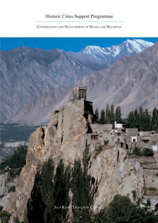
  • 1. Historic Cities Support Programme CONSERVATION AND DEVELOPMENT IN HUNZA AND BALTISTAN AGA KHAN TRUST FOR CULTURE 1-3 Avenue de la Paix, 1202 Geneva, Switzerland Telephone: (41.22) 909 72 00 Facsimile: (41.22) 909 72 92 www. akdn.org AGA KHAN TRUST FOR CULTURE
  • 2. THE IMAMAT AGA KHAN DEVELOPMENT NETWORK Economic Social Culture Development Development Aga Khan Fund for Aga Khan Agency Aga Khan Aga Khan University of Aga Khan Trust Economic Development for Microfinance Foundation University Central Asia for Culture Tourism Promotion Industrial Promotion Aga Khan Education Services Aga Khan Award Historic Cities Services Services for Architecture Support Programme Aga Khan Health Services Financial Media Education and Services Services Aga Khan Planning and Culture Programme Building Services Music ArchNet Humanities Museum Initiative Project Projects Aga Khan Program for Islamic Architecture at Harvard University and Massachusetts Institute of Technology Cover photograph: view of Altit Fort, Hunza, by Gary Otte, 2004 www. akdn.org
  • 3. TABLE OF CONTENTS 2 INTRODUCTION Stefano Bianca 7 THE CONSERVATION OF BALTIT FORT Richard Hughes 25 BALTIT FORT MUSEUM AND CULTURAL CENTRE Didier Lefort 31 S T E E R I N G T H E T R A N S F O R M AT I O N O F THE PHYSICAL ENVIRONMENT IN HUNZA Masood Khan 53 CULTURAL DEVELOPMENT PROJECTS IN BALTISTAN Izhar Hunzai and Salman Beg 65 THE REHABILITATION OF SHIGAR PALACE Masood Khan and Stefano Bianca 1
  • 4. INTRODUCTION Stefano Bianca, Director, Historic Cities Support Programme H unza and Baltistan, two high valleys located in the upper catchment area of the River Indus and deep within the Karakoram mountain range, abound with spectacular treasures of nature: 8000-metre-high mountain peaks, endless glaciers, rare flora and fauna, as well as beautiful, terraced fields using ingenious irrigation techniques, which attest to the efforts of man to make the best use of nature under harsh living conditions. In spite of their relative seclusion and inaccessibility, the valleys have provided the scene for important movements of cultural exchange. In Hunza, tales about Alexander the Great and his army are still part of living oral traditions transmitted by the village elders, and relations with China, as part of the centuries-old Silk Route system, have remained strong. In Baltistan, there is evidence of old cultural connections with Tibet and with Kashmir, both traditions leaving their imprint on its architectural heritage, which has, in its turn influenced the historic building styles of Hunza. This unique blend of nature’s pristine splendour and the wealth of local building traditions did not escape the curiosity of early Western explorers and scientists, nor has the geopolitical importance of the area gone unnoticed. In the late-nineteenth century, Hunza was an important arena of the “Great Game” – the power struggle between Russia, China and the British Empire. It was not until the late 1970s, however, that the Northern Areas of Pakistan became widely accessible through the construction of the Karakoram Highway between Islamabad and Kashgar. Within just a few years, the new road exposed the inhabitants to the impact of modern Western civilisation. Today’s situation is characterised by the inevitable clash between, on the one hand, an archaic, inward- looking mountain society (whose feudal traditions had lasted until 1974), and, on the other hand, a modern 2
  • 5. industrial civilisation with the combined impact of its secular governance systems, mechanisation, capitalist economy and powerful, omnipresent communication tools. Whenever precious but endangered local tradi- tions are exposed to a new (and often disruptive) type of development, fundamental questions arise, such as: How can the shock resulting from the sudden, compressed impact of modern civilisation be absorbed without destroying intrinsic traditional values and achievements? How can the dynamic forces of “progress” be tamed, adapted and integrated into local customs and living traditions? How can the existing cultural resources and social assets of local communities, rather than being ignored or suppressed, be enhanced to become driving factors of a controlled and fruitful evolution? The projects and activities presented in this publication do not claim to have definitive answers to these pressing issues, nor are they based on any specific ideological premises. Yet, they are conscious of the given context and respectful of the values at stake, and they try to respond in a pragmatic manner to perceived needs and opportunities that emerge through continued dialogue with local communities. Any intervention in such circumstances is experimental by necessity, insofar as it is without precedent. Strategies and procedures have to evolve on the basis of continuous feed-back from the field, because they apply to an environment which is in full transition, moving rapidly from an ancient rural way of life towards more urban living conditions. Moreover, no such intervention can rely on a “static” framework of given parameters, since the reference points are constantly changing as part of ongoing worldwide development trends. The underlying changes in social and cultural paradigms may not always be explicit but constitute important factors in ongoing development trends. Many of the traditional social conventions, which use to hold the community together in the past have been weakened over the last few decades. Meanwhile, modern governance 3
  • 6. tools of a much more abstract nature tend to be substituted for them but are far from being absorbed and internalised by local communities, and are hence not fully effective. The current planning effort, then, has had to operate in a sort of ambiguous institutional vacuum. Arising problems could, however, be overcome by drawing on the cooperation, goodwill and insight of the community and its representatives, and this has added a distinctive social quality to the development process. In such a situation of transition and uncertainty, cultural heritage has a particular role to play, since it can inspire the self-confidence, social coherence and emotional stability needed to achieve cultural continuity. This, however, presupposes that local communities are put into a position to view their tradition with new eyes: Instead of taking it for granted, they need to assess it and to retain what is of value by conscious choice – which may also involve an initial detachment. Occasionally, they may need to free inherited traditions of old, obsolete and even oppressive connotations, in order to reclaim their deeper meaning and to re-activate vital energies from within. Outsiders can often help in this process of reclaiming cultural identity, precisely because they are detached enough to discern and appreciate values, which those still immersed in old prac- tices may tend to overlook when suddenly confronted with radically new lifestyles and attitudes. To help release consciousness about the deeper values of a local society’s own tradition thus appears to be a matter of dialogue; but an abstract, theoretical discourse will hardly be effective, particularly when it comes to the crucial interaction between people and their built environment. Tangible projects are needed which visualise and demonstrate how certain aspects of a contemporary lifestyle can be reconciled with and incorporated into traditional patterns of life. While strict conservation principles may apply to unique landmark buildings, the traditional historic fabric must be allowed to evolve and to assimilate modern technical facilities, such as electricity and sanitation. To become productive and socially acceptable, conservation must therefore be made an integral part of development, and vice-versa. This deceptively simple statement is at the very heart of the philosophy of the Historic Cities Support Programme and has guided all its interventions since 1992. The restoration of Baltit Fort as a renewed symbol of cultural identity and civic pride served as the springboard for these efforts. It not only brought employment to the area but also helped revive meaningful traditional building techniques which are now being replicated by people in the rehabilitation of their own houses. Saving the old village of Baltit, beneath the Fort, from being abandoned in favour of scattered and unsuitable modern construction in the precious fields and terraced orchards around the village was the next important step. Moving out the cattle from the houses, paving the streets and providing proper sanitation to each house was a negotiated collective rehabilitation effort which directly engaged the local community in terms of both thinking pro- cesses and using their own hands. Eventually, the project became a living demonstration of the fact that old cultural traditions and modern technical resources need not be incompatible. These endeavours have been highly successful and motivated the community to start thinking about strategic development issues, such as planning of roads and public facilities, general land use, the impact of tourism and the preservation of precious cultural and natural assets as a basis for sustainable economic development. Through this very effort, it has been possible to nurture new institutions such as the Karimabad Town Management Society (TMS) and the Karakoram Area Development Organisation (KADO), followed by the Shigar Town Management Society and the Baltistan Cultural Foundation (BCF). The active participation and follow-up provided by these community-based institutions has been and remains essential to the success of the various projects. 4
  • 7. Without going into any more detail here, it is worth noting that the implemented projects have set in motion a self-propelled reha- bilitation process, which will gain momentum with each step forward. Staff training and education of local communities through the very implementation process has been a major factor in its success. Another factor is the continued support by a great number of institutions and individuals who have been involved over the past years. In particular, I would like to thank the partner agencies who have – conceptually and financially – sup- ported this innovative cultural development endeavour. The Norwegian Development Agency (NORAD) contributed significantly to the village rehabilitation projects in Karimabad and Ganish. It also co-financed the restora- tion of Shigar Fort and was instrumental in setting up a donor coalition for Baltistan. The Japanese Embassy in Islamabad has generously contributed to the rehabilitation programme in Altit and several historic set- tlements in Baltistan through its Grass-Roots Assistance Programme. The Swiss Develop- ment Agency (SDC ) was instrumental in launching handicraft development projects in both Hunza and Baltistan and in nurturing the growth of corresponding local institutions. Financial contributions from the Getty Grant Program towards the con- servation of Baltit Fort are gratefully acknowledged. Finally, cooperation with the International Union for the Conservation of Nature (IUCN) under the sponsorship of NORAD resulted in an innovative linkage between natural and cultural heritage inventories. While direct community involvement was essential for the successful implementation of the various projects described in this publication, support from local government agencies was equally important. Their relevance will increase in the future, particularly regarding legal back-up for the decisions of the Town Management Societies and public-sector investments in infrastructure, schools, hospitals, etc. In this respect, a fruitful cooperation with successive Chief Secretaries of the Northern Areas and the Public Works Department has already been put in place over the past years. Without their continued cooperation and support, many of the presented programme achievements would have been impossible. Panorama of the Hunza valley (Courtesy of the National Geographic Society). Map of the Northern Region of Pakistan, with Hunza located north and Baltistan south-east of Gilgit. 5
  • 8. 6
  • 9. THE CONSERVATION OF BALTIT FORT Richard Hughes, Conservation Engineer THE ENVIRONMENT T he Hunza Valley, a region within the Northern Areas of Pakistan, close to the border with China, reflects the dramatic terrain of the Karakoram Mountain Range, one of the world’s most actively forming landscapes. The Karakoram mountains, created by tectonic forces asso- ciated with continental drift, are raised by more than one centimetre each year. At the same time, geomorphological erosion processes continue to take place, making the Indus river one of the world’s greatest trans- porters of stone and sediment. Prone to natural disasters – floods, rock falls, avalanches and land slides – the area also offers spectacular and ever-varying vistas of steep slopes, rugged peaks, snake-like glaciers, View in 1984 of Baltit Fort in a and precipitous gorges. Within a radius of 100 kilometres, 32 mountain fragile state, before restoration peaks range in height from 5,500 to 7,500 metres, making this the most works began in 1992. rugged area in the world. Prior to the late 1960s, there was no access to the region, and tracking overland on foot from the villages of Gilgit to Baltit used to take up to four days: “For nearly half a mile it was necessary to scramble over rocky ledges, sometimes letting oneself down nearly to the water’s edge, then ascend- ing three-to-four hundred feet above the stream, holding on by corners of rocks, working along rocky shelves three-to-four inches wide, and around projecting knobs and corners where no four-footed animal less agile than a wild goat could find a path.” (From J. Biddulph, “Tribes of the Hindu Kush”, Calcutta 1880.) Habitation in the Karakoram mountains testifies to the endurance of its inhabitants. The entire valley floor is a mountain desert, with only 100 to 200 millimetres of rainfall per year. Granular soils have no organic content and thus support little vegetation except for shrub growth. Originally, the precipitous mountain slopes above 2,000 metres were heavily wooded, but these resources have been long ago depleted for fuel and building materials. The early settlements, nomadic at first, were all set on stable sites near stream waters or not too far above Left page: Baltit Fort in 1996 after the main valley floor. Expansion to higher and more exposed areas restoration, sits proudly looking out was made possible by bringing water from the nearest glacial streams over the Hunza Valley and the upper via channels cut into and traversing the mountain-sides for up to ten village of Karimabad. kilometres. These contoured water channels are wonderful examples 7
  • 10. of local engineering, ensuring until today the survival of the villages by irrigating their terraced fields. “The villages are in clusters of little stone huts, and in many hamlets there is a tower three storeys high. Most of the huts are diminutive, with rooms only eight or ten feet in diameter, and an entrance door two feet wide and two-and-a-half feet high. In the lower rooms one can barely stand up, but there is a notched pole used as a ladder to an upper room which is less cave-like. Many of the upper rooms are made in wattle, sometimes plastered over with clay. The mosques are of similar con- struction to the houses, but of more woodwork, large front verandas, and much beautiful ill-finished carving.” (From A. Neve, “Thirty Years in Kashmir”, London 1913.) THE SITE Beyond the main gorges of the lower Hunza valley, the landscape sud- denly opens into a broad, green valley edged with continuous, mighty, grey scree slopes more than 1,000 metres high and perhaps 15 kilometres across their base. The valley has no single floor, but is a complex ar- rangement of partly denuded terraces, plateaux, side gorges and slopes of many angles. Yet, most of the distant landscape is green and testifies to the remarkable achievements in farming over the last 1,000 years. Only on the lower flood plains can flat land be found with fields large enough to now be ploughed with a tractor. Everywhere else, the sides of the valley are terraced with minute, meandering fields, all supported by typical rubble walls. Roundish field stones, meticulously graded for size, are carefully located to form the walls. Poplar and willow trees punctuate the landscape and somewhat mask the fields, but introduce a vertical element in contrast to the low contours created by the terrace walls. Baltit Fort is located at the top of a natural amphitheatre formed by such terraced slopes, and the site was carefully chosen to control water extraction routes from the Ultar water channel (nullah) behind. Water discharge from this catchment is fed throughout the district, sustaining agriculture and, in turn, habitation. Today, as always, water is carefully controlled and monitored by appointed village committees. Hereditary rights on water are complex, and have become more so as systems of secondary and tertiary channels have been added to the primary routes and as inheritances have repeatedly divided the surrounding fields into a jigsaw puzzle of ownership. Villagers reinforcing the walls of an irrigation channel, which parallels Baltit village, re-named Karimabad by its inhabitants in honour of the the river below. Aga Khan, is a very old settlement, and the size of the Fort which domi- 8
  • 11. nates the village grew in response to the expansion and importance of Aerial view of Baltit Fort the settlement. The villages of Ganish and Altit, the other two original (before restoration) above the village. settlements of Hunza, are said to share a common ancestry with Baltit, The terraced slopes of the steep peak resulting from migration into Hunza from Gor, an extremely old vil- can be seen, as well as the stairway lage located south of Gilgit, high up in the hills facing Chilas. Ganish leading to the entrance. village is situated on a plateau on the edge of the main river gorge, surrounded by large, fertile fields, and still today retains very much of Typical housing clusters with its original form. Altit village also developed around a fort, and is built terraced agricultural fields. in a commanding position on a white marble bluff 600 to 700 metres above the main river. Yet the focal point of the valley has always been the fort at Baltit. “In the afternoon we were taken to see the old Palace, which is surely the most impressively situated mediaeval castle in the world. Its three storeys are built entirely of timber (if the building had been of stone it would have been destroyed by earthquakes long ago) and stands on a crag, around the base of which cluster picturesquely the not less ancient wooden houses of the Wazir and other functionaries. Immediately behind the castle is an abyss, the bottom of which cannot be seen however much you crane your neck, and close behind that again rise ice-crowned cliffs 9
  • 12. and glaciers to a height of 24,000 feet above the sea, second only to those of Rakaposhi in appalling perpendicularity. The woodwork of the castle’s interior is black with age, and the balustrades are highly polished by the touch of countless hands; nor is this surprising, for the palace is six hundred years old. On the top floor we found a suite of guest rooms, simply furnished with bright-coloured modern Kotan rugs and chairs locally made and carved. On the walls hang portraits of former Mirs and photographs presented to the Mir by “Sahibs” of his acquaintance. There is also a little collection of clocks, cups and other souvenirs of European friendships, and a few heirlooms such as a richly damascened sword and dagger handed down from Mir to Mir for centuries. But the glory of the Mir’s castle is the view from its windows.” (From C.P. Skrine, “Chinese Central Asia”, Methuen 1925.) When visited in 1979, Baltit Fort seemed a labyrinth of dark, smelly and dusty rooms. All the roofs were decayed and pierced by holes, renders were full of cracks, and walls were leaning precariously outside of the foundation lines. Yet, the fort had an undeniably unique and distinctive character. The massive structure remained delicately poised atop the soil cliff, and revealed wood construction detailing purposely arranged to better resist earthquakes. The archaeological value of the site and struc- ture was important, yielding strong evidence of a continuous historical past and very little evidence of modernity. More importantly, the build- ing still dominated and controlled contemporary life in Karimabad and Hunza. For the consultant team of Richard Hughes and Didier Lefort, the structure, although in precarious condition, was a masterpiece of craftsmanship, thoroughly adapted to climate and function, and the focus of the village settlement. The team considered it important not only to preserve the fort for posterity, but also for the valuable lessons it might provide for environmentally suitable building technology in general, as well as for building programmes being contemplated in the region. T H E H I S T O RY O F T H E F O RT Above: Baltit village and the fort More than 70 phases of construction have been identified by archaeo- pictured in 1934. logical techniques during the survey and conservation of Baltit Fort. Below: Mir Nazim Khan and Since one of the earliest phases of Baltit has been dated by Carbon 14 his retinue in front of the royal tests to more than 700 years, it is now clear that the present building dais in 1926. (D.L.R. Lorimer) grew as a response to local and external pressures. The original glacier moraine pinnacle was first settled by one or two single-storey houses, one with an attached defensive tower. This form of house was common throughout the valley, and examples are still to be seen in the Indus valley to the south of Gilgit. Attached to the houses would have been animal pens – an overall cluster configuration much like that still seen 10
  • 13. in the historic core of Karimabad village. As a result of many additions, the two properties were merged together, perhaps with tunnel-like pas- sageways between them. This complex then became the core of a grand Fort that changed sev- eral times in response to its growing importance. Baltit was clearly at a vital control point over the water supply out of the Ultar water channel, and no doubt the Fort owner was growing rich from booty obtained by raiding the trading routes between Persia and China some 300 kilome- tres to the north. As a result, the Fort was transformed several times, adding various towers and then a second storey. Some stages in the development of the Fort can be seen in the illustrations at right, which in turn can be related to details observed within the analysed historic structure. It was probably less than 150 years ago that the present west facade was built – perhaps to replace the rather decayed inner curtain wall or to generate a grander appearance. The external walls in the east side of Baltit are known from late-19th century photographs to have been considerably different – a series of linked walls formed by the rear walls of the earlier houses. The present front wall overlooking the village thus is a rationalisation undertaken in the early years of the 20th century when the Mir gentrified the whole top floor of the vernacular Fort to transform it into a palace, with many features drawn from British colonial buildings of the Punjab. The first floor level was left much as it had been in the 19th century, and the area for women and the Mir’s bedroom, on the second floor, behind the grand reception rooms, were also maintained in a traditional arrangement. These now constitute some of the finest rooms in the Fort and have been left untouched. Other second floor rooms were modified for the Mir’s private use, with the installation of fireplaces and Western furniture, and the use of wallpapers, curtains, and cement renders. The remodelling also included the introduction of a semi-round royal dais, mud-block walls, coloured glass windows, the Tibetan-style lantern, wood-planked and decorated ceilings, and wall-mounted fireplaces in many of the modernised rooms. Two roof mosques were removed, leaving the last one that has now been fully reinstated. Finally, one major four-storey tower was demolished at the north end of the Fort, as witnessed by a blocked doorway in the present north facade. The remodelling of Baltit Fort during the early twentieth century was Hypothetical evolution of Baltit often undertaken without considering the structural system of the lower Fort, depicting the various building rooms. For example, it was found during the conservation works that stages and ending with its the upper level walls were mis-aligned with regard to those below. current condition. While this helped to generate the more spacious rooms where important (Diagrams: Richard Hughes.) 11
  • 14. international guests could be received and entertained, it resulted in structural deformations. The impressive structure of the Fort as seen today is the end product of all these changes, which had to be respected in the conservation project, even if they were less than 100 years old. When first inspected, the fort had been empty and not maintained for almost half a century – hence the leaning walls, roof holes and graffiti all over the mud-stained, white-washed renders. Most possessions of mon- etary value had been long ago transferred to the Mir’s present palace, or given away or stolen. Only a variety of faded photographs and a range of local items, all in battered condition, remained within the deserted shell of the fort, providing some charm for the occasional visitors. Second floor courtyard with rearside of the Mir’s waiting room and If the fragile structure had been permitted to collapse, Hunza clearly access to the roof terrace. On the would have lost its major landmark and an important part of its cultural roof, the Tibetan type lantern of the identity. The Aga Khan Trust for Culture engaged the team of Hughes waiting room and a small prayer and Lefort in 1985 to develop proposals which would save Baltit Fort hall (see also page 21 and plans on from further decay, and to formulate an imaginative programme for the page 27). full-scale conservation of the complex. Early support for the project had been granted by the Royal Geographical Society as a complement to its 1980 International Karakoram Expedition, and significant additional funding for the early survey, documentary research, and project formu- lation was provided by the United Nations Development Programme (Pakistan) in 1984. The emphasis was placed upon preservation of the monument, employing high quality conservation technologies known in Europe. Additional importance was given to preserving the timber Western Elevation 12
  • 15. lacing and cribbage work, as a means of demonstrating the value of this unique engineering and construction system in resisting earthquakes and of reviving traditional local skills and crafts. C O N S E R VAT I O N P R I N C I P L E S AND PROCEDURES Before implementing the conservation plans for the Fort, an appropri- ate legal mechanism had to be set in place to transfer Baltit Fort from private to public ownership. This was achieved through the creation of a new public foundation, the Baltit Heritage Trust (BHT), which would take responsibility for the fort’s future maintenance. The transfer was greatly facilitated by the generosity of the Mir and his family, who had owned the fort for centuries. A preliminary programme for the re-use of the restored fort as a museum was established in consultation with the BHT, which was also given responsibility to secure long-term funding for the fort operation. These objectives were endorsed by the Getty Grant Foundation, which provided additional funding for the conservation of the fort through the BHT in 1991. The physical conservation of the fort was conceived by the Trust and the consultants to meet several inter-related objectives: through the rig- orous application of the highest international standards of conservation The royal dais and the throughout all phases of the work, it would serve as a demonstration of projecting balcony added in the excellence not only in the Northern Areas but throughout Pakistan and early-20th century, before the region. Training of local personnel in the principles and methods of and after restoration. conservation would establish a pool of qualified professionals capable of undertaking further restoration projects in the future; special research would also stimulate the study and understanding of other important structures in the Northern Areas, and encourage scholarly exchange, dialogue and publication; and finally, the wider range of expertise required to achieve the project would act as a stimulus and provide training in a broad range of sciences, from geology to archaeology, from engineering to timber construction techniques, and from museology to public and community administration. The conservation of Baltit Fort was planned in stages. To begin with, work was undertaken to determine and then remedy the structural prob- lems around the foundations and load-bearing walls. This reinstatement then allowed for conservation of the architectural fabric and finishes, followed by the insertion of new elements required for the new uses and safety of the existing structure. In practice, the reinstatement phase was often amalgamated with the engineering repairs: for example, while a wall at the south end was still being under-pinned with new foundations, 13
  • 16. the emergency stairs at the north end were being inserted, and, in the mid- dle, render was being variously patched and white-washed. Some of the early problems faced in the project were due to the hidden nature of most structural defects, which were difficult to assess prior to the actual works. Since this was to be the first conservation project undertaken in the Northern Areas, the project was conceived as a learning process for everyone involved. The remote location of Hunza, and the distance from regional administrative and finance centres in Karachi, and the Trust headquarters in Geneva, added operational complications which had to be overcome. A site team of young Pakistani architects, most of them from the Above: The scaffolded Baltit Fort Northern Areas, was composed under the leadership of the consultants during restoration works. Richard Hughes and Didier Lefort. Because heavy engineering was to Below: Repairing the terraces and be the focus for the first four years of the site programme, a resident retaining walls below the fort (see structural engineer was also engaged. The site workers were all drawn page 15) and anchoring them in the from the local community. Supplementary training for a number of slope was a major initial task. young architects and engineers was provided through conservation courses in Europe, during the less-active winter months. The Aga Khan Housing Board, with its proven building experience in these areas, took on the responsibility for construction management. From the inception, it was agreed that if the conservation was to surpass emergency actions to prevent collapse of the fort, the scope of interven- tions would have to be judged by prevailing international standards. Thus, an important objective was to ensure that the conservation retain the historic character and appearance of the fort. Careful records were kept to document the entire project and the restoration process before, during and after each component of work, and particular attention was paid to record and describe those elements made of non-durable ma- terials. Even the drawing conventions were designed beforehand, and a drawing style more archaeological than architectural was adopted to better reflect the character of the building. Samples of the original ma- terials were taken and preserved to be available for the future study of all walls, floors and ceilings that were examined and repaired. Similar principles were applied to the investigations below ground level, and soil samples and all discovered artefacts were documented and retained as museum resources. Another guiding principle was to base the restoration of missing fea- tures, such as those essential for safety and structural reasons, on sound archaeological evidence. When new elements were required, the modern materials and techniques employed are readily distinguishable, such as in the metal grille floor, for example, or the emergency staircase. 14
  • 17. These new elements comprise features of the contemporary history of the building, and have been undertaken in ways sympathetic to the original structure. Modern techniques were used whenever interventions could not be achieved to appropriate levels of safety with traditional technology. Following considerable research, experimentation and design, modern materials were determined necessary for the tie-ropes, soil-reinforcement and stabilisation, and wood preservatives. The uti- lisation of “Parafil” tie-ropes and “Geo-mesh” soil-reinforcement are the first application of these technologies in historic buildings anywhere in the world. None of these conservation works involved alteration of the original structural system or its proven resistance to earthquakes. If an attempt had been made to make the building stiffer or more flex- ible, the risk of future damage due to ground movement would have been potentially greater. This is well demonstrated by the southwest tower, which was and still is a free-standing structure, not tied to the rest of the building. All modern insertions needed for the re-use of the Fort were designed in such a fashion as to permit them to be removed or altered, if necessary, in the future, without damage to the adjacent components of the original fabric. This was readily achieved for most new com- ponents, such as the emergency stairs and grille floor, but was not always possible or practical. One example of alternatives adopted was Restored retaining walls at the foot of the fort. Northern Elevation 15
  • 18. the grouting of internal cavities to stabilise the cores of some walls. Another intervention was the installation of a new, suspended floor for the area foreseen as a public library. This scheme permits visitors to view beneath it and inspect the archaeological features discovered during the early engineering works. No compromise was permitted on the treatment of the west and south facades. Traditionally, these timber and rubble walls had been left exposed, and were later covered with mud render. In about 1900, Mir Mohammed Nazim Khan, perhaps under British influence, had the walls white-washed. The resulting impact, from a distance, of the white-washed facades against the otherwise grey, mountain backdrop Stripping the interior of the building became one of the most renowned and cherished aspects of the fort. “to the bones” in order to analyse Some consideration was given to returning these walls to their earlier structural defects. character, but this would also have required the removal of many other features and was therefore abandoned in favour of the soft, white render seen today. 16
  • 19. STRUCTURAL PROBLEMS Early investigations showed that the most significant defects of the fort resulted from the interaction of the structure with the ground. Some of the defects resulted from siting, since the earliest phases of the building were erected on top of the moraine, where the soils are hard on surface and feature large boulders. Deep foundations were required on slopes where the in-situ soils are loose, and thus the foundations were designed to also act as retaining walls. Similarly, deep foundations were required on areas where fill had been deposited to extend the size of the site, or thrown off the roofs onto the slopes during maintenance. In some instances, ground works did not exist, such as for later additions that were put up as minor extensions, or for rooms built over pre-existing retaining walls of unknown foundation character. Generally, the original foundations were roughly formed with rubble stone, not put together particularly well, and with longitudinal timber beams (cators) that were placed casually, and not always crafted in a well-carpentered system. For example, most cross pieces were actually bits of irregular logs, occasionally not pegged to the longitudinal cators. The foundations were normally no wider than the walls placed above them, and do not display the use of timber box work (cribbages) that characterises the superstructure. The overall footing system is therefore fairly discontinuous from the walls above. However, the complex system provides some flexibility, therefore accommodating substantial settle- Monitoring structural movements ment and bridging between extremely soft soils and hard boulders. during restoration works. Left page: The original “cage” construction of load-bearing walls, stripped of defective stone and mud infill which is to be replaced. To the left, a more recent layer of the western outer wall, now being tied to the opposite outer wall by a tensile cable. Right: Diagram of the typical construction of buildings in the Northern Areas, with reinforcing “cribbage” structures in the corners and horizontal “cators” stabilising the walls. 17
  • 20. It is clear that the early builders understood and appreciated the qualities of the soil and were able to match building loads to soil strengths. Over the centuries, however, the structure of the Fort underwent continuous change, often by the addition of second-storey rooms, or peripheral rooms lower down the more unstable slopes. The overall result was the super- imposition of additional loads on foundations designed for single-level structures. The surcharging of some walls was not helped by additional superstructure walls placed eccentrically on the ones below. The increased load pattern helps to explain the structural deforma- tion which occurred at different times throughout the history of the Fort. Some immediate movement would have occurred at the time of construction, as the foundation soils readjusted and consolidated themselves. The stabilisation of the structure was enhanced by the ca- tors and cribbage work, which allowed for the redistribution of loads at foundation levels, since the elasticity of the wood resists settlement. The cribbage system ingeniously channels forces away from weak spots to areas where foundations could be more firmly sited, and provides corner rigidity. Along with the square pegs which the cribbage system features, distortion of its square form into a trapezium is made difficult and provides far greater strength than quoin systems in rubble stone walls. The cribbage work, with its system of well-pegged joints, may The central first floor arrival also have some capacity to act in tension, thereby helping to resist up- lobby of the Baltit Fort before and lift forces induced during earthquakes. after restoration. The stairs lead up to the second floor terrace and The engineering programme was based on a concept of 13 work stations the royal dais. that divided the fort into structurally independent units. Each station comprised a portion of the main facade and the set of rooms located behind it. At each of the 13 stations, work followed successive steps in a similar agenda: survey, investigation, structural remedy, reinstatement and documentation. Interventions followed a progressive sequence, beginning with temporary and preparatory works followed by treatment of the foundations. The conservation of wooden wall elements then led to structural strengthening, the replacement and/or reinforcement of stone and mud mortar infill, and the treatment of surrounding retaining walls. Finally, the replacement and/or conservation of roofs and floors was followed by the reinstatement of finishes. Work proceeded on two or more adjacent work stations at the same time. Stabilisation of the south and north ends of the Fort was under- taken before proceeding to the west and east facades, where most of the structural work was anticipated. This sequence also allowed experience to be gained prior to beginning work on the walls that were dramatically out of plumb and temporarily supported to prevent risk of failing. The 18
  • 21. concept of work stations also responded to the shortage of scaffolding, which was to be moved as work progressed from station to station. The greatest problems were presented by the main, west facade, which showed active and old signs of severe tilting and bowing; column sup- ports had already been inserted below the cantilevered verandas in the 1930’s and 1940s to resolve some of these problems. For the current work, the complex series of walls which comprise the west facade was first stabilised at the two ends, thereby helping to anchor the middle section where there were most problems. It was already known that the western end of the southern wall had settled by some 40 centimetres. During the works, movement was reactivated as a result of exceptionally heavy rains, and further demonstrated the major faults in these founda- tions that had been built over very soft soils. However, the southwest tower proved very stable during the rains, indicating that the soil below could support new foundations. R E PA I R W O R K S In 1994, work was resumed to complete restoration of the west facade. The white-washed render, most of which had become detached due to bowing, had to be removed in light of structural failures discovered behind. Since the wall was so thin – less than 40 centimetres thick – it was necessary to passively restrain it with temporary “Parafil” ropes across to the other side of the fort. This permitted excavation of the high ground level in the rooms behind, and the walls (including some at the Baltit Fort from the north (back) higher level) were dismantled as necessary and then permanently tied or side, facing the ravine, after slightly pushed back, as appropriate. The in-fill of the walls could then restoration was completed. be replaced, and the inside ground levels re-established, incorporating “Geo-mesh” reinforcement. This is a high-strength polymer mesh that helps redistribute horizontal loads as vertical forces, thereby relieving lateral pressure on the walls. External and internal renders were only reinstated in 1995, after the building had had time to readjust in response to the new interventions. The south facade was stabilised by the insertion of new foundations at both ends; the middle section was left to span between the new foun- dations, easily achieved due to the horizontal timber cators. The new foundations are vertical columns of cribbage timber and stone sunk to hard moraine at six metres below ground level. Their construction was difficult and complex, and relied greatly on the courage and dexterity of the workers. The deep excavations required careful reinforcement with struts, since the ground was loose and contained large boulders; the walls above the super-structure walls, many thousands of kilograms 19
  • 22. in weight, were temporarily supported on gigantic needle beams and hydraulic jacks, and left suspended while work took place below. The two southeast towers were found to be pulling away from the main structure, which was not surprising as they turned out to have been built with no foundations at all. The tower walls were also left suspended while new foundations were inserted beneath them, with reinforced concrete bases made as large as possible so that the load could be widely distributed and not, as before, acting only vertically downwards. The walls above were then tied to the main structure so they could effectively act as buttresses. Since four metres of soil were located behind the south facade, the ground level of the rooms behind was lowered, with the intention of inserting “Geo-mesh” soil reinforcement to reduce the potential of bowing. During these works, however, important archaeological features were discovered, and the internal grade was therefore left at the reduced level to permit view of the archaeological remains. A suspended timber floor was provided for the area, which now serves as a library. The north end of the Fort proved to be more stable, with foundations resting a small depth below ground on hard moraine. Throughout the site works, the existing cracks had moved little more than one mil- Above: The defensive guards’ limetre. Therefore, work on the north facade was fabric repair only. gallery running along the western Though the timber frame was still sound, the wooden members were front of the Fort, now part somewhat distorted due to exposure, and to the falling-out of stone, in of the exhibition circuit. the lower levels, and of mud blocks in the higher level. The insertion of Below: The study room and the new emergency staircase provided the opportunity to rectify some library installed in one of the of these distortions and to use stabilised soil blocks, especially designed former guestrooms. to replicate the originals, since the north facade is a superb demonstra- tion of construction phases and techniques. Limited underpinning was necessary in the two northern corners to provide some extra security to the structure. While it had been relatively easy to detect localised soil weaknesses as signalled by defects, it was sometimes not possible to rectify the underly- ing problems, for several reasons. First, some areas of loose soil were very deep, often more than five metres, and excavation to such depths would have jeopardised more stable soils in adjacent areas. Second, drilling holes for grouting for stabilising the foundations was ruled out, since water flush systems would have caused soil settlement, and air flush would possibly have moved around the stones and damaged the drill holes. Third, grouting of a cavity-prone material would have risked surcharging the ground, thereby making the settlement larger, not smaller; it could also have caused bowing in nearby retaining walls as 20
  • 23. the grout found its own way downward into uncharted soil conditions. The uppermost terrace of the In cases where walls were found to be settling or where soil was particu- restored fort, with the lantern of the larly loose, one technique employed was to increase foundation widths Waiting Room, the small prayer hall to stepped strip footings, thereby reducing bearing pressures. Another and the northern defensive tower. technique was to span weak areas below the foundations with timber cators, in a fashion similar to placing lintels above window openings. Important interventions were required at foundation level, as many sections of the fort lacked foundations altogether, or those that existed were built on very soft soils composed of loose rubble or straw debris. Considerably more effort was required at the south end of the Fort than had been expected, due to the provision of a modern library and because of the discovery of archaeologically important structures. The timber cator and cribbage systems were better preserved than first considered. Major decay was only encountered at limited locations – at roof beam ends and just below ground – where rain had consistently penetrated. In most walls, the cators were found to be sound; though somewhat distorted, they were structurally stable under the existing 21
  • 24. engineering conditions. Although initial estimates forecast replacement of 10% of the structural timbers, replacement of only 2 percent was actually required. Additionally, the soundness of the timbers required a lesser quantity of the imported “Boracol” preservation chemical, and the surplus is now available for long-term maintenance. Considerable restructuring of the west facade had been predicted, due to its severe outward tilt of 1.3 metres. However, these early estimates were later reduced since the cator and cribbage systems provided excellent re- straint, and tying the walls with “Parafil” rope allowed them to be kept relatively intact. The cator system proved to be particularly effective in restraining the lateral pressure of earth-fill located behind outward bowing walls. This condition was encountered particularly in the south and west facades, though surplus fill was partially removed to lessen the lateral loading. One alternative employed was to excavate and replace the earth with fill laminated with geo-textile material. This solution was adopted in cases of structural deformation where it was not possible to strengthen the existing walls with additional cators and cribbage columns. A major weaknesses of the fort, like most houses in Hunza, was the decay of wooden roof beams and planking and rush roof-covering due to the penetration of rainwater. Engineered for ease of construction and maintenance, rigidity and wall connections were of little concern in roof construction and, not surprisingly, reveal no conception of the potential View of the western front side of for roof structures to act as shear plates to resist torsional motion during the restored Baltit Fort, from the earthquakes. Considerable research was devoted to improvement of the steep stone-paved walk-way leading fort roof coverings, particularly to help prevent rainwater penetration, up from the village. The windows as well as scuff and damage caused by the shoes of visitors. Although and balconies of the early-20th not frequent, rainfall in Hunza can be quite intensive and damaging, century additions are clearly seen. since the soils do not contain any clay, a natural cementing agent that (For interior views see impedes water infiltration. Regular maintenance will still be required pages 23 and 29.) to ensure the long-term durability of the roof coverings. Replacement of the soil surface on the roofs will be needed at intervals of about five years in order to ensure impermeability. At the same time that the walls of the second floor were undergoing conservation, teams worked on replacing the numerous roofs. Most were dismantled, and each and every piece of wood was carefully drawn and marked on a large-scale plan, thus permitting reinstatement to the origi- nal position and allowing the specification of necessary conservation treatments. The removal of the roofs also facilitated works undertaken on the supporting walls below, and for the amelioration of more effec- tive drainage gradients in the new coverings. 22
  • 25. STRUCTURAL MONITORING AND MAINTENANCE Since 1984, the entire fort has been continuously monitored to determine the extent and location of structural movement. Displacements in the form of visible cracks were measured and monitored for two years prior to the engineering works. In areas where active movement was found, scientific instrumentation was employed for more precise monitoring, allowing movements as small as 0.1 millimetres to be detected on a daily, weekly or monthly basis. For the project team, changes of two- dimensional movement of more than two-to-three millimetres were given priority attention. The instrumentation recorded movement at the location of cracks but, since the fort has a timber frame, the cause of Above: The Queen’s (“Rani’s”) the movement can often be located at some distance from the visible summer courtyard on the effects, and shifts may result in sudden and abrupt cracks. Later during second upper floor. the works, electrical gauges were installed to identify those locations Below: A detail of the restored where increasing strain could cause sudden jolts and thus instantly western bay window. increase the separations made evident by the cracks. 23
  • 26. 24
  • 27. BALTIT FORT MUSEUM AND CULTURAL CENTRE Didier Lefort, Architect / Exhibition Designer A part from its importance as an historic monument, Baltit Fort has great cultural and symbolic value for the local community and constitutes a major economic resource for tourism. Re-use of the fort, therefore, had to respond to a variety of concerns: it needed to meet the constraints imposed by architectural conservation; it needed to enhance and promote the cultural values of a living (and evolving) culture; it needed to contribute to the economic opportunities for the residents of the village; and it needed to generate sufficient income to sustain its operation and maintenance costs. Accordingly, the main uses selected for the restored fort were those of a museum and active cultural centre with associated facilities. The fort is expected to act as a focal point for research on local traditions, and as a centre for exchange between international institutions interested in the Northern Areas in need of a base for their field work. The “Hunza Silk Route Festival”, a recent initiative of the Aga Khan Cultural Service (Pakistan) sup- ported by NORAD – the Norwegian bilateral aid agency – will create a framework of activities which will establish direct synergies with the cultural centre at Baltit Fort. T R A N S F O R M I N G A P R I VAT E R E S I D E N C E Converting a private residence into a public facility always entails functional and architectural problems. This is particularly true in the case of a historic building, and even more so with a structure that has grown as an accretion of narrow houses following the typology of local domestic architecture, with constricted interior passages and low doorways. Installing a museum and cultural centre at Baltit Fort, therefore, required a certain number of difficult decisions and occasional compromises between traditional structures and modern uses. For the purpose of creating viable circuits for visitors, it was necessary to open a few new connecting doors, to add an emergency staircase, and Above: Waiting room attached to to introduce plumbing and lighting for basic facilities. A small kitchen the Mir’s reception room, with the has also been created in a side room of the former women’s quarters, Mir’s ceremonial robe on exhibition to enable special functions to be held in this attractive space which can (after restoration and conversion accommodate up to 25 persons for concerts of traditional music and into a museum). similar events. Such functions have been introduced without causing Left page: The restored former harm to the original structure. kitchen of the fort, displaying traditional utensils donated by The re-use project was facilitated by the fact that five old houses adjacent families from Karimabad. to the fort had been acquired by the Aga Khan Foundation to provide 25
  • 28. 1. Entrance staircase space for ancillary facilities. One of the houses close to the street lead- 2. Arrival lobby and grain storage ing up to the fort has been transformed into a ticket office, another one 3. Prison into a small coffee house with public toilet facilities and the others into 4. Guards’ room and guards’ store rooms and additional showrooms and workshop facilities. As in gallery the case of the fort itself, these functional changes have been carried 5. Court room (Office) out with preference for “minimum intervention”, and with high respect 6. Guestroom (Library) for the historic features of the buildings, which have not been altered 7. Kitchen in substantial ways. 8. Living room (Audio visual) 9. Queen’s apartment C R E AT I N G A M U S E U M 10. Old tower (Emergency staircase) The planning of the museum and the research facilities in the fort was 11. Staircase landing undertaken with the intention not to overshadow its main architectural 12. Royal dais features, which themselves constitute the main focus of attention. Thus, 13. Wasir’s dais the traditional rooms at the lower floor, with their attractive carved 14. Musician’s veranda timber columns and beams, have been kept as they were, and high- 15. Armoury lighted by integrated light fixtures. No modern showcases or modern 16. Guard room exhibition items were foreseen, except artefacts which relate to the 17. Open terrace traditional functions of the fort, such as wooden trunks and various 18. Waiting room utensils. Meanwhile, the more neutral and less decorated rooms, such 19. Mir’s drawing room as those along the defensive gallery between the two subsequent front 20. Mir’s living room and veranda walls of the fort, are used to exhibit documents relating to the history 21. Mir’s bedroom of the area and the building, including the conservation process of the 22. Queen’s summer apartment fort. The gentrified, more palatial rooms on the second floor provide 23. Store rooms the ideal setting to exhibit what was left of the private collections of 24. Queen’s summer bedroom the Mir. Special features are some of the old carpets used in the fort 25. Guest rooms (partly of Kashgar origin), furniture, ceremonial robes, and weapons, 26. Apartment for newly married all placed in their original context. couples 27. Living room 28. Toilet North /South Section 23 23 22 21 18 14 16 23 9 8 2 4 1 3 26
  • 29. 28 28 Second Floor 25 25 23 26 17 10 24 17 23 27 22 14 18 21 23 17 15 11 20 19 16 12 13 First Floor 6 7 10 3 23 9 8 4 2 5 4 4 3 Plans of the two upper floors of Baltit Fort, as well as north/south section (left page). The legend on the left page mentions the traditional room functions, with new uses mentioned in brackets. 27
  • 30. Wherever possible, existing niches and shelves have been adapted for exhibition purposes, complemented by a number of newly designed showcases providing security and good lighting. The massive timber frames of the new showcases respond to the predominance of wooden elements in the structure of the fort. An important part of the collection, particularly the vernacular artefacts of daily use such as stone vessels, wooden utensils, metal work, furni- ture items and clothing, were donated by the residents of Karimabad, following an appeal launched in fall 1994. Other items have been pur- chased from the local bazaar or from individual owners, with the help of grants provided by NORAD. The present collection (partly on exhibit, Above: Former reception room and partly stored for research purposes) is intended to grow over time, of the Mir, with ceremonial and to include significant specimens of local arts and crafts as well as embroidery on the wall. typical imported artefacts relevant to the local customs. However, the Below: Former Queen’s (“Rani’s”) cultural centre not only preserves and exhibits items of the traditional apartment on the first floor, now crafts but also endeavours to revive and promote these crafts in order exhibition space for traditional to foster cultural continuity and to create new development opportuni- timber furniture and utensils. ties for local crafts persons. A new initiative in this domain was begun 28
  • 31. in spring 1995 by the Aga Khan Cultural Service (Pakistan) and the Karakorum Handicraft Development Centre, with support from the Swiss Agency for Development and Co-operation. Products of this craft promotion project are exhibited in the rooms surrounding the upper terrace of the restored fort. The main rooms of the cultural centre have been accommodated on the first floor, around the small courtyard which is reached by the stairway leading up from the main entrance. A traditional living-room (ha) with a covered-up roof opening serves for audio-visual presentations, while on the other side of the courtyard, on the southern end of the building, a library and study centre have been accommodated, with their floors suspended above the excavated archaeological areas of the fort. The The “colonial” living room of library contains a basic stock of publications relevant to Hunza and the the Mir (early-20th century) with fort, and is expected to become a study centre and field base for na- projecting bay-window, attached to tional and international research missions, to be supported by a number the much older bedroom (below), of international academic institutions. Establishing a guesthouse for which uses the shape of a traditional researchers from overseas in a traditional house not far from the fort Hunza house. is also being considered. 29
  • 32. 30
  • 33. STEERING THE TRANSFORMATION OF THE PHYSICAL ENVIRONMENT IN HUNZA Masood Khan, Planning Consultant T he restoration of historic landmark buildings such as Baltit Fort has greatly increased the attraction of Hunza and Baltistan for tourism, while lending local culture a renewed legitimacy in the face of powerful factors of change introduced over the past few decades. From the inception of AKTC’s restoration activities, it was recognised that the new economic forces associated with development and tourism, if not properly controlled, could spoil the impressive natural setting and the cultural heritage, which are the Northern Area’s major resource base in this new context. Economic progress and well-being are to a certain extent dependent on preserving the outstanding environmental qualities of the valleys. Development therefore needs to be guided in order to sustain these essential assets. Over the past years, the Historic Cities The terraced village of Baltit/ Support Programme, through the Aga Khan Cultural Service-Pakistan Karimabad from above, with house (AKCS-P), has initiated a broad community-based effort to achieve repair in the foreground. these objectives. In Hunza, this initiative began in the Karimabad and Ganish areas, and was then followed up in Altit. In Baltistan, it started with Shigar village, and is being replicated in other valleys such as Khaplu. The following description of these initiatives gives some emphasis to Karimabad, as the ground-breaking and most extensive attempt at community-based planning and conservation undertaken by AKTC. KARIMABAD: A CONTEXT OF RAPID SOCIAL AND ECONOMIC CHANGE Until the late-nineteenth century, Baltit – the old name for Karimabad – was a tightly clustered fortified settlement surmounted by the Fort. What remains of the clusters of houses, huddled together at the foot of the Fort, are the two ancient villages of Diramishal and Khurukshal, named after the Diramiting and the Khurukutz, two of the four ancient tribes of Baltit. These villages were bound in dependence and servitude to the power of the ruler in the palace Fort. As late as the mid-twentieth century, the Northern Area was one of the most isolated of the world’s populated regions. In the early 1960’s came the first winds of change: the old pony track linking Gilgit to Karimabad was widened to enable access by jeep, and, at the urging Left page: View of Karimabad of His Highness the Aga Khan, the young men of Hunza began to join and Rakaposhi mountain from the the Pakistani army. As serving or retired personnel of the army, they balcony of Baltit Fort. returned with education, and with technical and organisational skills. 31
  • 34. They brought back to these isolated valleys their experience of a dif- ferent modern world and a transformed consciousness. The changes affecting the region and its people began to intensify after the Karakoram Highway (KKH) linking western China with Islamabad was opened to the public in 1972. In 1974, the state of Hunza was dis- solved by the Government of Pakistan. With the opening of the KKH to foreign tourists in 1979, the influx of foreign money began to change local occupation and employment patterns in radical ways, and agri- culture-related earnings began to give way to income generated from the increasing tourist trade. Further impetus was added by the com- mencement of the activities of the Aga Khan Rural Support Programme Above: The main street in lower (AKRSP) in 1979, and the creation of the Village Organisations to foster Karimabad which now serves as collective savings and launch income-generating economic activities. a bazaar. As a result, conditions have changed from subsistence agriculture to a Below: Plan of Karimabad vibrant cash economy which, though still predominantly agricultural, identifying architectural and scenic owed its dynamism to international tourism. assets to be preserved. 0 10 50 Meters 32
  • 35. The new trades and occupations now supported by tourism include The bowl of Karimabad, with retail commerce, hotels and restaurants, tour guides and tour agents, the Fort and the village in the and transportation of tourists in all-terrain vehicles and mini-buses. background, and the terraced A significant number of people are also employed in administrative fields in the foreground. government work and other tertiary sector activities. As agricultural income has decreased in relation to other forms of earnings, fewer people in agricultural occupations would like to continue with them, and the use of land for agriculture has become an increasingly lower priority. Since all the new activities require new buildings and infrastructure, agricultural land becomes vulnerable to building construction. Without adequate institutional resources and technical skills, these building projects tend to be badly located, designed and built, resulting in a threat to the scenic environment. This already may have had serious repercussions on the sustainability of the new prosperity brought to the population by tourism. 33
  • 36. ENABLING THE COMMUNITY TO MANAGE ITS PHYSICAL ENVIRONMENT Karimabad’s change from a secluded rural system into a semi-urban agglomeration is typical of the development process which, in various degrees, is affecting most traditional villages in the Northern Areas. It involves problems of infrastructure, traffic, commercial activities and new construction modes, all of which can have a considerable impact on the physical environment. With the aim of encouraging development that would steer Karimabad away from the potentially negative aspects of such transformations, an analysis of the current situation was initiated by the Historic Cities Support Programme and its consultants in 1992. Implemented with the help of a local technical cell of AKCS-P, it involved thorough discus- sions with the community about the consequences of present trends and desirable corrections. Eventually, a Conceptual Development Plan was worked out to provide a strategic framework for the orderly physical growth and development of Karimabad, and for the maintenance of its environmental and cultural assets. The multi-faceted planning process had a number of corollary objec- tives: first, the establishment of a local institutional base, representa- tive of the community and sufficiently independent to develop its own practices and priorities in response to local problems; second, the Partially collapsed traditional conservation of the traditional settlements and their architectural her- housing structures were typical itage, together with the protection of the scenic environment; third, a of early conditions found in more conscious management of land-use, based on creating a balance Karimabad. between tourism-related economic activities and traditional occupational patterns and on enabling the benefits gained from tourism to support less profitable activities; fourth, slowing down adverse trends in home construction arising from the changing social and economic conditions by means of re-valorising traditional settlements and planning for the growth of new settlements either adjacent to existing villages or on new sites agreed within the planned land-use framework; and, finally, establishing an adequate road and service infrastructure base to provide the necessary incentives for appropriate land-use patterns to support a well-functioning civic economy and a healthy community. Although the plan for Karimabad, as first conceived in 1995, is still not enforceable by law, it has increased the awareness of people about the issues at stake and helped forge a consensus on fundamental choices for ongoing and future development. Through the activity of discuss- ing and modifying land-use details by the directly concerned territorial 34
  • 37. and social units (the tribal councils and the Village Organisations), the development of the plan has given birth to a participatory development process. The grass-roots approach was instrumental in mobilising peo- ple’s commitment to Karimabad’s cultural and scenic resources and ensuring that conflicts arising from strategic long-term development options could be discussed and resolved internally, within the concerned social units themselves. Through these discussions, it became clear that it was necessary to sustain continued access of all segments of the population to shared natural resources and their economic potential, with a particular eye to the equitable distribution of economic benefits gained from the tourism industry. A community-based institution was required, which would represent the nascent urban identity of Karima- bad, provide an overarching platform for consensus-building, as well as monitor collective development projects. For this purpose, a Town Management Society (TMS) was formed in the early stage of the project and registered under the Social Welfare So- cieties’ Law. The TMS equivalent to a non-governmental municipality, as it were, and has evolved from a group of nominees representing the pre-existing institutional “building blocks” of Karimabad: leaders of the Shi’a Imami Ismaili religious institutions, the chairperson of the Union Council (the rural local government entity), the representative of Hunza in the Northern Area Council, delegates of the Village Organisations and local notables such as the former Mir of Hunza. With the inclusion of the “numbardars”, the leaders of the five tribal constituencies of Karimabad, the Town Management Society is now highly representative A traditional alleyway with of the local community, once led by the Mir of Hunza. ladders providing access to houses in old Karimabad. For the time being, AKCS-P still provides technical assistance to the TMS through its team of architects, engineers and social organisers, ranging in professional backgrounds from rural community develop- ment to experience gained at the restoration project of the Baltit Fort. Backed by Pakistani and expatriate consultants, AKCS-P is also engaged in cooperation with residents of the community (including occasional design assistance to individual house owners) and has acted as a facili- tator, implementing rehabilitation projects financed by the Aga Khan Trust for Culture and by other donors. Its main task is to promote and sustain the strategic policies contained in the Conceptual Development Plan, through patient day-to-day monitoring and through concrete projects, always in conjunction with the governance role performed by the Town Management Society. The technical support role of AKCS-P is likely to continue in the short-to-medium term, and will enable the establishment of a local technical support cell dedicated to the local municipality or the TMS. 35