Hydrogeology of Tennessee
•
10 likes•8,333 views

A presentation that covers hydrogeology basics for Tennessee, an overview of Tennessee hydrogeology and a discussion of the various groundwater provinces of Tennessee.

Recommended
More Related Content
What's hot
What's hot (20)
Viewers also liked
Viewers also liked (20)
Similar to Hydrogeology of Tennessee
Similar to Hydrogeology of Tennessee (20)
Recently uploaded
Recently uploaded (20)
Hydrogeology of Tennessee
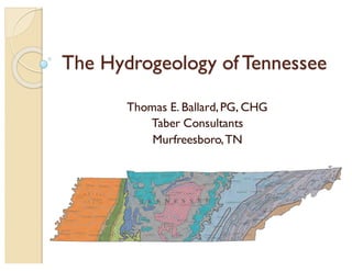
- 1. The Hydrogeology of Tennessee Thomas E. Ballard,PG, CHG Taber Consultants Murfreesboro,TN
- 4. Groundwater Recharge — Recharge is the processes involved in the addition of water to the saturated zone — Naturally by precipitation or runoff — Artificially by spreading or injection
- 6. Average Annual Precipitation 1951-80
- 7. Types of Aquifers — Unconsolidated — Sedimentary Bedrock — Limestone/Karst — Fractured Rock
- 8. Confined vs. Unconfined Aquifers Unconfined Aquifer Confined Aquifer
- 9. Properties of Aquifers — Porosity — Effective Porosity — Hydraulic Conductivity — SpecificYield — Specific Retention — Transmissivity — Storativity
- 10. Porosity The ratio of void space to the total volume of a soil or rock.
- 12. Effective Porosity The percent of the total volume of a given mass of soil or rock that consists of interconnected spaces. Essentially equivalent to permeability.
- 13. Primary vs. Secondary Porosity The porosity that represents the original pore openings when a rock or sediment formed The porosity developed in a rock after its deposition as result of fracturing or solution;usually not uniformly distributed. EXAMPLE: Karstic Limestone has relatively low primary porosity, but can have high secondary porosity due to development of solution cavities and channels. Primary Porosity Secondary Porosity
- 14. The volume of water at the existing kinematic viscosity that will move in a porous medium in unit time under a unit hydraulic gradient measured at right angles to the direction of flow. Generally designated as ‘K’ in most groundwater equations. Hydraulic Conductivity
- 17. SpecificYield/Specific Retention That part of the water in storage in the ground that will drain under the influence of gravity. That part of water in storage in the ground that is retained as a film on rock surfaces or in very small openings. Specific Yield Specific Retention
- 19. Head ht = z + hp ht = total head Z = elevation head hp = pressure head As a practical matter, head is really just the elevation (above sea level) of the standing water level in a well.
- 22. — Darcy’s Law — Groundwater Flow Rate (Velocity) — Transmissivity — Storativity Principles of Groundwater Flow
- 23. Darcy’s Law Groundwater Flow Rate 𝑽 = 𝑲 𝒅𝒉 𝒅𝒍 V = flow K = hydraulic conductivity dh = head difference dl = distance between points Groundwater FlowVolume 𝑸 = 𝑨 𝑲 𝒅𝒉 𝒅𝒍 Q = discharge A = aquifer cross-section area K = hydraulic conductivity dh = head difference dl = distance between points
- 24. 𝑽 𝒙 = 𝑸 𝒏 𝒆 𝑨 = − 𝑲 𝒅𝒉 𝒏 𝒆 𝒅𝒍 Where: Vx = the average linear (seepage) velocity ne = the effective porosity Q = the discharge (flux) A = the cross-sectional area of flow K = the hydraulic conductivity dh = difference in groundwater elevation between two measurement points dl = distance between the two measurement points used for dh GroundwaterVelocity
- 25. Transmissivity The capacity of an aquifer to transmit water at the prevailing kinematic velocity. T = Kb T = transmissivity K = hydraulic conductivity b = aquifer thickness
- 26. Volume of water that a permeable unit releases from or takes into storage per unit surface area per unit change in head. Unconfined aquifer: storativity is virtually equal to specific yield. Confined aquifer: water is derived from expansion of water and compression of the aquifer – specific storage. Storativity
- 27. Calculating Storativity S =Vw A dh Vw = volume of water A = surface area of aquifer dh = change in head Ranges from 0.01 to 0.30 S = b Ss b = aquifer thickness Ss = specific storage Ranges from 0.001 to 0.00001 Confined StorativityUnconfined Storativity
- 28. Relative Storage Capacity vs. Depth — Alluvium generally has highest storage capacity — Related to sand and gravel content — Bedrock storage capacity inTN is highly dependent on fractures — Fewer fractures with depth
- 29. Karst Hydrogeology — Two thirds of Tennessee is underlain by limestone. — Karst is an important groundwater source in those areas. — Primary porosity is low in limestone. — Secondary porosity i.e. solution cavities and fractures are an important groundwater source. — Karst aquifers best developed near surface and in relatively pure limestones.
- 30. Karst Aquifers — Openings forming the karst aquifer may be partly or completely water-filled. — The elevation where all pores are filled with water in an aquifer is the water table. — Water tables in karst areas can be highly irregular in elevation, because water- carrying conduits can develop at various elevations.
- 31. Idealized Diagram of Karst Development
- 33. Karst Regions of Tennessee
- 34. REGIONAL GEOLOGY
- 35. RegionalGeology
- 41. PRINCIPALAQUIFERSIN TENNESSEE Rate of water withdrawal by public water systems in millions of gallons per day, 2000 Source:U.S. Geological Survey 0.48 Mgal/d3.74 Mgal/d 244 Mgal/d 10.9 Mgal/d Cretaceous sand aquifer Ordovician carbonate aquifer Pennsylvanian sandstone aquiferTertiary sand aquifer 36° 89° 88° 87° 86° 85° 84° 83° 82° Modified from Bradley and Hollyday, 1985 35° 2.27 Mgal/d2.27 Mgal/d 4.09 Mgal/d 17.1 Mgal/d Alluvial aquifer Alluvial aquifer Cambrian-Ordovician carbonate aquifer Mississippian carbonate aquifer Crystalline rock aquifer 41.2 Mgal/d
- 42. TENNESSEE WATER SUPPLY SOURCES Source of water supply,in percent,for public water supply withdrawals in Tennessee, 2000 Source:U.S. Geological Survey
- 43. PRINCIPAL TN PUBLIC WATER SUPPLY SYSTEMS THAT WITHDREW GROUNDWATER IN 2000 88° 36° 89° 87° 86° 85° 84° 83° 82° 35° Base from U.S. Geological Survey digital data, 1972, No withdrawals Ground-water withdrawals (million gallons per day) Less than 1 1 to 10 Greater than 10 to 20 More than 150 EXPLANATION Public water-supply system using more than 0.02 million gallons per day ground water from wells. Number is system identifier Public water-supply system using more than 0.02 million gallons per day ground water from springs or from both wells and springs Public water-supply system using less than 0.02 million gallons per day ground water
- 45. TRENDS IN PUBLIC WATER SUPPLY WITHDRAWALS,1950- 2000 Source:U.S. Geological Survey
- 46. TOP 10 COUNTIES FOR PUBLICWATER SUPPLY WITHDRAWALS,2010 Source:U.S. Geological Survey County Population Served Withdrawals (Mgd) Shelby 924,861 173.07 Madison 86,464 13.23 Hamilton 333,606 10.7 Carter 44,302 7.46 Tipton 59,109 6.5 Obion 31,636 5.34 Gibson 39,774 5.25 Dyer 36,890 5.17 Jefferson 38,758 4.58 Montgomery 169,404 3.58
- 47. TOP 10 COUNTIES FOR DOMESTIC WATER SUPPLYWITHDRAWALS, 2010 Source:U.S. Geological Survey County Population on Well Water Withdrawals (Mgd) Rutherford 34,507 2.48 Sevier 31,317 2.25 Fayette 22,675 1.63 Robertson 20.752 1.49 Hawkins 17,885 1.29 Grainger 15,294 1.10 Blount 14,284 1.03 Carter 13,122 0.94 McMinn 13,104 0.94 Jefferson 12,649 0.91
- 48. WELL DRILLINGTRENDS INTENNESSEE Source:Tennessee Department of Environmental and Conservation,Division ofWater Resources Year Number of Wells Drilled (approx) 2007 5000 2010 2400 2015 2150
- 52. Mississippi Embayment Cross Section
- 53. Memphis Aquifers
- 57. Upper Claiborne
- 58. Middle Claiborne (Memphis Sand)
- 59. Lower Claiborne – UpperWilcox
- 60. Middle Wilcox (Fort Pillow Sand)
- 61. LowerWilcox
- 62. Top of LowerWilcox Aquifer
- 64. Pre-Pumping Groundwater Flow in the LowerWilcox Aquifer
- 66. Aquifer Characteristics — Cretaceous to Quaternary unconsolidated sediments. — Extremely productive multiple sand aquifers separated by local and regional confining beds. — Aquifers thicken from east to west where they occur in Tennessee. — Greatest yields come from the Memphis Sand (Middle and Lower Claiborne) – generally 200 to 1,000 gpm but over 2,000 gpm locally.
- 67. Central Basin Aquifer System
- 68. Central Basin Aquifer System
- 76. Conceptual Groundwater Model Inner Central Basin
- 77. Conceptual Groundwater Model Outer Central Basin
- 80. Aquifer Characteristics — Carbonate rocks (limestone and some dolomite) are primary aquifers. — Intervening confining units of shale and shaly limestones — Chattanooga Shale separates Central BasinAquifer System from overlying Mississippian rocks of the Highland Rim — Depth of freshwater varies greatly. — Wells are typically 50 – 200 feet deep. — Depth to salt water is generally greatest where the limestone and dolomite aquifers crop out i.e. the apex of the Nashville Dome. — Recharge rates affect depth to salt water.
- 81. Highland Rim Aquifer System
- 82. Highland Rim Aquifer System
- 86. Conceptual Groundwater Model Eastern Highland Rim
- 88. Aquifer Characteristics Most Productive Mississippian Aquifers — Ste. Genevieve Limestone — St. Louis Limestone — Warsaw Limestone — Fort Payne Formation Fine-grained clastic rocks are not generally productive — Mostly karst aquifers — Groundwater moves through fractures, bedding planes, and solution openings in the limestone — Hydraulic characteristics (yield and specific capacity) vary greatly over short distances
- 89. Knox Aquifer
- 90. Knox Aquifer
- 91. Cross Section of the Knox Aquifer
- 93. Conceptual Model of Groundwater Flow in the Knox Aquifer
- 94. Water Quality of the Upper Knox Aquifer
- 95. Aquifer Characteristics — Regional aquifer. — Distinct from Knox Formation units inValley and Ridge. — Only exposed in SequatchieValley. — Recharge through fractures that transect the overlying confining unit. — Water yields in upper 50 feet. — Dolomite typically has the best yield — Limestones yield little water — TDS < 1,000 mg/l at center of Nashville Dome and Sequatchie Valley anticline — Deeper zones have high TDS — Freshwater-saltwater interface does not coincide with shallower aquifers
- 96. Cumberland Plateau Aquifer System
- 97. Cumberland Plateau Aquifer System
- 98. Generalized Cross Section Northern Cumberland Plateau
- 99. Cross Sections - Mid and Southern Cumberland Plateau inTennessee Wilson, C.W., Jr. and Stearns, R.G., 1958, Structure of the Cumberland Plateau, Tennessee, State of Tennessee, Department of Environment and Conservation, Division of Geology, Report of Investigations No. 8
- 101. Groundwater Movement Model Aquifers in consolidated rocks are directly recharged by precipitation where they are exposed at the land surface. Water enters the aquifers primarily through fractures. Fractures decrease in width and number with depth.In Pennsylvanian rocks, underclay beneath coal beds creates perched water tables, which result in springs that issue from valley walls.Water percolates slowly downward through the underclay to reach the main water table.
- 102. Conceptual Groundwater Model Cumberland Plateau Groundwater moves primarily through fractures in clastic rocks and solution openings in limestone. Fractures in shale confining units allow rapid downward movement. Shallow near-surface fractures yield the most water to wells.
- 103. Cross Section and Recharge Cumberland Plateau
- 105. Aquifer Characteristics — Geology consists of easterly dipping Pennsylvanian and Mississippian rocks. — Pennsylvanian rocks are primarily sandstone, conglomerate and shale with some coal beds. — Mississippian rocks are primarily shale and limestones. — Locally,excessive concentrations of iron or sulfate may be present. — A complete, ideal cycle of Pennsylvania rocks consists of, from bottom to top: underclay,coal, gray shale or black platy shale, freshwater limestone, and sandstone or silty shale. — Water from limestones tends to be alkaline and from coal/black shale more acidic. — Deeper water tends to be more mineralized.
- 106. Valley and Ridge Aquifer System
- 107. Valley and Ridge Aquifer System
- 108. Valley and Ridge Province Generalized Cross Section
- 109. Valley and Ridge Province Conceptual Cross Section
- 110. Principal Aquifers inValley and Ridge — Principal aquifers are carbonate rocks of Cambrian and OrdovicianAge
- 113. Valley and Ridge Province Conceptual Groundwater Model Groundwater moves downward through interstitial pore spaces in residuum and alluvium into the consolidated rocks, where it moves along fractures, bedding planes and solution openings.The general direction of flow is from ridges to toward springs and streams in the valleys.
- 114. Conceptual Groundwater Model Valley and Ridge
- 116. Water Quality –Valley and Ridge
- 117. Aquifer Characteristics — Geology is defined by series of imbricate faulting related to deep detachment fault system. — Groundwater is primary stored in fractures, bedding planes and solution openings. — Nature of the geology dictates no regional flow systems. — Karst systems generally have the best yields. — Fractures in clastic rocks can yield water locally. — Some production from alluvium and residuum. — Groundwater type is typically calcium- magnesium- bicarbonate.
- 118. Blue Ridge Aquifers
- 119. Blue Ridge Aquifer System
- 120. Generalized Geologic Cross Section of EastTennessee
- 122. Blue Ridge Province Conceptual Groundwater Model
- 123. Water Quality – Blue Ridge
- 124. Aquifer Characteristics — Most available groundwater is in fractures within a few hundred feet of the ground surface. — Production capacity defined by number, size and degree of interconnected fractures. — Fractures close off at depth. — Regional groundwater flow is not significant — Groundwater quality is generally good with lowTDS. — Groundwater is calcium-magnesium- bicarbonate type.
- 126. Basal Sandstone Aquifer System
- 129. Conceptual Model of Basal Sandstone Groundwater Occurrence
- 130. Aquifer Characteristics — No surface exposures — Occurs at depths of 5,000 to 10,000 feet — 200 to 400 feet thick — Similar to other basal units throughout the world — Limited data — TDS exceeds 10,000 mg/l — Not drinking water quality — Has been used for deep injection wells
- 131. Questions?