2. GEOPAPARAZZI: INTRO
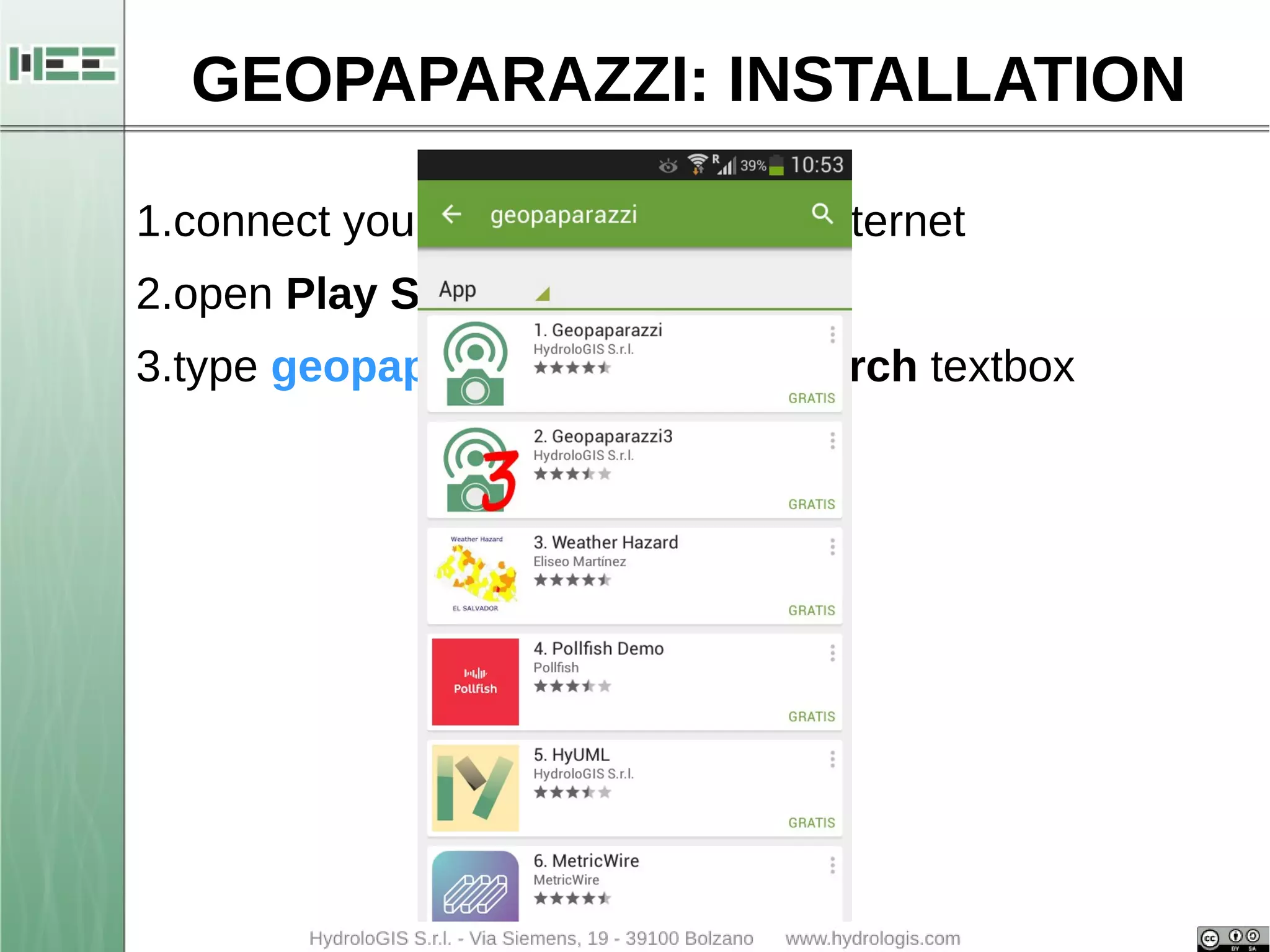
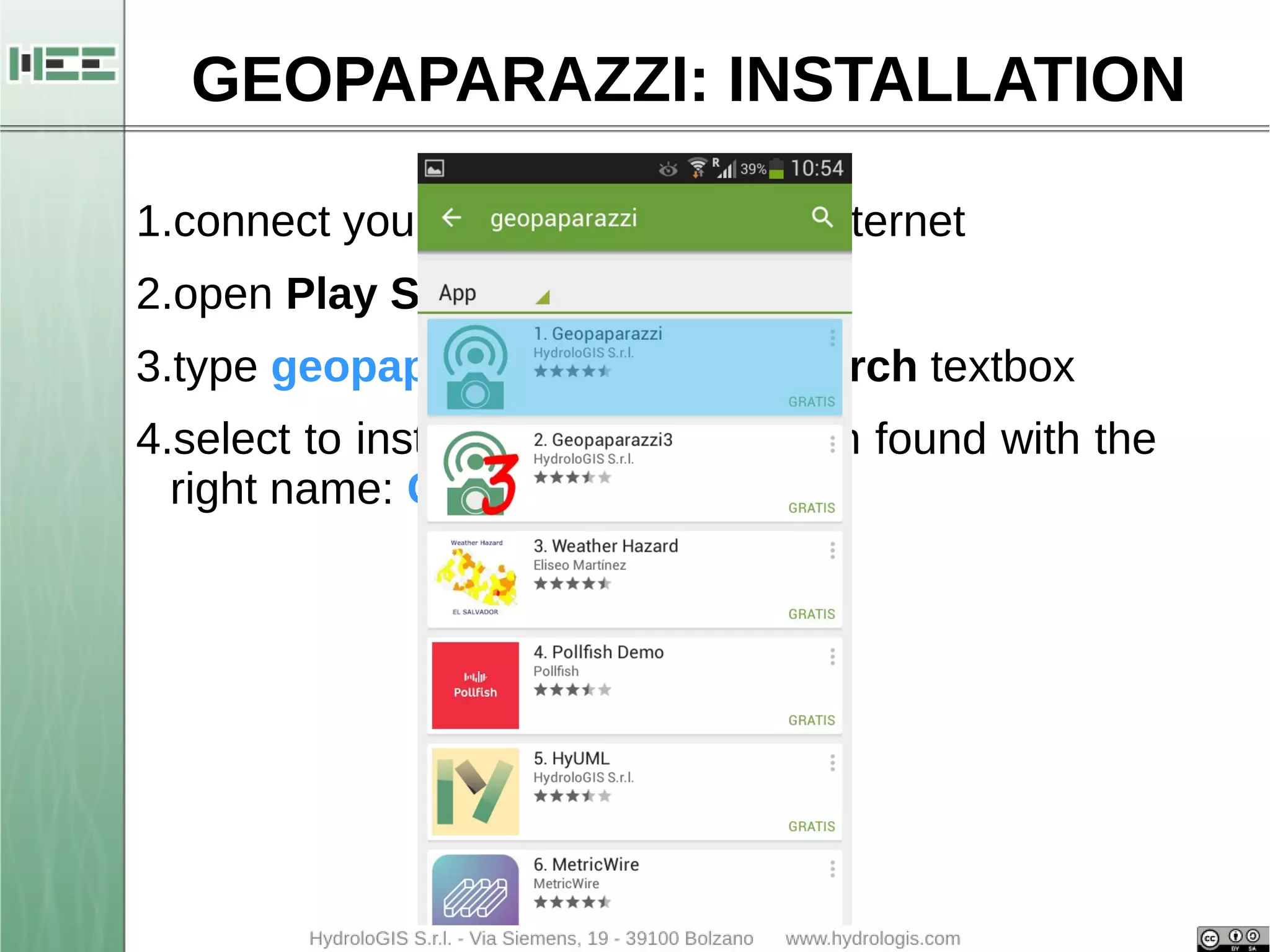
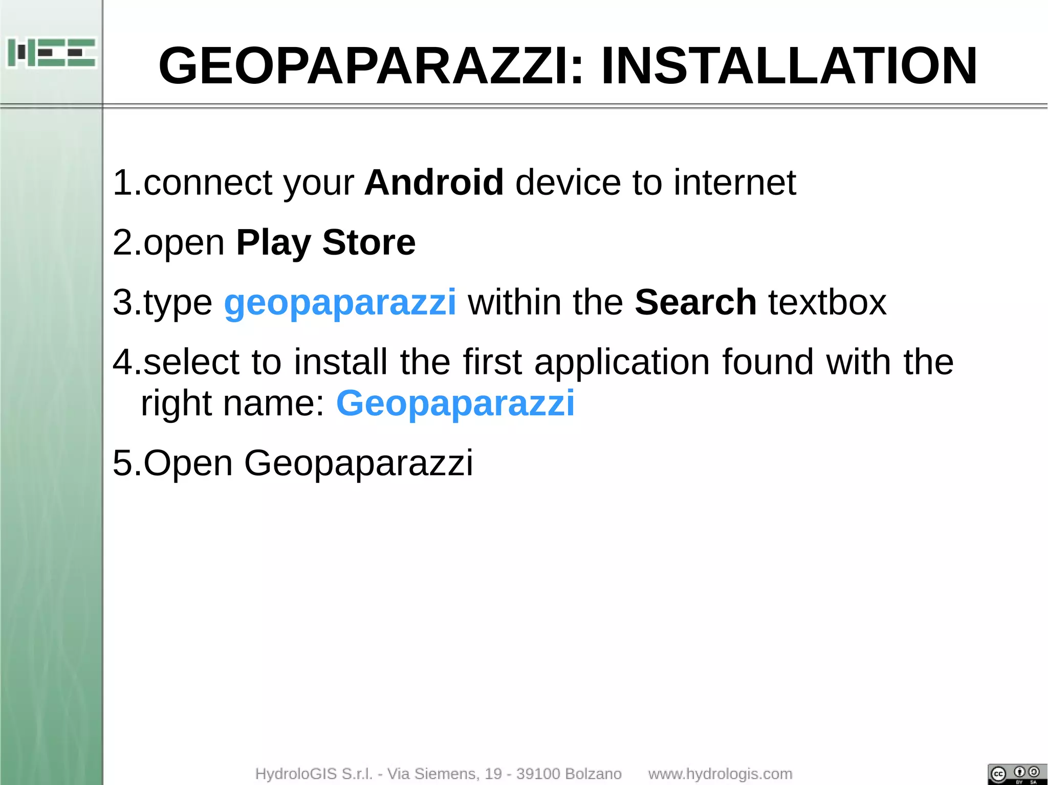
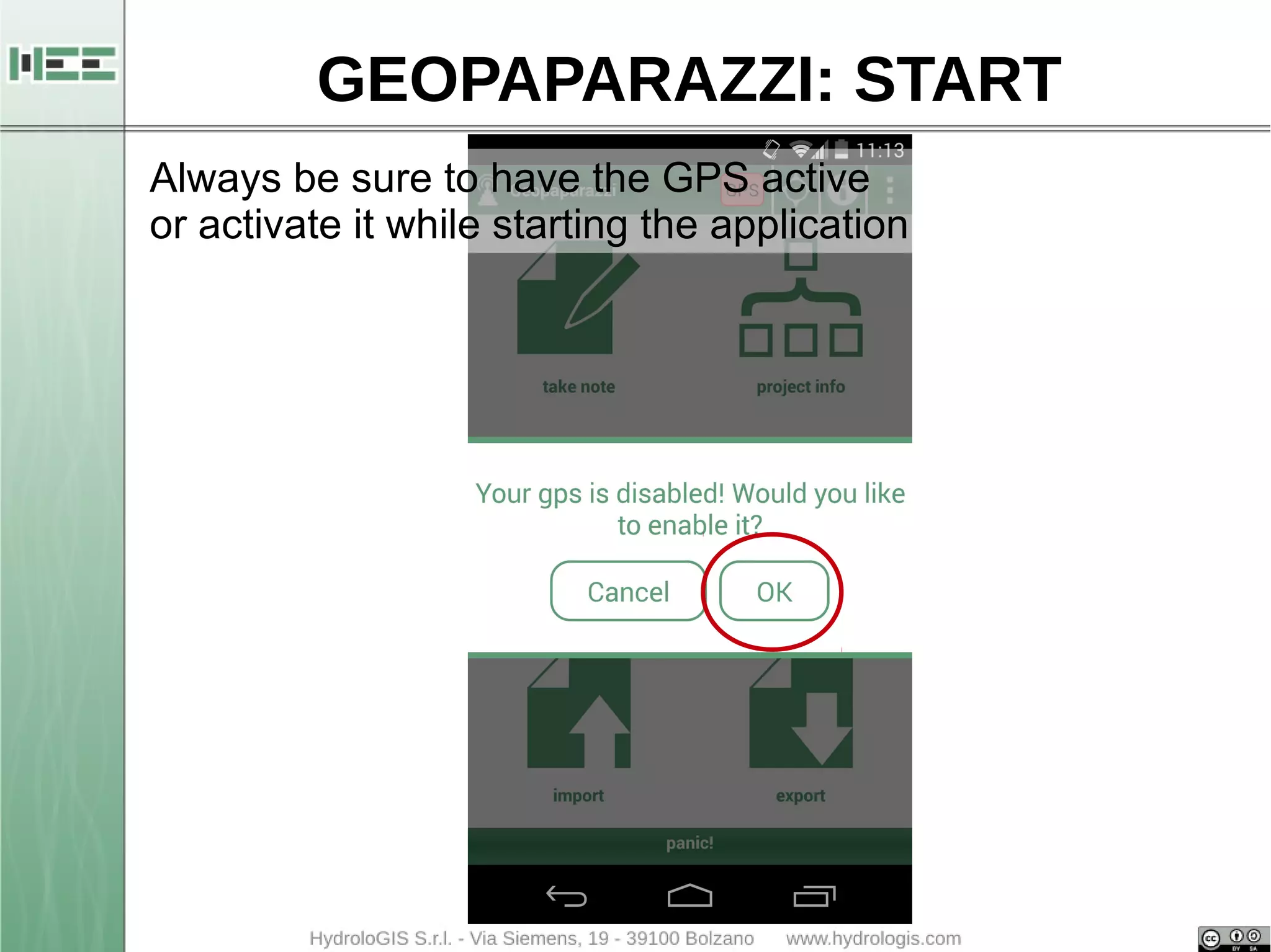
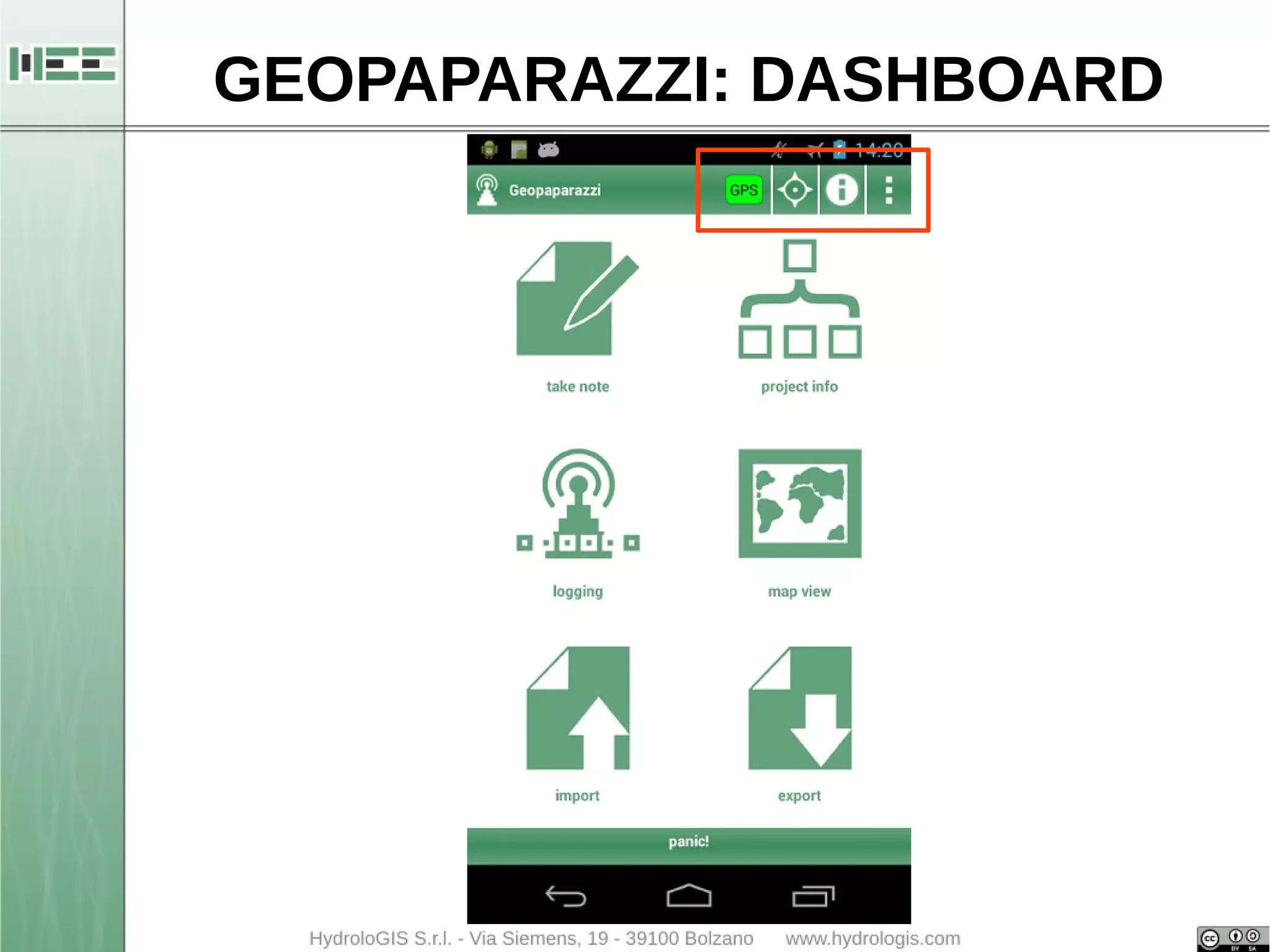
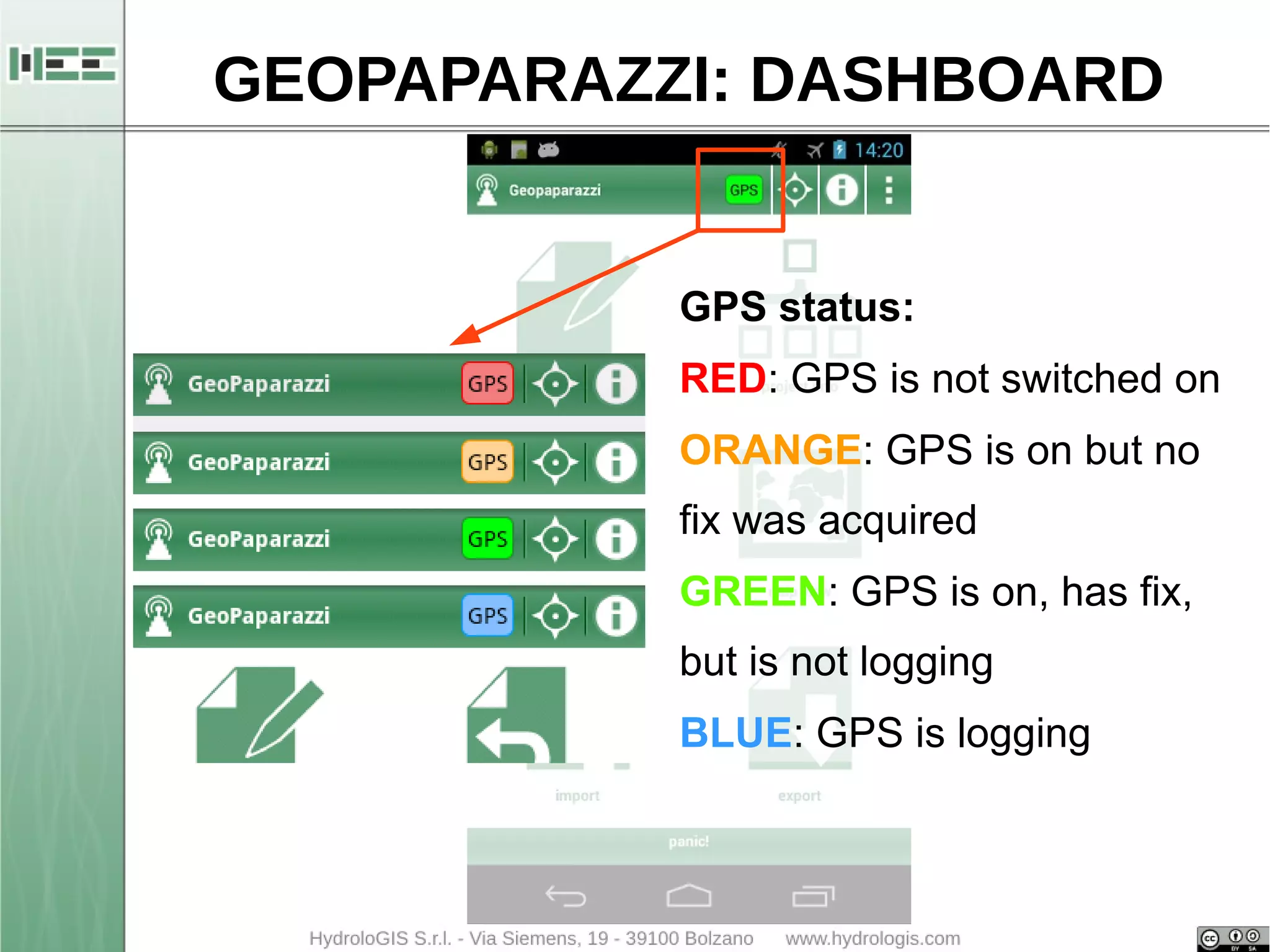
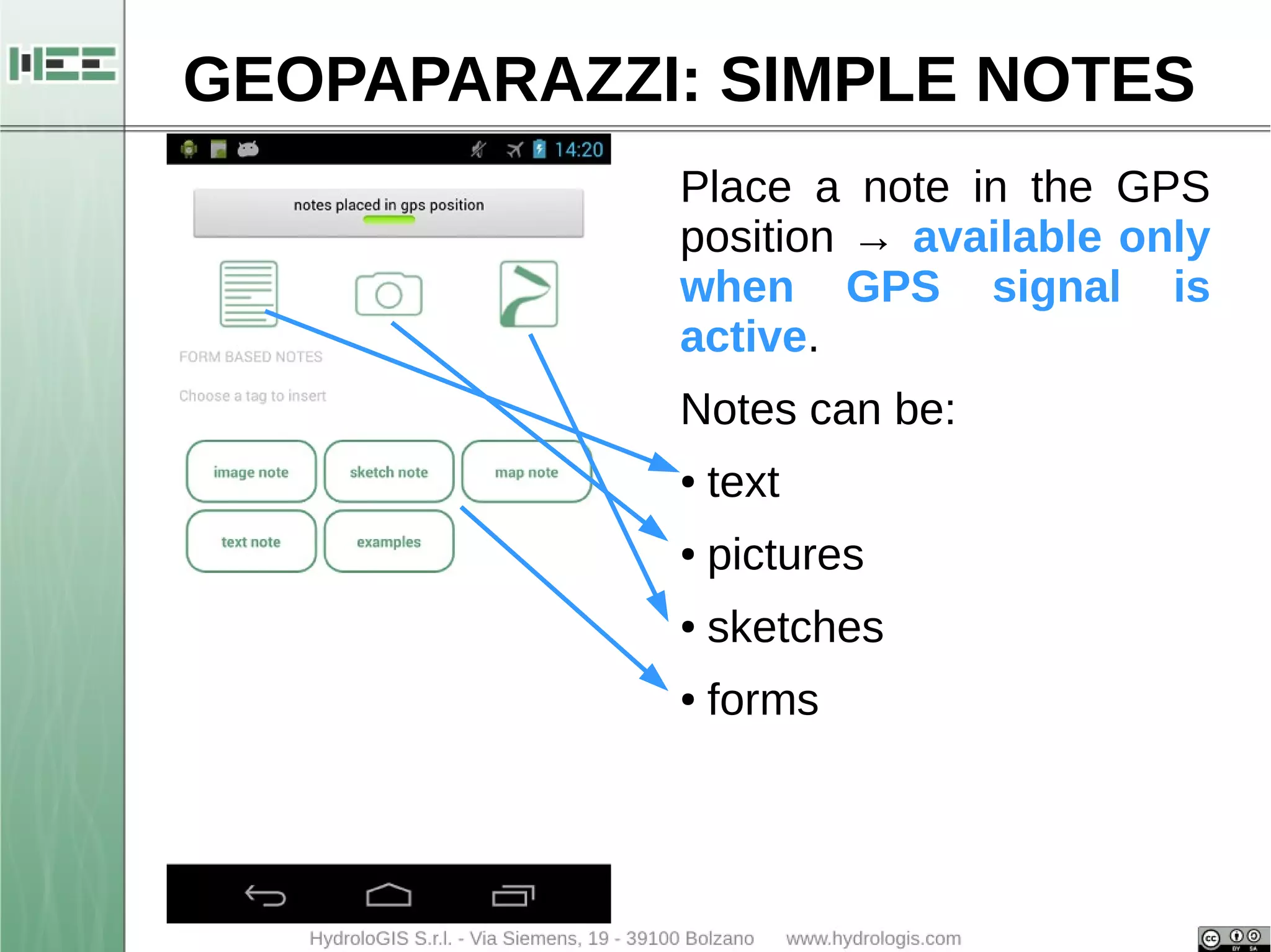
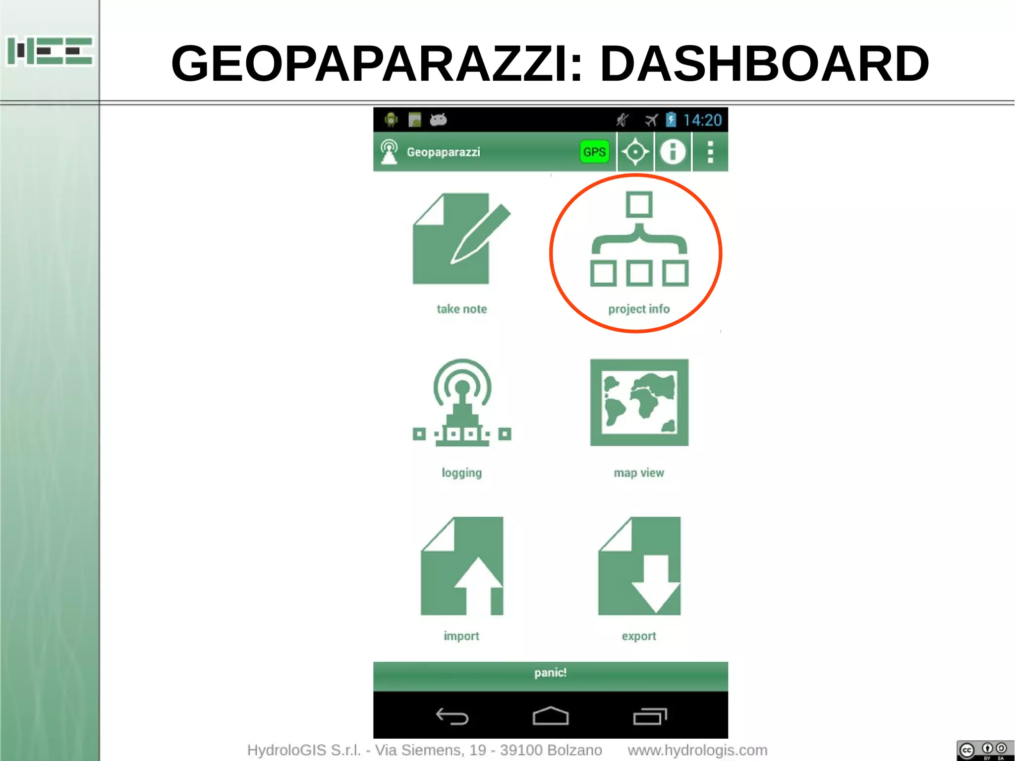
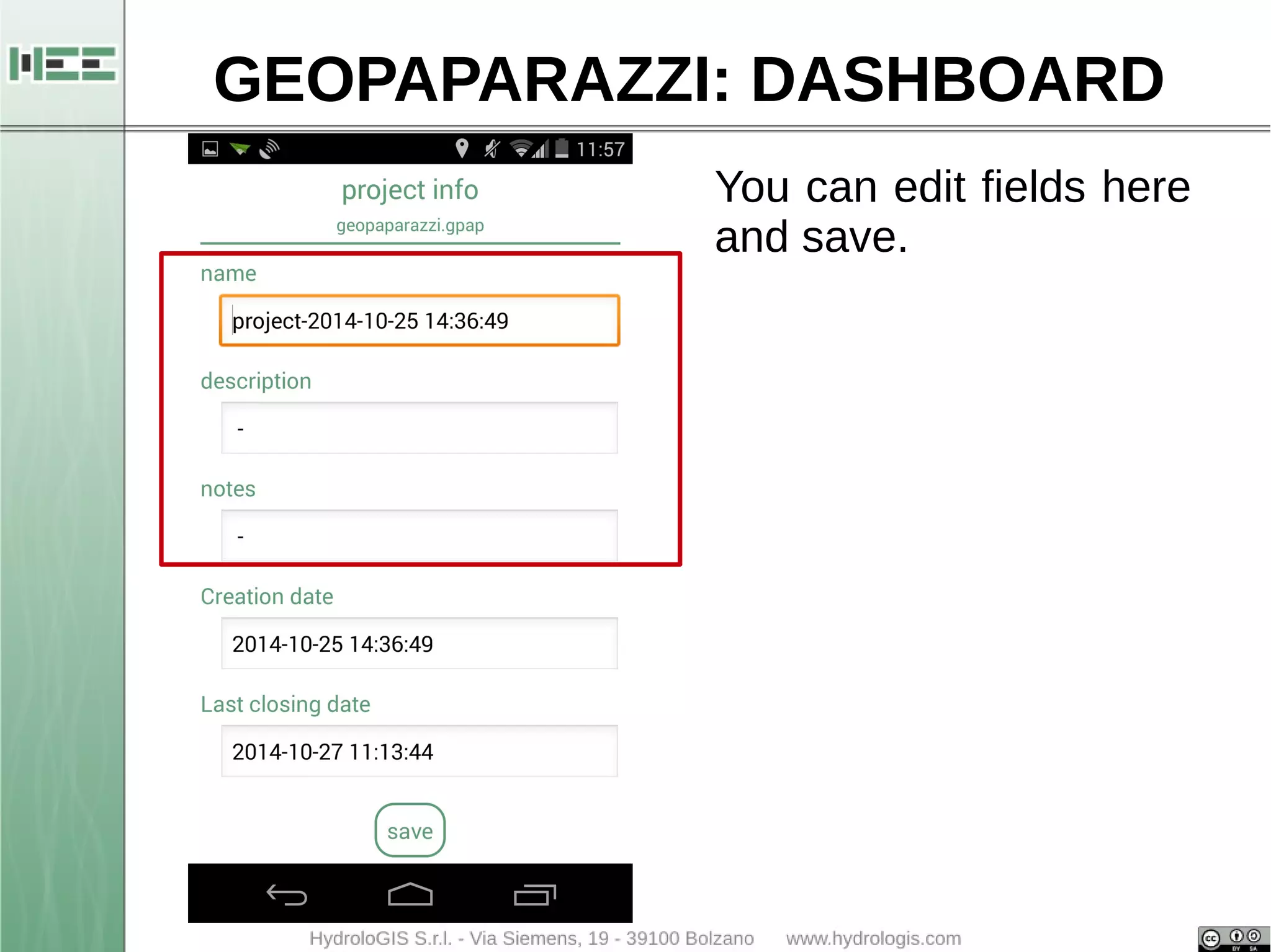
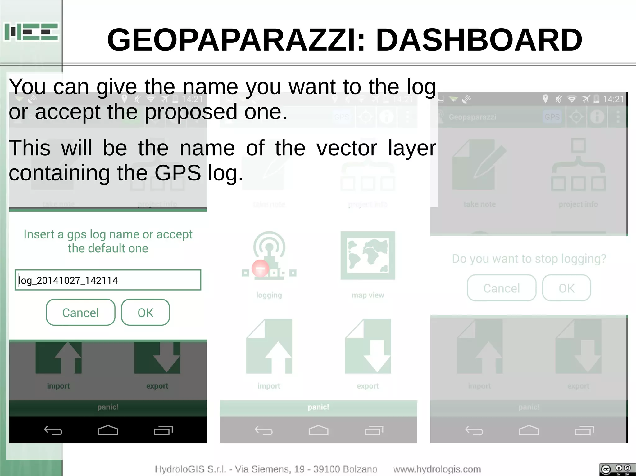
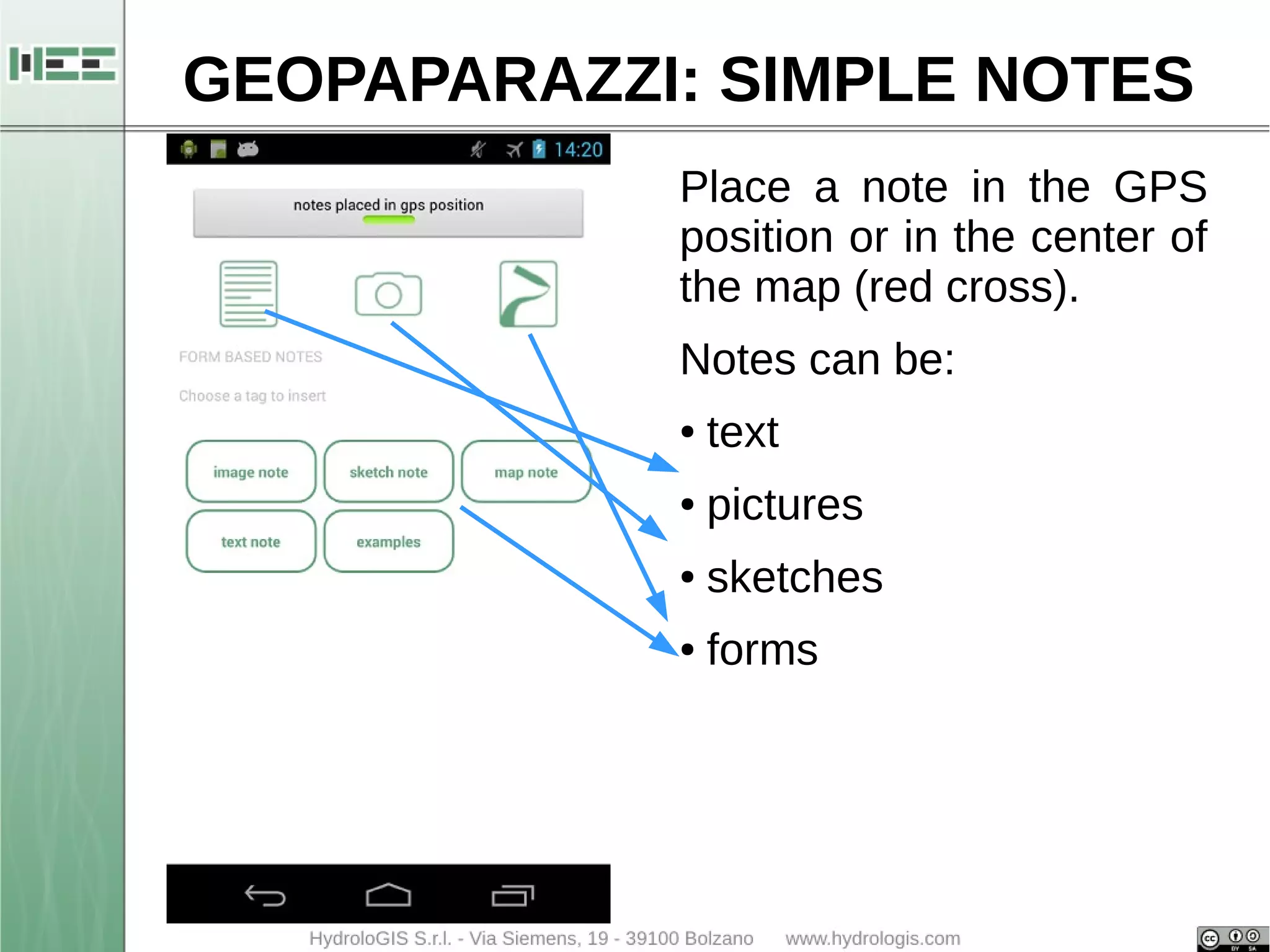
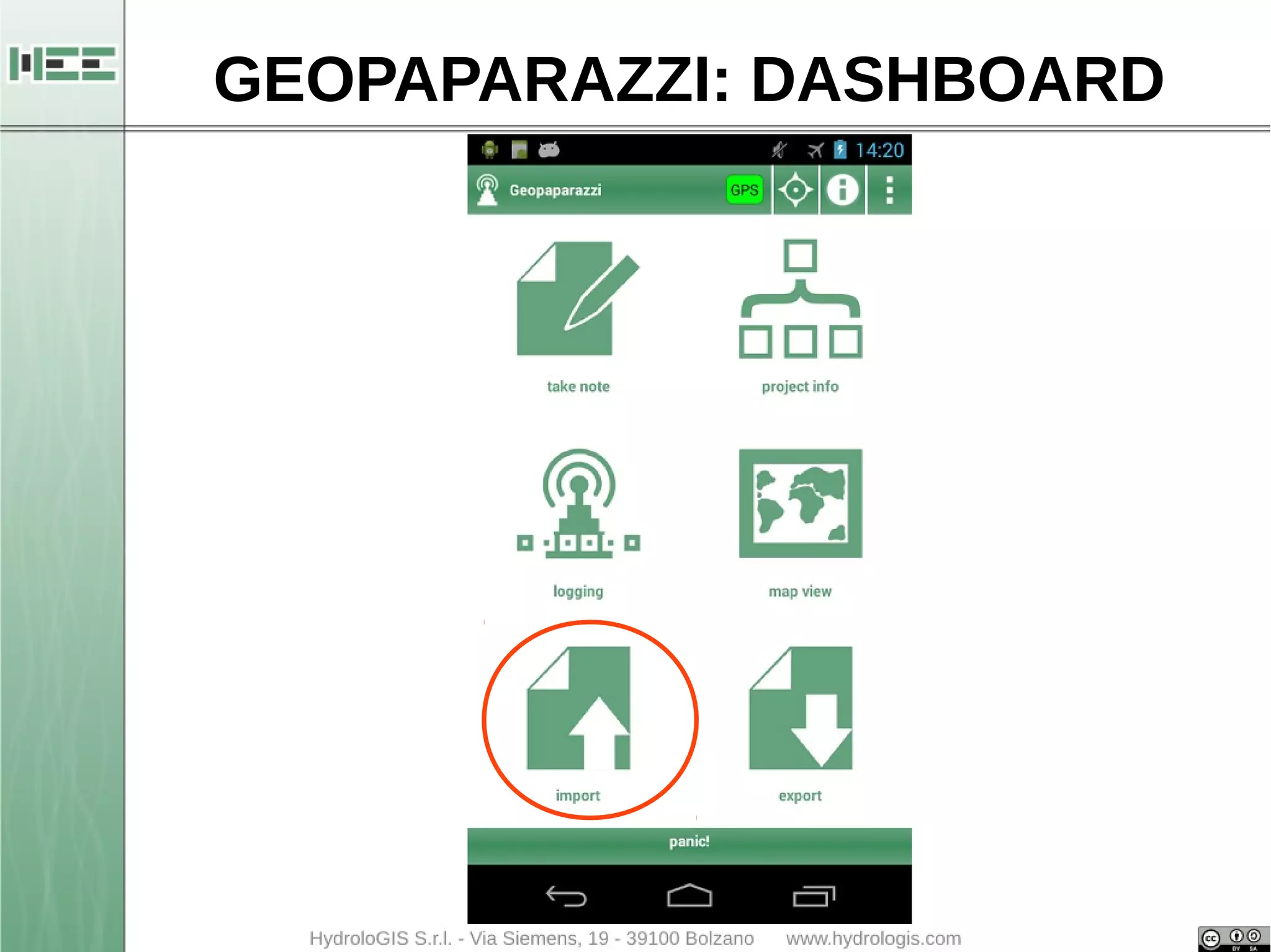
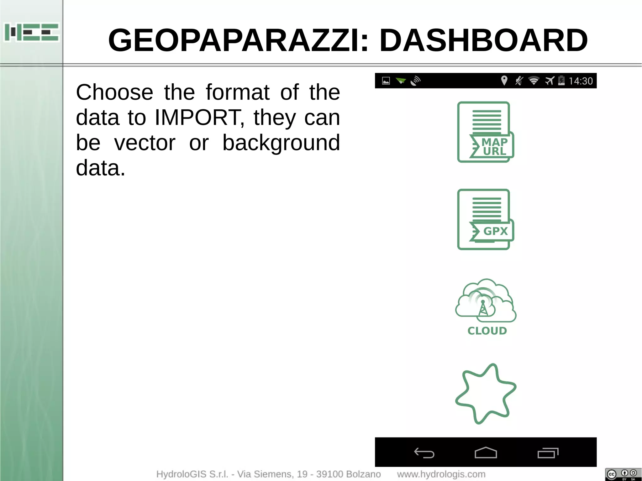
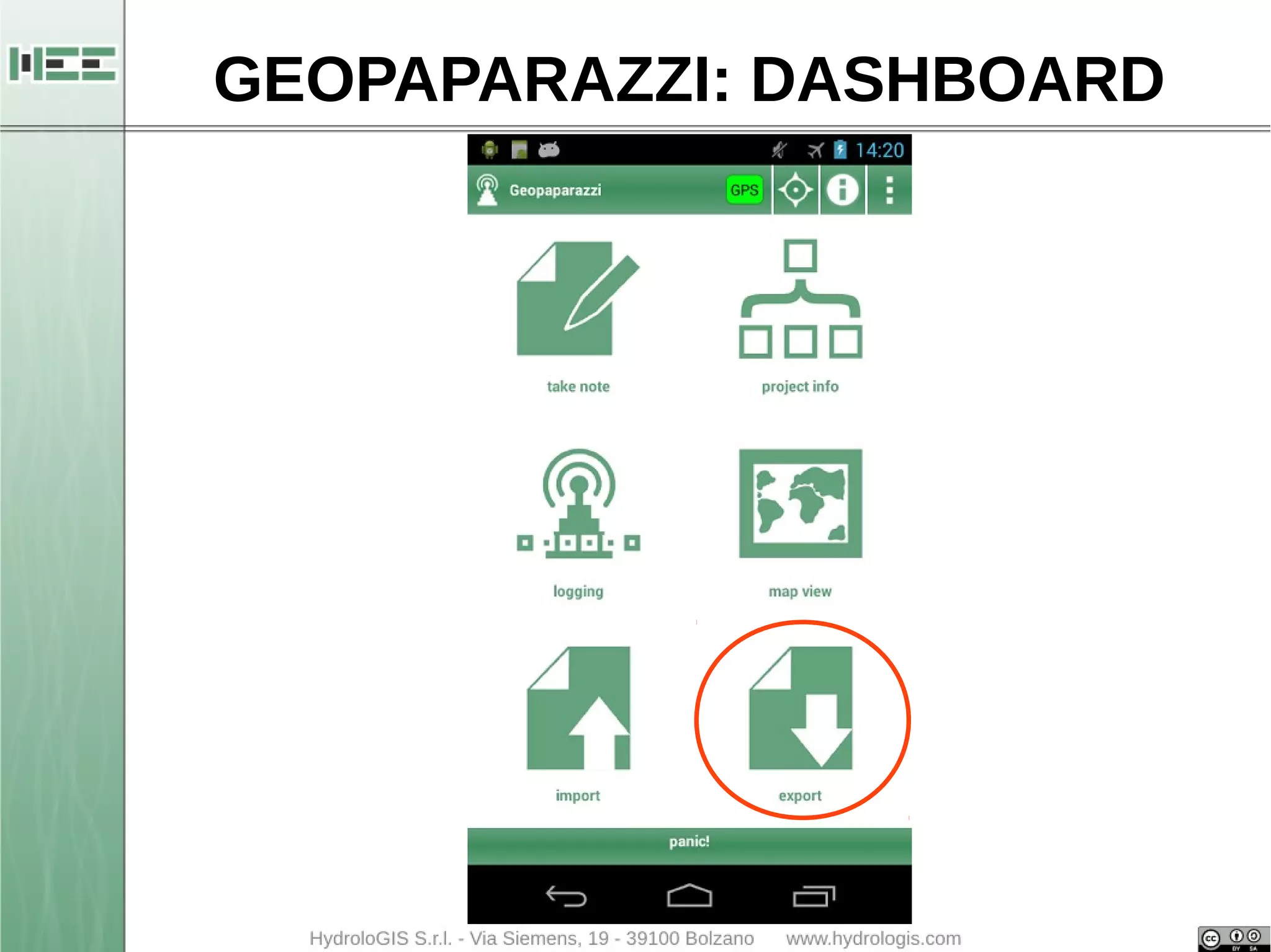
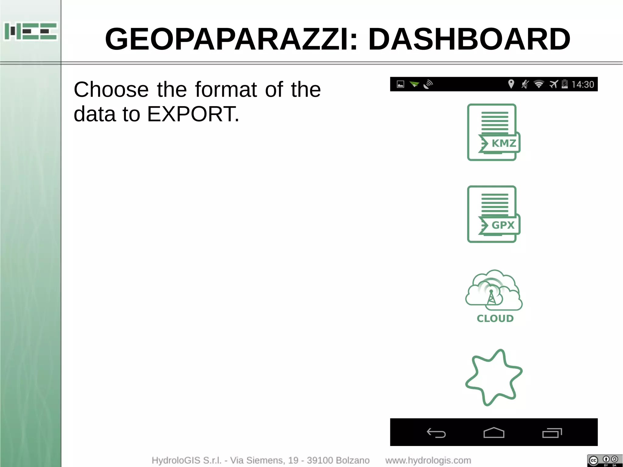
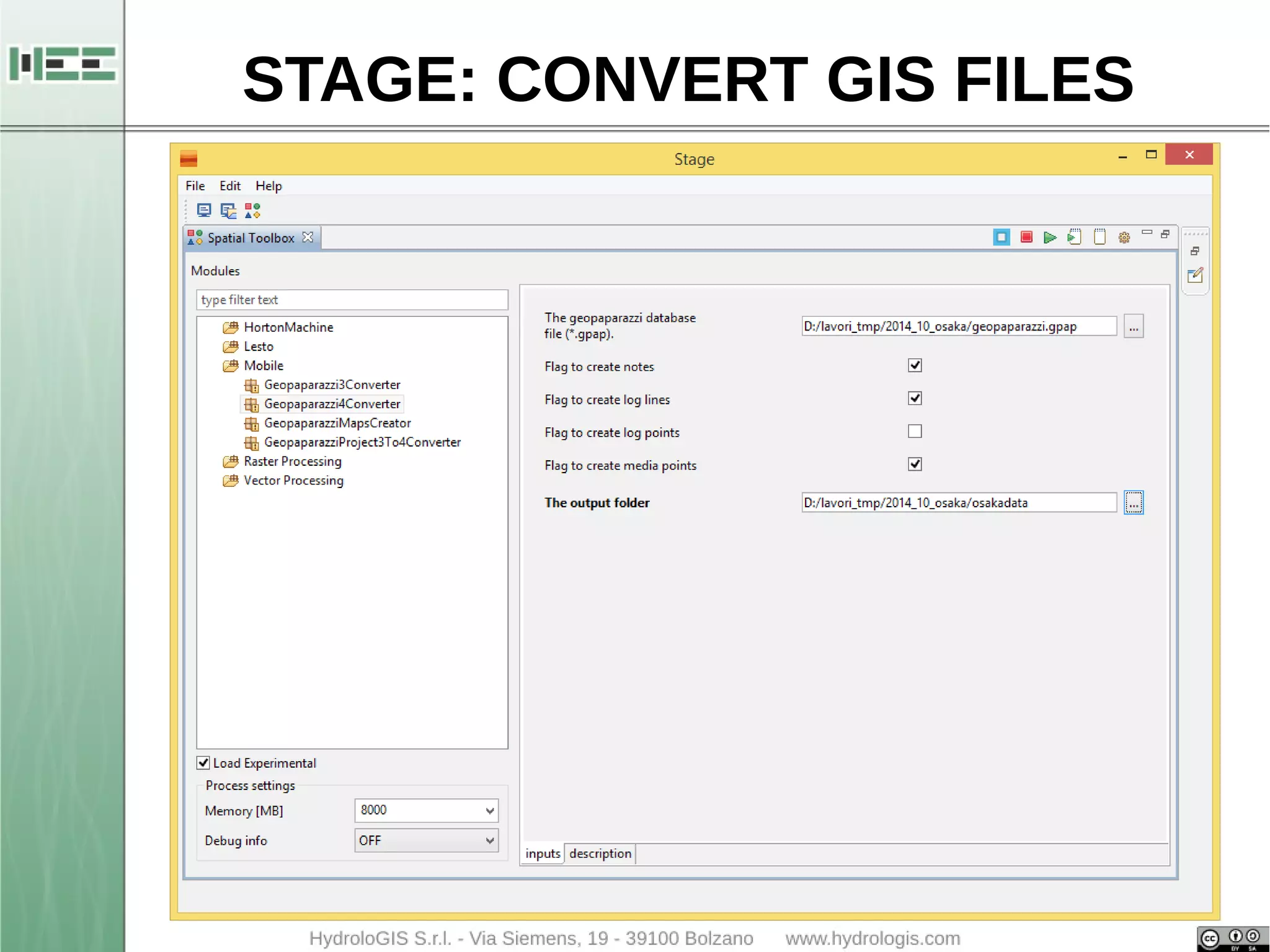
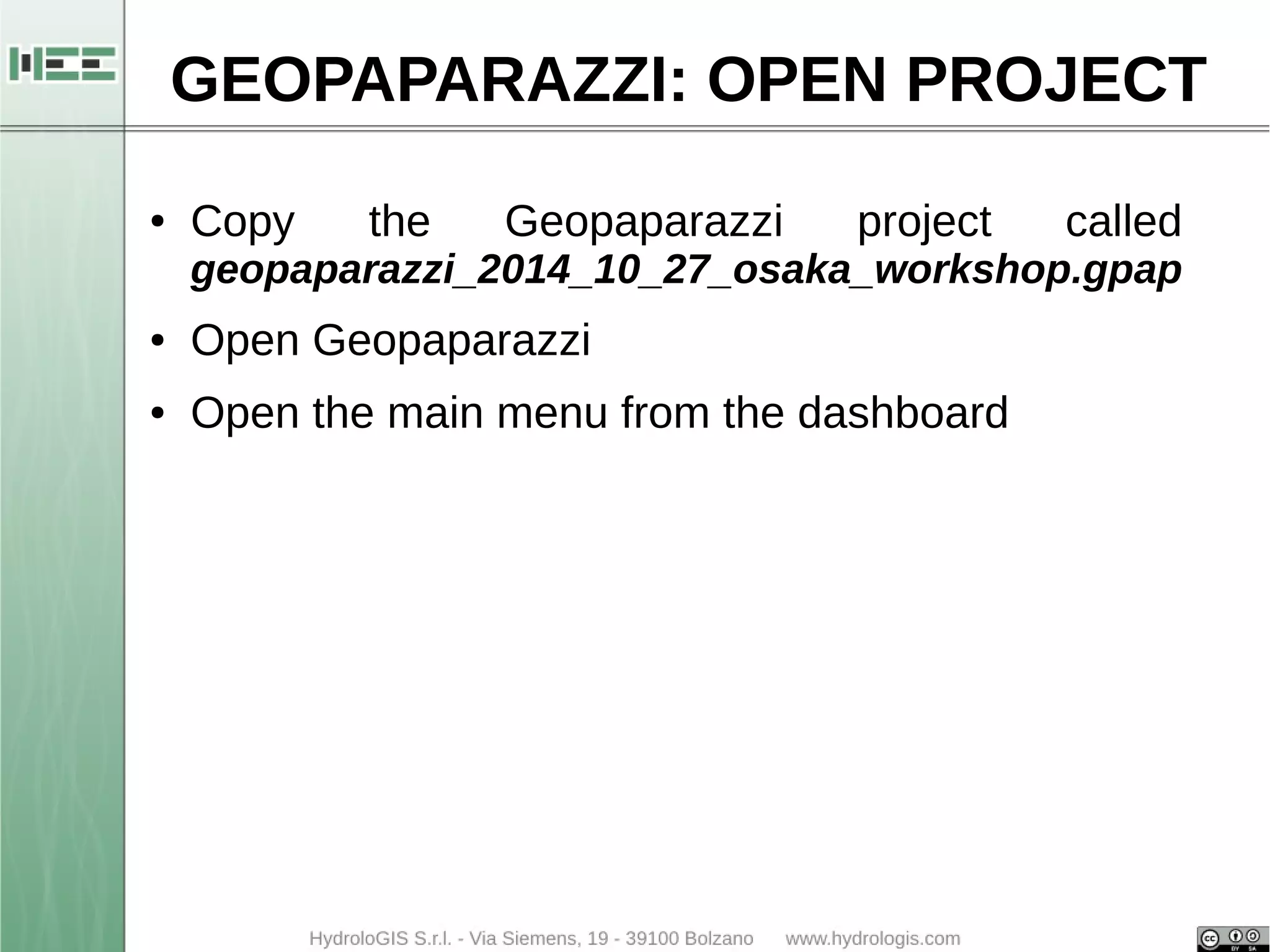
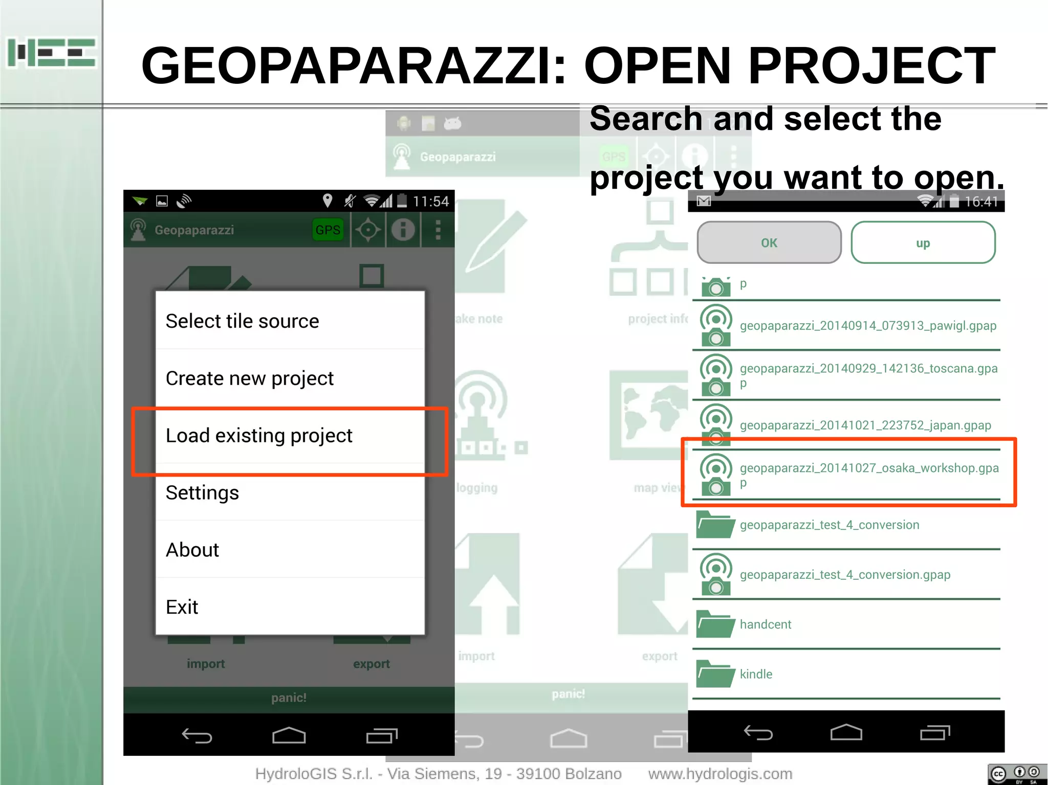
Geopaparazzi is a tool for digital field mapping.
Originally it has been developed for fast qualitative
engineering/geologic surveys but it can be used also
as a tool for emergency management, general field
activities and tourism.
Geopaparazzi is available on the Android Market.
Search for Geopaparazzi on your phone or get it from
the online android market.
Note: Geopaparazzi doesn't work on iPhone or other
MacOS devices.
3. GEOPAPARAZZI: INTRO
The main aim of Geopaparazzi is to have a tool that:
● can be always at hand when needed
● gives the possibility to take georeferenced pictures
during the survey, with further possibility to import
them into a main GIS application
● is extremely easy to use and intuitive, providing just
few important functionalities
4. GEOPAPARAZZI: INTRO
The main features available in Geopaparazzi are:
● georeferenced notes:
– text notes
– pictures
– sketches
– forms
● gps tracks logging
● a map view for browsing and navigation of the data
● easy export of collected data
● easy access to a base background data
7. GEOPAPARAZZI: INSTALLATION
1.connect your Android device to internet
2.open Play Store
3.type geopaparazzi within the Search textbox
4.select to install the first application found with the
right name: Geopaparazzi
8. GEOPAPARAZZI: INSTALLATION
1.connect your Android device to internet
2.open Play Store
3.type geopaparazzi within the Search textbox
4.select to install the first application found with the
right name: Geopaparazzi 4.0
9. GEOPAPARAZZI: INSTALLATION
1.connect your Android device to internet
2.open Play Store
3.type geopaparazzi within the Search textbox
4.select to install the first application found with the
right name: Geopaparazzi
5.Open Geopaparazzi
12. GEOPAPARAZZI: DASHBOARD
GPS status:
RED: GPS is not switched on
ORANGE: GPS is on but no
fix was acquired
GREEN: GPS is on, has fix,
but is not logging
BLUE: GPS is logging
13. GEOPAPARAZZI: DASHBOARD
Open the compass
This option works only if the
application GPS Status is
installed on your device.
14. GEOPAPARAZZI: DASHBOARD
Open the information box
Which contains:
● the active folder where the
maps are stored
● the name of the active
background map (Map View)
● the status of the GPS
17. GEOPAPARAZZI: SIMPLE NOTES
Place a note in the GPS
position → available only
when GPS signal is
active.
Notes can be:
● text
● pictures
● sketches
● forms
21. GEOPAPARAZZI: DASHBOARD
You can give the name you want to the log
or accept the proposed one.
This will be the name of the vector layer
containing the GPS log.
28. GEOPAPARAZZI: DASHBOARD
The map tools
Manage notes
Center map on
current GPS position
Manage
bookmarks
Zoom tools
Measure distances
29. GEOPAPARAZZI: SIMPLE NOTES
Place a note in the GPS
position or in the center of
the map (red cross).
Notes can be:
● text
● pictures
● sketches
● forms
34. STAGE: INSTALLATION
● Copy the zip file in a folder
– stage_0.7_win64.zip for PC 64 bits
– stage_0.7_win32.zip for PC 32 bits
● Unzip the file in the proposed folder
– stage_0.7_win64
● Enter the unzipped folder
● Run Stage application
– stage.exe
43. GEOPAPARAZZI: IMPORT MBTILES
● Tap the main menu button on the dashboard
● Select the first entry of the menu: Select tile source
● Select mbtiles on the top of the screen (unselect the
others (map and mapurl) just tapping the buttons
● Open the map view
45. STAGE: CONVERT GIS FILES
● Geopaparazzi saves all in a file in the home of the
device
● Copy the project file on the PC
● Use STAGE to create shapefile
48. GEOPAPARAZZI: OPEN PROJECT
● Copy the Geopaparazzi project called
geopaparazzi_2014_10_27_osaka_workshop.gpap
● Open Geopaparazzi
● Open the main menu from the dashboard